43 F. high in the Twin Cities Saturday.
25 F. average high on January 30 (up 2 degrees since mid-month).
27 F. high on January 30, 2015.
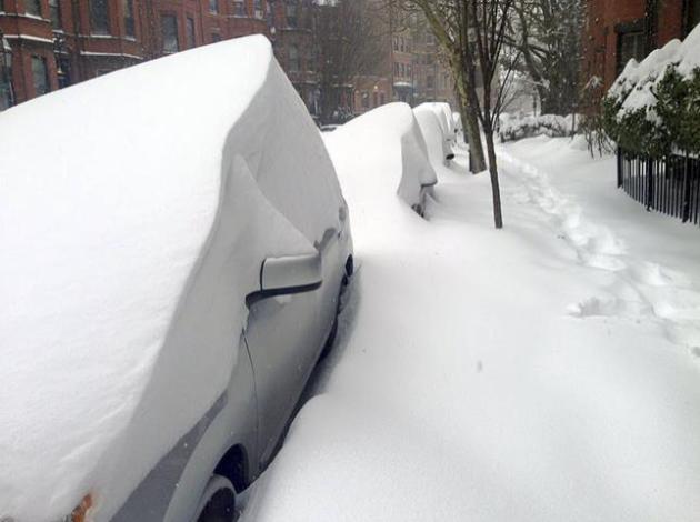
2" snow left on the ground at KMSP.
January 31, 1893: The temperature drops 40 degrees in five hours during a blizzard at Park Rapids.
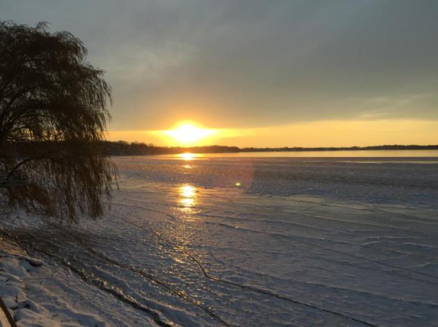
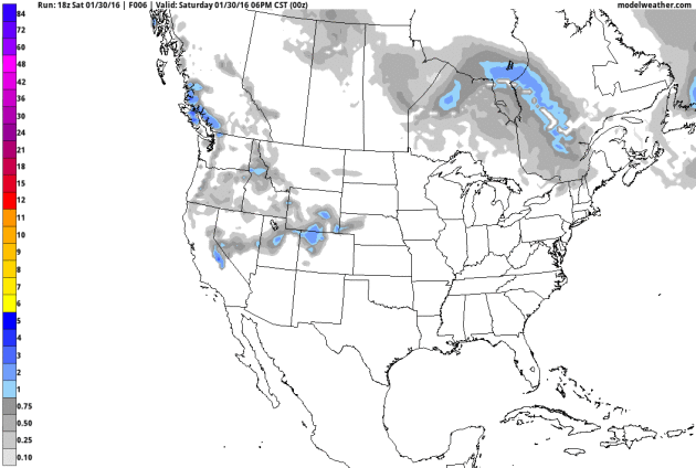
Midwinter Doldrums. Snowy Possibilities Tuesday"There
is a privacy about winter which no other season gives you. Only in
winter can you have longer, quiet stretches when you can savor belonging
to yourself" wrote Ruth Stout.
Breaking an ankle has forced
me to slow down, something I'm not terribly good at. It's left more time
for reading, reflection and recharging the battery. Believe it or not
meteorologists savor spells of quiet weather, because we know it can't
last.
Tuesday's
potential snowfall is still an enigma wrapped in a riddle. A consensus
of models keep the heaviest snow bands south/east of MSP. We could still
see a few inches; it may even be plowable. But don't trust any forecast
down to the inch this far out. The science just isn't there.
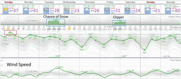
What's not in doubt is an inevitable cooling trend. We chill into the teens and 20s by late week. A quick thaw Superbowl
Sunday
gives way to a reinforcing shot of fresh air; a few more subzero nights
may be 10 days away. But it can't stay as cold - for as long - in
February, thanks to a higher sun angle.
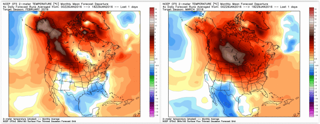
NOAA's CFS climate model predicts a milder than average February, and a much warmer March.
Limping Back into Winter.
By late January I'm always surprised (in a pathetic sort of way) how
good 30s and 40s (above zero) can feel. Meteorological relativity -
compared to subzero 32F feels like a bad vacation. Latest European model
guidance shows the descent back into winter will be gradual - nothing
bitter expected this week, but by the end of the week it will feel like
midwinter again. The chance of snow Tuesday is diminishing, but there's
still a chance we may see a period of snow as a storm tracks to our
south and east.
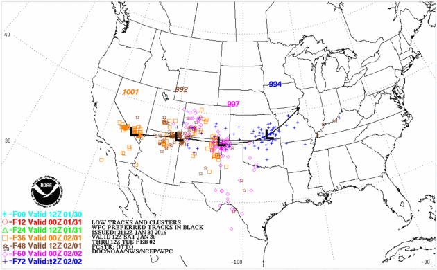
NAM Solution: Snowy Near Miss?
Confidence levels are still low, but last night NOAA's NAM model was
keeping any significant (plowable) amounts of snow across Iowa,
Wisconsin and possibly far southeastern Minnesota. Snow should reach
Iowa after Monday's caucus, if you're keeping an eye on weather impacts
getting out the vote. Source: NOAA and AerisWeather. On the other
hand...
GFS Solution: Snow Potential Lingers.
Spin the wheel, which model do you prefer - which version of possible
realities to come? NOAA's GFS simulation brings plowable snow into much
of southern and central Minnesota Tuesday PM, but the jury is still out.
We like it when models agree - that is not case with this system; not
yet.
Projected Storm Track.
The ideal track for significant snow in the Twin Cities runs from near
Des Moines to La Crosse to Eau Claire, keeping MSP on the cold
northwestern side of the storm track with enough southern moisture
pulled into the storm for significant amounts. Clarity is still elusive,
but NOAA's ensemble models suggest Tuesday's track may be 100-200 miles
too far south and east for a big pile of snow in the metro area. Stay
tuned.
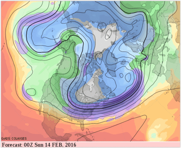
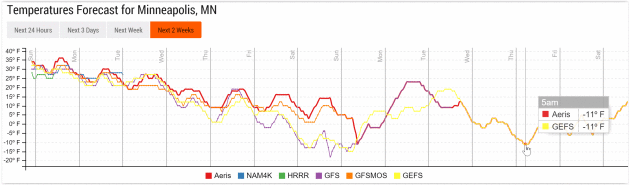
Numbing Second Week of February.
Temperatures return to "average" later this week; next week may bring
back memories of mid-January as a high-amplitude pattern returns,
pulling bitter air southward into Minnesota. I expect a few subzero
nights, maybe a handful of days with highs in single digits between Feb.
Feb. 10-15.
Another Subzero Spell.
GFS guidance suggests a few nights below zero by the middle or end of
next week; the second week of February may, in fact, be
character-building. Source: Aeris Enterprise.
Warm Phase Returns Second Half of February into March?
NOAA's CFSv2 (Climate Forecast System) model still shows a mild bias
for February, which implies a fairly radical warming trend the latter
half of next month. A lingering El Nino signal is forecast to result in
significantly milder than average temperatures anomalies for central
Canada and the northern tier states of the USA in March. We'll see.
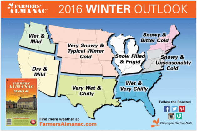
Very Snowy?
Here is what the Farmer's Almanac was predicting for the Winter of
2015-16. Maybe we'll catch up in the snowfall department in March. We
say that every March - it rarely happens.
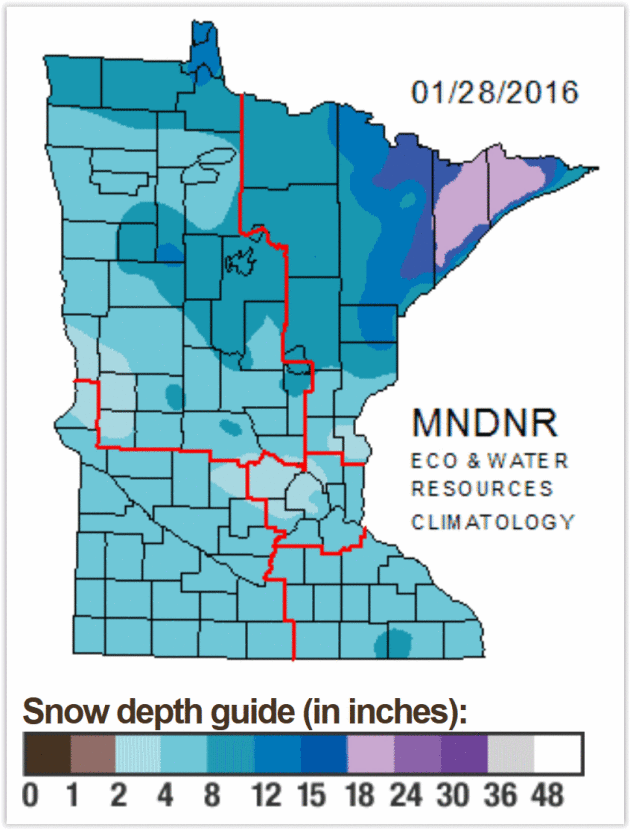
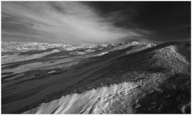
Current Snow Cover.
There's about 3-5" on the ground across the Ttwin Cities metro, fairly
meager amounts across much of central and western Minnesota. The North
Shore of Lake Superior is reporting some 1-2 foot amounts, but that's
the exception to the rule. Map:
Minnesota DNR.
Study: No Proof of Seasonal Depression. Really? A new study highlighted at
KARE11.com made me do a triple-take; here's an excerpt: "...
Researchers
looked at a survey of more than 34,000 adults in the United States.
According to their results, there was no evidence that season, latitude
and sunlight exposure had a significant effect on a person’s symptoms of
depression. “We analyzed the data from many angles and found that the
prevalence of depression is very stable across different latitudes,
seasons of the year, and sunlight exposures,” said Steven LoBello in a
released statement. LoBello is a professor of psychology at Auburn
University at Montgomery and senior author on the study. “The findings
cast doubt on major depression with seasonal variation as a legitimate
psychiatric disorder,” the researchers wrote..."
Morphing of The Word "Blizzard". Up until the late 1800s the term had nothing to do with snow, as described at
Voice of America: "...
The dictionary Etymology Online says blizzard came to mean a severe snow storm during the late 1800s. Before then, the word blizzard had nothing to do with snow. It had several other meanings. One was a sharp blow, like hitting a ball with a stick. Another meaning was a gun shot. And blizzard was also defined as a most extreme statement or event. These days, we do not use blizzard to mean any of those things. Blizzard is only used to mean an extreme snow storm. The first such use was in 1870. An especially violent and heavy snowstorm struck the state of Iowa. This storm was the worst winter storm in a long time. A newspaper editor in a small Iowa town called the terrible storm a blizzard..."
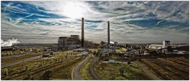
Xcel: Plan to Replace Sherco Units Won't Cost Much More. Here's a clip from a summary at
SCTIMES.com: "
Xcel
Energy said Friday that its plan to reduce carbon emissions at least 60
percent by 2030, including closing two coal-fired Sherco units and
replacing them with a new natural gas plant in Becker, will have a
minimal impact on electric rates. In documents filed with the Minnesota
Public Utilities Commission, Xcel said its plan, if approved, would
result in an annual rate increase of 2.4 percent, compared to
2 percent a year if it continued business as usual for the next 15
years..."
Photo credit:
xcelenergy.com.
What Went Wrong in Flint? FiveThirtyEight
has an exhaustive, well-researched article about the chain reaction of
errors (and horrors) now playing out in Flint, Michigan, and other
Flints around the USA; here's an excerpt: "..
.Lead is an extensively studied neurotoxin, and decades of research show that there is no safe level of exposure.
Although most elevated blood lead levels today are not high enough to
cause immediate problems, there are many long-term effects of lead
exposure, even for small doses. While it’s impossible to say what effect
a low exposure will have on an individual child, research is fairly
clear on what it does to a population. It causes miscarriages and low
birth weight for babies, and it shifts the entire IQ of a population
down a few points. It’s also believed to cause decreases in impulse
control and increases the incidence of attention deficit hyperactivity disorder, learning disabilities and potentially violent behavior..."
Graphic credit above:
Ritchie King and
Ella Koeze
Donald Trump and a Tale of Two Gospels.
WWJD? I don't pretend to know, but the Bible explains in no uncertain
terms that he commanded us to love unconditionally, to accept everyone.
My sister sent me a link to a post from
Rachel Held Evans, and I thought it was worth sharing. Here's an excerpt: "...
Yet
Falwell’s support is hardly isolated, and I suspect if Trump is the
nominee, he will continue to find even more of it from the Religious
Right (which I designate as a subset of a broader and more diverse
evangelicalism). Despite about a million think-pieces on the
topic, the reasons are not that mysterious. Racism and xenophobia remain
powerful forces in our country, as does celebrity worship, and white
Christians aren't as immune from these influences as they like to think....Trump’s
sloppy citations of Scripture are accepted by many at Liberty
University because, as an arm of the Religious Right, the school’s
primary function is political, not religious. The Bible is harvested for
a few conservative sound bites, Jesus reduced to an object of
veneration whose death saves but whose life and teachings remain
inconsequential. When power is the end game, faithfulness bows to
political expediency..."
Photo credit:
New York Times.
The Last Days of Target.
Canadian Business
takes a look at what went wrong north of the border, the untold tale of
Target Canada's difficult birth, tough life and brutal death. Here's an
excerpt: "...
Roughly two years from that date, Target Canada filed
for creditor protection, marking the end of its first international
foray and one of the most confounding sagas in Canadian corporate
history. The debacle cost the parent company billions of dollars,
sullied its reputation and put roughly 17,600 people out of work.
Target’s arrival was highly anticipated by consumers and feared by rival
retailers. The chain, whose roots stretch back to 1902, had perfected
its retail strategy and grown into a US$70-billion titan in its home
country. Target was a careful, analytical and efficient organization
with a highly admired corporate culture. The corporation’s entry into
Canada was uncharacteristically bold—not just for Target, but for any
retailer..." (Image credit
here).
28 Secrets of Incredibly Productive People. More clickbait? Actually there's some good information in a story at
TIME; here's a clip that caught my eye: "...
No is a powerful, productive word (James also wrote a book about it).
We think we’re obligated to say yes to everything, and then we wonder
why we never have enough time. Learning to say no–more specifically,
“No, thank you”–will energize you and excite you. Use it–as much as you
can. Another from James: Entrepreneurs (and writers) are nuts. To save
yourself many wasted hours of time and insanity, find a spouse who is
better adjusted and balanced than you..."
TODAY: Overcast, still mild. Winds: NW 7-12. High: 35
SUNDAY NIGHT: Mostly cloudy, temperatures still above average. Low: 24
MONDAY: Mostly cloudy, good travel weather. Winds: NW 7-12. High: 29
TUESDAY: Potential for a few inches of snow PM hours. Winds: NE 10-20. Wake-up: 23. High: 26
WEDNESDAY: Flurries taper, some PM sun. Winds: NW 10-20. Wake-up: 15. High: 18
THURSDAY: Weak clipper, few flurries possible. Winds: SW 5-10. Wake-up: 12. High: near 20
FRIDAY: Sunny start, light snow arrives late? Winds: SE 8-13. Wake-up: 16. High: 23
SATURDAY: Flurries taper, cold wind. Winds: NW 10-15. Wake-up: 14. High: 19
Climate Stories...
Temperature Study of Last Two Millenia "Confirms Global Warming a Reality." Here's the intro to a story at
BT.com: "
Recent
summers have been the warmest in Europe in the past two millennia,
scientists have said. Researchers from 13 countries including the UK
have used information from tree rings and historical records to
reconstruct summer temperatures stretching back 2,100 years. The data
suggests greater natural variation in summer temperatures, seen in warm
conditions in Roman times, cooler summers in the 4th to 7th centuries, a
warm medieval period and a cold Little Ice Age from the 14th to 19th
century, than previously thought...
Cloud Blanket is Warming Up a Melting Ice Cap. Here's the intro to an update from
Truthdig.com: "
Researchers have identified another piece in the climate machinery that is accelerating the melting of the Greenland ice cap.
The icy hills are responding to the influence of a higher command
system: the clouds. An international research team led by scientists
from the Catholic University of Leuven in Belgium report in Nature Communications journal
that cloud cover above the northern hemisphere’s largest single volume
of permanent ice is raising temperatures by between 2 degrees and 3
degrees C and accounting for 20-30% of the melting. The conclusion,
based on imaging from satellites and on computer simulations, is one
more part of the global examination of the intricate climate systems on
which human harvests, health and happiness ultimately depend..."
Photo credit above: "
Cloud cover shrouds the ice cap near Kangerlussuaq in western Greenland." (Nikolaj F. Rasmussen via Flickr).


No comments:
Post a Comment