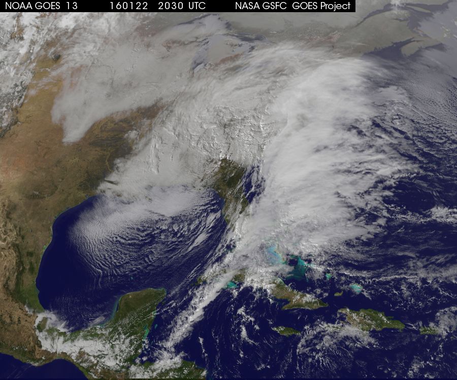
#Blizzard2016 was trending on Twitter yesterday as nearly 78 million people were under some type of winter weather headline. The image below was the visible satllite image from Friday afternoon as the storm system continued to intensify over the Eastern U.S.
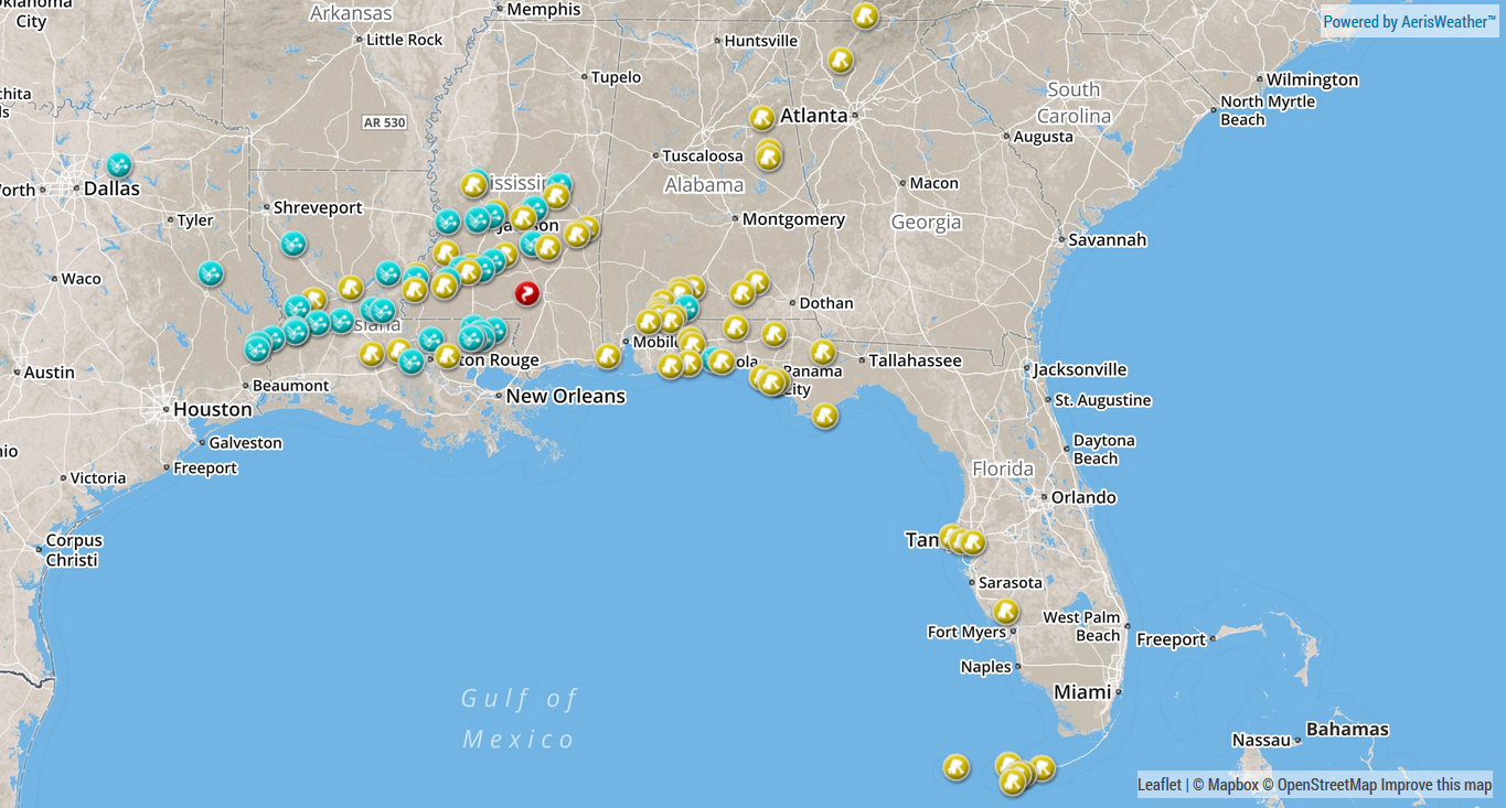
Storm Report Map
This
storm system was repsonbile for a number for a number of hail, high
wind and tornado reports from the Lower Mississippi Valley into the
Southeast and Florida. A number of these reports (including 1 tornado
report in Mississippi) occurred on Thursday.
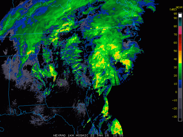
Radar from Friday
This radar loop from Friday afternoon showed several bands of precipitation across the Eastern U.S.. From strong to severe thunderstorms across the Southeast and Florida, to heavy sleet, ice and snow farther north. It was an active day Friday with more wintry weather expected into the weekend with significant snowfall tallies likely for some major cities in the Mid-Atlantic to parts of the Northeast.
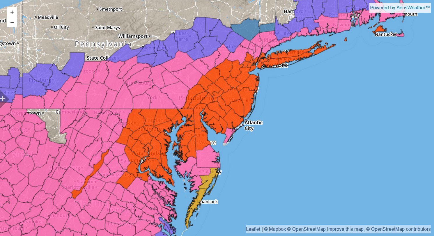
* HAZARD TYPES...HEAVY SNOW AND WIND WITH BLOWING AND DRIFTING
  SNOW THIS AFTERNOON THROUGH SATURDAY NIGHT. SLEET MAY MIX WITH
  THE SNOW TONIGHT INTO SATURDAY MORNING EAST OF INTERSTATE 95
  BEFORE CHANGING BACK TO ALL SNOW BY SATURDAY AFTERNOON.

* ACCUMULATIONS...SNOW ACCUMULATION 18 TO 24 INCHES ALONG AND EAST
  OF INTERSTATE 95...AND 24 TO 30 WEST OF INTERSTATE 95. THE CITY
  OF WASHINGTON DC IS EXPECTED TO RECEIVE AROUND 24 INCHES.

* TIMING...HEAVY SNOW WILL DEVELOP THIS AFTERNOON AND CONTINUE
  THROUGH SATURDAY NIGHT. CONDITIONS ARE EXPECTED TO DETERIORATE
  THIS AFTERNOON WITH THE HEAVIEST SNOW... STRONGEST WINDS...AND
  POTENTIAL LIFE THREATENING CONDITIONS EXPECTED TONIGHT THROUGH
  SATURDAY NIGHT.

* IMPACTS...HEAVY SNOW AND BLOWING SNOW WILL CAUSE DANGEROUS
  CONDITIONS AND WILL BE A THREAT TO LIFE AND PROPERTY. TRAVEL IS
  EXPECTED TO BE SEVERELY LIMITED IF NOT IMPOSSIBLE DURING THE
  HEIGHT OF THE STORM TONIGHT AND SATURDAY. VISIBILITY WILL BE
  REDUCED TO NEAR ZERO AT TIMES IN WHITEOUT CONDITIONS.

* WINDS...NORTH 25 TO 35 MPH WITH GUSTS UP TO 60 MPH ALONG THE
  CHESAPEAKE BAY SHORELINE...BECOMING NORTH SATURDAY AND
  NORTHWEST SATURDAY NIGHT.
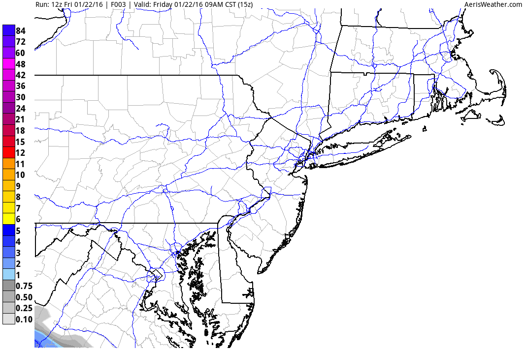
Snowfall Potential
Incredible snowfall tallies of 1ft to 2ft.+ will be possible across a large swath from the Ohio Valley to parts of the Northeast. The snowfall loop below shows some of the heaviest from near the Baltimore/DC area to New York City/Long Island. This also corresponds with the blizzard warnings that have been posted by the NWS.
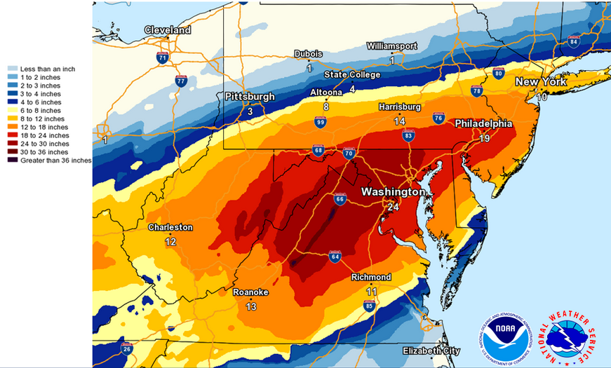
Total Snowfall Forecast
These really are some incredible amounts! Look at how widespread the 12" to 24" amounts will be!! Crippling snowstorm for some, no question!
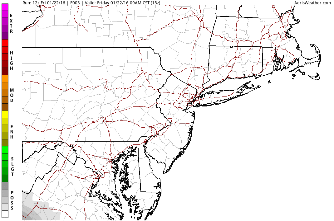
BPI: Blizzard Potential Index
The BPI combines snowfall and winds to show where the best potential for blizzard-like conditions may unfold at that specific time. Note that the brighter colors (indicating the best chances for blizzard-like conditions) fall within the blizzard warned areas above from PM Friday to early Sunday morning.
The Big One Out East; An Un-Arctic Weekend For Us
By Todd Nelson, Filling in for Douglas
A major winter storm continues today for some major cities in the Mid-Atlantic to parts of the Northeast. This crippling event will dump a whopping 1ft. to 2ft or more in locations with winds gusting to near 50mph, which could create blizzard-like conditions from Washington D.C. to New York City this weekend. Significant icing across parts of the Mid-Atlantic region could be even more devastating than the historic snowfall amounts expected just to the north. Yep, this is the big one!
For us, a much more sublime weather pattern has moved in. It's not nearly as Arctic as it was over the past couple of weekends. In fact, temperatures will be nearly 40 to 50 degrees warmer than it was last Sunday morning when many locations dipped into the 10s, 20s and even 30s below zero across the state.
I am reminded by one of my favorite movies, Grumpy Old Men, when Walter Matthau "Max Goldman" walks to the mailbox humming the tune, "Heat Wave".
Our Minnesota heat wave sticks around through next week with light snow accumulations by Monday.
__________________________________
Extended Forecast
FRIDAY NIGHT: Partly cloudy. Winds: S 5. Low: 11.
SATURDAY: Fading sun, stiff breeze. Winds: SSW 10-15. High: 26
SATURDAY NIGHT: Moslty cloudy and mild. Winds: SW 5-10. Low: 21.
SUNDAY: Mostly gray, risk of a thaw. Clouds thicken late with light snow overnight Winds: E 5. High: 32
MONDAY: Light snow, light accumulations. Wake-up: 24. High: 28
TUESDAY: Chilly breeze. Cloudy with flurries. Wake-up: 19. High: 24
WEDNESDAY: Cloudy. Light snow potential late. Wake-up: 12. High: 20
THURSDAY: Warmer and breezy with a few flakes. Wake-up: 20. High: 30
FRIDAY: Peeks of sun, still mild for January.
____________________________________
____________________________________
This Day in Weather History
January 23rd
January 23rd
1963: A record low of -31 is set at the Minneapolis-St. Paul International Airport.
____________________________________
____________________________________
Average High/Low for Minneapolis
January 23rd
January 23rd
Average High: 24F (Record: 53F set in 1942)
Average Low: 7F (Record: -34F set in 1886)
____________________________________
Average Low: 7F (Record: -34F set in 1886)
____________________________________
Sunrise/Sunset Times for Minneapolis
January 23rd
January 23rd
Sunrise: 7:42am
Sunset: 5:08pm
Sunset: 5:08pm
*Daylight Gained Since Yesterday: ~2mins & 11secs
*Daylight Gained Since Winter Solstice (December 21st): ~39mins
_____________________________________
*Daylight Gained Since Winter Solstice (December 21st): ~39mins
_____________________________________
Moon Phase for January 23rd at Midnight 0.2 Days After Full (Wolf) Moon
"Also known as the Moon after Yule, Old Moon or Snow Moon, the full moon in January was named after howling wolves." (Timeanddate.com)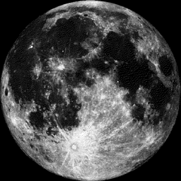
_______________________________________
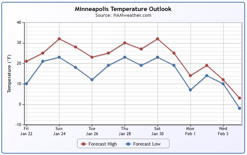
Minneapolis Temperature Trend
Here's
the forecast temperature trend into early February, which shows much
warmer temperatures through the end of the month compared to what we've
recently gone through. It appears that temperatures will be at or above
average through much of next week with a bit of a bigger cool down
possible by early February.
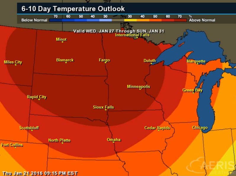
6 to 10 Day Temperature Outlook
After
several days of cooler than average temperatures across the Upper
Midwest, the extended forecast suggests warmer than average temperatures
by the end of the month. This will feel like a heat wave compared to
the Arctic invasions we endured over the last couple of weeks.
_______________________________________
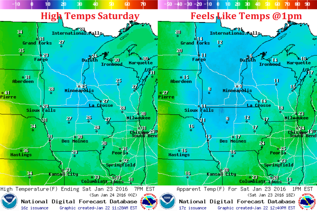
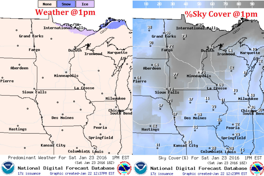
Weather Outlook for for Saturday
The
forecast for Saturday shows actual air temperatures in the 20s across
the state, which is considerably warmer than what we endured over the
last couple of weekends. However with the winds, it'll feel a bit cooler
with wind chills in the single digits and teens.
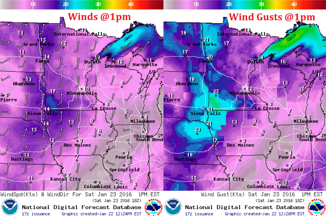
Weather Outlook for Saturday
Winds on Saturday across the region will be a bit breeze, especially in the western part of the state with gusts close to 20mph+
Weather Outlook for Saturday
A
low level cloud deck will keep much of the region partly to mostly
cloudy across the region on Saturday, however there may be a few peeks
of sun.
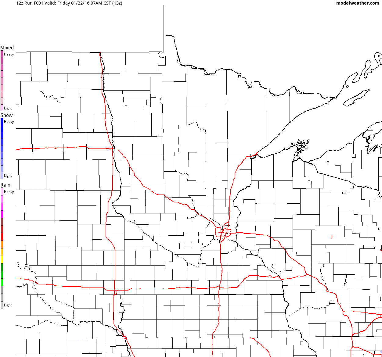
Simulated Radar
Here's
the simulated radar through the upcoming weekend. Note the fast moving
clipper that drifts across the northern part of the state Saturday with
another batch of light snow moving into North Dakota by Sunday. That
secondary batch of snow will be the beginning of some snowfall
accumulation potential across the Upper Midwest/Minnesota Sunday
night/Monday.
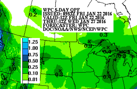
5 Day Precipitation Forecast
According
to NOAA's WPC, the 5 day precipitation forecast suggests a couple
tenths of an inch of liquid moving through the area through AM
Wednesday. A quick snow to liquid conversion would suggests the potential
of maybe 1" to 2" of snow possible across parts of the Midwest if the
moisture holds... stay tuned!
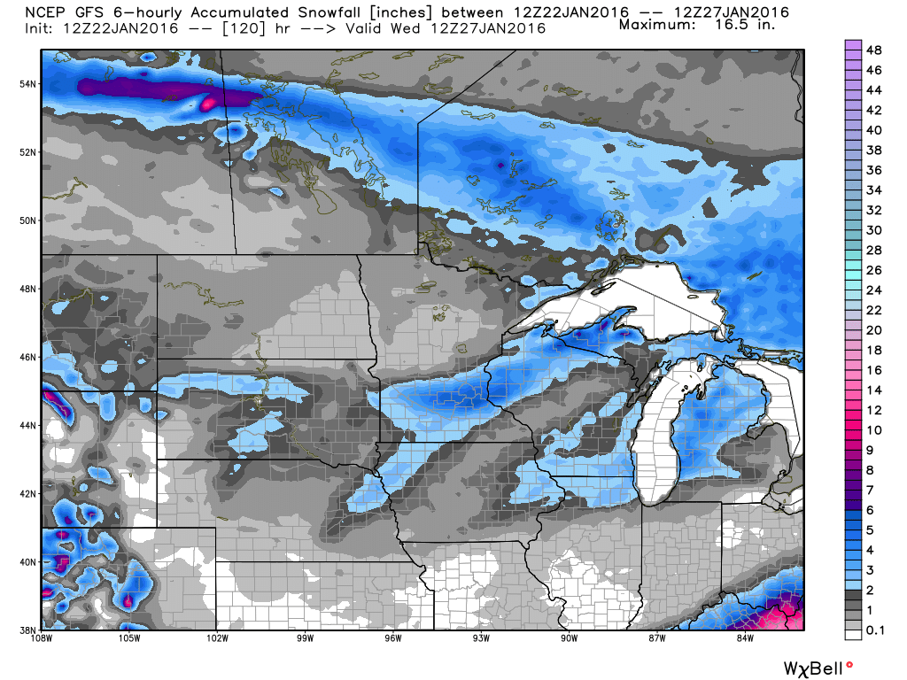
5 Day Snowfall Potential
Here's
the GFS snowfall forecast through the middle part of next week, which
shows accumulating snow possible across parts of the region. Some of the
snow might be shovelable.
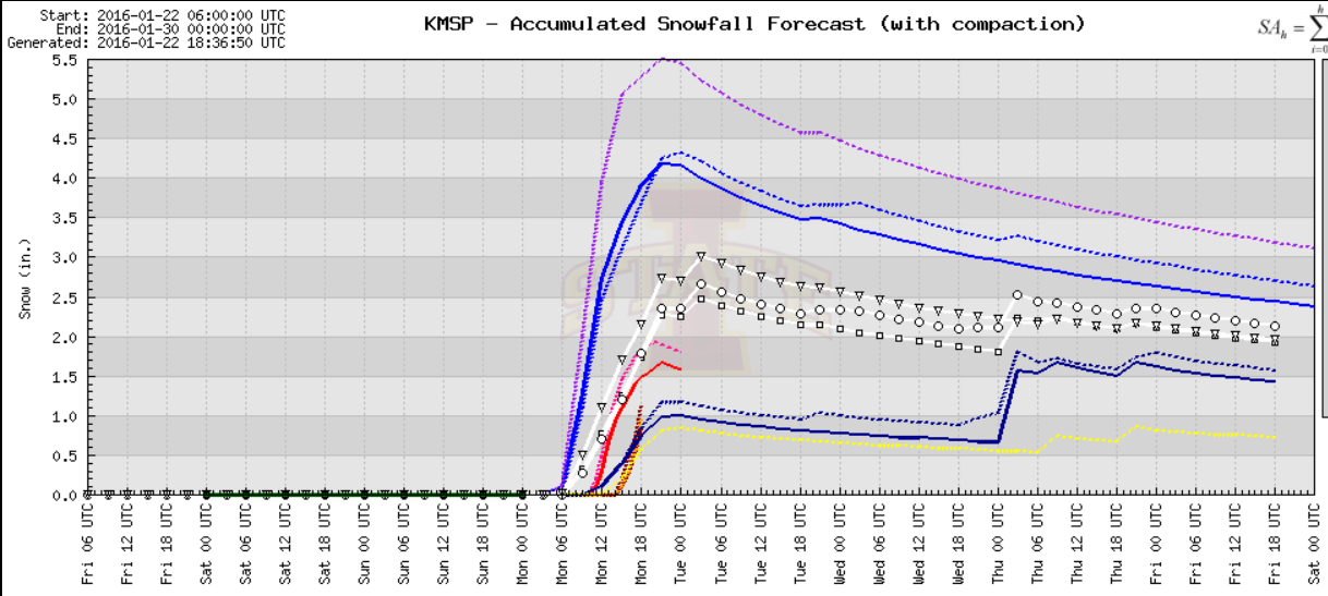
Minneapolis Snowfall Potential
Some of the latest models suggests at least of couple/few inches of snow for Minneapolis through early next week.
National Weather Outlook
The
historic snow event across the Eastern U.S. will move offshore by the
late weekend timeframe while another weak system will move through the
Central U.S. by early next week.This one will bring minor snow
accumulations to parts of the Central U.S. by early next week.
Thanks for checking in and have a good weekend ahead!

No comments:
Post a Comment