Tuesday, May 31, 2016

Slight Cooling Trend Into The Weekend - Historic Floods Grip Texas and Much of Europe

72 F. high in the Twin Cities Tuesday.

74 F. average high on May 31.

63 F. high temperature on May 31, 2015.

June 1, 1993: St. Cloud records its latest ever freezing temperature, with a record low of 32.


Canada Takes The Edge Off Our Heat and Humidity

You know that annoyingly-persistent friend or family member who gives you updates from Phoenix during January, gloating about blue sky and "perfect golf weather"? Now might be a good time to touch base.

An Excessive Heat Watch is in effect for Phoenix, for highs from 110-115F with a heat index topping 120F. "But it's a dry heat Paul!" Uh, my oven is a dry heat - I still wouldn't stick my head inside.
Send a note to your Florida friends, too. It's been 11 years since a major (category 3 or stronger) hurricane has struck the Sunshine State. La Nina cool phases tend to favor more hurricanes in the Atlantic. Remind them Minnesotans don't track "storms with names".

The inevitable cold fronts are looking better. Canada leaks cooler, fresher air south of the border, meaning highs in the 70s into the weekend, with a welcome dip in dew point. A lonely instability T-shower may sprout later this afternoon, but Thursday looks stunning. More widespread T-storms arrive Friday with a cool wind and nagging shower risk on Saturday.

No sizzling heat until mid-June at the earliest. Whew.
Floods Hit Historic Levels in Texas, And More Rain Is On The Way. Here's a video link at story excerpt from PBS NewsHour: "...We have had a history of rivering flooding in our area, and so we are, as always, continuing to monitor that. Unfortunately, it’s just the way that Houston was built. This was a small town that was eclipsed by the town of Galveston when it was built. And so, since then, we have just had a lot of development, we have had a lot of building, but, unfortunately, the way that the Southeast Texas area drains is through a system of bayous. So if we do receive heavy amounts of rain in concentrated areas, that can put a lot of strain on the bayous towards the Gulf of Mexico, which then results in flooding..."

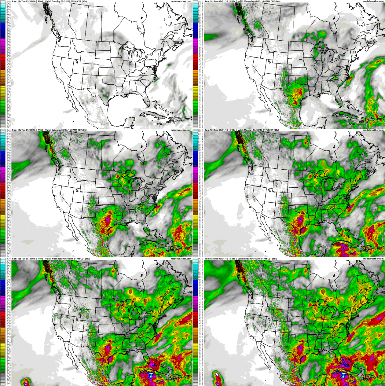
Adding Insult to Injury. NOAA's GFS model predicts another  4-8" for much of Texas this week, compounding the historic flooding already underway in the Houston area. Maybe it's always been like this, but (anecdotally) it sure seems like weather - increasingly - is getting stuck in extended ruts. Loop: AerisWeather.

Friday Storms May Be Severe. Instability will be sufficient, low-level shear and dew points marginal, but I could see a few reports of 1"+ hail with T-storms Friday afternoon and evening across the state of Minnesota. The 00z NAM model prints out .78" of rain for the metro area. Source: Aeris Enterprise.

From Upper 60s Saturday to Upper 80s Next Week? The graph above shows ECMWF (European) guidance looking out 10 days; hinting at full-frontal summer returning next week. Source: WeatherBell.

Heating Up By Mid-June. NOAA's GFS model has been fairly consistent, pulling the main belt of westerlies farther north by mid-June, hinting at 80s, maybe 90s just south of Minnesota as we sail into the third week of June.


If You Build It They Will Come - Hurricanes, That Is. Meteorologist John Morales from Miami has a timely post at WXshift; here's the intro: "In the classic baseball movie "Field of Dreams," a baseball diamond was built in a cornfield. In what could be a disaster movie-in-production, Florida has built enough housing and infrastructure in the past decade to accommodate 2.5 million new residents. It’s clear that a lot of building has been going on in the Sunshine State lately. But not one has come! Not a single hurricane has reached Florida since major Hurricane Wilma in October 2005. When this year’s Atlantic hurricane season starts on June 1, it’ll mark a record 10 years, seven months and eight days since the last landfall..."

Image credit: "Satellite image of Hurricane Wilma over Florida." Credit:


Column: A Big Hurricane Will Hit Us Sometime. You could make a (statistical) argument that Floridians are living on borrowed time. Is this the year the hurricane-drought ends? Here's an excerpt of an Op-Ed at The Tampa Bay Times: "A storm is coming. We just don't know when. After an unprecedented streak of 10 years without a hurricane, maybe you're comfortable with Florida's preparation for the next big hurricane, the flooding and powerful winds. But it's not wise to become complacent about storms; Florida remains the most hurricane-prone state in the nation, and a big one is coming — sometime..."

Meet TWIRL, The Storm Chasers Who Planted Sensors In The Heart of a Twister. Yes, but can they purchase life insurance at reasonable rates. Don't try this at home. Here's an excerpt from Yahoo Finance: "May 9 started out just like any other day for scientists and students participating in the Center for Severe Weather Research’s TWIRL project. The group’s fleet of mobile Doppler on Wheels (DOWs) and observation vehicles had already made their way some 800 miles from their Colorado home base to south central Oklahoma, looking to intentionally place themselves in harm’s way. And on this day, boy did they ever. Why would somebody do such a thing? Science, of course. TWIRL stands for “Tornadic Winds: In-situ and Radar observations at Low levels.” In plain English, these researchers want to understand better how tornadoes form, their strength, and how their winds do damage. The hope is by getting data at the surface often missed by stationary radars dozens if not hundreds of miles away, a better understanding of this killer weather phenomena will save lives later through improved forecasts..."

Photo credit: "Left to right, Molyneaux, Marshall, and DeFlitch with the damaged Pod O." CSWR.

Tornado Town USA. What is it about large, violent tornadoes and the Oklahoma City suburb of Moore? FiveThirtyEight takes a hard look - here's a snippet: "...Nobody knows how likely it is that a given town would be hit by four violent tornadoes in 16 years; if we knew that, then we’d also know whether Moore really is especially tornado prone, or just suffering a streak of bad luck. But we do know big tornadoes, themselves, are rare. Devastating EF4s made up 1.37 percent of all the tornadoes that hit the U.S. from 1994 to 2012.2 Just 0.14 percent were incredible EF5s. And that’s enough to make Moore’s recent history turn heads..."


Tornado Sirens, An Old Technology, Still Playing a Vital Role. Remember that sirens were created for outdoor alerting - just don't rely on them when you're in the house, office or shop. Here's a clip from a New York Times article: "...For out-of-the-way places, such as golf courses, lakes and hiking trails, where cellphone service might be spotty or nonexistent, sirens are an “important redundancy” to alert the public, said Bill Bunting, the chief of forecast operations at the Storm Prediction Center in Norman, Okla. Mr. Shelts said social media can be ineffective in delivering warnings because there is no true management or vetting of what gets posted. Incomplete, inaccurate or outdated information could be shared..."

Photo credit: "Most sirens emit sounds between 400 and 600 hertz, which researchers have found is the best range to get people’s attention." Credit Rogelio V. Solis/Associated Press.


Republicans and Democrats Agree On At Least One Thing: Wildfires Are a Major Threat. Here's the intro to a story at Grist: "A bipartisan group of U.S. senators is teaming up to do away with preordained spending caps on emergency fire recovery efforts as the American West braces for another wildfire season. Drier conditions, likely driven by climate change, have turned vast swaths of the continent into veritable tinderboxes; last summer, for example, five million acres of Alaska and 1.7 million acres across Washington, Oregon, and Idaho burned. “We need to call mega-fires what they are — disasters,” said Sen. Mike Crapo (R-Idaho), in a press release..." (Image credit: REUTERS/Noah Berger).

Can FEMA's Flood Insurace Program Afford Another Disaster? Blame Sandy and Katrina, and a litany of other flood-related disasters in recent years. 90% of all disasters in this country involve flooding. The hourlong documentary was extraordinary on PBS; here's an excerpt of a companion article from Fvrontline: "Floods cause more damage each year in the United States than any other kind of natural disaster — so much more, in fact, that most private insurance companies stopped offering flood insurance decades ago. In 1968, the federal government stepped in, creating the National Flood Insurance Program. The program is run today by the Federal Emergency Management Agency. Over the last 11 years, the program has fallen billions in debt; a 2015 report from the Government Accountability Office said it was unlikely to be able to repay the money it has borrowed from taxpayers. Worse yet, the program has been accused of waste, poor oversight and fraud..."

Extreme Weather Increasing Level of Toxins in Food, Scientists Warn. Reuters has the story and perspective; here's the intro: "As they struggle to deal with more extreme weather, a range of food crops are generating more of chemical compounds that can cause health problems for people and livestock who eat them, scientists have warned. A new report by the United Nations Environment Programme (UNEP) says that crops such as wheat and maize are generating more potential toxins as a reaction to protect themselves from extreme weather. But these chemical compounds are harmful to people and animals if consumed for a prolonged period of time, according to a report released during a United Nations Environment Assembly meeting in Nairobi..."

Image credit: "Slices of cucumber and a tomato slice are pictured in this illustration photo taken in Berlin May 30, 2011." Reuters/Pawel Kopczynski.


Weather and Mood: Rainy With a Chance of Depression. Are you "weather-sensitive"? It would appear that there's considerable data to suggest that some of us are more prone to ups and downs triggered by changes in the weather. Here's an excerpt from Everyday Health: "...Weather is going to affect you more if you are a highly-sensitive person, as defined by Elaine Aron, PhD, in her best-seller, The Highly Sensitive Person. If you answer yes to these and most of the questions on Aron’s website, you’re probably in the club, which holds 15 to 20 percent of human beings. Are you easily overwhelmed by bright lights and noise? Do you startle easily? Do other people’s moods influence you? Does caffeine have a great effect on you? Research has indicated that hypersensitive people are genetically different from folks who have a normal degree of sensitivity. This might explain why the rain or cold or heat affects some of us much more than others, and why some people would thrive in a humid, hot climate, while others would wilt. Your response to weather would depend on your sensitivity type..."
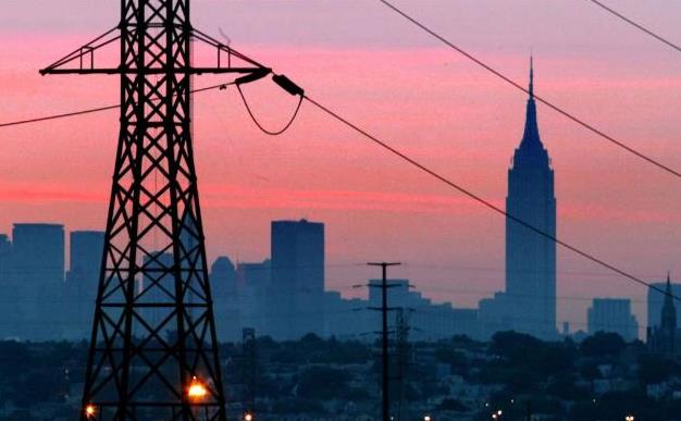
Why a Power Grid Attack is a Nightmare Scenario. Alarmist hype? I sure hope so. Here's an excerpt from TheHill: "...While cybersecurity experts and industry executives describe such warnings as alarmist, intelligence officials say people underestimate how destructive a power outage can be. The most damaging kind of attack, specialists say, would be carefully coordinated to strike multiple power stations. If hackers were to knock out 100 strategically chosen generators in the Northeast, for example, the damaged power grid would quickly overload, causing a cascade of secondary outages across multiple states. While some areas could recover quickly, others might be without power for weeks. The scenario isn’t completely hypothetical. Lawmakers and government officials got a preview in 2003, when a blackout spread from the coastal Northeast into the Midwest and Canada..." (File photo: AP).

Emotions Seem To Be Detectable in Air. The Atlantic recently ran a fascinating story; here's an excerpt: "...In Hunger Games: Catching Fire, for example, during the “suspense” scenes—when Jennifer Lawrence was in particular danger—the carbon dioxide, acetone, and isoprene levels in the theater air predictably increased. The researchers speculate that this may have something to do with breath-holding, or stress hormone production—but it is all speculation. The important point was that the signals occurred at exactly the same time in all four screenings of the film. They also found the reproducible changes in the air chemistry during “humor” scenes in other films..."


Arabic Weather Term "Haboob" is Apparently Troubling for Some Texans. You can't make this stuff up; here's an excerpt from Capital Weather Gang: "A wall of dust raced toward Lubbock, Texas, on Sunday, and the National Weather Service threw out a word of caution on its Facebook page. “A haboob is rapidly approaching the Lubbock airport and may affect the city as well,” the meteorologists wrote. The use of  the meteorological term “haboob,” a word with Arabic roots, didn’t sit well with some residents..."

Photo credit above: "On Sunday evening, a haboob — like the one showed here — rolled through Lubbock, Tex., but some Texans were more upset by the terminology than the storm itself." (Daniel Bryant).

Much-Needed Laughs. The news is more depressing than ever, so I welcomed a chance to be a guest judget at the House of Comedy last night at Mall of America. All 8 finalists were amazing - my congrats to all of them for having the courage to stand up there and take risks. I laughed so hard I had to change my man-diaper.

 
TODAY: Partly sunny, breezy. Slight risk of a late-day shower. Winds: W 10-20. High: near 70

WEDNESDAY NIGHT: Gradual clearing, cooling breeze. Low: 51

THURSDAY: Sunny and spectacular. Winds: NW 7-12. High: 74

FRIDAY: Warmer with strong PM T-storms. Winds: S 10-15. Wake-up: 59. High: near 80

SATURDAY: Cool wind, lingering showers. Winds: NW 10-20. Wake-up: 58. High: 68

SUNDAY: Slightly better. Sunny AM, late PM shower? Winds: NW 10-15. Wake-up: 53. High: 73

MONDAY: More sun, less wind. Winds: NW 8-13. Wake-up: 52. High: 74

TUESDAY: Sunny, turning warmer. Winds: S 10-15. Wake-up: 56. High: near 80
 

Climate Stories...

15 Photos of Devastating Floods Show What The Future of Europe Could Look Like. Here's a story excerpt from Huffington Post: "...The devastation caused by the flooding shows the vulnerabilities that even wealthy countries face as global warming causes the climate to change and weather to become more extreme. “We cannot predict climate on a local scale 10 years ahead or even further, but we can put a lot more effort on extracting the information on what could be happening in that far-away abstract future by looking at the extremes that happen today,” Bart van den Hurk, a doctor at the Royal Netherlands Meteorological Institute, said in a report published last week by the European Commission.  A study released in March 2014 found that the frequency of severe flooding across Europe is expected to double by 2050. The annual economic costs from that flood will go up nearly fivefold, the study found..."

Photo credit: Kai Pfaffenbach/Reuters. "A damaged car is pictured Monday after floods in the town of Braunsbach, Germany."


If Climate Scientists Are In It For The Money, They're Doing It Wrong. Here's an excerpt from Ars Technica: "...It's also worth pointing out what they get that money for, as exemplified by a fairly typical program announcement for NSF grants. It calls for studies of past climate change and its impact on the weather—pretty typical stuff. This sort of research could support the current consensus view. But it just as easily might not. It's impossible to tell before the work's done. And that's true for pretty much every scientific funding opportunity—you can't dictate the results in advance. So, even if the granting process were biased (and there's been no indication that it is), there is no way for it to prevent people from obtaining data that poses problems for the current consensus..."


Record-Breaking Heavy Rainfall Events Increased Under Global Warming. Professional climate deniers will tell you otherwise, but the data suggests an increase in extreme rainfall  events, worldwide. Here's an excerpt from PIK Research Portal: "Heavy rainfall events setting ever new records have been increasing strikingly in the past thirty years. While before 1980, multi-decadal fluctuations in extreme rainfall events are explained by natural variability, a team of scientists of the Potsdam Institute for Climate Impact Research detected a clear upward trend in the past few decades towards more unprecedented daily rainfall events. They find the worldwide increase to be consistent with rising global temperatures which are caused by greenhouse-gas emissions from burning fossil fuels. Short-term torrential rains can lead to high-impact floodings..."

Graphic credit: Lehmann et all, 2015. Climate Crocks has more on global rainfall trends here.
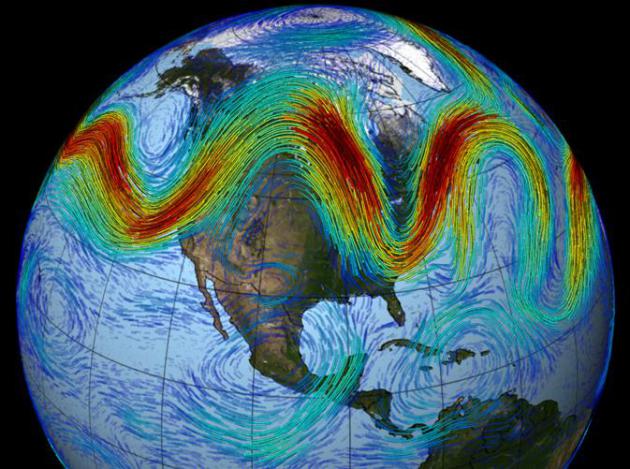
Meteorologists Are Seeing Global Warming's Effect on the Weather. Here's an excerpt of a recent story I wrote for The Guardian: "...A warmer atmosphere is increasing water vapor levels overhead, juicing storms, fueling an increase in flash floods in the summer, and heavier winter snows along the East Coast of the USA. “All storms are 5 to 10 percent stronger in terms of heavy rainfall” explained Dr. Kevin Trenberth, at the National Center for Atmospheric Research in Boulder, Colorado. “It means what was a very rare event is now not quite so rare.” In recent decades, weather patterns have appeared to become more sluggish and erratic, worldwide. Rapid warming of the Arctic may be impacting the jet stream, the high-speed river of air that whisks weather systems around the planet. These high-altitude winds are powered by north-south temperature gradients, which are being altered by rapid warming of northern latitudes..."

This Week's Wild Weather, Brought To You By The Letter Omega. Following up on the preceeding story here's further explanation of how a variation in north-south temperature gradients may be impacting jet stream winds, worldwide, causing weather to become "stuck" with greater frequency - courtesy of WXshift: "...While blocks are a normal part of weather, there is some tentative evidence that blocking may become more common with climate change. The warming Arctic may be the key driver and is a reminder that what happens in the Arctic does not stay in the Arctic. Fundamentally, the speed of the jet stream depends on the contrast between the temperature in the tropics and the Arctic. A larger temperature difference yields a faster jet stream. If the Arctic warms more quickly than the tropics, which has been observed, that temperature difference decreases and the jet stream slows. And as it does during its annual summer retreat, the slower jet stream tends to meander, leaving behind these large swirls responsible for atmospheric blocking. At the forefront of this research is Jennifer Francis at Rutgers University. And while the strength of this relationship that she has highlighted is still the cause of much discussion in scientific circles, a new study in the Journal of Climate lends support to the idea..."

Soggy Tuesday - Free A/C Next Weekend - Signs of a Changing Climate Showing Up in the Weather

60 F. low temperature Monday morning.
84 F. high reported in the Twin Cities on Memorial Day.
73 F. average high on May 30.

May 31, 1934: Extreme heat impacts the Twin Cities, with highs of 107 in St. Paul and 106 in Minneapolis. Rush City reached 110. Numerous cases of heat ailments affect people and livestock.
May 31, 1932: A heat wave hits southern Minnesota, with highs of 108 at Campbell, Fairmont, Faribault, and New Ulm.


High Puddle Index Today - Weekend Cooling Trend

I met an old meteorology buddy in Chicago last weekend, now teaching after being laid off from a major airline. "I still love the weather but is it a good business?" he asked.

Great question.

We are drowning in weather. Apps, TV, radio, print, social media, thousands of web sites with weather-on-demand. How can you create enough value to carve out a sustainable business model?
Every business is being disrupted by the Internet, automation, computerization, globalization and even AI - and meteorology is no exception. Computers have outsourced people, in many cases. And nobody wants to be in a commodity business, with hundreds or thousands of competitors, all selling the same product.

We've been hypnotized by technology; the real art is a (consistently) accurate forecast that keeps people safer, and companies more profitable.

Today is the wettest day of the week as a front pushes east. Skies clear tomorrow, leaving us with a stunning Thursday. T-storms late Friday mark the leading edge of cooler, Canadian air next weekend; 60-degree highs possible early next week.

This free A/C gives way to another surge of summer-like 80s by the latter half of next week.

A Plan B Tuesday. The risk of showers and T-storms is high today, probably the wettest day of the week. A few hours of showers and (heavy) T-storms are likely; 4 KM NAM guidance prints out the heaviest amounts north and east of the MSP metro, where some 2-3" amounts are predicted. The 00z 12 KM NAM guidance shows 46" of rain for the metro, but as is usually the case with convective fronts rainfall amounts will be all over the map. Rainfall guidance: NOAA and AerisWeather.

Canadian Aftertaste. Some are already complaining about the heat and humidity, and if you don't like the muggies you'll be breathing a lot easier by next weekend with highs in the 70s and a noticeable dip in dew point. Friday looks like the warmest day this week with some low 80s nearby. ECMWF guidance: WeatherBell.

Warming Up By Mid-June. After a relatively cool and comfortable start to June long-range GFS guidance shows the core of the jet lifting north, allowing warmer, stickier air to expand northward. A few 80s by mid-June? Likely, but I don't see any extended stretches of 90s, not yet.


6 Dead in Texas Floods, And More Rain is Coming. Here's an update on the incessant rains afflicting much of Texas from the New York Times: "..Since Wednesday, the thunderstorms have dropped pockets of intensely heavy rain, or “rain bombs,” as meteorologists call them. These have circulated through East Texas, Dallas and Corpus Christi, along with Austin and San Antonio, hitting some parts harder than others, said Kurt Van Speybroeck, a National Weather Service meteorologist. As a result, rainfall has ranged from four inches in parts of the Dallas-Fort Worth area to 30 inches in Washington County, the authorities said..."

Photo credit above: "The three men in the foreground had to abandon their truck Friday after getting caught in rising flood waters in Magnolia, Tex." Credit Michael Ciaglo/Houston Chronicle, via Associated Press.


Tornado Town USA. What is it about large, violent tornadoes and the Oklahoma City suburb of Moore? FiveThirtyEight takes a hard look - here's a snippet: "...Nobody knows how likely it is that a given town would be hit by four violent tornadoes in 16 years; if we knew that, then we’d also know whether Moore really is especially tornado prone, or just suffering a streak of bad luck. But we do know big tornadoes, themselves, are rare. Devastating EF4s made up 1.37 percent of all the tornadoes that hit the U.S. from 1994 to 2012.2 Just 0.14 percent were incredible EF5s. And that’s enough to make Moore’s recent history turn heads..."


Tornado Sirens, An Old Technology, Still Playing a Vital Role. Remember that sirens were created for outdoor alerting - just don't rely on them when you're in the house, office or shop. Here's a clip from a New York Times article: "...For out-of-the-way places, such as golf courses, lakes and hiking trails, where cellphone service might be spotty or nonexistent, sirens are an “important redundancy” to alert the public, said Bill Bunting, the chief of forecast operations at the Storm Prediction Center in Norman, Okla. Mr. Shelts said social media can be ineffective in delivering warnings because there is no true management or vetting of what gets posted. Incomplete, inaccurate or outdated information could be shared..."

Photo credit: "Most sirens emit sounds between 400 and 600 hertz, which researchers have found is the best range to get people’s attention." Credit Rogelio V. Solis/Associated Press.

Serious Hail. My father, who speaks fluent German, sent me a link from tagesschau.de from a town near Frankfurt, Germany, which was buried under enough hail over the weekend to bring out the plows.

Deadly Flooding in Southern Germany. The Houston, Texas area isn't the only spot seeing repeated, torrential rains. Deutsche Welle has details on recent flash flooding.


Abrupt Atlantic Ocean Changes May Have Been Natural. Here's an excerpt from Climate Central: "...Climate change may not have been to blame for an abrupt recent slowdown of a sweeping Atlantic Ocean current, a change that delivered an intense pulse of ocean warming and sea level rise through the Gulf of Maine and elsewhere along the East Coast. Modeling-based analysis by British scientists, published Monday in Nature Geoscience, concluded that the decline in the Atlantic meridional overturning circulation (AMOC) from 2004 to 2014 was “part of decadal variability of the North Atlantic,” representing a recovery following a previous strengthening of its currents. Still, leading scientists warn that greenhouse gas pollution appears to be causing the circulation pattern to slow down, and that it will continue to do so with far-reaching implications for weather and for flood-prone cities and farms around the world..."

Photo credit above: "Atlantic Ocean currents influence the weather and sea levels." Credit: John Spade/Flickr

Can FEMA's Flood Insurace Program Afford Another Disaster? Blame Sandy and Katrina, and a litany of other flood-related disasters in recent years. 90% of all disasters in this country involve flooding. The hourlong documentary was extraordinary on PBS; here's an excerpt of a companion article from Frontline: "Floods cause more damage each year in the United States than any other kind of natural disaster — so much more, in fact, that most private insurance companies stopped offering flood insurance decades ago. In 1968, the federal government stepped in, creating the National Flood Insurance Program. The program is run today by the Federal Emergency Management Agency. Over the last 11 years, the program has fallen billions in debt; a 2015 report from the Government Accountability Office said it was unlikely to be able to repay the money it has borrowed from taxpayers. Worse yet, the program has been accused of waste, poor oversight and fraud..."

Emotions Seem To Be Detectable in Air. The Atlantic recently ran a fascinating story; here's an excerpt: "...In Hunger Games: Catching Fire, for example, during the “suspense” scenes—when Jennifer Lawrence was in particular danger—the carbon dioxide, acetone, and isoprene levels in the theater air predictably increased. The researchers speculate that this may have something to do with breath-holding, or stress hormone production—but it is all speculation. The important point was that the signals occurred at exactly the same time in all four screenings of the film. They also found the reproducible changes in the air chemistry during “humor” scenes in other films..."

Why You Will Marry The Wrong Person. Here's an excerpt of a little day-brightener from The New York Times: "...Indeed, marriage tends decisively to move us onto another, very different and more administrative plane, which perhaps unfolds in a suburban house, with a long commute and maddening children who kill the passion from which they emerged. The only ingredient in common is the partner. And that might have been the wrong ingredient to bottle. The good news is that it doesn’t matter if we find we have married the wrong person. We mustn’t abandon him or her, only the founding Romantic idea upon which the Western understanding of marriage has been based the last 250 years: that a perfect being exists who can meet all our needs and satisfy our every yearning..."


TODAY: Showers & T-storms likely. Winds: SW 8-13. High: 74

TUESDAY NIGHT: Evening showers, drying out late. Low: 58

WEDNESDAY: More sun, PM instability shower up north. Winds: W 10-15. High: near 70

THURSDAY: Best day in sight. Bright sun. Winds: W 8-13. Wake-up: 53. High: 73

FRIDAY: Sunny start, watch for late storms. Winds: SE 10-15. Wake-up: 59. High: 81

SATURDAY: Peeks of sun, cooler breeze. Winds: NW 10-20. Wake-up: 60. High: 74

SUNDAY: Partly sunny, PM showers north. Winds: NW 10-15. Wake-up: 57. High: 73

MONDAY: Mix of clouds and sun, cool. Winds: N 10-20. Wake-up: 56. High: 69


Climate Stories...

Meteorologists Are Seeing Global Warming's Effect on the Weather. Here's an excerpt of a recent story I wrote for The Guardian: "...A warmer atmosphere is increasing water vapor levels overhead, juicing storms, fueling an increase in flash floods in the summer, and heavier winter snows along the East Coast of the USA. “All storms are 5 to 10 percent stronger in terms of heavy rainfall” explained Dr. Kevin Trenberth, at the National Center for Atmospheric Research in Boulder, Colorado. “It means what was a very rare event is now not quite so rare.” In recent decades, weather patterns have appeared to become more sluggish and erratic, worldwide. Rapid warming of the Arctic may be impacting the jet stream, the high-speed river of air that whisks weather systems around the planet. These high-altitude winds are powered by north-south temperature gradients, which are being altered by rapid warming of northern latitudes..."

This Week's Wild Weather, Brought To You By The Letter Omega. Following up on the preceeding story here's further explanation of how a variation in north-south temperature gradients may be impacting jet stream winds, worldwide, causing weather to become "stuck" with greater frequency - courtesy of WXshift: "...While blocks are a normal part of weather, there is some tentative evidence that blocking may become more common with climate change. The warming Arctic may be the key driver and is a reminder that what happens in the Arctic does not stay in the Arctic. Fundamentally, the speed of the jet stream depends on the contrast between the temperature in the tropics and the Arctic. A larger temperature difference yields a faster jet stream. If the Arctic warms more quickly than the tropics, which has been observed, that temperature difference decreases and the jet stream slows. And as it does during its annual summer retreat, the slower jet stream tends to meander, leaving behind these large swirls responsible for atmospheric blocking. At the forefront of this research is Jennifer Francis at Rutgers University. And while the strength of this relationship that she has highlighted is still the cause of much discussion in scientific circles, a new study in the Journal of Climate lends support to the idea..."


A Walk in the Dead Woods. Here's an excerpt of an Op-Ed at The New York Times: "...The dead woods are a sad symptom of a larger planetary illness. Last year, more than 10 million acres burned in the United States — a record, consuming an area larger than Maryland. Fire seasons are nearly 80 days longer than they were in the 1970s, according to the Forest Service. “We keep setting records that we don’t want to see beat,” said Vilsack. We keep setting horrid heat records as well. In April, for the seventh straight month, global temperatures posted a new average monthly high. Roads have melted in India. A city in the northwest, Phalodi, posted the warmest day in India since records were kept: 123.8 degrees on May 19..."

File photo: USGS.

Sunday, May 29, 2016

Sunny Memorial Day - Thundery Downpours Overnight

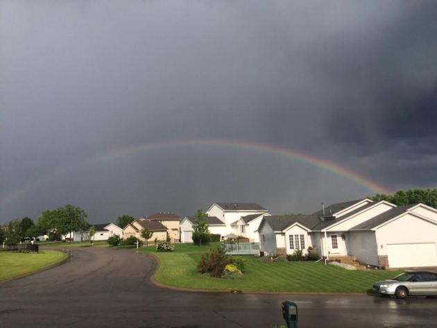
Sunday Rainbows
Sunday afternoon featured a few showers and storms across the southern half of the state. Here was a picture as a rainbow developed in the wake of a heavy downpour on the NW side of the metro.
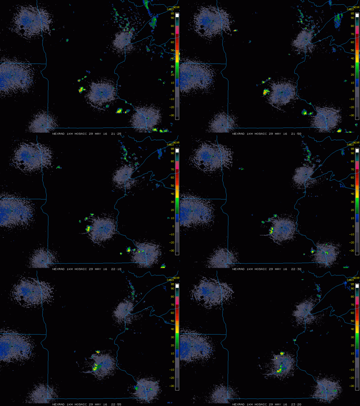
This is what the radar look like late Sunday afternoon/early evening as a few storms popped up and pushed through parts of Central MN.


Severe Threat Monday
...SUMMARY...
   ISOLATED SEVERE THUNDERSTORMS ARE POSSIBLE ACROSS PARTS OF THE
   NORTHERN GREAT PLAINS SOUTHWARD INTO THE CENTRAL AND SOUTHERN HIGH
   PLAINS MONDAY AFTERNOON AND EVENING.  ISOLATED STRONG TO PERHAPS
   LOCALLY SEVERE STORMS MAY DEVELOP OVER PORTIONS OF NEW ENGLAND
   DURING THE AFTERNOON. LOCALLY DAMAGING WIND GUSTS AND LARGE HAIL
   WILL BE THE MAIN THREATS.

   ...SYNOPSIS...
   COMPLEX SPLIT FLOW REGIME WILL PERSIST MONDAY. IN THE NRN STREAM A
   SHORTWAVE TROUGH NOW OVER THE PACIFIC NW IS FORECAST TO AMPLIFY AS
   IT MOVES INTO THE NRN HIGH PLAINS DURING THE AFTERNOON. THE NEGATIVE
   TILT TROUGH CURRENTLY OVER THE GREAT LAKES WILL DEAMPLIFY AS IT
   CRESTS UPPER RIDGE OVER THE NERN STATES. IN THE SRN STREAM THE
   CUTOFF UPPER LOW OVER THE SWRN U.S. WILL DRIFT VERY SLOWLY EWD
   ACROSS AZ...BUT POTENTIAL EXISTS FOR WEAKER DOWNSTREAM IMPULSES TO
   MOVE INTO THE SRN PLAINS.
   A SFC LOW WILL EVOLVE OVER THE NRN HIGH PLAINS IN ASSOCIATION WITH
   THE APPROACHING SHORTWAVE TROUGH. BY MID-DAY A WARM FRONT WILL
   EXTEND FROM THE LOW OVER WRN SD EWD INTO THE UPPER MS VALLEY. A COLD
   FRONT WILL ADVANCE SEWD THROUGH ERN MT AND EVENTUALLY MERGE WITH THE
   SFC TROUGH OVER THE NRN HIGH PLAINS.  THE COLD FRONT WILL ACCOMPANY
   THE PROGRESSIVE NRN-STREAM SHORTWAVE TROUGH THROUGH THE DAKOTAS AND
   NEB MONDAY EVENING AND OVERNIGHT. FARTHER SOUTH THE DRYLINE WILL
   PERSIST OVER THE SRN AND CNTRL HIGH PLAINS.
Severe Threat Tuesday
...SUMMARY...
   ISOLATED STRONG TO SEVERE THUNDERSTORMS ARE POSSIBLE TUESDAY
   AFTERNOON AND EARLY EVENING FROM THE UPPER MISSISSIPPI VALLEY
   SOUTHWESTWARD INTO THE SOUTHERN GREAT PLAINS.  LOCALIZED STRONG
   THUNDERSTORMS ARE POSSIBLE NEAR THE NORTHEASTERN GULF COAST AND
   NORTH FLORIDA DURING THE AFTERNOON.
Simulated Radar
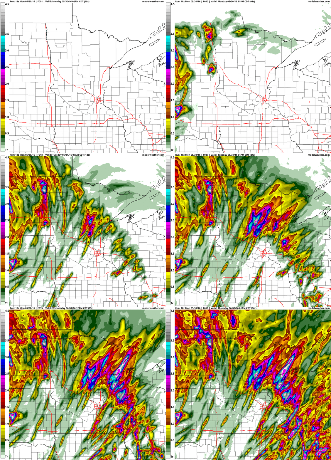
Here's the simulated radar from PM Sunday to Tuesday night. Note that a few lingering showers will be possible on Sunday. At this Point, Memorial Day Monday looks good for the most part, but showers and storms arrive late Monday night into Tuesday with locally heavy downpours. There may also be an isolated strong storm or two as the line moves through... stay tuned.


Rainfall Potential

The somewhat soggy weather will slowly push east on Sunday with a few lingering light showers across the region (mainly east). The next best chance of rain arrives late Monday night into Tuesday with some heavier downpour potential. The image below suggests rainfall tallies through midday Wednesday with some some near 1"+ tallies across MN & WI.


______________________________________________
Tropical Depression Bonnie: Radar Earlier Saturday During Tropical Storm Status
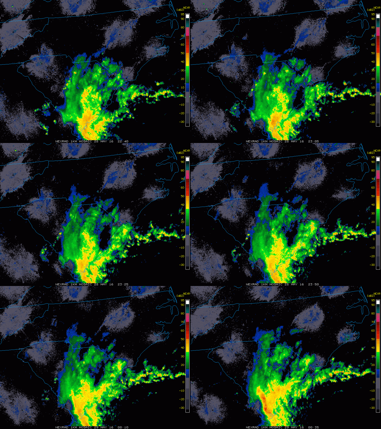
The radar loop below from PM Saturday showed bands of heavy rainfall pushing into South Carolina when Tropical Depression Bonnie was at Tropical Storm Strength.  Gusty squalls will continue to bring strong winds and heavy pockets of rain to areas along the Coast as the weekend continues. The other big concern will be a strong rip current potential.

Rainfall Potential

Here's the rainfall potential through PM Tuesday, which suggests widespread 1" to 2" amounts from the Carolinas to parts of the Northeast. Heavy rainfall could lead to flood concerns along the coast and for some inland locations.

IR Satellite
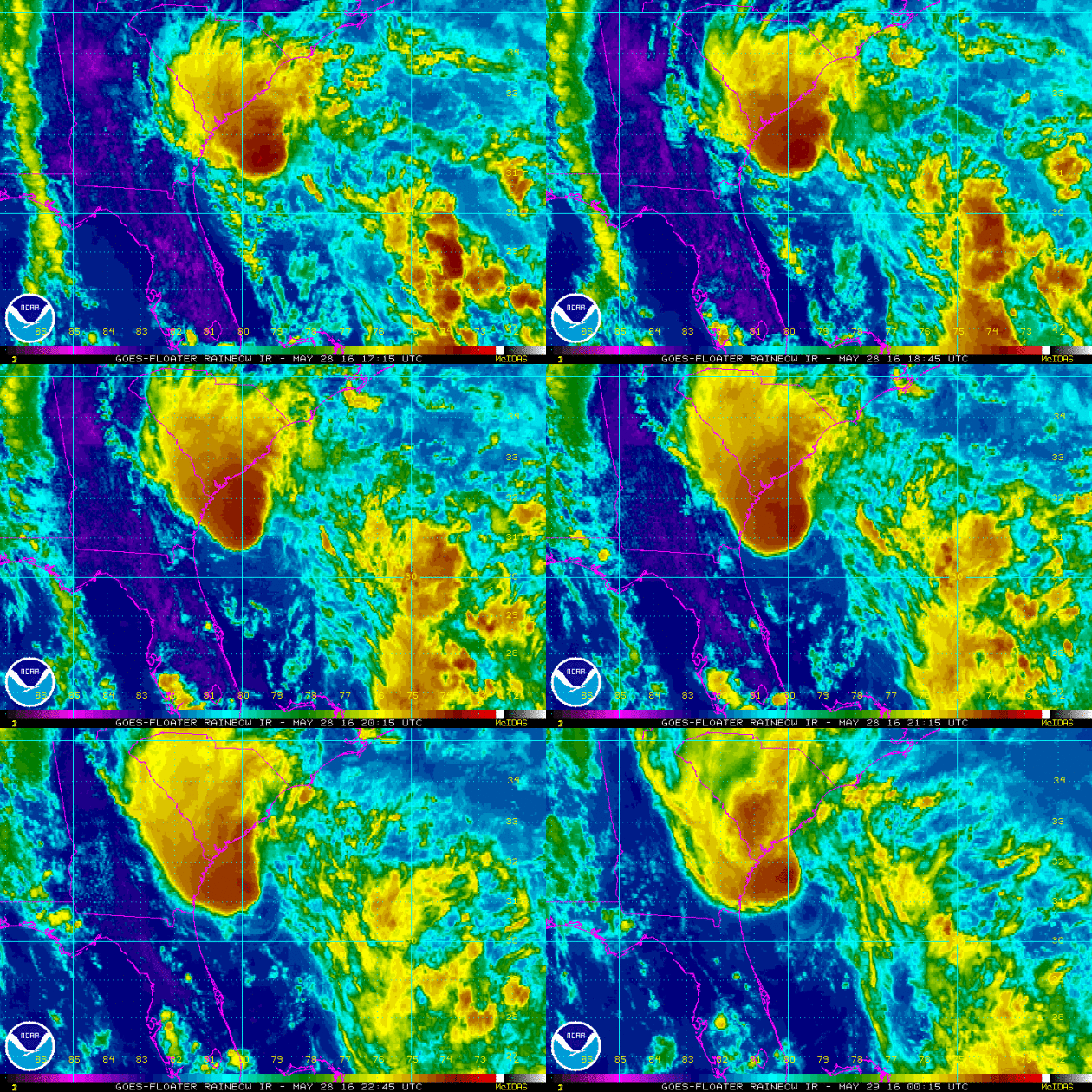
The IR satellite from PM Saturday when Bonnie was at Tropical Storm strength. The satellite loop showed a fairly large blob of intense clouds nearing the SE Coast. This blob of moisture brought areas of heavy rainfall, gusty winds and RIP currents along the coast through during the first part of the holiday weekend.
 
 Bonnie: Sunday Sunrise

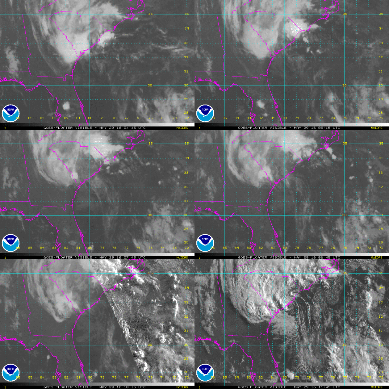
This was the visible satellite view of Bonnie on Sunday. The IR satellite turns to visible satellite revealing more definition in the clouds as the center of circulation was just about to make landfall along the coast of South Carolina

 
Wind Circulation From Early Sunday...

Wind circulation from early Sunday showed a very evident cyclonic wind field surrounding Bonnie. Note here that the center of circulation was sitting just off the coast of South Carolina. 


Projected Path
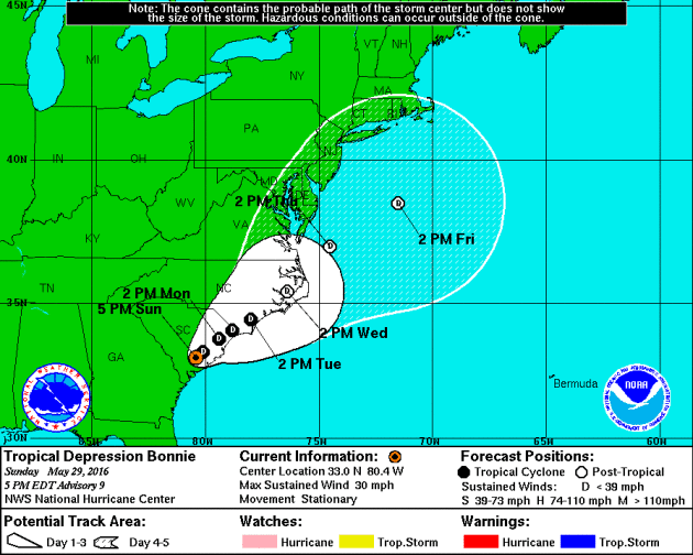
Here is the projected path for Bonnie through the end of next week. Note that the forecast keeps it as a Tropical Depression as we head through the week ahead. Interestingly, the Atlantic Hurricane Season officially starts on June 1st.
 
 
 Intensity Guidance
Here's an interesting produce that suggests potential wind speeds over time. Note that a few models keep this particular storm into Tropical Storm strength over the next few days, while most models bring it back down to Tropical Depression status.

 
Model Paths

The model path for this particular storm shows a pretty evident NE track  after the system tracks into South Carolina. This system will likely pick up speed as we head into next week as it start to encounter stronger upper level winds, which may help to minimize the heavy rainfall threat as some of the moisture lifts into parts of the NE.

____________________________________

Sunny Memorial Day - Thundery Downpours Overnight
By Todd Nelson
Ahh, now this is more like it! Saturday's cloudy, wet weather was for the birds; ducks, in fact. After a not too shabby Sunday, I am happy to report that today will be THE nicest day of the holiday weekend.
Reminiscent of late June, we reach the pinnacle today with bright sun and highs around 80 degrees. I guess this is what they call Chamber of Commerce weather. Even the complaint department has the day off!
Whether it's heading to the lake or mowing the neglected hay field in your back yard due to several days of inclement weather last week, today's a winner 3 weeks from the Summer Solstice (June 20th).
A fairly vigorous area of low pressure looks to spin up swarms of showers and storms late Monday with thundery downpours possible in spots through Tuesday. Cool exhaust on the backside of this storm brings us into the 60s for highs by the end of the week. Overnight lows will dip into the 40s with a few 30s possible up north. No worries though, widespread frost and freeze is not likely.
Keep calm and garden on!
__________________________
Extended Forecast
SUNDAY NIGHT: A few showers early, then turning mostly clear. Low: 58. Winds: WNW 5mph
MEMORIAL DAY MONDAY: Best day of the holiday weekend. Clouds thicken late. High: 81. Wind: SSE 5mph.
MONDAY NIGHT: Scattered showers and storms develop with locally heavy rainfall. Low: 62. Winds: SSE 5mph
TUESDAY: Scattered storms with locally heavy rain. A little muggy. High: 77. Winds: S 5-10mph.
WEDNESDAY: Breezy. Stray PM rumble. Wake-up: 58. High: 69. Winds: W 5-10mph
THURSDAY: More sun, refreshing breeze. Wake-up: 52. High: 69. Winds: WNW 5-10mph.
FRIDAY: Dry start. Scattered PM T-storms. Wake-up: 55. High: 76. Winds: SE 5mph.
SATURDAY: Lingering storm early, better later. Wake-up: 60. High: 77. Winds: SW 5mph.
SUNDAY: Mostly sunny. Nice June Day. Wake-up: 60. High: 78.
________________________
This Day in Weather History
May 30th

1998: A devastating line of storms hits east central Minnesota. 100 mph winds rip through Scott and Dakota County. Over 500 homes are damaged in Washington County. 15,000 trees are lost in the Twin Cities metro area, and 500,000 people lose power in Minneapolis.
1985: A tornado hits Lakefield, and the Twin Cities report 67 mph winds.
_________________________
Average High/Low for Minneapolis
May 30th

Average High: 74F (Record: 98F set in 1934)
Average Low: 53F (Record: 37F set in 1947)
__________________________
Sunrise/Sunset Times for Minneapolis
May 30th

Sunrise: 5:31am
Sunset: 8:50pm
*Daylight Gained Since Yesterday: ~1min & 30secs
*Daylight Gain Since Winter Solstice: ~6hours & 34 mins
*Length of Daylight: ~15hours & 21mins
___________________________

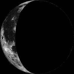
Moon Phase for May 30th at Midnight
1.8 Days After Last Quarter

_____________________________
Extended Forecast
Take a look at the extended forecast below, which takes us into the first full week of June. Note that temperatures 'mild' through the early part of this week, but we begin to slip by the middle/end of the week with highs dipping into the 60s. Overnight lows will be a little more refreshing by the end of the week as we fall in the 40s; a few of the normal cool spots up north could even dip into the 30s. The good news is that I don't see any major frost of freeze concerns with this cool spat... Keep calm and garden on!
_____________________________
6 to 10 Day Temperature Outlook
According to NOAA's CPC, the 6 to 10 day temperature outlook suggests a return of warmer than average weather across the High Plains and parts of the Midwest from June 3rd to June 7th. So even after a little bit of a cool down mid/late week, we should be able to warm up again by next week!
______________________________
Monday Weather Outlook
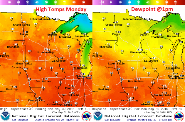
Monday WILL be the nicest day of the holiday weekend with bright sun and temperatures warming to near 10F above average across the state. The good news is that dewpoints will also be pretty comfortable in the 40s and low 50s, which by Minnesota standards isn't too shabby.
Monday Weather Outlook
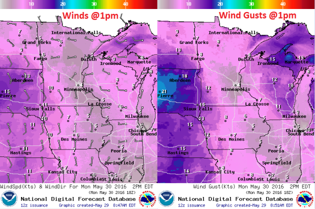
Winds on Monday will also be a non-factor for much of the day, however, note the increasing SE winds across South Dakota. This increase in wind speed is in advance of a storm system that will increase rain/thunder chances late PM Monday into Tuesday. Heavy rainfall and a few isolated strong storms can't be ruled out across parts of the Midwest from late PM Monday and again Tuesday.
Monday Weather Outlook
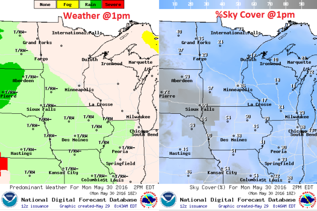
Again, Memorial Day Monday WILL be the nicest day of holiday weekend with plentiful sunshine across much of the state throughout much of the day. However, as we head into the second half of the day, high cirrus clouds look to move, which will make for filtered sunshine late across the Southwestern part of the state. Showers and storms will then move into MN & WI overnight Monday into Tuesday with heavy pockets of rain and isolated strong storm chances.
_______________________________
National Weather Outlook

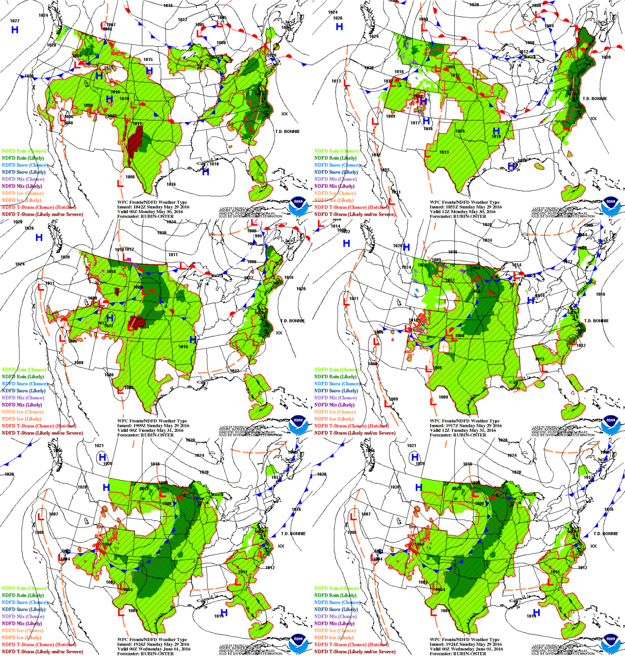
The national weather outlook through early next week shows slightly improved weather conditions on Sunday across parts of the Central U.S., but another blob of heavier moisture looks to return to the Midwest as Monday and Tuesday roll around. In fact, there is a chance of some strong to severe storms along with heavier rainfall tallies. 


Precipitation Outlook

According to NOAA's HPC, the rainfall potential through the end of next week suggests some of the heaviest rainfall across parts of the Central and Southern Plains. Some 2" to 4"+ tallies can't be ruled out, especially across parts of Oklahoma and Texas, where those amounts may be a little more widespread. Also note the heavier band of rain along the East Coast as our tropical system lifts NE along the coast there. Some spots in the Mid-Atlantic region could see as much as 3" to 5"+ with the potential of localized flooding.

 ____________________________________
"Obama is creating a 1,500-mile “butterfly corridor” to help Monarchs get from Mexico to Minnesota"
US president Barack Obama, a friend to bees and other pollinating insects in peril, has unveiled his national strategy (pdf) to mitigate honey bee loss, increase the Monarch butterfly population, and restore the habitats of both insects, whose health is essential to our food supply. The program will depend heavily on federal agencies and will also involve Mexico and Canada, since bees and butterflies know nothing of state laws and don’t really care about borders. The strategic report includes a section on “expanding pollinator habitat on rights-of-way.” This doesn’t mean the feds will tell bees and butterflies who flies first, but rather that the US Department of Transportation and US Fish and Wildlife Service will help rehabilitate butterfly habitats alongside Interstate 35—a federal highway that extends from the Texas-Mexico border to Duluth, Minnesota.
See more from qz.com HERE:
____________________________
Five Landmarks Threatened by Climate Change
Will a warming planet destroy humankinds' most precious cultural treasures?
Hunger, disease, dwindling natural resources—climate change promises to visit all of those misfortunes and more on humankind if it can’t be curbed. But there’s something else a changing climate can take away from humans, Fiona Harvey reports for The Guardian: their cultural heritage. A new UNESCO report suggests that some of the world’s most famous heritage sites could be destroyed by climate change. The report looks at the direct and indirect impacts of the changing climate on both UNESCO World Heritage sites and the tourism sector they support, calling it “one of the most significant risks” the sites face. Since cultural treasures are usually static and unable to move, says the report, they are inextricably tied to place—and as the landscapes that surround them change, they are uniquely vulnerable. From drought and rising seas to moles, here is a selection of landmarks facing climate change threats:
Read more from the SimthsoniaMag.com HERE:
___________________________
Thanks for checking in and have a great rest of your holiday weekend! Don't forget to follow me on Twitter @TNelsonWX