44 F. high in the Twin Cities Monday.
52 F. average high on October 28.
46 F. high on October 28, 2012.
Minnesota Weather History on October 28 (courtesy of the MPX National Weather Service):
2004:
Exceptionally muggy for October. Dew points surged into the middle to
upper 60's over central and southern Minnesota. Ladybugs are extremely
active.
1955: Early snow with 2.2 inches in the Twin Cities.
1905:
Snowfall accumulated in south central Minnesota. Snow totals included 7
inches at Fairmont, 6 inches at Farmington, 4.5 inches at Montevideo, 4
inches at Faribault, and 3 inches at New London.
Snow Tales
"Any
day you can walk to the window and look out is a good day" an older
friend explained. And any day snowdrifts don't cover up that big window
is an even better day.
My 25 year old son is dreading the upcoming
winter, sounding more like a 65-year old snowbird: "When I was a kid
snow brought snow days. Now it just brings commuting misery."
As
winters shrink and trend milder even nuisance snows can bring howls of
disapproval. Imagine what 5.5 inches of snow did to our rutted dirt
roads on October 29, 1905, when a lucky few had 1-horsepower daily
drivers. A huge blizzard on October 16, 1880 smothered Canby, Minnesota
under 20 foot drifts, bringing train traffic out west to a standstill
until the spring thaw in 1881.
This puts today's ration of morning
slush into stark perspective. A light mix may coat a few lawns early
today, but a rapid warm-up aloft should mean light rain by midday;
mainly wet roads after 9 AM. Heavier rain is expected Wednesday night as
a strong storm tracks across the Midwest. Showers taper to a light
drizzle for Thursday Trick or Treating; temperatures in the 40s.
Highs reach 50s again early next week - I still don't see anything bitter through mid-November.
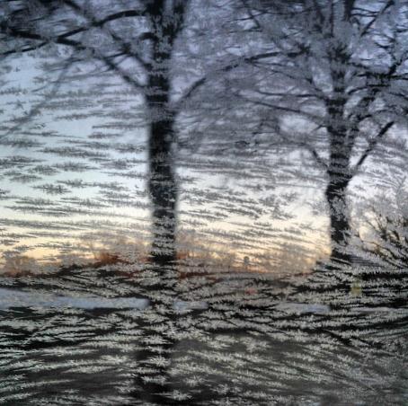
* Photo credit above: Imara Hixon.
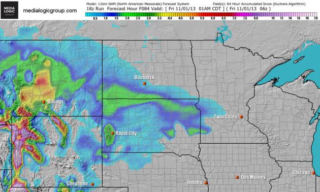
NAM Solution.
The 84-hour 12km NAM model from NOAA shows a couple inches of slush
over the Dakotas, a chance of a slushy coating into central Minnesota.
Map: Ham Weather.
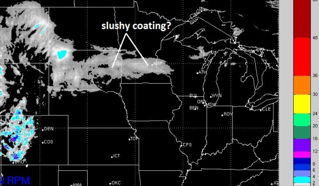
RPM Solution.
WSI's 4km RPM model shows a potential for a little slush over central
and southern Minnesota this morning; roads mainly wet after 9 AM or so.
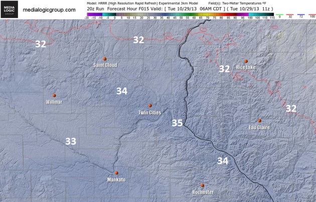
Close To Freezing.
NOAA's 3 km. HRRR model shows 6 AM temperatures just above freezing in
the MSP metro, the freezing line just north of St. Cloud and Taylor's
Falls. That said, a few slick secondary roads and bridges can't be ruled
out early this morning, a wet drive home this afternoon with
temperatures near 40F. Map: Ham Weather.
Halloween Mess.
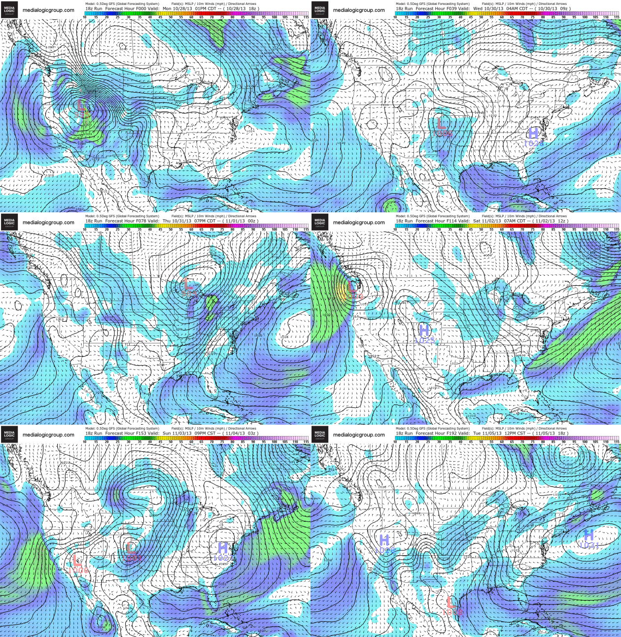
NOAA's GFS model shows a storm track from near Denver to the Twin
Cities (by Thursday), pushing rain across the Midwest into the Great
Lakes. The East Coast should see dry weather for Halloween - high winds
from a Pacific storm brushing the West Coast early next week. Loop
showing 10 meter wind speeds and surface pressure courtesy of Ham
Weather.
Halloween Outlook.
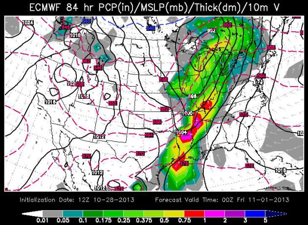
ECMWF model data courtesy of WSI Corporation shows a swath of rain from
Madison and Milwaukee to Chicago and Indianapolis, potentially heavy
T-storms pushing across the Mississippi River Valley into the Ohio
Valley; dry weather for most of the western half of the USA.
Relatively Mild Start To November.
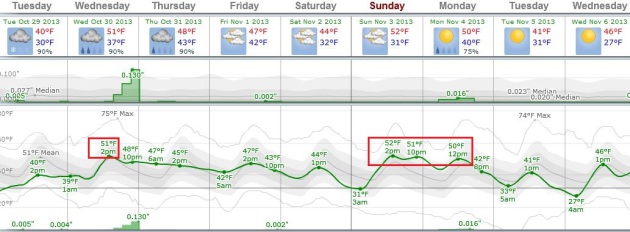
Talk about a reality readjustment: now 50F is considered a "warm
front". The mercury may surge close to 50F on Wednesday as steadier,
heavier rain approaches from the Gulf of Mexico, another round of 50s
early next week. Right now the weekend looks dry; Sunday the milder day.
Graph: Weatherspark.
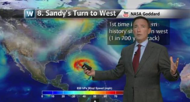
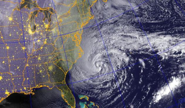
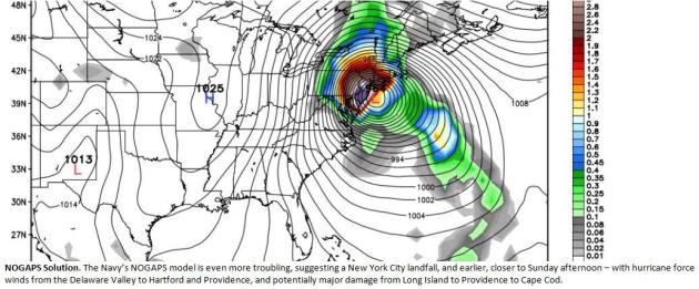
Today marks the 1 year anniversary of Sandy coming ashore over New Jersey:
The 12 Most Unique Things About Superstorm Sandy.
Thanks to the AP for summarizing some of the more head-scratching
aspects of this (historic) storm. Here's a YouTube video summary of the
things that made meteorologists to a triple-take one year today in
Climate Matters: "
Tuesday
is the one year anniversary of Sandy's landfall. Chief Meteorologist
Paul Douglas looks at a dozen head scratching factoids related to this
late season hybrid storm."
Hurricane Sandy And Its Aftermath: By The Numbers.
Reuters has a thorough run-down of Sandy's primary impacts; here's an excerpt: "
Here's a look at the 100 years' storm, by the numbers:
- At its height of intensity, just over Cuba, Hurricane Sandy clocked in as a category 3 storm. It had lost strength by the time it hit the East Coast of the U.S.
- Sandy was so large that tropical storm force winds extended over an area more than 1,000 miles in diameter.
- The
superstorm forced coastal water surges from Florida to Maine -- with
parts of New York City seeing the worst flooding. Recorded water level
values there exceeded 9 feet above the Mean Higher High Water line.
- More
than 12 inches of rainfall led to subsequent flooding in rivers,
streams and creeks throughout portions of the Mid-Atlantic.
- Sandy’s
peak winds increased to near 100 miles per hour over the Gulf Stream,
approximately 220 nautical miles south of Atlantic City, N.J..."
The Making Of A Superstorm: Merger Where Sandy Traded Strong Winds For Giant Size Was Key.
In reality Sandy mutated into an extratropical (non warm-core) center,
tying some of the vorticity or spin from an ex-hurricane into a much
larger wind field blowing around a developing Nor'easter. It was a 1+1=3
equation, and the result was a storm that was much larger than a
typical hurricane, pushing a much greater volume of water against the
Northeast coastline.
Newser has a good explainer; here's a clip: "...
Put
simply, what made the superstorm dangerous and freaky in more than a
dozen different ways was a meteorological trade in: The hurricane lost
some oomph in winds in return for enormous size. And just like Katrina
seven years earlier, Sandy caused so much havoc because of its record
girth, National Hurricane Center Director Rick Knabb said, adding:
"Smaller versions of those same storms would not have had the same scope
of disasters." Sandy's breadth pushed much more water into New Jersey
and New York, dropped 3 feet of snow in West Virginia, caused 20-foot
waves on the distant Great Lakes and registered other records reflecting
whopping energy. It meant at least 182 deaths and $65 billion in damage
in the United States, the second-costliest weather disaster in American
history behind only Katrina, according to the National Oceanic and
Atmospheric Administration..."
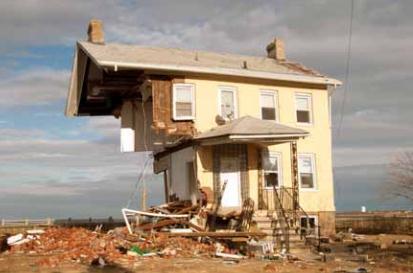
The Slow, Uneven Rebuilding After Superstorm Sandy. NPR has the story (and audio); here's the intro: "
After
Hurricane Sandy, the south shore of Staten Island looked like it had
been hit by a tsunami. The storm surge devastated whole neighborhoods
suddenly, in a matter of hours. In the year since the storm, some
families have been rebuilding their homes and their lives. Others are
ready to sell their flood-damaged properties and move on. Joe Salluzzo
lives in a neighborhood called New Dorp Beach, a few blocks from the
ocean. He rode out the storm on the second story of his brick bungalow,
which he's been repairing himself ever since. People are coming back
"little by little," Salluzzo says. He's staying put: "This is the only
house I got..."
File photo above: Patsy Lynch, FEMA.
Hurricane Sandy's Impact On South Jersey: A Precarious Situation That's Only Likely To Get Worse. Rising sea level is increasing the odds of damaging storm surges, from tropical systems and winter-type Nor'easters.
NJ.com has a good summary of the challenges facing coastal New Jersey (and the rest of the USA); here's an excerpt: "...
The
Atlantic coast has averaged 2-3 feet of land loss a year for more than
120 years, according to the Laboratory for Coastal Research at the
University of Maryland. But because of wave and wind dynamics as well as
geography, the Delaware Bay shoreline has receded much more
dramatically, at an average rate of between 6 and 7 feet a year,
according to a 2009 report from the Geological Society of America. The
most recent projections of sea-level rise from Rutgers University puts
the ocean up about 3-4 feet along the Atlantic coast by the end of the
century. For New Jersey’s Delaware Bay coast, the expected sea-level
rise is 4-6 feet..."
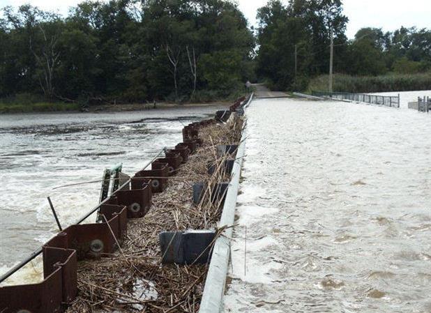
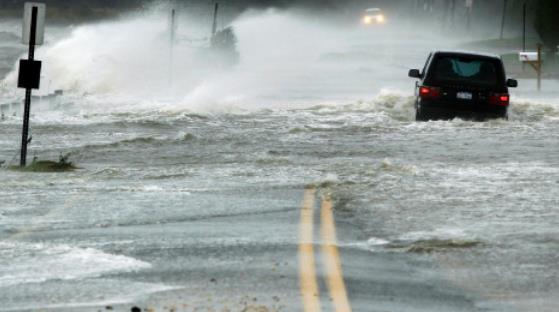
Photo credit above: "
Bacons
Neck Road in Greenwich, Cumberland County, was submerged by Hurricane
Sandy. Flooding is a recurring problem in the area, where no dikes are
accredited by FEMA to provide sufficient flood control." (For The Star-Ledger).
Will Sandy's Lessons Fade As A Sleepy Atlantic Storm Season Ends? Andrew Revkin asks the rhetorical question at The New York Times
Dot Earth blog - here's his intro: "
With the anniversary of Hurricane Sandy’s coastal assault here, The New York Times and other media have run a batch of helpful articles tracking how coastal communities are, and are not, responding to the lessons from the extraordinary surge raised by that storm — a 1-in-700-year event,
by some calculations. With sea levels rising for centuries to come,
amplifying the impact of any coastal storm, you’d think we’d wise up.
But, as I wrote in 2007, sea level rise is “a disaster epic in slo-mo.” (There’s more here on New York City’s response.)
Most of the coverage reveals an enduring and pervasive pattern after
disasters, in which forgetfulness and political imperatives cut against
commonsense actions that could reduce exposure to such hazards in the
future..."
A Hurricane-Proof Home?
Maybe hurricane-resilient is a better way to set expectations, but a
home going up in Gulf Shores, Alabama made me do a double-take. Details
from
Digital Journal: "...
On
the one-year anniversary of Hurricane Sandy, there are encouraging
signs that bode well for consumers and government entities that future
storms don't have to have the same costly impact on lives and
finances.Defender Technologies, Inc., of Gulf Shores, Alabama is
finishing the first truly affordable hurricane proof home ever built in
the United States, using a very simple patented and proven building
process. The homes are built to withstand winds up to 200 plus mph, and
are virtually tornado and hurricane proof. Video reports of the unique
construction process are available at http://www.DefenderTechnologies.net..."
In Flood-Damaged Colorado, A Race Against Winter.
The Los Angeles
times covers the aftermath and mad scramble to provide housing in time
for the first major snowfalls along Colorado's Front Range; here's an
excerpt: "Six weeks after floods ravaged Colorado, this small town at
the foot of the snow-covered Rockies was still without utilities, with
20% of homes damaged, most businesses shuttered and all roads in closed
to the general public. One of the few businesses that reopened was St.
Vrain Market, Deli & Bakery, named after the nearby creek that
overflowed its banks. Still, prospects are dim: 80% of inventory lost,
staff reduced from 16 to four. And no flood insurance..."
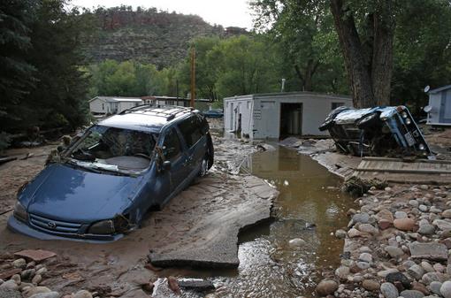
File photo credit: "
In
this Sept. 13, 2013 file photo, cars lay mired in mud deposited by
floods in Lyons, Colo. Little more than a year after Colorado Gov. John
Hickenlooper assured the world his wildfire-ravaged state was still
“open for business,” he may have to throw another lifeline to keep the
state’s billion-dollar tourism industry afloat." AP Photo/Brennan Linsley, File.
New Method Could Provide Heatwave Early Warnings. Meteorologist Andrew Freedman takes a look at some promising new research and methadology in this post at
Climate Central,
relying on work that's nearly 60 years old, from a man who made the
expression "Rossby Waves" commonplace, at least in weather centers
around the planet; here's a clip: "
Heat waves pose major health and economic problems in the U.S. and around the world. In 2012, a heat wave baked the U.S., shattering temperature records, causing 82 deaths, and withering crops across
the country. Improved forecasts with longer lead times could be an
asset to emergency managers, farmers, and others who suffer the worst
impacts from heat waves. New research holds some promise of being able
to predict them up to 20 days in advance across the U.S. by monitoring
weather patterns. The new research builds on the work of Carl
Gustav-Arvid Rossby, a giant in the field of meteorology. In the
mid-20th century, Rossby studied the perturbations in the jet stream as
air moves from west-to-east above the Northern Hemisphere. A math and
physics whiz who landed on the cover of Time Magazine in 1956,
his work unlocked the secrets of how the jet stream can become
contorted into deep dives, or troughs, and large ridges, and how these
waves move slowly around the world..."
What Would It Be Like If This Quarter-Mile-Wide Asteroid Hit The Earth In 2032 (And You Survived It).
The odds are microscopically small. Then again, not sure any of us are
feeling too lucky these days. Here's a clip from an eye-opening tale at
Quartz: "
Earlier this month, Ukrainian astronomers made a pretty big discovery: a quarter-mile-wide asteroid, to be exact. From their initial calculations, the astronomers learned that a relatively large, never-seen-before asteroid—named 2013 TV135—had just buzzed safely past Earth but would make an extremely close call on August 26, 2032. That was enough to instantly move the newly discovered asteroid to the top of NASA’s Near Earth Asteroid watch list, where it remains today..."
Image credit above: "2013 TV135 is coming a bit close for comfort." NASA.
Dolphins Inspire A New Bomb-Detecting System.
Gizmag has the fascinating details; here's the introduction: "
Chances
are, you know that dolphins use sonar to locate and stun prey
underwater. You might also know that they create "bubble nets," in which
they trap fish inside a ring of air bubbles that they blow while
swimming in a circle. With all those distracting bubbles suspended in
the water, though, their sonar needs to work in a special way in order
to pick out the fish. Scientists have copied that sonar system, to
create a type of radar that could differentiate between ordinary objects
and things like explosive devices..."
Photo credit: "
Dolphins' ability to tell the difference between fish and bubbles has inspired the creation of a new type of radar system." (Photo:
Shutterstock).
In Search Of The Hottest Chili Pepper On Earth. What causes people to inflict pain...on themselves? There's a little masochist in all of us, as this article at
The New Yorker points out - here's a clip: "...
Chief
among the chilihead’s occupational hazards is getting burnt up. In
layman’s terms, this means eating a chili that causes one to experience
profuse sweating, redness, nausea, ear-popping, abdominal cramps,
vomiting, or all of the above. Getting burnt up can happen by accident
(underestimation, misidentification) or on purpose (dares, pranks,
curry)..."

Can't Get Away From It All? The Problem Isn't Technology - It's You.
Can you hear me now? Damn. It seems we're loving our digital devices
(to death). Some will go to extreme lengths to get away from tidal waves
of e-mails, tweets and FB posts, but that's becoming increasingly
challenging, as this story at
Wired explains; here's a clip: "...
Which
means we’re now seeing some pretty bizarre attempts to get away from it
all. Technology critic Evgeny Morozov famously puts his router and
phone in a safe with a timer lock when he needs to be free of
distractions. Techno-isolation is one of Burning Man’s many appeals
(though citizens of the playa are increasingly willing and able to
Instagram or tweet their escapades in the desert). There are now
multiple high-end summer camps for adults, and part of what you pay for
is having counselors enforce strict no-phone, no-camera policies. Those
may be silly examples, but they’re worth thinking about. We’re living in
a remarkable time, when it will soon be impossible to be truly alone..."
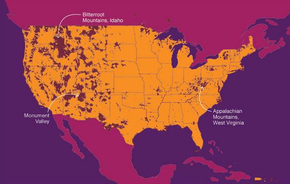
Graphic credit above: "Want to get away?
It’s a big country, but a huge portion of it is smothered in
high-bandwidth wireless coverage (shown in orange). Many places that
were previously thought to be completely off the grid are now
Instagram-friendly hot spots. If you’re really looking to unplug, the
connection you have to sever isn’t electronic anymore—it’s mental."
Commuting's Hidden Cost. I miss my local TV news friends, but I do not miss spending 2 hours a day on the Crosstown and I-35. According to this post at
The New York Times, all this driving, commuting, play dates and sports activities, is taking a toll on our long-term health; here's a clip: "...
Suburban
sprawl “has taken a huge toll on our health,” wrote Ms. Gallagher, an
editor at Fortune magazine. “Research has been piling up that
establishes a link between the spread of sprawl and the rise of obesity in our country. Researchers have also found that people get less exercise
as the distances among where we live, work, shop and socialize
increase. “In places where people walk more, obesity rates are much
lower,” she noted. “New Yorkers, perhaps the ultimate walkers, weigh six
or seven pounds less on average than suburban Americans...”
Graphic credit:
Lisa Haney
Grudging Respect For Russel Brand?
My 25 year old son shared this link with me, who told me he was
rethinking his opinion of Brand. Not sure if this will start a
revolution, but check out the video at
Gawker - I think he might just be onto something: "
The
revolution itself may not be televised, but on last night's edition of
the BBC's Newsnight, viewers may have witnessed the start of one.
Actor-slash-comedian-slash-Messiah Russell Brand, in his capacity as guest editor of the New Statesman's just-published revolution-themed issue,
was invited to explain to Jeremy Paxman why anyone should listen to a
man who has never voted in his life. "I don't get my authority from this
preexisting paradigm which is quite narrow and only serves a few
people," Russell responded. "I look elsewhere for alternatives that
might be of service to humanity." And with that, the first shots of
Russell's revolutionary interview were fired..."

TODAY:
Cloudy with a slushy coating possible this morning; a few light rain
showers by midday and afternoon. Winds: E 10-15. High: 41
TUESDAY NIGHT: Damp with a little light rain and drizzle. Wet roads. Low: 38
WEDNESDAY: More rain, heaviest at night. High: 52
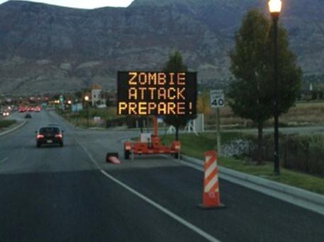
HALLOWEEN: Zombie Alert. Rain ends early. Probably dry for Trick or Treating. Wake-up: 41. High: 48
FRIDAY: Mostly cloudy and chilly. Wake-up: 37. High: 46
SATURDAY: Partly sunny, a fine fall day. Wake-up: 36. High: 45
SUNDAY: Dim sun, windy, turning milder. Wake-up: 32. High: 52
MONDAY: Increasing clouds, few showers around. Wake-up: 39. High: 51
Home
solar panels are “the new granite countertops,” according to Tom
Werner, CEO of US-based SunPower, one of the largest solar panel
companies in the world. What does that mean? That means that, for an
increasing number of new homeowners, solar panels are becoming an add-on
right from the beginning. Furthermore, Werner is confident home solar
panels will move beyond the “granite countertops phase” to mass adoption
rather quickly.
“You’re going to see a transition from novelty,
to granite countertops, to mainstream option,” Werner said. “We’re
rapidly passing the equivalent of a ‘countertops decision’ to a
‘no-brainer.’ You just do it.”
Read more at http://cleantechnica.com/2013/10/27/solar-panels-new-granite-countertops-long/#LyHXgCleps89D9e3.9At
some point we will have to treat climate change as an existential
threat, like the approach of a killer asteroid or other planetary
emergency. We're not there yet, but if the trends accelerate, as seems
likely based on the science, we'll be there faster than we think. Here's
an excerpt from a Q&A at
The Bennington Banner: "...
But
this is one of those situations in which we actually have to forget
about who the villains are. We have to treat this almost like an
extraterrestrial threat. The movie “Independence Day” is a great movie
because of the message that the only way the world gets together is when
everybody realizes they're being threatened in the same way.
In the case of the modern interpretation of climate change, we're not
actually all threatened in the same way, but we all have the same kind
of security issues. For some of us it's storms, for some of us it's
drought, for others it's heatstroke and disease.
The faster we get that message out, the faster we realize that we are
in fact being attacked by this thing that we have created ourselves."
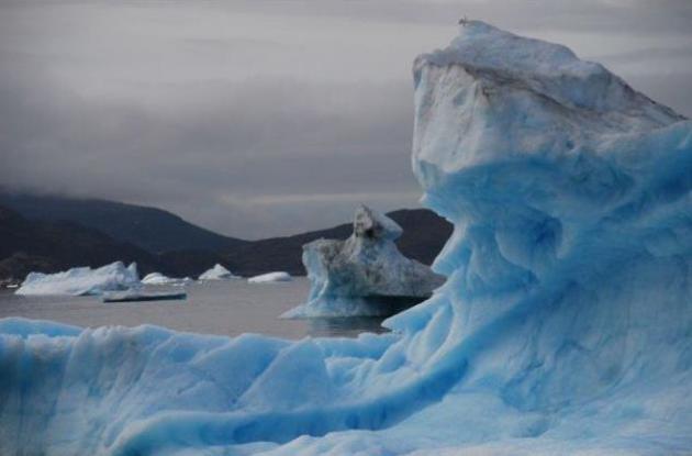
Photo credit above: "
Parts
of the Arctic have seen average temperatures rise 9 degrees Fahrenheit
in just the last five years, said climate scientist Paul Mayewski." (Solana Pyne/GlobalPost).
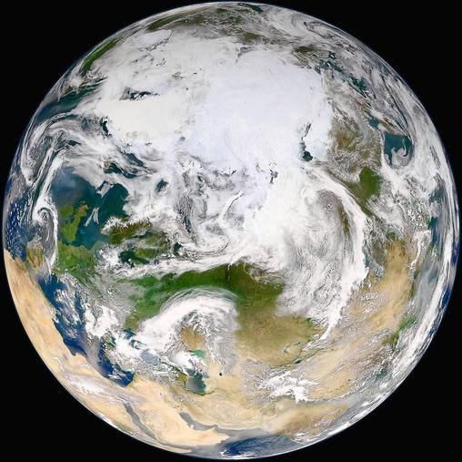
Global Warming, Asteroid Impacts And The Laws Of Physics. Mark Boslough has a thought-provoking article at
Huffington Post;
here's an excerpt: "...If the average surface temperature - which is
only one way to measure global warming - doesn't go up every year, it's
because the "blocks" are being hidden somewhere else, for now. But
energy changes forms, and sloshes back and forth between sub-systems.
Ice will continue to melt and sea level will continue to rise as the
water warms. A slowdown in one rate is compensated by a speedup in
another until the cycle of natural variability reverses. Scientists know
that more energy is coming in than going out. We can measure it and
there is no dispute.
Because of carbon pollution, the Earth is
gaining energy at the rate of 400,000 Hiroshima atomic bombs every day
of every year. And that rate is going up...." (image: NASA).
Nature Vs. Nature: Is "Green Infrastructure" The Best Defense Against Climate Disasters? Grist
has a story focused on recent trends; we may not be able to engineer
our way out of climate consequences; armoring America's coastlines may
only go so far - leaning on nature may be the best way to cope with
rising seas and increasingly severe storms. Here's a clip: "...
Ulfelder and his compatriots believe that Cape May holds lessons for other coastal areas as climate change whips up stronger, more damaging storms.
Restoring dunes, marshes, and oyster reefs could dampen future storm
surges, they say. Give a little back to Mother Nature, and maybe she’ll
go a little easier on us. The Nature Conservancy has become a vocal
champion of using “green infrastructure” to protect urban areas from
storm surges and other side effects of climate change..."
Photo credit above: REUTERS/Lucas Jackson.
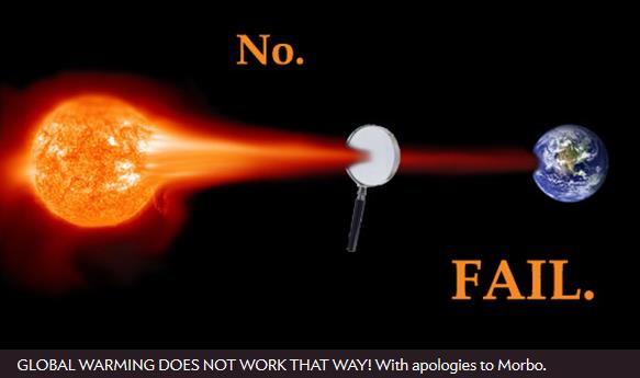
10 Failed Climate Change Denial Arguments. Details from
Slate; here's a clip: "
If
you think the climate isn’t changing, well, I've got some bad news for
you. It is. Of course the climate’s changing. It always does. The
problem is on top of that incredibly slow natural variation, the climate
is changing due to human influence, and it’s changing fast. Droughts,
floods, ice caps melting, fires raging out of control, temperature
records broken on a daily basis: This is the new normal. That hasn’t
stopped people from denying the change, and in fact seems to stoke them
like dry air and heat waves stoke wildfires. Rebutting the
reality-challenged challenges to reality is a full-time job, but Hank Green makes it look easy. Green — one half of the Vlog Brothers — claims he loves simple, powerful ideas..."
Photo by Phil Plait based on NASA image.
How Global Warming Could Boost Green Energy In An Unexpected Way.
It's all about water. As dry areas get drier and water becomes more
scarce and valuable, market conditions may tip in favor of renewables,
because other options (coal, natural gas-fired and even nuclear) plants
are very water-intensive. Here's an excerpt from
The Christian Science Monitor: "...
The
study marks the first time analysts have tried to account for water
availability as well as emission-reductions in trying to identify the
most economical mix of technologies to meet mid-century energy demand,
especially in regions where global warming is expected to bring
still-drier conditions, according to Mort Webster, an associate
professor of engineering systems at the Massachusetts Institute of Technology
in Cambridge, Mass., and the study's lead author. The study was
published Sunday in the journal Nature Climate Change. “If you're
reducing greenhouse gases, you're probably doing it, at least in part,
because water is a problem. Water's a bigger problem than temperature,”
Dr. Webster says..."
Photo credit above: "The
Browns Ferry Nuclear Plant, seen here in file photo, has a boiling
water reactor. Authorities had to temporarily shut down three reactors
here in August 2008, after a drought reduced water levels in the
Tennessee River." Tennessee Valley Authority/File.

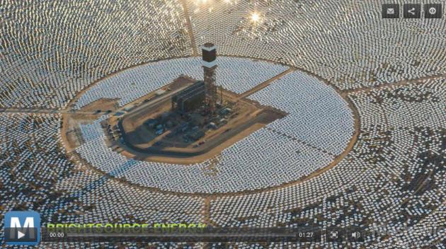
Israel To Build The 5th Largest Solar Power Station On The Planet. Mashable has the article; here's an excerpt: "
Israel plans to start construction next year on what will become the fifth largest solar power
station in the world, part of a plan to build three such structures
that will curb their dependency on fossil fuels. The $1.1 billion solar
plant will be able to generate 121 megawatts of electricity by the time
it's finished in 2016. That's enough juice to power 40,000 homes, and
it's only part of the 250 megawatts that all three solar plants will
generate. That's about 2.5% of Israel's energy consumption, according to
Inhabitat. The project will also contribute to the nation's plan to generate 10% of its energy from renewable sources by 2020..."

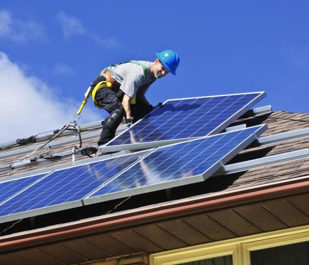
Solar Panel: The New "Granite Countertops"? Clean Technica
has an article about the adoption curve of solar, and how many
consumers are saving money over the long term by installing panels. Is
it right for you? There are now leasing options available, and yes, it
is possible to save green by going green.






No comments:
Post a Comment