20 F. high in the Twin Cities Wednesday.
33 F. average high on February 26.
36 F. high on February 26, 2013.
Trace of snow fell yesterday.
20" snow on the ground.
Minnesota Ice
Here's one thing I've discovered the hard way. Minnesota Nice quickly evaporates when you try to share warm weather travel experiences in late February. "Paul, you can (deleted) your (bleeped) and [censored] your tropical weather patterns!"
Message received.
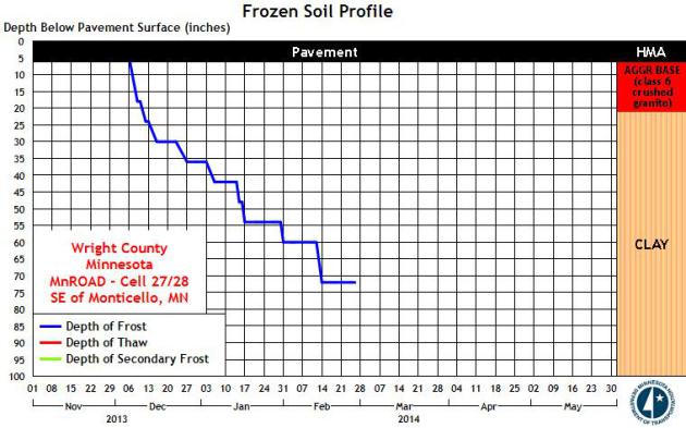
Now it's all about collective suffering - and surviving long enough to take in any kind of spring break. 10th coldest meteorological winter to date....and counting. That makes this the coldest stretch since December 21 since the brutal winter of 1978-1979, according to the Minnesota Climatology Working Group.
Oh yeah, on paper the 90 coldest days of the year, on average, should come to an end Saturday. Uh huh. Old Man Winter doesn't seem to care. He's stuck in a supernaturally persistent rut; the jet stream remains locked. Natural atmospheric variability, the natural ebb & flow of warm and cold, has been replaced by perpetually polar air - while much of the rest of North America runs a low-grade fever.
Baffling.
Windchill Advisories are in effect today; we may not climb above 0F with a chill factor dipping to -30F. Blizzard Warnings are posted just west of MSP for low visibility in blowing/drifting snow. Highly unusual for late February. Then again, highly unusual is the new normal.
Models hint at 30s by mid-March, but I've lost my faith in long-range models this winter. So far it's been meteorological bait and switch. The honest answer? It WILL warm up. I'm just not sure when.
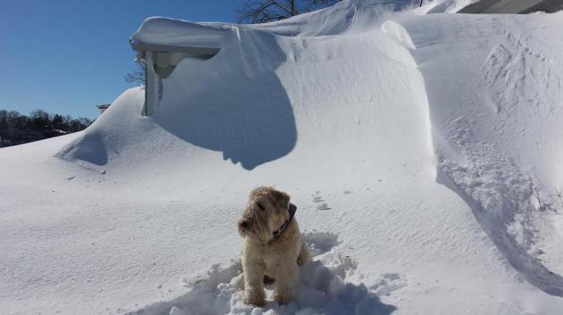
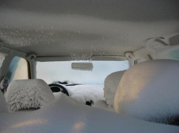
* Photo above of "Chewie" from Steve Erdahl at the Mtka Yacht Club House on February 23.
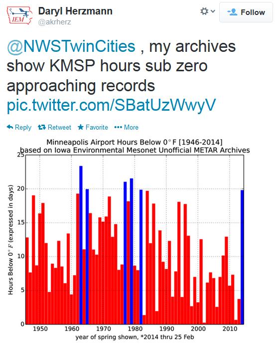
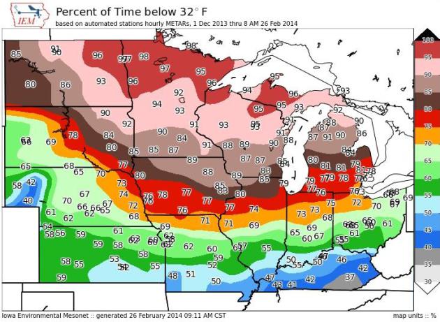
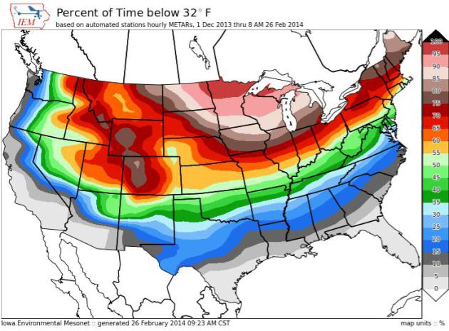
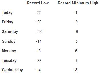
All-Time Records Next 7 Days (average high at MSP on February 27 is 33F, average low is 18F)

TODAY: Windchill Advisory. Numbing blue sky. Feels like -25F. High: -1
THURSDAY NIGHT: Partly cloudy, still way too cold. Low: -13
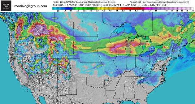
FRIDAY: Clouds increase, a little snow by Friday night, maybe an inch or so. High: 14
SATURDAY: Snow far southern MN early. Turning colder. Wake-up: -6. High: 4
SUNDAY: Sunny. What happened to March? Wake-up: -12. High: 2
MONDAY: Sunny. Call out the National Guard. Wake-up: -13. High: 8
TUESDAY: Not as numb. Chance of flurries. Wake-up: -2. High: 11
WEDNESDAY: Light snow. Some accumulation. Wake-up: 9. High: 21
* expect highs in the 20s the latter half of next week.
Paul, I know how weather guys can get accused for being inaccurate ... Well you've been actually getting it CORRECT all winter, it's just that the info and winter have been brutal !! .. That being said you also 'got it right' in late jan. when you wrote that there was a 'warmup' on the horizon for third week of Feb. .. Does your crystal ball show any 'above 40' temps for TC any time in March ? Or would you rather not create false hope ... Thanks from jay (not gordon) Outside of detroit as a Minnesota 'expatriate' .. detroit, currently 78.5 inches of snow for season, .4 shy of No. 2 amount all-time ... We'll set record lows tonight before midnight and friday a.m. .. Tomorrow's record of - 1 will be obliterated, probably - 10 or - 11.
ReplyDelete