57 F. average high on April 13.
44 F. high on April 13, 2014.
.01" rain fell yesterday.
1.82" rain so far in April, about .80" wetter than average, to date.
April 13, 1949: Snowstorm dumps over 9 inches at the Twin Cities.

Tornado Trends
All or nothing, flood or drought - our climate has become more volatile - and this trend includes tornadoes too. At Saturday's Minnesota Severe Storm Conference Dr. Harold Brooks, from NOAA's NSSL division, confirmed that days with 1 or more EF-1 tornado have dropped by a third. But we're seeing far more tornadoes on the big days, clumped up in major and often deadly outbreaks.
We've had four quiet tornado seasons in a row; the same ridiculously resilient ridge sparking epic drought for California has limited moisture and instability east of the Rockies, putting a lid on tornado formation.
This is Severe Weather Awareness Week in Minnesota, which sees an average of 40 twisters every year. In 2010 we saw 104 tornadoes, the most in the nation! With a bias toward heat/drought I expect a relatively quiet 2015.
Then again, all it takes is one.
No atmospheric tantrums are imminent; a stray shower is possible Wednesday night - a better chance of rain next Monday, but the biggest storms will still detour south of Minnesota. We brush 70F today, again Friday before a cool-down early next week.
No snow. Minnesotans lose their stoic sense of humor when it snows on their green, freshly-mowed lawns.

Take
advantage of Severe Weather Awareness Week to review your own and your
family's emergency procedures and prepare for weather-related hazards.
Each day of the week will focus on a different topic:
- Monday — Alerts and Warnings
- Tuesday — Severe Weather, Lightning and Hail
- Wednesday — Floods
- Thursday — Tornadoes (with statewide tornado drills)
- Friday — Extreme Heat
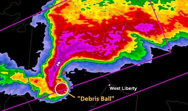
1). Multiple Safety Nets (e-mails and apps). Don't rely on any one source of severe weather information. There are hundreds of apps that can transmit the latest (NOAA) warnings for your county. You should also invest in a $20-30 NOAA Weather Radio that will send the warning, even if the power goes out.
2). Doppler on your smartphone. My favorite is RadarScope, although our new app, Aeris Pulse, is powerful as well, more of a general interest weather app with extensive mapping capabilities.
3). Don’t rely on outdoor sirens. They were designed for outdoor use only. If you depend on the sirens you're setting yourself up for trouble.
4). Football/bike helmets can avoid injury! It sounds crazy but many people have avoided head injuries by putting on helmets before seeking shelter in a basement or small, windowless room on the ground floor. The greatest source of tornado death and injury is blunt head trauma. A helmet can help lower the odds.
5). Tornado drills for your family. Much like a mock fire drill you should consider a tornado drill, so your kids know exactly where to go and what to do if it was the real thing.
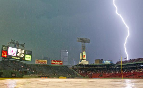
Myth: If it is not raining, there is no danger from lightning.
Fact: Lightning often strikes away from rainfall. It may occur as far as ten miles away from any rainfall.
Myth: Rubber soles on shoes or rubber tires on a car will protect you from being injured by lightning.
Fact: Rubber
provides no protection from lightning. However, the steel frame of a
hard-topped vehicle provides some protection if you are not touching
metal.
Myth: People struck by lightning carry an electrical charge and should not be touched.
Fact: Lightning victims carry no electrical charge and should be attended to immediately.
Myth: Heat lightning occurs on very hot summer days and poses no threat.
Fact:
What is referred to as heat lightning is actually lightning from a
thunderstorm too far away for thunder to be heard. However, the storm
may be moving in your direction.
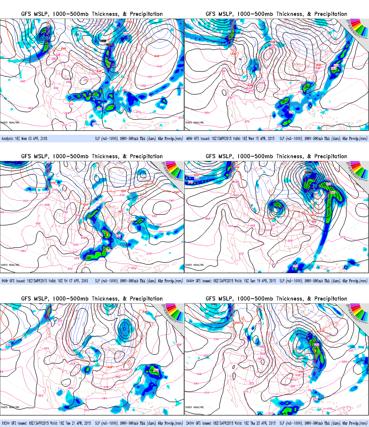
Late Season Clippers.
The GFS model is more impressive for late week showers and T-showers,
but the ECMWF solution suggests only a few isolated showers Friday. The
heaviest rains continue to slide off to our south and east, next week's
pattern dominated by a family of late-season clippers, meaning 50s for
highs, even some 40s up north. GFS guidance: NOAA.
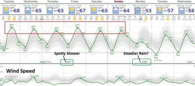
A Good-Looking Spell.
60s will do the trick into Sunday, based on European model guidance, a
few spotty showers possible Wednesday night into Friday, but the ECMWF
solution isn't nearly as wet as the GFS. Steadier rain is possible next
Monday ahead of a cooler front. Nothing wintry, but we may have to
settle for a string of 50s next week with a northwest wind flow aloft
whisking a family of clippers across Minnesota.
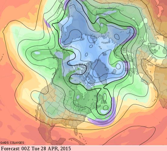
Quiet Late April.
GFS 500 mb (18,000 feet) forecast winds suggest a relatively benign
pattern in about 2 weeks, with a weak west/northwest flow aloft, a
pattern that continues to favor drier than normal conditions with
temperatures at or just above average. Source: GrADS:COLA/IGES.
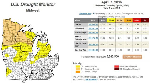
California's History of Drought Repeats. The New York Times has the story - here's a link and excerpt: "...The drought, now in its fourth year, is by many measures the worst since the state began keeping records of temperature and precipitation in the 1800s. And with a population now close to 39 million and a thirsty, $50 billion agricultural industry, California has been affected more by this drought than by any previous one. But scientists say that in the more ancient past, California and the Southwest occasionally had even worse droughts — so-called megadroughts — that lasted decades..."

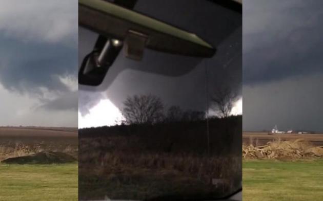

Rochelle Tornado "Stuck Out Like A Sore Thumb" for Meteorologists. Journal Standard in Freeport, Illinois takes a look at best practices for tornado warnings, and whether there is such a thing as too much lead time; here's an excerpt: "...
"I’m not sure we need more warning time for some tornadoes," Sebenste said. "Psychological studies have shown that once you get more than 13 minutes of warning and nothing has happened, people will come out of their basements and look around. That has actually killed some people.""A researcher in Texas has established pretty convincingly that 15 minutes is the ideal amount of notice for a tornado," Smith said, "and if you have more than 18 minutes, deaths go up. ... People either lose the sense of urgency to take cover or try to flee instead of immediately taking shelter, which is what we want them to do..."
Photo credit above: "In this Thursday, April 9, 2015 photo provided by Northern Illinois University meteorology professor Walker Ashley, a funnel cloud moves through near Rochelle, Ill. The National Weather Service says at least two tornadoes churned through six north-central Illinois counties on Thursday evening." (AP Photo/Walker Ashley)
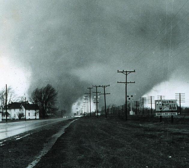
50 Year Anniversary of Palm Sunday Tornado Outbreak.
'65 was a tough year, for spring river flooding and tornadoes, leading
up to the May 6, 1965 outbreak in the Twin Cities, when Fridley was hit
by two EF-4 strength tornadoes. Here's an excerpt of a Wikipedia account of the Palm Sunday outbreak: "The second Palm Sunday tornado outbreak occurred on April 11–12, 1965, in the Midwest U.S. states of Indiana, Ohio, Michigan, Wisconsin, Illinois and Iowa,
with 47 tornadoes (15 significant, 17 violent, 21 killers). It was the
second-biggest outbreak on record at the time. In the Midwest, 271
people were killed and 1,500 injured (1,200 in Indiana). It was the
deadliest tornado outbreak in Indiana history, with 137 people killed.[1]
The outbreak also made that week in April 1965 the second-most-active
week in history, with 51 significant and 21 violent tornadoes. Despite
having 17 F4 tornadoes, 6 of them (4 in Indiana, and 2 in Ohio) are
questionable, and may have been F5's. (Photo credit: Paul Huffman, NOAA).
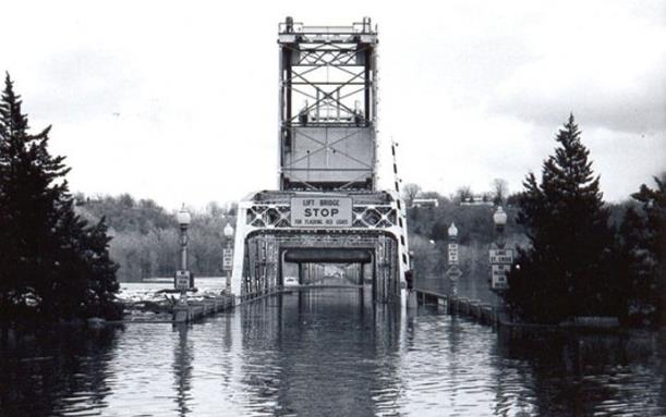
Flood Of The Century: 50 Years Ago Easter Weekend Saw Record Crest for the St. Croix.
The flood of '65 was truly historic, one for the record books, with the
highest crest on record for the Minnesota River at Shakopee. Stillwater
was also hit hard; here's an excerpt from The Stillwater Gazette: "On
Easter weekend 1965, Stillwater’s Main Street was shut down. Beginning
at 8 a.m. on Good Friday, no one was allowed east of Second Street
without an emergency pass. According to news reports from the time, the
closure was unprecedented in Stillwater history; so were the record flood levels threatening downtown.
Water covered the lift bridge’s driving surface, and a 5,000-foot-long
dike built by teenagers served as the only barrier preventing the St.
Croix River from bursting onto Main Street..."


TODAY: Plenty of sun, hard to concentrate. Wind: S 10-15. High: 71
TUESDAY NIGHT: Partly cloudy and pleasant. Low: 45
WEDNESDAY: Clouds increase, stray shower Wednesday night? High: 67
THURSDAY: More clouds than sun. Wake-up: 48. High: 65
FRIDAY: Partly sunny, lukewarm. Wake-up: 49. High: near 70
SATURDAY: Sunny, pretty spectacular. Wake-up: 47. High: 66
SUNDAY: Fading sun, probably dry. Wake-up: 48. High: 64
MONDAY: Cold rain, fairly unpleasant. Wake-up: 44. High: 54
Climate Stories...



Pope Francis Is A Powerful Messenger for Climate Change. Here's a snippet from a story at Quartz: "This
summer, Pope Francis plans to release an encyclical letter in which he
will address environmental issues, and very likely climate change.
His statement will have a profound impact on the public debate. For
one, it will elevate the spiritual, moral and religious dimensions of
the issue. Calling on people to protect the global climate
because it is sacred, both for its own God-given value and for the life
and dignity of all humankind, not just the affluent few, will create
far more personal commitment than a government call for action on
economic grounds or an activist’s call on environmental grounds..." (File photo: AP).
No comments:
Post a Comment