68 F. high in the Twin Cities Wednesday.
59 F. average high on October 14.
65 F. high on October 14, 2014.
October 15, 1968: Short-sleeve weather across central and southern Minnesota. The high was 85 in the Twin Cities.
October 15, 1899:
Heavy precipitation with 3.2 inches of rain in the St. Cloud area and
2.1 inches in Willmar. Source: Twin Cities National Weather Service.
Hard Freeze SaturdayFarewell to Bugs and Ragweed!
Minnesota has experienced
tornadoes
as early as March 18, 1968; as late in the season as November 16, 1931.
The Gopher State has seen tornadoes as early as March 18, 1968 - as
late in the season as November 16, 1931. 2015 saw 20 tornadoes in
Minnesota; fewer than average. Nationwide it was the 4th relatively
quiet year in a row for twisters.
On April 14, 1886 Sauk Rapids
was leveled by a massive tornado that left 72 dead. The twister was 800
yards wide; a tornado vortex so big and powerful the Mississippi River
was temporarily "swept dry". St. Cloud, which experienced a glancing
blow, went on to become the largest city in central Minnesota.
I find it vaguely fascinating that an
1883 F5 tornado resulted in the Mayo Clinic in Rochester. A small 1981 tornado in Roseville was the inspiration behind a "
Best Buy" sale that spun up a national chain based in Bloomington.
A silver lining to horrifying tornadoes? Sometimes tragic circumstances have happy endings.
No weather drama brewing, just an inevitable cold frontal passage today.
Tomorrow will feel like "football weather"; time to dig out the heavy jackets. Skies clear and winds ease
Friday night, setting the stage for a freeze
Saturday morning. A cool, sunny weekend is shaping up; more 60s return early next week.
Another Gusty Day.
The arrival of a colder front puts the squeeze on our atmosphere again
today, sustained winds forecast to peak around 20 mph between 2 PM and 5
PM (with gusts over 30 mph at times). Source: Aeris Enterprise.
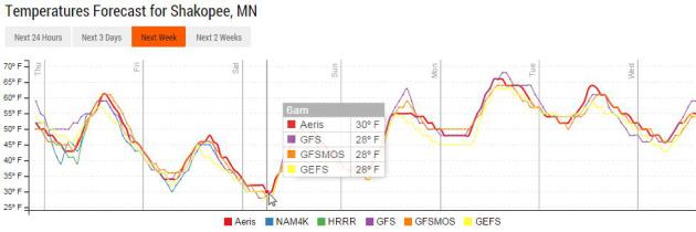
Hard Freeze Potential.
Temperatures in the suburbs are forecast to dip into the upper 20s by 6
AM Saturday morning, possibly long enough for a hard freeze, the best
chance of a killing freeze outside the 494/694 freeway.
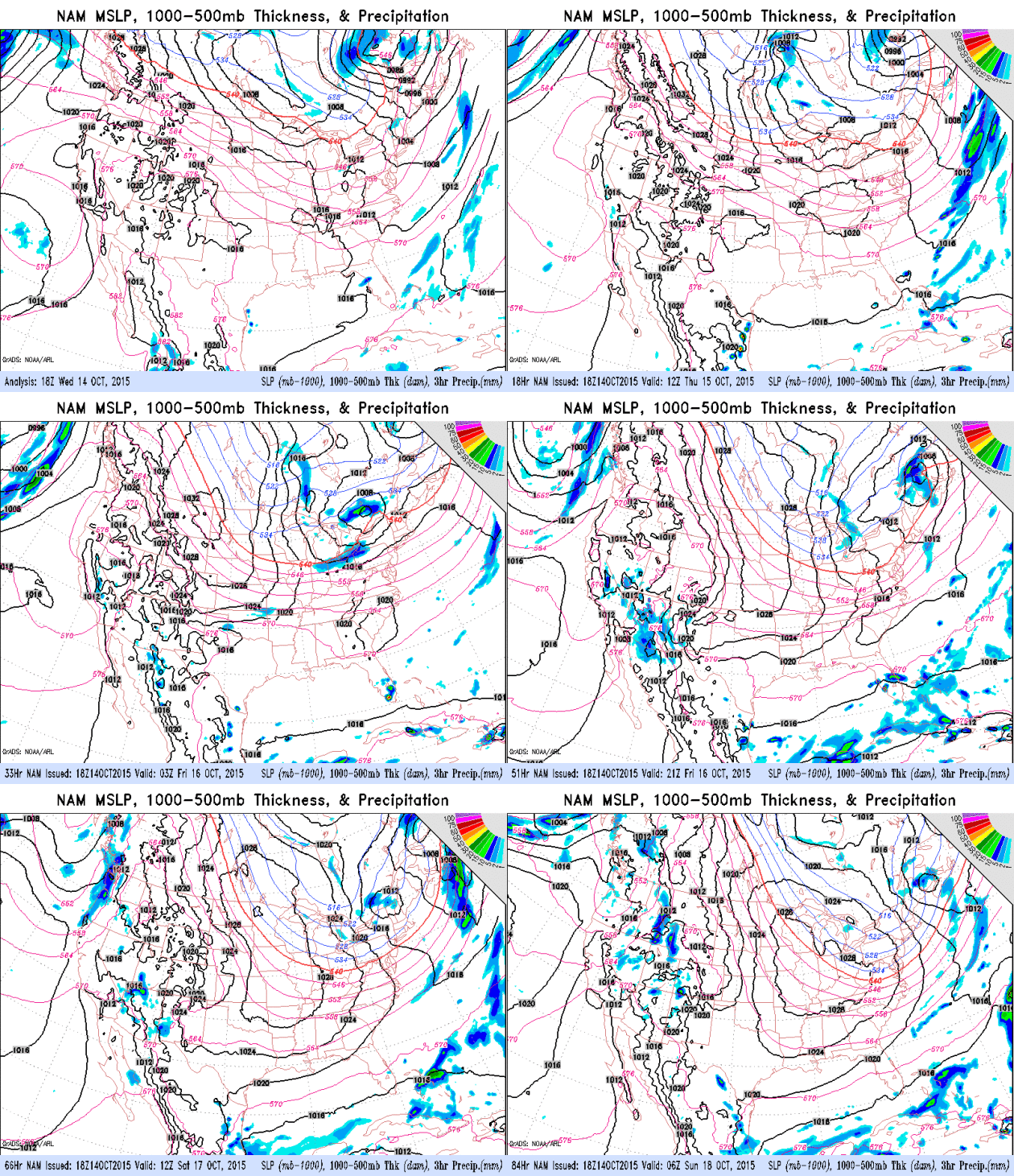
Canadian High.
Although hardly chilling air a 15-20F degree drop in temperature will
whip up strong winds today. But winds ease late Friday and Friday night,
a clearing sky setting the stage for a frost or freeze by Saturday
morning. A strong pressure gradient whips up 15-20 mph winds again
Sunday as milder air surges north. NAM data: NOAA.
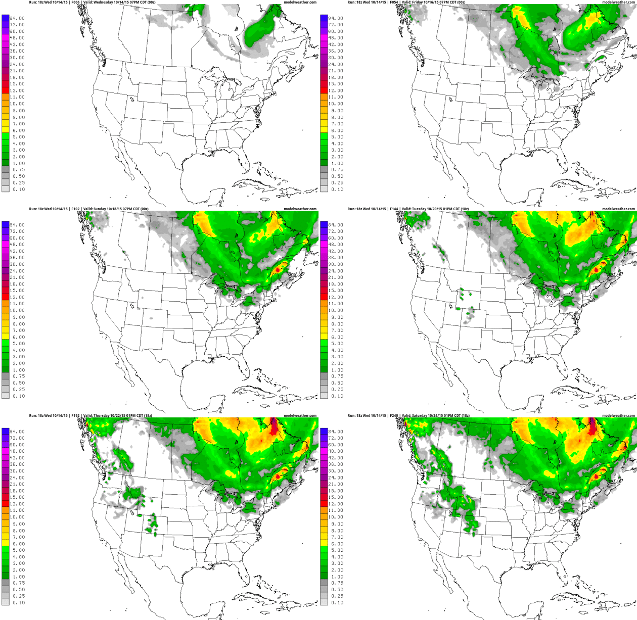
Getting Closer.
The animation above, courtesy of NOAA and AerisWeather, shows
accumulated snowfall over the next 10 days; snow showers pushing across
the Great Lakes into New England. Ground temperatures are still mild so
most of that snow will melt on contact, maybe a few inches for Montreal?
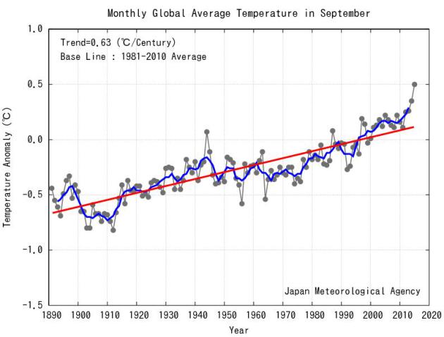
What Hiatus? Warmest September, Worldwide, on Record. Records date back to 1891; here's an excerpt from
Japan Meteorological Agency: "
The
monthly anomaly of the global average surface temperature in September
2015 (i.e. the average of the near-surface air temperature over land and
the SST) was +0.50°C above the 1981-2010 average (+0.82°C above the
20th century average), and was the warmest since 1891. On a longer time
scale, global average surface temperatures have risen at a rate of about
0.63°C per century..."
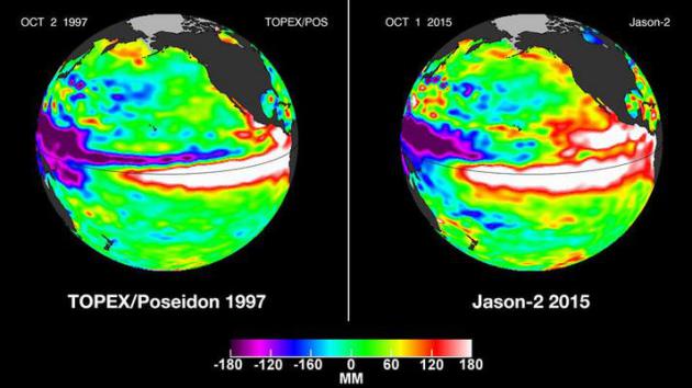
Massive El Nino Is Now "Too Big to Fail", Says Scientist.
The Los Angeles Times has the story - here's the introduction: "
An
El Niño that is among the strongest on record is gaining strength in
the Pacific Ocean, and climate scientists say California is likely to
face a wet winter. “There’s no longer a possibility that El Niño wimps
out at this point. It’s too big to fail,” said Bill Patzert,
climatologist for NASA’s Jet Propulsion Laboratory in La Cañada
Flintridge. “And the winter over North America is definitely not going
to be normal,” he said. Just three weeks ago, the National Weather
Service’s Climate Prediction Center raised the odds of California
getting doused with a wetter-than-average winter..."
Graphic credit above: "
Satellite
images comparing Oct. 1, 2015, and Oct. 2, 1997, show large areas of
white, which indicate high sea levels -- a reflection of high sea
temperatures. The images show how this year's El Nino could be as
powerful as the one in 1997, the strongest El Nino on record." (NASA Jet Propulsion Laboratory).
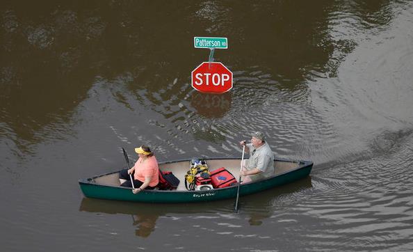
2015 Has Been A Year of Record-Breaking U.S. Weather Events. It's a fairly long list - here's an excerpt from
Huffington Post: "
Catastrophic flooding in South Carolina since last week shattered state rainfall records and shocked longtime residents and officials, who said they've never seen rain so powerful. But it's hardly the first extreme, record-breaking weather event in the U.S. this year. Floods, hurricanes, wildfires
and other extreme events are becoming more frequent and more intense
because of climate change, experts warn, and that's never been more
apparent than in 2015. Here's a look at some of the record-breaking
weather-related events that have hit the U.S. this year..."
Photo credit:
AP Photo/David J. Phillip.
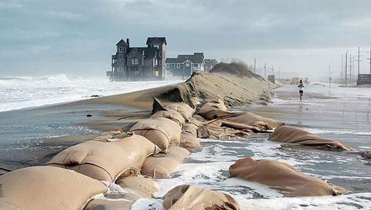
The American Cities Most Threatened by Rising Sea Levels.
Not a climate model, but actual observations: sea levels are rising -
the question is how much more, and how quickly? Here's an excerpt from
Mashable: "...
The
cities of Jacksonville, Virginia Beach, Sacramento and Miami follow New
York in terms of the size of the population that could avoid
submergence if steep carbon cuts were to take place in the next couple
of decades versus a business-as-usual course, according to data provided
by the study's authors. In Virginia Beach, for example, the difference
between a high and low emissions scenario means the contrast between
seeing the entire city submerged under the Atlantic, and only a portion
of it reclaimed by the sea. The study raises the possibility that the
cultural legacy of cities ranging from New York to Boston to Miami and
New Orleans are at existential risk..." (File photo: Andrew Demp, Yale).
America Is Increasingly Dependent on Just Two Crops, and It's Putting Us All At Risk.
Quartz has an interesting read; here's a clip: "...
In a study
published in August in PLOS One, US researchers have quantified for the
first time how much species diversity we are losing, due to our focus
on major commodity crops—up to 19% in some areas. The danger of a drop
in crop species diversity has been recognized for decades now:
As farmers plant more and more commodity crops like corn, they’re
planting fewer alternatives, leading to a loss in crop diversity, which
makes the country’s food supply more vulnerable to problems like pests
or climate change..." (Image credit: NebraskaCorn.org).
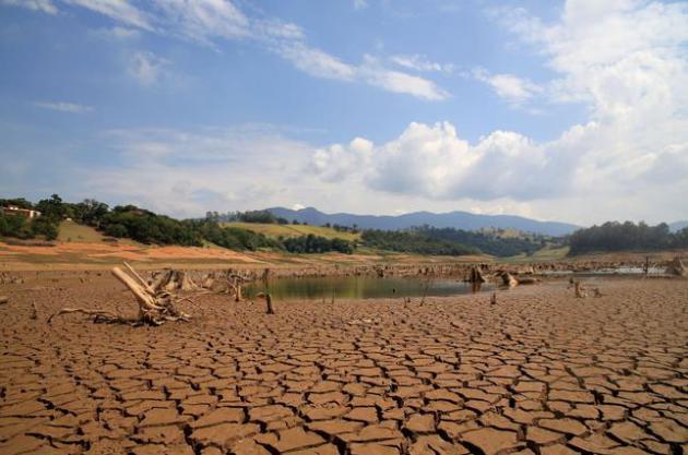
A Megacity Without Water: Sao Paulo's Drought.
TIME
has a sobering update on what's happening right now in Brazil, and how
other cities may face similar water shortages in the years to come.
Here's an excerpt: "
The biggest city in the Western hemisphere is facing its greatest water crisis in over 80 years — and climate change is only part of the problem. Millions of residents in São Paulo, Brazil face daily water shutoffs
unless the city manages its water better. It is not only a problem of
drought. The city of 20 million is plagued by failing infrastructure
across the city, and it has been unable to deliver the water it does
have to residents in need. Without major changes to the city’s
infrastructure and planning, commentators say the crisis is bound to
continue..."
File photo above: "
View of drought in
Rio Jacarei, region of Joanopolis, interior of Sao Paulo, southeastern
Brazil, on February 14, 2014. The level of Cantareira System, abastace
dam that almost 9 million people in Sao Paulo is in 18.7%, the lowest
level since 1974." Photo by: LUIS MOURA/picture-alliance/dpa/AP Images
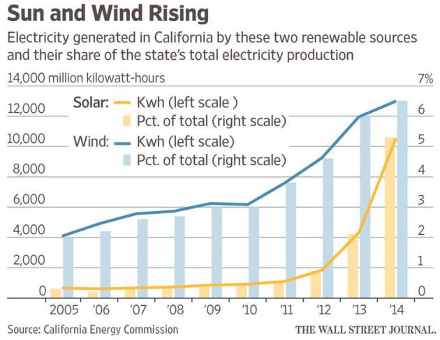
Renewable Energy's Potential May Be Understated. The headline I thought I'd never see at
The Wall Street Journal; here's an excerpt: "...
The
experience of California and other states with high concentrations of
solar and wind, such as Hawaii, is challenging long-held assumptions
about the limits of renewable energy. As the boundary of what is
considered possible expands, so does the momentum around investment in
new technology and resources. “You’ll hear numbers [that] people bandy
about and most of them are wrong: ‘We know we can get to at least 35% or
40%,’ ” says Haresh Kamath, an expert in energy storage and distributed
generation with the Electric Power Research Institute in Palo Alto,
Calif..."
Bill Gates: "We Need an Energy Miracle". Will technology save us from ourselves? Here's an excerpt of a fascinating interview at
The Atlantic: "...
Gates
is on a solo global lobbying campaign to press his species to
accomplish something on a scale it has never attempted before. He wants
human beings to invent their way out of the coming collision with
planetary climate change, accelerating a transition to new forms of
energy that might normally take a century or more. To head off a rise in
average global temperatures of 2 degrees Celsius above preindustrial
levels—the goal set by international agreement—Gates believes that by
2050, wealthy nations like China and the United States, the most
prodigious belchers of greenhouse gases, must be adding no more carbon
to the skies..."
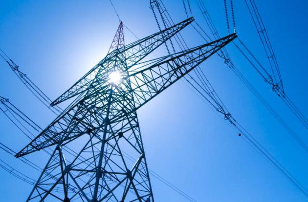
With Market On Their Side, Electric Utilities Skip Fight Against Carbon Rule. Renewables and natural gas are now helping utilities lower their costs (and carbon emissions), as reported by
The Wall Street Journal: "
U.S.
coal companies and at least 16 state governments are working on
challenges to the Obama administration’s new rule limiting carbon
emissions from power plants. Most electric utilities have a different
strategy: They are embracing it. From Dominion Resources Inc. in Virginia to Dynegy Inc. in Houston to Ohio’s FirstEnergy Corp. ,
electricity producers say they plan to comply rather than contest the
regulation. The main reason, executives and experts say, is that
economic forces are pushing the power industry inexorably toward a
lower-carbon future..." (File image: AARP).
It Finally Occurred To Someone To Crowdsource The Weather.
Motherboard has the details; here's a link and excerpt: "
There’s
a big hole in weather forecasting nowadays: none of them really ask the
guy on the street how it’s feeling outside. And that untapped avenue is
the target for Sunshine,
a mobile weather app released last week on the iOS App Store. Unlike a
traditional weather app, Sunshine shows you a local street map with
crowdsourced reports from people using it to report local sky conditions..."
Object of Intrigue: Banknotes for a Japanese-Occupied Hawaii. I had no idea - here's an excerpt from
Atlas Obscura: "
In
early 1942, the United States government began issuing a special set
of banknotes custom-made for Hawaii. The back of each note looked
identical to the existing U.S. paper currency apart from one major
difference: the word "HAWAII" was stamped across it. The design of these
notes wasn't the most elegant—the "HAWAII" looked as though it was
inscribed by someone with a black ballpoint pen and a ruler. But that's
understandable, given their circumstances: these banknotes were an
emergency series, rushed to print in the months following Japan's attack
on Pearl Harbor..."
Image credit above:
National Numismatic Collection, National Museum of American History).
Harvard Student Breaks Guinness Record for Standing on Work-Out Ball For 5 Hours.
The captions just sort of write themselves. I have no comment - just
ending on a high note, and feeling a little better about attending a
state university. Here's an excerpt from The Boston Globe: "After
standing barefoot atop a bright yellow exercise ball for nearly an
hour, Garrett Lam’s body began to shake and wobble. In a moment of
panic, the Harvard University senior extended his arms out to his sides,
making a “T,” to maintain his balance. He still had four more hours to
go to beat the Guinness World Record for “Longest time to stand on a
Swiss ball,” a title he was determined to secure — in the name of
charity..."
Photo credit: "Garrett Lam during the ordeal. If you’ve got some time, the video — more than five hours long — is at the bottom of the story."
TODAY: Mix of clouds and sun, cooling off a bit. Winds: NW 15-30. High: near 60
THURSDAY NIGHT: Partly cloudy and colder. Low: 37
FRIDAY: Chilled sun, grab a jacket for evening football games. Winds: NW 10-20. High: 48
SATURDAY: Hard freeze. Bright sunshine. Winds: SE 3-8. Wake-up: 30. High: near 50
SUNDAY: Sunny, milder wind. Wake-up: 35. Winds: SE 10-20. High: near 60
MONDAY: Unsettled as clouds increase, stray T-shower? Wake-up: 47. High: 65
TUESDAY: AM sun, late PM rain. Wake-up: 53. High: 63
WEDNESDAY: Periods of rain. Wake-up: 49. High: 55
Climate Stories...
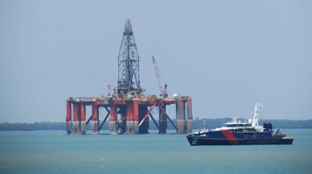
BP Admits Climate Concern Makes Some Oil Unburnable.
Stranded assets? Even the top oil producers now admit that much of the
oil will need to remain in the ground to avoid potentially catastrophic
warming; here's an excerpt from
Climate Home: "
Some
of the world’s oil will not be burned as a result of climate concerns,
BP’s chief economist said on Tuesday. Scientists have calculated
around a third of proven oil reserves need to stay in the ground to
hold global warming to 2C, the international goal. Spencer Dale’s
remarks, in a speech to the Society of Business Economists in London,
represented a rare acceptance of that analysis from the industry..."
Photo credit above: Flickr/Ken Hodge.
Excuses for Climate Inaction Melt Away: Our View. Here's the intro of an Op-Ed from the Editorial Board at
USA TODAY: "
With
every passing month, the arguments for inaction on climate change are
melting away faster than glaciers in Alaska. Let’s take them one at a
time. Argument No. 1: The science is uncertain. Actually, it’s not. An
overwhelming majority of climate scientists agree that human activity is
warming the planet. In fact, based on global surface temperatures, 2015 is on track to eclipse 2014 as the warmest year on record. This past summer was the hottest in recorded history,
topping 2014 and even 1998, which featured an El Nino-driven spike that
has allowed skeptics to claim, misleadingly, that temperatures haven’t
increased much since then..."
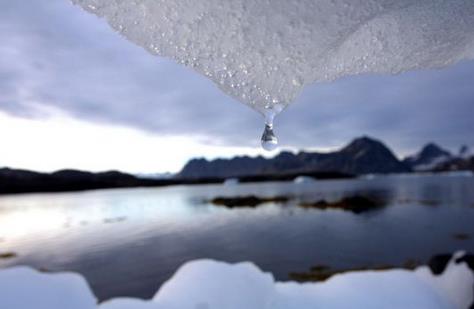
Photo credit above:
An iceberg melts in Kulusuk, Greenland, near the Arctic Circle in 2005.(Photo: John Mcconnico, AP)
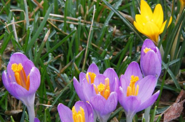
Climate Change Means Spring Could Come 3 Weeks Earlier Across U.S. The growing season is already longer for many northern locations.
NBC News has the story; here's a snippet: "
Spring flowers may arrive as much as three weeks earlier over the next century as climate change
drives an earlier end to winters in areas of the United States,
researchers say in a new report. Warmer weather earlier in the year
might have consequences for farmers as well as wildlife,
said the researchers from the University of Wisconsin, U.S. Geological
Survey and U.S. Fish and Wildlife Service. Their report was published in
the journal Environmental Research Letters..."
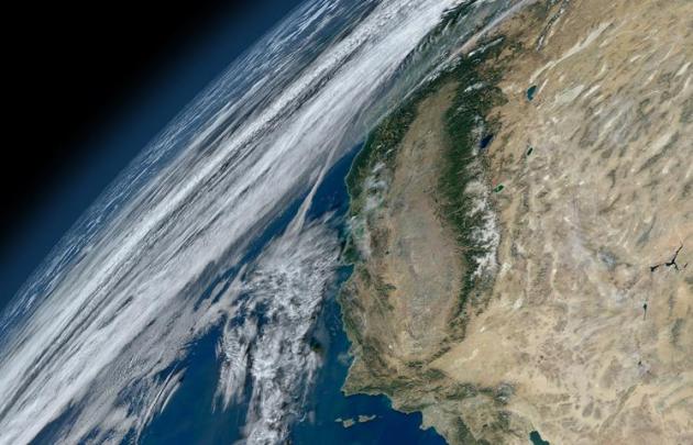
California Leads The Way on Climate Change. Here's a clip from
The New York Times: "...
Indeed,
at least a dozen states have challenged the Obama administration’s new
rule regulating carbon dioxide emissions from power plants and have
vowed to do everything they can to see it overturned in court. And then
there is California, which stands apart in its commitment to a
healthier, cleaner and less carbon-intensive energy future. Its
demanding effficiency rules for appliances and equipment have become a
de facto national standard by driving manufacturers to improve their
products..." (Image credit: NASA).
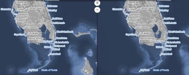
Even Under Best-Case Scenario, Sea-Level Rise Will Leave Miami Looking Like Florida Keys.
Miami New Times has the story - here's an excerpt: "...
Well, a new study published
in the Proceedings of the National Academy of Sciences of the United
States of America predicts that our choices are either completely
underwater or with some area left high and (relatively) dry. Which means
even under the best-case scenario, Miami will stop looking like
mainland Florida and start looking more like a string of Islands that
are essentially the new northern end of the Florida Keys. (Read an interview with the study's author here.)..."
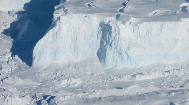
Why Scientists Are So Worried About the Ice Shelves of Antarctica. Tipping
points - we don't know what we don't know. If anything the rate of
melting of Greenland and sea ice in Antarctica has been taking place
faster than the climate models predicted. Here's an excerpt from
The Washington Post: "...
They
found that under both scenarios, Antarctic-wide surface melt doubles by
the year 2050, with the amount of meltwater produced coming close to
200 gigatons per year (a gigaton is a billion metric tons). This is a troubling finding, said Nerilie Abram,
a researcher from the Centre of Excellence for Climate System Science
at Australian National University who was not involved with the study,
in an e-mail to The Post. But, she said, “I think that the more
interesting result is to look at the huge divergence in predicted
Antarctic ice melt during the second half of the century...”
Photo credit above: "The photograph above shows an edge of the Thwaites Ice Shelf." (Jim Yungel/NASA)
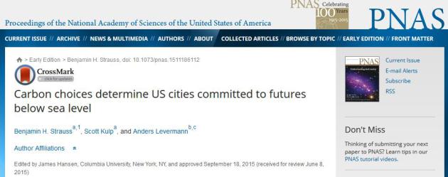
Carbon Choices Determine U.S. Cities Committed to Futures Below Sea Level. Here is an excerpt of the paper abstract, courtesy of
PNAS: "
As
greenhouse gas emissions continue to rise, the window to limit global
warming below 2 °C appears to be closing. Associated projections for
sea-level rise generally range near or below 1 m by 2100. However,
paleontological and modeling evidence indicates long-term sea-level
sensitivity to warming that is roughly an order of magnitude higher.
Here we develop relationships between cumulative carbon emissions and
long-term sea-level commitment and explore implications for the future
of coastal developments in the United States..."
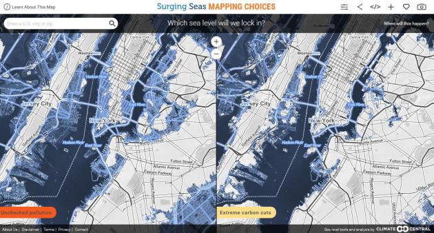
Sea Level Analyzer.
How quickly we curtail carbon emissions will determine the amount of
sea level rise that's locked in for the future. Climate Central has a
tool that helps to visualize best-case, and worst-case scenarios going forward.
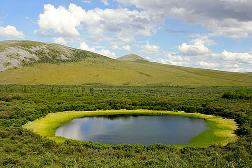
Methane Release From Melting Permafrost Could Trigger Dangerous Global Warming. Here's a snippet from
The Guardian: "...
To
put this in perspective, permafrost contains almost twice as much
carbon as is present in the atmosphere. In the rapidly warming Arctic
(warming twice as fast as the globe as a whole), the upper layers of
this frozen soil begin to thaw, allowing deposited organic material to
decompose. The plant material, which has accumulated over thousands of
years, is concentrated in to upper layers (half of it is in the top 10
feet). There is a network of monitoring stations that are measuring
ground temperatures have detected a significant heating trend over the
past few decades and so has the active layer thickness..." (File image: NASA).







No comments:
Post a Comment