88 F. high temperature at KMSP Monday.
84 F. average high on July 18.
88 F. high on July 18, 2015.
July 19, 1987: The town of Floodwood lives up to its name with nearly 6 inches of rain in two days.
Dangerous Heat Index Wednesday into Friday
"Hey Paul, hot enough for 'ya?" LOL. That never gets old. Thanks for asking!
I prefer Venus, where the surface temperature is a toasty 864F. But this is a good start. To quote Yogi Berra "it's not the heat, it's the humility." Or humidity for that matter.
The warming signal is manifesting itself with a longer growing season; winters trending milder overall. Summers aren't appreciably hotter (yet) but we are seeing more days with dew points in the 70s, even 80s. All this extra water in the air makes it harder for your body to cool itself naturally via perspiration.
Evaporating sweat has a cooling effect, but this natural A/C breaks down on hyper-tropical days.
Models suggest a dew point of 80F by Thursday, with an air temperature of 97F. It may feel like 110F by late afternoon. I see potential dangerous heat indices Wednesday into Friday, and that's why NOAA has issued an Excessive Heat Watch. I suspect they will upgrade to warnings shortly. Storms and "cooler" 80s return for the weekend, but the next 72-96 hours will be a mash-up of Scottsdale, AZ and Naples, FL.
Mostly nasty.
Preparations Before Extreme Heat. Here are a few bullet points from some timely reminders at ready.gov:
- Cover windows that receive morning or afternoon sun with drapes, shades, awnings, or louvers. (Outdoor awnings or louvers can reduce the heat that enters a home by up to 80 percent.)
- Keep storm windows up all year.
- Listen to local weather forecasts and stay aware of upcoming temperature changes.
- Know those in your neighborhood who are elderly, young, sick or overweight. They are more likely to become victims of excessive heat and may need help.
- Be aware that people living in urban areas may be at greater risk from the effects of a prolonged heat wave than are people living in rural areas.
2 in 3 Shot at 110F Heat Index Thursday In The Metro. The urban heat island will add a few degrees to the heat index, on top of dew points in the upper 70s and a surface temperature of 95-100F. I fully expect Excessive Heat Watches to be upgraded to Excessive Heat Warnings, at least for the metro area.
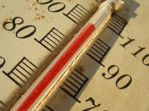
Heat Index: A number in degrees Fahrenheit (F) that tells how hot it feels when relative humidity is added to the air temperature. Exposure to full sunshine can increase the heat index by 15 degrees.
Excessive Heat Watch (Usually issued 2-4 days ahead of time) : Forecast Conditions are favorable for the heat index to meet or exceed 100 degrees (Hennepin/Ramsey counties) or 105 (the remainder of central and south central MN and west central WI)
Excessive Heat Warning (Usually issued 1-2 days ahead of time when confidence is 80% or higher): Heat index values are forecast to reach 100 degrees Hennepin/Ramsey counties) or 105 (the remainder of central and south central MN and west central WI)
Heat Advisory: Heat index values are forecast to reach 95 degrees (Hennepin/Ramsey counties) or 100 for the remainder of central and south central MN and west central WI
La Nina Effects Alive and Well Across U.S. Corn, Soy Belt. Here's a clip from a story at Reuters: "La Niña or not?" That has been one of the central debates in the agriculture markets in recent weeks. Since the beginning of the year, meteorologists have been warning that La Niña, the cool phase of the tropical Pacific Ocean, could begin at the start of the U.S. summer and could potentially place a high weather risk on the world’s largest corn and soybean crops. Since we are not yet in a full-blast La Niña, some have begun to doubt La Niña's presence or whether it is coming at all. Many weather watchers in the commodities space correctly point to the fact that on the presumed journey to La Niña, we are lagging key analog years such as 1998 and 2010..."
Photo credit: "A sprinkler waters corn in Los Banos, California, United States May 5, 2015." Reuters/Lucy Nicholson.
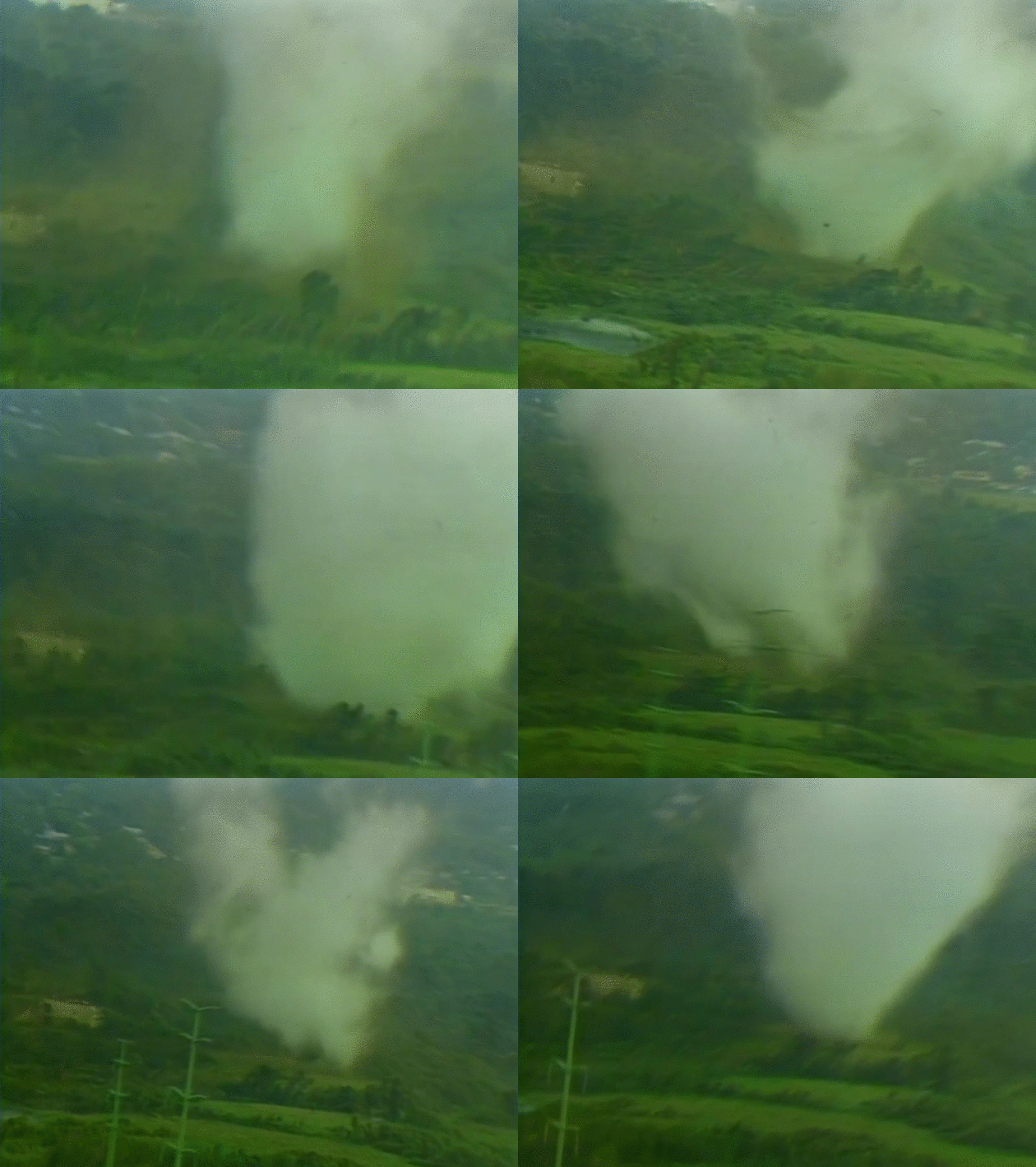
* The full TV newscast, a news show like no other (ever) is here, courtesy of KARE-11 and YouTube.
* Check out the new and improved Springbrook Nature Center for yourself. This is where the July 18, 1986 tornado spent most of its time, ripping trees out of the park as if they were weeds. You can still see some evidence of the tornado, but park staff and volunteers have done a wonderful job creating a remarkable urban park unlike any other in the Twin Cities metro.
Deadliest State for Tornadoes? Alabama.
Huh? In its defense, residents of Oklahoma, Texas and Kansas - the
heart of "Tornado Alley" are generally more tornado-aware; it's easier
to spot and track deadly tornadoes on the Plains than hilly, wooded
sections of the Mid South, and many tornadoes east of the Mississippi
are rain-wrapped and very hard to see, especially at night. Throw in
more trailer parks (per capita) and you have a higher overall risk for
Alabama than Oklahoma, according to KOCO-TV: "Over
the last 30 years the state with the most tornado-related deaths is
Alabama. Alabama averages 14 tornado-related fatalities each year,
followed by Missouri with eight. Arkansas averages five each year and
Texas, Mississippi, Georgia and Oklahoma all average four. The major
tornado outbreak of 2011 pushed Alabama's and Missouri’s averages way up
with the Joplin tornado responsible for 161 deaths and tornadoes in
Alabama killing 238 on April 27 and 28..." (Map: NOAA SPC).
A Dreaded Forecast for Our Times: Algae, and Lot's Of It. Here's an excerpt of a vaguely disturbing New York Times story: "Every
Thursday night, Bill Korbel, a veteran meteorologist, offers his
standard weather forecast to viewers on a Long Island cable channel.
Then he follows up with his outlook for toxic algae. On a map, Mr.
Korbel points out areas with high concentrations of algae — natural
gatherings of microscopic plankton that, while often innocuous, can
degrade water quality and even be dangerous. “Brown or red tide is much
catchier than harmful algal bloom,” Mr. Korbel joked about the right
wording to use in his broadcast. It’s a relatively new topic for him,
something that was never part of his decades-long career..."
Image credit: "A satellite image showing an algal bloom that caused a temporary ban on using tap water in Toledo, Ohio, in 2014." Credit National Oceanic and Atmospheric Administration
Artificial Intelligence Swarms Silicon Valley on Wings and Wheels. Here's an excerpt from an interesting New York Times story: "...Now Silicon Valley has found its next shiny new thing. And it does not have a “Like” button. The new era in Silicon Valley centers on artificial intelligence
and robots, a transformation that many believe will have a payoff on
the scale of the personal computing industry or the commercial internet,
two previous generations that spread computing globally. Computers have
begun to speak, listen and see, as well as sprout legs, wings and
wheels to move unfettered in the world..."
TODAY: Sticky sun, late T-storm possible. Winds: SE 10-15. High: 90
TUESDAY NIGHT: Risk of a few heavy T-storms. Low: 74
WEDNESDAY: Excessive Heat Watch. AM storms, PM sun. Feels like 105F. High: 93
THURSDAY: Heat wave peaks. Dangerously hot. Feels like 110F+ Wake-up: 78. High: 97
FRIDAY: Partly sunny, still beastly hot. Wake-up: 80. High: 95
SATURDAY: Not as hot; few T-storms possible. Winds: SE 8-13. Wake-up: 75. High: 87
SUNDAY: Cooler but unsettled, few T-storms. Winds: NW 10-15. Wake-up: 68. High: 81
MONDAY: Breathing easier. PM shower risk. Wake-up: 65. High: near 80
Climate Stories...
Photo credit: REUTERS/Rick Wilking.
Climate Change is Making Farm Work More Dangerous Than It Already Is. FUSION has an interesting story; here's an excerpt: "...There can be little argument that farm workers are among the most at-risk. “There is absolutely an association between climate change and the health of agricultural workers,” said Dr. Marc Schenker, director at the Center for Occupational and Environmental Health at UC Davis. “The health effects of climate change on workers are diverse, and range from heat stress to infectious diseases, and possibly kidney disease...” (Image credit: Omar Bustamante/FUSION).
Photo credit: "A flooded intersection in downtown Richwood on Friday, June 24." Christian Tyler Randolph, Gazette-Mail.
CHRISTIAN TYLER RANDOLPH | Gazette-Mail
A flooded intersection in downtown Richwood on Friday, June 24
-
See more at:
http://www.wvgazettemail.com/gazette-editorials/20160715/gazette-editorial-floods-part-of-climate-change-in-wv#sthash.CnrFUrgE.dpuf
Several
national climate experts said the severity of the Mountain State
devastation during the recent flood was almost certainly worsened by
human-caused global warming.
Climate change contributes to more extreme storms, floods, droughts, wildfires and other weather-related dangers. That means West Virginia is among the places where effects of climate change are being felt by people now, not in some distant, hypothetical future.
West
Virginia terrain has always been prone to flash floods, as residents
well remember and as the Sunday Gazette-Mail documented back to 1916. In
Appalachia’s mountains, people live on slopes and in valleys, making
them vulnerable to random, unpredictable washouts. Ominously, the menace
may worsen as climate change proceeds.
- See more at: http://www.wvgazettemail.com/gazette-editorials/20160715/gazette-editorial-floods-part-of-climate-change-in-wv#sthash.CnrFUrgE.dpuf
Climate change contributes to more extreme storms, floods, droughts, wildfires and other weather-related dangers. That means West Virginia is among the places where effects of climate change are being felt by people now, not in some distant, hypothetical future.
- See more at: http://www.wvgazettemail.com/gazette-editorials/20160715/gazette-editorial-floods-part-of-climate-change-in-wv#sthash.CnrFUrgE.dpuf
Graphics credit: "What #ExxonKnew vs what #ExxonDid." Illustration: John Cook, SkepticalScience.com.
No comments:
Post a Comment