72 F. average high on May 26.
81 F. high on May 26, 2016.
May 27, 1930: The Great Empire Builder Tornado occurs. A direct hit derails a famous train in Norman County.
Partly-Showery Holiday as We Ease Into Summer
It doesn't matter whether you win or lose. Until you lose.
Minnesotans become extra-sensitive to weather the next 3 months, jealously guarding 12 precious summer weekends. People become indignant when it rains on their up-north weekends, especially on major holidays. There's no compelling evidence that raindrops are mysteriously attracted to fishing boats, campfires or swimming pools. It's just we're outside more; truly weather-aware. When it rains we make a mental note.
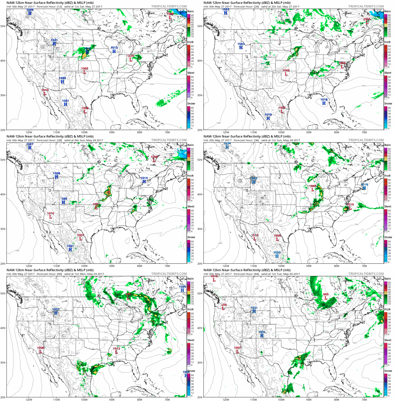
Today looks like the mildest day of the weekend with the sunniest weather over central and northern Minnesota. An area of showers overspreads southern Minnesota ahead of a cool front. The best chance of rain comes south of the Minnesota River; a shower may reach the MSP metro area by late afternoon or evening.
Winds swing around to the northwest Sunday and Monday with a cooling trend; the best chance of instability showers comes each afternoon. Sunday still looks salvageable, but Memorial Day may be a bust with highs near 60F and a leaky sky. 70s return next weekend but it seems summer is in no big hurry.
Persistent Rain in May. Dr. Mark Seeley takes a look at what is turning into another historically-wet May for much of Minnesota in this week's installment of Minnesota WeatherTalk: "Over the calendar period May 15-22, some Minnesota climate observers reported rainfall every day (8 consecutive days), and a large number of them reported rainfall on 7 of the 8 days. In addition, on some individual days the rainfall was slow but persistent, lasting for as much as 12-14 consecutive hours. Over May 15-22 within the Minnesota daily climate observation network there were 36 new daily rainfall records set. Some examples include: 2.96” at Hokah (Houston County) on May 16; 1.95” at Red Wing Dam (Goodhue County) on May 17; 2.09” at Morris (Stevens County) on May 18; and 1.32” at Milaca (Mille Lacs County) on May 21st. Total rainfall for the month of May is well above normal in most places, and in some areas is approaching values close to the historically wettest May. Many areas of the state report 4 to 7 inches of rainfall so far this month. This is the 6th time in the past seven years that May has been wetter than normal across the state...."
Significant Tornado Risk Mid South Today. NOAA SPC has a "moderate risk" for much of Missouri and northern Arkansas. Conditions are ripe for a few large, violent, long-track tornadoes by afternoon and evening. The significant risk area includes St. Louis and Springfield, Missouri.

This Is Why Homeowners Insurance Rates Have Risen.
Rain is falling harder during the spring months, but only 10,700 of
Minnesota's 1 million homes have purchased flood insurance. Large hail
appears to be on the increase, based on data from Dr. Mark Seeley. At a
recent talk Mark Kulda, VP of Insurance Federation of Minnesota,
reported that average homeowner premiums in Minnesota rose from $368 in
1998 to $1140 in 2012; a 310% spike in just 14 years. Some of that
increase is the result of more frequent hail and flash flood events.
We're not alone: 8 of America's 10 costliest hailstorms have occurred
since 2000. Fluke or trend?
Minnesota Storm Trends.
The PPT slides above are from a recent presentation in Plymouth,
courtesy of Mark Kulda, VP of Insurance Federation of Minnesota.
Harnessing Nature to Manage Rising Flood Risk. Phys.org has a story focused on natural defenses against rising water: "...Globally,
flooding is the most common disaster risk, accounting for nearly half
of all weather-related disasters during the past 20 years. Exposure and
vulnerability to flood risks are on the rise: the proportion of the
world population living in flood-prone river basins has increased about
114 percent and population exposed to coastal areas has grown 192
percent during the last decade. "We can't afford to continue to invest
in short term solutions that don't take into account how weather
patterns, sea levels and land use are changing the nature and severity
of flooding," said Anita van Breda, World Wildlife Fund's senior
director of environment and disaster. "The traditional approaches we've
used to manage flooding in the past - like sea walls and levees - in
most cases, won't work in isolation for the types of floods we're likely
to experience in the future..."
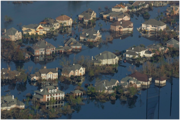
Photo credit: Walt Jennings, FEMA.
Globally,
flooding is the most common disaster risk, accounting for nearly half
of all weather-related disasters during the past 20 years. Exposure and
vulnerability to flood risks are on the rise: the proportion of the
world population living in flood-prone river basins has increased about
114 percent and population exposed to coastal areas has grown 192
percent during the last decade.
"We can't afford to continue to invest in short term solutions that don't take into account how weather patterns, sea levels and land use are changing the nature and severity of flooding," said Anita van Breda, World Wildlife Fund's senior director of environment and disaster. "The traditional approaches we've used to manage flooding in the past – like sea walls and levees – in most cases, won't work in isolation for the types of floods we're likely to experience in the future."
Read more at: https://phys.org/news/2017-05-harnessing-nature.html#jCp
Damaging Hail Trends.
Now this is for baseball size hail in Minnesota (2.75" in diameter).
Nature never moves in a straight line but the frequency of baseball size
hail has increases from 3-5/year to closer to 10-15/year. Data: Dr.
Mark Seeley, Minnesota Climate Office.

Above-Normal Hurricane Season Is Most Likely This Year. A weak or non-existent El Nino is a big factor in the prediction of a busier-than-average hurricane season, according to NOAA: "For
the upcoming Atlantic hurricane season, which runs from June 1 through
November 30, forecasters predict a 45 percent chance of an above-normal
season, a 35 percent chance of a near-normal season, and only a 20
percent chance of a below-normal season. "As a Florida resident, I am
particularly proud of the important work NOAA does in weather
forecasting and hurricane prediction," said U.S. Secretary of Commerce
Wilbur Ross. "These forecasts are important for both public safety and
business planning, and are a crucial function of the federal
government." Forecasters predict a 70 percent likelihood of 11 to 17
named storms (winds of 39 mph or higher), of which 5 to 9 could become
hurricanes (winds of 74 mph or higher), including 2 to 4 major
hurricanes (Category 3, 4 or 5; winds of 111 mph or higher). An average
season produces 12 named storms of which six become hurricanes,
including three major hurricanes..."
File image: NASA.

The Hurricane-Prone U.S. Coast Keeps Growing and Growing. Meteorologist Matt Lanza takes a look at population growth in some of America's most hurricane-prone coastal communities at Medium: "...So
what is the takeaway here? As a meteorologist, seeing that Eastern
United States coastal areas have added over 4.6 million people since
2010 is a bit unsettling, especially given how many of those people have
gone to Texas and Florida, two of the most hurricane prone states in
the country. If there’s a glimmer of good news, it may be that as a
whole, coastal counties in the United States are adding residents at a
slightly slower pace than they were earlier in this decade. But those
hurricane-prone places, Florida and Texas, show no signs of slowing
down. In fact, Florida continues to slam on the accelerator..."
Graphic credit: "Texas continues to add plenty of people." Source: U.S. Census Bureau.
NOAA's Newest Geostationary Satellite Will Be Positioned as GOES-East This Fall. Details via NOAA: "GOES-16,
the most advanced weather satellite NOAA has ever developed, will be
moved to the GOES-East position at 75 degrees west longitude, once it is
declared operational in November. Top officials from NOAA announced the
long-awaited decision at today’s 2017 Atlantic Hurricane Season Outlook
news conference in College Park, Maryland..."
Tornado Test Part 4: Two Tornadoes for TWIRL. KHQA.com has an update: "...Like
the eye of a hurricane, the tornado can be seen on radar. The DOW
measures winds of 195mph just 600 feet above the ground. Unfortunately
pods were not able to be put in the path so the ground winds are
unknown. The damage caused by tornadoes is exactly what TWIRL is trying
to better understand, how buildings are ripped apart. How pieces of roof
become projectiles in tornadoes. They want to better understand the
structure of them in order to better engineer structures to make
buildings safer, also to lead to better forecasts to be better able to
predict when a tornado may hit and where..."
Tornado-Spawning Eastern US Storms Examined by NASA's GPM Satellite. EurekaAlert! Science News explains: "On
Wednesday May 24, 2017 severe weather affected a large area of the
eastern United States. That's when the Global Precipitation Measurement
mission or GPM core satellite passed over the area and found extremely
heavy rainfall and towering clouds in the system. Tornadoes were
reported in Florida, Georgia, South Carolina, North Carolina and Ohio on
that day. The National Weather Service noted that rainfall in
Tallahassee, Florida set a record at 1.52 inches on May 24. The GPM core
observatory satellite flew above a line of tornado spawning storms that
were moving through the Florida panhandle on May 24, 2017 at 10:26 a.m.
EDT (1426 UTC). GPM's Microwave Imager (GMI) and Dual-Frequency
Precipitation Radar (DPR) instruments collected data showing that very
heavy downpours were accompanying some of these storms..."
Image credit: "The
GPM core observatory satellite flew above a line of tornado spawning
storms that were moving through the Florida panhandle on May 24, 2017,
at 10:26 a.m. EDT. GPM data showed the storm tops located north of the
extreme storms in the Gulf of Mexico reached altitudes above 9.2 mile
(16 km) dropping rain at a rate of over 8.5 inches (215 mm) per hour." Credits: NASA/JAXA, Hal Pierce.
Overnight Tornadoes. The greatest risk of late-night tornadoes is along the Gulf Coast, where nearly 30% of all tornado warnings were issued between midnight and 8 AM from 2002-2017. Late-night tornadoes produce a disproportionate number of injuries and fatalities - people are sleeping, not monitoring media, more vulnerable to severe storms.

Wind Power Catches a Mountain Breeze. The largest wind installation in the USA in Wyoming? TIME has the story: "...Despite enormous potential, wind-power development in the Western mountain states has lagged behind other parts of the nation. The sparsely populated states don't need more electricity, and the excess power didn't have anywhere to go. But that's changing fast, as demand for wind power increases around the country and technological advances make it cheaper and easier to transmit.The biggest strides are being made in Wyoming, where two companies are racing to build massive wind farms to supply the West Coast. In Carbon County, the Power Company of Wyoming has broken ground on what will be the largest wind-power installation in the country. The completed project, which is projected to create 1,000 local jobs, calls for 1,000 wind turbines generating enough energy to power nearly a million homes..."
File photo: Matt Young, AP.
They Were Supposed to Help People Suffering From Addiction. Then They Overdosed. Opioids truly are the devil's drug, a point driven home after reading a post at Vox: "The
two counselors at a drug treatment halfway house in Chester County,
Pennsylvania, were supposed to help others recover from their
addictions. But they were overwhelmed by their own drug problems — and
on Sunday, they both overdosed and died on a mix of the opioids heroin
and fentanyl.
“If anybody is wondering how bad the opioid epidemic has become, this
case is a frightening example,” Chester County District Attorney Tom
Hogan said in a statement.
“The staff members in charge of supervising recovering addicts
succumbed to their own addiction and died of opioid overdoses. Opioids
are a monster that is slowly consuming our population...”
Mossberg: The Disappearing Computer.
Computers? What computers? Walt Mossberg's last column proves why he's
been in a different league now for many years. We'll miss you Walt.
Here's an excerpt from Recode: "...I
expect that one end result of all this work will be that the
technology, the computer inside all these things, will fade into the
background. In some cases, it may entirely disappear, waiting to be
activated by a voice command, a person entering the room, a change in
blood chemistry, a shift in temperature, a motion. Maybe even just a
thought. Your whole home, office and car will be packed with these
waiting computers and sensors. But they won’t be in your way, or perhaps
even distinguishable as tech devices. This is ambient computing, the
transformation of the environment all around us with intelligence and
capabilities that don’t seem to be there at all..."
Photo credit: "This ragtag group of rebels went on to great victories." (Reuters/Fred Prouser)
Photo credit: "Feral hogs seen 1/23/16 at the In N Out Burger at 4251 N IH 35 in Round Rock."


SATURDAY NIGHT: Evening shower, then drying out. Low: 53
SUNDAY: Partly sunny, late-day pop-up shower possible. Winds: NW 10-15. High: 71
MEMORIAL DAY: Cloudier, cooler, more showers. Winds: NW 10-20. Wake-up: 52. High: 62
TUESDAY: Mostly cloudy, cool breeze lingers. Winds: NW 10-15. Wake-up: 49. High: 63
WEDNESDAY: More sunshine, low humidity. Winds: NW 8-13. Wake-up: 46. High: 66
THURSDAY: Blue sky, no weather complaints. Winds: NW 5-10. Wake-up: 48. High: 71
FRIDAY: Plenty of sunshine, milder. Winds: SE 7-12. Wake-up: 50. High: 74
Climate Stories...
So Much Water Pulsed Through a Melting Glacier That It Warped the Earth's Crust. Details via The Washington Post: "NASA scientists detected a pulse of melting ice and water traveling through a major glacier in Greenland that was so big that it warped the solid Earth — a surge equivalent in mass to 18,000 Empire State Buildings. The pulse — which occurred during the 2012 record melt year — traveled nearly 15 miles through the Rink Glacier in western Greenland over four months before reaching the sea, the researchers said. “It’s a gigantic mass,” said Eric Larour, one of the study’s authors and a researcher at NASA’s Jet Propulsion Laboratory. “It is able to bend the bedrock around it.” Such a “wave” has never before been detected in a Greenland or Antarctic glacier..."
Photo credit: "Rink Glacier on Greenland’s west coast." (NASA/John Sonntag).
Rising Seas May Wipe Out These Jersey Towns, But They're Still Rated AAA. Bloomberg reports: "Few parts of the U.S. are as exposed to the threats from climate change as Ocean County, New Jersey. It was here in Seaside Heights that Hurricane Sandy flooded an oceanfront amusement park, leaving an inundated roller coaster as an iconic image of rising sea levels. Scientists say more floods and stronger hurricanes are likely as the planet warms. Yet last summer, when Ocean County wanted to sell $31 million in bonds maturing over 20 years, neither of its two rating companies, Moody’s Investors Service or S&P Global Ratings, asked any questions about the expected effect of climate change on its finances..."
Exxon Investors Rally to Back Climate Change Plan Board Opposes. Bloomberg explains: "Almost 90 Exxon Mobil Corp. investors plan to back a proposal that would pressure the company to bolster its disclosure of climate change risks and opportunities. The shareholders include the New York State and city pension funds and the California Public Employees’ Retirement System, according to data compiled by investor advocacy group Ceres. Vanguard is evaluating the proposal in line with its proxy policies. “Vanguard, like other investors, views direct engagement with the board as a critical channel through which important matters can be discussed,” said Glenn Booraem, the firm’s investment stewardship officer. “Directors at any company who don’t engage with those on whose behalf they serve risk losing investor support...” (File photo: Mike Mozart).

Climate Change May Force Millions of Americans to Move Inland.
We already have climate refugees in coastal Louisiana and Alaska - this
may be the tip of the (melting) iceberg, according to research
highlighted at HuffPost: "...Using
migration data from the Internal Revenue Service and climate migration
models, Hauer concluded that a 6-foot increase in sea levels would cause
every U.S. state to experience climate-related migration by 2100. Scientists are predicting a 6-foot global sea-level rise by the end of the century if greenhouse gas emissions are left unchecked. In a study last year, Hauer had estimated that a 6-foot rise in regional sea levels would put 13 million people in more than 300 U.S. coastal counties at risk. The new report, published in the journal Nature, finds that nine
states could see population declines as rising waters force people to
flee. Florida would be worst off with millions of people leaving the
state. Other states would be taking in climate migrants. Texas could absorb as many as 2.5 million internal migrants..."
Photo credit: Carlos Barria/Reuters. "Rising
sea levels could threaten the homes of millions of people in coastal
states around the nation by 2100. Remember how neighborhoods were still
flooded two weeks after Hurricane Katrina went though New Orleans?"

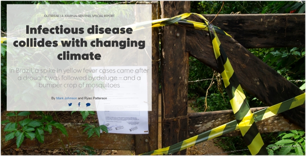
Photo credit: Mark Hoffman / Milwaukee Journal Sentinel.
Image credit: Nature.com.
Image credit: "A search for climate change information on the EPA website redirects to this holding page."
No comments:
Post a Comment