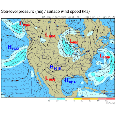
 Predicted weather map for 1 pm today, showing an unusually strong, almost springlike storm over Ontario, Canada. Counterclockwise winds swirling around this low will pump cool, Canadian air south of the border, a strong contrast in atmospheric pressure "putting the squeeze" on the airmass overhead, whipping up 20-40 mph winds.
Yesterday was a vivid reminder that if you blink, sneeze, turn away for just a minute or two, the weather will change on you. A wet start gave way to some badly needed sunshine by afternoon as a cool front swept across the state, a strong pressure gradient (a contrast in atmospheric pressure) whipped up winds as high as 60 mph, downing trees and powerlines from Madison and Clara City to Watertown and Waconia. These were straight-line winds, not from severe thunderstorms, fairly unusual for June. Today will be gusty and comfortably cool, more like late September than early June. Sustained winds will blow from the northwest at 20-30 with gusts as high as 40, even 50 mph this afternoon, when the atmosphere will be most unstable, allowing powerful jet stream winds to transport some of that momentum 5-7 miles overhead down to ground level. Expect a very choppy boat ride. The sun will be out during the morning and midday hours, but strong heating of the ground will whip up afternoon clouds, and the northern quarter of Minnesota may see rain showers popping up by mid/late afternoon, the best chance of a little rain coming north of Bemidji and Grand Rapids.
Something highly unusual will take place early this week - that storm over western Ontario will stall - temporarily - over the Great Lakes, a "cut-off low", cut off from the main belt of westerly jet stream winds howling overhead. Like a spinning top this slowly weakening storm will keep showery rains in the forecast from Detroit and Chicago to Eau Claire; much of Wisconsin will see wet weather Monday through Wednesday, and a few of these light showers may brush far eastern counties of Minnesota, near the St. Croix River Valley. A stubborn north to northwest wind will keep us on the cool side through midweek, sunshine increasing the farther west you drive across Minnesota the next few days. The warmest weather will be found over western counties of our fair state, highs well up into the 70s to near 80 as a bright sun shines overhead. Meanwhile far northern and eastern counties may see readings stuck in the 60s much of Monday, Tuesday and Wednesday (the absence of sun this time of year can make a 15-20 degree difference in temperature!)
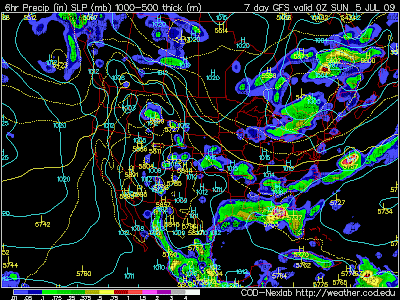
 GFS Forecast for 7 pm Saturday, July 4th, showing rain along the Gulf coast, showers spreading into New England, but high pressure over southern Manitoba providing generally dry weather for Wisconsin, Minnesota and the Dakotas.
Temperatures will mellow later in the week as the Great Lakes cut-off low finally breaks down, and a more west-to-east wind returns, luring the mercury back up near 80 the latter half of the week. The latest (GFS) computer run is more optimistic about the 4th of July weekend, keeping us dry Friday, Saturday and Sunday with temperatures close to average, maybe a couple degrees cooler than "normal" for early July. The model is hinting at a few sprinkles, even a light shower Saturday morning as a weak, reinforcing cool front pushes south across the state. It's too early to celebrate - I want to see a number of additional computer runs before I stand on the table and shout for joy, but the trends are encouraging: no stalled fronts that would sustain steady/heavy rain, no severe weather (that I can see right now - the atmosphere probably too dry for mutating thunderstorms). In fact if you believe the computers (I want to believe, believe me) most of us won't see any significant rain until Tuesday or Wednesday of NEXT WEEK.
Today will offer up some free air conditioning statewide, and I may just take those people up on their suggestion to go fly a kite. They've been encouraging me to go jump in a lake, too. Maybe by the weekend I'll work up the nerve.
 Forecast for 1 pm today, showing a "wind max" directly over Minnesota, with sustained winds of 20-30 mph. During the afternoon hours I wouldn't be surprised to see winds gusting over 40 mph. (from the northwest). Pass the dramamine.
Plot from yesterday, showing temperatures and dew points over time (top graph). Check out the wind speeds and gusts (second graphic down), showing frequent gusts close to 30 mph. in the Twin Cities
No comments:
Post a Comment