O.K. We're getting a little break in the weather today, if you call this a "break." Yes, it's hot out there, and (factoring a dew point near 70) it may feel even hotter Tuesday. In fact I wouldn't be surprised to see the Heat Index rise up into the 97 to 102 degree range tomorrow afternoon before a cooler front breaks the heat with heavy rain, thunder, lightning, and a potential for severe weather close to home. Today the atmosphere over central and southern MN should remain "capped", quite simply it's too hot and dry aloft for rising thermals of warm air to sprout into towering thunderheads. Tomorrow the arrival of a cooler front should be the spark that breaks the cap and helps to foster development of a squall line by mid afternoon, a line of strong to severe thunderstorms capable of large hail, damaging straight line winds, even an isolated tornado. I do expect a number of watches and warnings close to home by late in the day tomorrow.

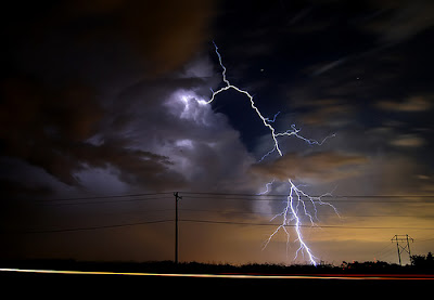
Thunderstorms Tuesday evening/night may be strong to severe, with frequent lightning strikes, large hail, even an isolated tornado close to home. We shouldn't be too surprised: June is the peak month for not only rainfall (average of 4") but severe storms as well.

I'm not sure how much of this is "noise" in the weather models, but the latest NAM/WRF computer run prints out nearly 1" of rain for St. Cloud, with a whopping 2.5" predicted for the Twin Cities Tuesday night into Wednesday morning. That may be overdoing it a bit, but there's little doubt, with precipitable water levels so high, that some gulley-gushers are very possible late tomorrow into Tuesday night. Good news: you may not have to do much watering this week.

In the winter we torment you with windchill-babble. In the summer you can't expect to catch a break, right? Now it's the Temperature-Humidity Index, or the "Humature". When there's a lot of water in the air your body can't cool itself naturally through perspiration. It's much harder to cool down, and the risk of overheating, being stricken with heat exhaustion or heat stroke (which can be fatal if not treated immediately) goes up dramatically. Tuesday, with a predicted afternoon high of 90-95 and a dew point near 70 it should FEEL like 95-100 degrees in the shade. Take it easy out there Tuesday, and know that more comfortable air is on tap by midweek.

The latest from SPC, the Storm Prediction Center, showing a slight risk of isolated storms from North Dakota into the western third of Minnesota. A "capped" atmosphere over central and southern Minnesota will probably prevent the storms from drifting too far south and east.

SPC Outlook for Tuesday, showing a slight risk over almost all of central and southern Minnesota, as a cool front plows into hot, humidifed air. A fairly widespread outbreak of hail-producing storms seems likely from mid afternoon into the early nighttime hours Tuesday.
 Thunderstorms Tuesday evening/night may be strong to severe, with frequent lightning strikes, large hail, even an isolated tornado close to home. We shouldn't be too surprised: June is the peak month for not only rainfall (average of 4") but severe storms as well.
 I'm not sure how much of this is "noise" in the weather models, but the latest NAM/WRF computer run prints out nearly 1" of rain for St. Cloud, with a whopping 2.5" predicted for the Twin Cities Tuesday night into Wednesday morning. That may be overdoing it a bit, but there's little doubt, with precipitable water levels so high, that some gulley-gushers are very possible late tomorrow into Tuesday night. Good news: you may not have to do much watering this week.
 In the winter we torment you with windchill-babble. In the summer you can't expect to catch a break, right? Now it's the Temperature-Humidity Index, or the "Humature". When there's a lot of water in the air your body can't cool itself naturally through perspiration. It's much harder to cool down, and the risk of overheating, being stricken with heat exhaustion or heat stroke (which can be fatal if not treated immediately) goes up dramatically. Tuesday, with a predicted afternoon high of 90-95 and a dew point near 70 it should FEEL like 95-100 degrees in the shade. Take it easy out there Tuesday, and know that more comfortable air is on tap by midweek.
 The latest from SPC, the Storm Prediction Center, showing a slight risk of isolated storms from North Dakota into the western third of Minnesota. A "capped" atmosphere over central and southern Minnesota will probably prevent the storms from drifting too far south and east.
 SPC Outlook for Tuesday, showing a slight risk over almost all of central and southern Minnesota, as a cool front plows into hot, humidifed air. A fairly widespread outbreak of hail-producing storms seems likely from mid afternoon into the early nighttime hours Tuesday.
No comments:
Post a Comment