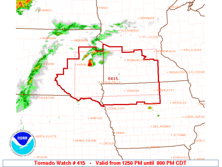
Tornado Watch. Valid until 8 pm Saturday evening conditions aloft are ripe for more supercell T-storms, greatest risk south/west of the MN River, but a few strong/severe storms may reach the metro area this evening. You should be ok for outdoor activities through 5 pm, after that all bets are off. Stay alert - stay tuned for more updates.
Tornadic "Mesocyclone". Also known as a "supercell", these long-lasting (rotating) thunderstorms show up on Doppler - the big tornadoes are (relatively) easy to spot - rarely forming in a line of storms, but rather lone, individual cells out ahead of a line of storms. These are the ones you have to watch. The supercell that formed near Montevideo tracked to the east southeast, sparking 3-4" diameter hail, and eventually all that spin lead to "tornadogenesis" as the supercell reached Fairfax/Klossner/Searle.


Not Again. Here we go again - the wind/moisture profile is ripe for a few more rotating "supercell" T-storms, especially over far southwestern MN later today and early tonight. I expect another round of watches/warnings - best chance of isolated reports of hail, violent straight-line winds, flash flooding, even a stray tornado: between 4 and 8 pm.

* At least 6 separate tornadoes in Minnesota Friday. Total for the season (so far) may be as many as 30. That is how many tornadoes we normally receive during an entire summer season.
* We aren't out of the woods just yet: slight severe storm risk again later today and this evening.
* Next week: one of the nicest of summer? Lower humidity, bright sun (and dry!) from Monday through Friday.
* Tropical depression east of the Yucatan forecast to strengthen into a hurricane over the Gulf of Mexico - the GFDL model brings "Hurricane Alex" into Louisiana next Wednesday with sustained winds close to 100 mph. The outlook is very much up in the air - you can only imagine how oil-plagued residents living on the Gulf of Mexico must feel right now.
 Friday's Outbreak. The "T"'s are the locations of tornado touchdowns yesterday - I counted 6, but there may wind up being more. Damaging wind reports show up as a "W", large, damaging hail shows up as an "H". Fairly intuitive, right? As you can see many of the "supercell" thunderstorms that spawned large hail also went on to spin up tornadoes. It goes back to my hypothesis: any thunderstorm with a (severe) updraft strong enough to suspend golf ball to baseball size hail up to 10 miles aloft may also be strong enough to spin up nature's deadliest wind.
 Damage Reports. Click here for a chronological list of the tornado, wind and hail reports for Minnesota (and the rest of the USA) for Friday's storms. A very long list.
Is it safe to go outside yet? Good grief, I feel like writing a (fictional?) account of a weather-traumatized guy afraid to leave his basement - perpetually hiding under the stairs, trembling, cowering - terrified to wander up the steps. I have met hundreds of Minnesotans who have what I can only describe as "weather-phobia", some event, a storm, tornado, flood, close lightning strike, something put the fear of God into them and it impacts how they live their lives. They fixate on the forecast, paralyzed by fear of the unknown - a storm within 50 miles triggers severe anxiety, sweaty palms, heart palpitations, pacing back and forth - unable to think (or move forward) because of the mere threat of a thunderstorm. Kids (and adults) who witness severe weather can suffer some of the same symptoms as PTSD patients, post traumatic stress disorders that trigger a physiological reaction.
Speaking from experience, living through a tropical storm at the ripe age of 14, having our home damaged by severe flooding, watching a guy drown in the stream behind our house, seeing dozens of 200-year old covered bridges washed downstream, had a powerful impact on me. Living through Tropical Storm Agnes sealed my fate - I wanted to understand what had happened to me, to my family and town, and I started studying hurricanes, then tornadoes, severe storms - ultimately leading to a career in meteorology. Think about it, nobody in their right mind wakes up and says, "hey - I want to be a weatherman!" Most TV meteorologists have a similar story, some wild & crazy weather event in their youth set them on a permanent career track.
I digress (sorry). You endured/survived another wild day, 8 days after the biggest tornado outbreak in 18 years (20 in one day last Thursday) we had another outbreak of tornadoes, straight-line winds and damaging hail. Golf ball to baseball size hail was reported, even in the immediate metro area, along with flash flooding - coming (conveniently) right around the evening rush, as people were trying to get home, head up to their cabins. Bad timing.
I don't think we'll get a clear understanding of how many tornadoes there were until National Weather Service teams have a chance to (literally) get out into the field and assess the damage from yesterday's storms. I counted 6 separate tornadoes, with the most intense (seemingly) west of Mankato, around Searles and Kossner, where a "rain-wrapped" tornado was reported. This is one of the most dangerous kinds of tornadoes, because (from a distance) it doesn't resemble a classic tornado funnel - it looks like a heavy shower, or a thunderhead that has lowered all the way down to the ground. Only strong counterclockwise rotation would be a tip-off that there is a tornado inside that curtain of rain. Rain-wrapped tornadoes are relatively rare - only Doppler radar can penetrate the outer coating of rain and detect the severe rotation of the parent thunderhead above (in almost every case the actual tornado itself is too small to show up on Doppler - the rotation visible on Doppler, the resulting "couplet" is of the attached T-storm, not the twister itself).
I've included a NWS damage report below.
 Another Swarm? Here is the NAM/WRF outlook for this evening around 7 pm, showing the most numerous/widespread T-storms over the southern third of Minnesota. The farther north you drive, the sunnier (and drier) the weather should be on Saturday.
 Sunday: Slow Improvement. Showers spill over into Sunday morning, but a drying west/northwest breeze (10-20 mph) should mean a welcome rerun of sunshine by Sunday afternoon and evening. The later in the day you plan your outdoor activities, the safer you should be.
It has been a rough June, between the tornadoes, monster-hailstones and gloomy, soggy weekends. We're due for a break, and it's almost here. A transfusion of drier, cooler Canadian air should treat us to 4-5 dry, sunny, comfortable days/row next week. July 4th weekend weather?
How 'bout those Twins?
 Detailed Storm Report. Here is the tally from the local NWS office in Chanhassen. The number of severe weather reports is impressive - even more individual storm reports than we experienced last Thursday.
 Major Minnesota Tornado Outbreaks. Thanks to Professor Mark Seeley for posting this graphic in his excellent weekly weather & climate blog, which you can see here. Last Thursday's outbreak of 20 tornadoes goes down into the record books as the largest swarm of tornadoes since 1992, when 22 tornadoes were reported. It ranks as Minnesota's second largest outbreak during modern day records, dating back to 1881.
 Outlook: Occasional Smoke. Look carefully at this (NASA/Terra) satellite image and you see a milky/hazy smear, especially over southern Wisconsin and lower Michigan. That's smoke from wildfires burning out of control over northern Alberta and Saskatchewan, being blown 500-1000 miles downwind by prevailing winds aloft. Remember the hazy sky on Wednesday, even though skies were crystal-clear? That was smoke drifting thousands of miles over Minnesota.
 Tracking the Plume. Although not as thick (and toxic) as volcanic ash, smoke from distant fires can lower air quality - and create spectacular sunrises and sunsets. To see the locations of fires, and subsequent smoke being generated by those fires, click on NOAA's Fire Detect web site here.
 "Pyromcumulus". Just when you think you've seen it all - wildfires near Lake Mary, Florida triggered rapidly warming air, sparking a jumbo cumulo-congestus cloud above the smoke and flames - an odd site indeed. The YouTube video is here.
 Climate Change "Thought Police." An interesting blog entry is here. BTW, even climate skeptics admit that global CO2 is on the rise, a fairly impressive rise in greenhouse gases in the atmosphere since 1960.
Paul's Conservation MN Outlook for the Twin Cities and all of Minnesota
Today: Partly sunny - dry much of the day. T-storms possible by late afternoon, a few may be severe. Winds: E 7-12. High: 85
Saturday night: Showers and T-storms likely, locally heavy rain. Low: 68
Sunday: Showers in the morning, tapering by midday - some sun returns by afternoon/evening. Winds: W/NW 10-20. High: 83
Monday: Mix of clouds and sun, dry statewide (finally!) High: 79
Tuesday: Bright sun, very pleasant. High: 76
Wednesday: Blue sky, very nice. High: 77
Thursday: Still spectacular - generous amounts of sun. High: 82
Friday: Partly sunny, warmer and more humid. High: 85
No comments:
Post a Comment