Severe Storm Watch. Far southwestern and south central MN is under a severe thunderstorm watch until 10 pm. The greatest risk is south/west of the Minnesota River, where a few isolated storms may pack large hail and straight-line winds - a risk of bow echoes with winds > 80 mph near the Iowa border. This watch does NOT include the Twin Cities.
Moscow Smoke. The smoke from nearly 1,000 fires is so thick and pervasive that it's showing up on satellite images from NASA's "Terra" low-orbiting satellite. Many countries are evacuating non-essential diplomats, travel advisories are in effect, hundreds of flights have been grounded because of near-zero visibility. Carbon monoxide levels are as much as 8 times greater than the allowable limits, another symptom of smoky, stagnant air. The story is here. Some amazing images of the impact of the heat (as hot as 104 F near Moscow), drought (worst in 130 years) and smoke here.

 Hail Yes! The icy stones that rained down on central South Dakota a couple weeks ago were record-setters alright, over 8" diameter hail, almost the size of soccer balls. And the farmer who scooped up this stone said there were LARGER hailstones in his field - he picked up this one because he was "intrigued by the spikes"! It had a circumference over 18", weighed over 1 pound. More on this "way out of whack monster hailstone" here.
Paul's Conservation MN Outlook for the Twin Cities and all of Minnesota
Today: Hot sun, sticky and steamy with little or no wind. T-storms possible far southern MN later. Winds: W 3-8. High: 93. Dew point: 74. PM Heat Index near 100.
Sunday night: Muggy and warm with a few T-storms over the southern third of Minnesota. Low: 76
Monday: Wet start, then partly sunny, still hot and humid. High: 91
Tuesday: More clouds and widespread T-storms, locally heavy rain. High: 88
Wednesday: Partly sunny, stray storm north, but a drier day overall. High: 90
Thursday: Plenty of sun, "hot enough for me." High: 92
Friday: Some sun, a few T-storms bubble up late. High: near 90
Saturday: Breath of fresh air? Storms north early, then partly sunny, breezy and LESS HUMID by afternoon. High: 86
 Saturday Touchdowns. There were at least 4-5 tornado reports, all coming from the same "parent" supercell thunderstorm, the same storm that sparked 2" diameter hail with an updraft strong enough to whip up tornadic winds.
 Damage Reports. The local NWS has a summary and chronology of yesterday's severe weather reports here.
* At least 3-4 tornado reports Saturday evening over west central Minnesota.
* Quieter Sunday on tap, but afternoon highs reach the low 90s with a dew point in the 70s. Heat Index may top 100 later today.
* Slight chance of thunder late Sunday night, early Monday.
* Better chance of T-storms Tuesday PM.
* 3-4 days of 90-degree heat this week? One of the hotter weeks of summer.
* Hints of September. First late-summer cool front arrives next weekend with a noticeable drop in temperature and humidity. Fresh air is 5-6 days away.
Welcome to a steamy, humidified, crazy-hot Sunday. Under a blue sky the mercury should reach low 90s. Factor in a dew point in the mid 70s and you wind up with a Heat Index close to 100 by late afternoon. The NWS may have to issue a heat advisory for parts of Minnesota later today, we'll be right on the edge of the criteria. The problem: when there's so much water in the air your body can't cool itself (naturally) by evaporating sweat off your skin. It's much easier to overheat when the dew point rises above 70, especially when winds are light, as they should be today.
Bottom line: get to a lake, pool, air conditioned mall or movie theater. Drink plenty of extra fluids, avoid midday sun, eat more salads (vs. big, meaty meals) and most of all: slow down! Won't be a problem for me today....I've gotten pretty good at slowing down during the Summer of '10.
At least 3-4 tornadoes were reported over far west central MN late yesterday, from Wilkin into Douglas counties, near Fergus Falls, Alexandria - the most significant damage may have been near Doran, out in Wilkin County, where a few homes were (apparently) damaged.
The metro area picked up dime size hail with wind gusts to 40-50 mph, but no reports of tornadoes close to the Twin Cities (although a touchdown was reported near Hayward, Wisconsin, of all places). We're seeing more big tornadoes farther north, touching down in the North Woods of Minnesota and Wisconsin as everything shifts north about 100-200 miles.
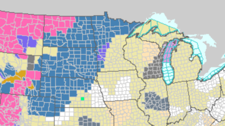
 Severe Zone. Yesterday's thundery boundary has been pushed just south of the Twin Cities, the best chance of a few isolated severe storms later today over far southern MN and roughly the southern half of Wisconsin.
Expect plenty of (hot) sun today, the best chance of late-day storms popping up south of the Minnesota River. Odds favor a mostly dry day from the Twin Cities up into the Brainerd and Detroit Lakes area - an isolated storm can't be ruled out, but I do NOT expect a rerun of yesterday. A few storms are possible (even in the Twin Cities metro area) late Sunday night and early Monday, but once again tomorrow most of the showers/storms should be focused over far southern MN. Tuesday looks like the wettest day of the week, with widespread heavy/severe storms, maybe some 1-2"+ rainfall amounts. We dry out again by midweek, with some BIG changes brewing for the end of the week.
Drumroll please: the first cooler front of late summer is shaping up for next weekend. You'll notice a drop in temperature and humidity Saturday, and by Sunday sweatshirts may be needed up north (at least for the early morning and late evening hours). Fresh air is 5-6 days away. In the meantime think cool thoughts - and hold off on watering the lawn or garden.
2010: Year of the Flood
 Historic Flooding in Pakistan. Millions of Pakistanis have been impacted by some of the worst flooding ever reported, the death toll reaching the thousands. The images are heartbreaking and mind-boggling.
 Towns Submerged as 7 Killed in Central European Floods. Noticing any trends? Good grief, I can't remember a year with the frequency and intensity of flooding we've seen (globally) this year. The story from msnbc.com is here.
* Climate Change Whips up Floods, Fire and Ice. The Sydney Morning Herald attempts to connect the dots here.
No comments:
Post a Comment