* Timing. Dry much of tomorrow, through midday and possibly early/mid afternoon. It looks like the brunt of the snow arrives late afternoon/evening - spreading in from the west/southwest - the heaviest snow falls Friday night, tapering to flurries Saturday morning.
* Cold snow. Temperature makes a HUGE difference with road conditions. With an air temperature projected to be within a couple degrees of 20 F it will be difficult for MnDOT road crew to keep even the major roads, freeways and interstates wet Friday evening/night. Expect snow-covered and increasingly icy travel conditions Friday night.
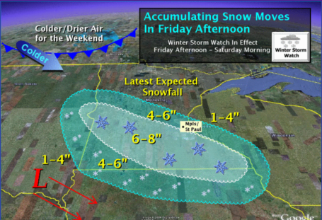
Fickle Clipper. Every storm is different, every storm has its own characteristics and complications. Clippers, by their nature, are extremely fickle and hard to predict, putting down a relatively narrow carpet of white. The NWS is tracking the storm and I think their snowfall predictions are pretty much right on the money. 5-8" for the southern/western suburbs, closer to 3-4" from Coon Rapids to White Bear Lake, Hugo and Stillwater - still enough to shovel and plow. Brainerd and Duluth probably won't see any accumulation from this clipper.
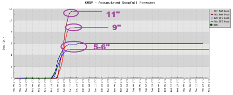
Pick Your Poison. O.K. I don't think we'll see 9-11". I don't buy it. I think the 5-6" range is going to be closer to verifying (as an average across the metro, especially the downtowns of Minneapolis and St. Paul). Expect less north/east, maybe 2-4" for the northern/eastern suburbs, with the best chance of 6-8" over the western/southern suburbs, from Rockford and Buffalo to Delano, Excelsior, Chaska, Prior Lake and Northfield.
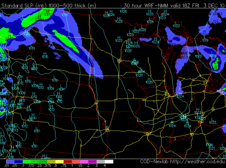
Friday Noon. No problems through 2 or 3 pm Friday. By midday tomorrow the clipper spreads snow into extreme southwestern Minnesota.
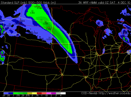
Friday Dinner Hour. Snow arrives in the metro between 4 and 7 pm tomorrow (western/southern suburbs will see snow a few hours before northern/eastern 'burbs). If you leave for home a little early tomorrow you may be able to get out ahead of this burst of snow. The heaviest snow should arrive Friday night.
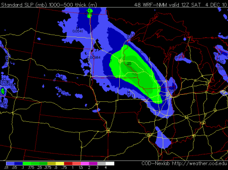
Saturday Breakfast. The latest NAM model for 6 am Saturday shows the heaviest snow bands moving rapidly east into Wisconsin - accumulating snow should wind down after 8 or 9 am with travel conditions improving as the day goes on. Saturday winds are forecast to blow from the north/northwest at 10-15, so I don't see widespread blowing and drifting, but if you're planning to drive first thing Saturday roads will still be snow-covered and potentially icy.
No comments:
Post a Comment