* Bitter air may be preceded by a few inches of snow from Friday, January 14 into Sunday, the 16th, potentially enough to shovel and plow.
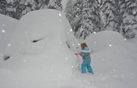
* Today's clipper capable of a coating to 1/2" of snow, enough to ice up a few roads.
* Behind the clipper, some weekend sun, but single digit highs are possible across much of Minnesota, nighttime lows dipping below zero.

Extreme Cold Warnings? Beginning January 10 the NWS may begin issuing extreme cold warnings (even on days when winds are relatively light) in a number of markets, including the Twin Cities. More information here.
Next Semi-Storm? Not sure if it will be an outright "storm", but the GFS model is hinting at a "few inches" of snow next Friday, the 14th, with light snow/flurries spilling over into the following weekend - followed by what may be the coldest airmass of the winter.
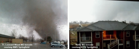

- Much of Oklahoma experienced at or below normal numbers of tornado watches, even though the state (unofficially) recorded the 3rd most number of tornadoes on record. (This is because of two large tornado outbreaks in May!)
- Portions of southern California and central Arizona experienced tornado watches this year (in October), even though the 10-year average is for less than 1 per year
- The central plains experienced an above normal number of severe thunderstorm watches
- Parts of western Louisiana and northern Florida did not record a single severe thunderstorm watch
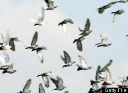
Not Again - More Dead Birds. Thousands of Turtle Doves Fall Out Of The Sky in Italy. The latest from Huffington Post: "On Wednesday, GeaPress reported hundreds -- possibly thousands -- of dead and dying birds in Italy. Countless turtle doves were found scattered in the streets, in flower beds and hanging tragically from trees "like Christmas balls" in the town of Faenza. Many of the birds that fell dead from the sky were discovered with a mysterious blue stain in their beaks."
* But Wait, There's More. Reports of thousands of dead crabs washing up on the shoreline of the U.K. Good grief - what the heck is going on? Wish I knew - I have yet to hear a scientifically believable explanation.
"Global Weirding". Could some of the abrupt swings in temperature be responsible for the simultaneous deaths of so many animals around the planet? I don't pretend to know the answer to that, but it's one (of many) theories floating around the 'net. More on the phenomenon of global weirding from this You Tube clip.
December Weather Extremes. 150" snow at Mammoth Ski Resort in California in 5 days? Just one of many examples of wild weather last month, documented by Dr. Jeff Masters on his Wunderblog.


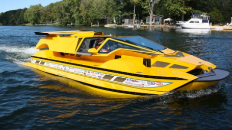


Is There A Hydrocar In Your Future. Rick Dobbertin spent 9 years building this 762 hp beast, which runs on land and water at speeds (reportedly) up to 60 mph. It will only set you back a cool $777k. That's a nice, round number. Exclusivity guaranteed. Details at gizmag.com here.

Paul's Conservation Minnesota Outlook for the Twin Cities and all of Minnesota:
TODAY: Light snow and flurries. Coating to 1/2" of light snow possible, more south/west. Winds: NW 15-25. High: 19
FRIDAY NIGHT: Flurries taper, turning colder again. Low: -2
SATURDAY: Peeks of sun, better travel statewide. Colder. High: 8
SUNDAY: Numbing start. More clouds than sun, quiet. Low: -8. High: 9
MONDAY: Storm stay south, mostly gray, few flurries possible. High: 15
TUESDAY: Clouds, chance of flurries, a very light accumulation possible. High: 17
WEDNESDAY: Intervals of sun, no big weather-worries. High: 14
THURSDAY: Light snow or flurries possible. High: 16
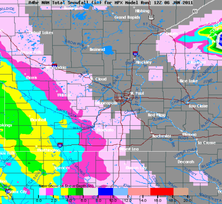
* Heavier snow possible next Friday/Saturday, January 14-15.
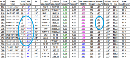
* Coldest air may come between January 16-21, a few subzero days with nighttime lows as cold as -20 to -25F around the metro, some -40s possible up north.

Coming Cold Wave
For snow we use the patented "nuisance-plowable-crippling" scale. We probably need a comparable scale to evaluate cold air. I would consider what we're experiencing now to be "irritating-cold", but hardly debilitating, especially when the sun is out (which seems to make a huge difference).
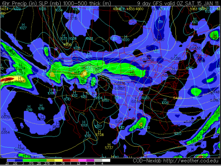
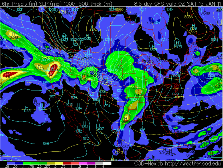
What may wind up being a newsworthy cold wave, a potentially dangerous 3-4 day episode of Siberian air, is shaping up for the 3rd week of January, between the 17th and 21st, give or take. Models are fairly consistent, pulling polar air into Minnesota. The good news: it may be a relatively quick shot of brutally cold air, 3-5 days. The bad news: even the metro may experience a few days of subzero highs (-3 to -8 F) with nighttime lows in the -25 F. range. Up north I wouldn't be surprised to see -45 or colder. Still time to call your travel agent or check out those low-low fares on Expedia.com!
Fresh bursts of bitter air are often preceded by major storms, even blizzards. Today's clipper grazes the MSP metro with a coating, 2-5" amounts far southwestern MN. This time next week a plowable snowfall is possible, followed by what MAY be the coldest smack since Jan. 2004 (-24 in the metro). Ouch.
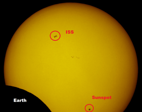
Celestial Event. Check out this amazing image of the sun, captured during the recent solar eclipse. That's the Earth's shadow in the lower left, the ISS (International Space Station) passing in front of the sun, and a sunspot in the lower right. Image courtesy of Discover Magazine.
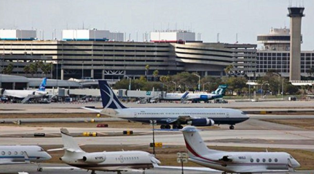
Shift Of Earth's Magnetic North Pole Affects Tampa's Airport. One of the more random, bizarre stories I've seen in recent days, courtesy of TBO.com:
"Scientists say the magnetic north pole is moving toward Russia and the fallout has reached -- of all places -- Tampa International Airport. The airport has closed its primary runway until Jan. 13 to repaint the numeric designators at each end and change taxiway signage to account for the shift in location of the Earth's magnetic north pole. The closure of the west parallel runway will result in more activity on the east parallel runway and more noise for residential areas of South Tampa."

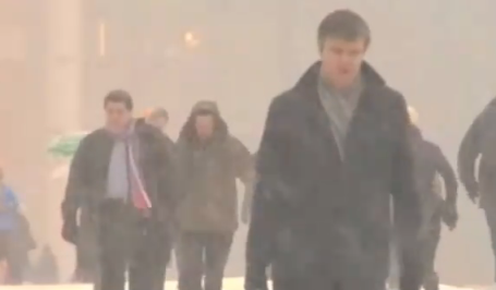
Climate News Snooze. In his Dot Earth blog, the New York Time's Andrew Revkin asks: "Has media coverage of human-driven climate change gone away, or gone undercover, as was the case for this CBS radio reporter seeking a quiet zone at Copenhagen climate talks a year ago? If so, does this matter?"
No comments:
Post a Comment