50 F. average high for April 3.
66 F. high in Rochester on Sunday.
13 days since the Twin Cities has seen measurable snow, more than a trace. 4.1" fell on March 23.
4" snow fell on Grand Marais yesterday.
Wind Advisory in effect today from west central to south central MN for gusts to 40-45 mph.
55 F. predicted high in Minneapolis on Friday for the Twins Home Opener (less than a 20% chance of a shower).
.56" rain predicted for Thursday night and early Friday morning (GFS).
.70" rain predicted for next Sunday night (GFS).
Record Highs on Sunday:
88 F. St. Louis
90 F. Kansas City
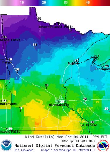
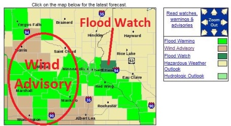
...STRONG WINDS DEVELOPING LATE TONIGHT INTO MONDAY...

.A WIND ADVISORY REMAINS IN EFFECT FOR PARTS OF WEST CENTRAL
THROUGH SOUTH CENTRAL MINNESOTA FROM LATE TONIGHT THROUGH MONDAY.
THE ADVISORY BEGINS IN WEST CENTRAL MINNESOTA AT 1 AM...AND THEN
AT 4 AM FOR SOUTH CENTRAL MINNESOTA. THE ADVISORY WILL BE IN
EFFECT UNTIL 4 PM ON MONDAY...AND NOW INCLUDES AREAS SOUTHWEST OF
A LINE FROM AROUND ALEXANDRIA...TO WILLMAR...TO ST. PETER AND
OWATONNA. THE ADVISORY ALSO INCLUDES THE INTERSTATE 90 CORRIDOR
OF SOUTH CENTRAL MINNESOTA.

BEHIND DEPARTING LOW PRESSURE LATE TONIGHT...NORTHWEST WINDS AT
25 TO 35 MPH...WITH GUSTS OF 40 TO 45 MPH...WILL ENVELOP WEST
CENTRAL MINNESOTA. THESE WILL EXPAND EAST ACROSS SOUTH CENTRAL
MINNESOTA DURING THE DAY MONDAY...BEFORE GRADUALLY DECREASING IN
SPEED ACROSS THE ENTIRE AREA BY LATE MONDAY AFTERNOON.
A FLOOD WATCH CONTINUES FOR THE FOLLOWING RIVERS IN MINNESOTA... WISCONSIN...
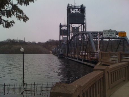
ST CROIX RIVER AT STILLWATER AFFECTING WASHINGTON...PIERCE AND ST. CROIX COUNTIES. .THIS RIVER FORECAST IS BASED ON SATURATED GROUND FROM PREVIOUS AND ON GOING SNOW MELT...AND OR THE PRECIPITATION RECEIVED OVER THE LAST FEW DAYS...AND THE FORECAST SNOW MELT WHERE APPROPRIATE...AND THE FORECAST PRECIPITATION OUT FOR THE NEXT SEVERAL DAYS. HEAVY RAINS WILL CAUSE EXTRA RUNOFF THAT WILL CAUSE RIVER LEVELS TO RISE EVEN HIGHER AND FASTER THAN PREDICTED. (file photo of Stillwater).
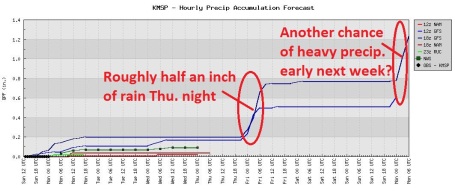
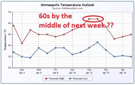
Latest Trends. See the impending warming trend for yourself, courtesy of WeatherSpark. The European solution (met.no) is hinting at 60 by Saturday - the best window for rain Thursday night, again late Sunday into Monday.
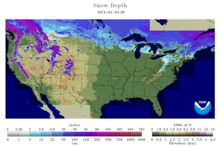
Going Fast. A swath of 5-15" of snow remains on the ground from the Great Lakes into the northern half of Wisconsin, central and northern Minnesota and much of North Dakota. Click here for the latest, courtesy of NOAA's National Snow Analyses.
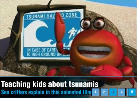
How To Talk To Your Children About Tsunamis. Granted, this is one of the few natural disasters Minnesotans don't have to worry about. The odds of encountering a major offshore quake and subsequent tsunami are minimal - but if questions arise about what happened in Japan you may want to consider sharing this video, geared to kids under 12 years of age.

Tsunami Facts. NOAA's Ocean Today has a video that delves into the science behind tsunamis. A few highlights: "It can be many miles long, from 1 to 100 feet high, traveling at 400 miles per hour. This ocean monster is known as a tsunami and it can wreak havoc on coastal populations and landscapes. A tsunami is a series of ocean waves caused by any large and sudden disturbance of the sea surface. Tsunamis can be generated by landslides, volcanic eruptions, or even meteorite impacts in the ocean. But they are most often caused by an earthquake where there's a sudden displacement of the ocean floor. When that happens, there's a transfer of energy from the seafloor to the ocean, causing waves on the surface to radiate outward in all directions. In deep waters, these waves may not even be detectable. But when the tsunami enters shallower waters, the wave speed slows and its height increases. The water along the coast may recede noticeably. A large wall of turbulent water, called a "bore," may also form. When the tsunami hits, it may come ashore like a fast rising flood and strike with devastating force. The series of waves may continue for hours. The first one may not be the last or the largest. For your safety, know the potential warning signs of an incoming tsunami: a strong earthquake that causes difficulty standing; a rapid rise or fall of the water along the coast; a load ocean roar."

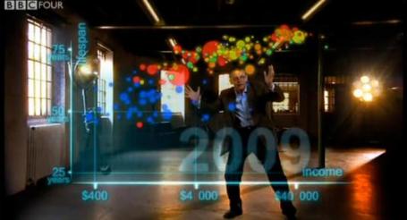
When The Data Struts Its Stuff. Suddenly data is sexy again - new ways of visualizing complex data to make the story come alive. The NY Times has the details: "In an uncharted world of boundless data, information designers are our new navigators. They are computer scientists, statisticians, graphic designers, producers and cartographers who map entire oceans of data and turn them into innovative visual displays, like rich graphs and charts, that help both companies and consumers cut through the clutter. These gurus of visual analytics are making interactive data synonymous with attractive data. “Statistics,” says Dr. Hans Rosling, a professor of international health at the Karolinska Institute in Sweden, “is now the sexiest subject around.” Dr. Rosling is a founder of Gapminder, a nonprofit group based in Stockholm that works to educate the public about disparities in health and wealth around the world — by offering animated interactive statistics online that help visitors spot trends on their own."

Erasing The Digital Past. Yes, by now we all know to be VERY careful about what we tweet, or post on FB. Some of those (nasty) photos and details can come back to bite us, when we least expect it. The New York Times has a story focusing on companies trying to help individuals (and companies) erase some of those forgettable posts: "The Internet never forgets. Just ask the New York City teacher who recently divorced his wife of five years. Drop his name into Google, and his ex-wife appears in pictures of vacations and Christmas parties. “It’s difficult when you’re trying to date and your ex is still in the picture, so to speak,” said the teacher, who didn’t want to make matters worse by having his name in a newspaper......Now when they perform a Web search of themselves, the negative links are harder to find. “It took a couple of months, but now when you Google my name, the negative sites are buried about six or seven pages in,” the physiologist said. “My clientele has dramatically improved, and when people call to make inquires, they always say they got my name from the Internet.” The company he used, Reputation.com, is among a growing corps of online reputation managers that promise to make clients look better online. In an age when a person’s reputation is increasingly defined by Google, Facebook and Twitter, these services offer what is essentially an online makeover, improving how someone appears on the Internet, usually by spotlighting flattering features and concealing negative ones."
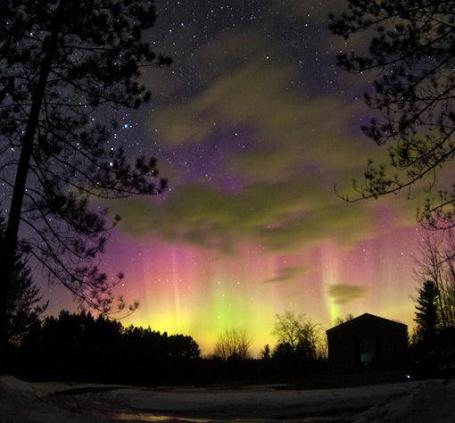
Deep Sky Auroras. According to spaceweather.com a geomagnetic storm over the weekend triggered spectacular "deep sky" auroras. They explain: "This weekend, April 2-3, Northern Lights spilled across the Canadian border into the United States with sightings as far south as Wisconsin, Minnesota, and Michigan. To the naked eye, the auroras were mostly pale-white, but exposures of 10 or more seconds with off-the-shelf digital cameras revealed spectacular color. Brian Larmay sends this picture from Pembine, WI. These are called "deep sky auroras" because like other deep-sky objects (e.g., galaxies and nebulae) they are best seen using optics and timed exposures. More of them could be in the offing. For the third night in a row, a solar wind stream is buffeting Earth's magnetic field. Moreover, the Moon is new, so the night sky is dark enough for long exposures. Photographers, grab your cameras and be alert for auroras."
Paul's Conservation Minnesota Outlook for the Twin Cities and all of Minnesota:
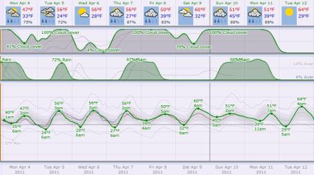
TODAY: Feels like early March again. Windy and cold with passing Flurries. NW 20-30, gusts close to 40. High: 43 (wind chills in the 20s). With any luck this is the last time I utter the phrase "wind chill" for the next 6 months. I sure hope so.
MONDAY NIGHT: Gradual clearing, still breezy. Low: 29
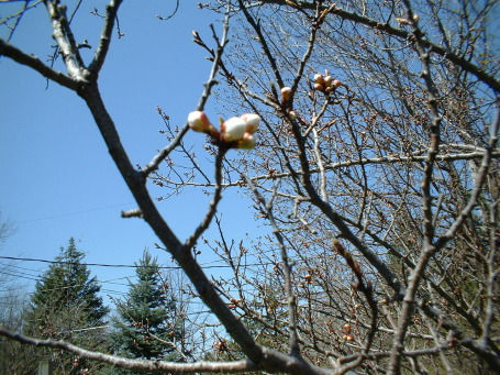
TUESDAY: Sun returns, winds subside, feels like spring again. High: 53
WEDNESDAY: More clouds, passing shower? Low: 43. High: 57
THURSDAY: Fading sun, rain arrives Thursday night. Low: 38. High: 56
FRIDAY: Mostly cloudy for Twins Opener. Damp, but probably dry. Low: 39. High: 55
SATURDAY: Intervals of sun, pleasantly mild. Dry weather expected right now. Low: 42. High: 57
SUNDAY: Clouds increase, rain arrives late? Low: 41. High: 53
MONDAY (April 11): Potentially heavy rain (wet snow western MN and the Dakotas?). Low: 43. High: near 50
Brief Relapse
The worst meteorological sins? Missing a tornado. Predicting flurries, only to wind up with a FOOT of flurries. Forecasting a sunny 4th of July, and tracking flooding storms on Doppler. People have long memories, and are slow to forgive.
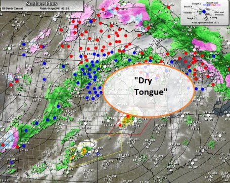
When the weather turns out nicer than predicted (like yesterday), it's not quite as bad, but an explanation is required nonetheless. The storm tracked farther north; dry air got tangled up in its circulation (the dreaded "dry tongue") - with enough sun for mid 50s. Picnic weather. Cold exhaust on the backside of the storm will spark flurries today as winds gust to 35 mph; a sturdy jacket recommended. Spring fever returns tomorrow and lingers much of the week, a streak of 50s, the GFS still hinting at a few 60s by the middle of next week.
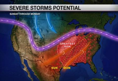
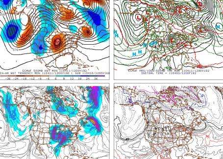
Big storms? I could see a period of rain Thursday night, skies brightening for the Twins Home Opener Friday (mid 50s at Target Field). Mild sun lingers part of the weekend, but long-range models continue to spin up a more substantial storm one week from today, possibly a foul smorgasbord of rain, snow and high winds. The ECMWF (European) model looks downright threatening. Check out the weather blog for details.
Opinion:

The Truth, Still Inconvenient. A number of Republican friends (who still have respect for the scientific method) are scratching their heads over an apparent disregard for peer-reviewed climate science and a willingness to turn this issue into a political litmus test. You can't be a true Republican and believe that people, industry, and the release of trillions of tons of greenhouse gases into the atmosphere might actually be having an impact on long-term climate trends? 97.4% of peer-reviewed climate scientists believe that anthropogenic (man-made) climate change is real, yet many are unconvinced. Some can't get past Al Gore - others are stuck on "Climategate" and rumors of a global conspiracy to fudge the numbers. Don't call them deniers - they prefer to be called skeptics, or "the unconvinced." O.K. Minnesota's own Thomas Friedman at the New York Times tackles the subject in a Monday editorial: "So the joke begins like this: An economist, a lawyer and a professor of marketing walk into a room. What’s the punch line? They were three of the five “expert witnesses” Republicans called for last week’s Congressional hearing on climate science. But the joke actually ended up being on the Republicans, when one of the two actual scientists they invited to testify went off script. Prof. Richard Muller of Berkeley, a physicist who has gotten into the climate skeptic game, has been leading the Berkeley Earth Surface Temperature project, an effort partially financed by none other than the Koch foundation. And climate deniers — who claim that researchers at NASA and other groups analyzing climate trends have massaged and distorted the data — had been hoping that the Berkeley project would conclude that global warming is a myth. Instead, however, Professor Muller reported that his group’s preliminary results find a global warming trend “very similar to that reported by the prior groups.” The deniers’ response was both predictable and revealing; more on that shortly. But first, let’s talk a bit more about that list of witnesses, which raised the same question I and others have had about a number of committee hearings held since the G.O.P. retook control of the House — namely, where do they find these people?"
No comments:
Post a Comment