* Tornado Watch: for parts of west central MN until 10 pm.
* Dew Point hits 80 Sunday at 5 pm in the Twin Cities. All-time record dew point is 81.
* Extreme Heat Warning will probably remain in effect most of this week: highs well up into the 90s, coupled with dew points in the 75-80 range, will make it feel like 105-115.
* Hottest week of summer? Probably.
* No significant relief from heat/humidity until Sunday.

Tropical Downpours. NWS Doppler at 5:40 pm show a few heavy showers in the Twin Cities metro (nothing severe, at least not yet). Conditions are ripe for severe storms, especially north of St. Cloud, from Fergus Falls and Alexandria to Brainerd, Hibbing and the Duluth area.
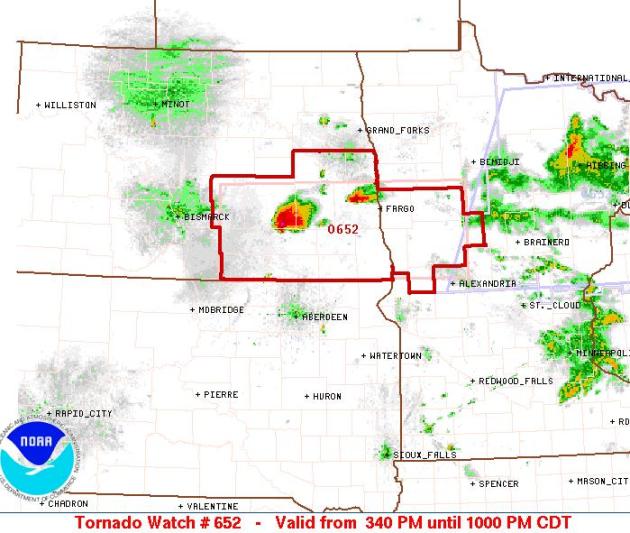
Tornado Watch Until 10 pm. SPC has issued a Tornado Watch for portions of west central Minnesota, including Moorhead, Fergus Falls and Detroit Lakes. A few violent T-storms may form along a violent warm frontal boundary through the evening hours.
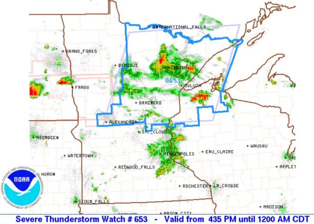
Severe Storm Watch Until Midnight. The watch includes the northern suburbs of St. Cloud, Alexandria, Brainerd, Duluth and the Hibbing area, calling for large hail and potentially damaging straight-line winds.
No comments:
Post a Comment