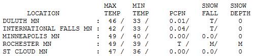
57 F. normal high for October 19.
November 1: average high in the Twin Cities on Nov. 1 is 49.
30 F. predicted low temperature for Friday morning.
May 3: last time the mercury hit 32 F. in the Twin Cities.
Next Chance Of Rain: Saturday Night. Models are pretty consistent - the next chance of rain showers comes Saturday night into Sunday morning. A few of the long-range models are hinting at a little wet snow mixing in with the rain by Wednesday of next week.
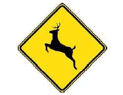
Don't Veer For Deer. "Deer-vehicle crashes peak in the autumn months, but Minnesota’s large deer population makes them a safety hazard on the road all year long. Deer crashes are especially dangerous for motorcyclists — a group which accounted for 16 of the 19 vehicle-deer related deaths over the last three years. An important safety tip for drivers is to never veer for deer — swerving can take a motorist into oncoming traffic or off the road."
(thanks to the Chaska Police Department for passing this along!)
* Drive at safe speeds and always buckle up.
* Motorists: don’t swerve to avoid a deer. Swerving can cause motorists to lose control and travel off
the road or into oncoming traffic. The best defense is to buckle up and brake.
* Motorcyclists: a rider’s best response when encountering a deer is to slow down quickly and then
drive carefully around the animal at low speed. Riders are encouraged to wear helmets and other
high-visibility protective gear to prevent injury or death in a crash.
* Don’t count on deer whistles or deer fences to deter deer from crossing roads.
* Watch for the reflection of deer eyes and for deer silhouettes on the shoulder of the road. If
anything looks slightly suspicious, slow down.
* Slow down in areas known to have a large deer population — where deer-crossing signs are
posted; places where deer commonly cross roads; areas where roads divide agricultural fields from
forest land; and whenever in forested areas between dusk and dawn.
* Deer do unpredictable things — they stop in the middle of the road when crossing; cross and
quickly re-cross back; and move toward an approaching vehicle. Blow horn to urge deer to leave
the road. Stop if the deer stays on the road, don’t try to go around it.
* Any Minnesota resident may claim a road-killed animal by contacting a law enforcement officer. An
authorization permit will be issued allowing the individual to lawfully possess the deer.
* If a deer is struck but not killed by a vehicle, keep a distance as deer may recover and move on. If a
deer does not move on, or poses a public safety risk, report the incident to a DNR conservation
officer or other local law enforcement agency.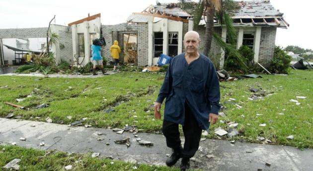
* more from the Miami office of the NWS on the EF-2 tornado here (pdf file).
Chicago Area Webcams:
http://navypiercam.com/ (Navy Pier)
http://www.glerl.noaa.gov/metdata/chi/
http://www.mwhazecam.net/adler.html (downtown Chicago)
http://www.luc.edu/webcams/lsc.shtml (Loyola University)
http://www.glerl.noaa.gov/metdata/chi/
http://www.mwhazecam.net/adler.html (downtown Chicago)
http://www.luc.edu/webcams/lsc.shtml (Loyola University)
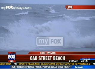
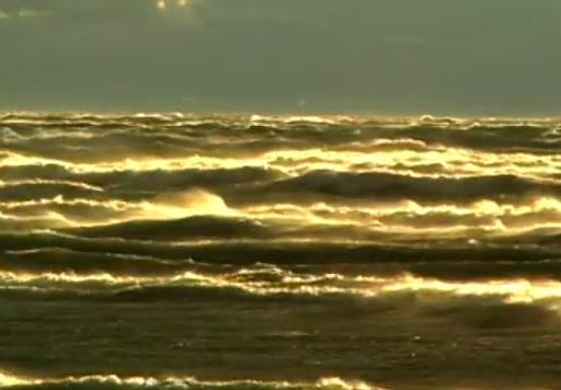
"The National Weather Service is warning of the possibility of flooding in Chicago on Wednesday as high winds create waves in Lake Michigan that could build up to 22 feet, MyFoxChicago reports. Large and “battering” waves will result in flooding of areas near the lake and more susceptible parts surrounding the area. A gale warning is in effect and expected to last through 3 p.m. Wednesday, according to the weather service. Forecasters predict the strongest winds will come from the northeast and clock in at nearly 52 mph."
Chicago Wind Gusts. Thanks to the Chicago Weather Center for the updated information:
O’Hare Airport operations have been affected by the winds, low clouds and rain resulting in 148 canceled flights and 662 delays.
Here are a few of the more recent wind gusts:
58 mph Chicago- Harrison-Dever Crib
52 mph Chicago- Soldier Field
48 mph Gary, IN
47 mph Chicago- West Loop
47 mph Chicago- Rogers Park
45 mph Highland Park, IL
45 mph East Chicago, IN


November Breeze. Under a gray, lumpy sky with gusty north winds temperatures held in the 40s across most of Minnesota. Highs ranged from 42 at International Falls to 47 St. Cloud, 49 Twin Cities and 51 at Grand Marais, where the sun peeked through for a few hours.

Paul's Conservation Minnesota Outlook for the Twin Cities and all of Minnesota:
TODAY: Mix of clouds and sun, breezy and cool. Winds: N 10-20. High: 49
THURSDAY NIGHT: Clear and cold - first official frost of the season at MSP International? Low: 30
FRIDAY: Blue sky, less wind, a few degrees warmer. High: 55
SATURDAY: Some sun - clouds increase during the afternoon/evening. Shower possible north. Winds; NW 5-10. Low: 39. High: 58
SUNDAY: Early shower, some PM sun. Low: 41. High: 57
MONDAY: More clouds than sun, warmer than average. Low: 42. High: 58
TUESDAY: Clouds increase, turning cooler. Low: 45. High: 54
WEDNESDAY: Chance of a cold rain (mainly south/east). Low: 38. High: 47
Winter Coping Skills
"There's no such thing as bad weather...just inappropriate clothing choices." Living in Minnesota for 28 (winters) that proverb rings true. How can you make it through a Minnesota winter and keep your sanity? Layers. Something as simple as wearing an undershirt will preserve precious body heat. Invest in a couple of space heaters for your office, family room and bedroom.
Our coldest days are usually sunny, which helps, psychologically. Buy a full spectrum light bulb, one that mimics the sun. A lack of sunlight can leave many of us in a blue funk - full spectrum light bulbs seem to help.
Plan a February getaway. The THOUGHT of a vacation can be just as good as the trip itself. The best remedy? Don't huddle indoors. Get out and ski, fish, snow shoe, snowmobile. It will change the way you think about winter.
For the record - in 3 1/2 months temperatures will start to trend upward again. Really!
A massive storm whipping up 20 foot seas and 60 mph winds on Lake Michigan will push east today; skies clear - a warming trend into Monday. I still don't see a real storm looking out roughly 2 weeks. After cooling into the 40s next week the mercury may bounce back to 60 on Halloween.

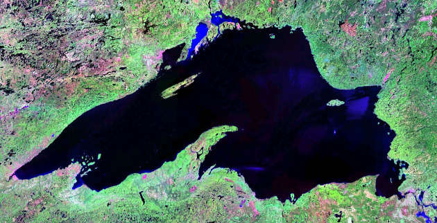
Study: Less Severe Great Lakes Water Loss. The Duluth News Tribune has more: "Global warming may not lower Great Lakes’ water levels as much as some studies have suggested, according to a new computer model. Using a new approach to modeling future water levels, researchers at the National Oceanic and Atmospheric Administration’s Great Lakes Environmental Research Laboratory predict either a smaller drop or an actual rise in water levels. The researchers reported their work online in the Journal of Great Lakes Research. “Even small drops in lake water levels create problems for shipping and navigation, hydroelectric energy production and recreational boating,” said Brent Lofgren, lead author of “Effects of using air temperature as a proxy for potential evapotranspiration in climate change scenarios of Great Lakes basin hydrology.”
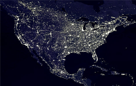
Cities Role In Global Warming Said Minor. The urban heat island's impact on overall warming of the troposphere appears to be far less than warming from greenhouse gases. UPI.com has more details:
"Cities put more heat into the atmosphere than rural areas but U.S. researchers say it's modest compared with what greenhouse gases contribute to global warming. "Between 2 percent and 4 percent of the gross global warming since the Industrial Revolution may be due to urban heat islands," Mark Z. Jacobson, Stanford University professor of civil and environmental engineering, said. Greenhouse gas contributes about 79 percent to gross warming and black soot from burning fossil fuels accounts for about 18 percent of, a Stanford release said Wednesday."
No comments:
Post a Comment