Todd's StarTribune Outlook for the Twin Cities and all of Minnesota:
THURSDAY: Mostly cloudy with light snow, mainly south (Coating to 2" across the Twin Cities, better chance of 2" in the southern part of the Twin Cities) (2" to 4" in the heaviest bands setting up south of the Twin Cities and north of the I-90 corridor) (3" to 6" along the I-90 corridor). Winds: NNE turning NW 10-15mph. High: 34
THURSDAY NIGHT: Cloudy and breezy with some lingering light snow showers and flurries. Winds: NW 10-15mph. Low: 22
FRIDAY: Mostly cloudy another shot of light snow. Breezy. Feels like February again. Winds: NW 10-20mph. High: 29
SATURDAY: A chilly and somewhat sunny start, clouds thicken through the day. Turning breezy. Winds: ESE 10-15mph Low: 14. High: 28.
SUNDAY: Cloudy, chance of snow. System to watch! Low: 18. High: 29.
MONDAY: Lingering snow early, still breezy and colder. Low: 15. High: 25.
WEDNESDAY: Cloudy with a chance of snow. Low: 13. High: 25.
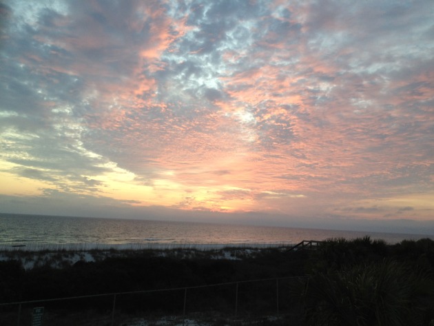
Beautiful Seaside Florida
Ahh... this looks good right about now, doesn't it? I could use a little Florida sun!
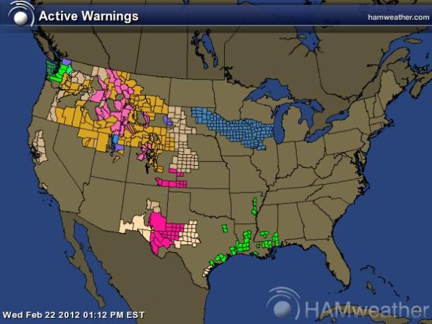
National Watches & Warnings
It seems as if the weather has suddenly snapped into winter mode and just like that, we're dealing with winter storms and shovelable snow events. Take a look at the watches and warnings map across the nation. The Pacific Northwest is the most active region for the moment, but pieces of energy are heading into the middle part of the country as well with snow to the north and severe storms to the south.
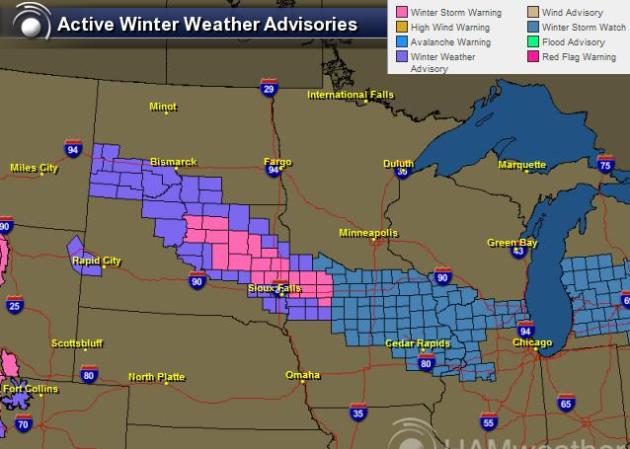
A Robust Clipper Drops a Carpet of White
This fairly fast and robust clipper-like system is going to quickly skirt through the Upper Midwest with snowfall totals through Thursday big enough to drag out shovels and snow blowers, mainly across the Minnesota River Valley and along the I-90 corridor, but light amounts will also be possible a little closer to the Twin Cities.
Choose Your Favorite Weather Model
The hardest part about forecasting events like this is that the heaviest snow is sometimes only a county wide! Here we may be talking about a very thin narrow strip of 6" to 8" and just outside of that band, snowfall amounts will dramatically drop off. The big question is where EXACTLY where that band set up... for that we consult the weather models. Round 'em up and choose your favorite one!
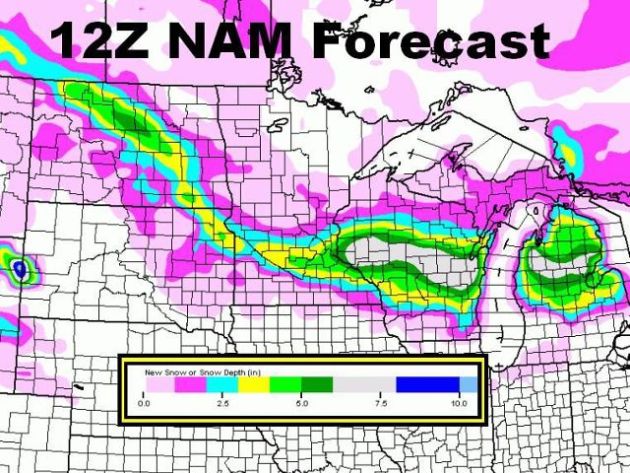
NAM Solution
The NAM solution is the northern most solution, which would bring accumulating snow to the Twin Cities and into central Wisconsin.
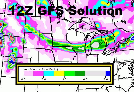
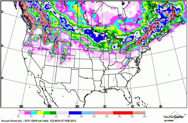
GFS Solution
The GFS solution takes the heaviest snow corridor across the Minnesota River Valley and along the I-90 corridor into the extreme northeastern corner of Iowa and southern Wisconsin
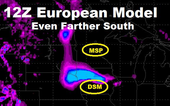
European Model
The European model tracks even farther south and keeps most of the snow across Iowa, giving very little (if any at all) to the Twin Cities. The image below would suggest the placement of the snow around the early/mid afternoon hours on Thursday.
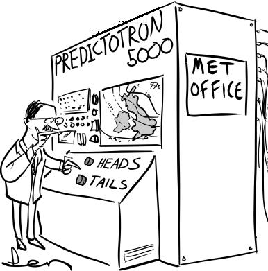
Heads Or Tails Forecast
I have a love or hate relationship with clipper-like systems like this. These are very finicky and any deviation in the storm track will have HUGE implications to the overall snow forecast. Forecasting for these types of events is almost like consulting the "Predictotron 5000"
Stormy Pattern Continues
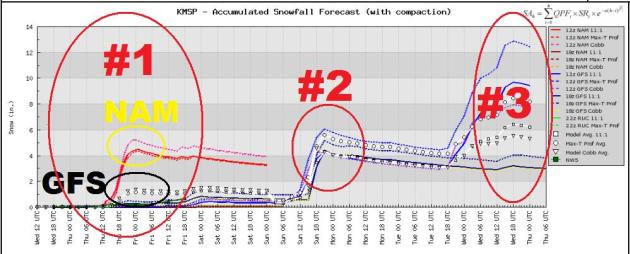
I am amazed by how active the weather pattern is. I guess we're making up for lost time here. The extended GFS model is picking up TWO other storm systems after our mid-week system. #2 would come in late Sunday into Monday with shovelable snow and system #3 would come in around Tuesday with even more shovelable snow! Keep those shovels handy... just in case! You can see system #1 with differing opinions between the NAM and GFS. The NAM brings in quite a bit more snow than GFS.
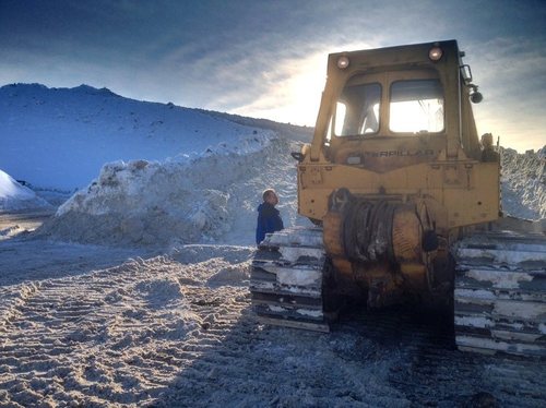
Pounding in the Pacific Northwest
There have been reports of 2" to 6″ of rain along the coastal locations of the Pacific Northwest along with heavy winds in the higher elevations of the Intermountain West exceeding hurricane force (74mph). Unfortunately, heavy snow of up to 30″ in spots is leading to more avalanche danger and another life was recently claimed in Montana due to the unsettled snow pack.
“A northwest Montana avalanche apparently triggered by a snowmobiler left him dead while a companion was able to escape, authorities said Tuesday.“
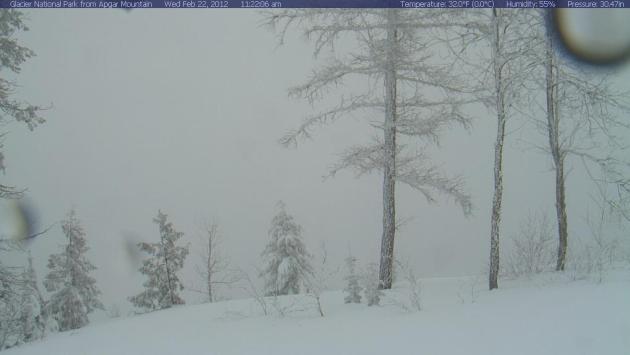
Glacier National Park, MT
The webcam below is from Apgar Mountain, see other webcams HERE:
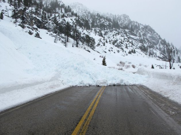
Avalanche Danger
The avalanche danger continues across much of the Northwest, this is evidence of one slide that took place in Idaho.
Strong Winds in the Northwest
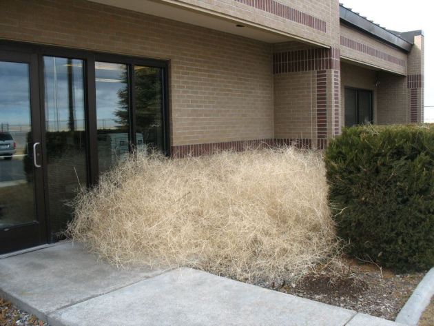
More From Idaho... A Tumbleweed Snow Drift
The National Weather Service in Pocatello, ID snapped this shot of a tumbleweed 'snow' drift? I can honestly say I've never seen anything like it before.
Anchorage Alaska
This is kind of a crazy story… There has been so much snow this winter season in Anchorage that snow removal crews are running out of spots to put the snow!
“ANCHORAGE, Alaska — Plow operators are running out of room to deposit the massive amounts of snow they’re collecting this winter and now the Anchorage Assembly is considering a plan to open up more dump space.”
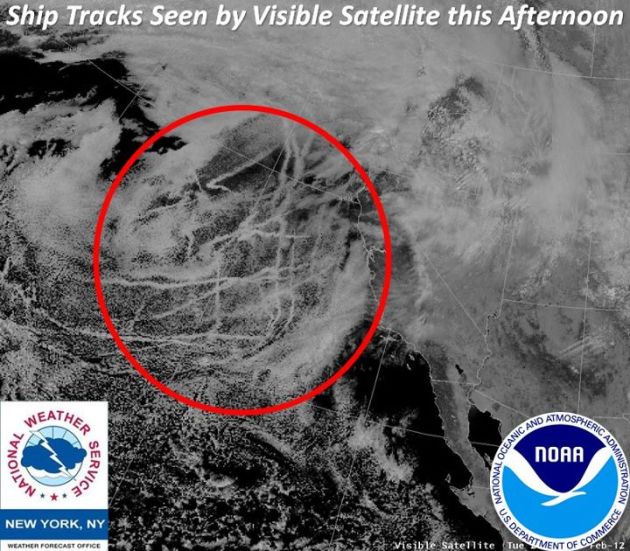
Shipping Lanes From Space?
This is neat, you can actually seen shipping lanes from space, see the full story here from the National Weather Service NY’s Facebook Page
“Take a look at what we can see off the West Coast today on visible satellite! Notice the streaks of low clouds? They were created by ships traveling on the Pacific Ocean. If conditions are right, cloud droplets form on the particles found in ship exhaust, creating low clouds such as in this image!“
Big Bug Problem??
Warm weather in Texas this early in the season is causing a big bug problem. Typically, the bugs don’t appear until March, but they’re out in February.
“They’re never really a welcome sight: the creepy, crawly critters that sneak into your home and invade your lawn. And thanks to the warm weather this year, they may be showing up earlier than expected.“

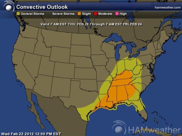
Severe Weather Potential
These are the convective outlooks for Thursday. This is where storms could be severe with hail, high winds and isolated tornadoes.
Active Snow Forecast Ahead
The extended forecast shows fairly heavy snow amounts across the norther tier of the nation through the weekend. Some folks will have to shovel and plow once again.
Thanks for checking in on this Wednesday, have a great rest of your week.
Don't forget to follow me on Twitter @TNelsonWNTV

-Meteorologist Todd Nelson-
No comments:
Post a Comment