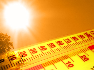
26 F. average high for February 4.
34 F. high temperature a year ago, on February 4, 2011.
0" snow depth at KMSP.
14.9" snowfall so far this winter in the Twin Cities (MSP International Airport).
60.4" snowfall as of February 4, 2011.
2,890 daily high temperature records were broken or tied in January across the USA. That's 4 times the number of record highs reached or surpassed last year. Source: NOAA.

Happy National Weatherperson's Day! What...you didn't know? Neither did I. Tantalizing details below.
“A true conservationist is a man who knows that the world is not given by his fathers, but borrowed from his children.” - John James Audubon, Wildlife Artist/Author
"Hoar Frost" and "Advection Frost" reported across much of Minnesota. Details below.
Superbowl Forecast for Indianapolis: mostly sunny, high of 45 F.


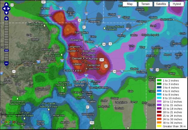
50.5" snow reported at Pinecliffe, Colorado. That's without the drifts.
22.7" fell at Boulder, Colorado.

16% savings in heating bills, nationwide, so far this winter. Source: Weather Derivatives, WSJ.
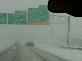
.5" snow has fallen at Kansas City so far this winter. Last winter Kansas City had already picked up 30" snow.
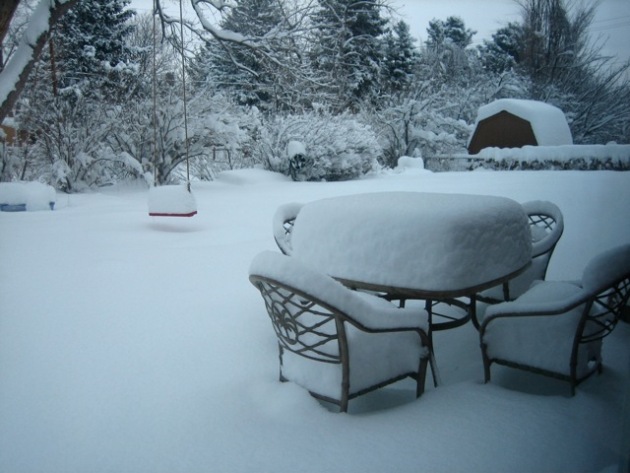
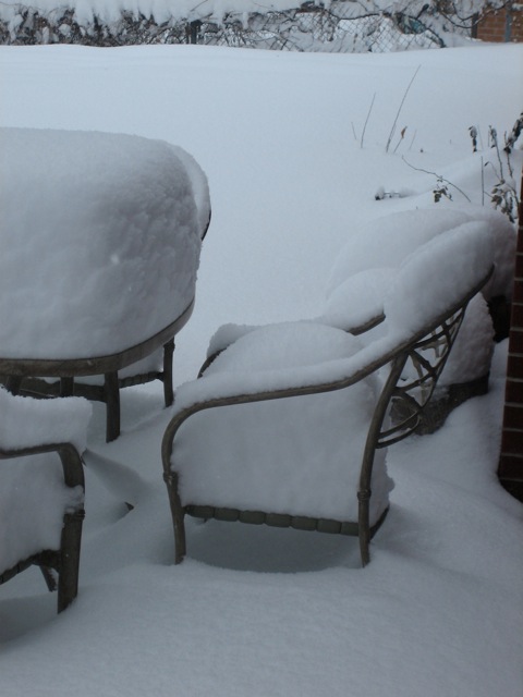
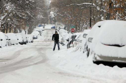
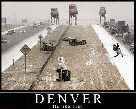
Minnesota Snow Lovers Are In Mourning. Yes, I have my black armband on too. I can rationalize the lack of subzero weather - I don't miss that one bit. But no snow, on the 5th day of February? That's just...unnatural. It's starting to look like Tulsa (with lakes) out there. Not good. Details on the photo above: "A man digs his car out of the snow on Friday, Feb. 3, 2012, after a snow storm hit Denver with 10 inches of snow overnight. A powerful winter storm swept across Colorado on Friday as it headed east, bringing blizzard warnings to eastern Colorado and western Kansas, and winter storm warnings for southeast Wyoming and western Nebraska.(AP Photo/Ed Andrieski)."
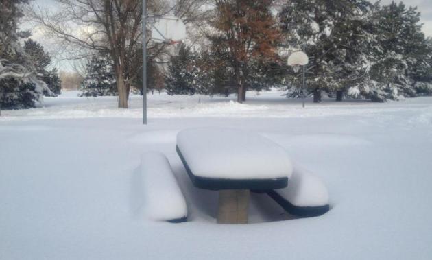
Des Moines Snow. Yes, it was that close. Anywhere from 4-6" snow accumulated in Des Moines, Iowa, enough to shovel, plow and generally gum up area highways. Photo courtesy of Heather Burnside.
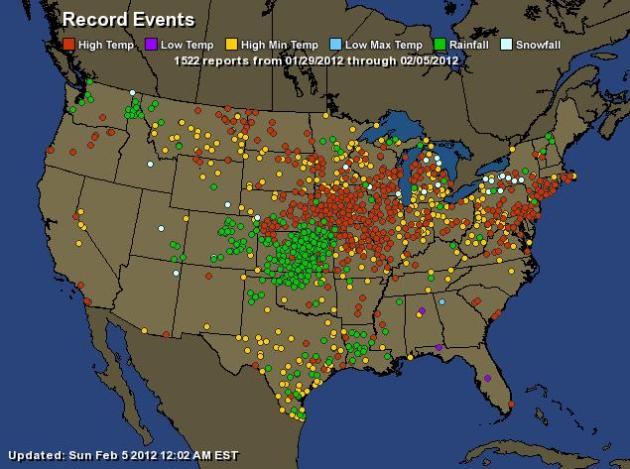
1,522 Records In The Past Week. All those red dots are record highs, yellow dots are record warm nighttime lows, green dots record 24 hour rainfall amounts. Click here to see an interactive map, courtesy of Ham Weather and NOAA. Check out the new Aeris platform from Ham Weather - nothing like it out there. Then again I'm a little biased.

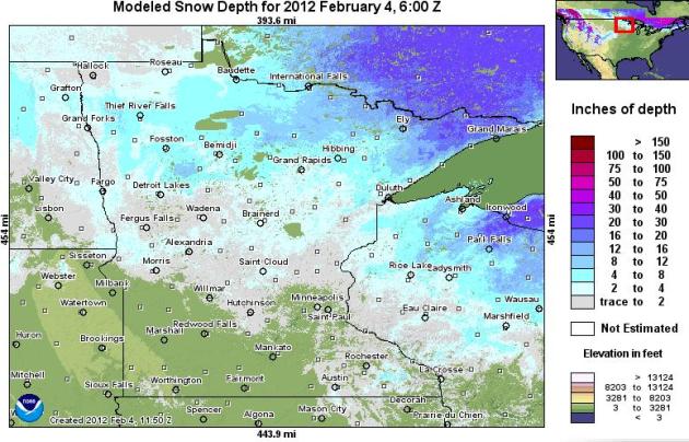
February 4 or April 4? The latest high-res snowcover map for Minnesota (courtesy of NOAA) shows a total lack of snow south/west of the Minnesota River, a trace to 1/2" snow on the ground around the metro area, about 2-3" for Brainerd and Duluth, with a whopping 12-24" from the Boundary Waters to Grand Marais. I can't remember the last time there was so little snow on the ground in early February. 2006 was bleak for snow lovers, so was 2000, but this winter is breaking new ground...brown ground at that.
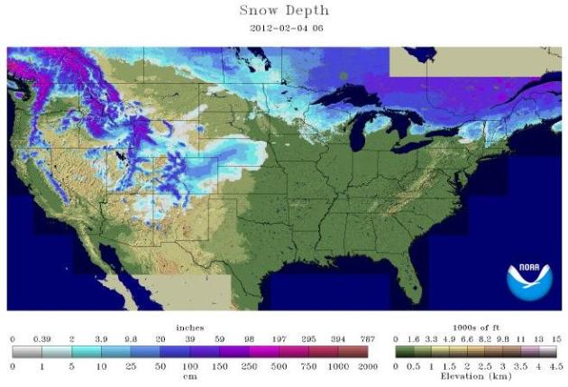
Latest USA Snowcover. According to NOAA, 25.5% of the USA (lower 48 states) was covered by snow, as of Saturday. That's up 4% since January 4.
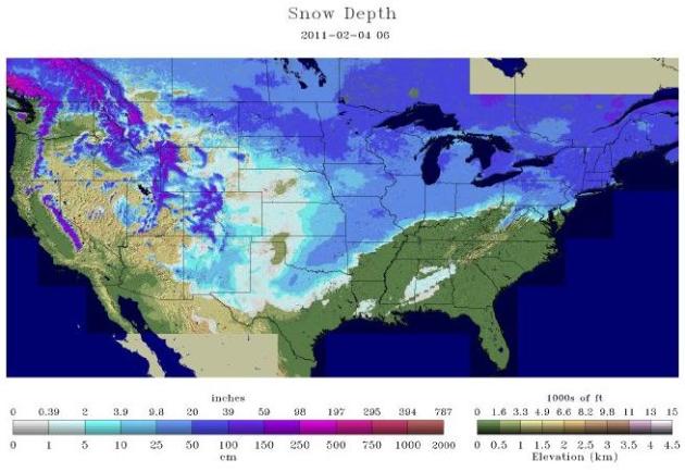
One Year Ago. According to NOAA's NOHRSC (National Operational Hydrological Remote Sensing Center) 56.9% of the USA was snowcovered on February 4, 2011.
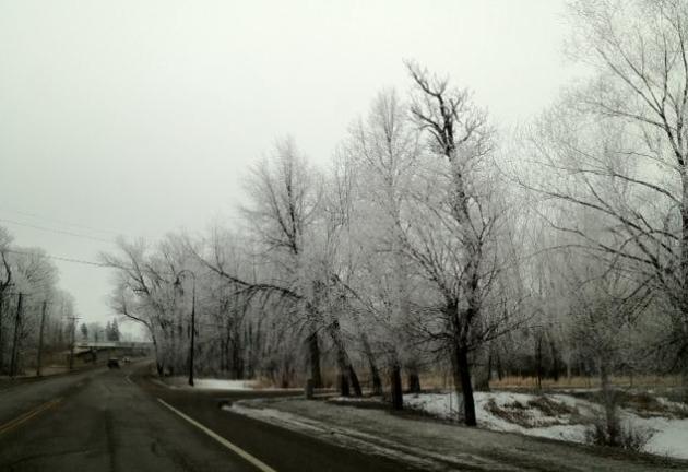
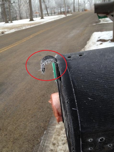
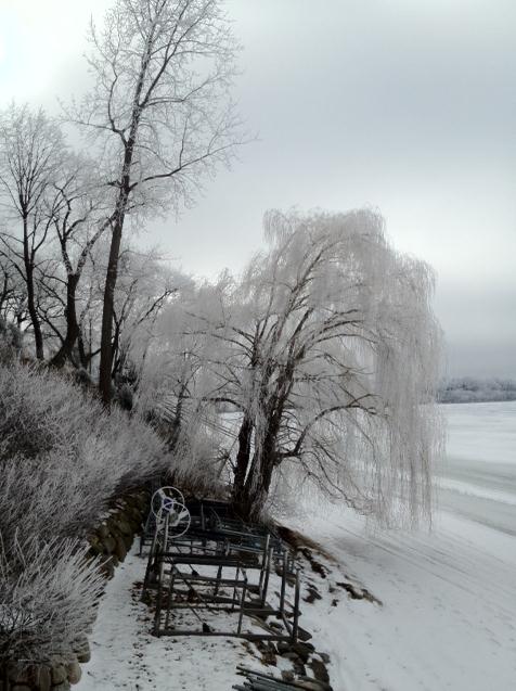
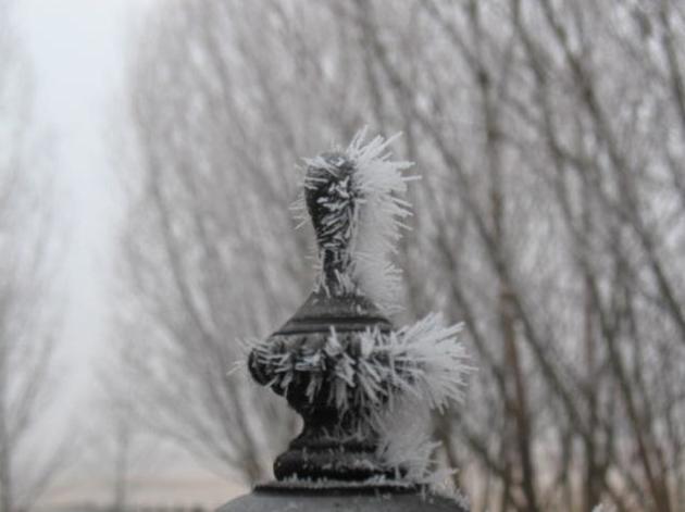
* Note the spindly build-up of ice crystals on my mailbox - an odd sight, but beautiful nonetheless. I think this was an example of "advection frost, which "refers to tiny ice spikes forming when there is a very cold wind blowing over branches of trees, poles and other surfaces. It looks like rimming the edge of flowers and leaves and usually it forms against the direction of the wind. It can occur at any hour of day and night."
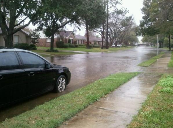
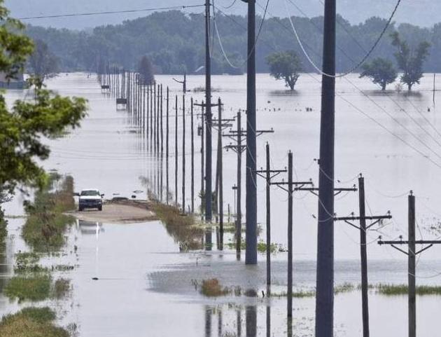
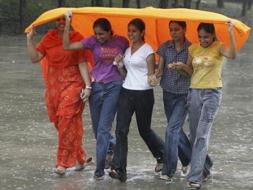
Houston Flooding. The epic Texas drought is finally showing signs of easing. Dallas is no longer in drought, and heavy rain triggered significant flash flooding in the Houston area in recent days.

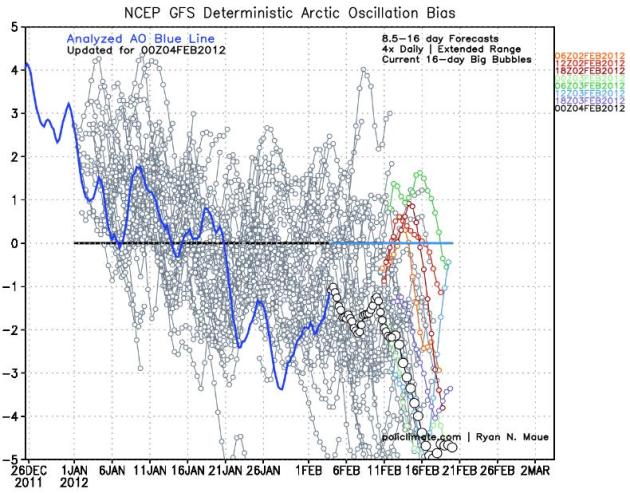
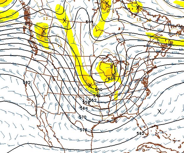
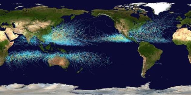
Shift In The Pattern? We've been down this road before. A strongly positive AO (Arctic Oscillation) for much of the winter (correlating with incredibly strong and persistent westerly wind pumping Pacific air across North America), but all the models show a possible negative swing, bottoming out around Feb. 21 (when a full-latitude trough may spin up the first real storm in well over 2 months). It all adds up; we're long overdue for the jet to buckle, pulling Gulf moisture northward into Minnesota - but we've had a few false alarms in recent weeks. I need to see a few more computer runs to see if there's any continuity to this solution, or if it's another bogus computer glitch. Graphic courtesy of policlimate.com.

Rare Snows In North Africa. AccuWeather.com reports on the first significant snowfall for Algeria (Africa!) in 7 years: "A rare accumulating snowfall is in progress in Algiers, the capital city of Algeria. Cold air associated with a storm system currently moving into the region from the north is providing for some decent accumulations of snow in the north African country. According to Accuweather Meteorologist Eric Wanenchak, most reports say the last time Algiers saw this kind of accumulation was at least seven years ago in 2005. He said Algiers must fight a combination of limiting factors in order to see snowfall. First, the city is near the Mediterranean Sea, which is still quite warm, currently in the low 50s."

Today Is National Weatherperson's Day. Proving everyone and everything has at least one day dedicated to making them feel special. Right. Details from the central Illinois office of the National Weather Service: "Today, Feb. 5, is National Weatherperson's Day, commemorating the birth of John Jeffries in 1774. Jeffries, one of America's first weather observers, began taking daily weather observations in Boston in 1774 and he took the first balloon observations in 1784. This is a day to recognize the men and women who collectively provide Americans with the best weather, water and climate forecasts and warning services of any nation. Weather observations in central Illinois date back to the early 1800s. Visit our weather history page for more details."
Why Viewers Could Soon Control Superbowl Ads. MIT's Technology Review has the story: "During this Sunday's Super Bowl, a record five million viewers are expected to tweet or make other social media comments—not just about the game, but also about the many beer, snack, and car ads that are integral to the annual sports and entertainment ritual. This activity—up from 900,000 people making Super Bowl posts during last year's game—is now happening at such a vast scale that executives in television, broadcast news, and advertising expect analytics of the comments to start shaping advertising choices—and even the direction of news coverage—in near real-time."


Paul's Conservation Minnesota Outlook for the Twin Cities and all of Minnesota:
TODAY: Super Sunny Sunday. Snack alert. Any fog should give way to mild sun. Winds: W 8. High: near 40
SUNDAY NIGHT: Partly cloudy, still mild for early February. Low: 24
MONDAY: Mildest day. Feels like March. High: 42
TUESDAY: Clearing, breezy and colder. Low: 13. High: 27
WEDNESDAY: Partly sunny, close to average for this time of year. Low: 7. High: 26
THURSDAY: Clouds increase, colder late PM. Low: 16. High: 31
FRIDAY: Feels like winter again. Cold sunshine. Low: 2. High: 18
SATURDAY: Few flurries? Not as cold. Low: 0. High: 24
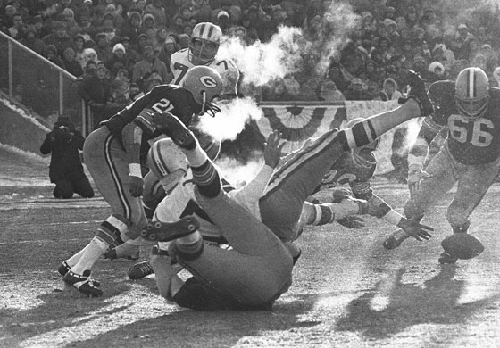
"Ice Bowl" Memories
I'm old enough to remember the infamous "Ice Bowl", the first Superbowl played in 1967. The Packers narrowly defeated the Cowboys, in weather conditions that defy description. The temperature was -15 F at gametime, with a wind chill of -50. Players complained of frostbitten fingers and toes. A metal whistle froze onto the lips of the referee. It was the coldest NFL game on record; probably the worst Superbowl weather ever.
Now we have climate-controlled, hermetically-sealed stadiums where players can focus on the game, not surviving the elements.
The last few days have been a bust with thick fog and stratus; highly unusual for February, when windblown cold fronts should be scrubbing our skies with arctic sunlight.
We see an average of 1.4 foggy days/month in February. So yes, this is a bit odd. Jet stream winds are blowing in from the Pacific. It's been mild enough for significant snowmelt, moistening the lowest layers of the atmosphere. Light winds and a low sun angle made it hard to burn away lazy clouds (fog).
With reluctant sun we should hit 40 today, mid 40s Monday, colder next week, then a shot at 50 the 3rd week of February. No snow - maybe rain by Feb. 14? Really. A potentially big storm is brewing around February 20, but I want to see a few more computer runs before I get too excited.
* Ice Bowl photo above courtesy of dsmweather.com.
Climate Stories....

Climate Change Predicted To Escalate Tropical Cyclone Damage Costs For U.S. And China. Indybay.org has the details: "A new study looking at the economic costs of tropical cyclone damage taking into account climate change, forecasts that tropical cyclones will cause $109 billion in damages by 2100. Increased vulnerability of populations and growing economic wealth is expected to double the costs from $26 billion per year to $56 billion by 2100. Climate change is predicted to add some $53 Billion in damages. Two countries are responsible for incurring 75% of the extra damage from climate change associated with tropical cyclones: the United States and China. But tropical island nations will incur the highest damage per GDP - up to 37%."
Extreme Rainfall In Central India In Past 50 Years. Zeenews.com has the story: "Meteorologists have observed a very high rise in the "extreme events of rainfall" in the country in the last 50 years, particularly in Central India region in a climate change that can be attributed to global warming. The finding is noted by the scientists at the city-based Indian Institute of Tropical Meteorology (IITM) which is engaged in various research projects relating to the monsoon behaviour in the country. "We feel that the rise in extreme events of rainfall which has almost doubled in the past 50 years in Central India (excluding mountainous region) has a relation with global warming," B N Goswami, Director, IITM said in a talk with PTI."
No comments:
Post a Comment