MONDAY: Sunny, heating up - feels like summer. High: 83 Winds: WSW 5-15mph
MONDAY NIGHT: Mostly clear and quiet. Low: 57
TUESDAY: More sun, still balmy. High: 83
WEDNESDAY: Mix of clouds and sun, still summery . Low: 56. High: 79
THURSDAY: Warm, more humid. Few T-storms possible late. Low: 59. High: near 80
FRIDAY: Slight thunder potential. Hazy sun, almost hot. Low: 60. High: 81
SATURDAY: Steamy sun, very humid. still unsettled with some afternoon thunder possible. Winds: S 15. Low: 62. High: 83
SUNDAY: Front sags south, scattered afternoon thunder across the southern part of the state. Cooler, less humid up north. Low: 60. High: 78
Larger Than Life
Thanks to Beautiful Planet for sharing this picture on their facebook page. Quiet an amazing shot!

Rocky Mountain National Park
Thanks to the Rocky Mountain National Park for sharing this on their Facebook page, see more HERE:
"SNOW in MAY? A mountain bluebird, male, ponders the precipitation. (photo by VIP Hahn) 5/11"

Fishing Opening Weekend
Thanks to my good friend, Roxanne Wilmes,
for these pictures on Lake Edwards. Sounds like they did alright even
though the bite was a little slow... Nice catch Ben! Fritz the dog looks
quite excited too.

Sunset Over Lake Edwards

Nice Catch Ava!
Thanks to Kirsten Monshaugen hage for this picture from Mille Lacs... It's a keeper!

Mother's Day Sunshine
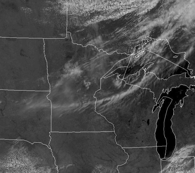
WOW! What a weekend!! Can't believe we
actually managed to sneak a keeper weekend after having nearly a months
worth of crummy ones. This was the satellite over the Upper Midwest
Sunday afternoon. Other than a few clouds, most of the 11,842 Minnesota
lakes had ample sun.
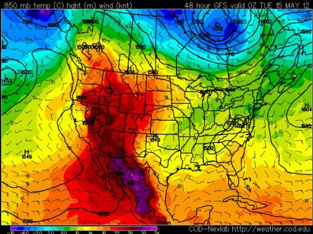
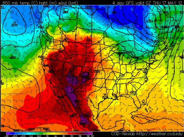
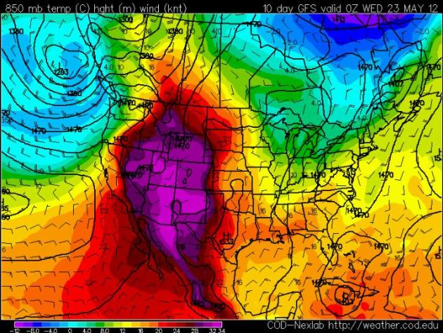
Heating Up
Temperatures in the western half of the
nation will be heating up through the week, some of which will be
spilling out into the Plains through the week. Get ready for a slow and
steady climb in those heat and humidity values. I predict that some
close to home will probably start using the A/C very soon. Below are
several forecast snapshots of temperatures a few thousand feet off the
ground throughout the week. Note how the bubble of warmth gets warmer
and expands through mid May.
Monday 850mb Temps
Wednesday 850mb Temps
Friday 850mb Temps
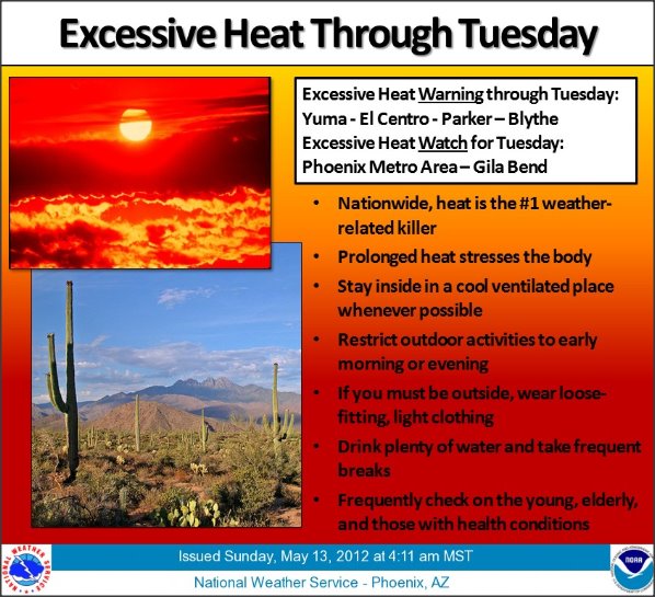
Excessive Heat in the Desert Southwest
Temperatures in the Desert Southwest are
expected to warm into the triple digits through the early week. The
National Weather Service is warning residents of the upcoming heat.
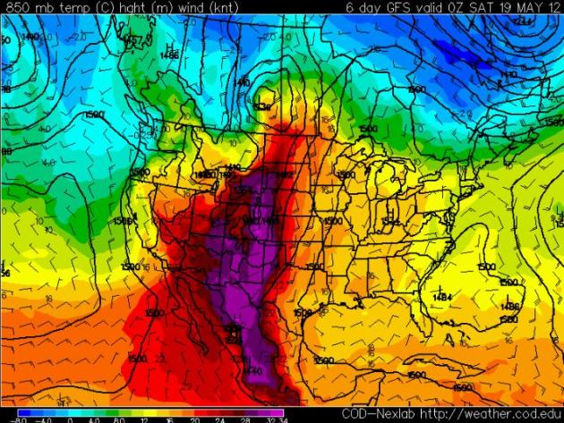
May Stays Hot Out West
The extended GFS Forecast is suggesting
that the end of the month could be even hotter over a larger number of
locations out west. Some of that heat will likely spill out into the
Plains... stay tuned!
Temps Next Tuesday
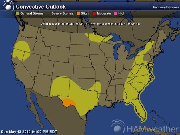
Severe Threat Monday
A few strong to severe storms may bubble
up across Texas, but no widespread or organized areas of severe storms
are expected across the nation anytime soon.
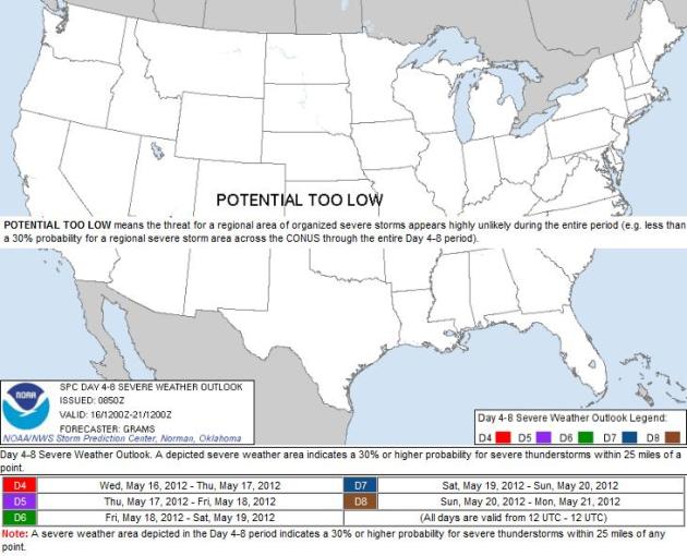
4 to 8 Day Severe Outlook
Thanks to the large ridge of high
pressure (large bubble of heat) out west, the severe threat over the
next several days is expected to be very minimal through the week.
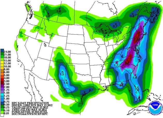
5 Day Precipitation Outlook
The Hydrological Prediction Center
precipitation forecat shows heavier rain across the Eastern Seaboard
early this week with another smaller blob of moisture across Texas.
Other than that, things are looking pretty dry this week... you might
have to start watering soon!
Thanks for checking in and have a great week ahead!
Don't forget to follow me on Twitter @TNelsonWNTV

No comments:
Post a Comment