By Todd Nelson
An Irish proverb states that "A good laugh and a long sleep are the best two cures"... At this point, I think it's almost healthy to laugh about our nagging winter season. I guess I know now why bears sleep the whole winter!
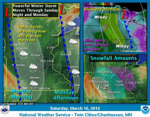
Sunday funday weather will remain quiet. Winds pick up by late afternoon as the highly advertised storm moves in to the Dakotas. Unfortunately, the storm will move in overnight with quick 2" to 4" of snow. Perfect timing, right? Just what we need, another white-knuckle commute. If it's any consolation, this won't be the "SnowNami" potential that you may have heard about a few days ago. The bulk of the heavy snow will fall across far northern Minnesota and Canada. Cold and blustery winds get your attention by Monday afternoon. This will create blowing and drifting problems, so roads may still be a bit problematic by the evening commute.
Although the calendar will say Spring on Wednesday, it'll be a bit of a seasonal time warp for us as we struggle to get to 20F both Tuesday and Wednesday. Average highs are now in the low 40s, which we may not see until next weekend? Last year on this day, we hit 80F; our earliest 80F in March ever!
__________________________________________________________________________
Todd's CONSERVATION MN Outlook for the Twin Cities and all of Minnesota:
SUNDAY: Getting breezy by afternoon. Sun fades and snow develops overnight. High : 28. Winds: SE 10-20
SUNDAY NIGHT: Snow develops. 1" to 3" by daybreak. Low: 21
MONDAY: White-knuckle AM commute. Snow
lingers, total storm accumulation of 2" to 4" by midday Monday. Windy
with blowing and drifting snow through the afternoon. High: 28.
Winds: WNW 15-30
TUESDAY: Feels like winter again. Low: 5. High: 20.
WEDNESDAY : Hello Spring! Where are you? Low: 3. High: 20.
THURSDAY: Less wind, doesn't feel as raw Low: 7. High: 25.
FRIDAY: Cool breeze. Partly sunny. Low: 12. High: 31.
SATURDAY: Partly sunny, a bit warmer. Low: 18. High: 38.
________________________________________________________________________________
Happy St. Patrick's Day!
I think one of my favorite sights on St. Patrick's Day is the green river in Chicago! Thanks to my good friend, Matt Funk, who made the trip down to Chicago this year for the festivities!

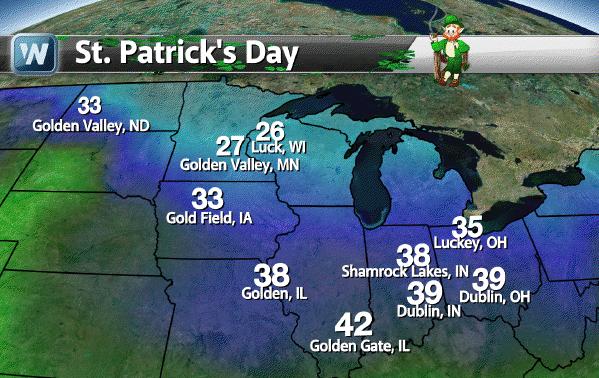
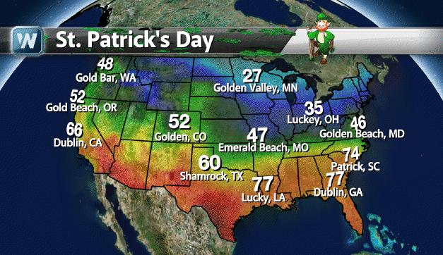
Some Festive City Forecasts
This is kind of fun... here are
forecasts for some selected St. Patrick's day themed cities. Did you
know that these cities even existed?
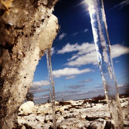
Still Wintry
Thanks to @FishinNiagara for the picture below. Neat look at still a wintry landscape.
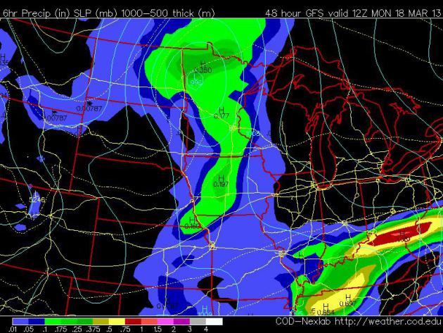
More Snow on the Way...
A storm system will be sliding through the Upper
Mississippi Valley late Sunday night through Monday with shovelable to
plowable snow potential for folks across the far north. Here's the
system around 7am Monday, note that the center will be sitting across
far northern Minnesota, which would mean that the heaviest snow
associated with the storm would generally fall on the north/northwest
side of the storm.
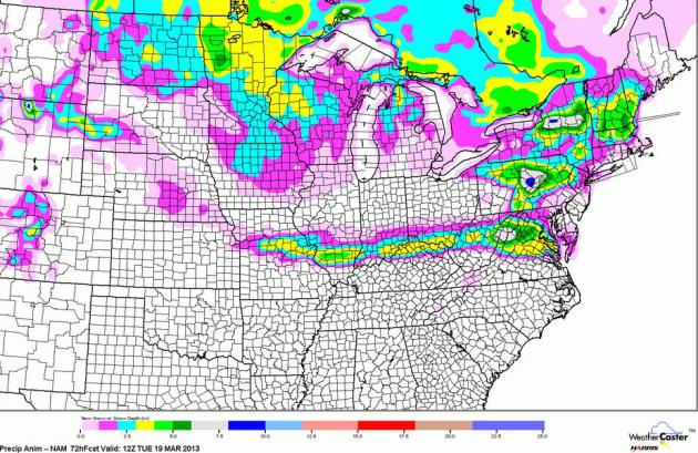
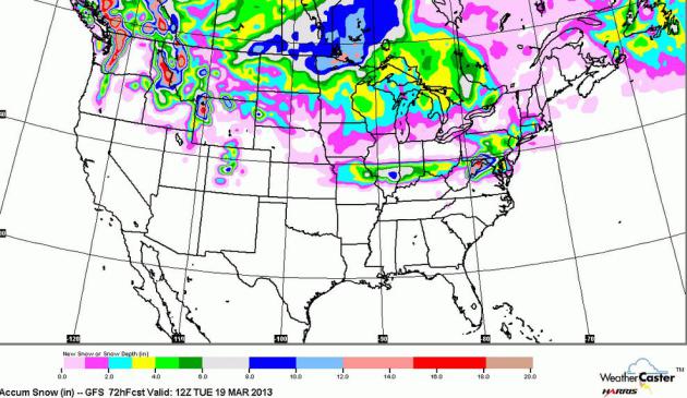
Models Keep Heaviest Snow North
Models have been pretty consistent as of late,
keeping the heaviest snow across far northern Minnesota and into Canada.
Here's a look at two different models. Also note the band of snow that
develops from near St. Louis, MO to near Washington D.C.
NAM Thru AM Tuesday
GFS Thru AM Tuesday
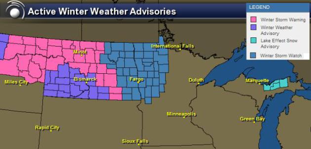
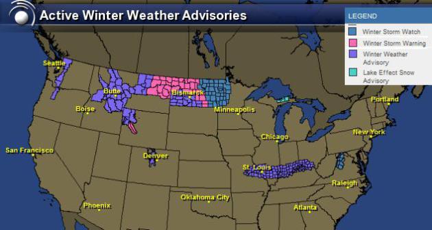
Winter Weather Headlines
The National Weather Service has issued several winter weather headlines for a number of locations in the Midwest. Updates to this map will likely be needed as the storm nears.
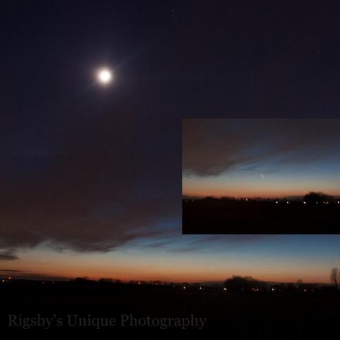
Comet Pan-STARRS
Thanks to Aaron Rigsby for the picture below out of Ohio. Comet Pan-STARRS continues to shine in the evening sky. Don't forget to look west after sunset (weather permitting of course).
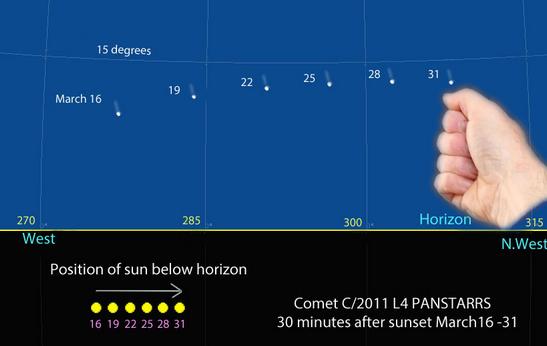
Finding Pan-STARRS
Have you ever heard of Astro Bob? He's from Duluth Minnesota and runs an incredible blog on "Celestial happenings you can see in your own backyard".
"Use this map to find Comet PANSTARRS now through March 31. It depicts the sky facing west-northwest 30 minutes after sunset. The comet’s height remains fairly steady at about 10-14 degrees but it moves steadily northward (to the right). The yellow circles represent the sun’s position every 3 days. It also moves northward but more slowly. One fist equals about 10 degrees of sky. Created with Chris Marriott’s SkyMap software"
See more from Asto Bob HERE:
Will The Sky Turn Green on St. Patty's Day?
Why not! Just in time for St. Patty's day, dwellers in the northern latitudes might be able to see some green in the sky!
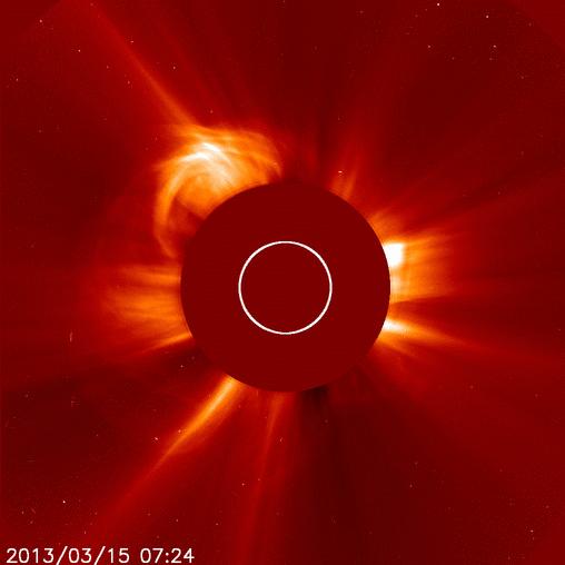
"A magnetic filament snaking around sunspot AR1692 erupted on March 15th at about 0600 UT. The slow explosion, which took hours to unfold, produced an M1-class solar flare and a bright CME. SOHO (the Solar and Heliospheric Observatory) photographed the expanding cloud, which is heading directly toward Earth:"
"The CME left the sun traveling some 900 km/s (2 million mph). Three-dimensional computer models based on observations from SOHO and NASA's twin STEREO probes predict the CME will cross the void between sun and Earth in two days or less. NOAA forecasters estimate a 70% chance of polar geomagnetic storms when the cloud arrives on March 17th. This means the sky could turn green on St. Patrick's Day! High latitude (and possibly even middle latitude) sky watchers should be alert for auroras this weekend."
See the loop HERE:
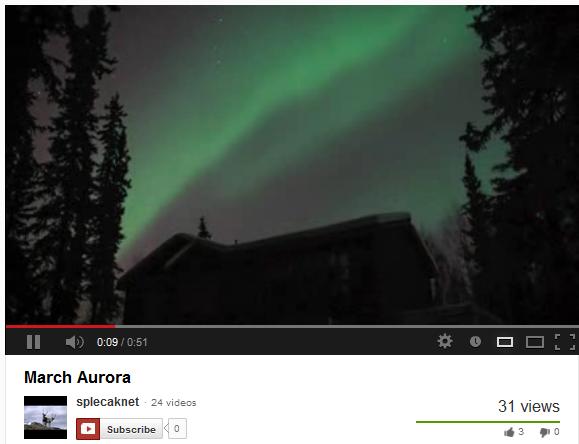
Alaska Aurora
The National Weather Service out of Alaska shared this on their Facebook page on Saturday. It was early morning northern lights captured by Youtube user Splecaknet! Pretty awesome!!
See the full video HERE:
Thanks for checking in, have a great rest of your weekend!
Don't forget to follow me on Twitter @TNelsonWNTV

No comments:
Post a Comment