By Paul Douglas
The transition from slush to chirping robins is never a straight line. Spring comes in waves. A big crest arrived Wednesday; the warmest day in nearly 6 months.
A higher sun angle is coaxing warm fronts farther north, but the overall pattern still favors warm, dry weather for the west, with a nagging cool bias east of the Rockies.
The Polar Vortex is long gone (good riddance), but prevailing jet stream winds are still dipping out of Canada, meteorological muscle-memory of a head-shaking winter that brought 50 subzero mornings.
NOAA's Climate Prediction Center predicts cooler than normal weather much of spring, with a few spasms of summerlike warmth every week or two.
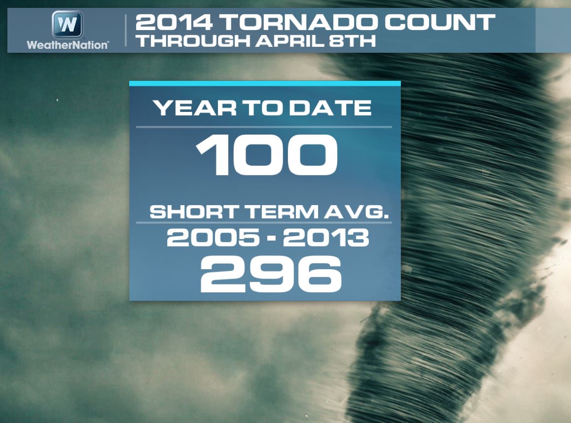
One silver lining: a parade of cooler fronts is suppressing tornado season. The Storm Prediction Center reports only 93 tornadoes, nationwide, in 2014 to date. That's a third the average number. Seems those cold fronts are good for something.
Until we green up (two weeks away?) the risk of wildfires will be high. Showers Friday & Saturday will perk up your lawn a bit. Colder air arrives Sunday, but the chance of a slushy mix has diminished for MSP.
Keep a jacket handy; highs hold in the 40s early next week.
========================
WEDNESDAY NIGHT: Mostly cloudy, a few rain showers possible. Isolated rumble of thunder possible? Low: 45. Winds: Turning NW 10-15
THURSDAY: Early shower, then slow clearing. Cool breeze. High: near 61. Winds: NW 10-25.
THURSDAY NIGHT: Increasing clouds, chance of a light rain shower late. Low: 44
FRIDAY: Unsettled, few pop-up showers. High: 62
SATURDAY: Showers likely. Few T-storms possible. Wake-up: 45. High: 61.
SUNDAY: Cool and cloudy with a few showers. Wake-up: 43. High: 46
MONDAY: Raw. Mix tapers, clearing late. Wake-up: 31. High: 44
TUESDAY: What April? Still chilly and gray. Wake-up: 29. High: 43
WEDNESDAY: Sunny, less wind. Wake-up: 26. High: 50
==========================
This Day In Weather History
April 10th
1977: A record of 86 is set at Redwood Falls.
=========================
Sunrise/Sunset Times
April 10th
SUNRISE 637 AM
SUNSET 752 PM
=========================
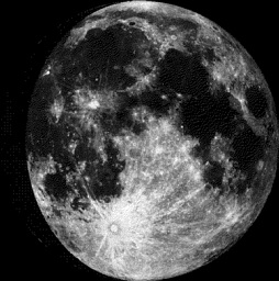
Moon Phase at Midnight For April 10th
4 Days Until Full (Pink) Moon
============================
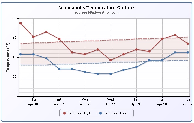
Minneapolis Temp Trend
Temperatures have been a little more spring-like as of late, but we all knew it wouldn't last forever right? Take a look at the temperature tumble into next week. Highs will once again be below average for an extended period with lows dipping into the lower/middle 20s...
===========
Photos
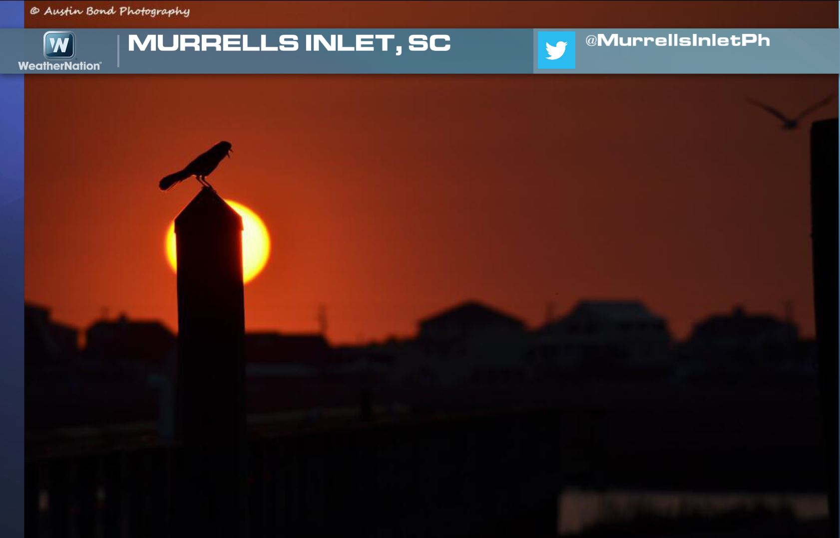
Thanks to @MurrellsInletPh for the amazing picture below out of Murrells Inlet, SC! Looks like the birds were up chirping away on a bright Wednesday morning!
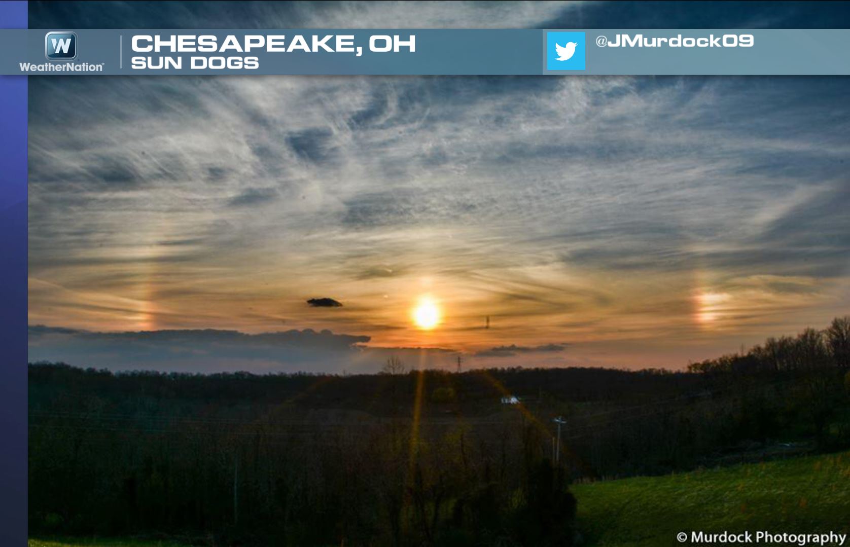
Here's another great picture from @JMurdock09 from Chesapeake, OH. Note the two bright reflections on either side of the sun. Those are called Sundogs and form very similarly to that of a halo as sunlight is being reflected by plate-like ice crystals high in the atmosphere.
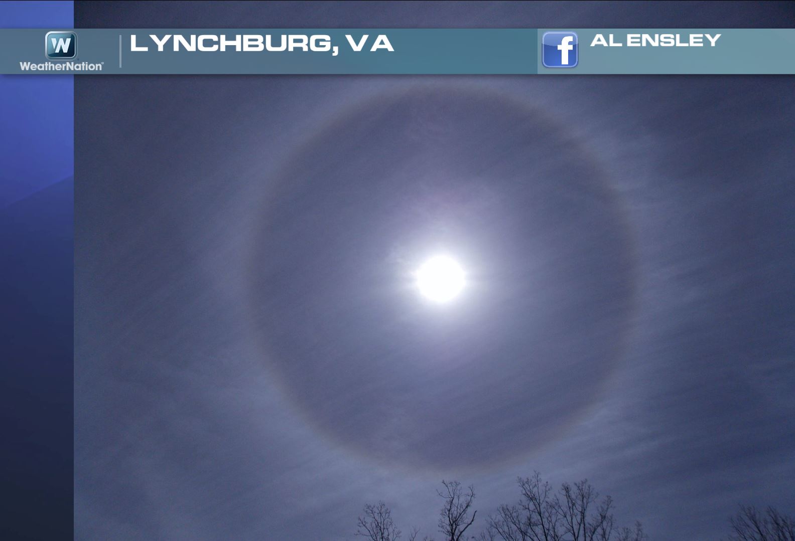
Here's the Halo I spoke of in the picture above. Thanks to Al Ensley out of Lynchburg, VA for this picture. There's an adage that states: "Ring around the moon or sun, then rain or snow will surely come."
Explore the meaning behind this nifty little saying from Meteorologist Jeff Haby HERE:
Tornadoes Earlier This Week
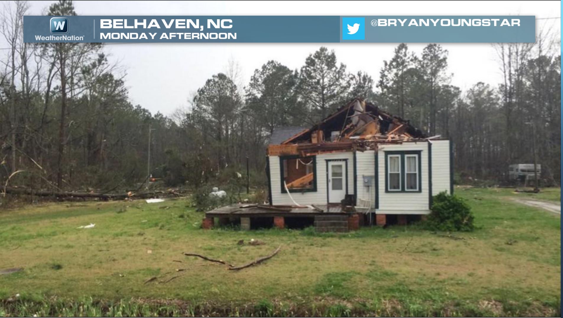
Here's an interesting picture from Belhaven, NC from earlier this week. Thanks to @BryanYoungstar... sad to see the damage here, but thankfully nobody lost their life! Other than a few injuries and some damage, this particular tornado didn't go on to claim any lives!
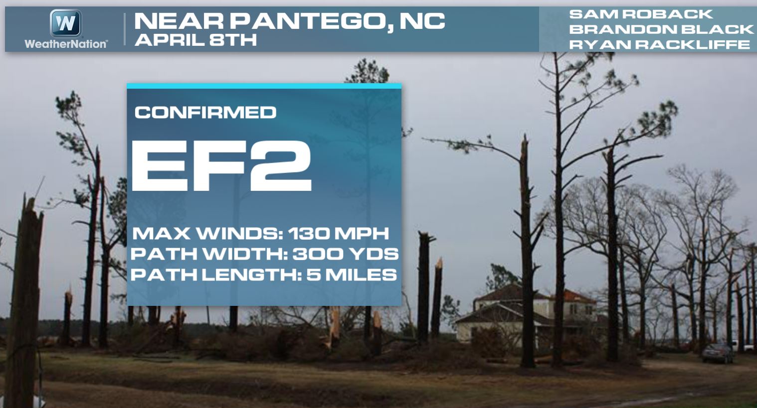
This particular tornado was confirmed as an EF2 tornado by NWS employees with a maximum wind speed of 130mph. Interestingly, the NWS also found EF1 tornado damage in Spalding county, GA.
Here is more information from the eastern North Carolina tornado:
Here is more information from the Atlanta flooding and tornado event from April 7th & 8th
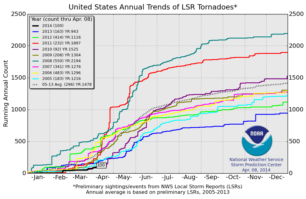
2014 Tornado Count
An updated look at the 2014 PRELIMINARY tornado count from NOAA's SPC across the nation is up to 100 reports as of April 8th. Keep in mind that the 2005-2013 average is nearly 300, so we are almost 1/3 of what we typically see by now.
Here's a more detailed look at the tornado reports since 2005. Note that 2010 was the only other year (thru April 8th) that had seen less tornado reports than what we've seen this year.
More Tornado Stats
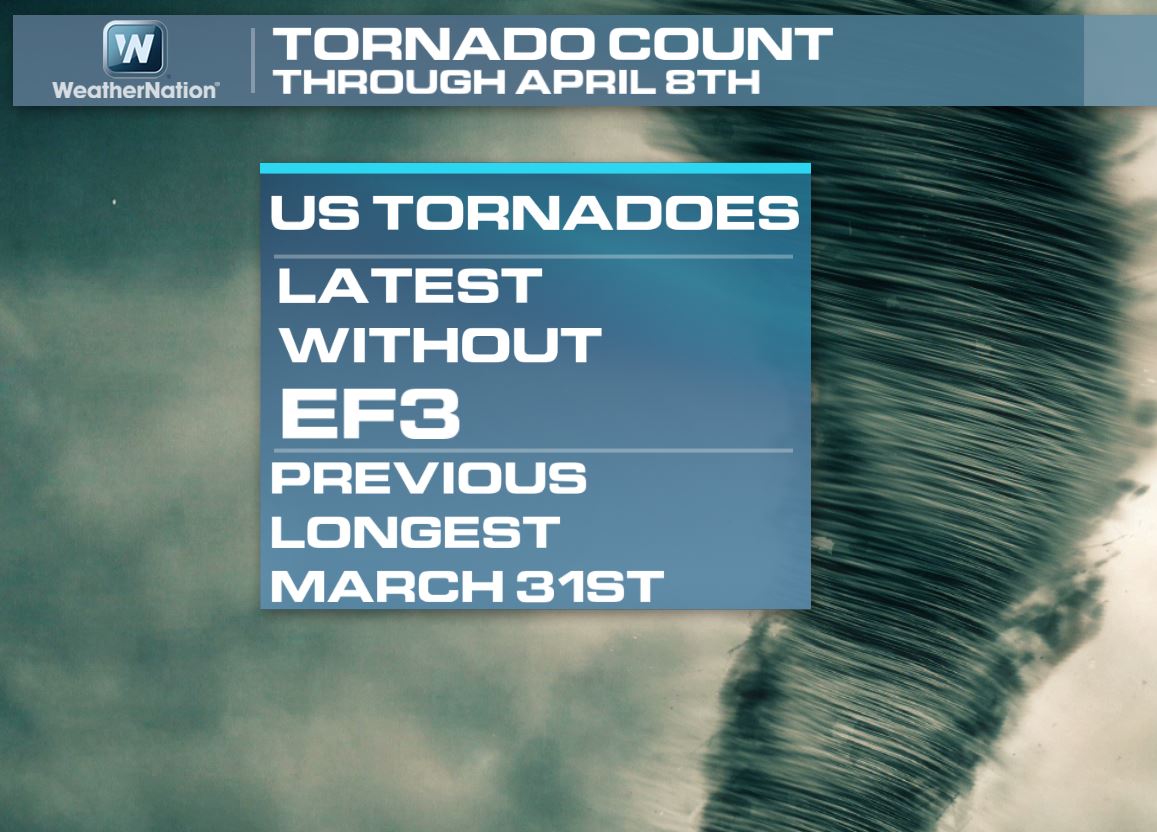
Interestingly, we have not yet seen an EF3 rated tornado this year, which is the latest we ever gone without seen this strong of a tornado (since 1950)! The previous latest EF3 tornado didn't occur until late March of 2002.
Quiet Severe Weather Season So Far...
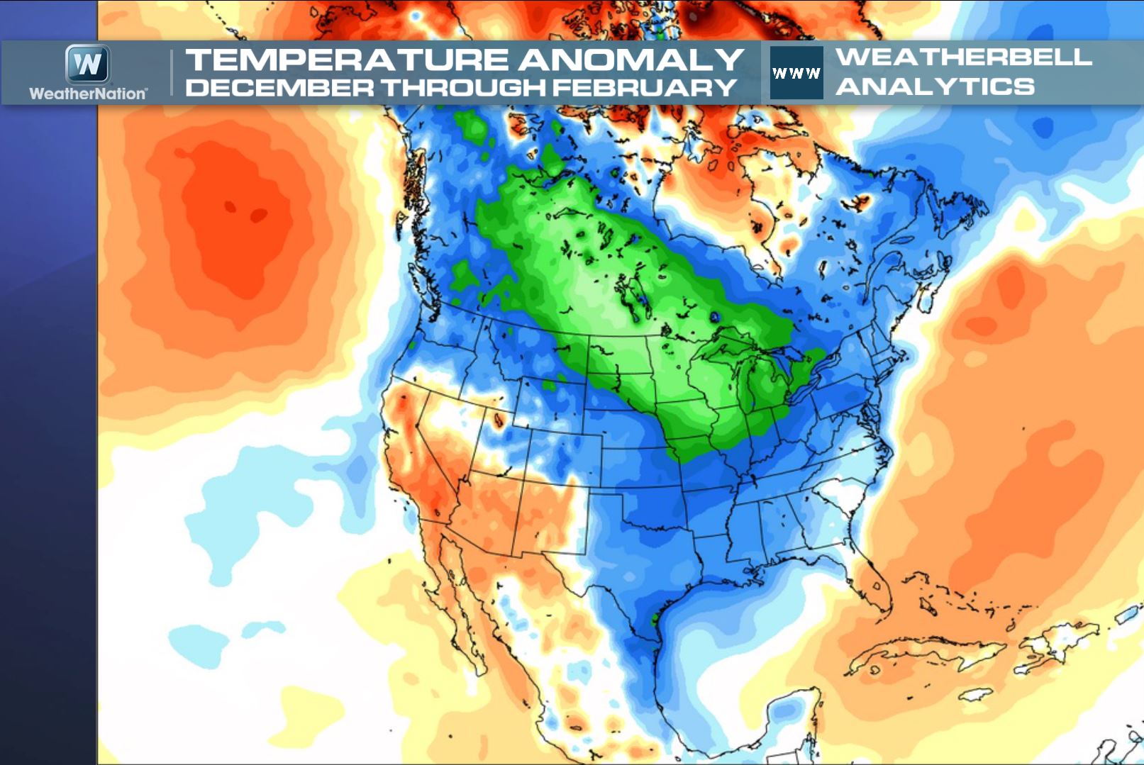
Why has it been so quiet this season so far? One of the main reasons is become of the nearly persistent trough of cooler than normal temperatures in the eastern two-thirds of the nation. The image below shows the temperature anomaly or temperature difference for meteorological winter (December-February).
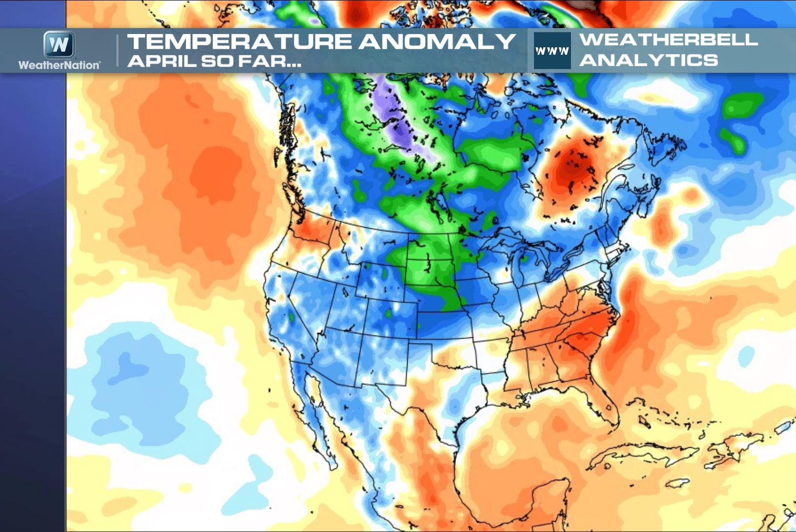
March 2014 remained cool in the eastern part of the country, but the early part of April warmed a bit and we actually saw a slight increase in the severe weather over the past few days. However, the image below still suggests that the Midwest/Great Lakes and Northeast are running below average temperatures so far this April.
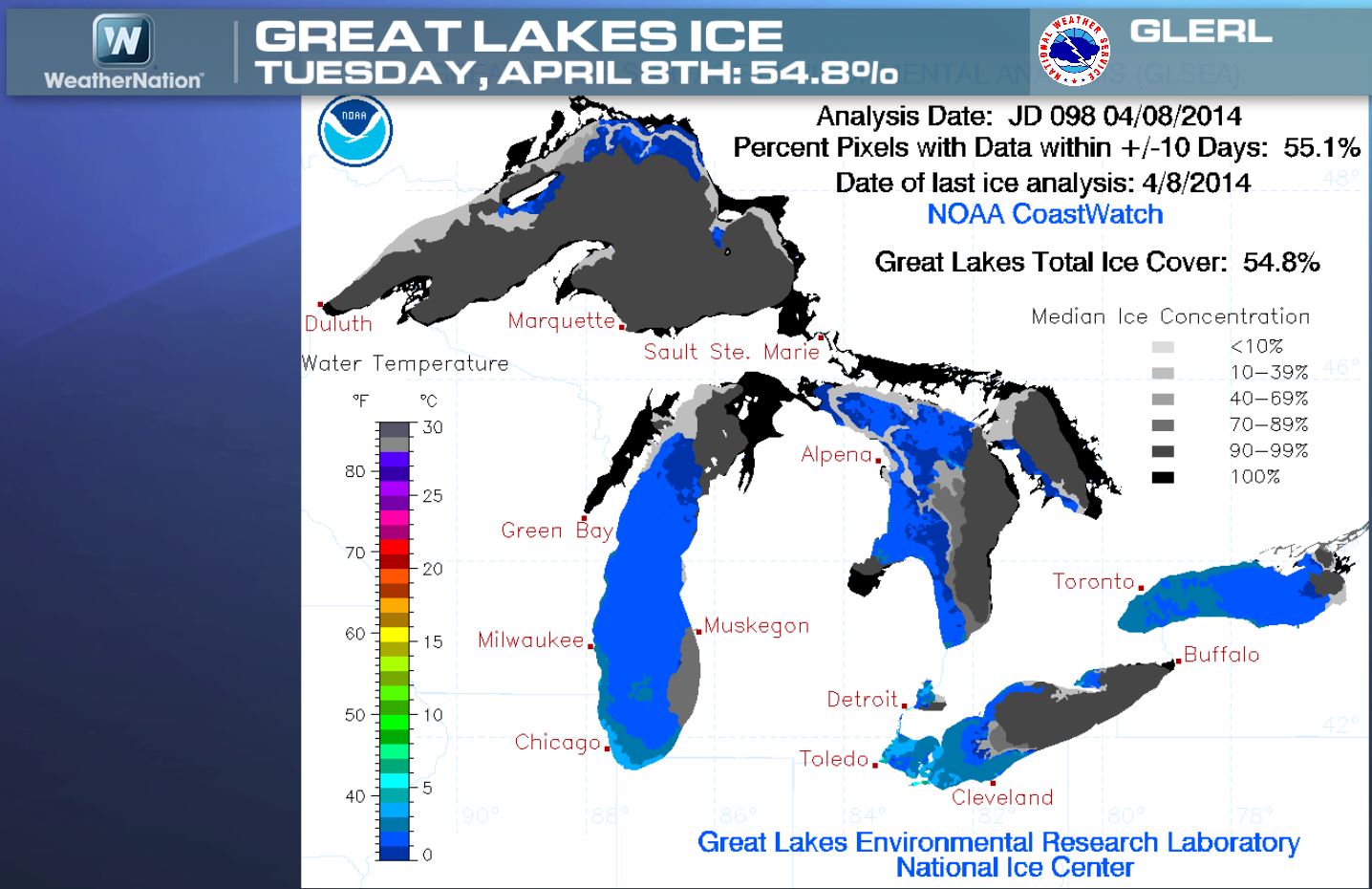
Great Lakes Ice Coverage
Due to the persistent cooler than average weather, the Great Lakes Ice Coverage is still running a bit high. Note that as of Tuesday, April 8th, nearly 55% of the Great Lakes were covered in ice!
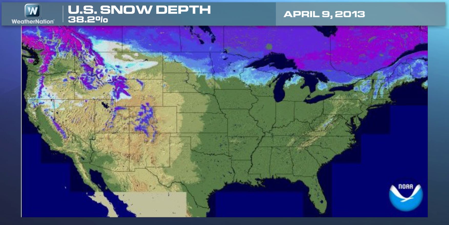
Snow Coverage Update
Despite running cooler than average in spots across the nation, we don't have quite as much snow cover as we did last year at this time. As of Wednesday, April 9th, nearly 29% of the nation was covered in snow.
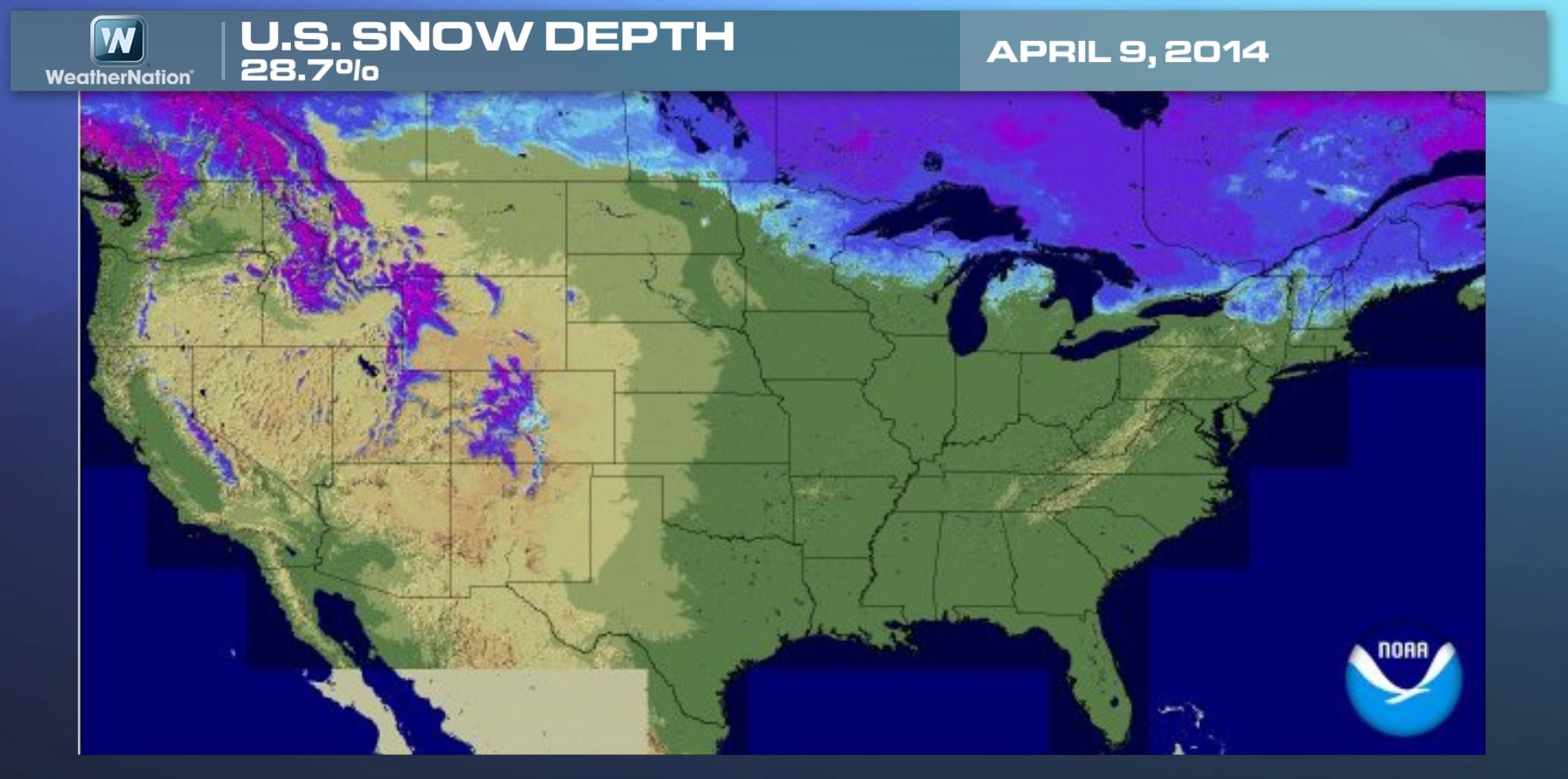
Last year at this time, nearly 38% of the nation was snow covered.
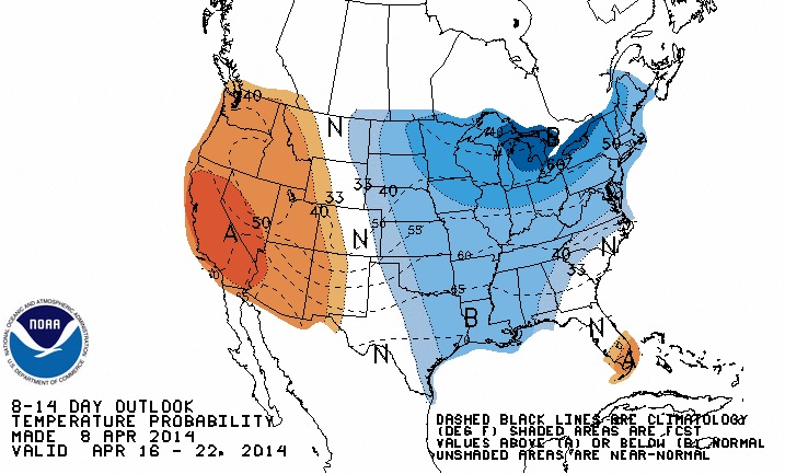
8 to 14 Day Temperature Outlook
According to NOAA's CPC, the 8 to 14 day temperature outlook (April 16-22) shows that the eastern part of the country will once again be below average, while the western third of the nation has a good chance of remaining above average.
Cha-Cha-Cha Changes....
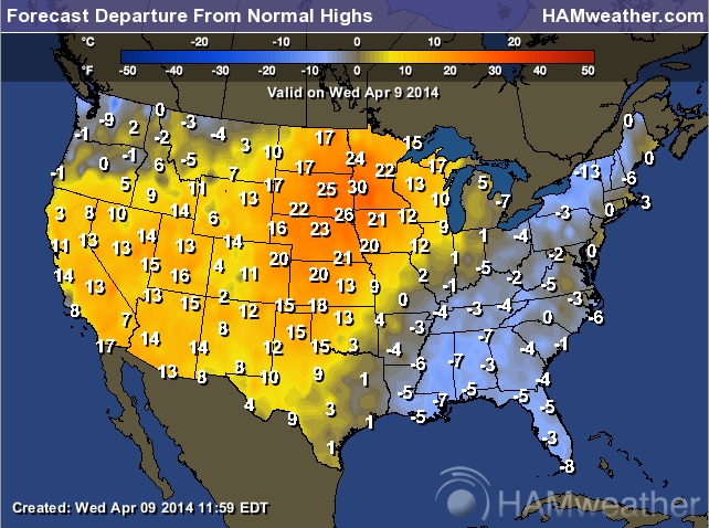
Wednesday's highs were running nearly 10F to 25F above average from the Southwest to the Midwest, however temperatures will take a nosedive into early next week as the jet stream takes another dip south of the border.
Wednesday's Highs From Normal
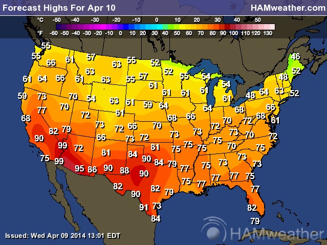
Thursday's Highs
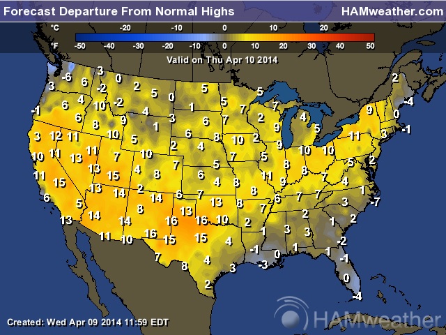
Thursday's Highs From Normal
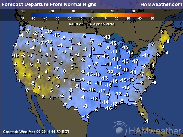
Next Tuesday's Highs
Highs Next Tuesday From Normal
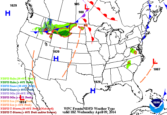
Mostly Quiet End of Week
After a very active start to the week, weather conditions have quieted down a bit. The weather outlook through Friday morning shows a clipper dropping through the Midwest and that's about it. At this point, there are no major storms expected to be moving through the middle part of the country through the rest of the week!
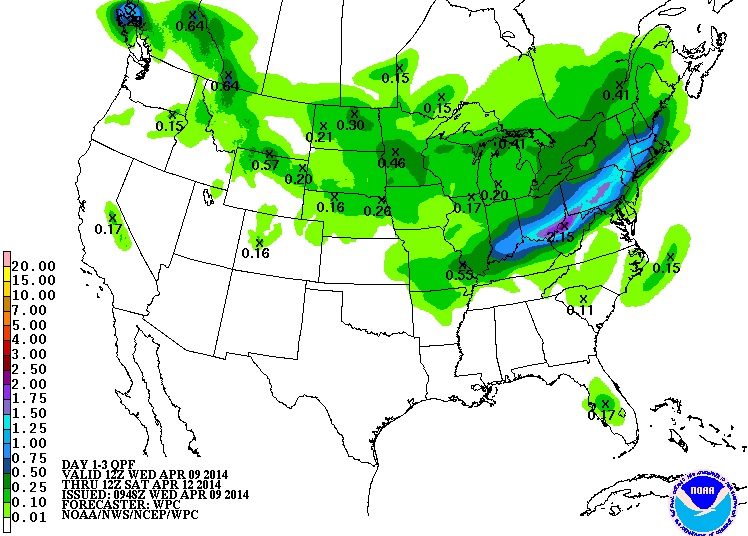
Precipitation Outlook
According to NOAA's HPC, the 3 day precipitation outlook looks somewhat quiet nationally except for areas of light to moderate rain across the northern tier of the nation as our clipper system drags its heels through the Midwest. Rain and thunder could promote some heavier downpours later this week in parts of the Ohio Valley/Northeast as the front stalls out a bit.
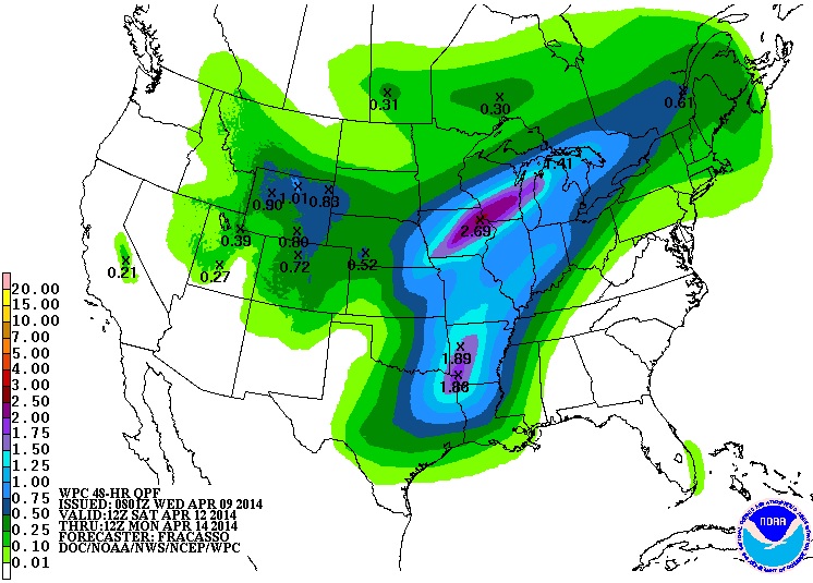
Precipitation Outlook
Note that the precipitation potential looks to increase more dramatically across the middle part of the country as we head into the weekend. NOAA's HPC precipitation forecast from AM Saturday to AM Monday looks a little more substantial from the Great Lakes to the Ohio Valley as another storm system develops... Stay tuned!
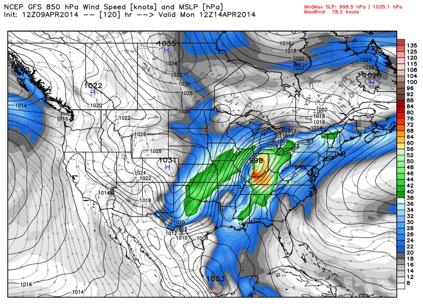
Easter Week Storm?
The week leading up to Easter Sunday could be a little more interesting. A storm system looks to develop over the weekend/early next week. Keep in mind that there could be enough cold air on the northern side of this from some snow, but there could also be some severe weather on it's south/southeastern flank. It appears to be shaping up as another classic spring storm... stay tuned for more details.
Thanks for checking in and have a great rest of your week. Don't forget to follow me on Twitter @TNelsonWNTV

No comments:
Post a Comment