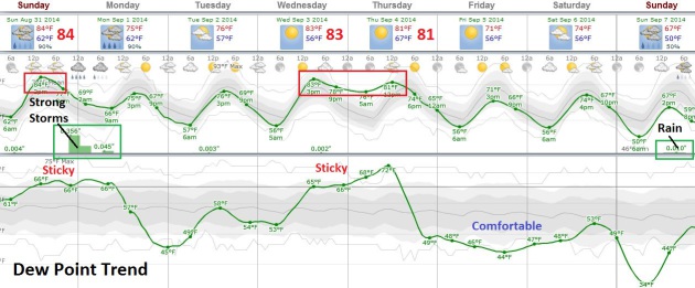
TODAY: Sticky sun, severe storms later? Dew point: 68. Winds: S 15+ High: 83
SUNDAY NIGHT: Thunderstorms likely, some strong to potentially severe. Low: 66
LABOR DAY: Wet start. Slow clearing, less humid. Dew point: 54. High: 79
TUESDAY: Some sun, pop up PM T-shower possible. Wake-up: 59. High: 78
WEDNESDAY: Sunny and warmer again. Wake-up: 61. High: 82
THURSDAY: Less sun, few T-storms. Dew point: 70. Wake-up: 67. High: 85
FRIDAY: Clearing, drop in dew point. DP: 49. Wake-up: 60. High: 76
SATURDAY: Plenty of sun, pleasant. DP: 52. Wake-up: 54. High: 75
A Local Touch
It's
been said that all weather, like politics, is local. You tend to care
about what's outside your window, not weather building 90 miles up the
road.
Meteorologists factor local conditions into their forecasts,
like proximity to water, hills and the urban heat island. And they all
think THEIR town's weather is the hardest on Earth to predict. I ask a
buddy in Phoenix at a local station "What do you do all day?" He gets
indignant. "It's harder than it looks, Paul. We get summer monsoon
storms and massive haboobs, giant sandstorms that come on with little
warning". Uh huh. He also told me that management told him not to use
the word "hot" in the 7-Day. Apparently it agitates the locals and
scares the tourists.
"Very warm with a high of 113!"
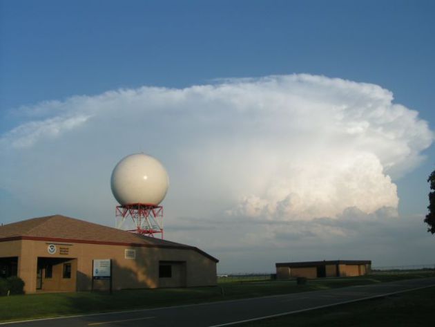
Sticky
sun gives way to a rare severe storm outbreak later today. Hail,
isolated tornadoes and a possible MCS squall line may form by the dinner
hour. Go jump in a lake before 3 PM but keep an eye on the western sky.
Labor Day gets off to a damp start but the sun comes out by midday with a welcome dip in dew point. Not bad for a holiday.
80s return by midweek with signs of a more September-like airmass sweeping into Minnesota by late in the week.
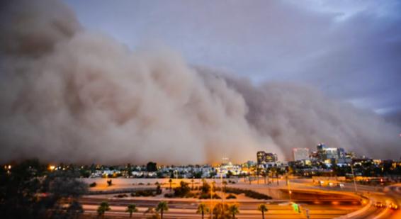
Swirls of Dust and Drama, Punctuating Life in the Southwest.
With all apologies to my TV meteorology friend in Phoenix, haboobs are a
clear and present danger, especially during the summer months. Here's
the intro to a story at
The New York Times: "
The
best way to explain a haboob is to say it is a tsunami of sand, in the
sense that there is no stopping it or outrunning it. It is a supreme
spectacle. The fierce winds that precede it make the leaves on palm
trees stand as if they are hands waving an effusive goodbye, the sky
darkens and the world takes the color of caramel as the dust swallows
everything in its path..."
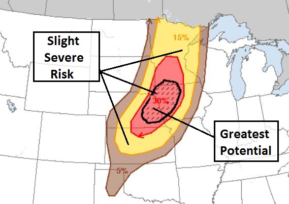
Significant Severe Threat.
A slight risk of severe storms extends from Minnesota and western
Wisconsin into Iowa, eastern Nebraska and northeastern Kansas later
today; the greatest potential for damaging hail and a few isolated
tornadoes over western Iowa and eastern Nebraska, from roughly Des
Moines to Omaha. I wouldn't be surprised to see NOAA SPC elevate the
risk to moderate for some of these areas.
Tornado Potential Index.
Ham Weather's proprietary TPI shows a strong risk of severe storms
between 4 PM and 10 PM from Omaha and Des Moines into southeastern
Minnesota and the St. Croix River Valley. Although the greatest
potential for damaging winds and hail will stay south of Minnesota I
wouldn't be shocked to see a couple of smaller EF-0 or EF-1 tornadoes
over east central and southeastern Minnesota by the dinner hour.
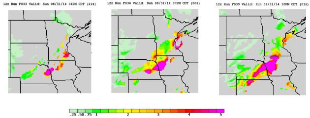
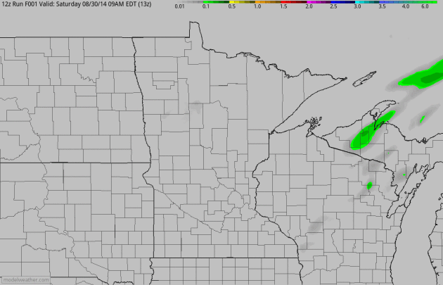
Sunday Super-Soakers.
The 4 KM NAM prints out some excessive 2-5" rainfall amounts just south
of the metro area by tonight as cooler air sparks a series of squall
lines, even a slight chance of an MCS (meso-convective) system flaring
up later, especially south of the Minnesota River Valley where dew
points are highest. 60-hour rainfall accumulation amounts courtesy of
NOAA and HAMweather.
Irritable Sunday - Slow Improvement on Labor Day.
Strong to severe storms are likely later today across much of the
state, but a wind shift to the west/northwest pushes drier, more stable
air back into town tomorrow. I still expect a wet start, but partial
clearing is expected by midday with enough sun for mid to upper 70s
Monday afternoon. We warm up again by midweek, before a more
September-like airmass arrives by Sunday. Graphic: Weatherspark.
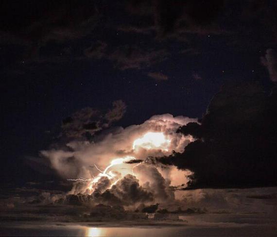
* lightning photo credit: AJ Pena.
Climate Stories...
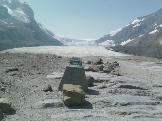
Athabasca Glacier: A Tragic Vanishing Act. Here's the introduction to a story at Skeptical Science and
Critical Angle: "
The
Athabasca Glacier in the Canadian Rocky Mountains is probably the
easiest glacier in the world to access by car. It’s just a few hundred
metres’ stroll from the nearest parking lot on the magnificent Icefields Parkway in
Alberta. The problem is, the stroll keeps getting longer by about 10
metres every year. Since 1992, the snout of the glacier has retreated
about 200 metres, requiring tourists anxious to set foot on the glacier
to walk a little further. The glacier has lost about 2 km of its length
since 1844 (Geovista PDF)..."
Photo credit above: "
The
Athabasca Glacier seen from the access trail. This point is about
halfway from the parking lot and the current snout of the glacier, which
is about 200 metres away. In the centre background is the ice-fall from
the Columbia Icefield. The marker shows where the glacier snout was in
1992, coincidentally the year of the Rio Earth Summit. It is just possible to make out some people walking on the glacier on the left-hand side."
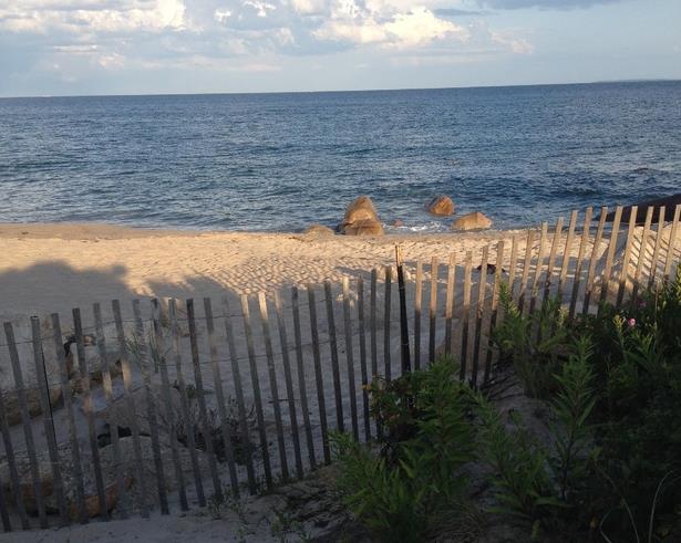
Beachfront in the Time of Climate Change. The Atlantic's
Citylab has a poignant article of what we will soon miss; here's an excerpt: "...
But
this year, as everybody packs up and heads back to school in the ritual
of Labor Day Weekend, there’s something sinister about being near the
water. It’s an end-of-days feeling, the grim reality that, because of
climate change, these places are going to be very different in 30 to 50
years. Vast acreage will be inundated. Many of the most sought-after
houses on the coastline will be erased from the landscape..." (Photo credit: author Anthony Flint).
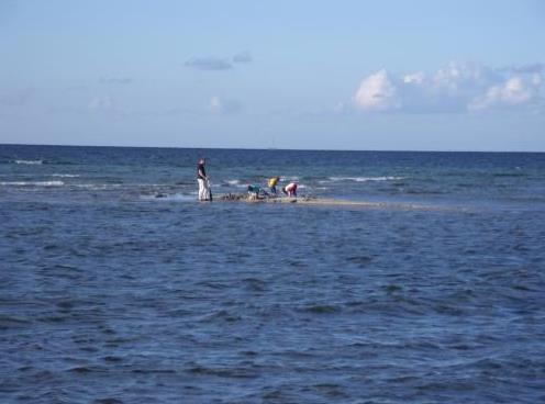
Managing Coasts Under Threat from Climate Change and Sea Level Rise. Is there an orderly, methodical way to gradually retreat from the oceans? Here's a clip from a story at
phys.org: "...
The
scientists also acknowledged that long-term adaptation to climate
change can greatly reduce impacts, but further research and evaluation
is required to realize the potential of adaptation. "Many parts of the
coast can, with forward planning, adapt to sea-level rise, but we need
to better understand environments that will struggle to adapth, such as
developing countries with large low-lying river deltas sensitive to
salinization, or coral reefs and particularly small, remote islands or
poorer communties," said Dr. Brown..."
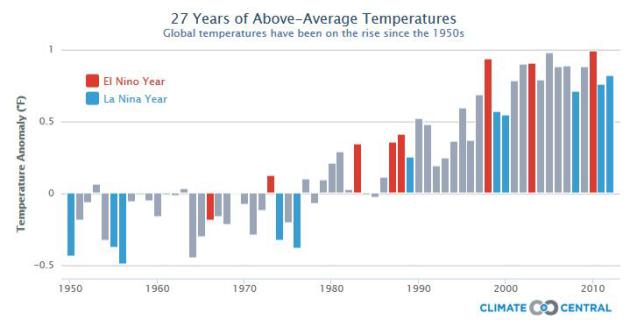
1 in 4 Republicans Say Global Warming is a Major Threat.
The Daily Caller has highlights of a recent Pew research study.
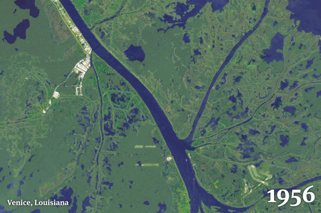
As Louisiana Sinks and Sea Levels Rise, The State is Drowning. Fast. Here's an excerpt from
Huffington Post that caught my eye: "...
In
just 80 years, some 2,000 square miles of its coastal landscape have
turned to open water, wiping places off maps, bringing the Gulf of
Mexico to the back door of New Orleans and posing a lethal threat to an
energy and shipping corridor vital to the nation’s economy. And it’s
going to get worse, even quicker. Scientists now say one of the greatest
environmental and economic disasters in the nation’s history is rushing
toward a catastrophic conclusion over the next 50 years, so far
unabated and largely unnoticed..."
Animation credit:
From Bob Marshall, The Lens, Brian Jacobs and Al Shaw, ProPublica:
Why Climate Change Won't Intensify Extreme Snowstorms.
The most intense snowstorms may shift north over time, which isn't
surprising in a slowly warming world. Here's an excerpt from Live
Science and
Yahoo News: "...
The
study revealed little change in the intensity of major snowstorms in
wintry regions. In areas where winter temperatures hover near the snow
"sweet spot," the heaviest snowstorms became only eight percent less
intense. The higher latitudes will shift the other way, with 10 percent
more snow during extreme events, O'Gorman found. In regions where there
is usually little snowfall, there will be fewer days with history-making
storms..."
No comments:
Post a Comment