By Paul Douglas
Technology will save us from ourselves. A comforting thought, and it may even be true, at least some of the time. I'm a techno-optimist but there are limits to my exuberance.
Doppler radar, smart phone apps & social media have created new ways to receive actionable weather intelligence - to help make smarter weather decisions or take evasive action when severe storms threaten. Yet many people don't heed the warnings until they can SEE the tornado on the ground, or friends text/tweet them that the risk is real.
Weather satellites update every 15 minutes, lulling coastal residents into a false belief they can evacuate at the last moment, if it turns out to be "a big deal" - not realizing the traffic mess a mad-dash would create. Technology empowers. It can also lead to overconfidence.
If I heard that "Bertha" was coming I'd probably run for the hills, but Tropical Storm Bertha should stay out to sea. No storms with names nearby; just a few T-storms sprouting by evening. Soaking T-storms brush southern Minnesota late Tuesday and Wednesday, then 80s return by late week.
We're on a time-delay. Now that it's August we're finally seeing the July we never had. Makes total sense.
==================
SATURDAY NIGHT: Clearing, warm and pleasant. Risk of a Beatle. Low: 65
SUNDAY: Warm sun, late day thunderstorm. High: 85. DP: 64. Wind: WSW 5mph.
SUNDAY NIGHT: Lingering spotty T-Shower. Low: 64
MONDAY: Partly sunny, slightly cooler. High: 80. DP: 57.
TUESDAY: Some sun, heavy T-storms late. Wake-up: 59. High: near 80
WEDNESDAY: Storms taper, slow clearing late. Wake-up: 60. High: 78
THURSDAY: Plenty of sun, pleasant. Dew point: 55. Wake-up: 58. High: 82
FRIDAY: Intervals of sun, probably dry. Wake-up: 60. High: 80
SATURDAY: Wetter day, few T-Storms. Wake-up: 63. High: 82
==================
Beatle Warning
Thanks to my Aunt Kaye Kruse for the picture who attended Saturday night's Paul McCartney concert last night at Target Field. It looked a little sketchy early on, but rain/thunder dissipated before the concert got underway.

===================
This Day in Weather History
August 3rd
1896: Violent hailstorm destroys two thirds of the crops in Swift County.
=================
Average High/Low For Minneapolis
August 3rd
Average High: 82F (Record: 99 in 1941)
Average Low: 63F (Record: 54 in 1915)
==================
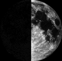
Moon Phase for August 3rd at Midnight
0.3 Days Since First Quarter
=======================
Minneapolis Temperature Trend
Here's a brief glance at temperatures over through mid August, which shows the potential for a slight cool down (70s) by the second half of the week ahead.

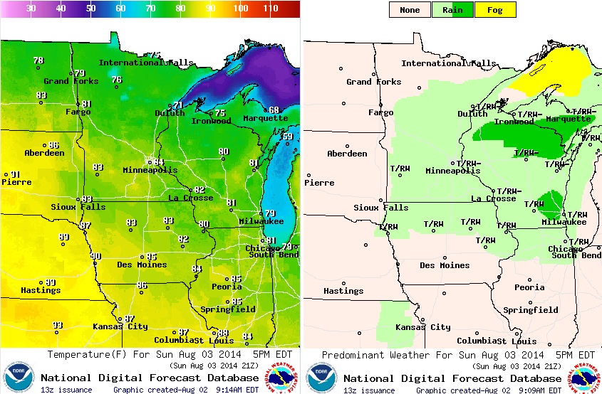
Sunday Weather Outlook
Not a bad Sunday ahead... Very summer-like with warm temperatures and a few spotty thunderstorms during the afternoon/evening hours. The image below shows temperatures (80s) and weather conditions (spotty thundershowers) by 5pm Sunday.
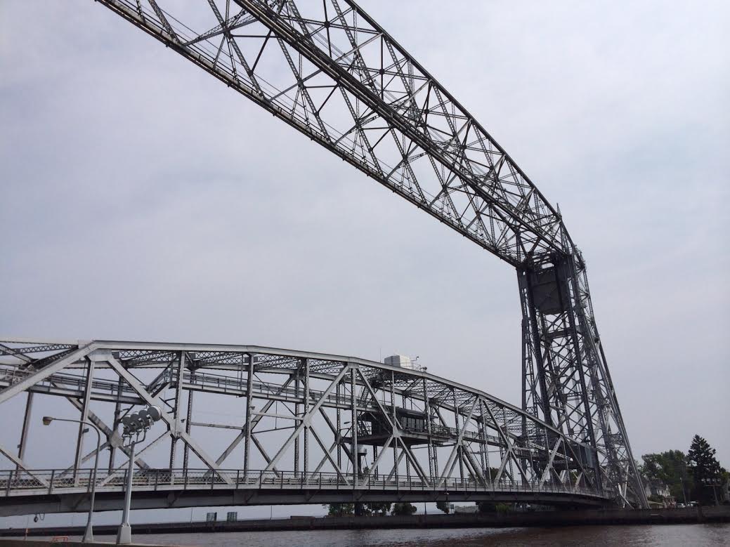
Duluth Aerial Lift Bridge
World's most inland seaport
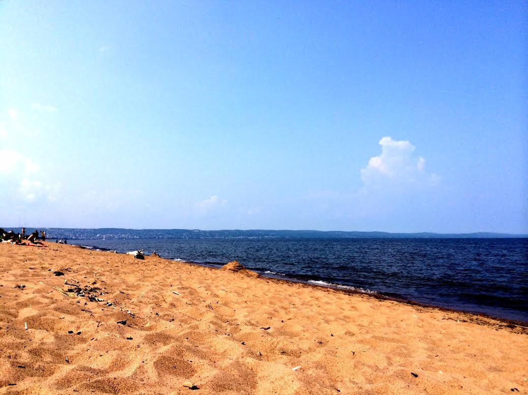
Beach Day!
Yes, it was a beach day!! I lived in Duluth for 4 years and we didn't get too many days like that on Friday... The picture below was my view from "Park Point" on Friday, which is the world's longest freshwater sandbar (~6 miles long)!! I was trying to figure a way to bottle that up, so I could open it sometime this winter.
Weather Outlook
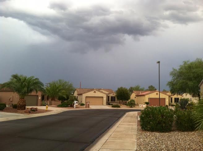
Here's the weather outlook through AM Monday. Note the week front sliding through the Midwest - this will be responsible for a few spotty showers/storms from PM Saturday through Sunday evening. Some of the heaviest precipitation will be found along the Eastern Seaboard as a front stalls there. Another area of abundant moisture will be found in the Southwest where monsoonal moisture continues.

Precipitation Potential
According to NOAA's HPC, the precipitation potential from AM Sunday through AM Monday shows the potential of nearly 0.30" as the weak front slides through. Keep in mind that some spots could see nothing, while some that get a heavy downpour from any isolated thunderstorm could see nearly 1" or more in a very short amount of time.

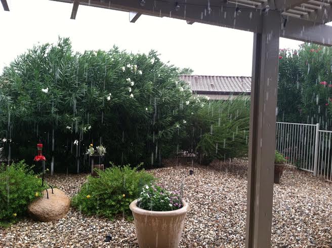
Raining in AZ
Thanks to Jody Musil out of Sun City Grand, AZ for the picture below where thunderstorm brought heavy rain rainfall and flash flooding to some of the surrounding areas.
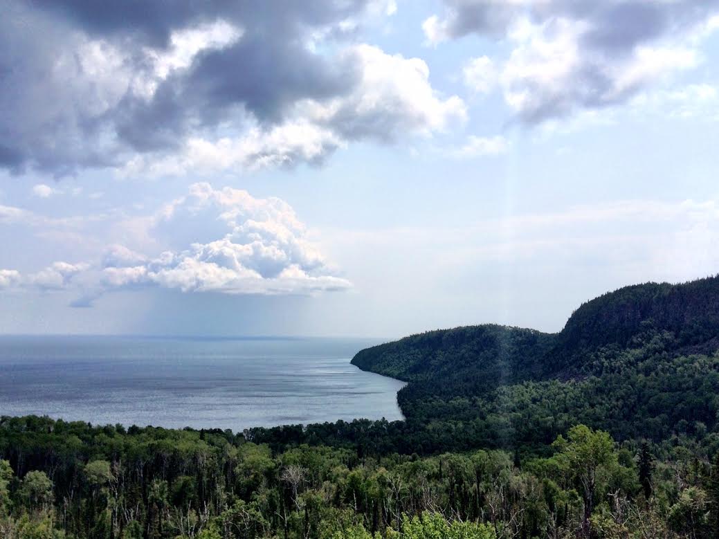
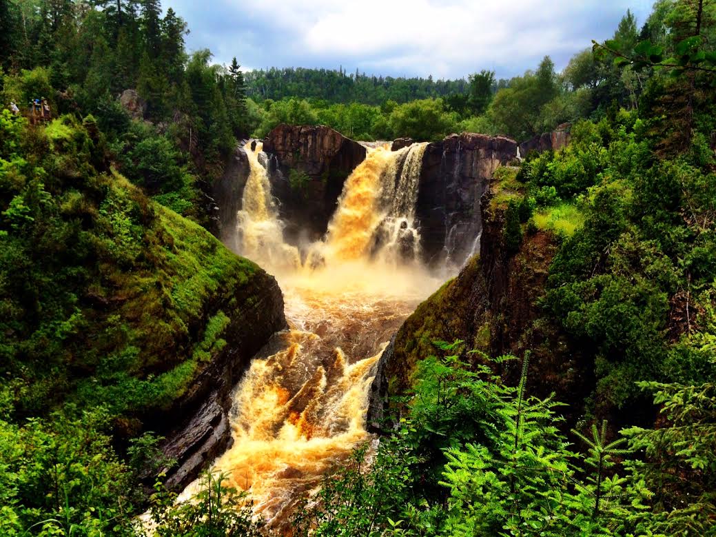
North Shore Trip
I recently got back from a trip along Minnesota's North Shore and the views never cease to amaze me! For the first time, I made a trip with the family to Grand Portage (Canadian border) to view the High Falls along the Pigeon River and what a view! If you ever get a chance to get up that way check it out and stop at the Mount Josephine overlook along the way!
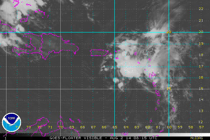
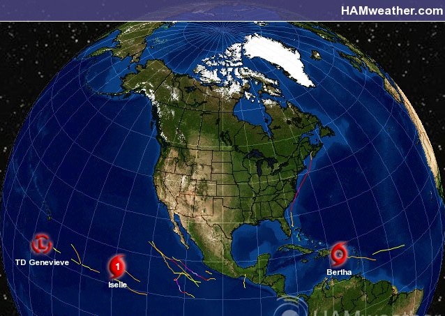
Tropical Update
Bertha is the second named storm of the Atlantic Hurricane Season, which officially started June 1st. The loop below showed the sunrise over Bertha, which was located in the Caribbean when winds were sustained at nearly 50mph.
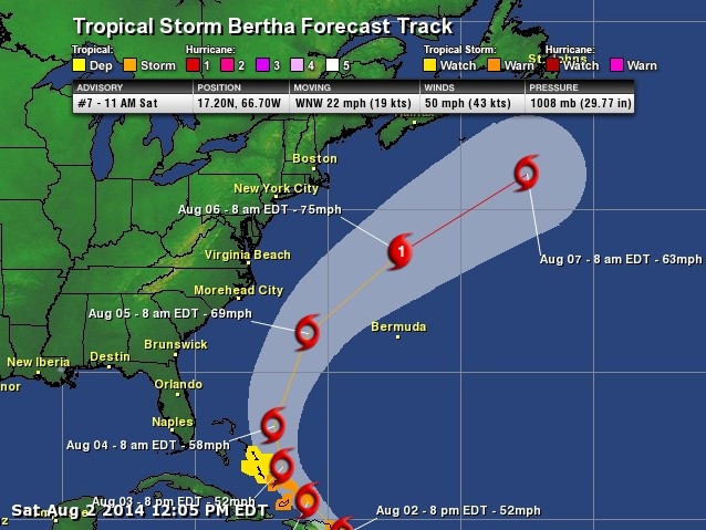
Tracking Bertha
According to NOAA's National Hurricane Center, Bertha should track northwest towards the U.S. a bit before making a sweeping arc back over the open waters of the Atlantic. There is a chance that Bertha could briefly become a category 1 hurricane and 2 for 2 on hurricanes this season in the Atlantic basin (Arthur was briefly a category 2 hurricane as it made landfall with the Outer Banks of North Carolina).
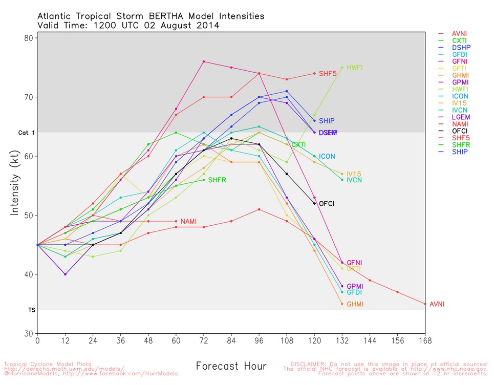
Bertha Intensity Forecast
This is an interesting look at a Bertha Forecast... it shows a number of different model intensities for Bertha, which bring the storm close to Hurricane Force (74mph) by midweek.
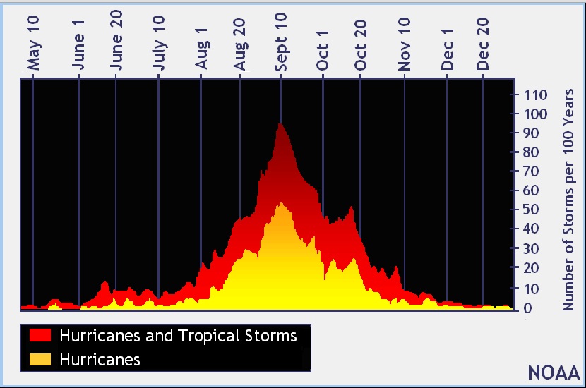
Hurricane Climatology
Bertha is only the 2nd named storm of the Atlantic Hurricane Seaon, but climatologically speaking, we're still about 1 month from the peak of hurricane season (September 10th).
Tropical Update Continued...
Meanwhile, Genevieve and Iselle were still playing a small role in the East Pacific. By midday Saturday, there had been 9 named storms in the Eastern Pacific, 4 of which were hurricanes; Amanda, Cristina, Hernan and Iselle.
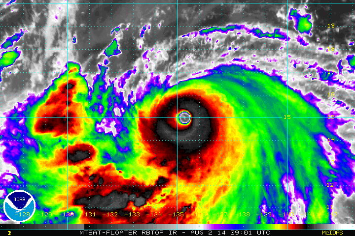
Super Typhoon Halong
Take a look at this beast! According to the Joint Typhoon Warning Center, Super Typhoon Halong had sustained winds of nearly 155mph with gusts up to 190mph as of midday Saturday (EDT). This storm was equivalent to a top end category 4 hurricane and makes it the 3rd super typhoon of the Western Pacific Hurricane Season!! The eye with Halong was very impressive! The good news is that Halong is expected to make a turn north away from the Philippines Islands, which was hit by Super Typhoon Haiyan earlier this season. However, the turn north could bring hurricane conditions to southern Japan later this week.
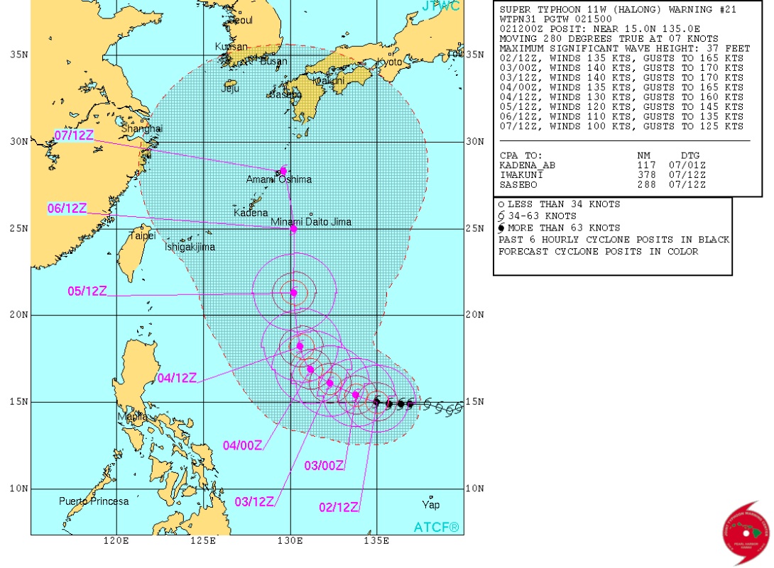
Halong Track
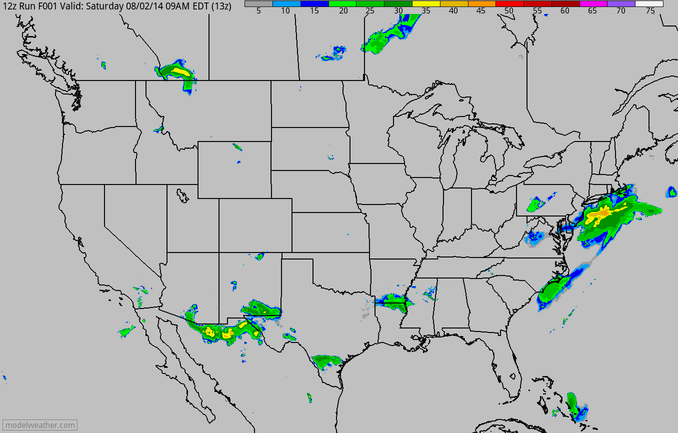
Weather Outlook
Here's the weather outlook through PM Monday, which shows more widespread rain/thunder across the Eastern Seaboard and the Intermountain West. An impulse of energy will slide through the Upper Midwest from Sunday through Monday. One spot that needs moisture is California and it doesn't appear that any relief is in sight anytime soon.
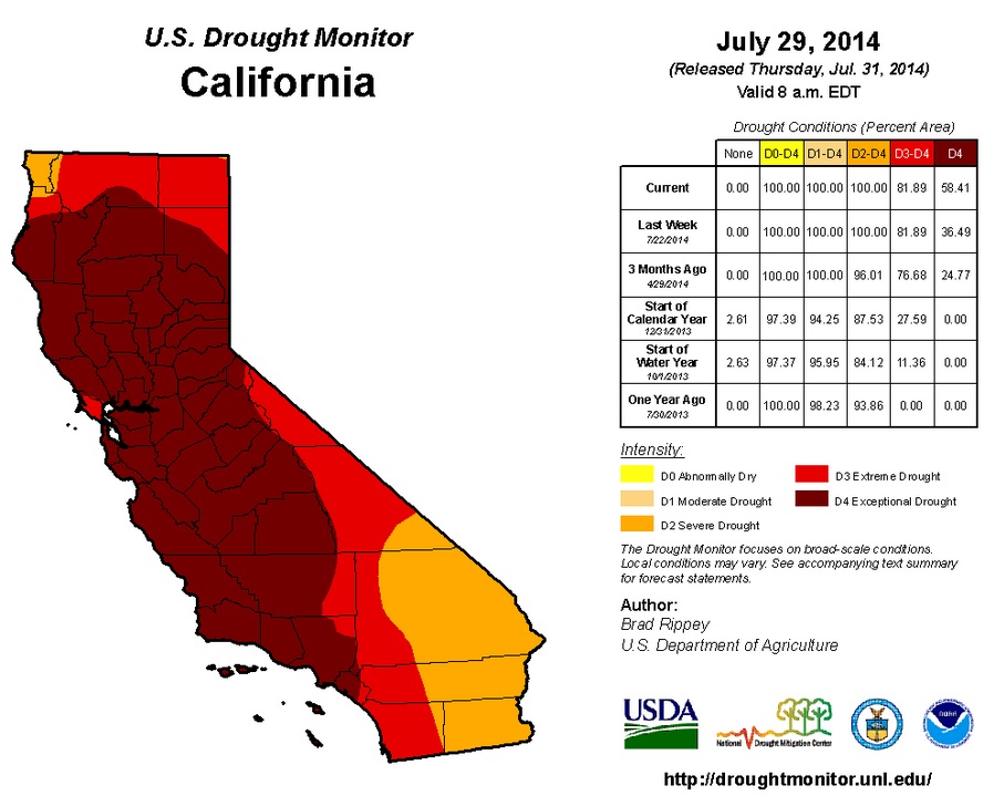
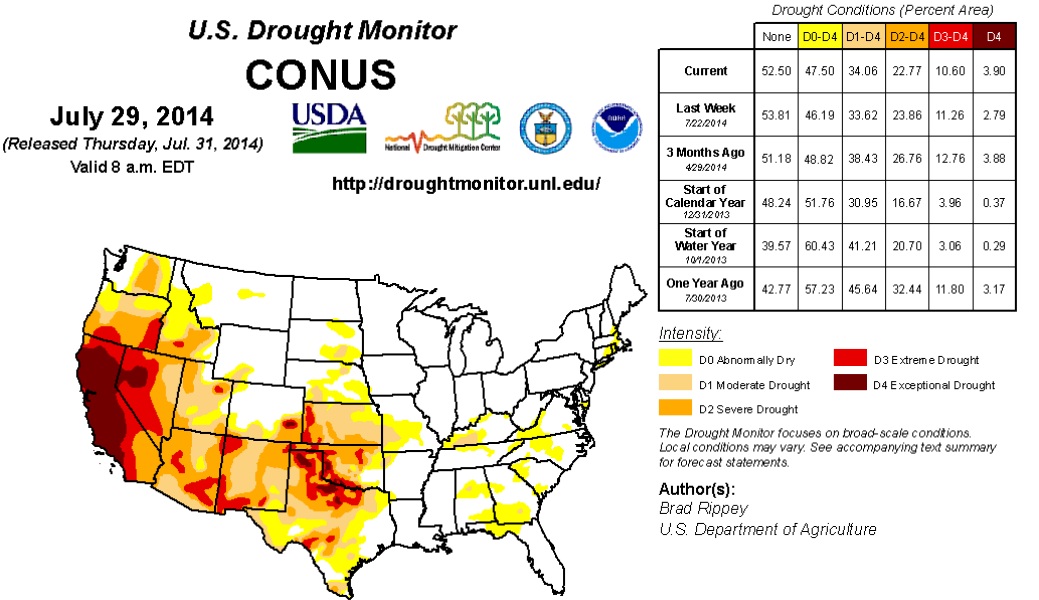
California Drought Worsens
Where we need the moisture the most, we're not getting it. California has now been upgraded for 36% of the state to 58% of the state under an EXCEPTIONAL DROUGHT.
"We may have to migrate people out of California"
Here's an interesting article from CNBC that quotes an academic chair at Kaplan University that says "We might have to migrate people out of California."
It's going from worse to worst each week in California. Suffering in its third year of drought, more than 58 percent of the state is currently in "exceptional drought" stage, according to the latest U.S. Drought Monitor map. That marks a huge jump from just seven days ago, when about 36 percent of the state was categorized that way. Exceptional drought, the most extreme category, indicates widespread crop and pasture losses and shortages of water in reservoirs, streams and wells. If the state continues on this path, there may have to be thoughts about moving people out, said Lynn Wilson, academic chair at Kaplan University and who serves on the climate change delegation in the United Nations. "Civilizations in the past have had to migrate out of areas of drought," Wilson said. "We may have to migrate people out of California." Wilson added that before that would happen, every option such as importing water to the state would likely occur— but "migration can't be taken off the table."
Read more from CNBC HERE:
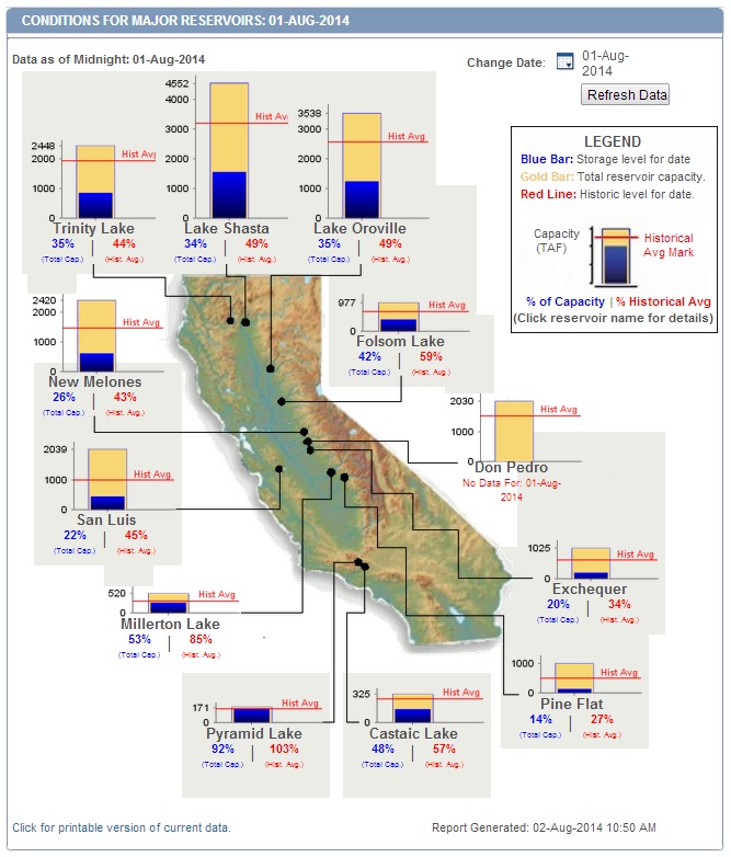
California Reservoir Levels
According to cdec.water.ca.gov - a number of the reservoirs across the state are sitting about half of the historical average. The only spots sitting at near historical levels is Pyramid Lake in the southwestern part of the state.
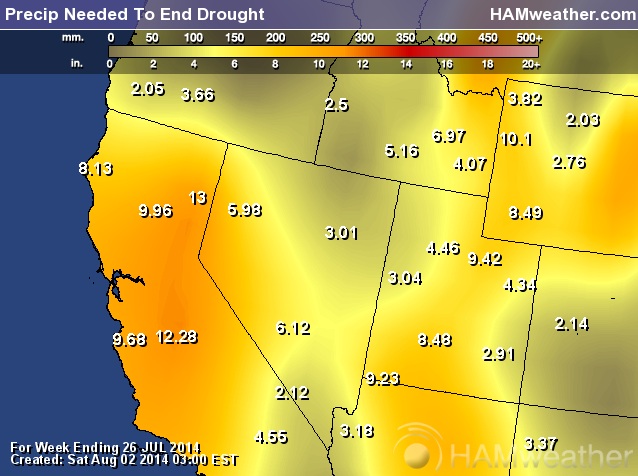
Precipitation Needed to End Drought
The graphic below shows how much precipitation may be needed to end the drought and interestingly, some spots may need more than a foot of water to end the drought in the Central Valley.
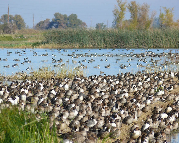
Central Valley Drought: North American Waterfowl Casualties
Here's something that I came across that I thought was interesting; the California drought is actually having a big impact on the North American Waterfowl migrate to the Central Valley!
Add another casualty to California’s prolonged and punishing drought: Wildlife officials warned this week that dry conditions in the state’sCentral Valley could have a devastating effect on North American waterfowl. The Central Valley is recognized as the most important resting and wintering ground on the Pacific Flyway, a global migratory path for millions of ducks, geese and other birds. About 5 million waterfowl spend the winter on state and federal wildlife refuge areas and flooded rice fields in the Central Valley each winter.
Read more from Sacbee.com HERE:
Drought Monitor Continued...
Despite the tremendous drought in the Western U.S., the Midwest is actually doing quite well. As of last week, no parts of Minnesota were considered to be in any drought or abnormally dry across Minnesota! In fact, we've almost had too much rain so far this summer. 'No Wake' restrictions were recently just lifted on Lake Minnetonka.
Spotty showers were heaviest in the East, where rain benefited pastures and summer crops. Meanwhile, mostly dry weather prevailed in the Midwest, except for a few bands of locally heavy showers. Despite a July drying trend, most Midwestern crops continued to thrive due to near- to below-normal temperatures and abundant soil moisture reserves. On July 27, USDA rated three-quarters of the U.S. corn and 71% of the soybeans in good to excellent condition—the highest such ratings this late in the season since 2004. Farther west, hot weather on the Plains yielded to sharply cooler conditions. In addition, rain overspread the central and southern High Plains late in the drought-monitoring period. The spell of hot weather hastened winter wheat maturation on the northern Plains and promoted rapid crop development throughout the nation’s mid-section. However, the Plains’ high temperatures also stressed some summer crops, especially in areas dependent upon rain or with lingering subsoil moisture deficits. Elsewhere, heat also arrived across the Southwest during a temporary break in the monsoon circulation, while cooler weather and beneficial showers overspread the Northwest. In particular, Northwestern showers aided containment efforts for a rash of lightning-sparked wildfires. However, the weather pattern reversed during the second half of the drought-monitoring period, with heat returning to the Northwest and a monsoon surge delivering heavy rain to parts of the Southwest.
Looking Ahead
From July 31 – August 4, locally heavy showers will shift eastward across the South, eventually reaching the southern Atlantic States. Five-day rainfall totals could reach 1 to 3 inches from Florida into the southern mid-Atlantic region. Meanwhile, showers will linger across the central and southern Rockies in the wake of a significant rainfall event. Most of the remainder of the West will experience dry weather, except for isolated showers across the Great Basin and Intermountain region. Mostly dry weather will also prevail during the next several days from the northern Plains into the middle Mississippi Valley. Elsewhere, an ongoing heat wave in the Northwest will contrast with near- to below-normal temperatures in most other parts of the country. The NWS 6- to 10-day outlook for August 5 – 9 calls for the likelihood of below-normal temperatures in large sections of the central and eastern U.S., as well as the central Rockies, while hotter-than-normal conditions will cover the lower Southeast, the lower Rio Grande Valley, and the Far West. Meanwhile, near- to above-normal rainfall across the majority of the U.S. will contrast with the likelihood of drier-than-normal conditions in the Pacific Northwest, northern Plains, far upper Midwest, and southern parts of Arizona, Texas, and Florida.
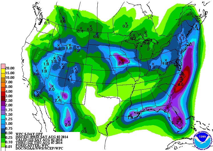
5 Day Precipitation Outlook
According to NOAA's HPC, the 5 day precipitation outlook looks greatest along the Eastern Seaboard where a stalled frontal boundary will be in place, but there will also be pockets of heavy moisture in the Southwest and the Midwest.
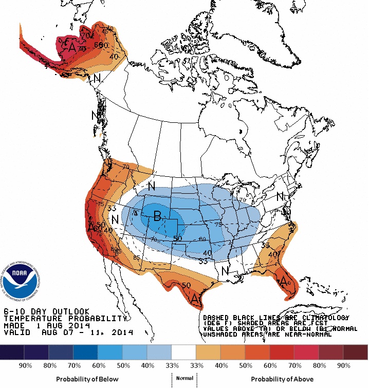
Temperature Outlook
According to NOAA's Climate Prediction Center, the center of the nation still has a fairly good chance of slightly below average temperatures in the 6 to 10 day range (August 7th-11th).
Thanks again for checking in and have a great rest of your weekend.
Don't forget to follow me on Twitter @TNelsonWNTV

No comments:
Post a Comment