Weather or not
By Paul Douglas
"There is no such thing as bad weather, only different kinds of good weather" said John Ruskin. I beg to differ. Farmers want rain, although increasingly intense summer downpours can wash topsoil & nitrogen away. Boaters, bikers and campers prefer a dry sky. And a Technicolor Sunset would be nice. A sunny day can make or break a business. "Dry, sunny summer days can generate 3 times more revenue than sloppy days" said Jack Stevens, owner of Maynard's in Excelsior.
If anyone asks 2014 has featured only 2 days of 90F or warmer. Since 1873 there have been only 9 years with 2 or less days above 90F.
Summers aren't appreciably hotter, at least not yet, but we're seeing more days with dew points above 70F.
The St. Paul campus of the U saw a dreadful dew point of 79F on Thursday, according to Mark Seeley.
Cue up a Chamber of Commerce weekend with blue sky, low humidity and mid-70s. Make the most of the next 2 days because midweek rain ushers the first real cold front of autumn into town. Highs may hold in the 50s late next week with lows sinking into the 30s; an early frost can't be ruled out up north.
Your September wardrobe should consist of shorts and jackets. Sounds right.
=================
FRIDAY NIGHT: Clearing and cool. Low: 52
SATURDAY: Sunny, beautiful. Dew point: 45. Winds: NW 8. High: 75
SATURDAY NIGHT: Mostly clear, cool and comfortable. Low: 53
SUNDAY: Sunny, still postcard-worthy. High: 76
MONDAY: More clouds, isolated shower possible south. Wake-up: 55. High: 77
TUESDAY: Some sun, clouds increase. Wake-up: 57. High: 80
WEDNESDAY: Showers, possible T-storms. Wake-up: 64. High: 71
THURSDAY: Mostly cloudy, risk of sweatshirts. Wake-up: 51. High: 56
FRIDAY: Hello October! Frost possible up north. Wake- up: 41. High: 54.
=================
This Day in Weather History
September 6th
1977: An early morning thunderstorm dropped 2 inch hail in McLeod County.
1922: Heat wave over Minnesota with highs over 100 in southwest Minnesota. One of the hot spots was New Ulm with 105.
=================
Averages High/Low for Minneapolis
September 6th
Average High: 76F (Record 98F set in 1922)
Average Low: 57F (Record 35F set in 1885)
================
Sunrise/Sunset Times for MSP
September 6th
Sunrise: 6:41am
Sunset: 7:41pm
================
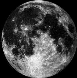
Moon Phase for September 6th at Midnight
2.8 Days Before Full Moon
==================
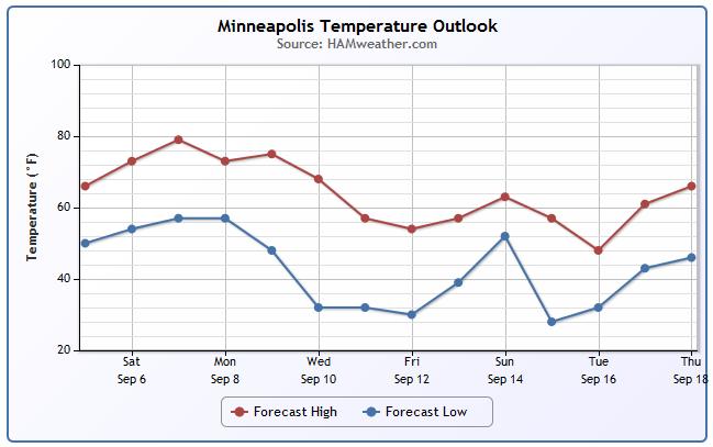
Minneapolis Temperature Trend
The temperature trend into the 2nd half of next week looks a little frightening! Extended model runs continue to show a fairly significant blast of cold air. In fact, if current forecasts hold, it could be cold enough for widespread frost across the northern half of the state!
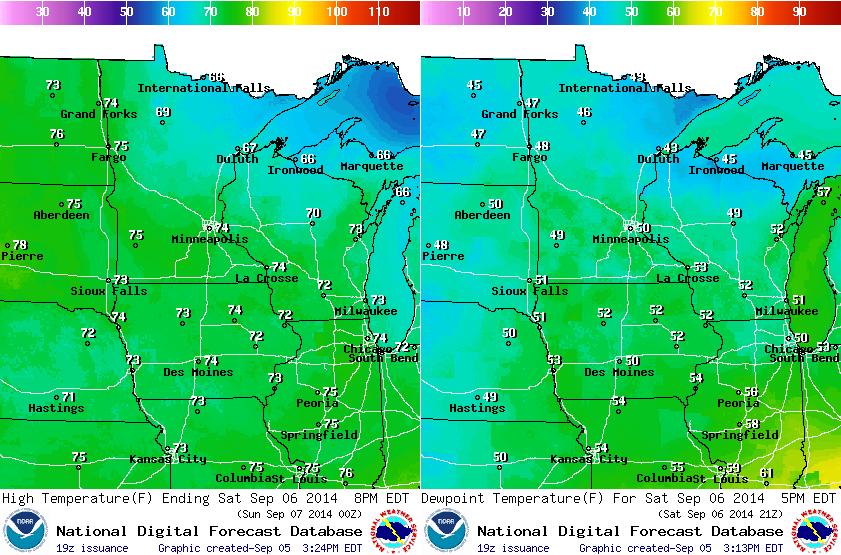
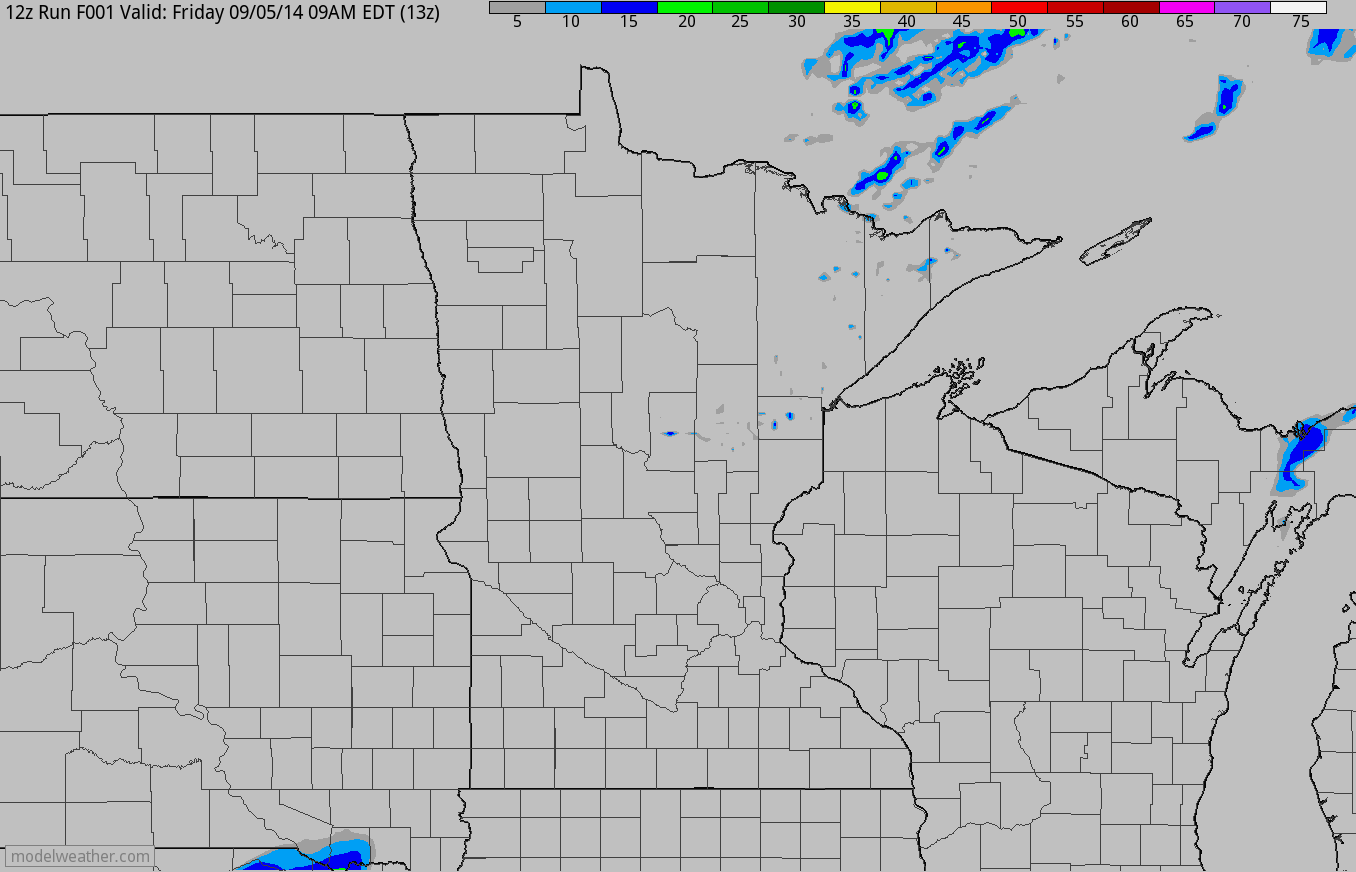
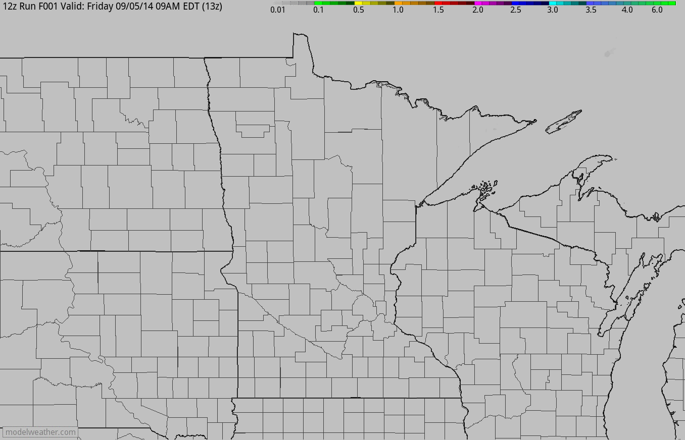
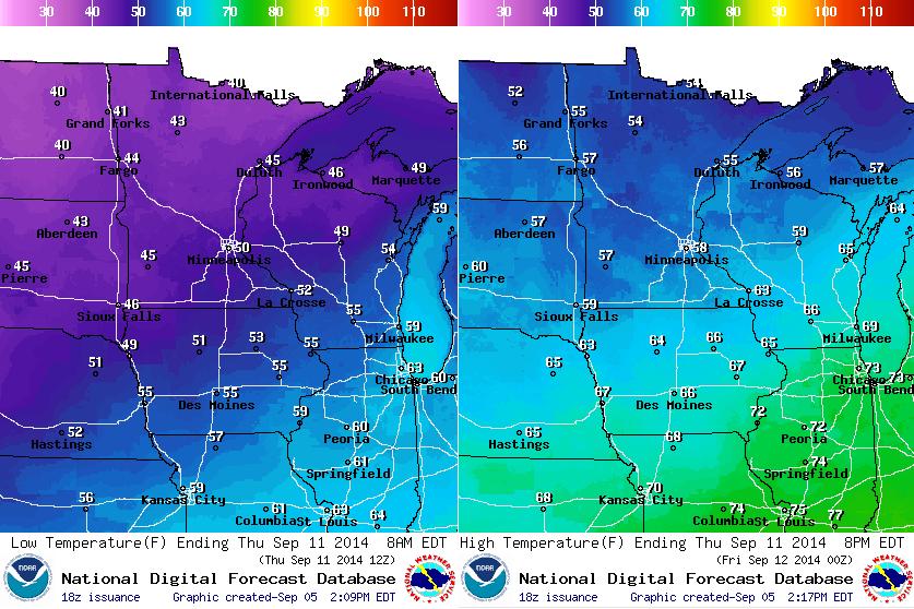
Saturday Weather Outlook
Saturday appears to be a stunning day with low humidity, comfortable temperatures and plenty of sunshine. Despite not actually being Fall officially (Autumnal Equinox: September 22nd) - there will be hints of Fall (weather-wise) this weekend. The images below show the high temperature expected on Satuday (left), while the image on the right shows the dew point, which is nearly 20F cooler than it was late Wednesday/early Thursday. Keep in mind that for every 20F dew point drop, there's half as much water in the atmosphere as there was before! That's why it feels so much nicer out there now!!
Simulated Radar
The loop below suggests the radar reflectivity from AM Friday through PM Sunday. Other than a few spotty/passing showers across the extreme northern part of the state this weekend, it'll be pretty quiet.
Rainfall Potential
The loop below shows the rainfall potential from AM Friday through PM Sunday... Again, other than a few spotty/passing showers, it'll be a mostly quiet weekend.
Fall Colors... ??
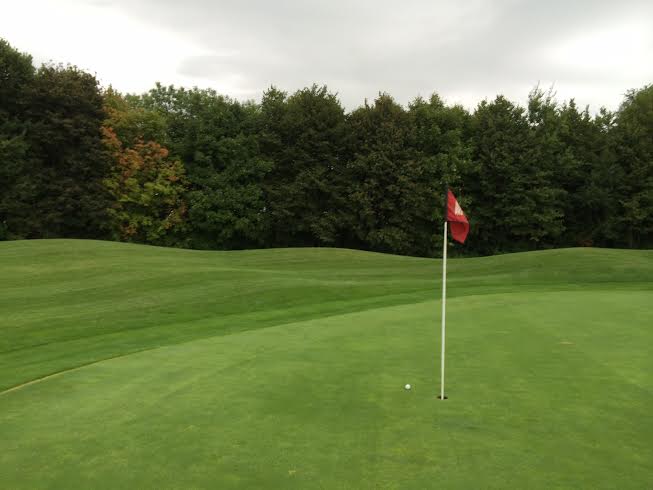
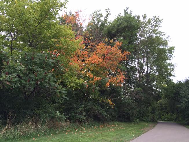
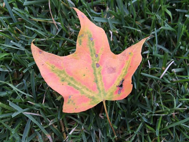
I had a chance play a round of golf on Friday and happened to notice some all too familiar signs that Fall is quickly approaching. Some of the sumac and maple trees are beginning to turn red! While it's beautiful, it's a friendly reminder that colder/darker times for our latitude are quickly approaching.
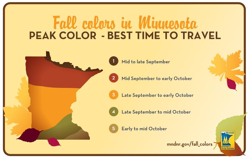
Average Fall Color Peak in Minnesota
Interestingly, we're only a few weeks away from the 'typical' peak of fall colors in the northern part of the state! In fact, according to the MN DNR, peak across the extreme northern part of the state can be as early as mid/late September!
The MN DNR has a great website dedicated to Fall color, see more HERE:
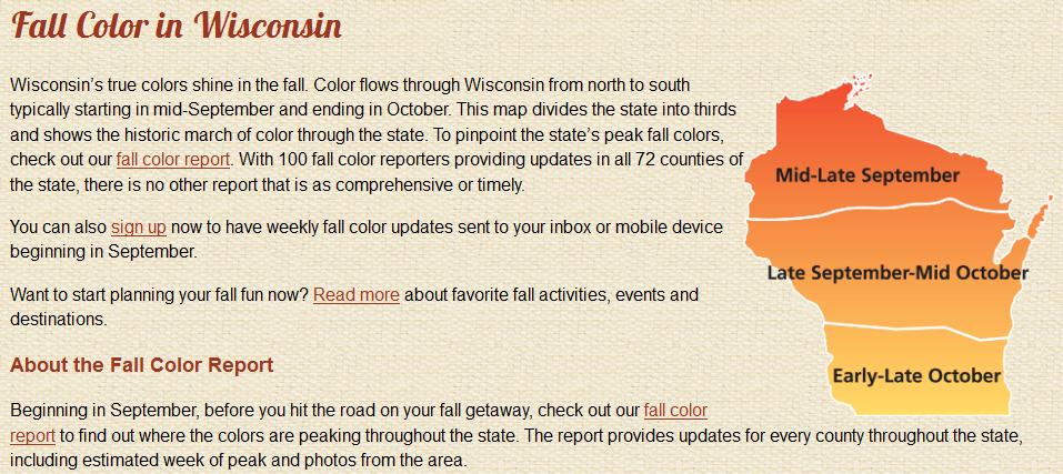
Average Peak for Wisconsin
According to TravelWisconsin.com - fall colors start peaking across the northern part of the state in late September, while the rest of the state typically sees peak in October.
See more from TravelWisconsin.com HERE:
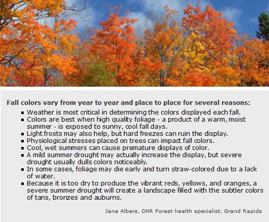
How Can Weather Affect Fall Color?
Here's a great sample from Jana Albers (DNR Specialist) on how weather can help or hurt fall color!
Jack Frost Visits Fairbanks, AK
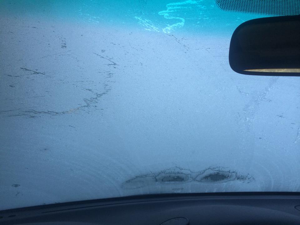
Thanks to my good friend Jane Taffe who sends this picture from Fairbanks, AK. She says she woke up to frost September 4th... YIKES! This is an image that most of us are used to; frost on the windshield. I just hope we don't have to see this too soon! Unfortunately, Jane says her tomato plant was a casualty of the recent cold blast.
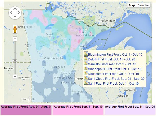
Average First Frost Map
Believe it or not, it's getting to be that time of the year when Jackfrost starts nipping at our gardens and flower beds. Here's a map from PlantMaps.com that show our our average first frost across the state. Note that some locations across the far north/northeast has an average first frost in early/mid September, while folks in darker blue see their average first frost around early October.
Average First Frost for Minneapolis
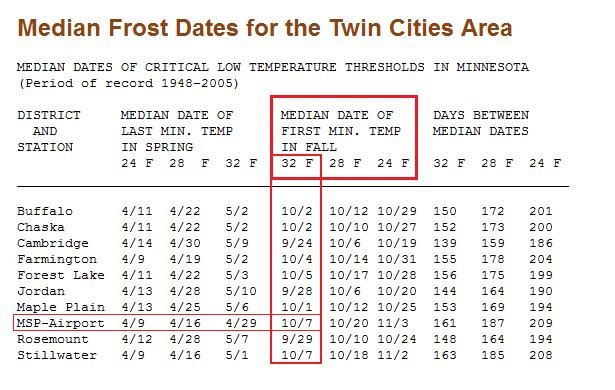
We typically don't see our first frost until the first week of October in the Twin Cities Metro, however some folks across the northern/northeastern part of the state typically see their first frost in September. According to the State Climatology Office, the average first frost (32F) in the Twin Cities Metro is October 7th. Note other locations; Cambridge, Jordan, Rosemount see their average first 32F by late October!
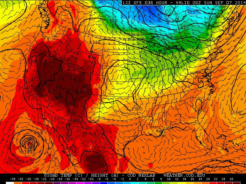
Cold Blob Approaches Next Week
The graphics below show temperatures a few thousand feet off the ground and the developing cold blob into next week. Note that at the beginning of the graphics, our first cool blobs departs and we actually warm up into the early week. However, the next colder air mass approaches by mid week. The coldest of the cold air appears to settle in by AM Thursday.
Saturday, September 6th
Monday, September 8th
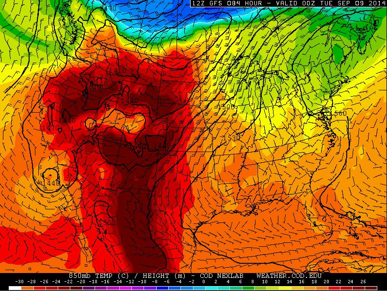
Wednesday, September 10th
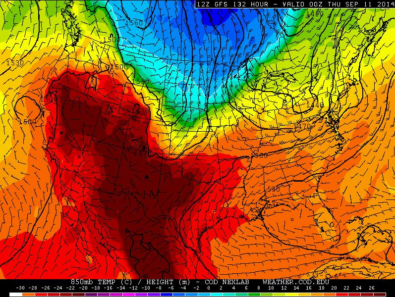
Thursday, September 11th
By Thursday morning, it appears come of the coldest air of the season will be settling in. There could be widespread 30s across the northern part of the state both Thursday and Friday morning.
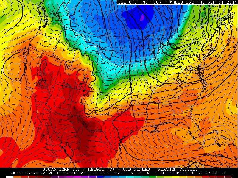
Thursday, September 11th Weather Outlook
The graphics below from the National Weather Service suggests the temperature outlook for Thursday, September 11th when some of the coldest air of the season could be settling in. Morning lows on Thursday could be in the 30s and 40s across much of the state, while daytime highs look to rebound into the 50s!! BRR!!
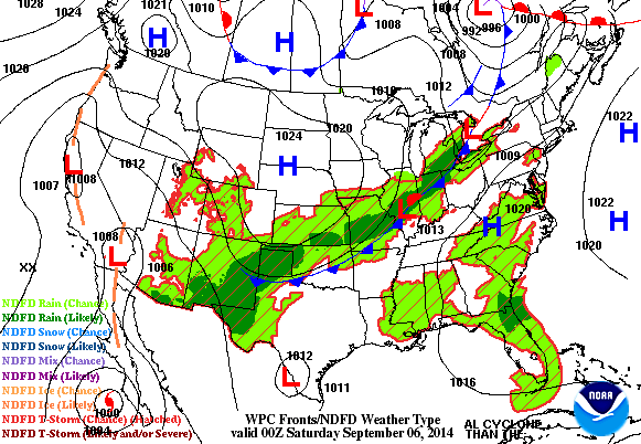
Hints of Fall This Weekend
After last weeks sweaty and severe weather, things have changed dramatically! Note the big blue "H" drifting though the middle of the country, this will bring sunshine and comfortable temperatures/humidity into the region for both Saturday & Sunday!
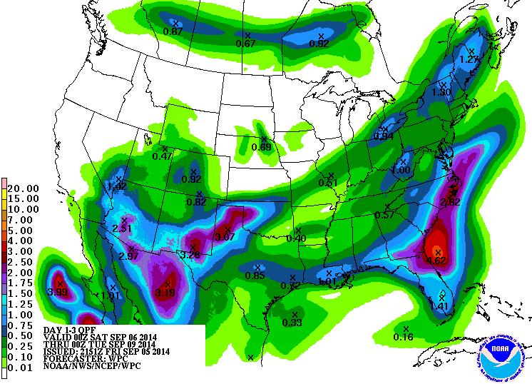
Rainfall Potential
According to NOAA's HPC, the rainfall potential through PM Monday shows heavy rain across the Southwestern and Southeastern part of the country. Keep in mind that some of the rain in the Southwest will be enhanced by the remnants of Hurricane Norbert in the Eastern Pacific.
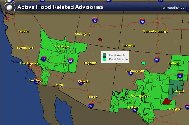
Southwest Flood Potential
With the increase in moisture from the remnants of Norbert, flooding will be a major concern in the Southwest. The areas highlighted in green are areas that could see flooding through the weekend.
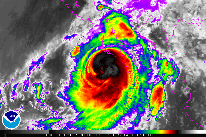
Norbert
As of 7:15pm EST Friday, Norbert was still a category 1 hurricane with 90mph sustained winds. Norbert will continue to deteriorate as it moves north/northeast into the weekend, but heavy rainfall will be one of the main concerns for folks in the southwestern part of the U.S..
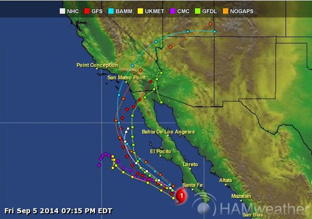
Norbert Track
Interestingly, several models track whatever is leftover of Norbert into the southern California! Again an increase in tropical moisture over these areas could enhance rainfall/flooding potential through the weekend!
Cosmic Shooting Gallery
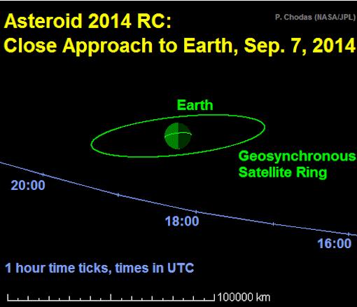
While the Earth isn't in any immediate danger, a near-Earth asteroid will pass just outside the orbit of geosynchronous satellites on September 7th! This house-sized asteroid is a gentle reminder that we are in a wild cosmic shooting gallery and there's a lot big things floating around in Space...
"WEEKEND ASTEROID FLYBY: This Sunday, a house-sized asteroid named "2014 RC" will fly through the Earth-Moon system almost inside the orbit of geosynchronous satellites. At closest approach, Sept. 7th at 18:18 UTC, the 20-meter-wide space rock will pass just 40,000 km over New Zealand. This diagram from NASA shows the geometry of the encounter:"
Learn more from www.SpaceWeather.com HERE:
Northern Lights Potential?
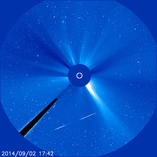
"FILAMENT ERUPTION, EARTH-DIRECTED: On Sept. 2nd, an enormous filament of dark plasma, which had been snaking across the face of the sun for days, became unstable and erupted. NASA's Solar Dynamics Observatory recorded the blast, soon thereafter, a lopsided CME billowed away from sun. According to NOAA analysts, the CME will deliver a glancing blow to Earth's magnetic field on Sept. 6th. This is not a particularly fast or powerful CME. Nevertheless, the coming impact could spark auroras. The last two minor CMEs that struck Earth in late August triggered beautiful displays of Northern and Southern Lights. The reason: it's aurora season. High-latitude sky watchers should prepare for Sept. 6th."
See more from www.SpaceWeather.com HERE:
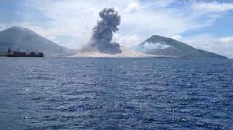
Volcanic Eruption at Close Range
This video from Papau New Guinea shows the immense power of Mother Nature. The Tavurvur volcano erupts with a significant shock wave that can be seen, which is eventually followed by a sonic boom! Pretty amazing!!
Check it out HERE:
Thanks for checking in and have a great weekend ahead! Don't forget to follow me on Twitter @TNelsonWX

No comments:
Post a Comment