25 F. average high on December 22.
19 F. high on December 22, 2013.
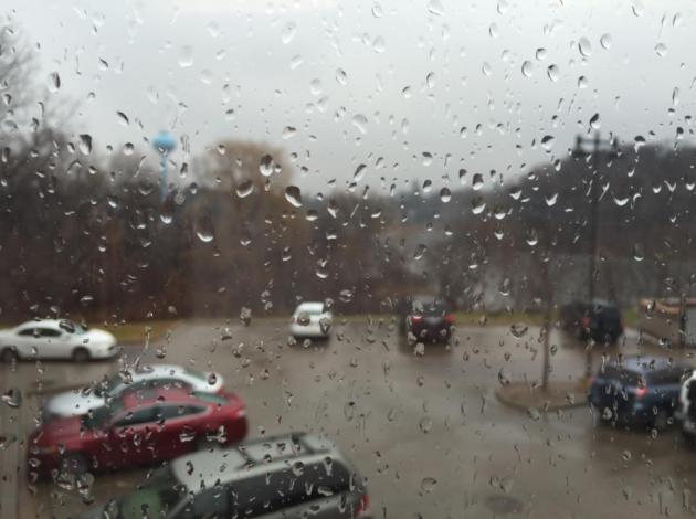
.09" rain fell yesterday.
0" snow on the ground as of 7 PM Monday.
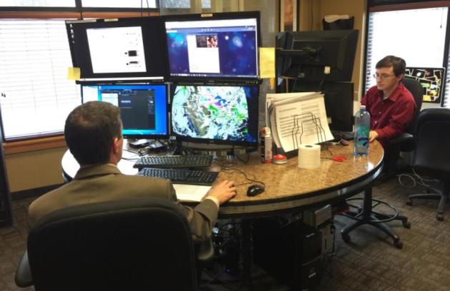
December 22 in Minnesota Weather History. Source: Twin Cities National Weather Service:
1996: Heavy snow fell across much of central Minnesota. The heaviest snow of 6 to 10 inches fell in central and eastern sections of area while snow amounts were in the 4 to 6 inch range in the north. Other snowfall totals included 6 to 8 inches across the Twin Cities metro area, 10 inches in Jordan, 8 inches at Cambridge, Forest Lake, Hutchinson and Montevideo, and 6 inches at St. Cloud, Glenwood and Redwood Falls. Counties affected include: Sherburne, Sibley, Stearns, Steele, Stevens, Swift, Todd, Waseca, Washington, Watonwan, Wright, and Yellow Medicine.
1983: The Twin Cities had a high of 17 degrees below zero.
1833: Warm spell at Ft. Snelling. Temperature reached 45 degrees.
December Disconnect
In Meteorology 001 they teach you days of the week, the seasons and which finger to point to the weather map with. As a general rule December is colder than November, at least that's how I was raised.
But not this year, not in Minnesota. As of Monday December's average temperature (both highs and lows for the first 21 days) was 26F. The average temperature for all of November was 25.4F. A cold snap shaping up for the end of December will make it a close call, but December warmth and rain is trying to make up for a nasty November that was 8.3F colder than average.
A healthy 9.4 inches of snow fell in November. So far this month: 1.4 inches. More Memphis than Minneapolis.
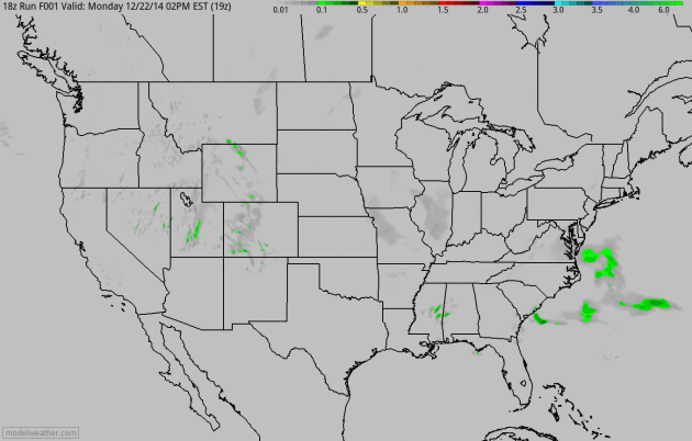
As temperatures cool a rain-snow mix changes to snow today; an inch of slush possible on lawns, but most roads stay wet until tonight, when a little ice may form.
We dry out for Christmas - the leading edge of a parka-worthy cold front sparks a little snow Friday, but right now it doesn't look like much. A subzero New Year is still possible across much of Minnesota but no big storms are brewing nearby for any post-Christmas travel plans.
Sorry Santa, I can't promise a bright/white Christmas this year.
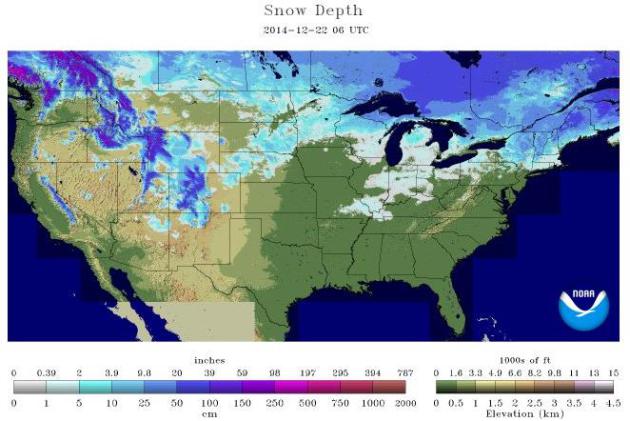
Who Will See A White Christmas This Year? As of yesterday NOAA NOHRSC 26.3% of the lower 48 was covered in snow. That's down from 27.5% on November 22. Higher terrain in the Rockies will see snow for Christmas, so will the Upper Midwest, Great Lakes and northern New England.
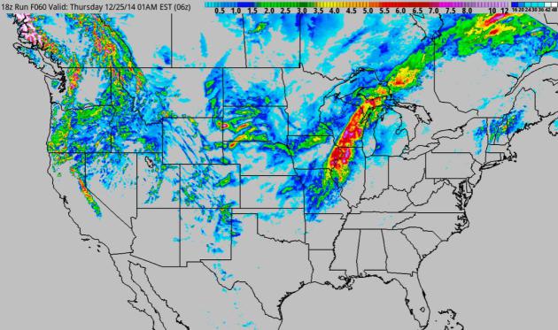
Midwestern Travel Complications. A storm tracking from New Orleans to Detroit will send a burst of moderate to heavy snow from near St. Louis to the Quad Cities, Madison, Milwaukee and Green Bay, where some hefty (4-5"+) snowfall amounts are possible on Christmas Eve. Good timing.
Christmas Eve Soaker Out East. Had this storm been brewing last winter (when December temperatures were consistently colder nationwide) we'd be looking at a foot or more of snow for much of the eastern USA. As it is there will be enough warm air in place for heavy rain from Atlanta to Raleigh, Washington D.C., New York and Boston. Flash flooding is possible with gusty winds capable of flight delays. But it won't be a worst-case travel scenario for the I-95 megalopolis.
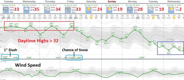
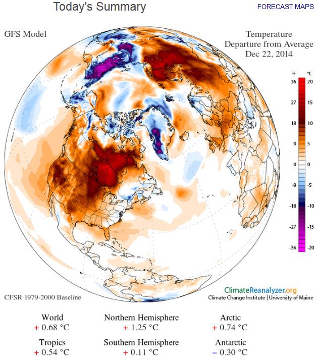
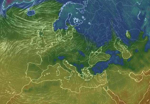
Image obtained using Climate Reanalyzer (http://cci-reanalyzer.org), Climate Change Institute, University of Maine, USA.
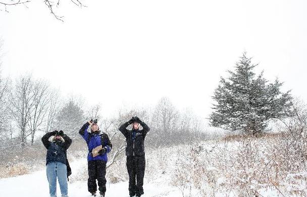
All About The Christmas Bird Count in Minnesota. The Star Tribune has more details on the CBC, which is quite a holiday tradition in Minnesota and much of North America; here's a clip: "...Dubbed
the world’s longest-running “citizen science” survey, the 115th annual
CBC will lure more than 70,000 volunteer birders afield in roughly 2,400
locations across the United States, Canada and parts of Latin America.
This year’s CBC runs from Dec. 14 through Jan. 5. “The Christmas Bird
Count has been happening in Minnesota for more than 100 years,” said
Mark Martell, director of bird conservation for Audubon Minnesota in St.
Paul, the state office of the National Audubon Society. “The counts
help accumulate an enormous amount of data about bird populations across
a very wide geographic range. There’s really nothing like it in the
world...” (File photo: Star Tribune).

TODAY: Rain/snow mix changes to mostly wet snow. Slushy lawns, wet roads. Winds: N 15. High: 35
TUESDAY NIGHT: Light snow tapers - a few icy patches. Low: 31
CHRISTMAS EVE: Mostly cloudy, better travel statewide. High: 35
CHRISTMAS DAY: Dreaming of a gray Christmas? Lot's of clouds. Wake-up: 28. High: 34
FRIDAY: Quick shot of PM show possible. Wake-up: 29. High: 32
SATURDAY: More clouds than sun, colder. Wake-up: 17. High: 22
SUNDAY: Peeks of sun, still seasonably chilly. Wake-up: 11. High: 23
MONDAY: Chance of light snow, flurries. Wake-up: 15. High: 19
Climate Stories...
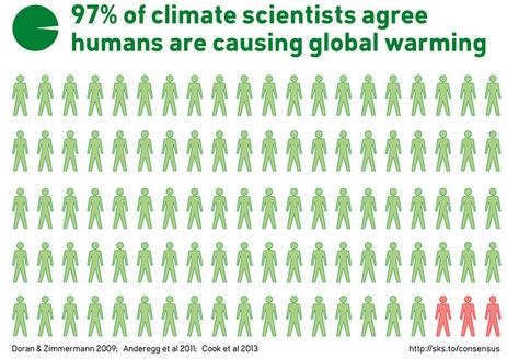
* With 2014 coming to a close, weather organizations and independent researchers have crunched the numbers and found that 2014 will almost certainly go down in history as the hottest year on record. Global land and sea surface temperatures for the year-to-date have already broken records, and December is seeing above-average temperatures as well.
* 2014 marks only the latest in a string of years with record-breaking heat, however. It has been 358 months since we had a cooler-than-average month, and the fifteen hottest years on record have all come since 1997.
* Assuming current trends hold throughout the last week of this month, 2014 has set a new global temperature record despite the fact that it is also an El Niño Southern Oscillation (ENSO)-neutral year.
- bullet points above courtesy of Climate Nexus.
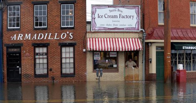
Photo credit above: "Sveinn Storm, owner of Storm Bros. Ice Cream Factory, surveys flood water outside his store in Annapolis, Md., on Oct. 30, 2012, in the aftermath of Superstorm Sandy." Image: Susan Walsh/Associated Press.
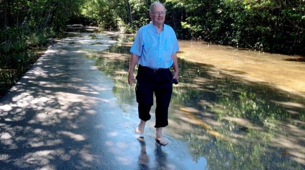
Photo credit above: "Rising concern: Geologist Harold Wanless takes a stroll through flooded Miami streets."
Rapid warming across Finland means that even Santa’s hopes for a white Christmas are shrinking.
The average temperature in the Arctic country has risen by more than 2C since 1847, twice as fast as the global average.
Warming is most extreme during the festive month, which is now 4.8C hotter than it was before the industrial era, Finland’s top scientists have found.
“In future, if the temperature rises, we will not have snow cover in December,” researcher Santtu Mikkonen told RTCC.
- See more at: http://www.rtcc.org/2014/12/22/fast-finland-warming-means-blue-christmas-for-santa/#sthash.h3Gk1l2O.dpuf
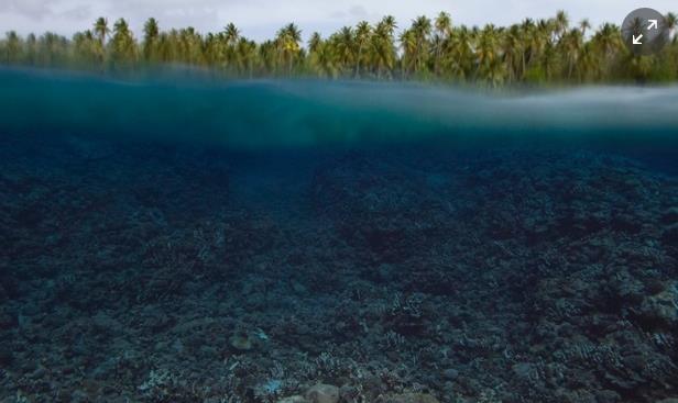
Photo credit above: "The destruction of coral reefs will make these vital barriers for the land less effective against the effects of climate change - such as sea level rise and storms." Location: Arno atoll, Marshall Island. Photograph: Remi Chauvin.
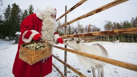
Photo credit: Visit Finland via Flickr.
Rapid warming across Finland means that even Santa’s hopes for a white Christmas are shrinking.
The average temperature in the Arctic country has risen by more than 2C since 1847, twice as fast as the global average.
Warming is most extreme during the festive month, which is now 4.8C hotter than it was before the industrial era, Finland’s top scientists have found.
“In future, if the temperature rises, we will not have snow cover in December,” researcher Santtu Mikkonen told RTCC.
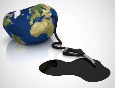
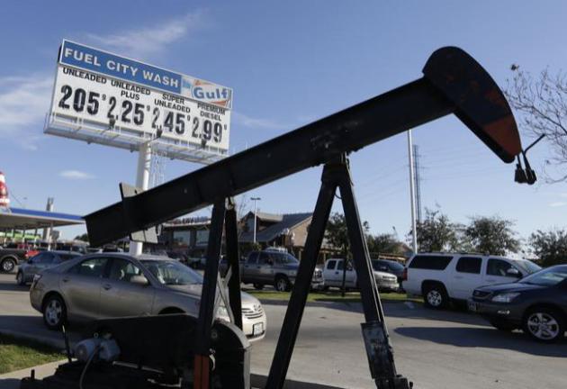
- See more at: http://www.rtcc.org/2014/12/22/fast-finland-warming-means-blue-christmas-for-santa/#sthash.h3Gk1l2O.dpufOil, Coal and Gas Soon Worthless? I wouldn't bet on this unfolding anytime soon, but history has a way of surprising most people. Here's an excerpt from a story at Deutsche Welle: "...World Bank President Jim Yong Kim earlier this year encouraged governments and business to consider withdrawing funding from oil, gas and coal companies. And the World Bank in November announced it will only fund coal projects in developing countries in extreme cases. "Climate change is threatening assets," said Georg Kell, director of UN Global Compact in an interview with DW. And investors are beginning to grasp this, he added..."
Photo credit above: "In this Dec. 15,
2014 file photo, vehicles line up to take advantage of low gas prices at
the Fuel City gas station in Dallas. The collapse of oil prices this
year has become a huge topic of worry and comfort for investors." (AP Photo/LM Otero, File)The average temperature in the Arctic country has risen by more than 2C since 1847, twice as fast as the global average.
Warming is most extreme during the festive month, which is now 4.8C hotter than it was before the industrial era, Finland’s top scientists have found.
“In future, if the temperature rises, we will not have snow cover in December,” researcher Santtu Mikkonen told RTCC.
- See more at: http://www.rtcc.org/2014/12/22/fast-finland-warming-means-blue-christmas-for-santa/#sthash.h3Gk1l2O.dpufOil, Coal and Gas Soon Worthless? I wouldn't bet on this unfolding anytime soon, but history has a way of surprising most people. Here's an excerpt from a story at Deutsche Welle: "...World Bank President Jim Yong Kim earlier this year encouraged governments and business to consider withdrawing funding from oil, gas and coal companies. And the World Bank in November announced it will only fund coal projects in developing countries in extreme cases. "Climate change is threatening assets," said Georg Kell, director of UN Global Compact in an interview with DW. And investors are beginning to grasp this, he added..."
What Would a 4C Warmer World Look Like? New Republic takes a look, and it's not pretty; here's an excerpt: "....This
future is not all that unlikely, since “present emission trends put the
world plausibly on a path toward” 7.2 degrees Fahrenheit (4°C) warming
by the end of the century, according to a 2014 report from the World Bank.
At that level, what might the planet look like? In starker language
than what scientists normally use, the report described the impacts at
7.2 degrees as "devastating," stating, "given that uncertainty remains
about the full nature and scale of impacts, there is also no certainty
that adaptation to a 4°C world is possible. This world means
"communities, cities and countries would experience severe disruptions,
damage, and dislocation, with many of these risks spread unequally..."
No comments:
Post a Comment