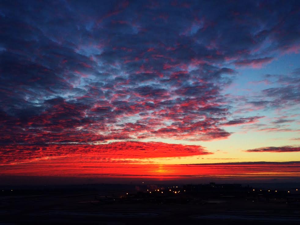
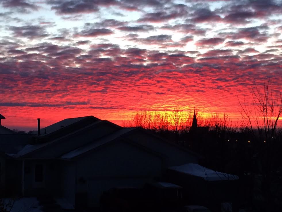
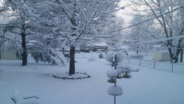
Any chance you got to see the sunrise Saturday morning?? What a treat it was! If you missed the briefly stunning colors, here you go! By the way... the Minneapolis Airport climbed to 42F at 2pm Saturday. That was the warmest day since December 15th (51F) and the warmest January day since January 31st, 2012 (45F)!!
Gentle January
By Paul Douglas
"Where's the snow?" It was a baffling drive up to Pelican Lake Friday, staring out at brown fields and bare highways. It looked like something out of late March. To quote Todd Nelson it's been a gentle January, our snowiest month on average - on paper - reduced to dribs and drabs; a nondescript collection of sputtering clippers. 42F yesterday at MSP, warmest January temperature since 2012.
New York and Boston may see a 1-2 foot blizzard by Tuesday; more evidence of an El Nino capable of a warmer, wetter (earlier) spring than we've seen in recent years. That's NOAA's long-range outlook.
We awake to another Canadian Disappointment. Last night's clipper painted a snowy stripe south and west of the metro; we'll be lucky to pick up a coating. Did I mention Dalhart, Texas has seen more snow than the Twin Cities this winter? Something not right about that.
Highs may top 40F Monday into Wednesday, followed by a late week tumble. I expect a Superbowl Sunday wind chill dipping to -15F. Yep, get ready for F-F-February.
Rice Park ice carvings drip for about 72 hours, but in the end a defiant King Boreas gets the last laugh at St. Paul's Winter Carnival. Somehow that seems fitting.
================
SATURDAY NIGHT: Snow developing, light coating. Low: 21. Winds: Turning NE 5-10.
SUNDAY: Snow tapers early. More sun later. High: 29. Winds: NNE 5-10
SUNDAY NIGHT: Clouds thicken again, light snow chance late. Low: 19. Winds: NNE 5-10.
MONDAY: Mostly cloudy, mild again. High: 40.
TUESDAY: Partly sunny, feels like March. Wake-up: 28. High: 42
WEDNESDAY: What January? Mild spike. Late day rain shower possible Wake-up: 27. High: 44
THURSDAY: Passing flurries, turning colder. Wake-up: 26. High: 31
FRIDAY: Fading sun, closer to average. Wake-up: 22. High: 29
SATURDAY: Arctic winds, sharply colder! Wake-up: 13. High: 15.
================
This Day in Weather History
January 25th
1964: A record high temperature of 64 is set at Redwood Falls.
================
Average High/Low for Minneapolis
January 25th
Average High: 24F (Record: 58F set in 1944)
Average Low: 7F (Record: -31F set in 1904)
================
Sunrise/Sunset Times for Minneapolis
January 25th
Sunrise: 7:40am
Sunset: 5:11pm
================
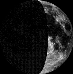
Moon Phase for January 25th at Midnight
0.9 Days Before First Quarter
===================
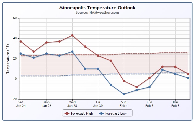
Minneapolis Temperature Trend
Our gentle January continues with high temperatures well above average through much of the rest of the month. Highs by Wednesday could be approaching the low/mid 40s even in the Twin Cities!! However, we are getting indications that the bottom may fall out as we head into the early part of February. Take a look at the big dip in the graphic below by the first couple of days of the month... YIKES!!!
======================
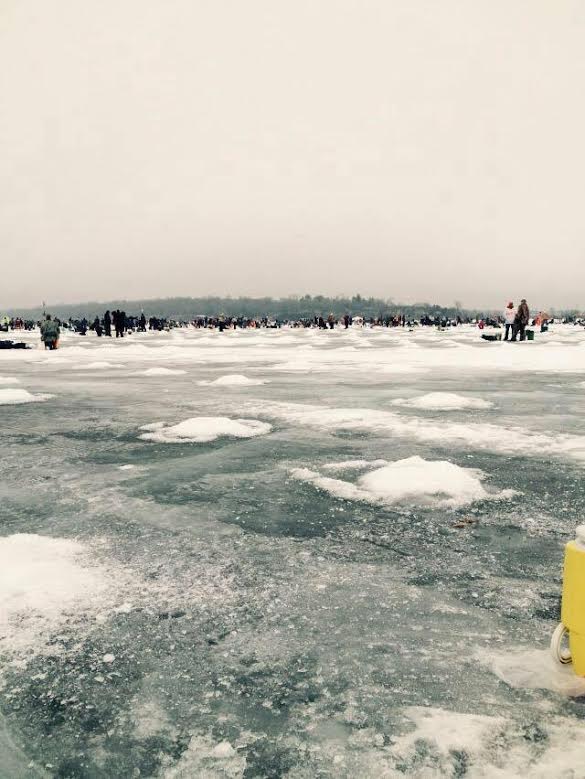
Brainerd Jaycees Ice Fishing Extravaganza
Thanks to my good friend Tina Tamura for the picture below who spent her Saturday on a frozen lake Gull Lake in Brainerd, MN at the Jaycee Ice Fishing Extravaganza! I definitely need to find a way to get to this next year!!!
Clipped by a Clipper
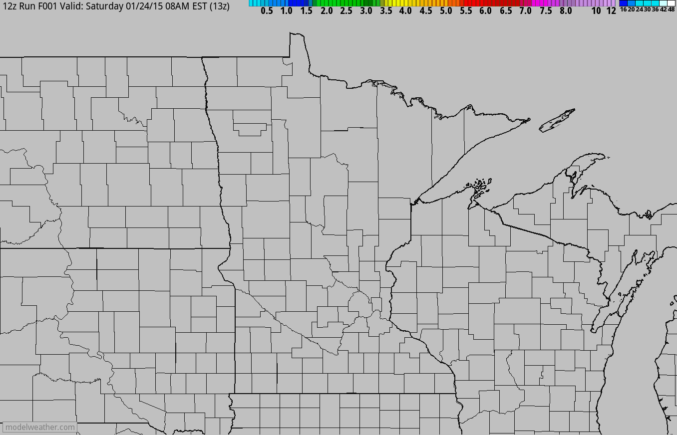
It certainly looked more promising earlier this week that folks across central Minnesota would have had some shoveling duties over the weekend, Mother Nature had other plans... When dealing with these finicky clipper systems (fast moving, moisture starved) a 100 mile shift east, west, north or south can make a HUGE difference on your eventual snow total. At one point earlier this week, the clipper looked like it was going to bring northeastern MN a plowable snow event, while at times is looked like central Minnesota would see some shoveling potential. The end result was a clipper that brought snow to mainly the Dakotas and southwestern MN... go figure! However, it appears that we'll be dealing with another clipper system late weekend/early next week. At this point, it looks like the main (light) snow belt will be across northeastern MN... stay tuned!
Sunday Weather Outlook
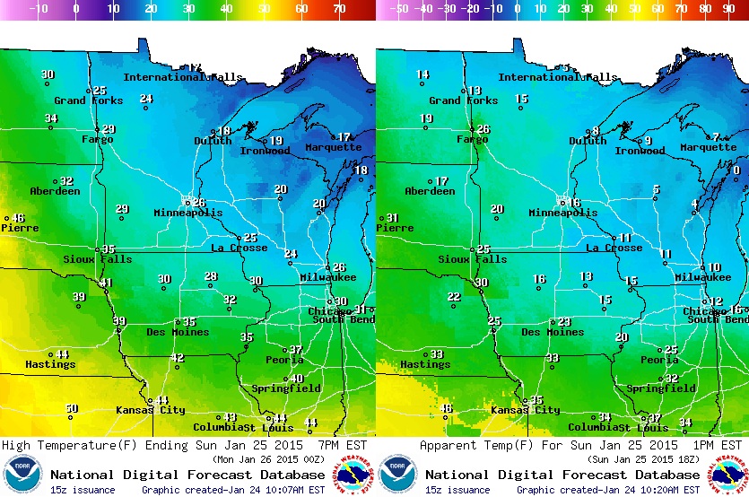
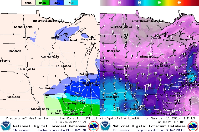
Temperatures on Sunday will be a little cooler post clipper. Despite the cool down, actual air temperatures will still be close to average in the mid 20s in the Twin Cities. The coolest readings will be across northeastern MN with highs in the teens. A light NNE breeze will make it feel more like the teens, but still not too bad for late January!
Sunday Weather Outlook
Our clipper system will quickly find itself in the Ohio Valley by Sunday afternoon, so expect some sunshine in the afternoon as weather conditions improve. There may still be a little light lake effect snow on the western side of Lake Superior, but much of the region will be cooler and quieter on Sunday.
A Snowy Friday in Franklin County, Kentucky
Thanks to @Peachbug for the picture below out of Franklin County, Kentucky were nearly 5" of snow fell late Friday!
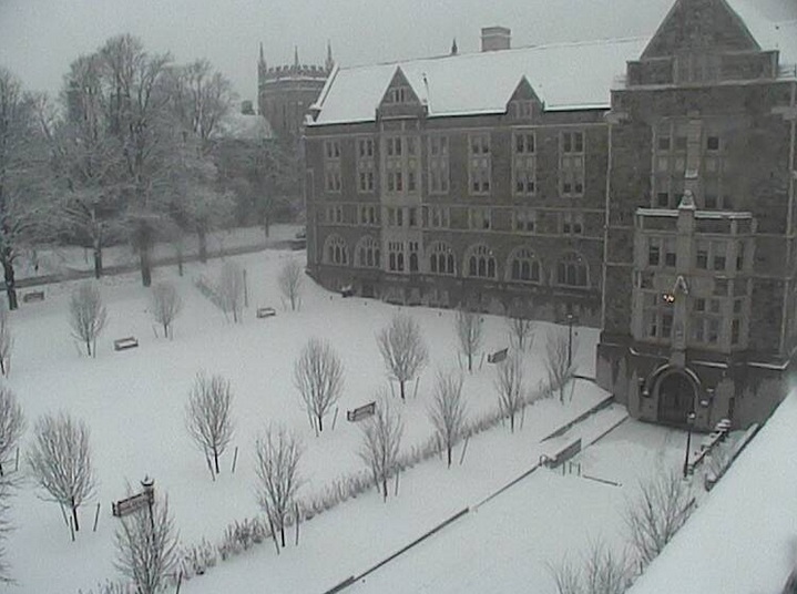
A Snowy Saturday in Boston
This was the view from St. Mary's Hall at Boston College on Saturday morning during times of moderate to heavy snow. See the latest views from Boston College HERE:
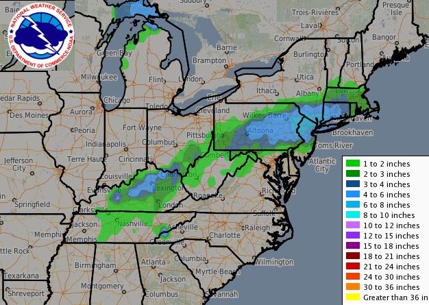
24 Hour Snowfall Analysis (7am Friday - 7am Saturday)
Friday and Saturday's snowfall event fell in a fairly narrow band from the Ohio/Tennessee Valley to the Northern New England States. There were reports of 6" to nearly 12" along this path!
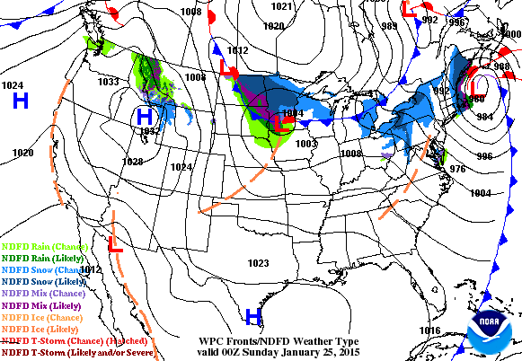
National Weather Outlook
Looking at the weather loop below, much of the nation will stay quiet through early next week with the exception of the northeastern quadrant of the country. A storm system departing the northeast late Saturday/early Sunday will give way to a fast moving clipper moving in from the Midwest. The fast moving clipper could may things quite interesting by Monday/Tuesday of next week as it intensifies along the East Coast. Heavy snow and wind could become a major talker early next week for folks in the Northeast. This clipper will also be responsible for some shovelable snow for folks in the Ohio Valley Sunday/early Monday.
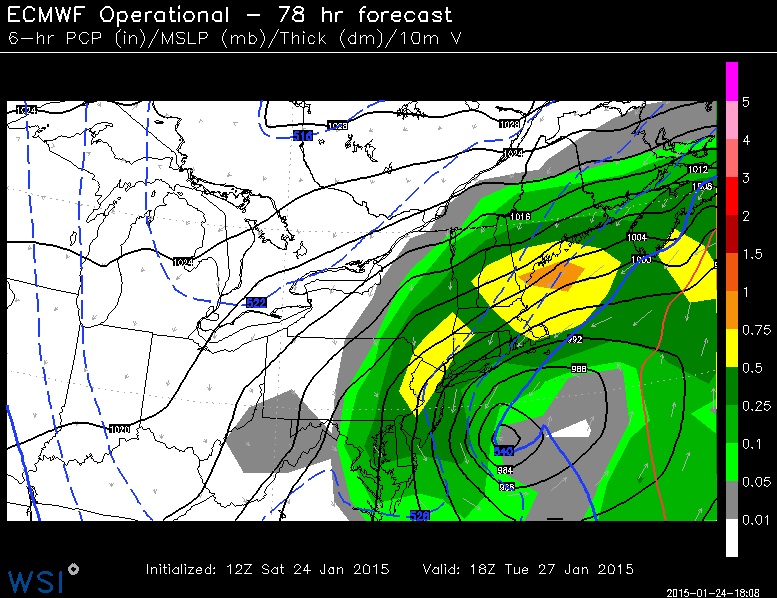
Nor'Easter Early Next Week?
Weather models are starting to come together for what could be a VERY interesting situation early next week in the Northeast. The clipper system that skimmed the Twin Cities over the weekend could become a fairly formidable storm in the Northeast early next week. The track of the storm and the temperature profile will be a HUGE factor to whether or not this storm pans out. The potential exists for significant wind and snow. Travel would become significantly impacted if this in fact does pan out... Stay tuned for more!!
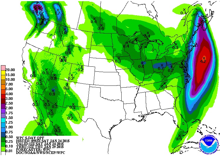
5 Day Precipitation Forecast
According to NOAA's HPC, the 5 day precipitation forecast looks fairly active from the Midwest to the Northeast. The Saturday/early Sunday system will wrap up, but there's another clipper that will be heading in over the late weekend/early next week time frame with more snow potential! The other interesting thing to note about the graphic below is the moisture moving into the Southwestern U.S.!
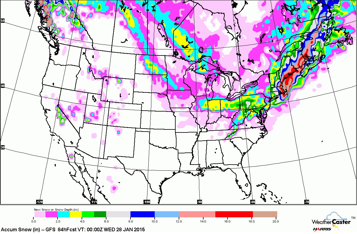
National Snowfall Potential
Heavy snowfall potential continues! WOW! Look at what a few folks in the Northeast could be dealing with through early next week! Due to 2 separate systems, quite a few folks will be be adding shoveling/plowing duties to their agenda. Note that snowfall tallies in Minnesota look way less than areas even in the Ohio Valley! One other area of interest is parts of the Sierra Nevada Range in California! Moisture moving up from the Eastern Pacific could lead to some much needed high elevation snowfall!
The Arctic Oscillation Reveals Colder Weather Ahead
Take a look at the Arctic Oscillation forecast below... note how the forecast red lines dip below the '0' line... this entails that our Arctic Oscillation may be trending towards the negative phase, thus indicating the potential of colder weather ahead! While forecasting specifics for several weeks in advance can be quite difficult, forecasting 'trends' can be a little easier.
"NASA climatologist Dr. James E. Hansen explains the mechanism by which the AO affects weather at points so distant from the Arctic:"
"Positive and negative phases of the Arctic Oscillation"
"The degree to which Arctic air penetrates into middle latitudes is related to the AO index, which is defined by surface atmospheric pressure patterns. When the AO index is positive, surface pressure is low in the polar region. This helps the middle latitude jet stream to blow strongly and consistently from west to east, thus keeping cold Arctic air locked in the polar region. When the AO index is negative, there tends to be high pressure in the polar region, weaker zonal winds, and greater movement of frigid polar air into middle latitudes."
Read more about the AO HERE:
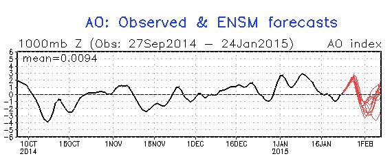
Temperature Outlook
While looking at the graphics below, note the AO Forecast (above). It is interesting to note that the positive AO corresponds with the warmer weather through the week ahead, while the negative AO corresponds to the potential cold snap during the early part of February!
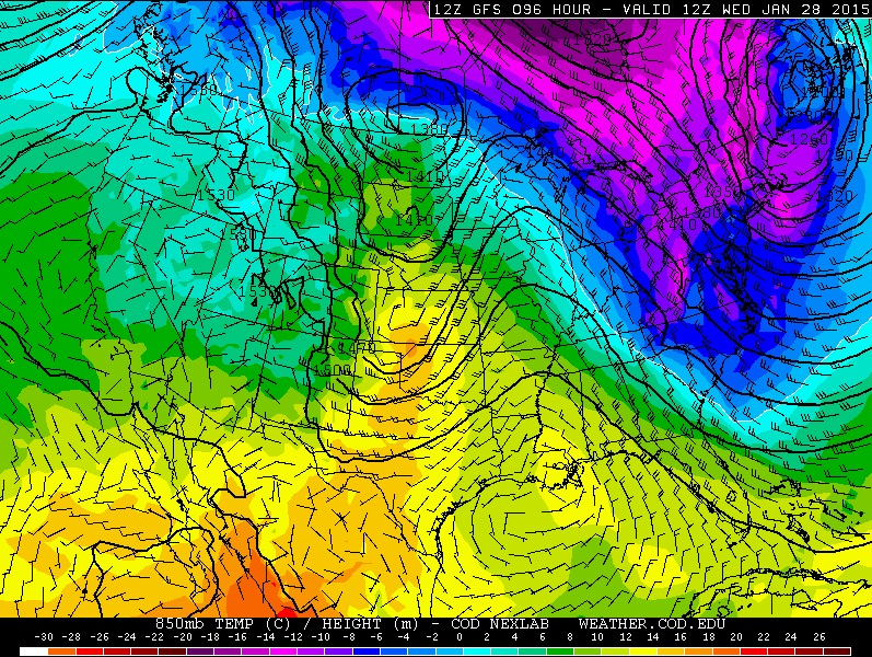
Warm Wednesday: 850mb Temperatures
Here's a look at the 850mb temperature map for AM Wednesday. Note that a large part of the mid-section of the country looks quite mild at this time...
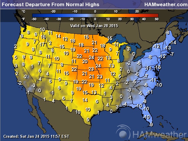
Wednesday Highs From Average
A quick look at the high temperatures from average on Wednesday suggests that a large chunk of the mid-section of the nation could be nearly 10° to 20° + degrees above average!
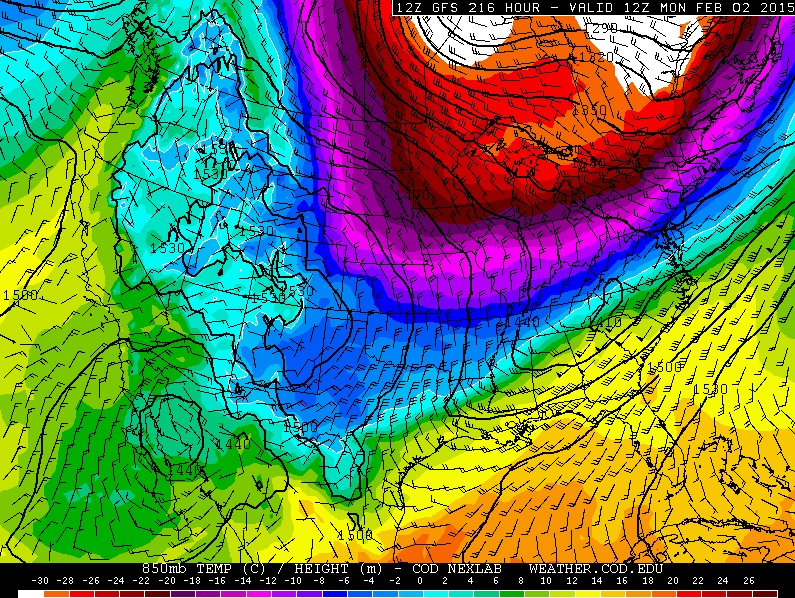
Frigid Start to February?
A look at the long range temperatures maps suggest a fairly good poke of Arctic air heading into the Lower 48 by early February. Again, note how the AO forecast (above) shows that during this time, we go into a negative AO phase!
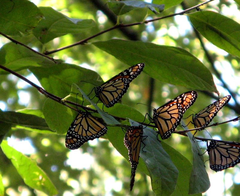
Monarch Butterflies to be Added to Endangered Species List ??
Here's an interesting story from SmithsonianMag.com about how the loss of milkweed has contributed to the dwindling monarch butterfly population sine the mid 90s...
See more from SimthsonianMag.com HERE:
"The monarch butterfly, perhaps the most recognizable butterfly in North America, is in trouble: since the mid-1990s, their population has declined 90 percent from its 20-year average, and their wintering colonies in Mexico now occupy the smallest amount of land they have since 1993. Illegal logging around their wintering sites in Mexico, as well as the loss of milkweed in the midwestern United States, threatens their magnificent migrations from Canada to Mexico—one of the most spectacular annual occurrences in the insect world. Earlier this year, the U.S. Fish and Wildlife Service announced that it would launch a year-long study into whether the monarch butterfly should be placed on the Endangered Species list, thus giving it federal protection."
(Photo Courtesy: Flickr user Andrea_44)
It's 3 Minutes to Midnight...
Here's another interesting story from abc.net.au about how we are all now a little closer to "Doomsday" due to the rising threat from climate change and nuclear arsenals...
Read more from abc.net.au HERE:
"Rising threats from climate change and nuclear arsenals prompted the scientists who maintain the Doomsday Clock, a symbolic countdown to global catastrophe, to move it two minutes closer to midnight on Thursday, its first shift in three years. The Doomsday Clock, devised by the Chicago-based Bulletin of the Atomic Scientists, now stands at three minutes to midnight, or doomsday. It has been adjusted 18 times since its creation in 1947. It has been set as close as two minutes to midnight, in 1953 when the United States tested a hydrogen bomb, and as far as 17 minutes from midnight, in 1991 as the Cold War expired."
(Scientists speak during a press conference after updating the Doomsday Clock in Washington from five minutes to midnight to three minutes to midnight. AFP: Win McNamee/Getty Images)

Thanks for checking in and have a great rest of your weekend! Don't forget to follow me on Twitter @TNelsonWX

No comments:
Post a Comment