75 F. high in the Twin Cities Sunday.
56 F. average high on April 12.
55 F. high on April 12, 2014.
April 12, 1931:
July-like temperatures across the area with 90 degrees at Beardsley in
west central Minnesota. Source: Twin Cities National Weather Service.
"Adirondack Day"
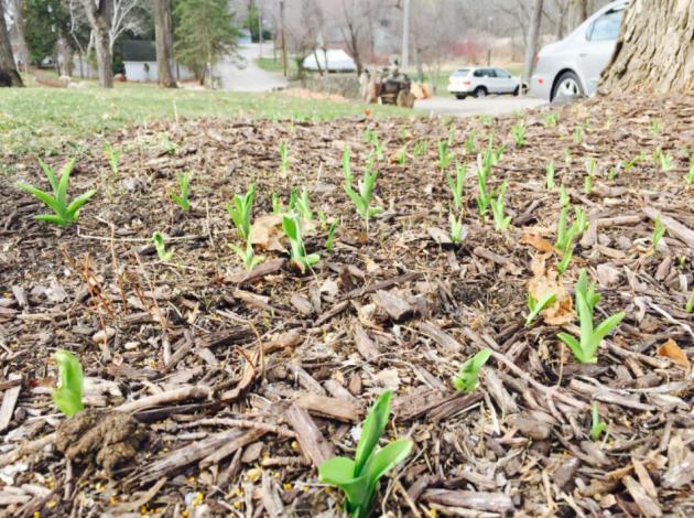
"Life stands before me like an eternal spring, with new and brilliant clothes" wrote Carl Friedrich Gauss.
I keep a pair of shorts and flip flops prominently displayed in my closet year-round, there to remind me that everything turns around. The cold and darkness, the dead of winter, gives way to warmth, life and rebirth. Some years earlier than others. A year ago lakes were ice-covered; spring a distant illusion.
So often we go from slush to heat advisories in a meteorological blink of an eye. It's nice to savor a real spring, a pregnant pause of possibility before the rush of bugs, sweaty storms and mad dashes up to the lake.
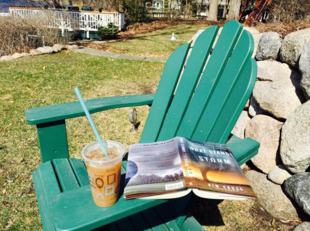
Yesterday renewed my faith in a Minnesota spring. We dragged our Adirondack chairs out of cold storage, then I happily escorted the space heater back into the garage. Good riddance.
A fine week is shaping up: 60s into Sunday with little or no drama. We cool off 10-15 degrees today with a stiff west breeze - but not nearly as windblown as Sunday was. T-showers may speckle the Doppler midweek, a better chance of rain a week from today. A series of clippers the latter half of April keep us from overheating too quickly.
A real spring? What a concept.

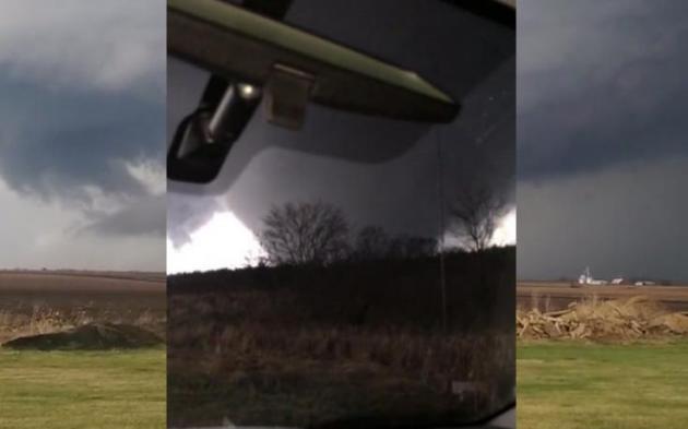
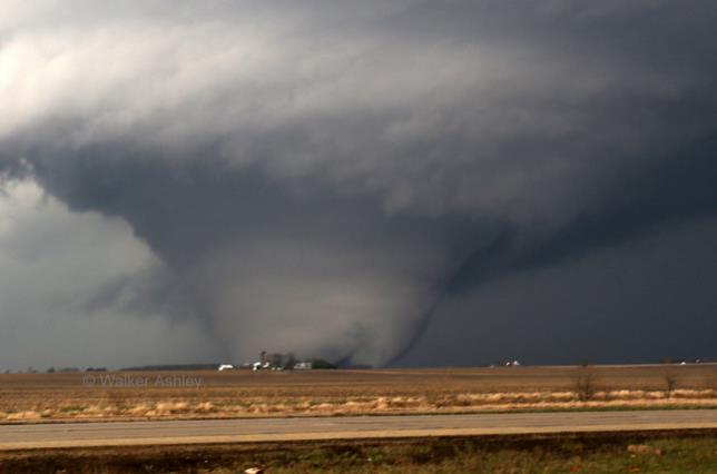
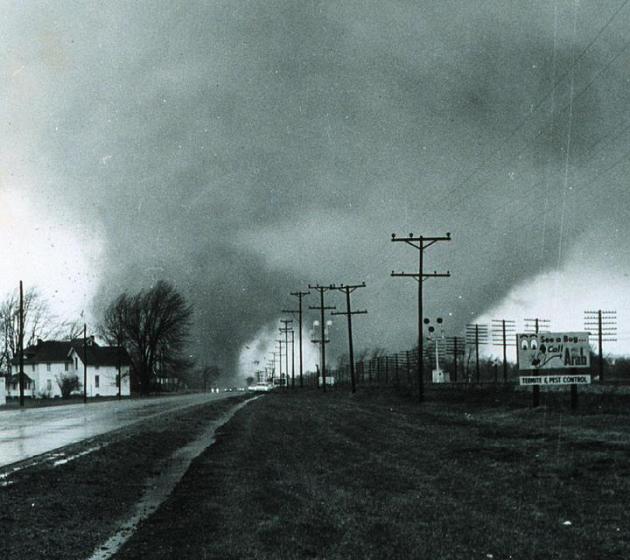
Rochelle Tornado "Stuck Out Like A Sore Thumb" for Meteorologists. Journal Standard in Freeport, Illinois takes a look at best practices for tornado warnings, and whether there is such a thing as too much lead time; here's an excerpt: "...
"I’m not sure we need more warning time for some tornadoes," Sebenste said. "Psychological studies have shown that once you get more than 13 minutes of warning and nothing has happened, people will come out of their basements and look around. That has actually killed some people.""A researcher in Texas has established pretty convincingly that 15 minutes is the ideal amount of notice for a tornado," Smith said, "and if you have more than 18 minutes, deaths go up. ... People either lose the sense of urgency to take cover or try to flee instead of immediately taking shelter, which is what we want them to do..."
Photo credit above: "In this Thursday, April 9, 2015 photo provided by Northern Illinois University meteorology professor Walker Ashley, a funnel cloud moves through near Rochelle, Ill. The National Weather Service says at least two tornadoes churned through six north-central Illinois counties on Thursday evening." (AP Photo/Walker Ashley)
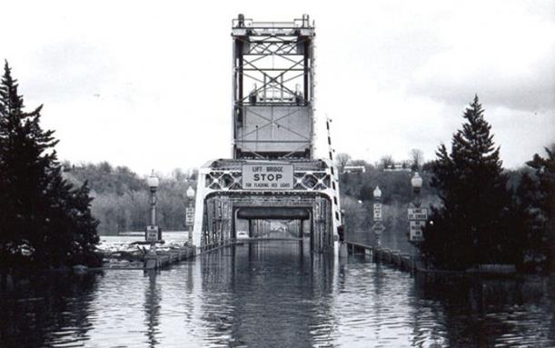
Flood Of The Century: 50 Years Ago Easter Weekend Saw Record Crest for the St. Croix.
The flood of '65 was truly historic, one for the record books, with the
highest crest on record for the Minnesota River at Shakopee. Stillwater
was also hit hard; here's an excerpt from The Stillwater Gazette: "On
Easter weekend 1965, Stillwater’s Main Street was shut down. Beginning
at 8 a.m. on Good Friday, no one was allowed east of Second Street
without an emergency pass. According to news reports from the time, the
closure was unprecedented in Stillwater history; so were the record flood levels threatening downtown.
Water covered the lift bridge’s driving surface, and a 5,000-foot-long
dike built by teenagers served as the only barrier preventing the St.
Croix River from bursting onto Main Street..."
50 Year Anniversary of Palm Sunday Tornado Outbreak.
'65 was a tough year, for spring river flooding and tornadoes, leading
up to the May 6, 1965 outbreak in the Twin Cities, when Fridley was hit
by two EF-4 strength tornadoes. Here's an excerpt of a Wikipedia account of the Palm Sunday outbreak: "The second Palm Sunday tornado outbreak occurred on April 11–12, 1965, in the Midwest U.S. states of Indiana, Ohio, Michigan, Wisconsin, Illinois and Iowa,
with 47 tornadoes (15 significant, 17 violent, 21 killers). It was the
second-biggest outbreak on record at the time. In the Midwest, 271
people were killed and 1,500 injured (1,200 in Indiana). It was the
deadliest tornado outbreak in Indiana history, with 137 people killed.[1]
The outbreak also made that week in April 1965 the second-most-active
week in history, with 51 significant and 21 violent tornadoes. Despite
having 17 F4 tornadoes, 6 of them (4 in Indiana, and 2 in Ohio) are
questionable, and may have been F5's. (Photo credit: Paul Huffman, NOAA).
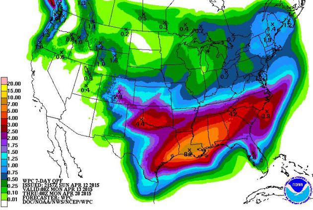
Another Southerly Detour.
For the better part of 9-10 months storms have been (consistently)
tracking south and east of Minnesota, another symptom of the
ridiculously resilient ridge of high pressure straddling the west coast,
creating one of the worst droughts in a millenia for California. That
pattern lingers with some 6-10" rains for the Gulf Coast and Deep South,
while rainfall remains light and spotty for the Upper Midwest.
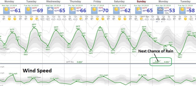
April Gets Better.
A streak of 60s, even a shot at 70F Tuesday, again Friday? What's not
to like - other than the lack of additional puddles. A dry pattern
lingers with the next chance of widespread rain about 1 week from today,
based on European guidance.
TODAY: Sunny, windy, a bit cooler. Winds: W 15-25. High: 63
MONDAY NIGHT: Clear and comfortably cool. Low: 38
TUESDAY: Blue sky, beyond pleasant. Winds: S 10. High: near 70
WEDNESDAY: Less sun, isolated T-shower? Wake-up: 46. High: 66
THURSDAY: Mix of clouds and sun. Wake-up: 48. High: 64
FRIDAY: Clouds increase, showers up north. Wake-up: 49. High: 68
SATURDAY: Blue sky, still too dry out there. Wake-up: 45. High: 64
SUNDAY: Breezy with lukewarm sunshine. Wake-up: 47. High: 66
Climate Stories...

Pope Francis Is A Powerful Messenger for Climate Change. Here's a snippet from a story at Quartz: "This
summer, Pope Francis plans to release an encyclical letter in which he
will address environmental issues, and very likely climate change.
His statement will have a profound impact on the public debate. For
one, it will elevate the spiritual, moral and religious dimensions of
the issue. Calling on people to protect the global climate
because it is sacred, both for its own God-given value and for the life
and dignity of all humankind, not just the affluent few, will create
far more personal commitment than a government call for action on
economic grounds or an activist’s call on environmental grounds..." (File photo: AP).
Photo credit above: "Freshman education major, Josh Medel, has his picture taken by alumna Anjali Cadambi for social media." Emily Cohen/NewsWorks.
No comments:
Post a Comment