
Getting Better - Balmy Weekend - Cooler Next Week
By Paul Douglas
You do realize we could be slipping and sliding on snow right now? Accumulating flakes are mercifully rare in late September, but theoretically possible. On September 24, 1985 half an inch of snow delighted Twin Cities commuters. I was standing in KARE-11's Backyard; I remember the collective gasp. "How is this possible?" Well, the sun is as high in the sky as it was in mid-March; longer nights are brewing colder airmasses over Canada which can dribble south.
A strong El Nino should, in theory, trigger more storms for California, and a more zonal, west to east steering wind, pumping milder Pacific air into Minnesota. Odds favor fewer jaw-dropping arctic outbreaks than usual. But we will see cold fronts. That I can predict with rare 100% accuracy.
A shot of cooler air arrives next week but no prolonged chill is shaping up - yet. The sun peeks out Friday; upper 70s Saturday, maybe low 80s Sunday before an outbreak of sweatshirts by Tuesday. 70s return later next week; a lukewarm start to October.
We have precious little to complain about in the weather department, for a change!
_____________________________
THURSDAY NIGHT: Lingering showers early, then turning partly cloudy. Patchy fog possible. Low: 58. Winds: ENE 5mph
FRIDAY: Cloudier, foggier start. More PM sun. Winds: ESE 5-10mph. High: 74
FRIDAY NIGHT: Mostly clear and quiet. Winds: ESE 5mph. Low: 57
SATURDAY: Warmer, more sunshine. Winds: SSE 5-10mph. High: 79
SUNDAY: Warm sun, lake-worthy. PM thunder up north? Winds: S 10-20. Wake-up: 59. High: 82
MONDAY: Clouds increase, mild. Wake-up: 61. High: 76
TUESDAY: Cooler wind. Showery. Wake-up: 60. High: 62
WEDNESDAY: Patchy clouds, chilly. Wake-up: 50. High: 57
THURSDAY: Partly sunny, milder. Wake-up: 52. High: 73.
_______________________________
This Day in Weather History
September 25th
1998: A wind gust to 78 mph was reported at Staples Municipal Airport, just to the north of Staples in Wadena County. In Todd county, trees were blown down in the city of Staples. Buildings were damaged at a farmstead on the northwest edge of the city. A roof was torn off of Stern Rubber Company. Rooftop heating and cooling units were ripped off McKechnie Tool and Engineering. In Mille Lacs County, 3 inch hail was reported, damaging many automobiles.
1929: Willmar experiences a deluge that dropped 5.22 inches in 24 hours.
_____________________________
Average High/Low for Minneapolis
September 25th
Average High: 68° (Record: 91° set in 1920)
Average Low: 48° (Record: 31° set in 1926)
_______________________________
Sunrise/Sunset Times for Minneapolis
September 25th
Sunrise: 7:03am
Sunset: 7:05pm
_______________________________
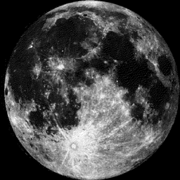
Moon Phase for September 25th at Midnight
1.8 Days Until Full Moon
______________________________________
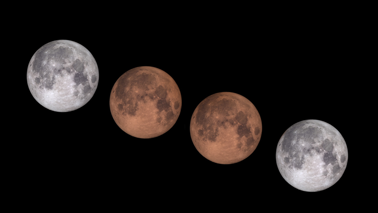
Lunar Eclipse September 27th
If you haven't heard yet, there will be a lunar eclipse this Sunday evening, which will be visible locally, weather permitting. Here are the times you can view different stages of the eclipse.
Central Daylight Time (September 27, 2015)
Partial umbral eclipse begins: 8:07 p.m. CDT on September 27
Total eclipse begins: 9:11 p.m. CDT
Greatest eclipse: 9:47 p.m. CDT
Total eclipse ends: 10:23 p.m. CDT
Partial eclipse ends: 11:27 p.m. CDT
(Image Courtesy: Space.com)
___________________________________
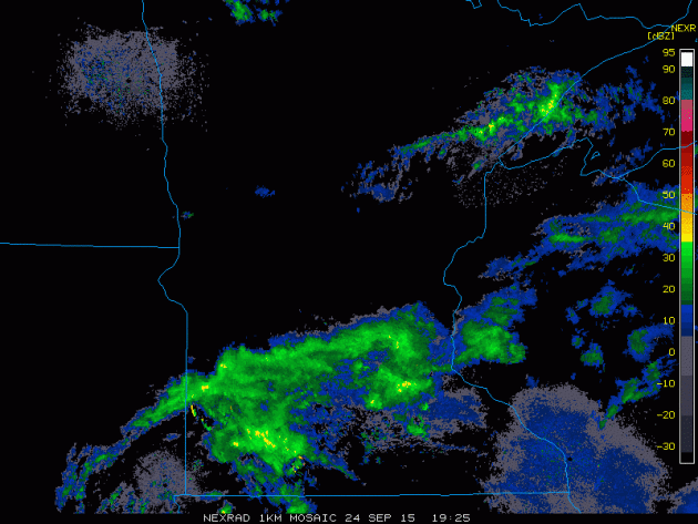
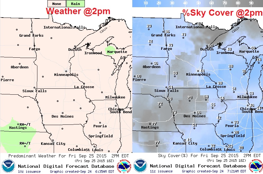
Thursday's Rain
It was a bit soggy on Thursday with much of the rain falling during the early half of the day. However, showers held on for much of the evening across the southern part of the state.
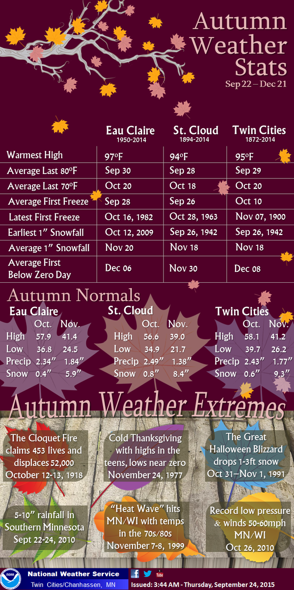
Fall Weather Stats
With Fall officially starting on Wednesday, the National Weather Service made a list of Autumn Weather Stats... see below:
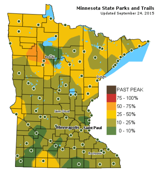
Fall Color Update
According to the MN DNR, fall colors are now finally starting to show in many areas across the state, especially up north, where some areas are already near 50%. While we're like still a few weeks away from some serious peeping, this will be a wonderful weekend to get out and find some fall signs.
See more from the MN DNR HERE:
______________________________________
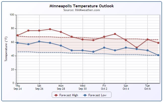
Minneapolis Temperature Trend
Looking at the temperature trend below, there is anything too eye-opening about the extended forecast other than being mostly warmer than normal. At this point, I don't see any attention getting cold front or major storm systems that we'll have to watch for.
_______________________________
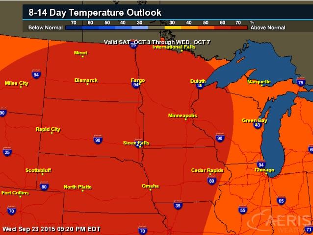
8 to 14 Day Temperature Outlook
It was been a warm September so far with temperatures running nearly 5F to 6F above average in the Twin Cities, St. Cloud and Duluth. According to NOAA's CPC, the 8 to 14 day temperature outlook keeps temperatures quite warm into early October.
_________________________________
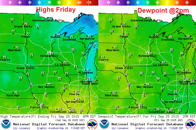
Friday Weather Outlook
Temperatures on Friday look to be much warmer than that of Thursday. Highs in the 70s look to be widespread across the entire region with comfortable dewpoints in the upper 50s to near 60F
Friday Weather Outlook
Friday looks like a fairly enjoyable day with gradual clearing, mild temperatures and light winds.
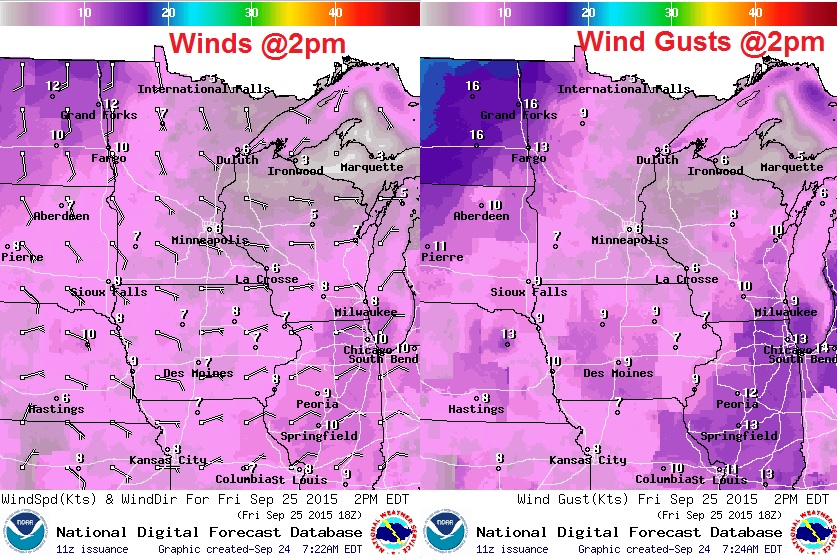
Friday Weather Outlook
After a couple of soggy days Wednesday and Thursday, Friday may be a little slow to clear across the region, but expect more sunshine the second half of the day and more clearing through the evening.
___________________________________
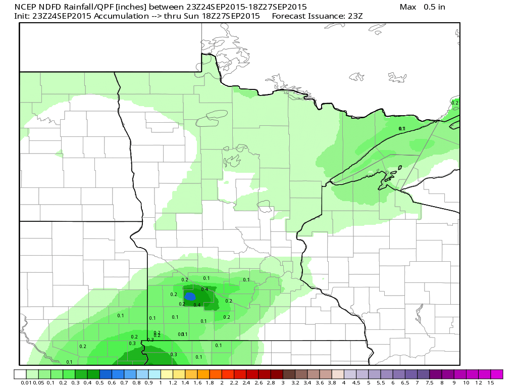
Rainfall Outlook
Any additional rainfall from PM Thursday looks to be fairly light across the extreme southern part of the state. Weather conditions on Friday will be drier and warmer.
__________________________________________
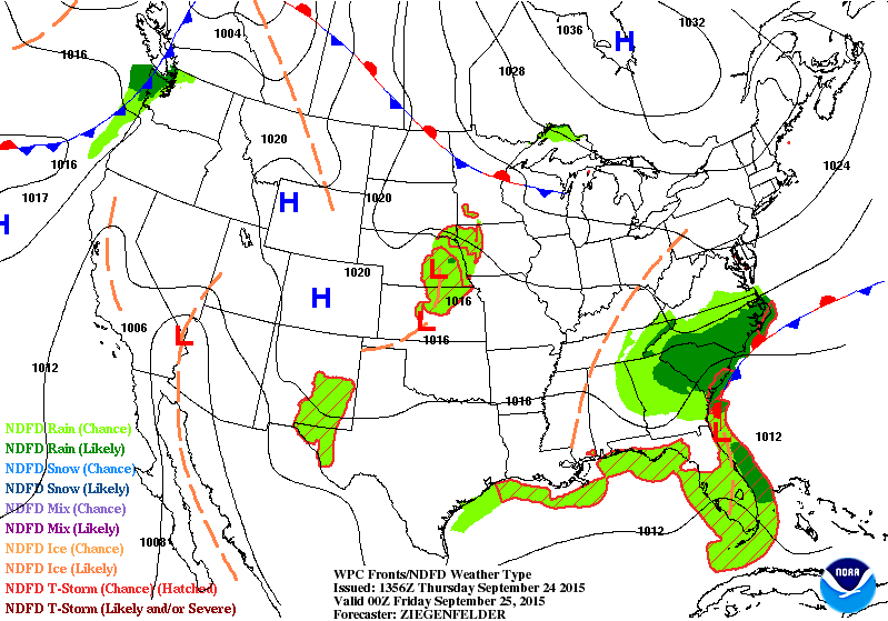
National Weather Outlook
Heavy rains that fell from the Southwest to the Midwest over the last few days was thanks to the remnants of Tropical Depression Sixteen in the Eastern Pacific. That rain will fade into Friday, while heavier rains look to develop and continue over parts of the Mid-Atlantic States.
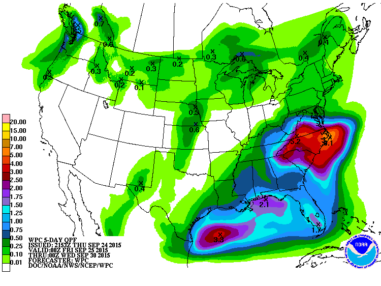
Precipitation Outlook
According to NOAA WPC, heavy rains will really kick in through the Mid-Atlantic states over the next few days with rainfall tallies nearing 4" to 6"+. Localized flooding will be possible over the next couple/few days.
______________________________________
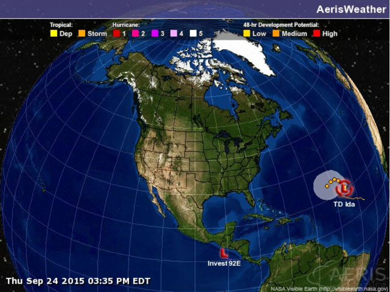
Tropical Basin
Here we are a couple of weeks past the historical peak of the Atlantic Hurricane Season and the tropics are fairly quiet right now... The only storm in the Atlantic is that of Tropical Depression Ida, which has been downgraded from Tropical Storm strength.
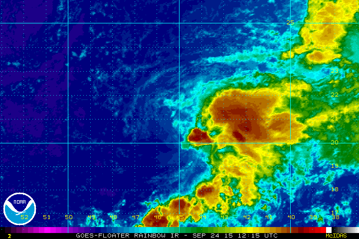
Ida Weakens...
This was the remnants of Tropical Storm Ida PM Thursday, which looked pretty disorganized. Note that the brighter clouds (thunderstorms) seem to be blowing east off of the main area of circulation.
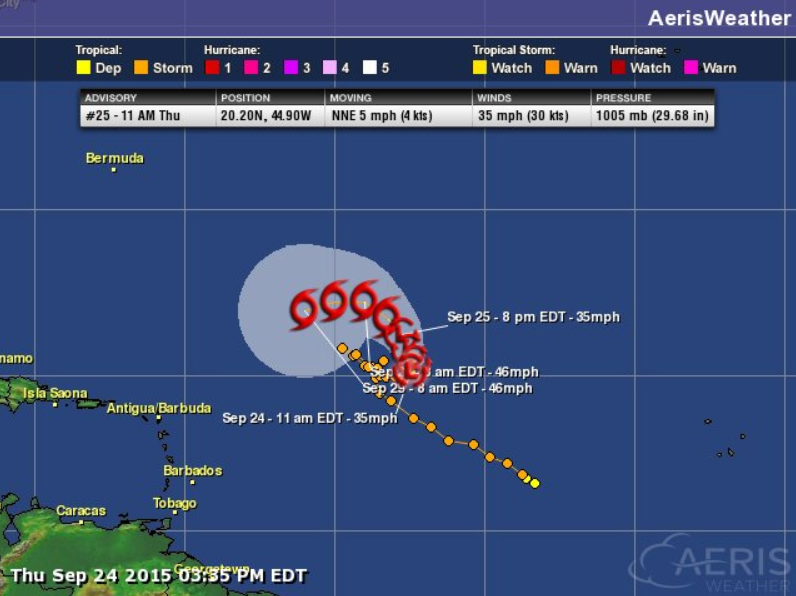
Tracking Ida
Although Ida had been downgraded, the forecast calls for additional strengthening by the end of the week/weekend ahead.
Thanks for checking in and have a great rest of your week/weekend ahead! Don't forget to follow me on Twitter @TNelsonWX

Hi Paul!
ReplyDeleteHow does the forecast look for the Twin Cities Marathon on Sunday, October 4th??
Thanks!
Kari