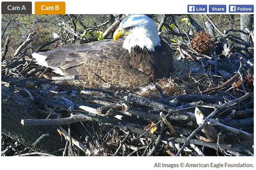
WOW - This is cool!! Watch a pair of Bald Eagles LIVE as they nest in Washington D.C.!!
"In 2014, a pair of mated Bald Eagles chose the most idyllic of nest sites within the United States’ National Capital (Washington, DC), nestled high in a Tulip Poplar tree amongst the Azalea Collection at the U.S. National Arboretum, which is operated by the United States Department of Agriculture. This is the first Bald Eagle pair to nest in this location since 1947. The two Eagles have been iconically named “Mr. President” and “The First Lady.” Join us in viewing the most patriotic nest cam in the United States, 24 hours a day."
See the LIVE cam HERE:
_________________________________________
Spits of Snow - Warming Trend Early Next Week
By Paul Douglas
Spring is always two steps forward, one step back. Nature never (ever) moves in a straight line. Warm air can't push the last gasps of Canadian chill out of the way; cold air has to retreat on its own.
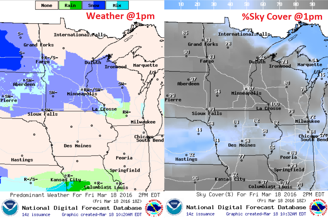
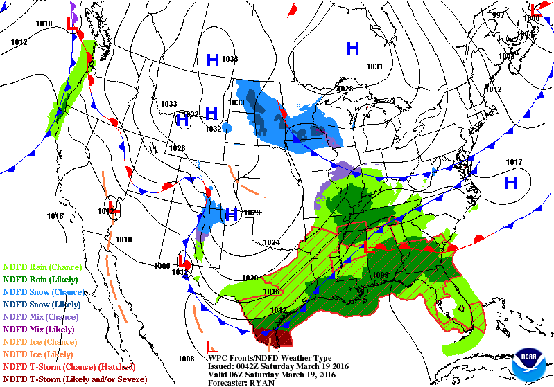
A cold, cyclonic twist of air high overhead may slush up lawns and bewildered robins this morning; the best chance of a sloppy inch south of the Minnesota River. Roads may be slick before 9 AM, but a September-like sun angle should mean wet roads most of the day as flurries taper. More of a cosmetic snowfall; a blunt reminder it's still March.
Out east cherry blossoms are blooming in DC. A coastal storm may paste Washington, New York and Boston with a few slushy inches, maybe enough to shovel & plow; a far cry from 70s and 80s last week. Serious weather whiplash.
No drama close to home; 40s return Sunday with a shot at 50F by Tuesday. ECMWF guidance hints at a sloppy mix late next week, but don't count on a snow day anytime soon.
NOAA's GFS hints at rapid warming in April. I suspect the greening and flowering of Minnesota will arrive 2-3 weeks earlier than usual this year.
__________________________________________
Extended Forecast
FRIDAY NIGHT: Mostly cloudy, slight chance of snow. Winds: NE 5-10. Low: 28.
SATURDAY: Nagging clouds and flurries, slushy coating possible (mainly south). Winds: NE 5. High: 39
SATURDAY NIGHT: Mostly cloudy. Winds: N 5. Low: 27.
SUNDAY:More sun, trending milder. Winds: NW 10-15. High: 42
MONDAY: Partly sunny, feels like spring. Winds: SE 10-20. Wake-up: 29. High: 45
TUESDAY: Mostly cloudy and milder. Winds: NE 7-12. Wake-up: 34. High: 50
WEDNESDAY: Overcast, light mix possible. Winds: E 10-15. Wake-up: 37. High: 43.
THURSDAY: Cold rain or mixed precipitation. Winds: NE 10-20. Wake-up: 35. High: 39.FRIDAY: Flurries taper, colder wind. Winds: Winds: NW 10-15. Wake-up: 31. High: 37.
______________________________________________
This Day in Weather History
March 19th
2012: This is the 4th day in a row that the Twin Cities reaches at least 79 degrees, and the 8th record high in a 10 day span.
1977: An energy emergency finally ends in Minnesota. It was caused by the extended cold.
_______________________________________________
Average High/Low for Minneapolis
March 19th
Average High: 43F (Record: 61F set in 2012)
Average Low: 25F (Record: -15F set in 1875)
________________________________________________
Sunrise/Sunset Times for Minneapolis
March 19th
Sunrise: 7:17am
Sunset: 7:25pm
*Daylight Gained Since Yesterday: ~3mins & 9secs
*Daylight Gained Since Winter Solstice (Dec. 21st): ~3hours & 21mins
_________________________________________________
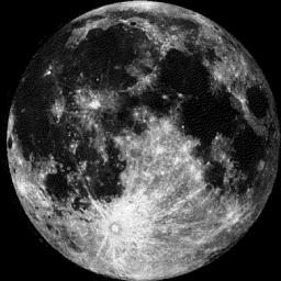
Moon Phase for March 19th at Midnight
3.2 Days Until Full (Worm) Moon
_________________________________________
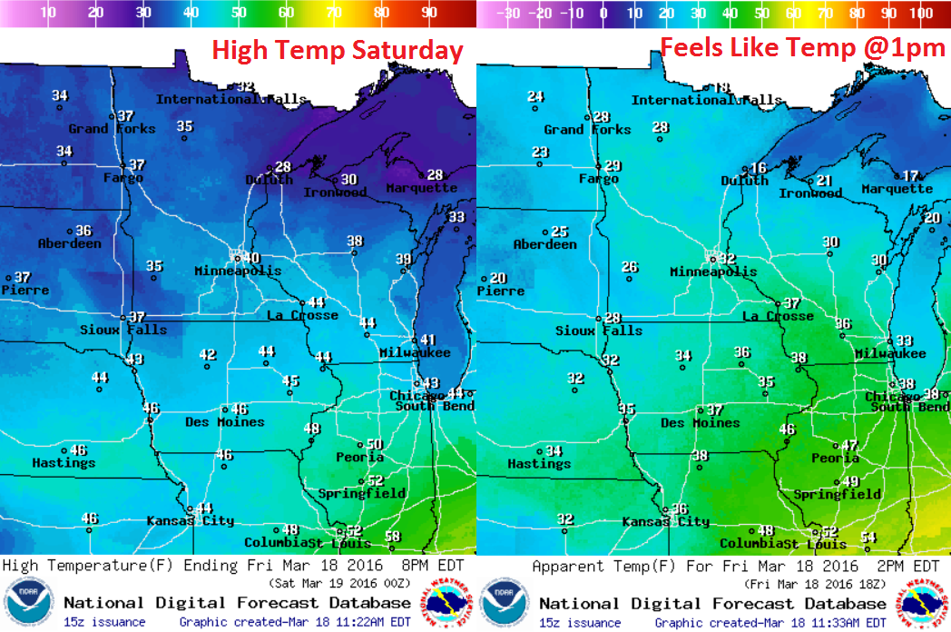
Saturday Weather Outlook
High temperatures on Saturday will be pretty close to near normal levels for mid/late March. However winds will still make it feel a little more raw with feels like temps in the 20s and lower 30s around midday.
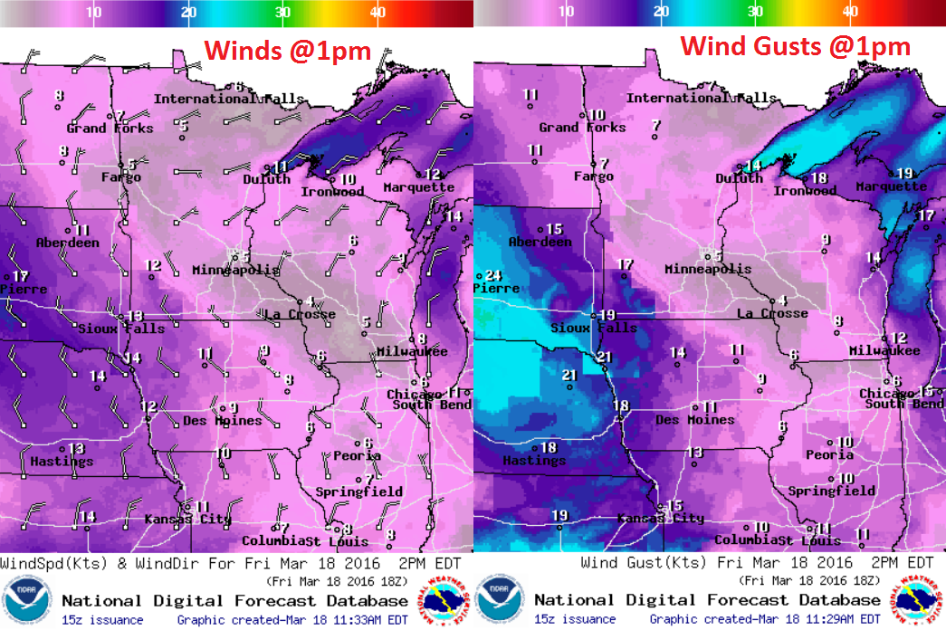
Saturday Weather Outlook
Winds on Saturday will be fairly light across much of the state with the exception of southwestern MN. Sustained winds there could be 10-15mph with gusts to near 20mph.
Saturday Weather Outlook
More clouds and scattered flurries/light snow showers will continue on Saturday across parts of the Midwest. However, the extreme northern part of the state could see quite a bit of sun on Saturday as drier/cooler air slides in there.
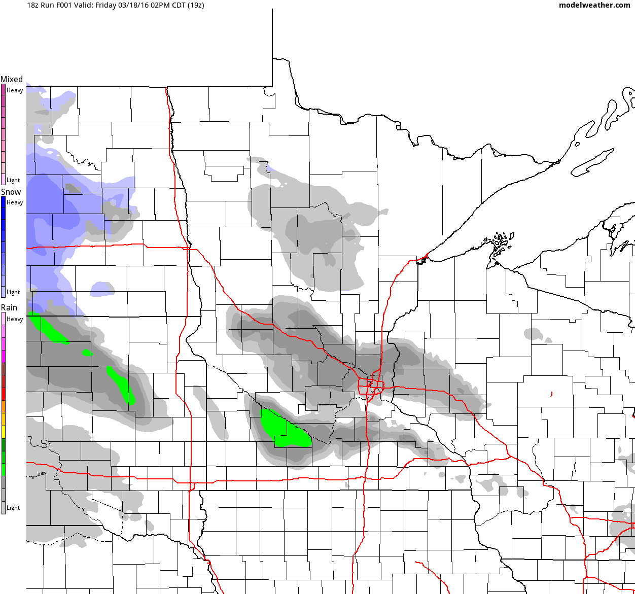
Simulated Radar
Areas of light rain/snow will continue to rotate through the region through Saturday with very minor precipitation and snowfall accumulations. It appears that the heaviest will fall early Saturday before tapering even more late weekend.
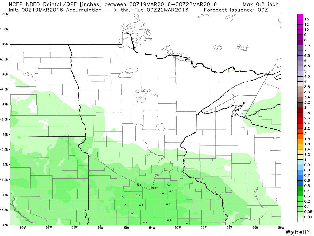
Precipitation Potential
Here's the precipitation potential through 7pm Sunday, which shows the heaviest across the southern part of the state. There may be a few areas that see up to a couple of tenths of an inch of liquid, but most would be lighter than that if any at all.
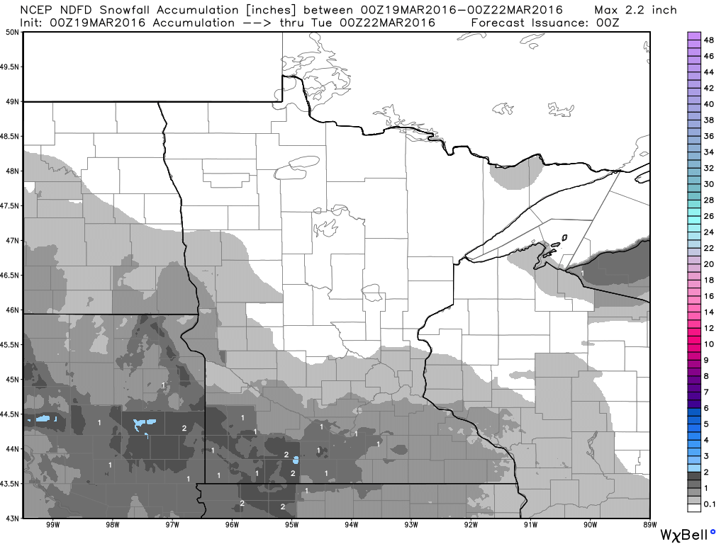
Snowfall Potential
There are still some indications of some slushy snow accumulations across the southern part of the state as well, but most look to stay accumulation free. through the weekend.
________________________________________
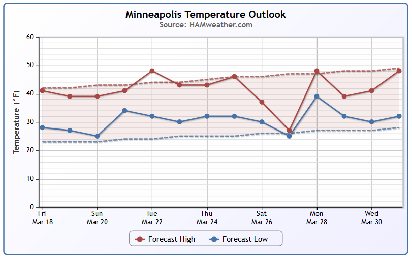
Minneapolis Temperature Trend
The extended forecast for Minneapolis shows near average temperatures continuing through much of next week with perhaps slightly below average temperatures returning by the end of the month. Note that overnight lows seem to be consistently above average, hovering around the freezing mark (32F).
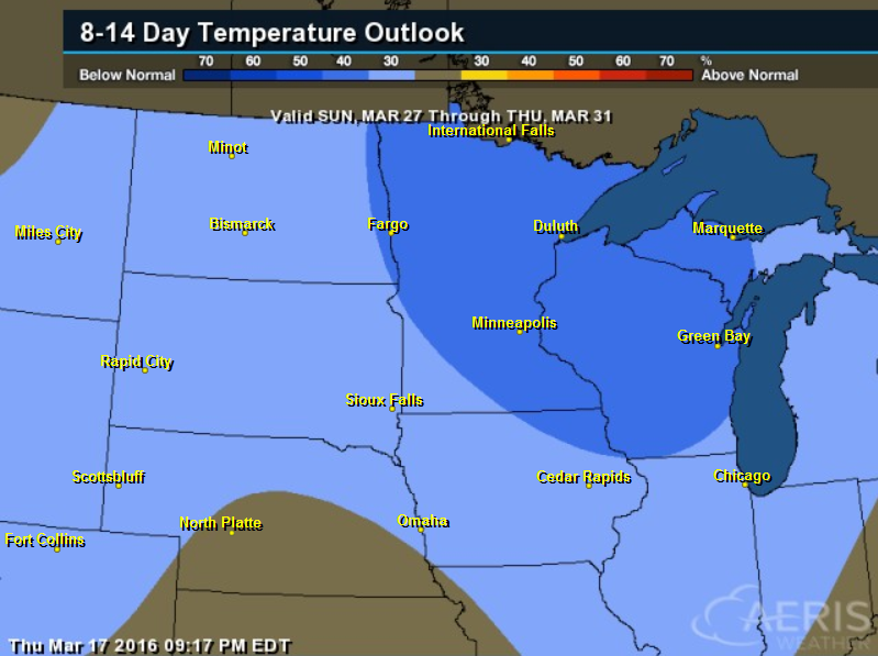
8 to 14 Day Temperature Outlook
According to NOAA's CPC, the 8 to 14 day temperature outlook suggests that there is a chance of below average temperatures returning to the region from by the end of the month.
_________________________________________
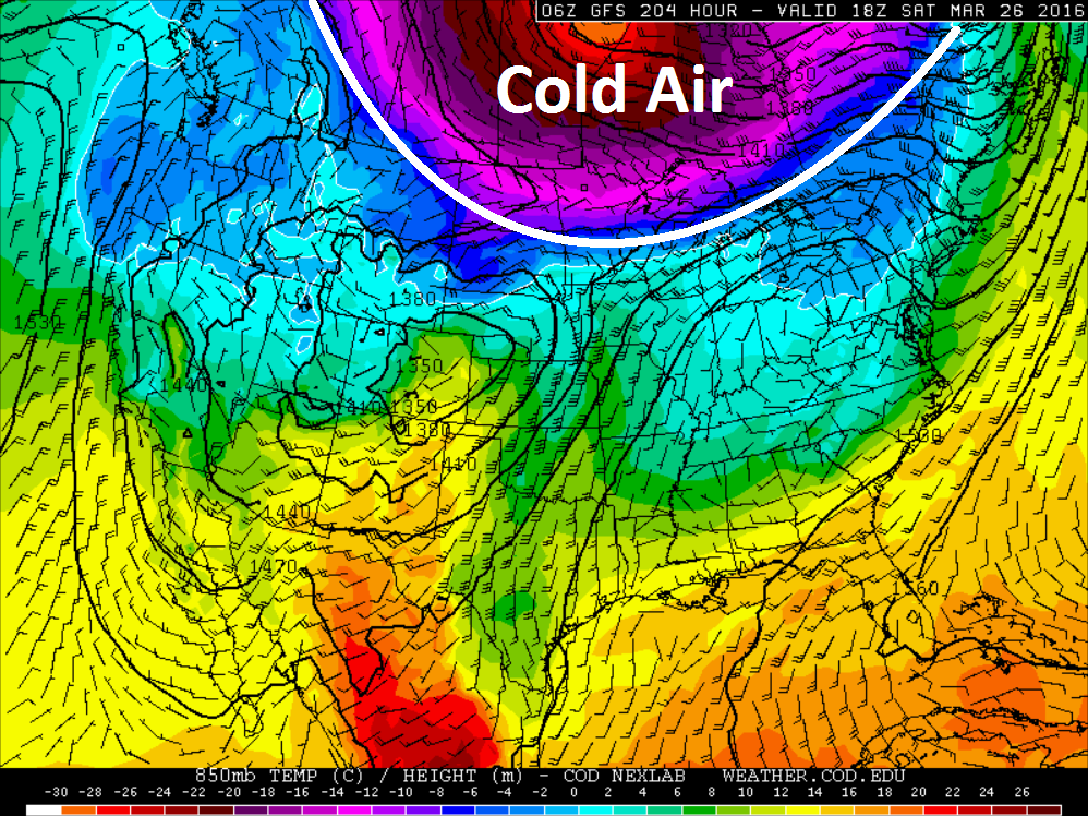
Temperature Outlook Next Week
Here's the long range temperature forecast for next weekend (March 26th-27th) - although it's a bit too far in the future to say whether it will happen for certain, it appears there will be a cold pool of air sitting just north of us that may keep the threat of colder air in place through the end of the month... stay tuned.
_________________________________________
National Weather Outlook
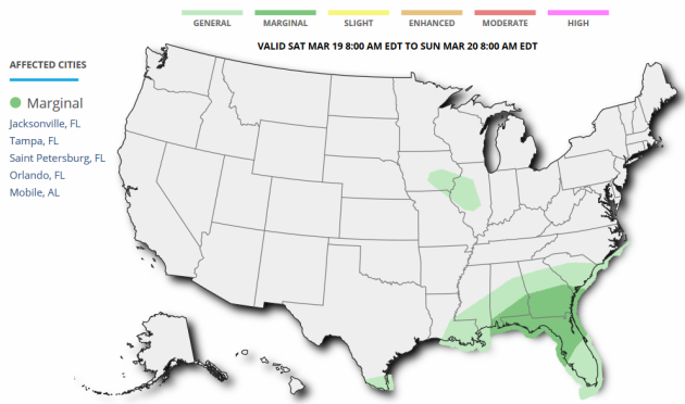
Lingering light snow showers will continue across parts of the Midwest through the early weekend with scattered storms and heavy rainfall across the Southern U.S.. Note that an area of low pressure looks to develop in the Eastern U.S. through the weekend which may not only bring strong/severe storms to parts of the Southeast, but it may also bring wintry precipitation and accumulating snow to parts of the Mid-Atlantic/Northeast as well.
Severe Threat Saturay
...SUMMARY...
   ISOLATED STRONG TO POSSIBLY SEVERE THUNDERSTORMS MAY OCCUR ACROSS
   PARTS OF THE SOUTHEAST UNITED STATES ON SATURDAY.

   A LARGE-SCALE TROUGH --WITH AN ASSOCIATED CLOSED MID-LEVEL LOW--
   CENTERED OVER THE MIDWEST WILL AMPLIFY ON SATURDAY.  EQUATORWARD
   FROM THIS TROUGH...AN UPPER JET WILL STRENGTHEN OVER THE GULF INTO
   THE WRN ATLANTIC.  A WEAK AREA OF LOW PRESSURE WILL DEVELOP ENEWD
   FROM AL/GA ACROSS THE SERN U.S. TO E OF THE OUTER BANKS DURING THE
   PERIOD.  SCTD SHOWERS/TSTMS WILL BE COMMON ACROSS THE ERN GULF
   COAST/SERN U.S. IN VICINITY OF THE SURFACE LOW AND COLD FRONT WHICH
   IS FORECAST TO SWEEP THROUGH MUCH OF THE SERN U.S.
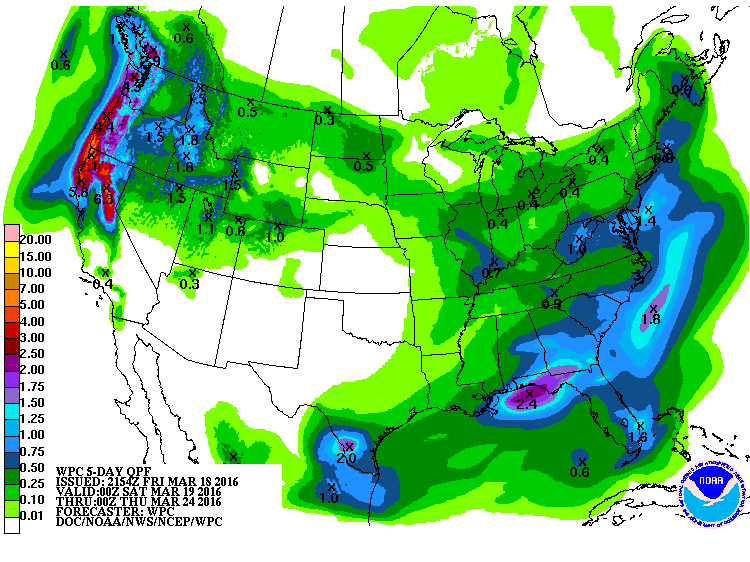
5 Day Precipitation Outlook
According to NOAA's WPC, the 5 day precipitation forecast suggests heavy moisture continuing along the Gulf Coast Region as showers and thunderstorms develop through the early weekend. However, as this developing storm system moves northeast along the East Coast, heavier moisture will be found there too. Unfortunately, some of this moisture could fall in a wintry fashion late weekend/early next week as temperatures will be flirting with the freezing mark. Another area of heavy moisture will be found along the West Coast/Pacific Northwest with some 3" to 6"+ liquid tallies through the middle part of next week.
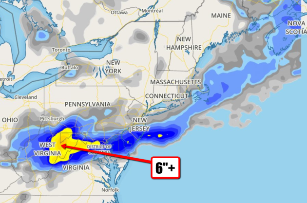
Snowfall Potential
Here's the NAM's snowfall depiction through midday Monday, note the heavier blob of snow potential over parts of the Mid-Alantic/Northeast.
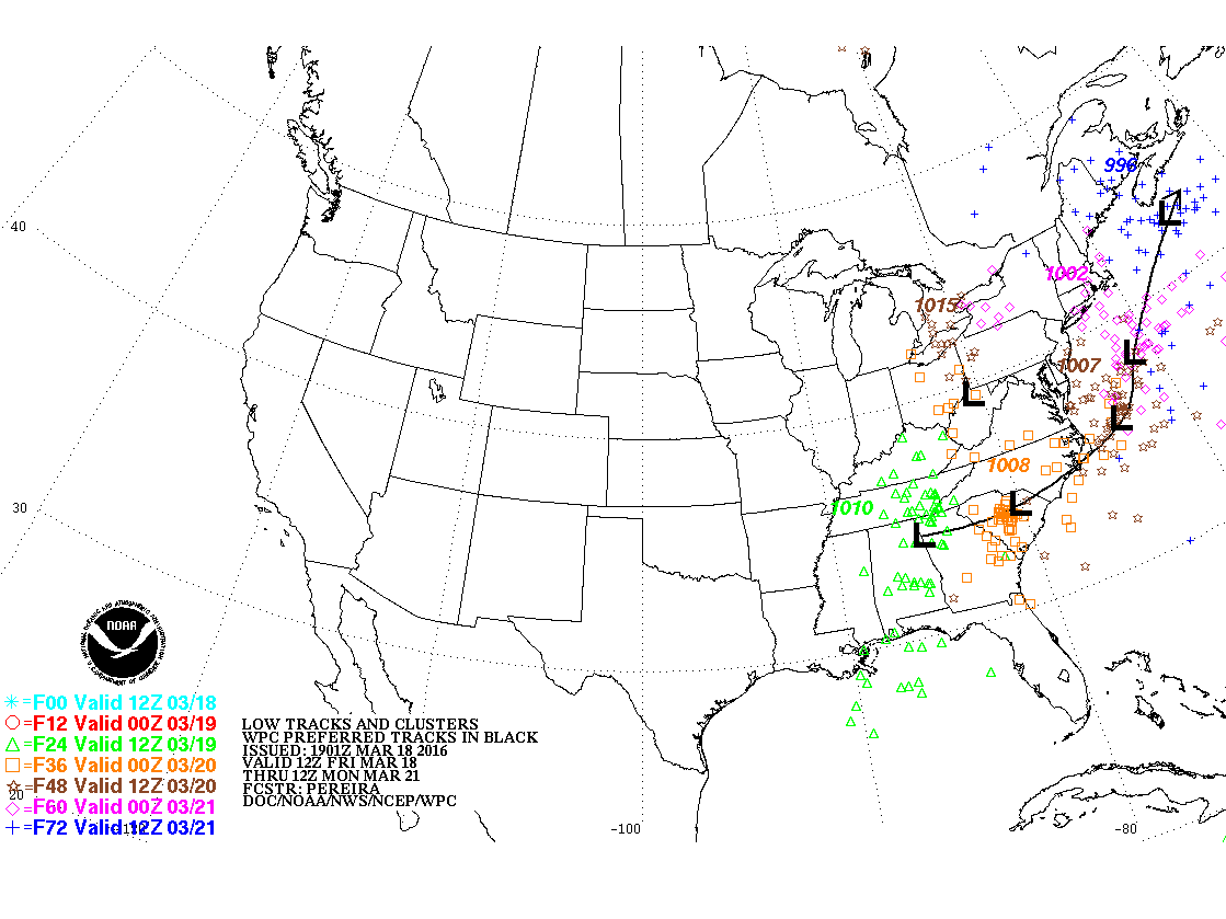
Tracking a Weekend Storm in the Eastern U.S.
The image below shows the developing storm system through late weekend. Note the arc north just off the East Coast... This could potentially have bigger impacts on some areas in the Mid-Atlantic/Northeast with heavy snow/wind.
Developing Storm
Here's a look at the GFS depiction at 7am Sunday as the storm slides just offshore. It appears that this developing storm will bring wintry precipitation and gusty winds to parts of Mid-Atlantic/Northeast through the weekend/early next week.
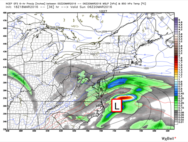
It appears that some of the heaviest snow will fall over the higher elevations of the Mid-Atlantic states with the potential of near 6"+ amounts possible. Again, this is still a developing system so amounts and placement could change depending on the track the storm takes and how much cold air gets drawn into the system.
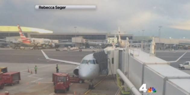
Plane Diverted to JFK After Lightning Strike: 'Very Bright Burst of Blue and Tremendous Bang'
This would be scary... your plane getting struck by lightning as you're in the air!! It happened to a plane on Thursday evening...
"Officials
say a lightning strike forced a plane from North Carolina to land at
New York's John F. Kennedy International Airport. It happened around 6
p.m. Thursday as the plane was circling New York City, according to
passengers. Shock filled the aircraft. "There was a very bright burst of
blue and a tremendous bang, like the plane had been hit by something,"
said Rebecca Seger of Yorktown. The American Airlines flight had taken
off from Raleigh-Durham International Airport in North Carolina and was
scheduled to land at LaGuardia Airport, about 10 miles away from JFK."
_______________________________________________
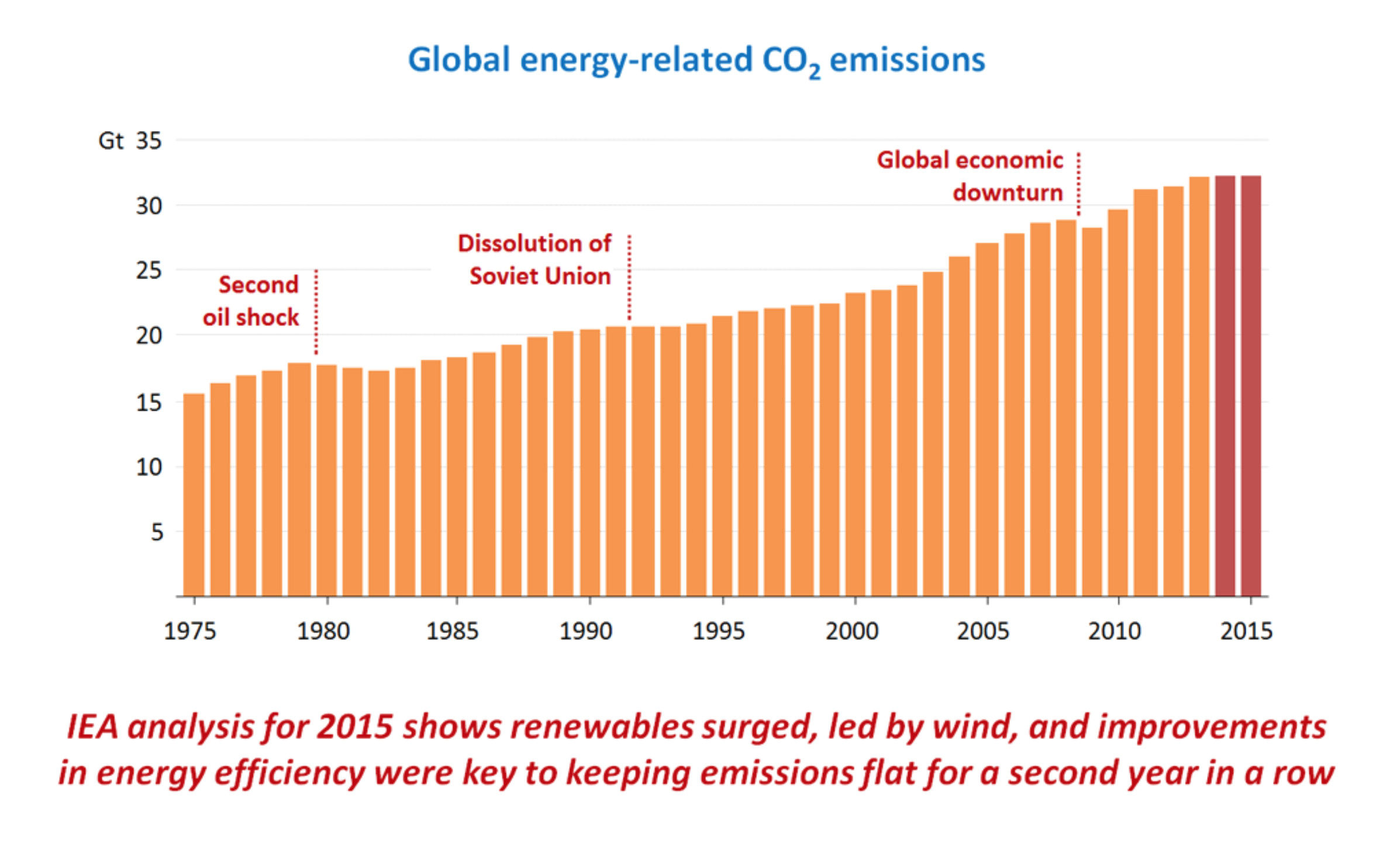
"Report Shows We Really Can Fight Climate Change Without Breaking the Bank"
"One
argument made by climate skeptics that has been particularly successful
at infecting non-skeptics is that, sure, the climate is a big deal,
and, yeah, that climate is undergoing unprecedented volatility, and,
okay, maybe mankind’s record carbon output has some small bit of
relevance to this fact — but don’t be naive, fighting this existential
threat to civilization would simply be too damned expensive. Reorienting
the energy and transportation sectors (among many others) will simply
cost far too much for growth-hungry capitalist economies to bear. What,
do you hate progress or something?"See the full story from ExtremeTech.com HERE:
____________________________________________
Thanks for checking in and have a great weekend ahead! Don't forget to follow me on Twitter @TNelsonWX

No comments:
Post a Comment