2.1" snow fell yesterday at MSP International Airport.
4" snow on the ground in the Twin Cities.
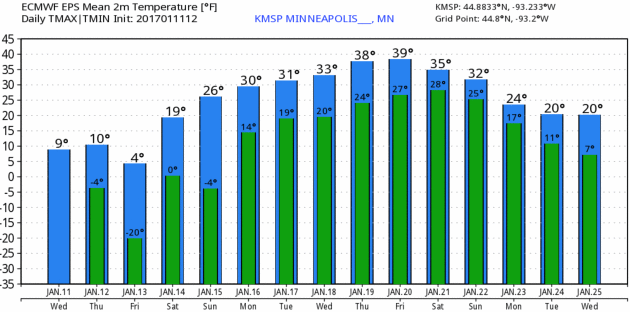
10 F. high temperature yesterday.
23 F. average high in the MSP metro area on January 11.
6 F. high temperature on January 11, 2016.
January 12, 1888: The infamous 'Blizzard of '88' occurs. It hit during a mild day when many children were heading home from school. They made up the majority of the 200 people that died. At the end of the storm the thermometer at St. Paul read -37.
Tales from the Tundra - 40 Degrees Next Week?
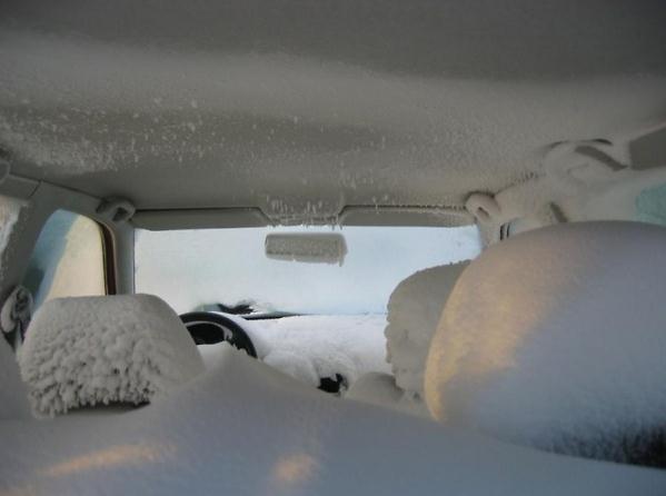
"Just for the record, the weather today is bitter with occasional fits of jealous rage” wrote Chuck Palahniuk in "Diary". Some of my favorite January memories? Pleading with my car heater. Using a credit card to chip the ice off the INSIDE of my windshield. Trying to time job interviews so potential employees wouldn't show up when it's -20F. That was more of an issue in the 80s and 90s than the 2010s.
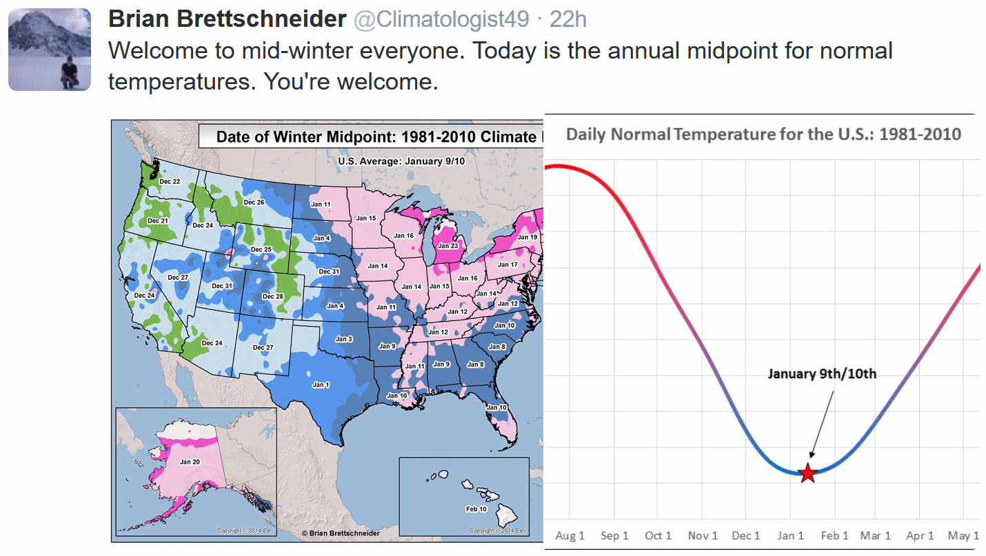
We are fast approaching the nadir, the midpoint of winter, the bottom of the temperature bell curve - when temperatures bottom out, historically. Next week a higher sun angle will compensate for long nights and snow on the ground; average temperatures will be on the rise again.
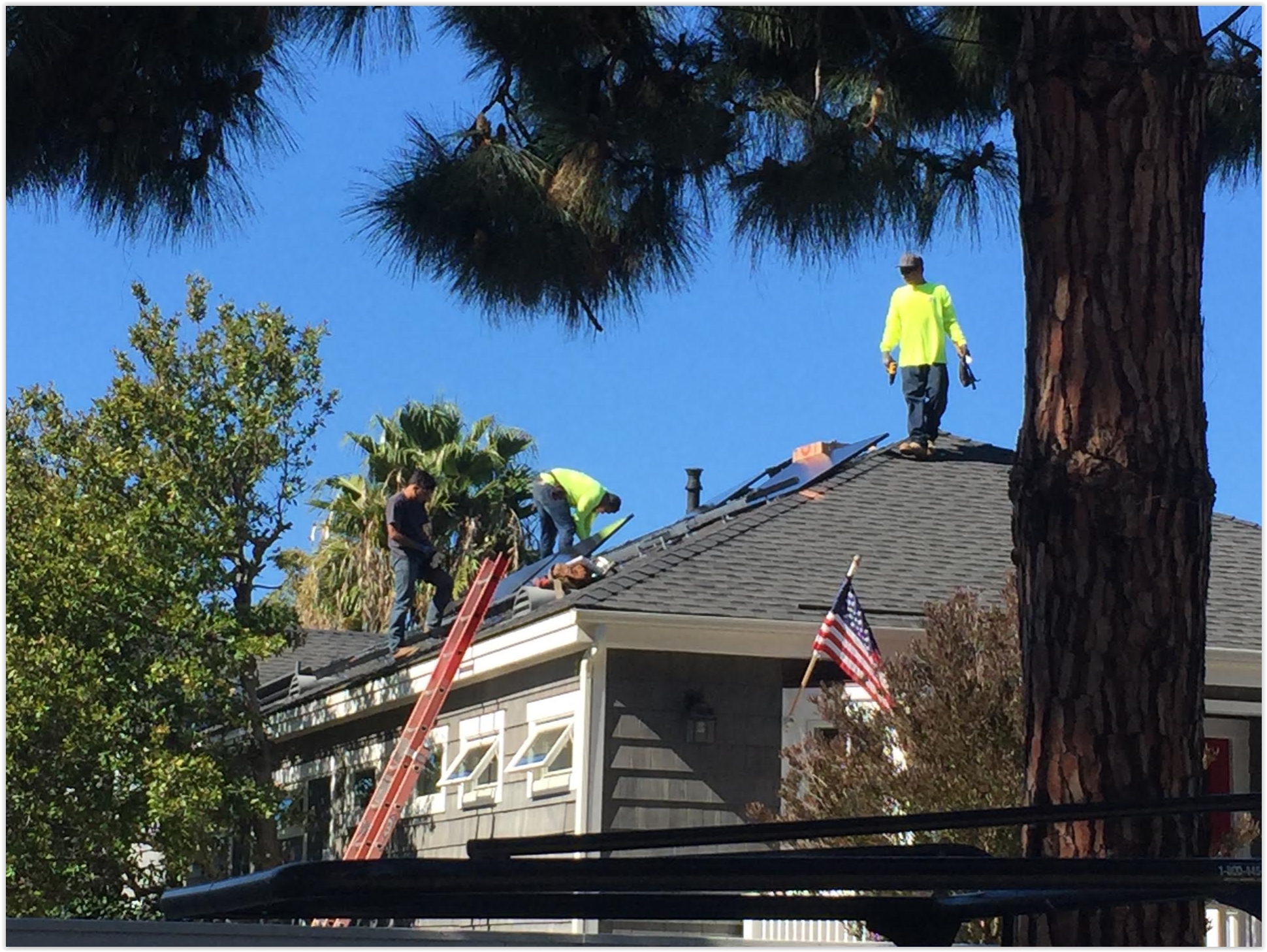
More flurries are possible this morning but I don't expect the same level of vehicular mayhem we witnessed the past few days. What a mess.
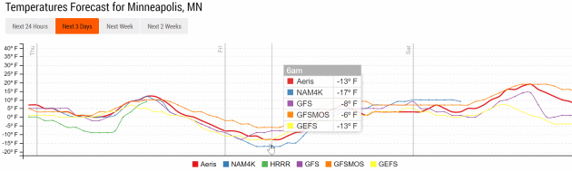
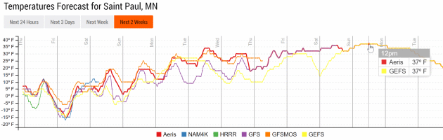
After waking up to a brisk -15F Friday morning temperatures mellow over the weekend. A thaw is likely next week, in fact ECMWF guidance hints at 40F by late next week.
It's been an perfectly average winter - but with recent warming 'average' feels unnecessarily cold.
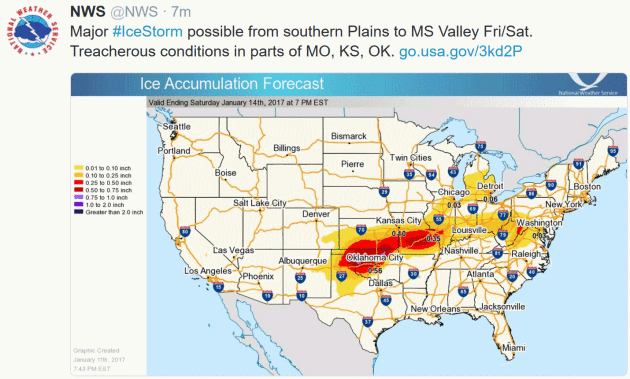
* A potential ice storm is shaping up for the end of the week and into the early weekend for areas from northern Texas to Illinois.
* Ice accumulations of over a quarter inch will be possible across portions of this region. This would lead to significant travel issues as well as impacts to trees and power lines.
* A Winter Storm Watch has already been issued across parts of Oklahoma, Kansas, Missouri and Illinois for the icing threat. This includes the St. Louis and Oklahoma City metros.
* Out west, the heavy rain and snow will gradually come to an end in California over the next 24-36 hours, with a much needed break in precipitation through the weekend expected.


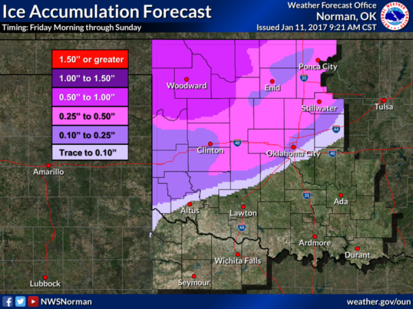


Summary: We’re tracking a potentially crippling ice storm later this week for parts of the central and southern Plains, with ice accumulations of a quarter to a half an inch or more possible through the end of the weekend. Winter Storm Watches have been issued from Oklahoma to Illinois for the potential of heavy icing, including the Oklahoma City and St. Louis metros. This heavy of ice accumulation would lead to significant travel issues as well as impacts to trees and power lines across the region. In California, the rain and snow will gradually taper off as we head through Thursday across the region, with a much needed break in moisture coming into the weekend and early next week.
D.J. Kayser, Meteorologist, AerisWeather
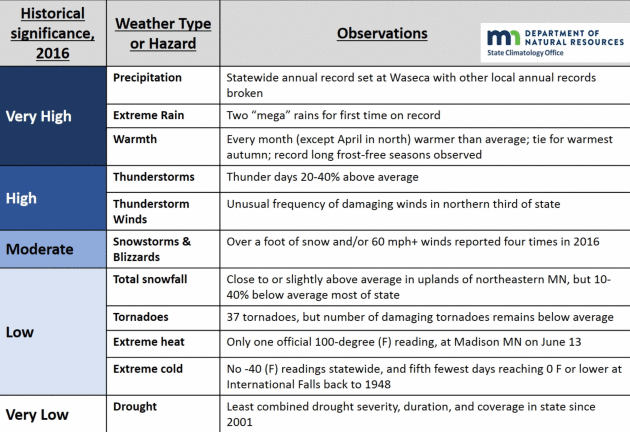
Top 5 Weather Events of 2016 in Minnesota. The Minnesota DNR has the list; here are the top 2 weather events of last year: "Here
are the results of voting for the top five weather events of 2016 from
the Minnesota State Climatology Office. Votes were cast from various
weather enthusiasts including the National Weather Service, the
University of Minnesota, State agencies and Facebook followers...
#2 Central Minnesota Flash Flood July 11-12, 2016
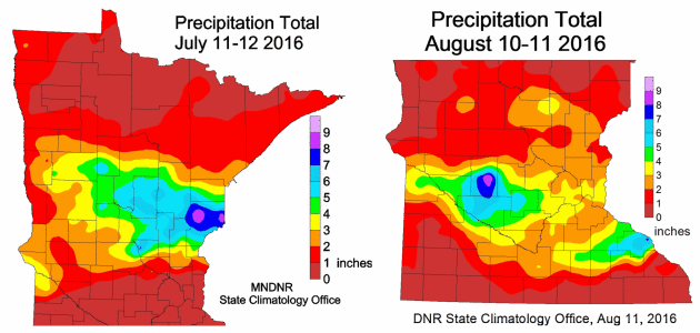
The largest flash flood in Minnesota since the event of June 19-20, 2012 struck part of the same region on July 11-12, 2016. The highest two-day total was a volunteer reader in Pine County with 9.34 inches. Southbound I-35 and Highway 61 was closed for a time on July 12. The area covered by six inches or more of rainfall exceeded 2,000 square miles, qualifying it as a "Mega Rain" event. The flooding would have been worse had it not been for the relatively dry conditions beforehand. In addition to the heavy rain, there were three tornadoes, two of which were EF2. .
#1 State Record Precipitation Total at Waseca and Record Annual Twin Cities Precipitation.
The event that garnered the most votes was the statewide annual precipitation record set at Waseca and the Twin Cities annual record precipitation. The preliminary 2016 precipitation total at Waseca is 56.24 inches, handily breaking the old record at St. Francis in Anoka County of 53.52 inches in 1991. The 2016 total at Waseca breaks the old record by 2.72 inches. The Twin Cities also broke the annual precipitation record that was set over 100 years ago. The preliminary total for 2016 is 40.32 inches, breaking the old record of 40.15 inches set in 1911. The precipitation record for the Twin Cities begins in 1871..."
Map credit: Minnesota DNR, State Climate Office. The July 11-12 "Mega-Rain" was one of 2 mega-rain events of 2016; the first time on record Minnesota has experienced 2 such widespread flood events.
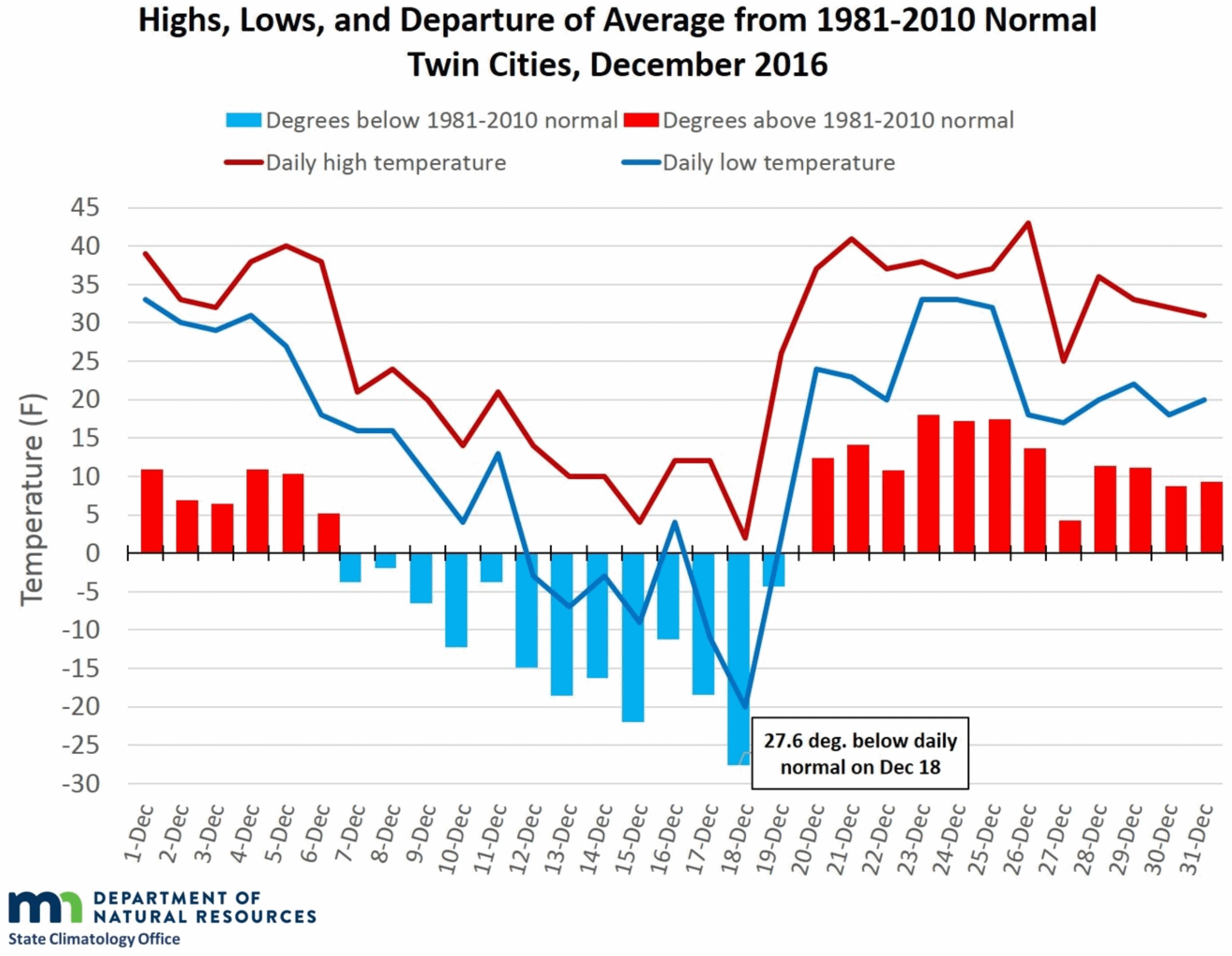
December 2016: Really Cold, Really Warm, Nearly Average. The Minnesota DNR has a very good recap highlighting just how manic last month was: -20F on December 18. One week later nearly an inch of RAIN on Christmas Day! Here's an excerpt: "...Minnesotans are used to large variations in temperatures, but December 2016 was notable for its long streaks of warm and cold conditions: the temperatures only switched from one side of average to another two times during the month. The result of these long stretches of seemingly opposite conditions was that the month ended up pretty close to average--slightly warmer in most locations, making it 16 straight warm months Twin Cities. December was also wet enough to help the Twin Cities break its all-time annual precipitation record. What a perfect way to end such a warm, wet, and stormy year!"
Graphic credit: "December 2016 daily temperatures and departures in the Twin Cities."

Keep Your Pets Warm and Healthy This Winter Season. An article at High Plains Journal has some very good advice: "Just because they have a fur coat does not mean your pet can endure extended time outdoors when the temperature is frigid. Dogs, like other animals, must be out of the wind and dry for the insulating properties of their coats to be effective. Dogs that evolved in warm climates have short hair coats to protect them from the sun and help them stay cool, versus dogs that evolved in cold climates and have longer hair coats. If you are cold, your short-haired pet may be cold, too. Just as people add extra layers of clothing, bump up the thermostat or throw an extra log on the fire to keep warm, pet owners must take action to ensure their four-legged friends stay warm and healthy through the winter season..."
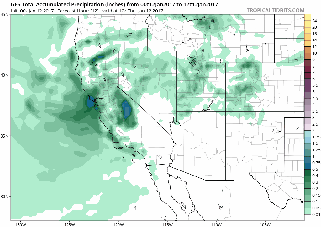
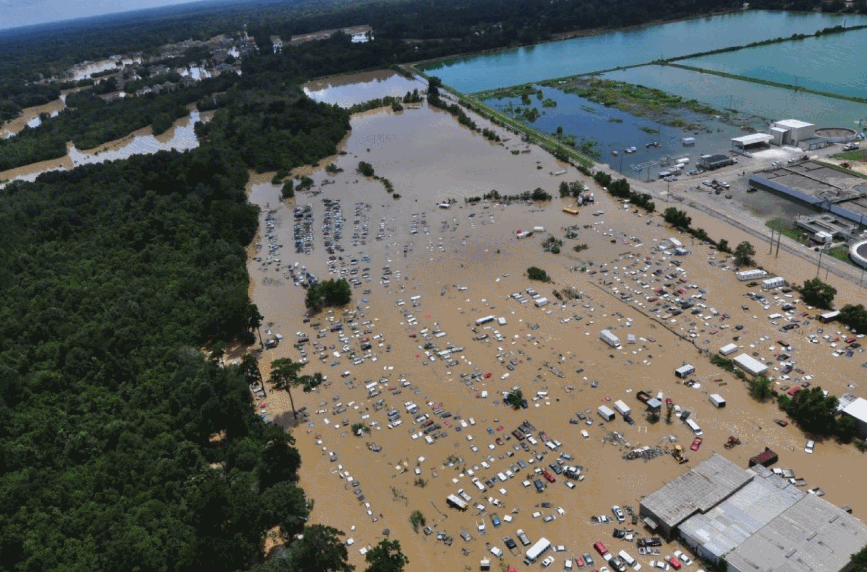
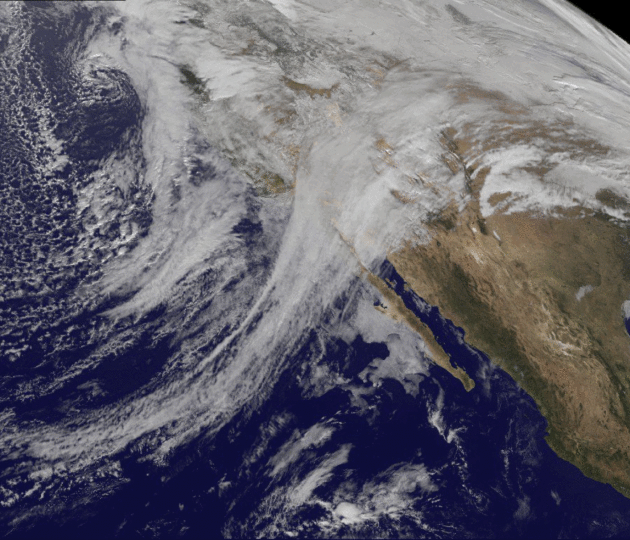
California: Stuck in a Stormy Rut. After a series of wild storms California dries out by the weekend, but strong storms are forecast to return the latter half of next week - another wave of flooding, mudslides and general disruption is likely within a week. Accumulated precipitation between now and Wednesday morning, January 25, courtesy of NOAA's GFS model and Tropicaltidbits.com.
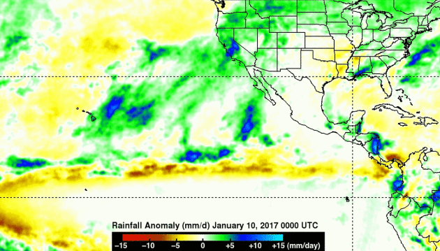
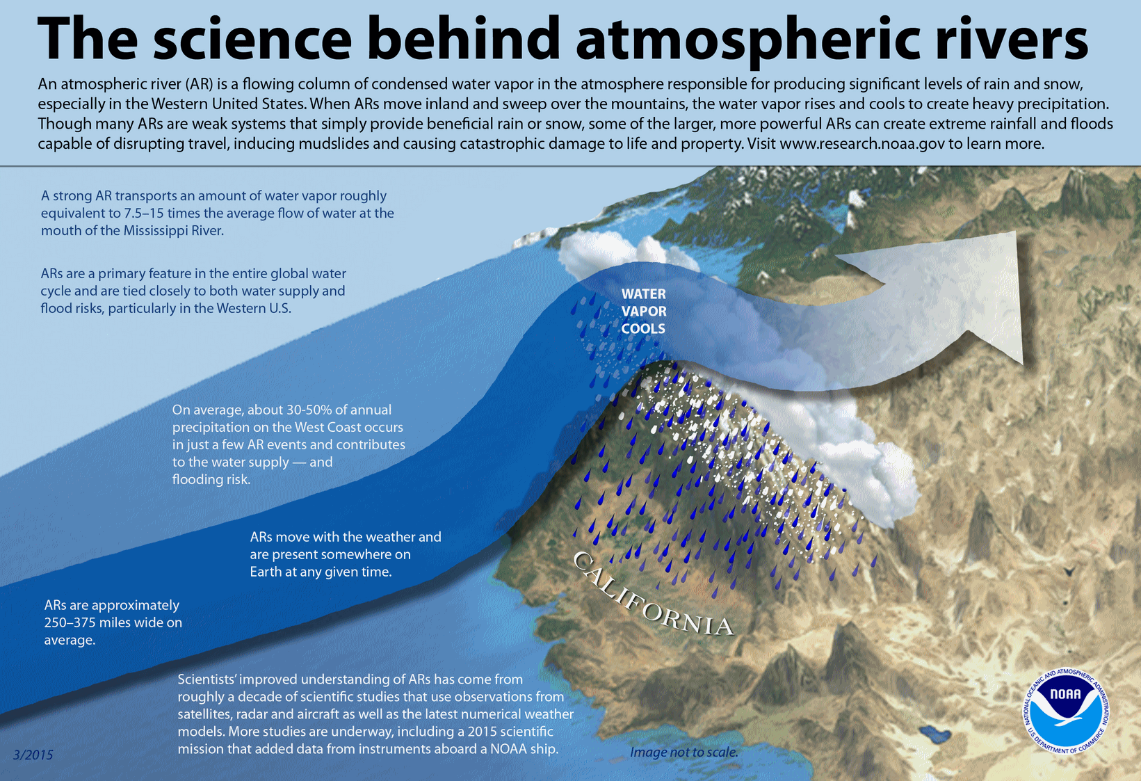
What Is An Atmospheric River? Weather Phenomenon Hits California, Nevada with Rain, Snow and Flooding. A few interesting nuggets from International Business Times: "A not-entirely-unwelcome storm dumped heavy rain on parts of California and Nevada Sunday during part of a weather phenomenon known as an atmospheric river. Another followed close on its tail and was expected to bring up to 15 inches of rain in places like the Sierra Nevada mountains Monday. Atmospheric rivers are actually common weather patterns that occur all over the world. The term is used to describe narrow portions of the atmosphere that hold water vapor and bring rain, wind and snow as they travel. At any given moment, an atmospheric river is depositing rain or snow somewhere, according to the National Oceanic and Atmospheric Administration. Anywhere between 30 to 50 percent of the annual precipitation that occurs on the West Coast of the United States is caused by atmospheric rivers..."
Infographic credit: NOAA.
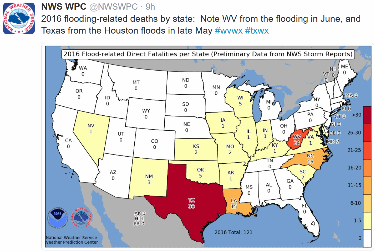
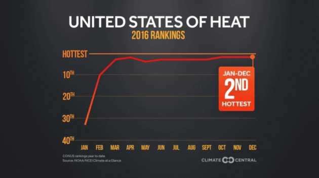
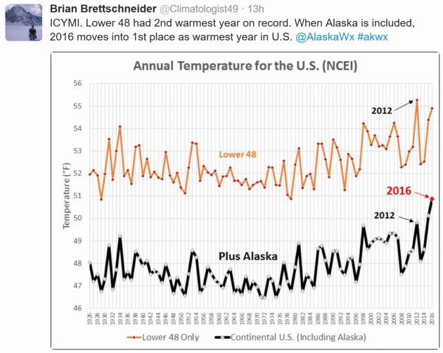
Climate Disasters Cost U.S. $46 Billion as Flooding Leads List. Bloomberg has more perspective on 2016's toll: "Climate-based disasters caused $46 billion in damage and killed at least 138 in the 48 contiguous U.S. states last year, with inland flooding emerging as the costliest weather event for the first time since 1997. The number of billion-dollar occurrences was the second-highest since 1980, with one less than the 16 in 2011, according to the National Centers for Environmental Information. It was also the second warmest year behind 2012 over 122 years, and the 20th consecutive warmer-than-normal year..."
File photo: Coast Guard.

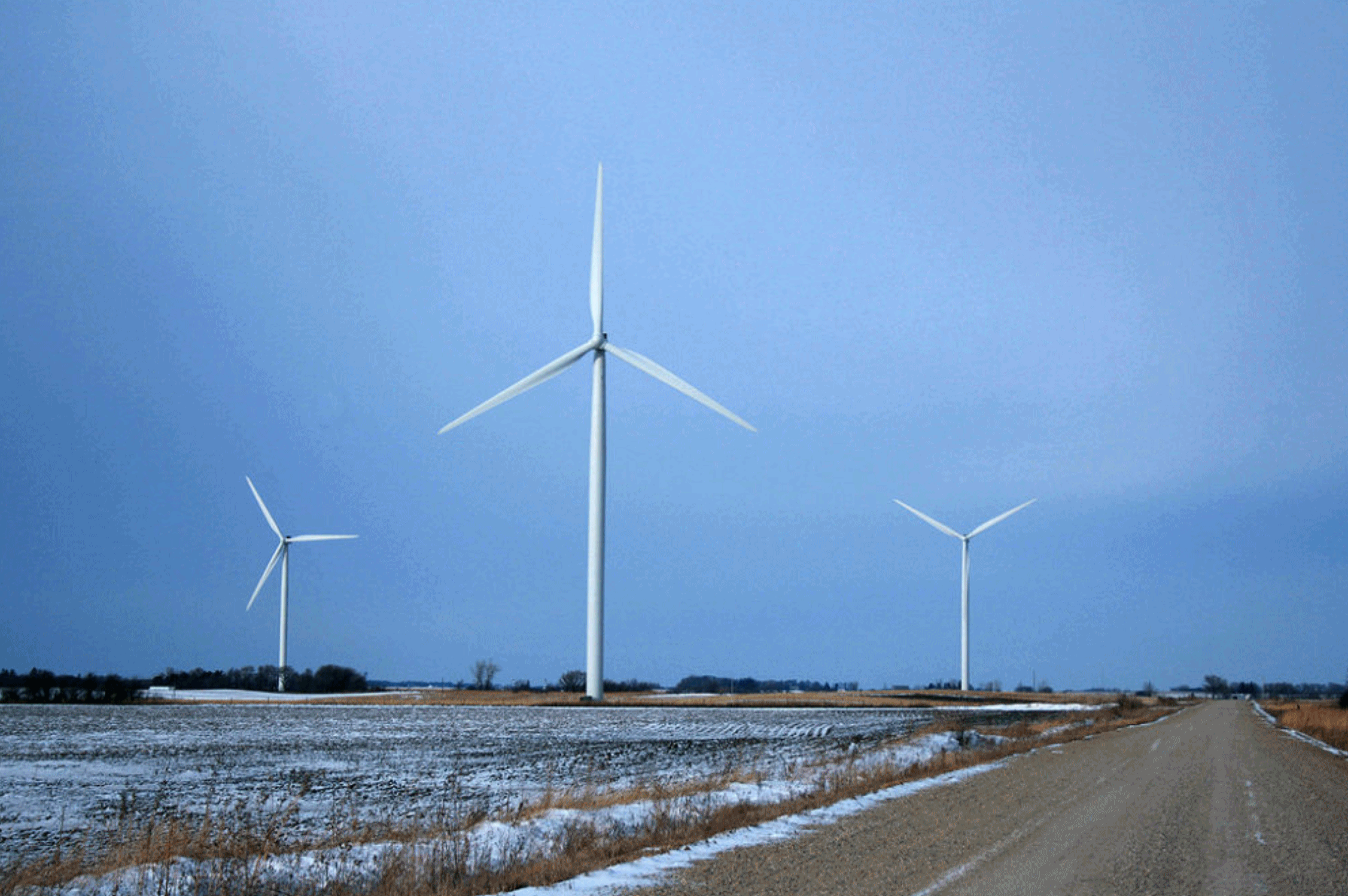
Report Ranks Iowa as Top State for Corporate Access to Clean Energy. Midwest Energy News reports: "According to a new report, companies looking for easy access to renewable energy should consider moving to Iowa. That state, followed by Illinois, topped a ranking released Tuesday by the nation’s retail and tech sectors urging state governments to lower barriers to the further development of renewable energy. Ohio came in 8th. The report, assembled by Clean Edge on behalf of the Retail Industry Leaders Association and the Information Technology Industry Council, comes just as state legislatures across the country are convening for their 2017 sessions. The report was quite clear about its intentions: to urge changes in state laws and regulations regarding renewable energy, and especially corporate access to it..."
File photo credit: Reddit, leegethas
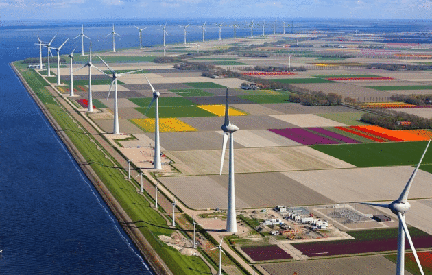
A California Bill Would Require Solar Panels on All New Buildings. Here's a link to a post at Pacific Standard: "California Senator Scott Wiener introduced legislation on Monday that would require certain buildings erected in the state to be equipped with solar panel installations.
California law already requires all residential and commercial
buildings under 10 stories to have at least 15 percent of the roof clear
of obstructions and shade—in other words, “solar ready.” Wiener’s
legislation goes a step further, mandating that either solar
photovoltaic or solar water panels actually be installed on any new
rooftops..."


Why Do Canadians Say "Eh"? I learned something today, thanks to Atlas Obscura: "...Jack Chambers, a linguist at the University of Toronto,
writes that these “ehs” are all of a piece. “All of these uses have one
pragmatic purpose in common: they all show politeness,” he wrote in a
2014 paper. Using “eh” to end the statement of an opinion or an
explanation is a way for the speaker to express solidarity with the
listener. It’s not exactly asking for reassurance or confirmation, but
it’s not far off: the speaker is basically saying, hey, we’re on the
same page here, we agree on this. Even in the use of “eh” as a criticism
or a command, the word seeks to find common ground. If I say “you’re an
idiot, eh?”, what I’m saying is, you’re an idiot, but you should also
think you’re an idiot, and our understanding of you as an idiot finds us
on common ground..."
Photo credit: "Canada Day items on sale in Nova Scotia." Nicole Bratt/CC BY-SA 2.0

TODAY: Few flakes, then peeks of sun. Brisk. Feels like -15F. High: 10
THURSDAY NIGHT: Clearing and very cold. Low: -14
FRIDAY: Numbing start. Intervals of sun with light winds. Winds: SE 3-8. High: 5
SATURDAY: More clouds than sun. Better. Winds: SW 5-10. Wake-up: -1. High: 21
SUNDAY: Patchy clouds, feeling in my toes! Winds: S 5-10. Wake-up: 11. High: 29
MONDAY: Overcast, light mix possible late. Winds: NE 5-10. Wake-up: 15. High: 31
TUESDAY: Early mix? Clouds linger. Winds: W 5-10. Wake-up: 25. High: 33
WEDNESDAY: Some sun, vague hints of March. Winds: S 8-13. Wake-up: 27. High: 35
Climate Stories...
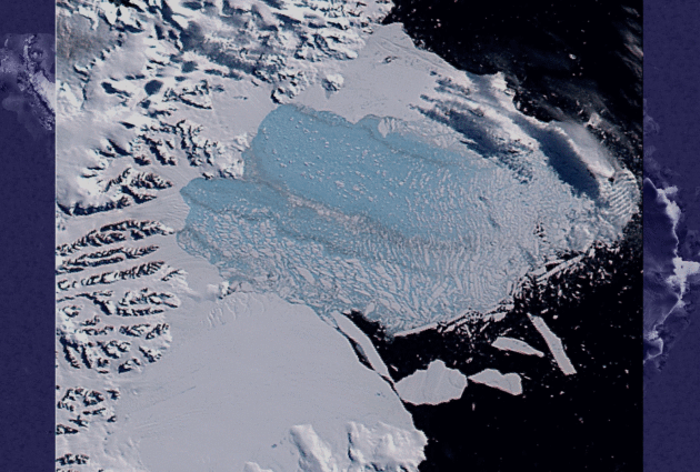
Image credit: "The Larsen B ice shelf on March 7, 2002, after it shattered into thousands of smaller icebergs." (NASA/Goddard Space Flight Center Scientific Visualization Studio.)

Photo credit: "The Ninglick River is eating away at the shoreline in Newtok, Alaska, shown here in August 2016. Engineers estimate the village is losing 70 feet of land per year." Eric Keto/Alaska's Energy Desk.

Photo credit: "Carbon dioxide trapped in crystals."
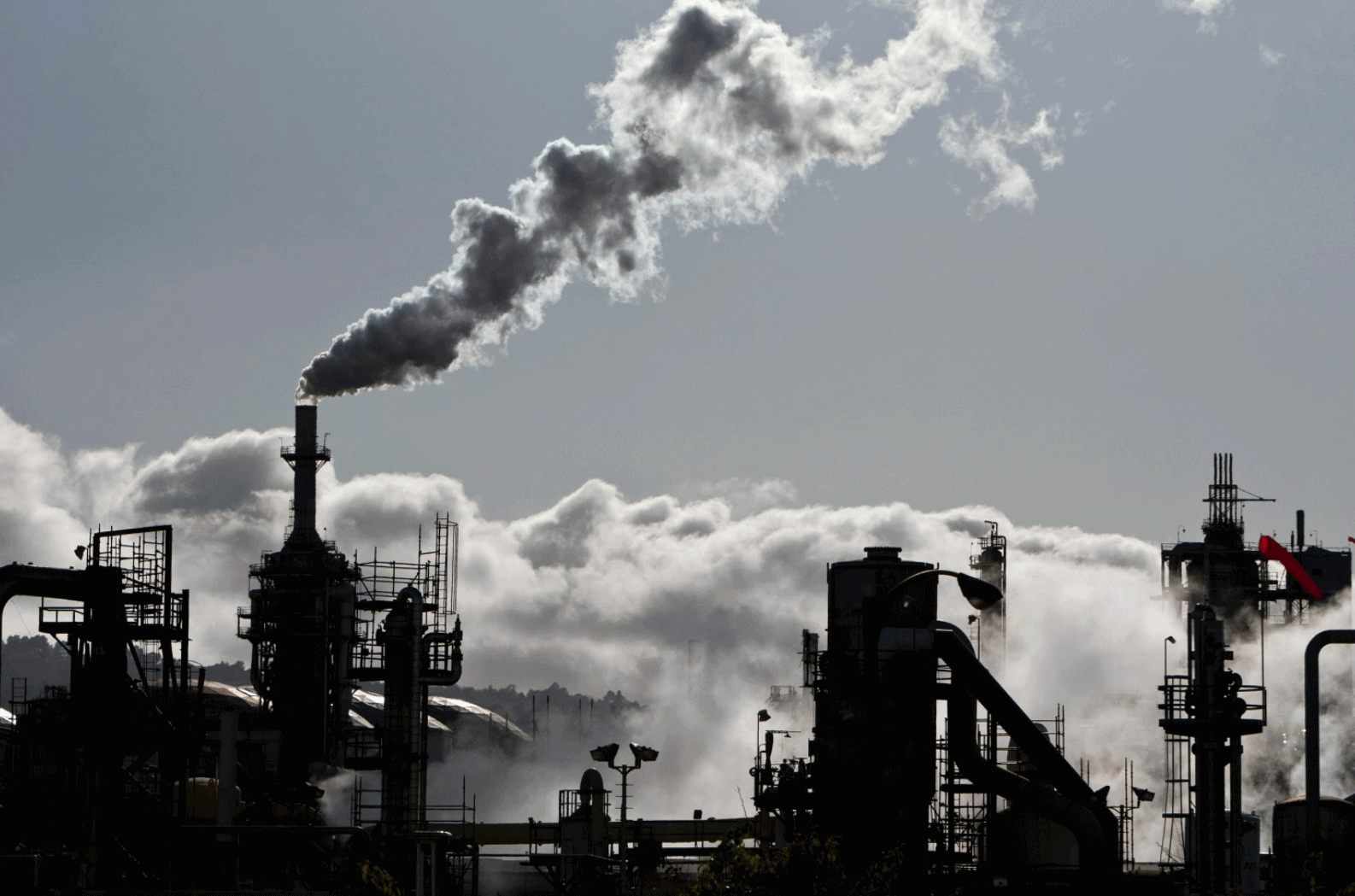
Photo credit: "Smoke is released into the sky at a refinery in Wilmington, Calif." (Bret Hartman/Reuters).

The letter to President Elect Trump is here.
Global Warming Will Increase "Pineapple Express" Storms in California. Basic physics: a warmer atmosphere can hold more water vapor. Here's an excerpt from Pacific Standard: "...An atmospheric river — also
known as the Pineapple Express — is shunting moist Pacific air from
near Hawaii to the slopes of the Sierra Nevada. While the surge of
moisture is mostly welcome to boost snowpack and reservoir storage, California
will likely experience similar extreme events much more frequently if
global greenhouse gas emissions aren’t cut to near zero — and soon.
Right now, California sees about six extreme atmospheric river rain
storms per winter season, but if greenhouse gases keep increasing,
global temperatures will rise by 4 degrees Celsius by 2100. That means
the number of extreme rain events will increase to nine per winter, a
team of Massachusetts Institute of Technology researchers concluded in a study published this week in the Journal of Climate..."
Image credit: NASA/Goddard Space Flight Center/Flickr
U.S. Should Pursue Controversial Geoengineering Research, Federal Scientists Say for First Time. Because the world's governments aren't moving fast enough. Here's an excerpt from AAAS at Science: "The U.S. government office that oversees federally funded climate research has recommended studies into two areas of geoengineering research, marking the first time scientists in the executive branch have formally called for studies in the controversial field. The move, part of a climate science planning report sent today to Congress, will likely further normalize discussion of deliberate tinkering with the atmosphere to cool the planet, and of directly collecting carbon from the sky, both topics once verboten in the climate science community. Yet the new endorsement of geoengineering research comes amid deep uncertainty about the direction that climate research will take under the new administration of President-elect Donald Trump. Geoengineering is discussed in just two paragraphs of the 119-page plan, which aims to set out a research roadmap through 2021..."
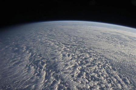
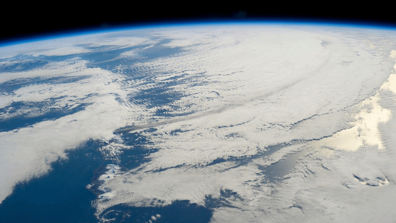
Photo credit: NASA/ISS Crew/Johnson Space Center.
News reports say that California and Nevada have been flooded in early January 2017 occasioning chances of evacuations. Relevant to this scenario , readers may like to know this Vedic astrology writer’s alerts for natural disaster like snow - floods in a State whose name begins with letter “C” , “N” and “T” in US impacting health of citizens during November-December 2016. Since States of Nevada , California and Texas have been snowed and flooded in early January 2017 just edging the period of prediction of this writer , it can be said the alert has been meaningful. These predictions were published in article “ Astrological probable alerts for US in year 2016” on 15 October 2015 in online magazine thesop.org.
ReplyDelete