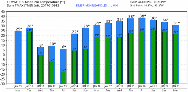
23 F. maximum temperature yesterday in the Twin Cities.
23 F. average high on January 9.
22 F. high on January 9, 2016.
January 10, 1990: A January 'heat wave' forms. MSP Airport warms to 49 degrees.
January 10, 1975: The 'Blizzard of the Century' begins. Also called the 'Super Bowl Blizzard,' it was one of the worst blizzards ever. The pressure hit a low of 28.62. This was the record until 1998.
40F Next Week? January Thaw Last Half of Month
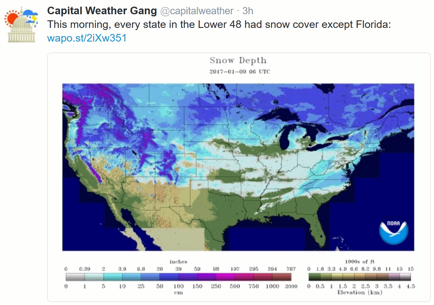
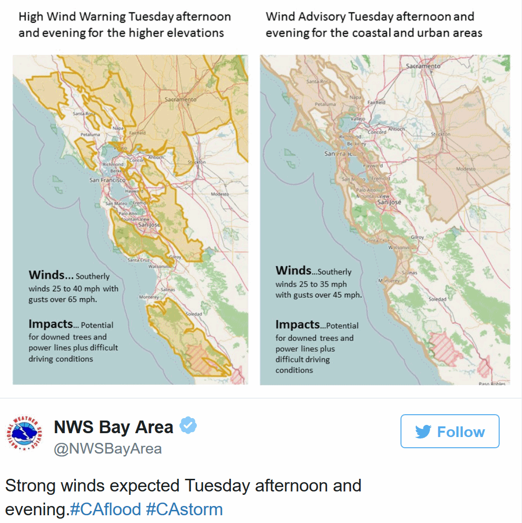
It's a manic weather map: snow on the ground in every state but Florida as of last Saturday, some of the worst California flooding in nearly 20 years, with gusts up to 174 mph in the Sierra Nevada range, and a Chinook wind boosting the mercury up to 60F at Denver yesterday - a taste of milder, Pacific air to come.
Grinding cold for Minnesota? I remember far worse in the 80s and even the early and mid 90s. On this date in 1982 northern Minnesota saw -30F air temperatures, with winds over 40 mph. That translated into wind chills of -71F with the new (warmer) formula, and -100 with the old formula!
School-closing cold. So a few nights in a row below zero is no big deal at this northerly latitude.
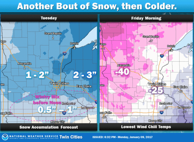
Nice to see it can still snow in January. Expect at least a couple inches today, another inch or so tomorrow as the next slap of colder air approaches. 2 subzero nights late week and then real warming begins.
ECMWF (European) guidance shows a thaw by next Monday; maybe 40 degrees by the middle of next week. Warm, wet Pacific winds keep us in the 30s for much of the latter half of January, with spurts of slushy snow.
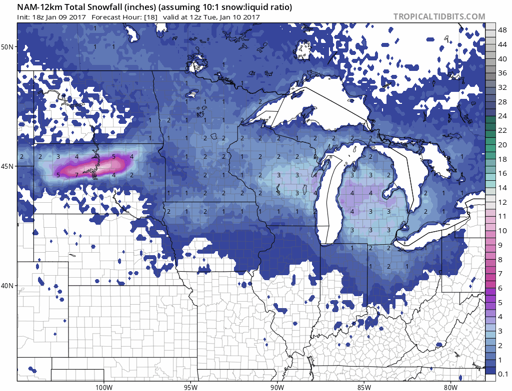
Potentially Plowable. Another 2-4" burst of snow today (possibly mixed with sleet and freezing rain) gives way to a third burst on Wednesday with temperatures much colder; meaning more of a light, powdery snowfall. A couple inches in the Twin Cities today, another couple inches tomorrow. Some 3-5" totals are possible by Wednesday night. NAM guidance above: Tropicaltidbits.com.
Taste of What's To Come. While we basked in the low 20s Monday temperatures shot up to 60F in the Denver area. Granted, they had an assist from the Rocky Mountains and a strong Chinook wind, and there isn't much snow on the ground in Denver, but Pacific-warmed air will be sweeping across much of the USA next week. Monday afternoon 3 PM temperatures: Aeris AMP.
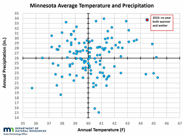
Graphic credit: "Chart showing annual statewide combinations of average temperature and total precipitation. No year back to 1895 was both as warm and as wet as 2016."
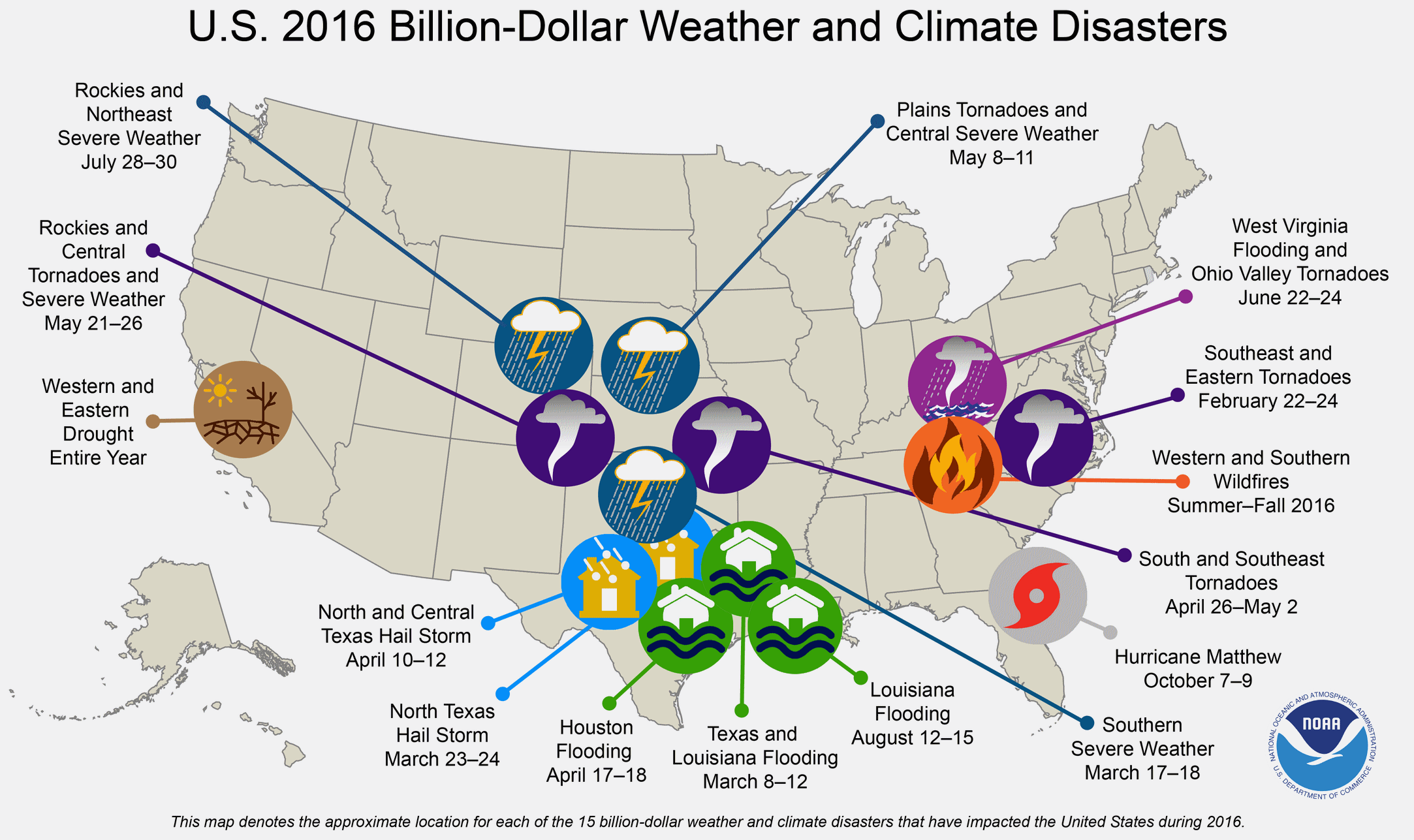
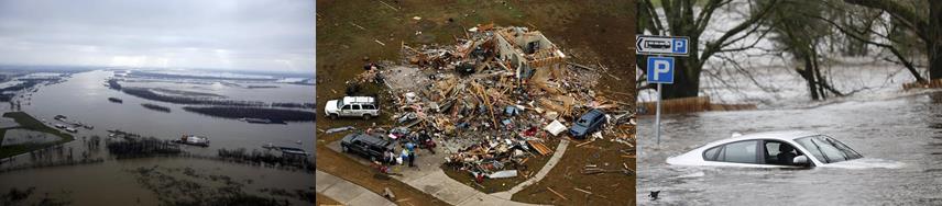
2016: Total of 15 Weather and Climate Disasters. Only 2011 saw more, according to NOAA NCDC: "In 2016, there were 15 weather and climate disaster events with losses exceeding $1 billion each across the United States. These events included a drought event, 4 flooding events, 8 severe storm events, a tropical cyclone event, and a wildfire event. Overall, these events resulted in the deaths of 138 people and had significant economic effects on the areas impacted. The 1980–2016 annual average is 5.5 events (CPI-adjusted); the annual average for the most recent 5 years (2012–2016) is 10.6 events (CPI-adjusted). Three new billion-dollar disaster events were added during the 4th quarter, bringing the 2016 total to 15 events. This represents the 2nd highest total number of events surpassing the 11 events observed in 2012. The record number of events in one year (since 1980) is 16, as observed in 2011..."
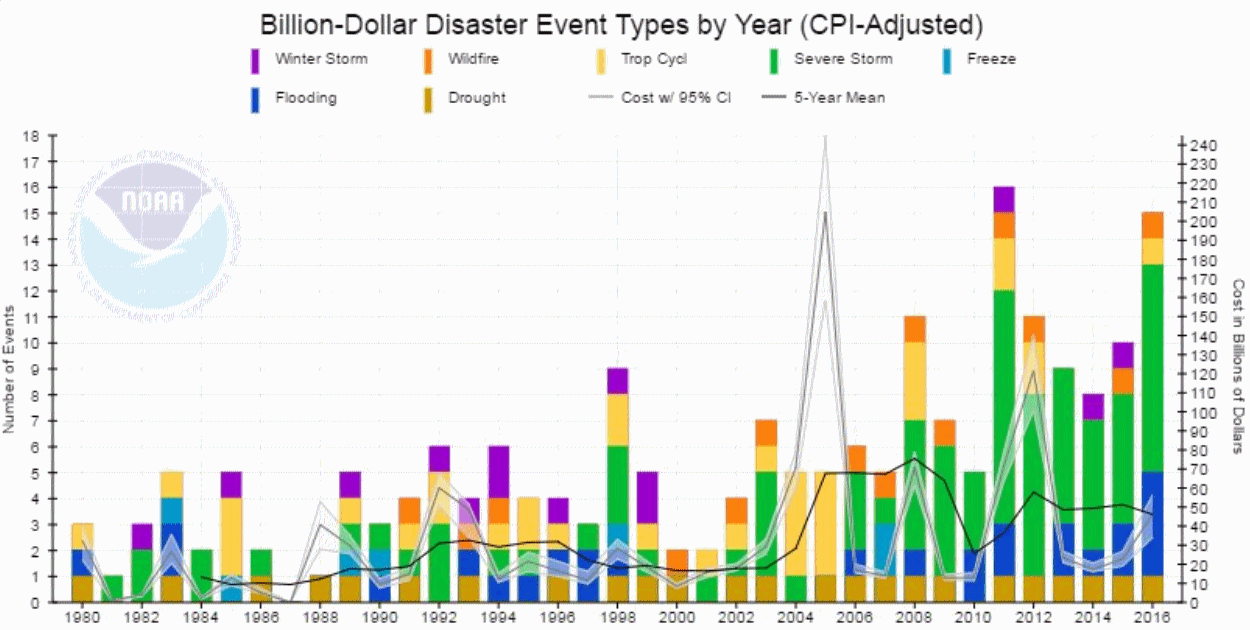
Billion Dollar Weather and Climate Disasters Since 1980. Severe storms and flooding events have been on the increase, especially since 2010, according to NOAA NCDC.
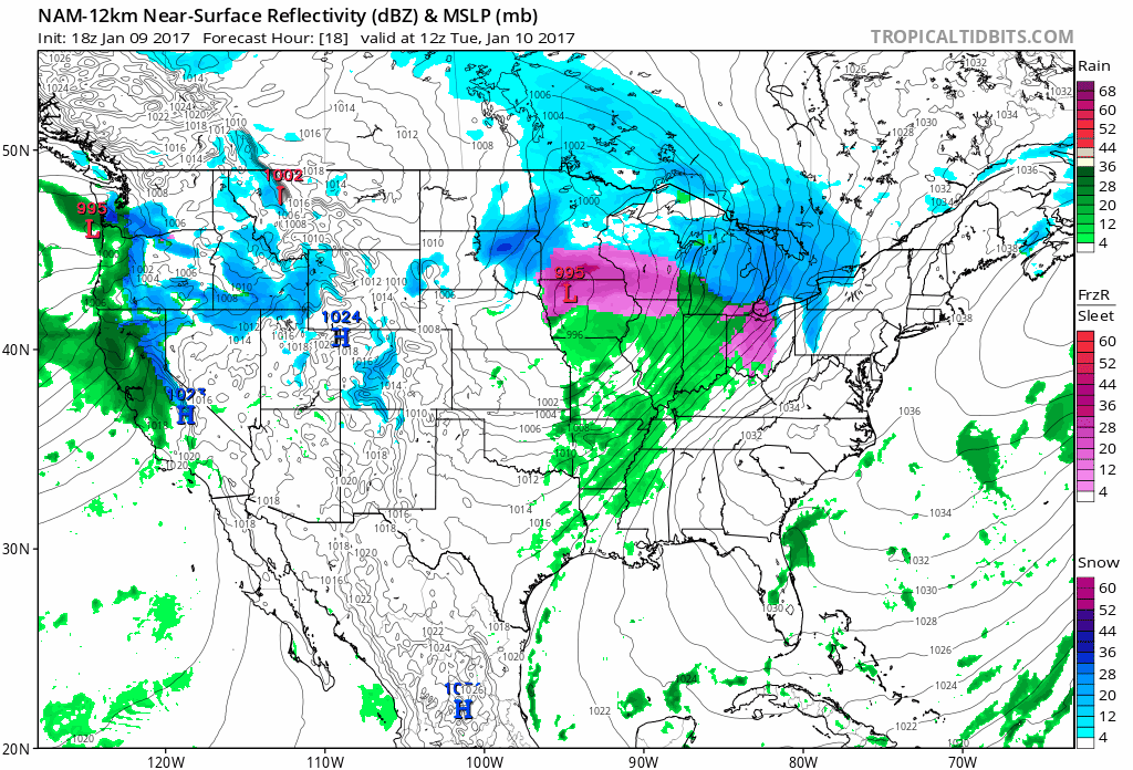
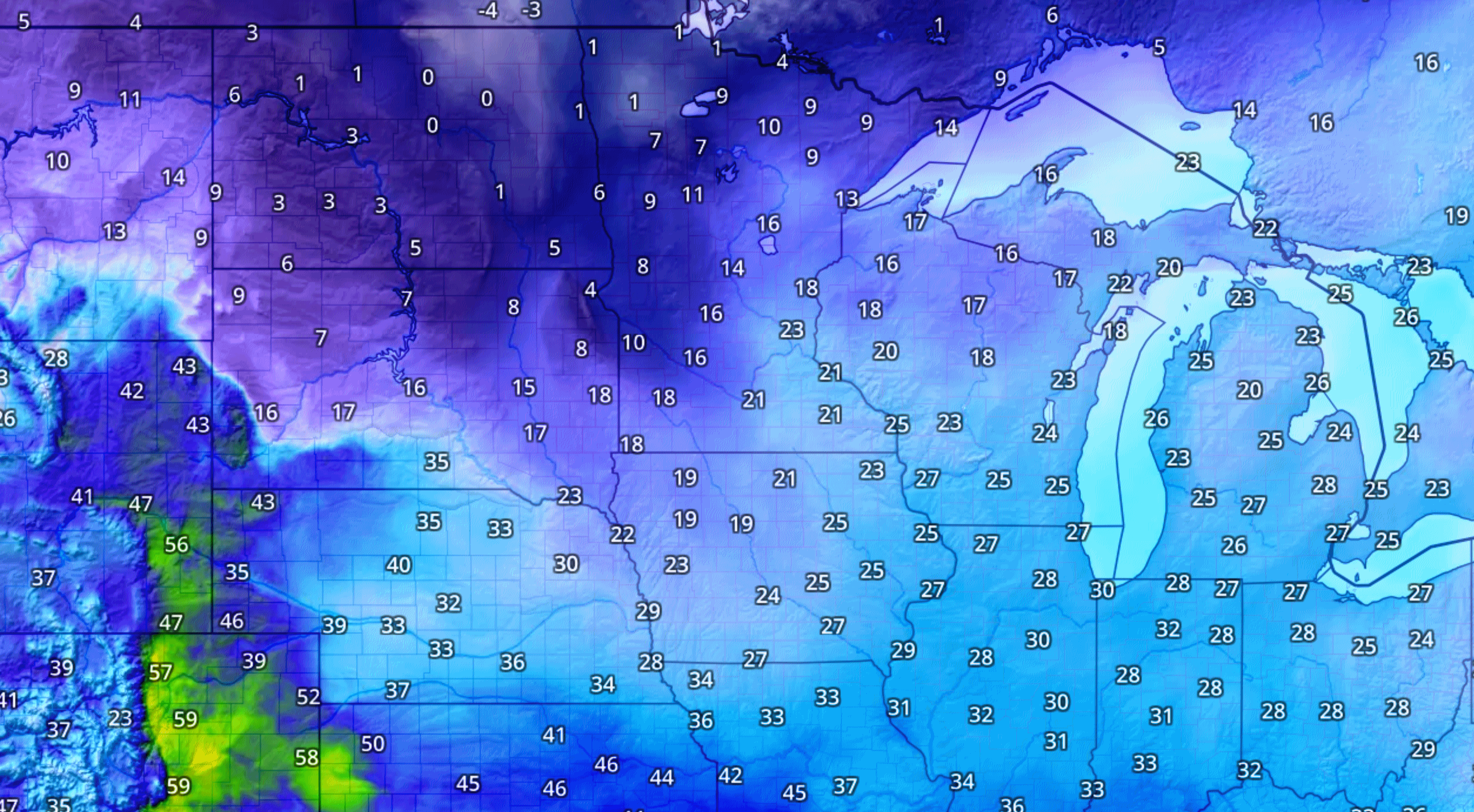
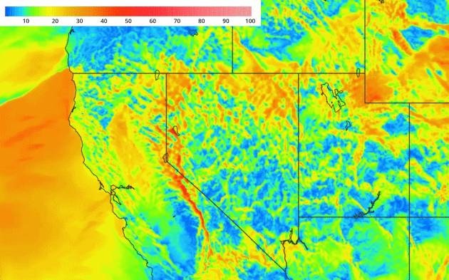
More Heavy Rain for California. 12 KM NAM data from NOAA shows the latest surge of Pacific moisture pushing into California; a few more inches of rain, with accompanying mudslides, road closures and high winds capable of power outages. Snow and ice pushes across the Upper Midwest with accumulating snow from Minnesota and Wisconsin into northern Michigan; the atmosphere warm enough for rain south of Milwaukee, Chicago and Detroit. 84-hour Future Radar: Tropicaltidbits.com.
AerisWeather Briefing: Issued Monday afternoon, January 9th, 2017:
* Heavy rain over the weekend – over six inches in spots – has led to numerous reports of flooding across California and into Nevada. The Truckee River has hit major flood stage in some areas.
* Another round of heavy rain is expected Tuesday and into Wednesday across the region, with at least another 1-3” of rain falling for areas like San Francisco and Redding. This will continue to create flooding issues through the middle of the week.
* The good news is that a dry stretch of weather is expected across the region after this next round of rain as we head toward the end of the week and into the weekend.
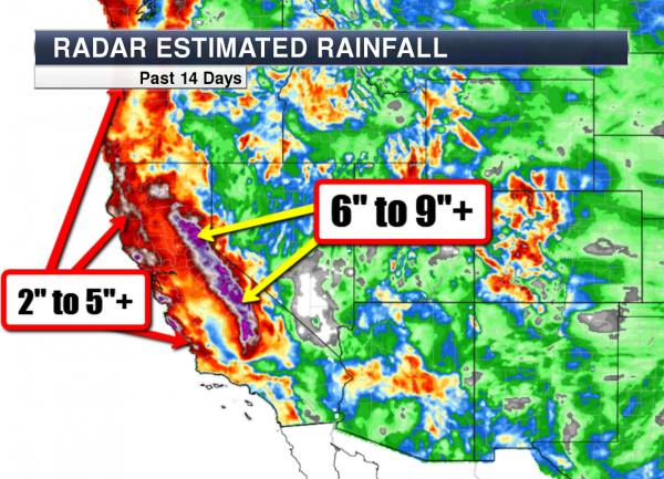

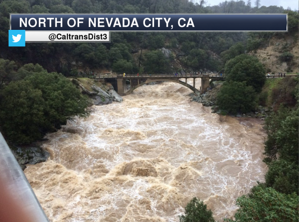


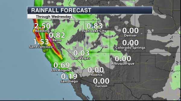
Summary: After a weekend of very heavy rain across portions of the west coast – particularly in California – another round of heavy rain is likely as we head into Tuesday and Wednesday. Rainfall totals could top an inch and a half in the Bay Area, with totals of six inches or more of rain in the higher terrain. Already some rivers across the region are in major flood stage, and any additional rain over the next several days will continue to exasperate the problem. Facilities that have had issues in the past with situations like this will continue to see issues over the next several days. The good news is once we get past this next round of rain, conditions look to dry out across the region late this week and into this weekend.
D.J. Kayser, Meteorologist, AerisWeather
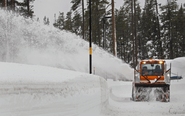
Photo credit: "Snow is cleared from the Donner Pass rest area near Truckee, Calif., on Saturday." (Bob Strong/Reuters).
 Nevada Flood Damage Not As Bad As Feared. ABC News has a running tally of impacts from days of flooding rains, mudslides and heavy mountain snows: "...A
Nevada National Guard official says high-water vehicles arrived but
were not needed to evacuate residents affected by flooding in a town
east of Reno. Lt. Col. Mickey Kirschenbaum said Monday that guard
members and five of the big vehicles will remain for now in Lockwood.
Kirschenbaum says it appears residents who wanted to leave a
neighborhood cut off by flooding were able to make their way out.
Kirschenbaum says plans have been called off for the guard to use two
more of the 2.5-ton diesel vehicles to shuttle damage assessment teams
to Sparks. He says regular emergency vehicles are being used..."
Nevada Flood Damage Not As Bad As Feared. ABC News has a running tally of impacts from days of flooding rains, mudslides and heavy mountain snows: "...A
Nevada National Guard official says high-water vehicles arrived but
were not needed to evacuate residents affected by flooding in a town
east of Reno. Lt. Col. Mickey Kirschenbaum said Monday that guard
members and five of the big vehicles will remain for now in Lockwood.
Kirschenbaum says it appears residents who wanted to leave a
neighborhood cut off by flooding were able to make their way out.
Kirschenbaum says plans have been called off for the guard to use two
more of the 2.5-ton diesel vehicles to shuttle damage assessment teams
to Sparks. He says regular emergency vehicles are being used..."
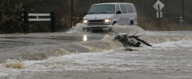
Photo credit: "A
van drives through flooded water on Green Valley Road in Graton,
Calif., Saturday, Jan. 7, 2017. On the California coast, weather
forecasters anticipate a storm surge from the Pacific called an
atmospheric river to dump several inches of rain from Sonoma to Monterey
counties, and up to a foot in isolated places in the Santa Cruz
mountains." (AP Photo/Jeff Chiu)
California Today: Severe Flooding, But Does That Mean Drought Relief?
Much of the water is running off into streams, rivers and the Pacific
Ocean. Snowpack in the mountains melts slowly, filling reservoirs and
providing water for consumers and agriculture yearround. It's money in
the bank. Here's a clip from The New York Times: "...Much
depends on the resilience of the Sierra Nevada snowpack, which acts as
California’s largest water storage facility by replenishing depleted
rivers and reservoirs after the winter. The latest data showed the
snowpack’s depth roughly equal
to its historical average, an encouraging sign. But those gains could
be threatened if warm weather melts it too soon. And while Northern
California has seen copious precipitation since the fall, other parts of
the state — notably, in the San Joaquin Valley and the Central Coast —
remain severely parched..."
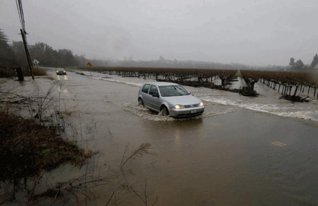
Photo credit:"A flooded road in Graton, just west of Santa Rosa, on Saturday." Credit Jeff Chiu/Associated Press.
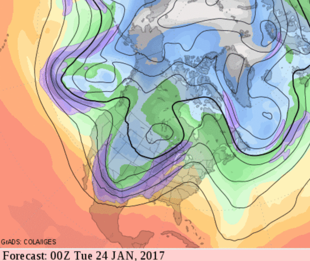
A Stormy Rut In The Jet Stream.
Looking out 2 weeks the GFS model continues to carve out a full
latitude trough of low pressure, a storm incubator capable of spinning
up a family of storms, with potentially heavy wet snow for the Plains
and Upper Midwest. The east coast looks unusually mild.
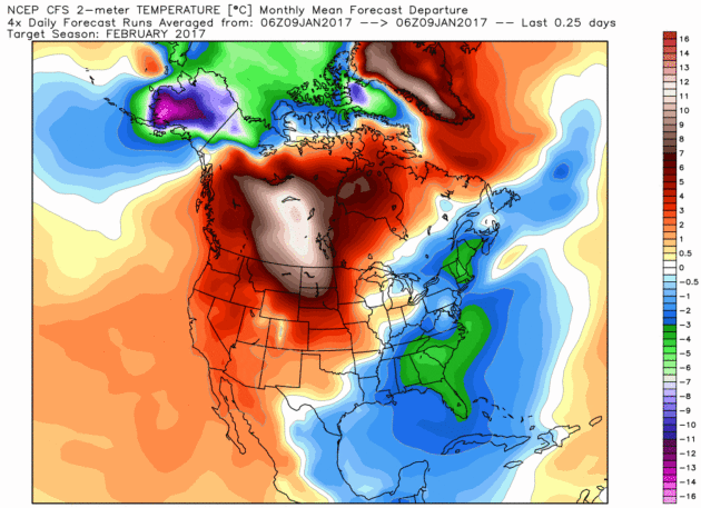
February: Pockets of Freakish Warmth?
The latest runs of NOAA's CFSv2 (Climate Forecast System) model show a
warm solution for much of North America next month. No, I'm not buying
it yet, but with such a strong Pacific signal and an almost El Nino-like
subtropical jet stream pumping warmth and moisture into the western USA
(persistently) I wouldn't be surprised to see February make up for
January's chill. February temperature anomalies: WeatherBell.
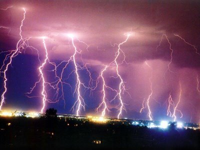
Lightning, Weather's Byproduct, May Become One of its Predictors. Here's are a couple of excerpts of a good New York Times explainer: "...When I got started back in the ’80s, nobody cared,” said Hugh Christian, a research professor at the University of Alabama at Huntsville and director of the team that developed a lightning sensor
that will be attached to a truss of the International Space Station in
2017. It will augment coverage provided by a geostationary satellite,
known as GOES-16,
that was successfully launched in November. “It’s been a long road,”
Dr. Christian said. “But now it’s universally accepted that lightning
flash rates are correlated with storm intensification and severity.”
This means the more that is known about lightning activity, the more advance warning it is possible to give people about the possibility of associated severe weather events like tornadoes and hail...In
2016, 38 people were killed by lightning in the United States. That’s
the highest death toll in 10 years, and some experts expect that number
to climb in future years because of climate change. The stakes are
higher in less-developed nations like India, where deaths average about
1,000 per year..."

U.S. Warns of "Imminent" Cyberattack Threat on Electric Grid. Another argument for solar, battery storage and not being totally dependent on the grid. CNET reports: "A report that Russian computer attackers had penetrated a Vermont electrical utility company may have turned out to be baseless, but the nation's grid is in "imminent danger" of cyberattacks, the Energy Department warned Friday. "Widespread disruption of electric service because of a transmission failure initiated by a cyberattack at various points of entry could undermine U.S. lifeline networks, critical defense infrastructure and much of the economy; it could also endanger the health and safety of millions of citizens," the DOE said in a massive 494-page report. "Also, natural gas plays an increasingly important role as fuel for the nation's electricity system; a gas pipeline outage or malfunction due to a cyberattack could affect not only pipeline and related infrastructures, but also the reliability of the nation's electricity system..." (Image: Department of Energy).
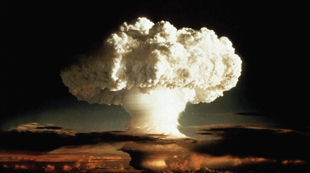
File photo credit: New York Times. "The mushroom cloud of the "Ivy Mike" hydrogen bomb test by the United States on Enewetak, an atoll in the Pacific Ocean, in 1952." Credit Department of Defense Nuclear Information Analysis, via Reuters.

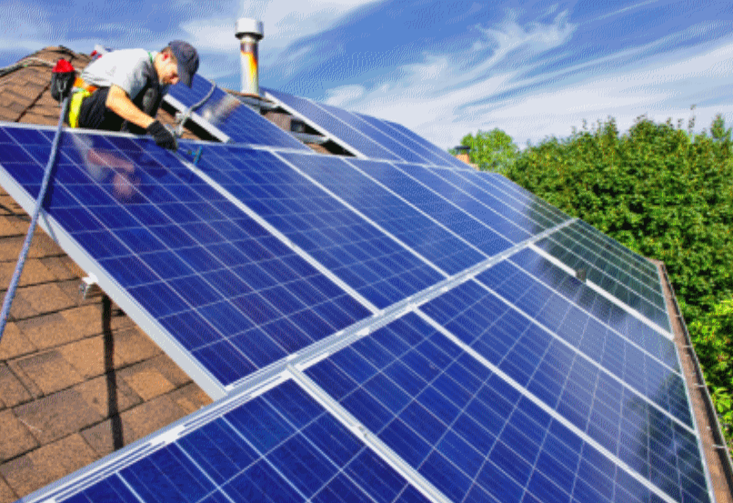
The Most Solar-Friendly States in America? Greentech Media has the list and explainer: "Solar research and advocacy group Solar Power Rocks released its 2017 ranking of the states most friendly to rooftop solar Friday, based on a compilation of state renewables policies and incentives. Massachusetts retained top honors, shaking off New York and New Jersey, which had split the gold three ways last year. Eleven states earned failing grades, with Oklahoma, Alabama and Mississippi rounding out the bottom three. The ranking factors in 12 variables, including policy (like renewable portfolio standards, electricity prices, net energy metering), incentives (including tax credits, performance payments, tax exemptions), and outcomes (payback time and internal rate of return). The rankings don't equate to the states with the most solar; they capture the states with the policy framework most amenable to customers putting solar on their roofs..."
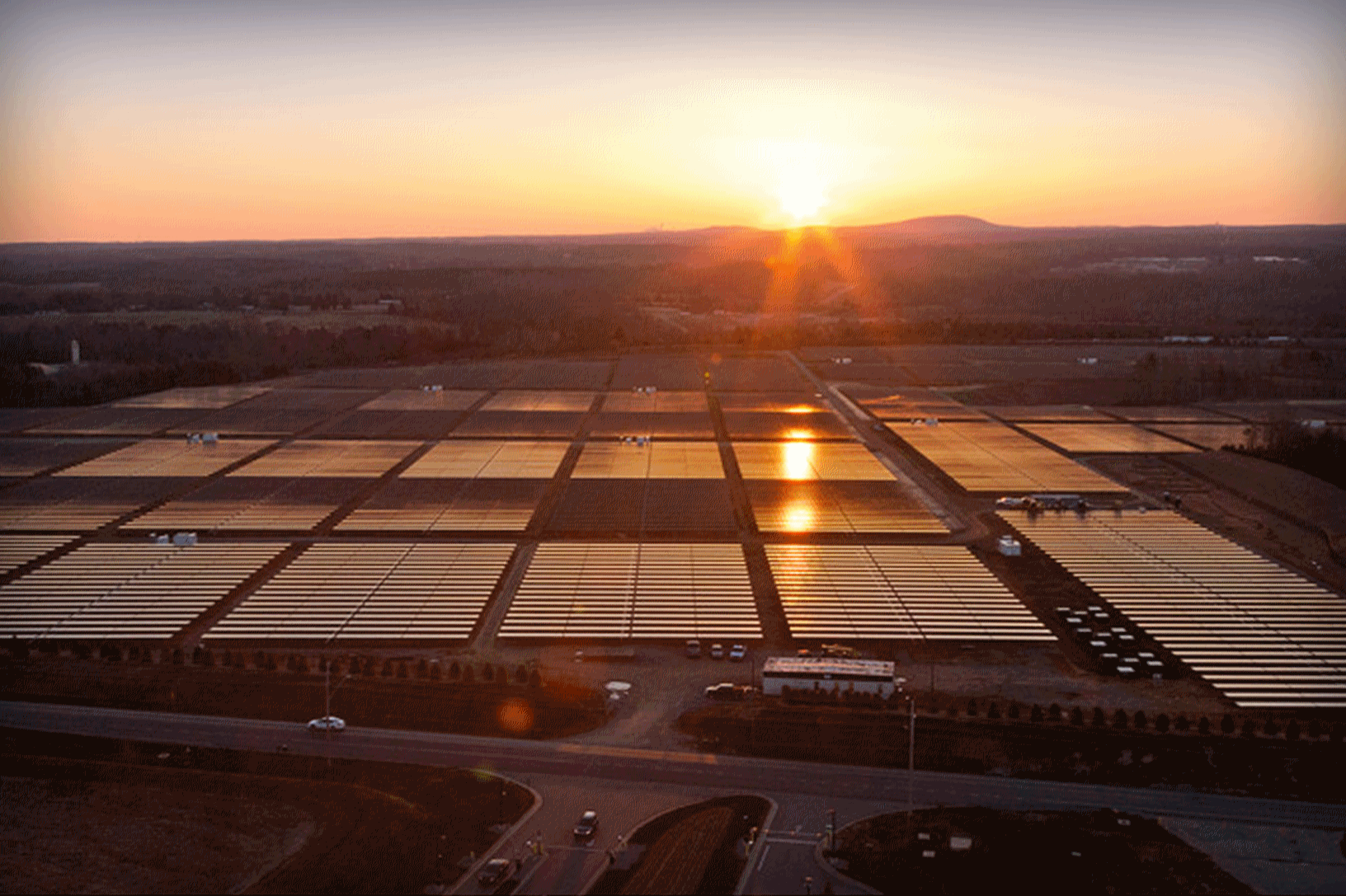
Solar Could Beat Coal to Become the Cheapest Power on Earth. Here's a clip from Bloomberg: "Solar power is now cheaper than coal in some parts of the world. In less than a decade, it’s likely to be the lowest-cost option almost everywhere. In 2016, countries from Chile to the United Arab Emirates broke records with deals to generate electricity from sunshine for less than 3 cents a kilowatt-hour, half the average global cost of coal power. Now, Saudi Arabia, Jordan and Mexico are planning auctions and tenders for this year, aiming to drop prices even further. Taking advantage: Companies such as Italy’s Enel SpA and Dublin’s Mainstream Renewable Power, who gained experienced in Europe and now seek new markets abroad as subsidies dry up at home. Since 2009, solar prices are down 62 percent, with every part of the supply chain trimming costs..." (File photo: Apple).

Photo credit: "The Concept-i from Toyota showcases what the company expects cars will look like in 2030. It was revealed on Wednesday at CES in Las Vegas." (Courtesy of Toyota).


TODAY: 2-4" snow & ice possible - slippery travel. Turning gusty, colder. Winds: NW 10-20. High: 27 (falling rapidly by afternoon)
TUESDAY NIGHT: Snow tapers to flurries, colder. Still very icy. Low: 7
WEDNESDAY: Burst of snow; another inch or two? Winds: NW 8-13. High: 11
THURSDAY: Mostly cloudy, feels like -10F. Winds: NW 10-15. Wake-up: 1. High: 10
FRIDAY: Bright, ineffective sunshine. Windchills dip below -20. Winds: SE 3-8. Wake-up: -8. High: 7
SATURDAY: Mostly cloudy, not quite as numb. Winds: SE 5-10. Wake-up: -2. High: 21
SUNDAY: Clouds thicken, light mix late? Winds: SE 7-12. Wake-up: 15. High: 31
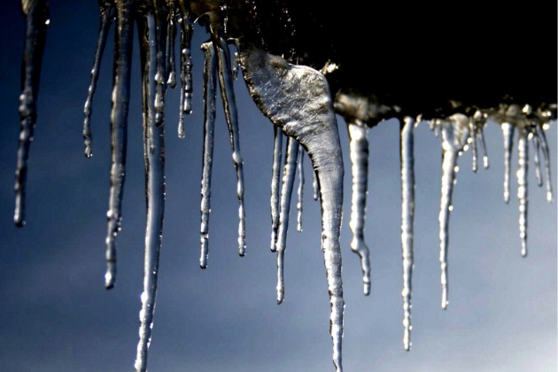
MONDAY: Melting icicles - January Thaw arrives. Winds: SW 5-10. Wake-up: 20. High: 34
Climate Stories...
When I Talk About Climate Change, I Don't Talk About Science. Southern Fried Science has a very interesting take on this: "...In stakeholder interviews, people generally understand and acknowledge the impacts of climate change on local and regional scales, as long as you don’t call it “Climate Change”.
This has been my experience working in rural coastal communities, which
tend to be strongly conservative and intimately connected to the
changing ocean.Which is why, when I talk about Climate Change, I don’t
talk about science. When I talk about Climate Change, I talk about Fishing. Fishing
communities have a long, rich history in the United States. Many are
among the oldest townships in the country, tracing their roots back
before the Revolution. Fishing, in many ways, built this country.
Fishermen know that things are changing, that black bass, scup, and butterfish (an important prey species in the tuna fishery) are moving further and further north..."
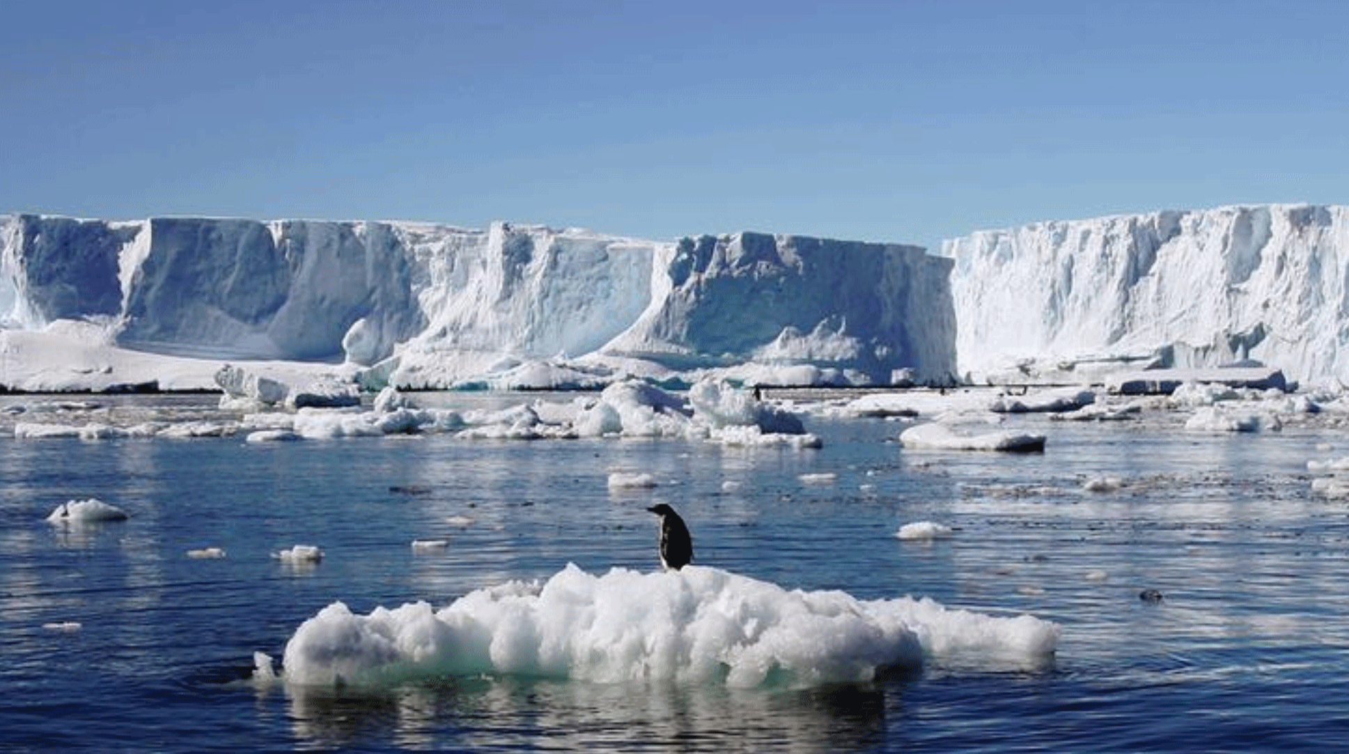
Photo credit: "An Adelie penguin stands atop a block of melting ice near the French station at Dumont díUrville in East Antarctica January 23, 2010. Picture taken January 23, 2010." REUTERS/Pauline Askin/File photo

Is More Tech the Answer to Climate Woes? New Study Says Yes. Here's an excerpt from Greenbiz: "The
pace of the global rollout of clean technologies needs to increase
tenfold, exceeding the pace of change seen in previous industrial
revolutions, if the world is to have any chance of meeting the climate
change targets set out in the Paris Agreement. That is the conclusion of
a new study from a team at Duke University,
which compared the pace of change in per capita carbon emissions during
the industrial revolution of the late 19th and early 20th century and
the clean tech revolution that has been seen in recent years. "Based on
our calculations, we won't meet the climate warming goals set
by the Paris Agreement unless we speed up the spread of clean
technology by a full order of magnitude, or about 10 times faster than
in the past," said Gabriele Manoli, a former postdoctoral associate at
Duke's Nicholas School of the Environment, who led the study..."
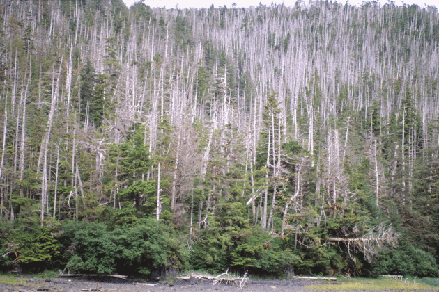
Study Documents Tree Species' Decline Due to Climate Warming. The Associated Press has the story: "...The
study published in the journal Global Change Biology found death due to
root freeze on 7 percent of the tree's range, including areas where
it's most prolific. It cited snow-cover loss that led to colder soil. Additional mortality is likely as the climate warms, researchers said.
"Lack of snow is only going to become more and more prevalent," said
lead author Brian Buma, a University of Alaska Southeast assistant
professor of forest ecosystem ecology.
By 2070, winter temperatures in about 50 percent of the areas now
suitable for yellow cedar are expected to rise and transition from snow
to more rain, according to the study.
Yellow cedar began to decline in about 1880, according to the U.S.
Forest Service, and its vulnerability is viewed as one of the
best-documented examples of climate change's effect on a forest tree..."
Photo credit: "Yellow-cedar in West Chichagof-Yakobi Wilderness Area, a pristine area of coastal Alaska, faces intensive mortality." Photo: Paul Hennon, U.S. Forest Service.
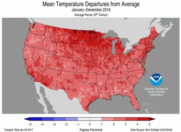
Global Warming Made Every State a Red State in 2016. ThinkProgress reports: "Last
year was the second-hottest year on record for the United States (after
2012), the National Oceanic and Atmospheric Administration (NOAA) reported
Monday. And only 2011 saw more billion-dollar weather disasters. But
what made 2016 unusual was just how widespread the warming was. “The
breadth of the 2016 warmth is unparalleled in the nation’s climate
history,” explained NOAA. “No other year had as many states breaking or
close to breaking their warmest annual average temperature...”
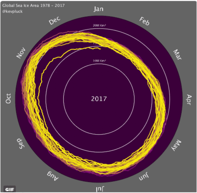
The Unprecedented Drop in Sea Ice, in One Terrifying GIF. Alarmist hype? Check out the trends for yourself. Here's an excerpt from ThinkProgress: "Arctic sea ice area and volume have collapsed
in recent decades. And the North Pole has been freakishly warm this
winter, as carbon pollution has made what would have been
once-in-1,000-years heatwaves increasingly commonplace. But what’s so remarkable about this year is that the ongoing drop in Arctic sea ice has been matched by an unexpectedly sharp drop in Antarctic sea ice. A new animation from Kevin Pluck shows just how unprecedented this is..."
Image credit: "A new animation (below, in motion) shows a precipitous decline in global sea ice." CREDIT: Kevin Pluck.
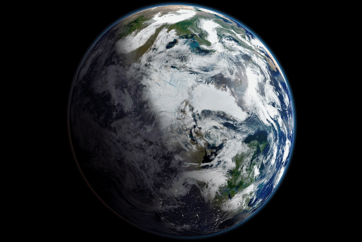
Image credit: "On September 16, 2012, Arctic sea ice extent was at its lowest level since satellite monitoring began in 1979. This view of Earth, centered on the Arctic, is a mosaic of images taken on September 2, 2012 by NASA’s Suomi-NPP satellite." Photo courtesy of NASA.
More information on NASA's Suomi NPP satellite platform here.

No comments:
Post a Comment