-7 F. wake-up temperature in the Twin Cities Thursday morning.
2 F. maximum temperature yesterday. Doesn't seem right calling it a "high".
24 F. average high on January 5.
32 F. high temperature in the MSP metro on January 5, 2016.
January 6, 1942: The temperature rises from 32 below zero to 41 above in 24 hours in Pipestone.
10 minutes of additional daylight since December 21, increasing 1-2 minutes every day.
 Yukon Bling - We Earn Our Springs in Minnesota
A Minnesota January is an acquired taste. Iced lutefisk - with a Jagermeister chaser. Not for the timid or faint of heart.
And yet, armed with the right attitude (and clothing) these brisk fronts become almost tolerable.
A
few things I've learned the hard way: if your feet and ears are warm
you stand a better chance of braving the chill. A warm undershirt and
socks help for drafty rooms. And warm shoes or boots can go a long way.
Research suggests cold feet may cause blood vessels in our noses to constrict, lowering our immune response. Go figure.
20s
early next week will feel like a revelation; another arctic slap the
end of next week won't last as long. Weather models still suggest a
moderate, Pacific flow in 2-3 weeks, with a string of 30s. Woohoo!
Although no mega-storms are brewing anytime soon a series of clipper-like systems
next Tuesday,
Wednesday and
Saturday may drop plowable amounts of snow on Minnesota. The GFS prints out nearly 4-8 inches over a 10-day span.
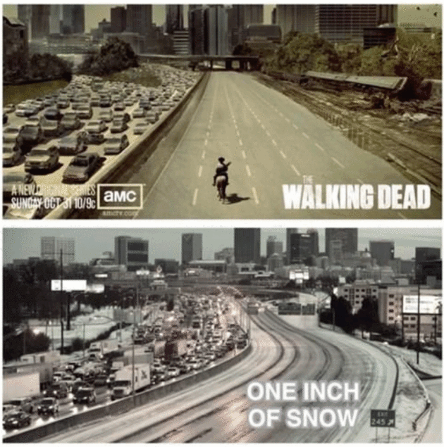
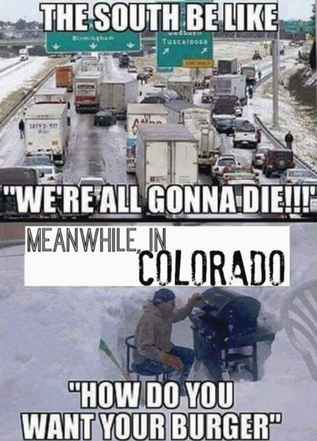
Meanwhile, Atlanta may pick up an inch or two of slush
tonight. Uh oh. Call out the National Guard.
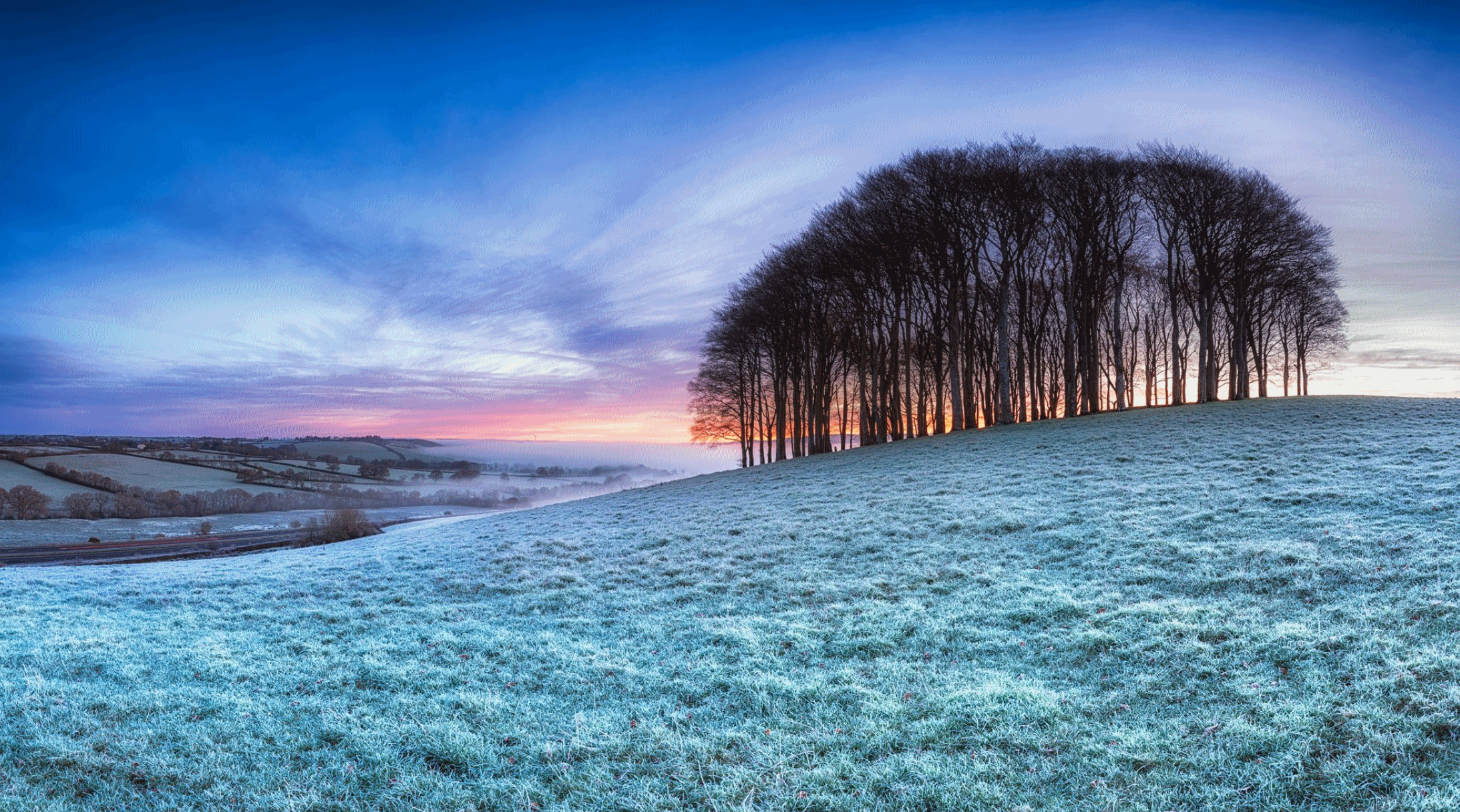
Photo credit: UK Met Office.
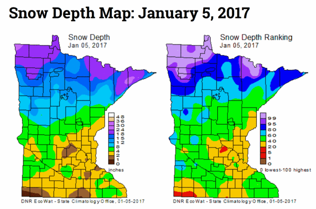
Minnesota Snow Cover: The Have's and Have-Nots.
Head north if you want to romp in the snow; recent rain and ice has
really taken a toll on snow cover over central and southern Minnesota.
Here's an excerpt from the
Minnesota DNR's HydroClim: "
Snow depths
across Minnesota range from as little as one or two inches in portions
of central and southern Minnesota, to over twelve inches in northern
Minnesota. Snow depth totals approaching two feet can be found in the
far northwestern part of Minnesota, and the higher terrain of Cook
County in northeast Minnesota. Snow depths are near, to above,
historical medians for the date in the northern one-third of Minnesota.
Snow cover is below the historical median for the date in many southern
and central Minnesota counties..."
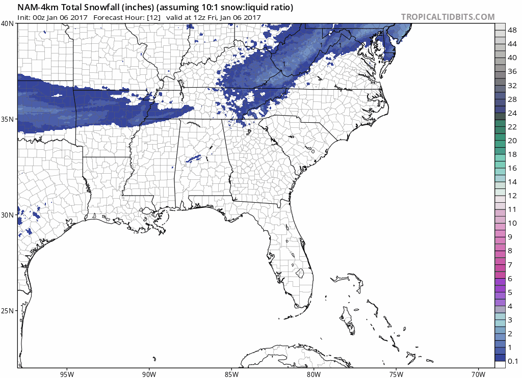
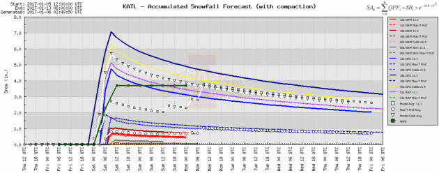
 Not Buying It - Yet
.
This is 10-Day potential snowfall from the GFS, which has a nasty habit
of over-estimating snowfall amounts. Do I think the Twin Cities will
see 15-18" of snow by January 15. No, but the transition to a somewhat
milder pattern may shift the storm track farther north, with a better
chance of accumulating snow from the Dakotas into Minnesota, Wisconsin
and Michigan. Source: Tropicaltidbits.com.
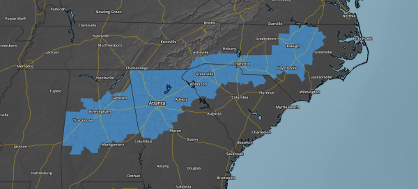
 Plowable Snow for Atlanta, Charlotte, Raleigh and Richmond?
The map above shows 4 KM NAM guidance from NOAA, which has been
printing out a consistent streak of accumulating snow. Rain will quick
change to snow tonight in Atlanta and then push into the Carolinas an
Tidewater region of Virginia. Atlanta may be a mess, the only saving
grace: this snow event is coming on a weekend.
Not Hot-Lanta.
The local Atlanta NWS office is predicting close to 4" snow tonight
into early Saturday from this next system, after a cold rain much of
today. Here's the thing: it'll melt. Graphic: Iowa State.
 AerisWeather Briefing
:
Issued Thursday, January 5
th, 2017:
*
Confidence is growing on a high impact snowfall for parts of the
Southeast and Mid-Atlantic as we head into the end of the week and the
weekend. This includes places like
Atlanta, Charlotte, Raleigh and Birmingham.
* Winter Storm Watches are in effect for 1-4" of snow across parts of the region,
which would be enough to cause major travel troubles.
*
The heaviest snow will fall in parts of eastern North Carolina and
southeast Virginia where over a half a foot of snow will be possible.
* Back out west, we continue to watch waves of moisture for California move in into the weekend and early next week.
*
Rainfall
totals of a foot or more are likely across parts of California through
the weekend, which will lead to significant flooding. Flash
Flood Watches are in effect. Facilities that have had issues in the past
with situations like this will likely see issues as we head into the
weekend and next week.
Snow Coming To The Southeast.
The models have been coming into better agreement over the past 24
hours on a winter storm impacting the Southeast and the Mid-Atlantic as
we head through the day
Friday and into
Saturday.
However, it is noted that a slight shift in the overall track could
still make some major changes as to who gets what from this system. At
the moment we expect sleet/mix of rain and snow to form across parts of
Mississippi, Alabama and into Georgia
tomorrow, changing over to snow
tomorrow night before pushing out during the day
Saturday.
Winter Storm Watch. Due to the impending snow threat, Winter Storm Watches have been issued for
Friday through
Saturday from Tuscaloosa and Birmingham through Atlanta, Charlotte and Raleigh. 1-5” of snow is expected. Source: Aeris AMP.
System Starts Off In The Southern Plains Tonight.
Snow will start spreading east into the Southern Plains as we head into
the overnight hours, with Oklahoma City expected to wake up to an inch
or two of snow
Friday morning. A Winter Weather Advisory is in place
tonight until
noon Friday for the Oklahoma City metro. This snow will cause slick roads for the
Friday morning commute. Source: NOAA.
Snow Moves Into The Southeast. As we head through
Friday and into
Saturday, snow will continue to spread into the Southeast and Mid-Atlantic, along with some sleet at times.
Even
1-2” of snow across these regions is enough to gum up the roads and
make travel difficult or near impossible. The evening commute Friday
will be slow in the Birmingham metro; however, at the moment it looks
like the snow may hold off long enough for the evening commute in
Atlanta. There will be a band of 6”+ of snow in parts of eastern North Carolina into southeast Virginia. Source: Aeris Weather.
Local Snowfall Forecast:
Birmingham, AL:
Atlanta, GA:
Charlotte, NC:
Raleigh, NC:
Newport/Morehead City, NC:
48 Hour Rain Totals.
Numerous reports of 2”+ of rain over the past 48 hours have come in
across parts of northern and central California, with some reports of
flooding as well. Meanwhile, snow has been piling up in the mountains as
well, with reports of 24-46” of snow at Mammoth Mountain in California
and almost 47” in the Sierra Madre Range in Wyoming. Source: NOAA.
More Heavy Rain/Snow This Weekend. While we will have a break in the precipitation across most of California today and
Friday,
as we head into the weekend we will be watching another Atmospheric
River situation set up over the west coast. An atmosphere river is
essentially a plume of moisture that originates from the
tropics/subtropics. These types of events typically bring heavy rain and
snow with them to California, and according to NASA can be the cause of
30-50% of the precipitation California sees each year. However, they
are also the cause of approximately 80% of floods in the state.
You
can see the firehose of moisture coming out of the Pacific into the
West Coast into the weekend, likely to cause very heavy rain and snow
amounts. What could also make this worse is snow levels are expected to
increase heading into the weekend, so heavy rain could fall on top of
snowpack, making the flooding situation worse in parts of the mountains.
Flood Watches In Effect.
Flood Watches have been issued for the weekend across parts of
central/northern California and western Nevada, including Sacramento and
Reno. Rainfall totals of 3-15” will be possible through early
Monday in these areas, leading to more flooding across the region.
 Rain Into Monday.
 Almost 4” of rain is expected to fall in the Bay Area into
Monday
with the weekend atmospheric river event; however the heaviest rainfall
totals (a foot or more) will be toward the Sierras, where snow levels
are likely to be only as low as 8,000 feet. This heavy rain will fall on
top of already saturated soils from the last few days – or, in some
locations, on top of snowpack – which will lead to excessive runoff and
flooding of roads, rivers and urban areas.
With the very
heavy rain expected, I see the potential of a significant flooding event
across the region. Facilities that have had issues in the past with
situations like this will likely see issues as we head into the weekend
and next week.
 Significant River Flood Threat.
We are expected to see numerous rivers reach or exceed flood stage as
we go through the weekend. Already two rivers are expected to reach
major flood stage.
Record Crests Possible? This is the forecast for the Merced River near Yosemite National Park, which is expected to crest at 23.1’ during the day
Sunday.
This would almost match the historic level reached back in January of
1997. That flood ended up causing $178 million in damages to Yosemite
National Park and caused visitors to be trapped for days as all roads to
get out of the park were flooded.
 Very Heavy Mountain Snow.
 While
snow levels will be high during the next event, we are still expecting
the potential of two or more feet of snow in parts of the Sierras.
Winter Storm Watches. Winter
Storm Watches have been issued for the heavy snow potential across
parts of the Sierras and the Coast Range for the weekend.
Here Comes Round Three. Looking
even further out, it appears another atmospheric river event will try
and set up toward the middle of next week, bringing even more rain and
snow to California.
Rain Into Next Wednesday. With even more rain
next Tuesday/Wednesday, rain totals could top five and a half inches in the Bay Area through
next Wednesday.
Summary: Winter Storm Watches are in place across portions of the Southeast and Mid-Atlantic
Friday and
Saturday for snowfall accumulations of 1-4”, including in Birmingham, Atlanta, Charlotte and Raleigh.
This amount
of snow across these regions will be enough to gum up the roads and
make travel difficult or near impossible as we head through Friday afternoon into Saturday.
The heaviest snow is expected across eastern North Carolina and into
southeast Virginia, where six inches or more can be expected.
Out
west, we are tracking very heavy rain as we head into the weekend with
another atmospheric river event expected. Rainfall totals of 2-5” can be
expected in the Bay Area, but the heaviest will be out in the
mountains, where snow levels will be high and 5-10”+ of rain can be
expected.
This heavy rain will likely cause a significant
flooding event across the region. Already some river forecasts would
have river levels reaching potentially historic levels. Facilities that
have had issues in the past with situations like this will likely see
issues as we head into the weekend and next week. More heavy rain can be expected across these regions by the middle of next week.
D.J. Kayser, Meteorologist, AerisWeather
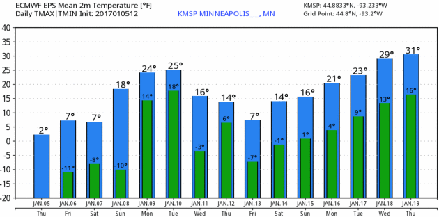
Reason To Keep On Going.
If you feel like you're getting crushed under a big, dirty, arctic boot
- cheer up! 20s return early next week; a good chance of freezing
within 2 weeks. Anywhere else this would be a meteorological death
sentence. But Minnesota? Hey, things are looking up! 15-Day ECMWF
numbers: WeatherBell.
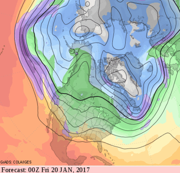
January Thaw Brewing.
The timing and scope of (relative) warmth is still very much up in the
air and open to debate, but the GFS moddel shows a Pacific flow by the
third and possibly fourth week of January with big storms returning to
the west coast and possibly the Gulf Coast; along with a warming trend
east of the Rockies.
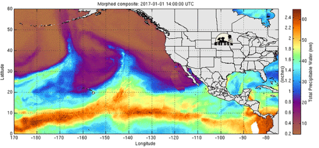
A Series of Storms Will Dump Rain and Snow All Across California. Here's the intro to a good overview at
WXshift: "
Californians
are about to hear a phrase that’s been rarely uttered during the
five-year drought that’s dogged the state: atmospheric river. A band of
moisture extending from the central Pacific to the Golden State’s shores
and mountains will bring rain totals measured in feet and snow totals
measured in yards. While it remains to be seen if 2017 is the year that
California’s drought finally becomes a thing of the past, the next week
will provide at least some welcome relief. The storms are already
arriving fast and furious. As of Wednesday, ski areas up and down the
Sierras have seen 3 feet or more of snow. Parts of Oregon’s Cascades
have also been hammered by the first set of storms..."
Animation credit: "
An atmospheric river is sending moisture streaming from the central Pacific to California." Credit:
Cooperative Institute for Meteorological Satellite Studies
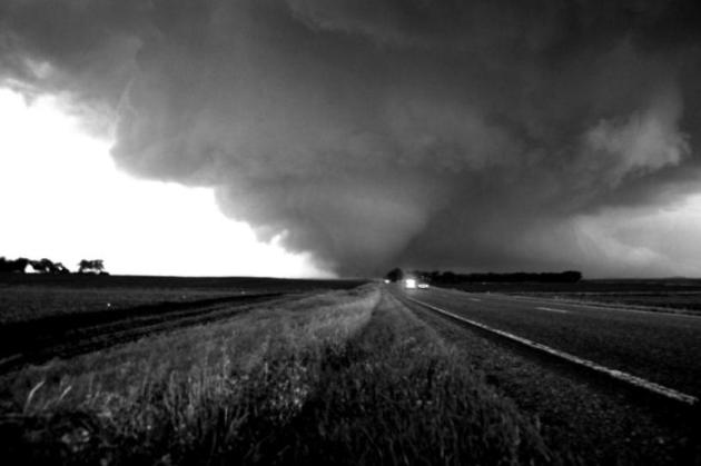
Large-Scale Tornado Outbreaks Increasing in Frequency, Study Finds. Here's a clip from
Military Technologies: "...
In the study, published in the Dec. 16 issue of Science,
the researchers used new statistical tools, including extreme value
analysis—a branch of statistics dealing with deviations—to analyze
observation-based meteorological estimates associated with tornado
outbreaks together with National Oceanic and Atmospheric Administration
datasets. The researchers estimated that the number of tornadoes in the
most extreme outbreak in a five-year interval doubled over the last
half-century. This means that in 1965 the worst outbreak expected over
five years would have had about 40 tornadoes, while in 2015 the worst
outbreak expected over five years would have had about 80 tornadoes..."
File photo: Aaron Shafer.
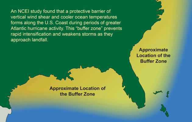
Conditions That Favor More Hurricanes Also Protect U.S., Study Finds. Here's a clip from a
New York Times story: "...
Scientists
say a long-term pattern of climate variability called the Atlantic
meridional mode helps determine the level of hurricane activity. In one
phase, the mode results in warmer surface water in the tropical Atlantic
and less wind shear, or changes in wind speed with altitude. Both
circumstances favor the formation of hurricanes. But at the same time,
conditions near the coastal United States are the opposite: colder
water, which provides less energy to a hurricane, and more wind shear,
which tends to rip a storm apart. So although more hurricanes may form
in the open ocean, as they approach land they are more likely to weaken.
This protective barrier, as Dr. Kossin called it, does not exist in the
Caribbean. In a period of less hurricane activity, the mode shifts and
opposite conditions prevail, both in the ocean and along the coast. That
means fewer hurricanes but a greater likelihood of their intensifying
near the United States..." (Graphic credit:
NOAA).
Pacific Standard has more context and perspective on the new research
here.
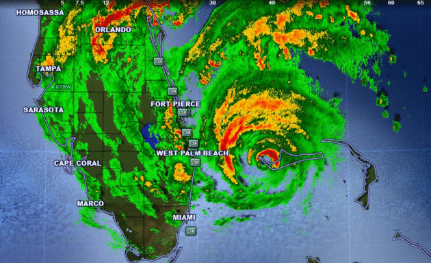
Periods of Greater Atlantic Hurricane Activity Linked to Weaker U.S. Landfalls. I know, it's a bit counterintuitive, but an article at
NOAA provides more perspective on the new research referenced above: "...
The
absence of the buffer zone had an even greater impact on major
hurricanes. Without it, major hurricanes were two to four times more
likely to intensify and three to six times more likely to intensify
rapidly. This presents major implications for forecasters, as rapid
intensification near the coast is difficult to predict and shortens
public warning time. The period of high Atlantic hurricane activity over
the past 20 years and the accompanying development of the buffer zone
may help explain the present “drought” of major hurricane landfalls in
the United States. The buffer also may have come into play when
Hurricane Matthew headed toward the country. While Matthew’s rains were
devastating for some areas, the buffer zone helped weaken the storm from
a Category 4 as it advanced on Florida to a Category 1 when it
officially made landfall in South Carolina. By keeping higher wind
speeds at bay, the buffer zone likely helped prevent further compounding
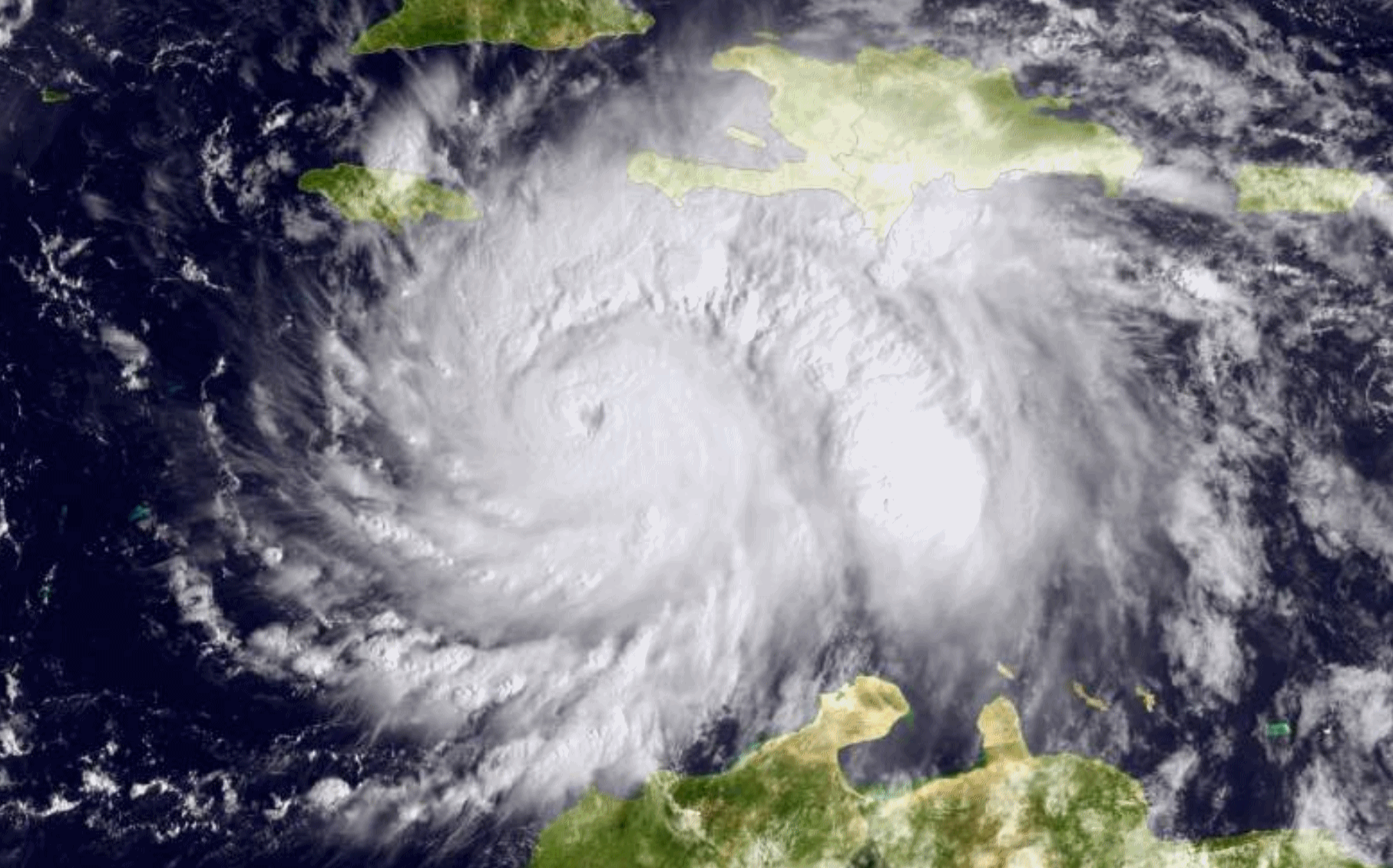
damages from Matthew..." (Doppler radar loop: Hurricane Matthew).
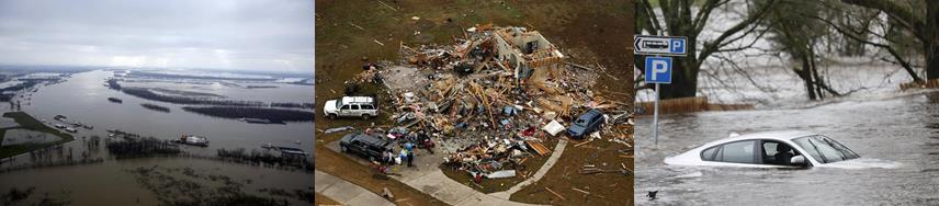
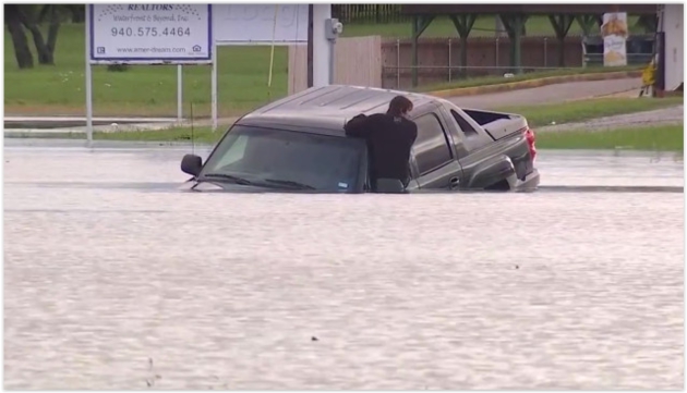
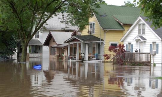
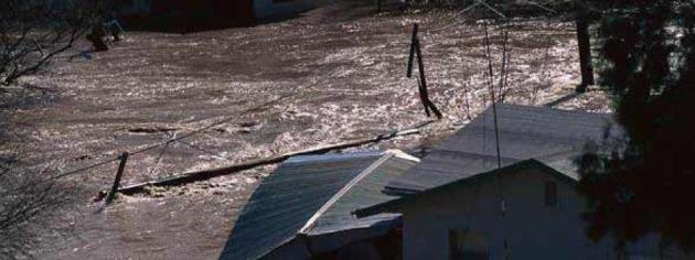
U.S. Had More Major Floods in 2016 Than Any Year on Record.
USA TODAY has more details: "
2016
really was the year of the flood in the U.S.: In total, 19 separate
floods swamped the nation last year, the most in one single year since
records began in 1980. This is according to an analysis by Munich Re,
a global reinsurance firm. The worst flood was in August in Louisiana.
At least 13 people were killed and roughly 60,000 buildings were
destroyed. The disaster cost $10 billion, Munich Re reported, which
noted it was the worst natural catastrophe in the U.S. since Hurricane
Sandy in 2012. "We had a lot of severe flash floods in heavily developed
areas," said meteorologist Mark Bove of Munich Re. Other major flood
disasters in 2016 included those in West Virginia in June, Houston in
April and Maryland in July. "We did get very unlucky" last year, Bove
said..."
2016: Most North American Natural Disasters on Record. Data from Munich Re goes back to 1980, reports
Yale Environment 360: "
North America was hit by 160 natural disasters in 2016, more than any other year since records began in 1980, according to an analysis
by the global reinsurance firm Munich Re. The disasters — which
included floods, wildfires, droughts, heat waves, and coastal storms —
caused an estimated $55 billion in damage. Only 54 percent of those losses were insured, Munich Re said..."
Press release from Munich Re is
here. Flood photo: USGS.
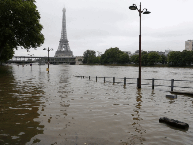
Extreme Weather Killed Thousands and Cost Billions Across the Globe in 2016. Here's a snippet from
The Washington Post: "...
Historic flooding inundated parts of France and Germany in late May and early June after days of record-breaking rainfall. An upper-level low-pressure system
that formed over central Europe drew warm, moist air from the
Mediterranean northward, and caused days of torrential downpours and
thunderstorms. A record seven inches of rain fell
over the Paris region in May, much of it during the final week of the
month. In central Paris, the Seine River crested more than 20 feet above
normal, the highest level in 34 years.
The Louvre and other museums were closed to visitors to move and
protect valuable artwork from rising floodwaters. Heavy rain also hit
neighboring Germany, where flash floods killed several people in Bavaria as rivers breached their banks and inundated several towns and villages..."
Photo credit: "
The flooded River Seine near the Eiffel tower in Paris is seen on June 3, 2016, after days of almost nonstop rain." (Philippe Wojazer/Reuters).
 Insurers Paid Out $50 Billion For Natural Disasters in 2016. Reuters reports: "Insurers
paid out around $50 billion for natural disaster claims last year,
almost double 2015's payout of $27 billion, reinsurer Munich Re said in
its annual natural catastrophe review on Wednesday. Earthquakes
in Japan and devastating floods in China - only 2 percent of whose
losses were insured - were the most expensive natural catastrophes of
2016. But the year saw the second-fewest fatalities from natural
disasters in 30 years. Some $125 billion of losses were uninsured.
It was the costliest twelve months for natural catastrophe damage after
three years of relatively low losses, and above the 10-year average of
$45.1 billion..."
File photo of Hurricane Matthew: NOAA.
Insurers Paid Out $50 Billion For Natural Disasters in 2016. Reuters reports: "Insurers
paid out around $50 billion for natural disaster claims last year,
almost double 2015's payout of $27 billion, reinsurer Munich Re said in
its annual natural catastrophe review on Wednesday. Earthquakes
in Japan and devastating floods in China - only 2 percent of whose
losses were insured - were the most expensive natural catastrophes of
2016. But the year saw the second-fewest fatalities from natural
disasters in 30 years. Some $125 billion of losses were uninsured.
It was the costliest twelve months for natural catastrophe damage after
three years of relatively low losses, and above the 10-year average of
$45.1 billion..."
File photo of Hurricane Matthew: NOAA.
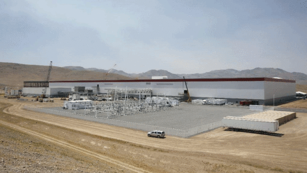
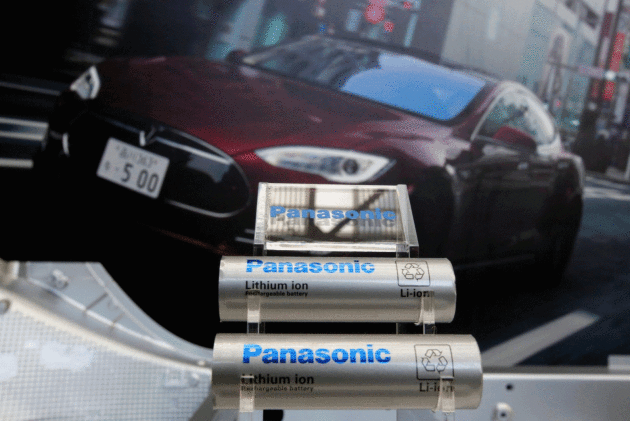
Tesla Begins Churning Out Battery Cells at Nevada Gigafactory. The Los Angeles Times reports: "Batteries are crucial to the future of Tesla,
best known as a car company but currently transforming itself into an
ambitious alternative energy provider. On Wednesday, the company and its
partner, Panasonic, announced the start of mass production of
lithium-ion battery cells at Tesla’s giant Nevada battery factory dubbed
the Gigafactory. It’s an important step for a couple of big reasons.
First, huge numbers of batteries are needed to power Tesla vehicles,
including the mid-market Model 3, set to begin production later this
year. In 2018, the company plans to produce 500,000 vehicles, including
the Model S and Model X, all packed with Tesla-made batteries..."
Photo credit: "
The $5-billion Tesla Gigafactory in Sparks, Nev., began the mass production of lithium-ion battery cells on Wednesday." (Rich Pedroncelli / Associated Press).
Tesla Aims To Sustain Purity of Car Batteries, But Can Any Company Be Sure? The Washington Post reports: "...
But
the electric-vehicles revolution Musk and others envision depends on an
immense escalation in the world’s capacity to manufacture lithium-ion
batteries, and the race for the raw materials to build those batteries
is creating strains for people and the environment far from Silicon
Valley, a Washington Post investigation has found. The series of Post
stories found that the manufacture of lithium-ion batteries — the power
source for smartphones, laptops and electric cars — is linked to child
labor in cobalt mines in Congo, severe air and water pollution around graphite plants in China and complaints of mistreatment of indigenous communities near lithium deposits in South America..."
Photo credit: "
Panasonic supplies lithium-ion batteries for Tesla vehicles such as the Model S." (Yuya Shino/Reuters).
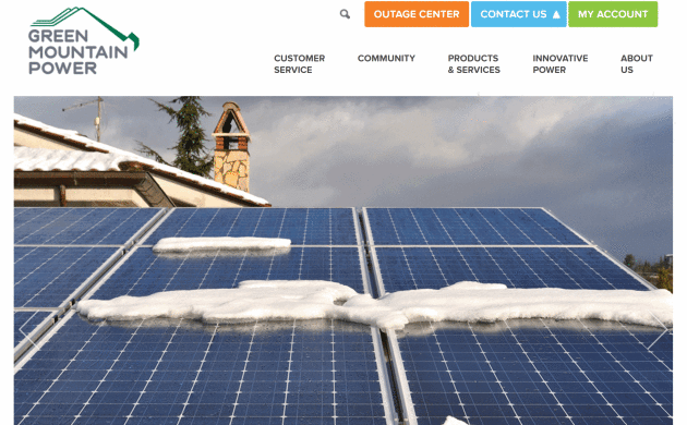
New Utility Program Helps Customers Go Off-Grid.
Renewable Energy World has the story: "...
According
to GMP if more customers go off-grid the utility might be able to some
retire line sections over time, reducing maintenance costs that would
directly lower costs for customers. In addition, off-grid homes that
otherwise would be connected to the grid will no longer contribute to
costly system peaks during peak summer energy days, lowering costs
further and reducing the need to build and maintain lines to meet that
demand, said GMP. With net-metering challenges
taking place in multiple states and energy storage prices dropping,
utilities are in a race to figure out a solution to the dilemma of how
to keep customers satisfied but still have enough money to pay for the
grid. If a customer wants solar and won’t be compensated to their
satisfaction by their utility through net-metering,
and if storage prices are low enough, why not pair storage with the
solar and just go off-grid? For now, that doesn’t make economic sense
for customers but what happens when storage costs come down and
utilities have cut off net-metering? Instead of waiting for the day to
happen, it appears that GMP is embracing what some consider the biggest
threat to utilities today – customers not using the grid..."
Where is America's Heartland? Pick Your Map. Is it geography or state of mind? The New York Times has a thought-provoking article: "...The
word captures an idea that is more expansive than the Midwest, harder
to map than Appalachia, more evocative than the Great Plains. But now we
are searching for its boundaries, after an election that pundits
proclaimed cast the heartland
against the rest of America. “It’s much more a state of mind than an
actual place,” suggests the historian William Cronon (who teaches in
Madison, Wis., which is surely the heartland, unless your heartland
omits liberal college towns). “It describes a deep set of beliefs about
places that somehow authentically stand for America.” In that sense, the
word is not purely about geography. It’s a value judgment. “Who’s
authentically from the middle? Who’s from implicitly the heart? Who
represents the core?” Mr. Cronon said..."
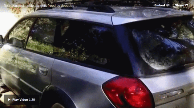
This Is What Happens When a Bear Gets Into Your Subaru. There's a (bad) commercial here somewhere, but the video clip highlighted at
The Washington Post is worth a look. It will brighten your day: "
This
story about a bear somehow getting stuck inside a Subaru is what we
need right now. Don’t worry, it ends well: The bear eventually gets out,
thanks to sheriff’s deputies who freed the animal in Jefferson County,
Colo. Annie Bruecker, 17, just got the 2004 Subaru a few months ago and
uses the car to drive to a summer job, she told ABC affiliate KMGH. But she didn’t lock the doors Monday night, which apparently puts you at risk for a bear break-in..."
Image credit: "
Deputies
from Jefferson County Sheriff's Office in Denver freed a bear that was
trapped inside a small car. In the video, one deputy asked, "How did he
get in? I don't see a broken window." (Jefferson County Sheriff's Office).
The 5 Dirtiest Things You Touch Every Day. Turns out the toilet seat is the least of your concerns, according to
TIME: "...
In
the kitchen, your trusty sink sponge is health enemy number one. In
fact, that sponge is likely the dirtiest item in your home, Gerba says.
“It’s probably home to hundreds of millions of bacteria,” he says. NSF
agrees. Its researchers found that 75% of home dish sponges and rags
contained Coliform. You want a kitchen cleaning tool you can throw into
the dishwasher to disinfect—like a brush, Gerba says. The same goes for
cutting boards. “Most people just rinse or wipe them off,” he says. But
only a run through the dishwasher—or a good scrub with dish soap—will
get it clean. When it comes to the items you touch most, Gerba says your
cell phone is a big bacteria haven. Studies
have found that one in six phones is contaminated with fecal matter,
even though a simple swab with a disinfectant wipe is enough to clear
away that icky residue..."
 TODAY
TODAY: Mix of clouds and sun, not quite as Nanook. Winds: SW 5-10. High: 7
FRIDAY NIGHT: Partly cloudy. Low: -5
SATURDAY: Plenty of sun, feels like -20F. Winds: NW 8-13. High: 6
SUNDAY: Numbing start, then breezy with increasing clouds. Winds: S 10-15. Wake-up: -8. High: 17
MONDAY: Few flurries, temps. near average! Winds: E 7-12. Wake-up: 15. High: 24
TUESDAY: Period of snow, couple inches? Winds: NW 10-15. Wake-up: 18. High: 27
WEDNESDAY: Dry start, more light snow PM hours. Winds: SE 8-13. Wake-up: 8. High: 16
THURSDAY: Mostly cloudy, cold wind returns. Wake-up: 5. High: 10 (falling)
Climate Stories...
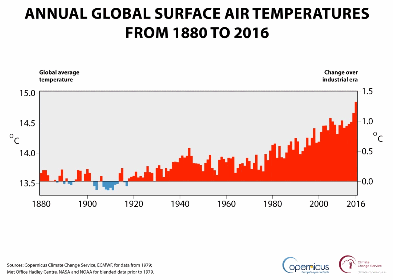 Earth on Edge: Record Breaking 2016 Was Close to 1.5C Warming. Here are a few bullet points from Copernicus and Climate Change Service:
- 2016 confirmed as the warmest year on record, warmer than 2015 by close to 0.2°C
- Global temperatures reached a peak in February 2016 around 1.5°C higher than at the start of the Industrial Revolution
- Extreme conditions impacting several regions across the Earth
The
first global analysis of the whole of 2016 has confirmed last year as
the warmest on record and saw the planet near a 1.5°C warming, according
to the Copernicus Climate Change Service (C3S).
The
latest figures from C3S, part of the EU’s Copernicus earth observation
programme, show that 2016’s global temperature exceeded 14.8°C, and was
around 1.3°C higher than typical for the middle years of the 18th
century. 2016 was close to 0.2°C warmer than 2015, which was previously
the warmest year on record..."
Graphic credit: "
Annual
global air temperature at a height of two metres (left axis) and
estimated change from the beginning of the industrial era (right axis).
Sources: Copernicus Climate Change Service, ECMWF, for data from 1979;
Met Office Hadley Centre, NASA and NOAA for blended data prior to 1979." (Credit: ECMWF, Copernicus Climate Change Service)
Turns Out There Was No "Global Warming Pause". A
frequent meme of perpetual climate science deniers has been debunked -
again. All that excess warmth went into the world's oceans. Scientific American has an explanation: "Various
studies have debunked the idea of a pause, or hiatus, in global
warming—the contention that global surface temperatures stopped rising
during the first decade of this century. The arguments for and against
“the pause” were somewhat muted until June 2015, when scientists at the
National Oceanic and Atmospheric Administration published a paper
in Science saying that it had slightly revised the sea surface
temperatures it had been citing for the 1900s. The measurement methods,
based on sensors in the engine intake ports of ships, had been flawed,
NOAA said. The revised methodology also meant that sea surface
temperatures during the 2000s had been slightly higher than reported.
NOAA adjusted both records, which led to a conclusion that global
surface temperatures during the 2000s were indeed higher than they had
been in previous decades. No hiatus..." (Image: NASA ISS).
Beyond 2016: Year in Review. More details on last year's warmth from
NOAA.
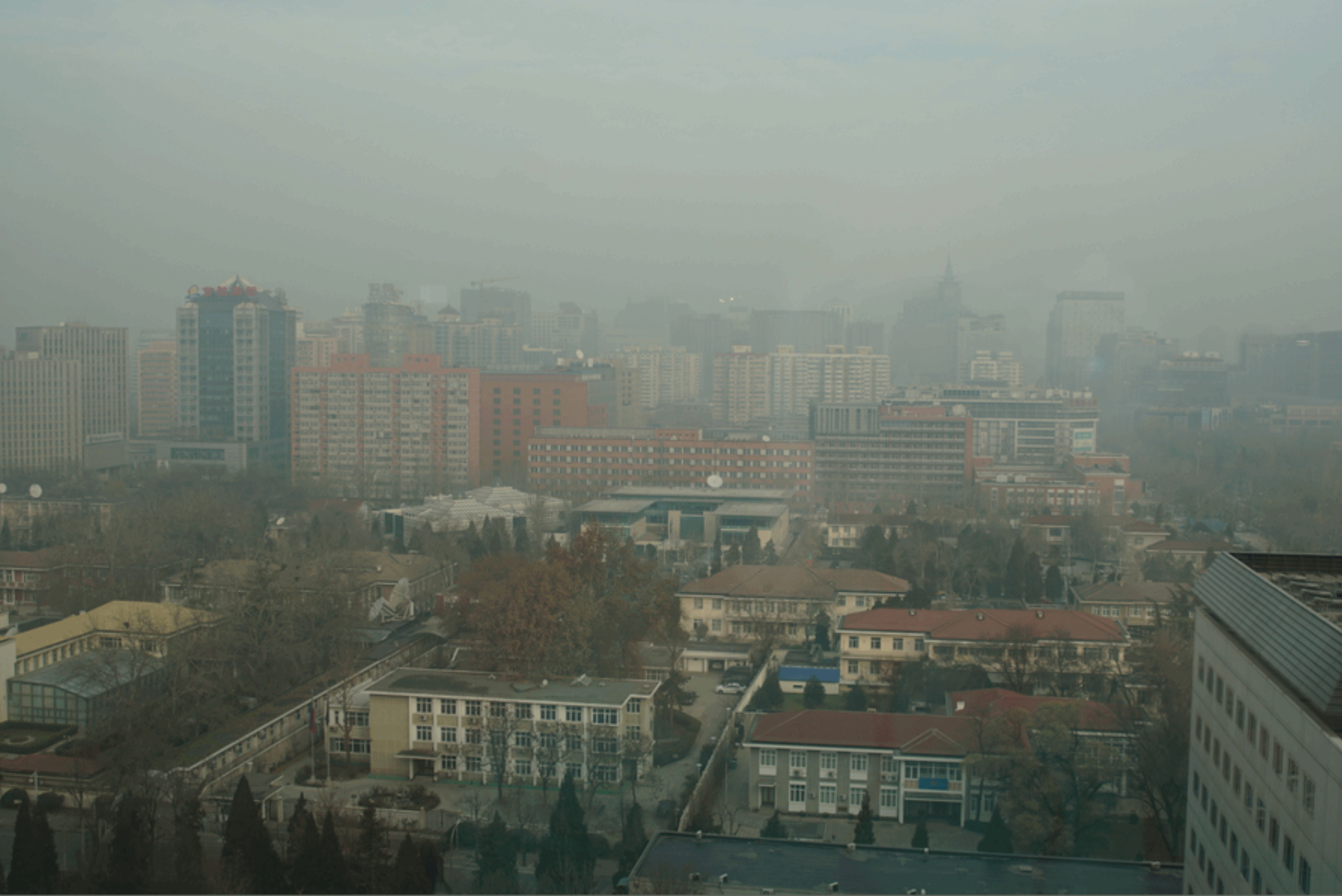
China Aims To Spend at Least $360 Billion on Renewable Energy by 2020. Here's an excerpt from
The New York Times: "
China
intends to spend more than $360 billion through 2020 on renewable power
sources like solar and wind, the government’s energy agency said on Thursday.
The country’s National Energy Administration laid out a plan to
dominate one of the world’s fastest-growing industries, just at a time
when the United States is set to take the opposite tack as Donald J. Trump,
a climate-change doubter, prepares to assume the presidency. The agency
said in a statement that China would create more than 13 million jobs
in the renewable energy sector by 2020, curb the growth of greenhouse
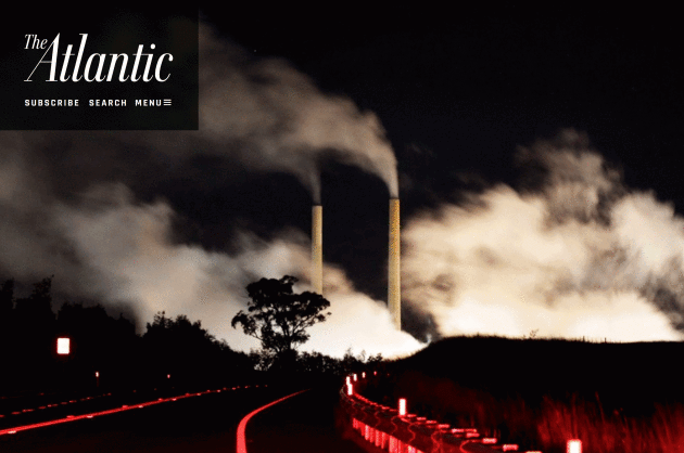
gasses that contribute to global warming and reduce the amount of soot that in recent days has blanketed Beijing and other Chinese cities in a noxious cloud of smog...."
Photo credit:
I snapped this picture from our room at the St. Regis in Beijing during
a severe smog event during the first week of December, 2016.
Signs of Climate Change Hit Great Lakes. NCPR,
North Country Public Radio, has the story: "...
The
Great Lakes Integrated Sciences and Assessments Center in Michigan
specializes in presenting climate change information specific to this
area. Researcher Laura Briley said one sure sign of regional climate
change can be found in the water. “The lakes themselves, are actually
changing,” she said. “Water temperatures have been increasing and in
some cases increasing at a faster rate than air temperatures.” Briley
said other signs of climate change in the Great Lakes basin include
severe storms, increased precipitation and reduced ice cover on the
lakes. "In the last 30 or so years, we've seen a large increase in
extreme precipitation events ... so more risk of flooding and runoff,"
she said..."
Photo credit: "
Lake Erie at Buffalo, NY." Photo: Angelica Morrison.
New Technique Predicts Frequency of Heavy Precipitation with Global Warming. Here's an excerpt from
phys.org: "...
Now
MIT scientists have found that such extreme precipitation events in
California should become more frequent as the Earth's climate warms over
this century. The researchers developed a new technique that preicts
the frequency of local, extreme rainfall events by identifying telltale
large-scale patterns in atmospheric data. For California, they
calculated that, if the world's average temperatures rise by 4 degrees
Celsius by the year 2100, the state will experience three more extreme
precipitation events than the current average, per year..." (File photo: Munich Re).
Paris Climate Deal to Ignite a $90 Trillion Energy Revolution. Here are a couple of excepts from an Op-Ed at The Telegraph: "...
The
fossil fuel industry has taken a very cavalier bet that China, India
and the developing world will continue to block any serious effort to
curb greenhouse emissions, and that there is, in any case, no viable
alternative to oil, gas or coal for decades to come...The old energy
order is living on borrowed time. You can, in a sense, compare what is
happening to the decline of Britain’s canals in the mid-19th century
when railways burst onto the scene and drove down cargo tolls,
destroying the business model. Technology takes no prisoners. Nor does
politics. World leaders have repeatedly stated that they would defend
the line of a 'two degree planet’, and now they are taking the concrete
steps to do so. Fossil investors have been warned..."
Companies Should Report Possible Climate Costs, Say Global Executives. Here's an excerpt from
The Wall Street Journal: "
Companies should publish an assessment of the losses they could suffer through climate change as
part of their routine financial statements, according to a panel of
financial and business executives chaired by Michael Bloomberg. The Task
Force on Climate-related Financial Disclosures, headed by the former
New York City Mayor, in a report Wednesday said that greenhouse gas
emissions pose a serious risk to the global economy and
investors need better information to assess which firms are most
vulnerable to shifting weather patterns and related threats. “What gets
measured better gets managed better,” Mr. Bloomberg said in a letter to
Mark Carney, governor of the Bank of England and chairman of the
Financial Stability Board, a group of global regulators, which
commissioned the 73-page report..."
The Republicans Who Want Trump to Fight Climate Change. Here's an excerpt from
The Atlantic: "...
Like
other members of the eco-right, Inglis believes that efficient markets
are the ultimate problem solver, and he has a general skepticism about
all but the most basic of regulations. “The essence of [the eco-right]
is all about internalizing negative externalities,” Inglis says,
referencing the hidden expenses of carbon’s seepage into the atmosphere.
He says that polluters are “socializing their soot and climate costs.”
By making them pay and stripping out all energy subsidies, the thinking
goes, firms will shift their business models accordingly, weeding out
wasteful fuels, making the Paris Agreement and Obama’s Clean Power Plan
superfluous. “Our view of the Clean Power Plan is that it’s precisely
the worst way to deal with climate change,” Inglis explains. UN
agreements and regulatory pushes, Inglis argues, represent the kind of
policies which keep conservatives out of the conversation on climate,
because they are both too complicated and too confrontational. “I think
the path in is mostly through the business community, where unlikely
partners could really step forward and say, ‘There’s a free enterprise
solution to this. Don’t give us regulations..." (Photo credit above:
Daniel Munoz / Reuters).
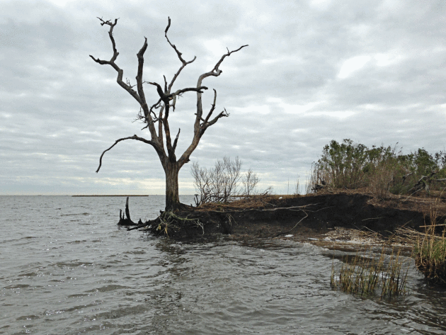
Louisiana History Washes Away as Sea Levels Rise, Land Sinks.
NPR has the story: "
Louisiana
is losing its coast at a rapid rate — because of rising sea levels,
development and sinking marshland. Officials are trying to rebuild those
marshes and the wetlands, but much of the coast can't be saved. This
makes Louisiana's history an unwitting victim. As land disappears and
the water creeps inland, ancient archaeology sites are washing away, too..."
Photo credit: "
Louisiana
is losing its coast faster than any place in the world. As land
disappears and the water creeps inland, ancient archaeology sites are
washing away. The roots of a dead oak tree at the edge of an ancient
Native American mound, are all that hold the land together.
" Tegan Wendland/WWNO.
 New Study Confirms Faster Rate of Global Warming. Here's an excerpt from Dr. John Abraham at The Guardian: "...This
paper is another reminder why it is so important to invest in the
temperature measurements that are needed to create long-term climate
records. We really need uninterrupted measurements that span many
years/decades if we want to truly understand the Earth’s changing
climate. Even though the costs of making these measurements are very
small compared to what we spend on other less important activities, I am
concerned that the new US administration will decide to pull the plug
on these projects. If that happens, we will be flying blind. Finally,
and for those who read my posts regularly, I am sounding like a broken
record. Global warming is happening, it never stopped, it never paused,
and the models have gotten it right.
New Study Confirms Faster Rate of Global Warming. Here's an excerpt from Dr. John Abraham at The Guardian: "...This
paper is another reminder why it is so important to invest in the
temperature measurements that are needed to create long-term climate
records. We really need uninterrupted measurements that span many
years/decades if we want to truly understand the Earth’s changing
climate. Even though the costs of making these measurements are very
small compared to what we spend on other less important activities, I am
concerned that the new US administration will decide to pull the plug
on these projects. If that happens, we will be flying blind. Finally,
and for those who read my posts regularly, I am sounding like a broken
record. Global warming is happening, it never stopped, it never paused,
and the models have gotten it right..."


No comments:
Post a Comment