"2016 marks three consecutive years of record warmth for the globe"
It's official - the numbers just came in from NOAA and 2016 was in fact THE warmest year on record for the entire globe! Interestingly, this marks 3 consecutive years with record warmth for the globe, which seems a bit unsettling... Here's an excerpt:
"With a boost from El Nino, 2016 began with a bang. For eight consecutive months, January to August, the globe experienced record warm heat. With this as a catalyst, the 2016 globally averaged surface temperature ended as the highest since record keeping began in 1880, according to scientists from NOAA's National Centers for Environmental Information (NCEI). The average temperature across global land and ocean surfaces in 2016 was 58.69 degrees F or 1.69 degrees F above the 20th century average. This surpassed last year’s record by 0.07 degrees F. Since the start of the 21st century, the annual global temperature record has been broken five times (2005, 2010, 2014, 2015, and 2016)."
What a Wednesday!
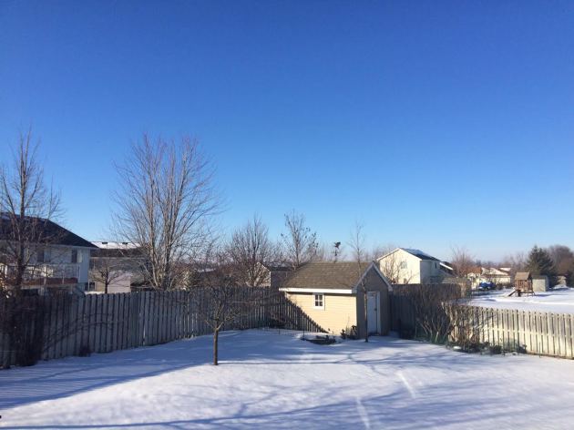
For the first time in a long time I felt like it was spring! Sunshine, mild temps and melting snow sure got my garden growing senses going. I felt like I should have been starting my tomato seeds indoors. Obviously it's too early to start planting seeds, but we're not too far away! Keep in mind that it's still January... Meteorological winter just passed the halfway point and we still have ALL of February to go. Keep in mind that February average around 6 nights of at or below zero temperatures.
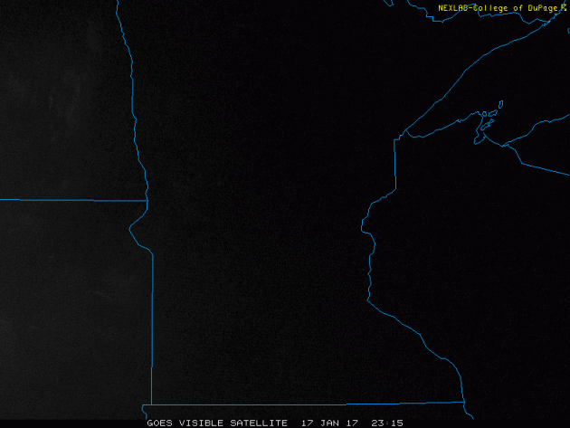
Snow Melt Seen Via Visible Satellite on Wednesday
Bright sunshine and very warm temperatures for January allowed for quite a bit of melting around the region. Take a look at the visible satellite from Wednesday below. Note how the southern edge of the snow line seems to be receding across South Dakota and southwestern Minnesota as the day wore on. A southerly wind helped to boost temperatures into the upper 30s and lower 40s across much of the state.
_________________________________________________________________________
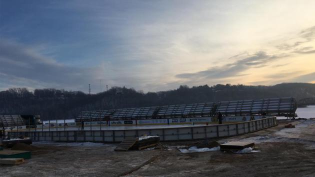
Hockey Day In Minnesota - Saturday, January 21st
One of my favorite days of the year is coming up this weekend! Weather conditions for Hockey Day in Minnesota over the years have ranged from brutally cold with frigid wind chills to picture perfect with light snow. This year's event will be held in Stillwater, located along the beautiful St. Croix River and while the setting couldn't be any more beautiful... unfortunately, the weather this Saturday looks a little ugly. High temperatures are expected to be in the low/mid 40s with a chance of a little light rain.
Here's an excerpt from NHL.com/wild/news in regards to the event being held in Stillwater this year.
"Building an outdoor hockey rink in any location is a unique blend of meteorology, technology, craftsmanship, and blue-collar labor. But putting a hockey rink on a river bank in a park famous for being an idyllic summer location for picnics, weddings, and jogging has created numerous challenges. Novalany and the Stillwater community have worked closely with an assortment of companies such as Ice Rink Events, Xcel Energy and Raleigh Trucking to build the rink in the unique location. It has been a mix of hard hats, modern hockey rink construction supplies, and, of course, looking at the volatile Minnesota winter forecast. "All of the work has been weather dependent," Novalany said with a sigh and chuckle."
(Image below courtesy NHL.com/wild/news)
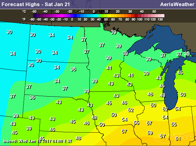
Temperature Outlook Saturday
Here's the temperature outlook for Saturday, which shows high temperatures across the southern half of Minnesota in the low/mid 40s, which nearly 20F above average! High temperatures like this are more typical of mid March!
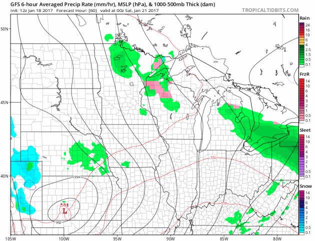
Weather Outlook for Saturday
Here's the weather outlook from Friday night to Saturday night, which shows scattered light rain showers rotating through the region. The storm system responsible for this somewhat soggy weather will also be responsible for temperatures in the low/mid 40s, which will be nearly 20F above average for mid/late January.
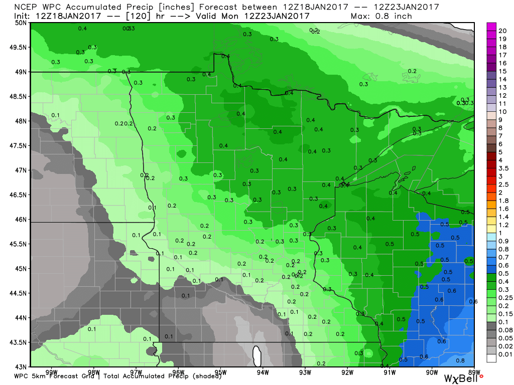
Precipitation Potential
Here's the precipitation potential through AM Monday, which shows up to 0.4" liquid possible across parts of northern Minnesota and Wisconsin. Note that temperatures will be warm enough for mostly rain. Although rainfall tallies don't appear to be too terribly heavy, warm temperatures and rain will make any outdoor winter activities unfavorable. In the case for Saturday's Hockey Day in Minnesota, ice conditions will likely be warm, soft, slow and possibly even wet.
 ______________________________________________________________________________
Weather Sours Into the Weekend. Still March-like
Hack, cough, sneeze... I, like just about everyone out there came down with the crud. I guess it's that time of year to share colds. The wild weather extremes don't seem to be helping either.
The first half of January was pretty chilly, featuring 7 sub- zero nights in the Twin Cities. Note that the average number of at or below zero nights in January is about 10.
The next several days will be running nearly 50 degrees warmer than the sub-zero lows that we had less than 1 week ago. Daytime highs in the 40s with lows above freezing will continue to cut into the meager snow pack through the weekend. Scattered light rain chances Friday through Sunday will help to speed up the melting process, which means we're in for lots of puddles.
Might not be a bad idea to equip your feet with something good to slop around with. Road spray will also have you tapping the windshield washer fluid quite a bit.
Extended forecasts suggest snow chances building in early next week with temps returning to normal levels. Winter isn't over yet!
___________________________________________________________________________
___________________________________________________________________________
Extended Forecast:
WEDNESDAY NIGHT: Partly cloudy and quiet. Winds: S 5. Low: 31.
THURSDAY: Feels like March. Few afternoon sprinkles? Winds: SSE 5. High: 41
THURSDAY NIGHT: Cloudy. Chance of light rain and sprinkles. Winds: SE 5. Low: 33
FRIDAY: Cloudy. Scattered light rain showers. Winds: SE 5. High: 40
SATURDAY: Mild. Passing showers. Winds: ESE 5. Wake-up: 34. High: 43.
SUNDAY: Light rain mixes with a few wet PM flakes. Winds: SSW 5. Wake-up: 34. High: 41.
MONDAY: Cloudy. Sprinkles or wet flakes. Winds: NW 5. Wake-up: 31. High: 38.
TUESDAY: Cooler. Light snow late. Winds: NNE 10-15. Wake-up: 30. High: 36.
WEDNESDAY: Breezy and cooler. Lingering light snow. Winds: NW 10-20. Wake-up: 25. High: 32.
_______________________________________________________________________________
_______________________________________________________________________________
This Day in Weather History
January 19th
January 19th
1994: The cold continues from the previous day with a low of -47 at Brainerd and, despite the heat island effect, the Twin Cities' airport hit -27.
_______________________________________________________________________________
_______________________________________________________________________________
Average High/Low for Minneapolis
January 19th
January 19th
Average High: 24F (Record: 49F set in 1921)
Average: Low: 7F (Record: -34F set in 1970)
Average: Low: 7F (Record: -34F set in 1970)
*Record Snowfall: 7.5" set in 1988
_______________________________________________________________________________
_______________________________________________________________________________
Sunrise Sunset Times For Minneapolis
January 19th
January 19th
Sunrise: 7:44am
Sunset: 5:03pm
Sunset: 5:03pm
*Daylight Gained Since Yesterday: ~2 minute 01 seconds
*Daylight Gained Since Winter Solstice (December 21st): ~33 minutes
________________________________________________________________________________
*Daylight Gained Since Winter Solstice (December 21st): ~33 minutes
________________________________________________________________________________
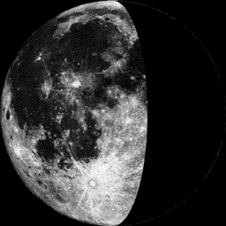
Moon Phase for January 18th at Midnight
0.6 Days Before Last Quarter
0.6 Days Before Last Quarter
_______________________________________________________________________
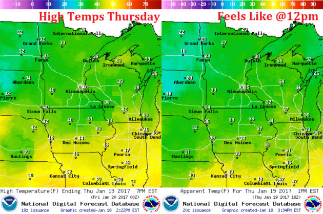
Weather Outlook For Thursday
Thursday will be another very mild day across the region with high temperatures nearing 40F or warmer, which will be nearly 20F above average!
Weather Outlook For Thursday
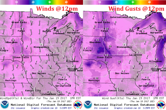
Wind speeds on Thursday won't be terribly strong, but they will remain out of the south, which will help to keep mild temperatures in place.
Weather Outlook For Thursday
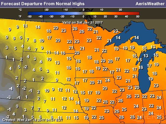
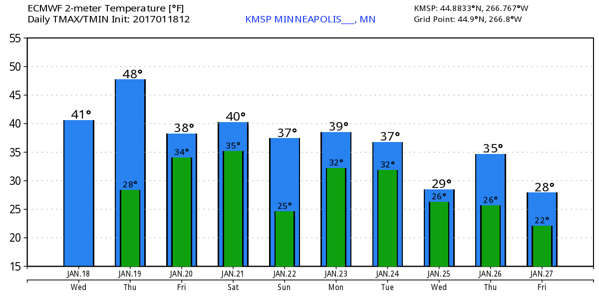
Extended Temperature Outlook for Minneapolis
Here's the temperature outlook through January 27th, which shows a VERY mild trend heading into the week ahead with highs in the 30s and even 40s this weekend! With several days above freezing, our snow pack will likely take a big hit... we may also have a fog concerns with melting snow and added moisture in the lower levels of the atmosphere.
___________________________________________________________________________________
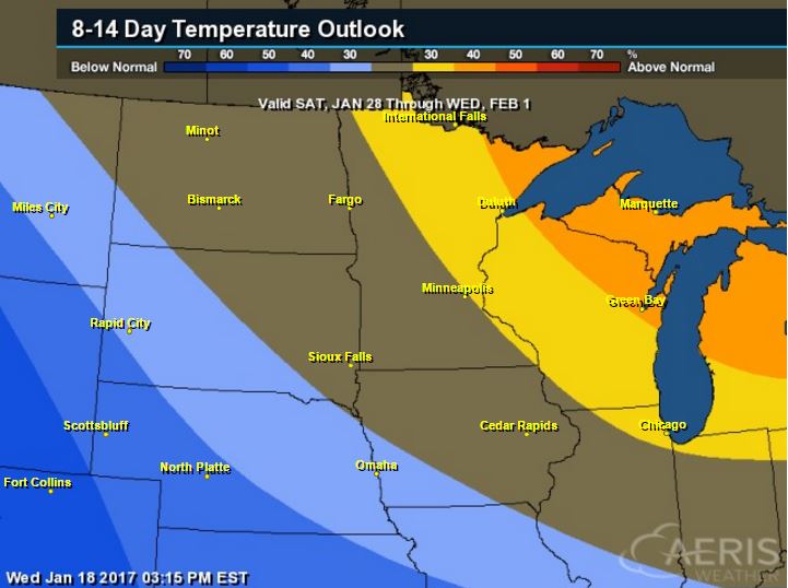
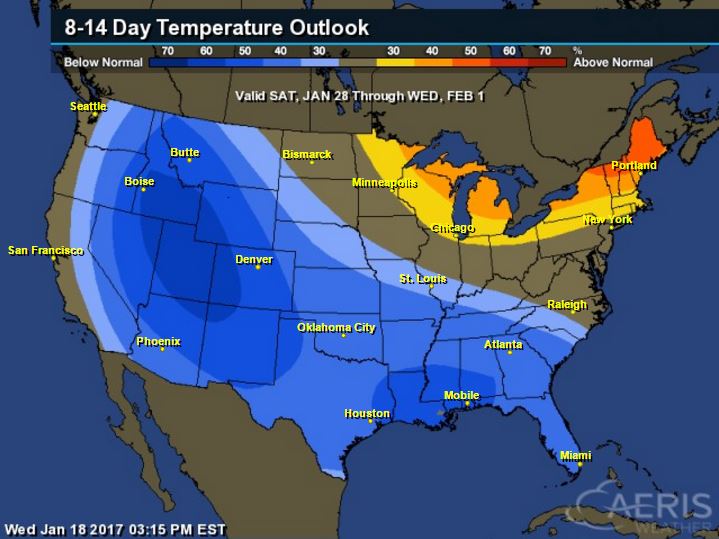
8 to 14 Day Temperature Outlook
According to NOAA's CPC, the 8 to 14 day temperature outlook suggests warmer than average temperatures continuing across much of the Upper Midwest from January 28th to February 1st. With that said, extended models are suggesting temperatures returning to near normal levels by the end of the month. Looking ahead, there doesn't appear to be any major cold snaps brewing over the next couple of weeks.
_________________________________________________________________________________
Temperature Outlook
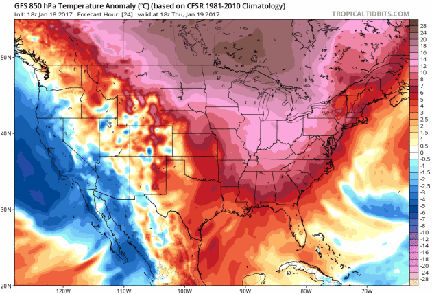
National Temp Outlook
Take a look at the temperature anomaly through Thursday, January 26th. Note that the Eastern half of the country looks to stay warmer than average through much of that time period, but colder than average temps begin moving into the Western & Central U.S. by nearly next week.
 ________________________________________________________________________________
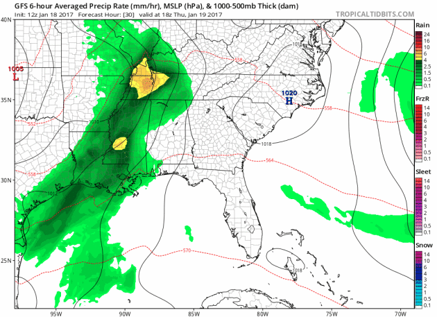
Thundery Outlook In the Southeast Through The Weekend
Heres' the simulated radar from Thursday to Monday morning, which shows ongoing showers and storms across parts of the Gulf Coast States. Note that an even more impressive storm develops over the weekend with more showers and storm across the Gulf Coast. This may be responsible for isolated severe storms and locally heavy rainfall.
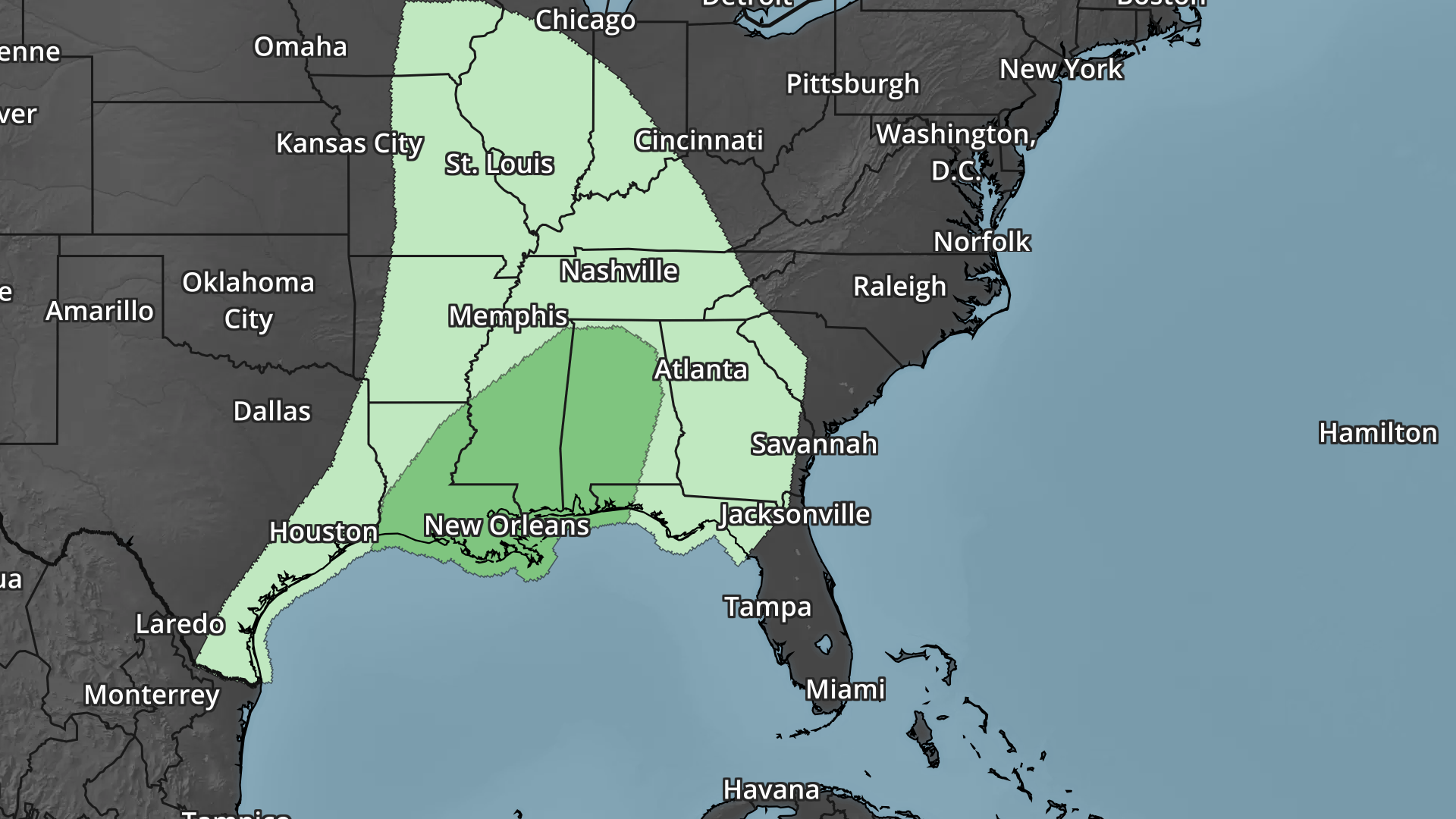
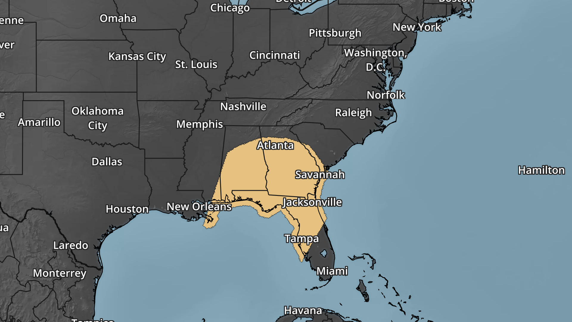
Severe Weather Concerns Ahead
Here's the severe weather outlook from Thursday to Sunday, which shows a several day severe weather concern across parts of the Southeastern U.S.. Strong to severe storms and locally heavy rainfall could impact some of the same areas through the end of the week and weekend ahead.
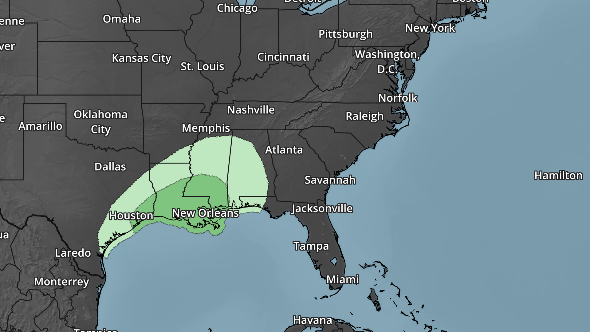
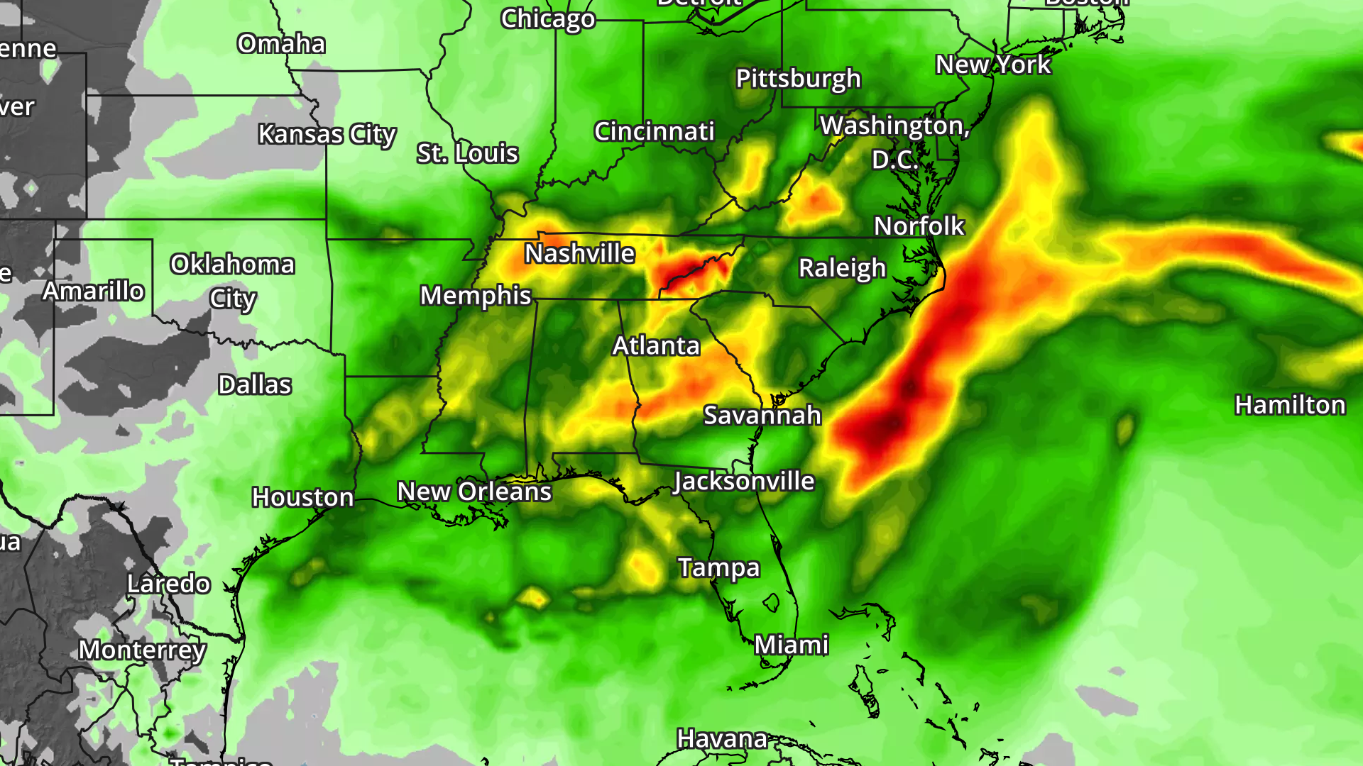
Heavy Rain Threat Ahead
With scattered showers and storms ongoing across the southeastern U.S. over the next several days, heavy rainfall potential will follow. The rainfall potential through early next week suggests widespread 2" to 4" amounts with some isolated 5" to 6"+ amounts possible, which may lead to flooding.
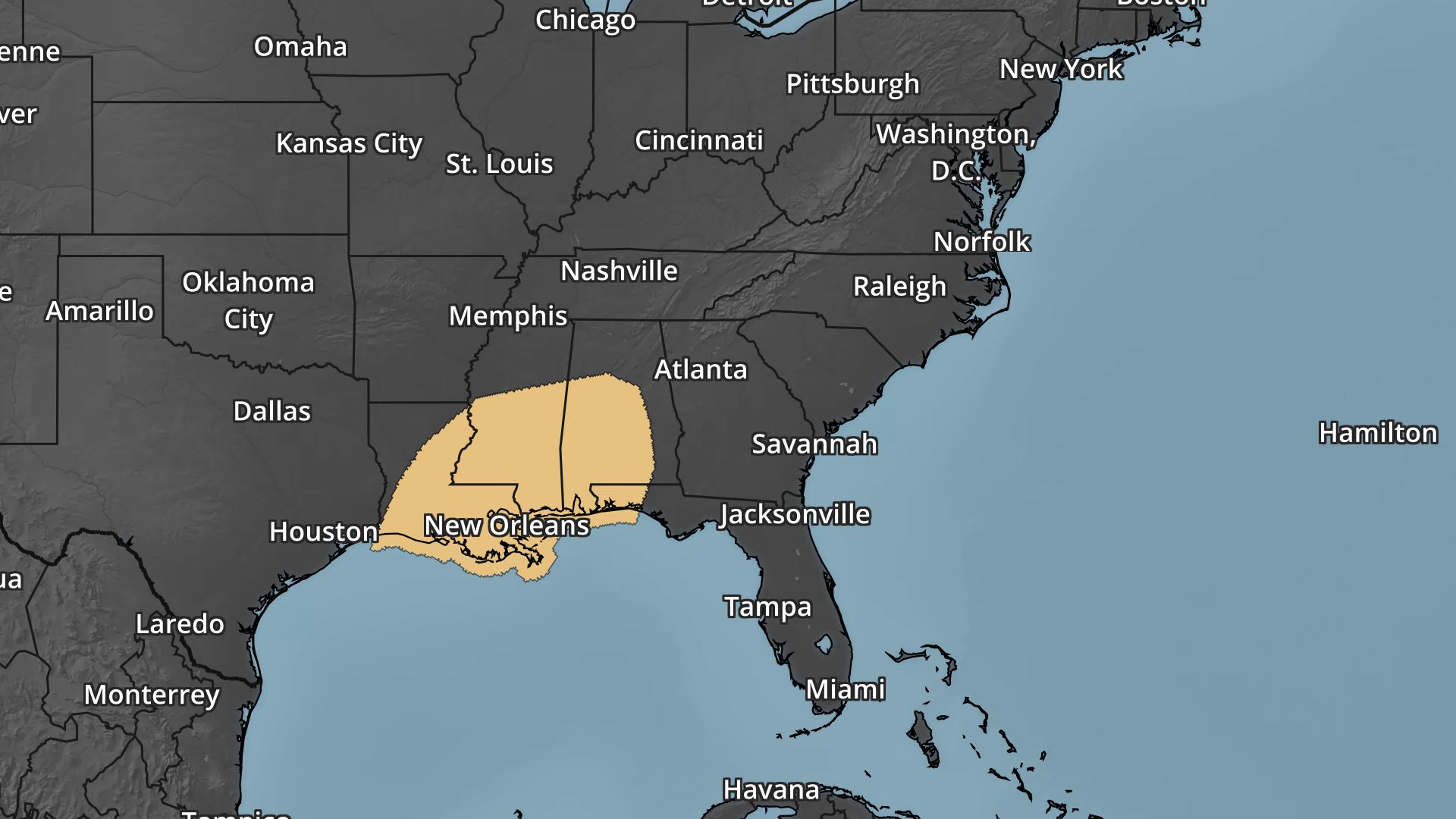
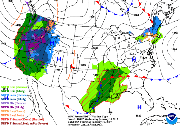
National Weather Outlook
Here's the national weather outlook through the end of the week, which shows scattered storms and locally heavy rainfall continuing and redeveloping across the Gulf Coast States. Note that some of the storms late week and into the weekend could be severe. The Western U.S. will also be inundated with widespread heavy precipitation over the next several days. Heavy rain, flooding and heavy mountain snow will be possible as several rounds of Pacific moisture "Atmospheric Rivers" move through during the end of the week, weekend ahead and into early next week.
A number of winter weather headlines continue across the Western U.S. over the next few days with 1ft. to 2ft. possible in some of the most extreme cases. Also note that the mountains near Los Angeles and southern Arizona are under winter storm warnings, where up to 1ft of snowfall will be possible through the weekend.
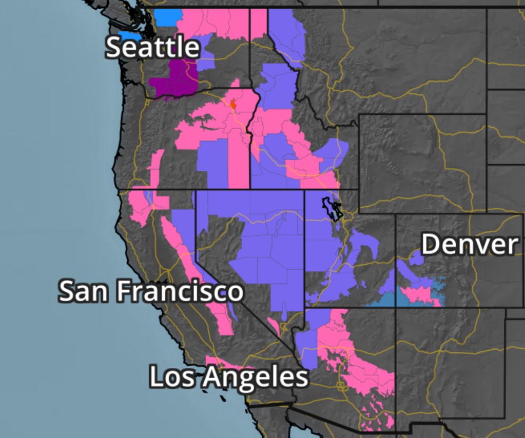
Snowfall Potential
The forecast model loop shows heavy snowfall returning to much of the Western U.S. over the next several days with some fairly hefty tallies across the Sierra Nevada Range once again. Interestingly, the mountains in southern California and Arizona look to get some pretty decent snowfall amounts too!
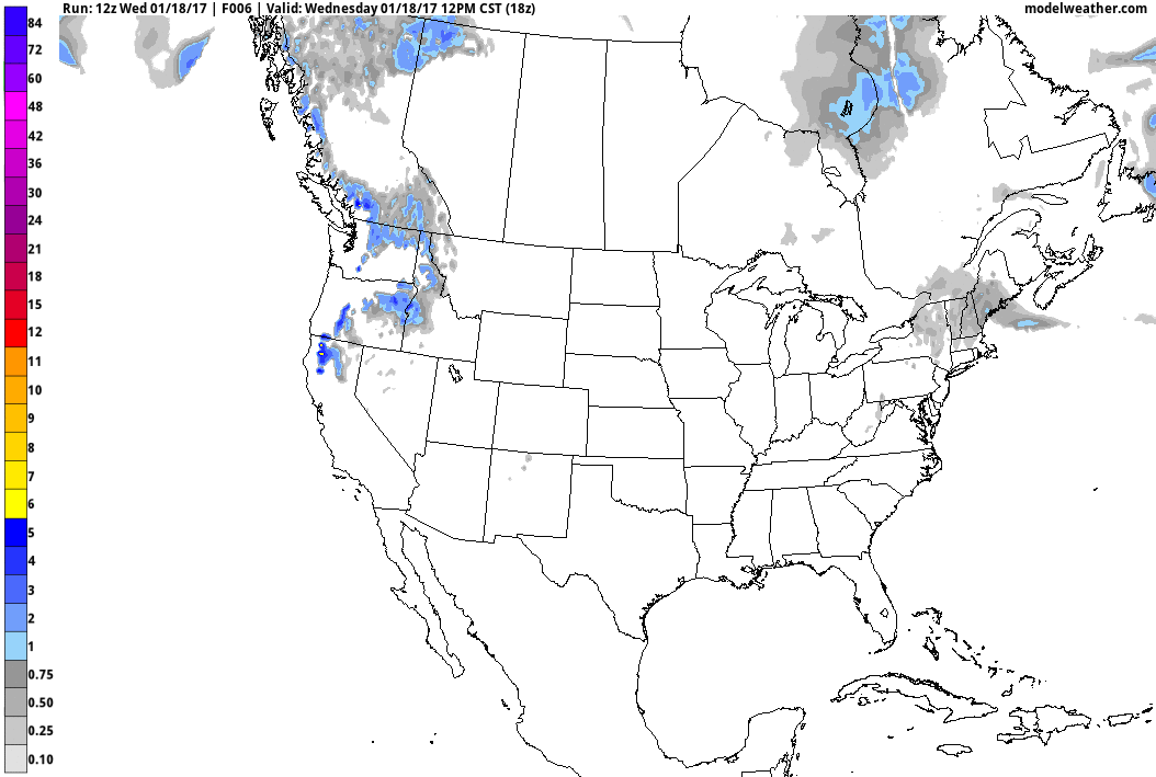
The forecast model loop shows heavy snowfall returning to much of the Western U.S. over the next several days with some fairly hefty tallies across the Sierra Nevada Range once again. Interestingly, the mountains in southern California and Arizona look to get some pretty decent snowfall amounts too!
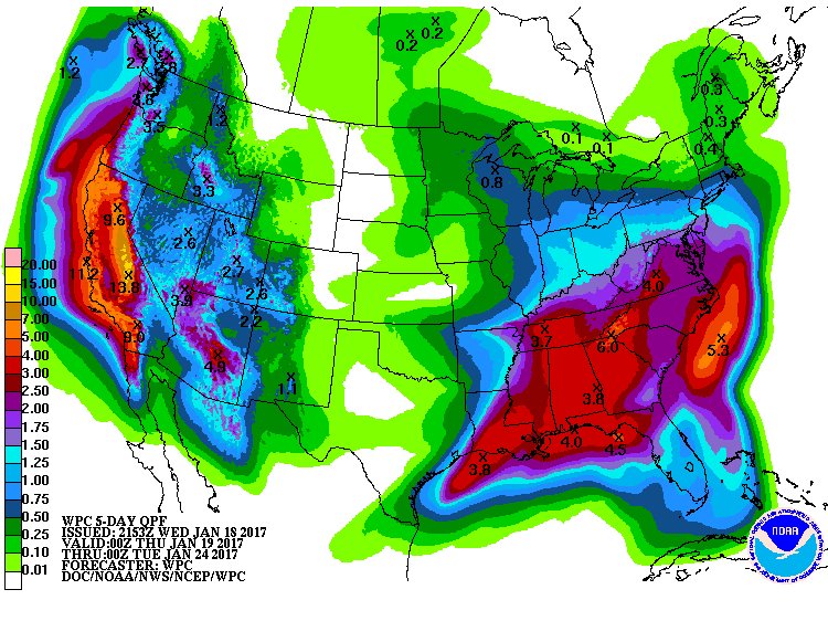
5 Day Precipitation Forecast
According to NOAA's PC, the 5 day precipitation forecast suggests widespread 2" to 4"+ rainfall amounts across the Southern and Eastern U.S.. Also note the heavy moisture moving back into the West U.S., especially along the West Coast. Some 6" to 12"+ liquid tallies can't be ruled out from northern California to western Oregon and western Washington. There may even be some 3" to 6"+ tallies across parts of southern California through early next week.
 _________________________________________________________________________________
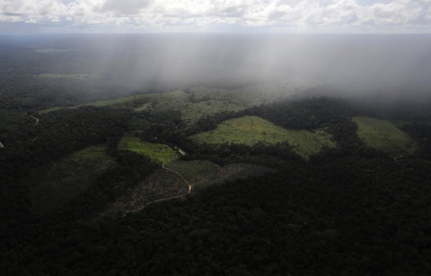
"Humans have destroyed 7% of Earth’s pristine forest landscapes just since 2000"
"Using satellite data, the researchers investigated changes to the world’s intact forest landscapes between 2000 and 2013. In 2000, they found that intact forest landscapes covered a total global area of 12.8 million square kilometers, or nearly 5 million square miles. But in the years since, human activities have altered and fragmented many of these areas. In total, truly intact forest landscapes declined by 7.2 percent. More than half these losses occurred in three countries alone: Russia, Brazil and Canada. In general, though, tropical parts of the world tended to suffer the greatest declines."
{A tract of Amazon rain forest, which has been cleared by loggers and farmers for agriculture, is seen near Santarem, Brazil, in April 2013. (Nacho Doce/Reuters)}
______________________________________________________________________________
"China, Europe drive shift to electric cars as U.S. lags"
"Electric cars will pick up critical momentum in 2017, many in the auto industry believe - just not in North America. Tighter emissions rules in China and Europe leave global carmakers and some consumers with little choice but to embrace plug-in vehicles, fuelling an investment surge, said industry executives gathered in Detroit this past week for the city's annual auto show."
{A 2018 Chevrolet Bolt EV is displayed during the North American International Auto Show in Detroit, Michigan, U.S., January 9, 2017. (REUTERS/Rebecca Cook/File Photo)}

Thanks for checking in and don't forget to follow me on Twitter @TNelsonWX

No comments:
Post a Comment