Quiet Weather Continues
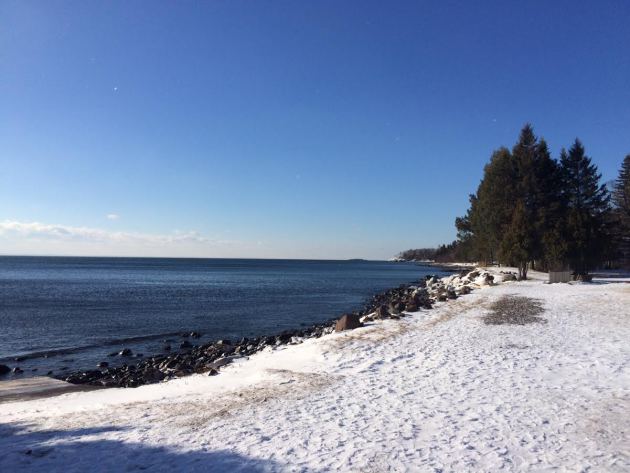
I recently spent some time along Minnesota's beautiful North Shore and the incredible weather made the stay even better. I've stayed along the shore many times during the month of February, but this year there seemed to be much less than I recall in prior years.
______________________________________________________________________________
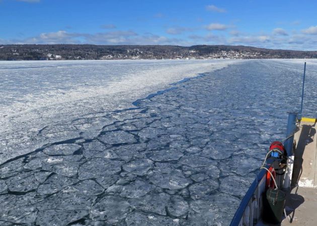
"Open water: Madeline Island watches, worries as winter climate shifts"
Here's an excerpt from mprnews regarding the "Madeline Island Ice Road" that isn't even close to being a road this year...
"There ought to be a road here, made of ice. Lake Superior should be frozen solid, and the Island Queen should be snug in dry dock for the winter. But there's no road this winter, nothing's solid and though it's February, the Island Queen is still working in open water, making the 25-minute trip between Bayfield and the town of La Pointe on Madeline Island eight times a day. "This ice we're going through right now is just turned up over and over and over again, so it's probably only 2 inches thick, originally," captain Shannon Mager said as she steered the ferry through broken plates of ice."
(Typically, by this time in the winter, the ice is thick enough to support an "ice road" from Bayfield to Madeline Island. This year, though, the ferry will run all winter long, for the second year in a row, and third year in the past six. Dan Kraker | MPR News)
_______________________________________________________________
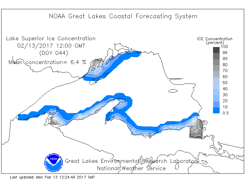
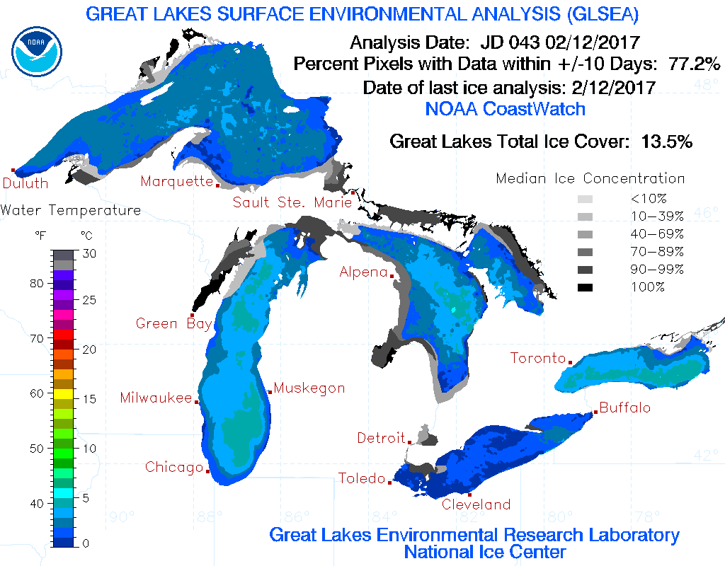
Lake Superior Ice Coverage
According to NOAA's GLERL only 6.4% of Lake Superior was covered with ice on 2/13/17. Last year at this time (2/13/16) nearly 7% of the lake was covered and two years ago (2/13/15), nearly 58% of the lake was covered. Note that the last time Lake Superior nearly froze over was back in February 2014 when more than 90% of the lake was covered. 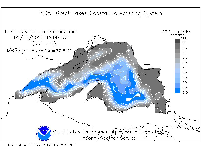
Great Lake Ice Coverage
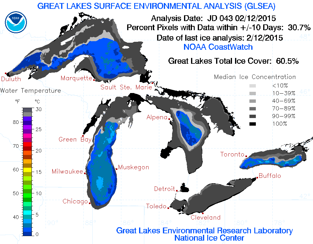
Here's a look at the rest of the Great Lakes, which shows that on 2/12/17 the total ice coverage was only 13.5%, which interestingly is up from the 12.2% set last year (2/12/16), but is down considerably from the 60.5% set at this time two years ago (2/12/15).
Great Lakes Ice Coverage 2015
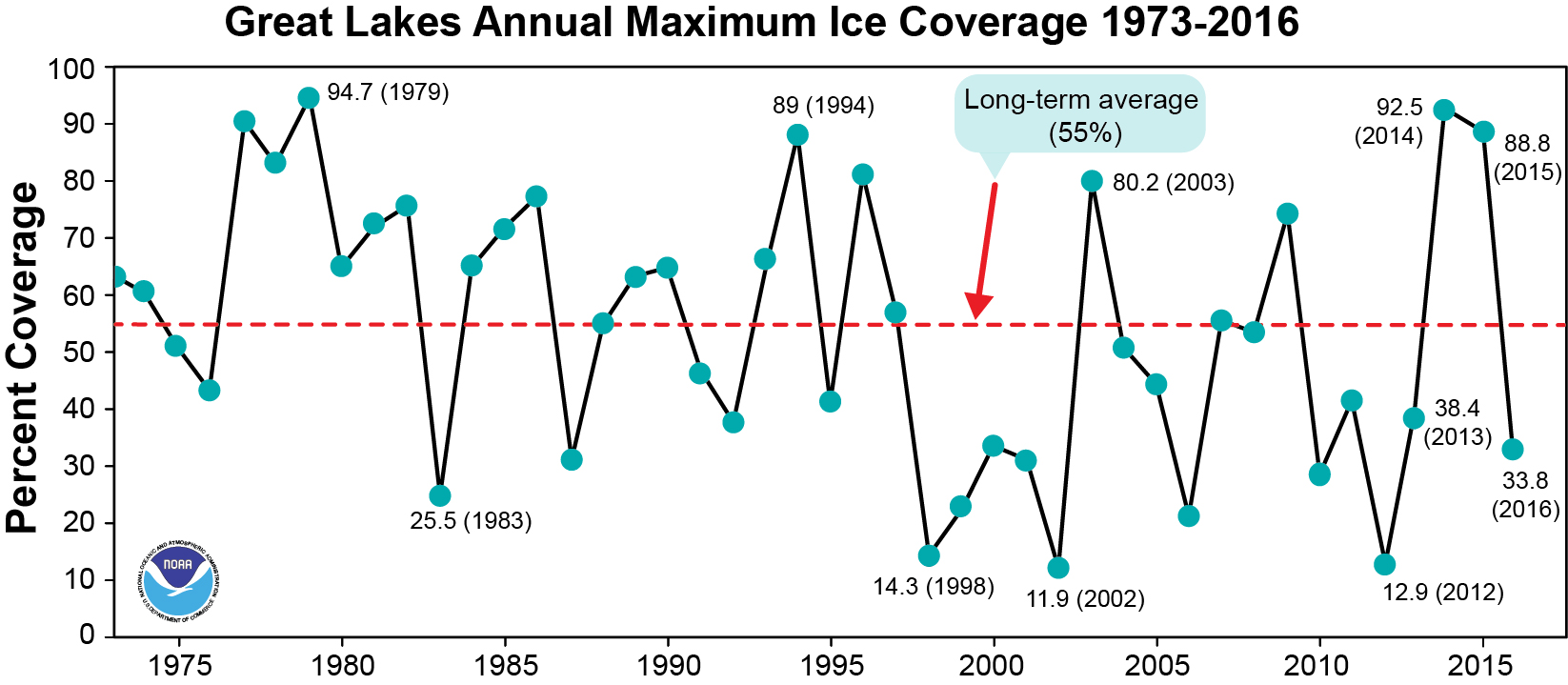
Historical Ice Coverage of the Great Lakes
According to NOAA's GLERL, the long term average of the entire Great Lakes Annual Maximum Ice Coverage is around 55%, which dates from 1973 to 2016. Note that in 2014, the maximum was 92.5%, but was as low as 12.9% in 2012.
Weather Outlook for Through Early Next Week
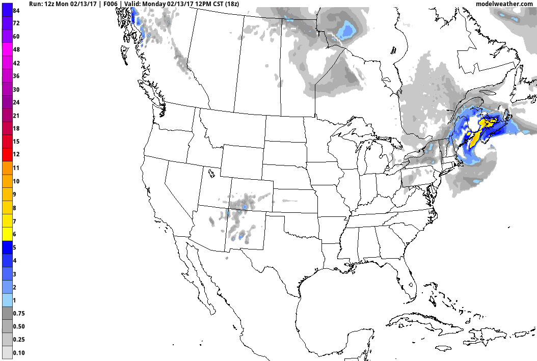
Here's the weather outlook from Tuesday to Monday night of next week. Note after a few flurries blow through the Arrowhead of Minnesota and the Great Lakes Region, we stay mostly dry all the way through the weekend. It appears that our next best chance of moisture (rain) doesn't move in until early next week. Until then, we stay well above average in the temperature department across much of the region.
______________________________________________________________________________
March-like this week. April-ish this weekend
I keep rubbing my eyes and wondering when I am going to wake up from this fast-forward spring. Weather maps continue to keep looking like March this week with hints of April this weekend. Unreal.
I spent some time this last weekend along Minnesota's beautiful North Shore and noticed very little to no ice floating around the coldest and deepest of all the Great Lakes. According to NOAA's GLERL, Lake Superior is currently only 6 percent covered in ice. Last year at this time it was only 7 percent covered and in 2015 it was 58 percent covered. In 2014, it was more than 90 percent covered!
Unfortunately for folks that enjoy winter weather in Minnesota, this year hasn't been all that great. Who would've thought that my outdoor hockey rinks would've melted in February, what gives? Note that with highs in the 40s this week and into the 50s this weekend, lake ice conditions will continue to rapidly deteriorate.
Incredibly, according to NOAA's Climate Prediction Center, we could remain above average right into the last week of February
___________________________________________________________________________
___________________________________________________________________________
Extended Forecast:
MONDAY NIGHT: Partly cloudy and quiet. Winds: WNW 10. Low: 29
TUESDAY: Mostly sunny, mild and breezy. Winds: NW 15-25. High: 38.
TUESDAY NIGHT: Partly cloudy and cooler. Not as breezy. Winds: NNW 10-15. Low: 17
WEDNESDAY: Less wind. Passing clouds. Winds: NNW 5-10. Wake-up: 23. High: 45.
THURSDAY: More sun, feels like March again. Winds: SE 5-10. Wake-up: 23. High: 45.
FRIDAY: Sunny with a hint of April. Winds: S 5. Wake-up: 30. High: 52.
SATURDAY: Dry. Still very warm for February. Winds: WNW 5-10. Wake-up: 35. High: 51.
SUNDAY: Another shot at 50? Clouds thicken late. Winds: SSE 5-10. Wake-up: 35. High: 52.
MONDAY: Mostly cloudy. Chance of showers. Winds: ESE 10-15. Wake-up: 35. High: 48.
_______________________________________________________________________________
_______________________________________________________________________________
This Day in Weather History
February 14th
February 14th
1923: A 'Black Dust Blizzard' ends after two days. Dirt blown into the state from North Dakota created drifts.
_______________________________________________________________________________
_______________________________________________________________________________
Average High/Low for Minneapolis
February 14th
February 14th
Average High: 29F (Record: 50F set in 1882)
Average: Low: 12F (Record: -25F set in 1875)
Average: Low: 12F (Record: -25F set in 1875)
*Record Snowfall: 6.4" set in 1950
_______________________________________________________________________________
_______________________________________________________________________________
Sunrise Sunset Times For Minneapolis
February 14th
February 14th
Sunrise: 7:15am
Sunset: 5:40pm
Sunset: 5:40pm
*Daylight Gained Since Yesterday: ~2 minutes & 54 seconds
*Daylight Gained Since Winter Solstice (December 21st): ~1 hour & 39 minutes
________________________________________________________________________________
*Daylight Gained Since Winter Solstice (December 21st): ~1 hour & 39 minutes
________________________________________________________________________________
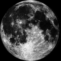
Moon Phase for February 13th at Midnight
3.3 Days After Full Moon
3.3 Days After Full Moon
________________________________________________________________________________
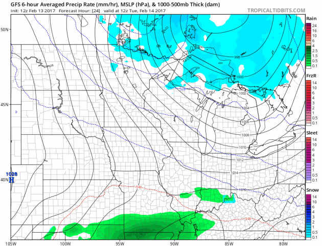
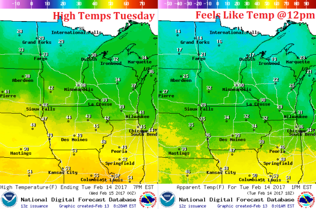
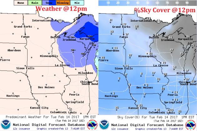
Weather Outlook For Tuesday
A fast moving clipper with dive through the Great Lakes region on Tuesday, which will help to kick up a breezy wind, but temperatures won't move too terribly much. In fact, this brief cool down will still be nearly 10 degrees above average. Feels like temps, however, will dip into the teens across northern Minnesota.
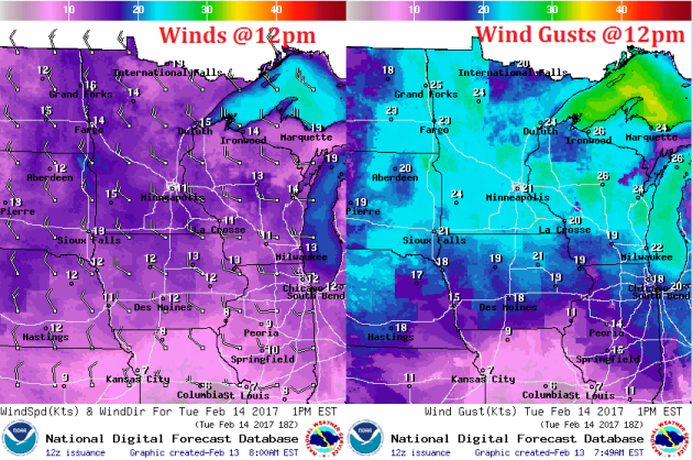
Weather Outlook For Tuesday
Take a look at winds across the region on Tuesday. Note that sustained winds around midday will be in the 10-20mph range with gusts approaching 25mph more greater.
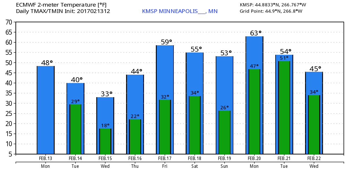
Here's the temperature outlook through February 22nd, which shows well above average temperatures continuing through the weekend and into early next week. Note that we could see our first 50F in the Twin Cities since November 28th. This weekend is going to feel very much like April with highs in the 50s! Unreal!
___________________________________________________________________________________
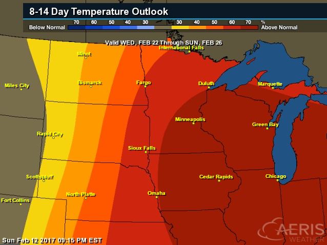
8 to 14 Day Temperature Outlook
According to NOAA's CPC, the 8 to 14 day temperature outlook suggests warmer than average temperatures continuing across much of the Upper Midwest from February 22nd - 26th. There may be a slight cool down late month, but the overall trend remains warmer than average.
_________________________________________________________________________________
Temperature Outlook
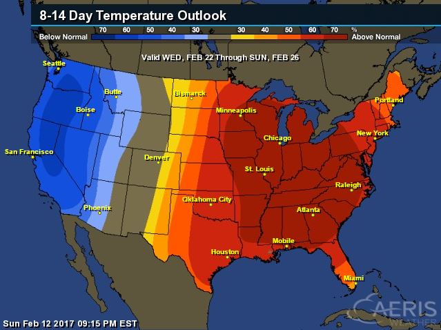
National Temp Outlook
Take a look at the temperature anomaly through Tuesday, February 22nd. Note that the despite a quick shot of cooler than average temps by the middle and end of this week, the eastern half of the country looks to stay warmer than average through much of that time period, but colder than average temps begin moving into the Western part of the country next week.
 ________________________________________________________________________________
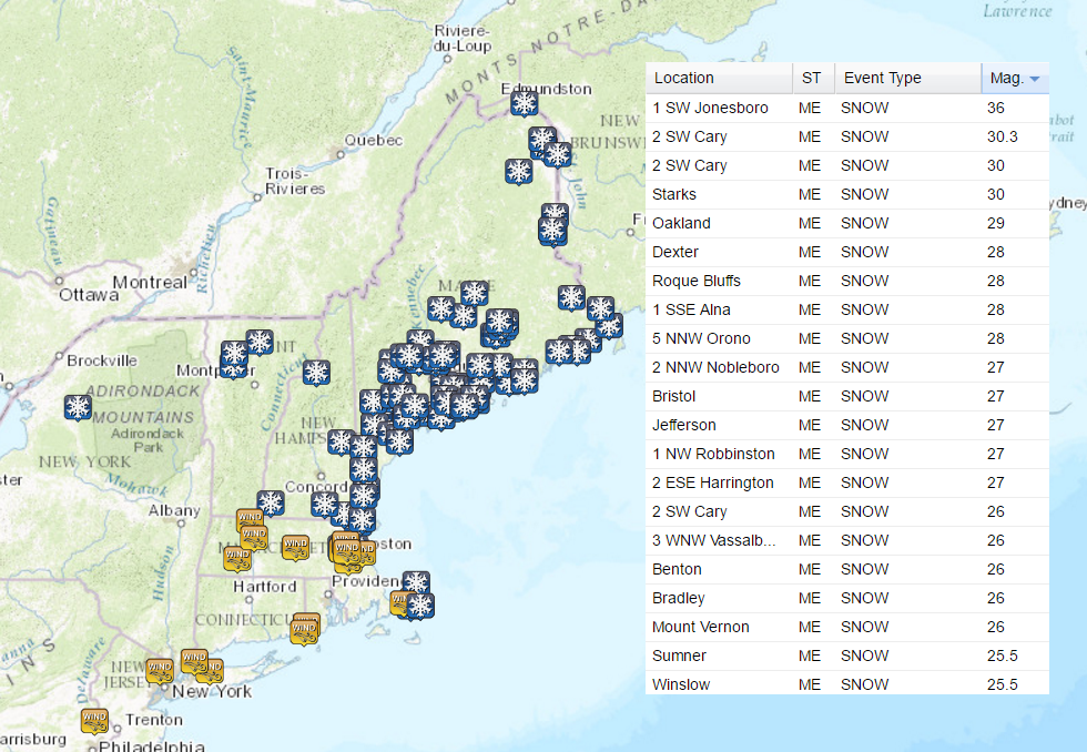
Heavy Snow and Wind Wraps Up in the Northeast
Another round of heavy snow pushed through parts of the Northeast over the weekend and early week time frame with up to 3ft of snow being reported in Maine! There were several 2ft+ reports as well along with some 60mph+ wind gusts! Quite a storm!
_____________________________________________________________________
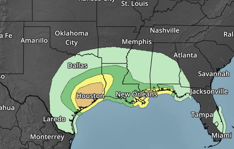
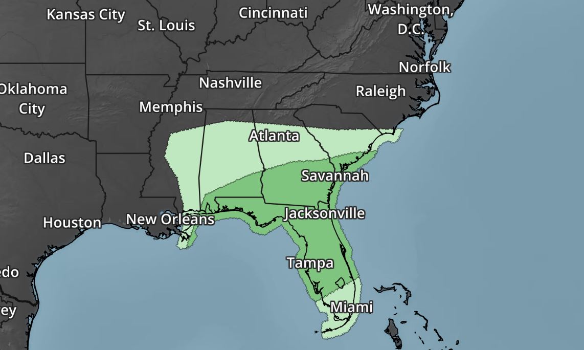
Severe Weather Concerns Ahead
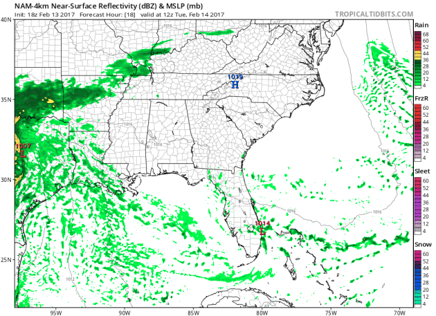
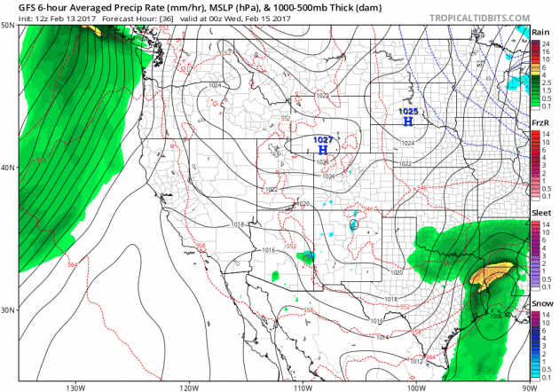
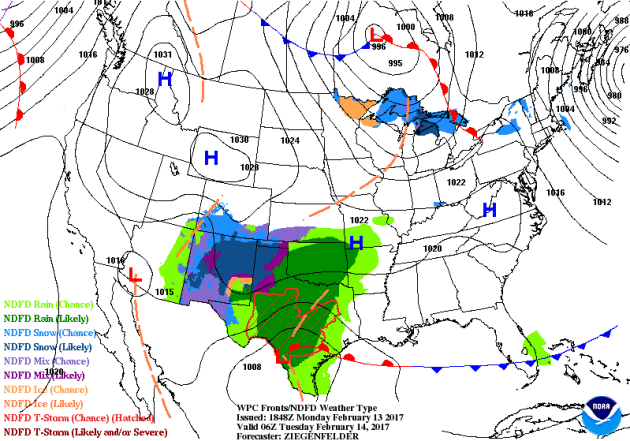
Here's the simulated radar from AM Tuesday through PM Wednesday, along with the severe weather outlook for Tuesday and Wednesday, which shows severe weather concerns continuing across parts of the Southern and Southeastern U.S.. Strong to severe storms may be capable of large hail, damaging winds and even tornadoes.
_____________________________________________________________________________
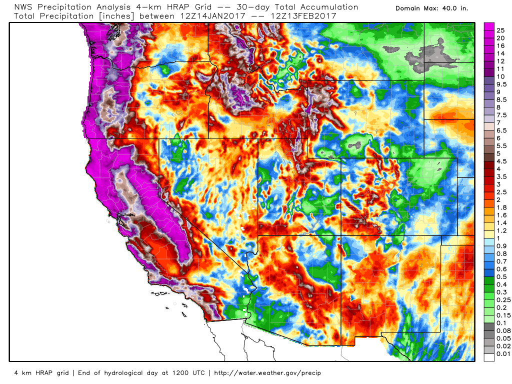
Take a look at how impressive the 30 day precipitation tallies are across the West Coast. Note the purple colors that indicate 12" of liquid! Some spots have quite a bit more than that and there's more precipitation on the way!
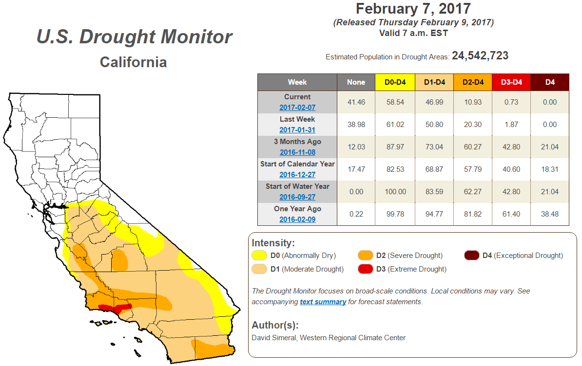
Improving California Drought
According to the U.S. Drought Monitor, the California drought continues to improve. Note that over the last 3 months, we have seen major improvement in the Exceptional, Extreme and Severe drought. With the additional moisture expected this week, we should continue to see even more improvement!
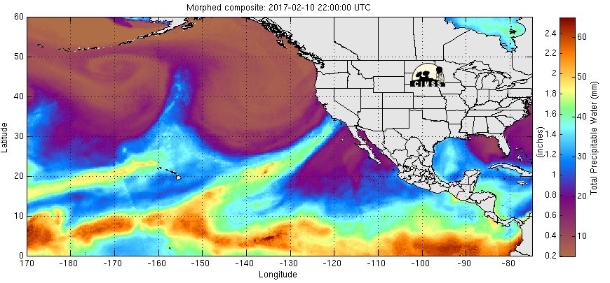
Atmospheric Rivers Continue...
Heavy precipitation has been falling across the Western U.S. due to rivers of Pacific moisture plowing into the region. Note the deep plumes of Pacific moisture that seems to be directed right toward the West Coast, these are the Atmospheric Rivers that are responsible for the extensive precipitation. Note the next big plume setting up just west of the region, this will be responsible for another heavy surge through the week ahead.
Waves of Pacific Moisture in the Western U.S. Continue
Several rounds of heavy precipitation have blasted the West Coast and we're not quite done yet. Another surge of heavy precipitation will push through the region this week and weekend ahead with more possible into early next week with significant rainfall and flooding along with heavy mountain snow.
Snowfall Potential
Here's the snowfall potential into early next week, which shows heavy mountain snow developing once again across parts of the Western U.S.. Heavy looks to develop once again across the Cascades, Sierra Nevada Range in and across the Rockies.
Here's the national weather outlook through the middle part of the week, which shows another round of snow pushing through the Great Lakes and the Northeast, while snow ends across Texas and strong to severe storms develop across the Gulf Coast States. Meanwhile, another surge of Pacific moisture looks to begin moving into the West Coast. This next surge of Pacific moisture will continue sliding down the coast and will likely bring parts of southern California heavy precipitation as well.
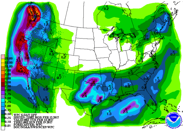
 5 Day Precipitation Forecast
National Weather Outlook
According to NOAA's WPC, the 5 day precipitation forecast suggests widespread 3" to 6"+ precipitation amounts across the West Coast through the early weekend. This will likely help improve the drought even more as we head into the 3rd week of February.
_________________________________________________________________________________
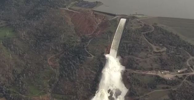
"Crews work to seal California dam spillway that forced mass evacuation"
OROVILLE, Calif. – Emergency crews early on Monday prepared loads of rock to be dropped by helicopters to seal a crumbling spillway that threatens to inundate communities along the Feather River in Northern California, local media reported. Almost 200,000 people were ordered on Sunday to evacuate from the area below the Lake Oroville Dam, the tallest dam in the United States, after authorities said its emergency spillway could give way. Officials said the situation seemed less dire overnight but Sacramento television station KCRA reported that helicopters from around the state were sent to drop chest-high bags of rocks to close the hole in the spillway. The NBC affiliate showed dump trucks dropping off piles of rock, which were then loaded into the bags with backhoes. The operation to close the gap would begin as soon as it was feasible, the station said.
 ________________________________________________________________________
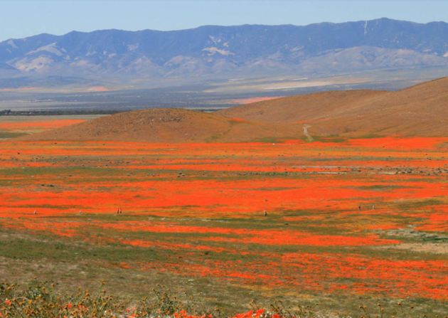
Heavy Rains May Bring a California Poppy Spectacle This Spring
All the rainfall Southern California has seen this winter has helped to ease the state’s six-year drought and may offer a flicker of hope for fans of a certain bright orange flower. In a good year, the green fields of the California Poppy Reserve in Lancaster appear afire with the blooming of the state flower. Park officials told KPCC the reserve has already received the minimum amount of rainfall to make a bloom possible — more than 7 inches — and that the poppy stalks have sprouted.
California poppies carpet a valley near Lancaster. (Jerry Frausto/Flickr)
Thanks for checking in and don't forget to follow me on Twitter @TNelsonWX

Kentucky Derby 2017 Live
ReplyDeleteKentucky Derby 2017 Live Stream
Kentucky Derby 2017 Live Streaming
2017 Kentucky Derby Live
2017 Kentucky Derby Live Stream
2017 Kentucky Derby Live Streaming
Guardians of the Galaxy Vol. 2
ReplyDeleteCanelo vs Chavez Live
Kentucky Derby 2017 Live
Kentucky Derby 2017