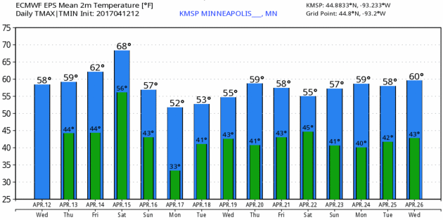
56 F. average high on April 12.
49 F. high on April 12, 2016.
.06" rain fell yesterday as of 7 PM.
April 13, 1949: A late-season snowstorm dumps over 9 inches in parts of the Twin Cities metro area.
More Puddles Brewing - But Nothing Severe Yet
"April prepares her green traffic light and the world thinks Go" wrote Christopher Morley in "John Mistletoe." This time of year we get to flirt with warm fronts but early spring warmth is elusive.
Then again, be careful what you wish for. As the thermometer rises so does the risk of severe thunderstorms. Amazingly, severe thunderstorms have been costlier than hurricanes here in the USA over the last decade. And 2017 is getting off to an inauspicious start: 5 separate billion dollar weather/climate disasters from January through March; the most since records began in 1980.
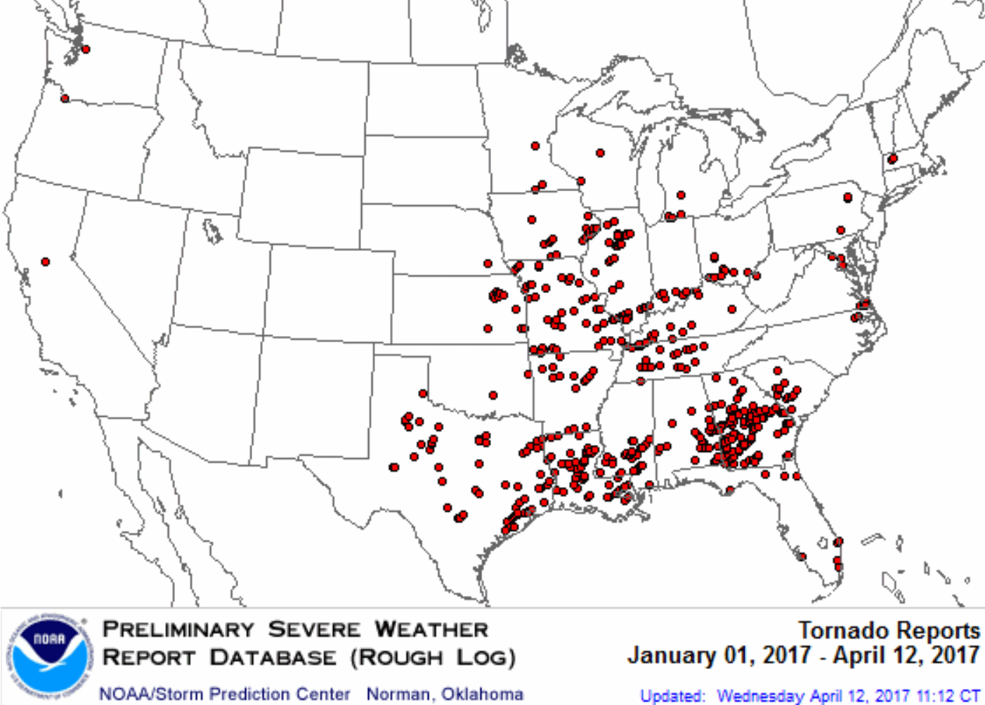
NOAA reports 536 preliminary tornadoes in 2017, to date, the most on record so early in the season. I predict a lively severe storm season in Minnesota, especially May and June.
Expect a ration of lukewarm sun today with low 60s. More showers return Friday into Saturday, even a clap of thunder, but any severe T-storms should pass off to our south - deeper in the warm, humid air. Sunday looks like the drier day of the weekend.
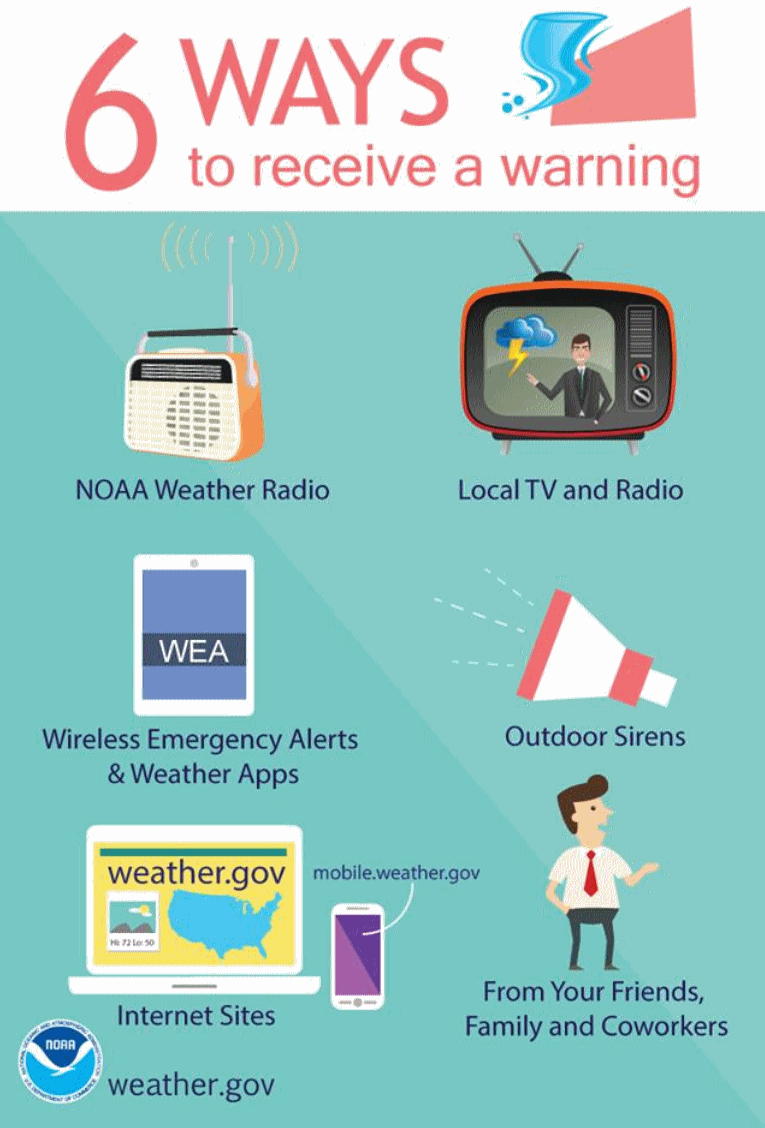
Next week is Severe Weather Awareness Week in Minnesota. It's time to prepare.
Map credit: Preliminary tornado touchdowns in 2017, courtesy of NOAA SPC.
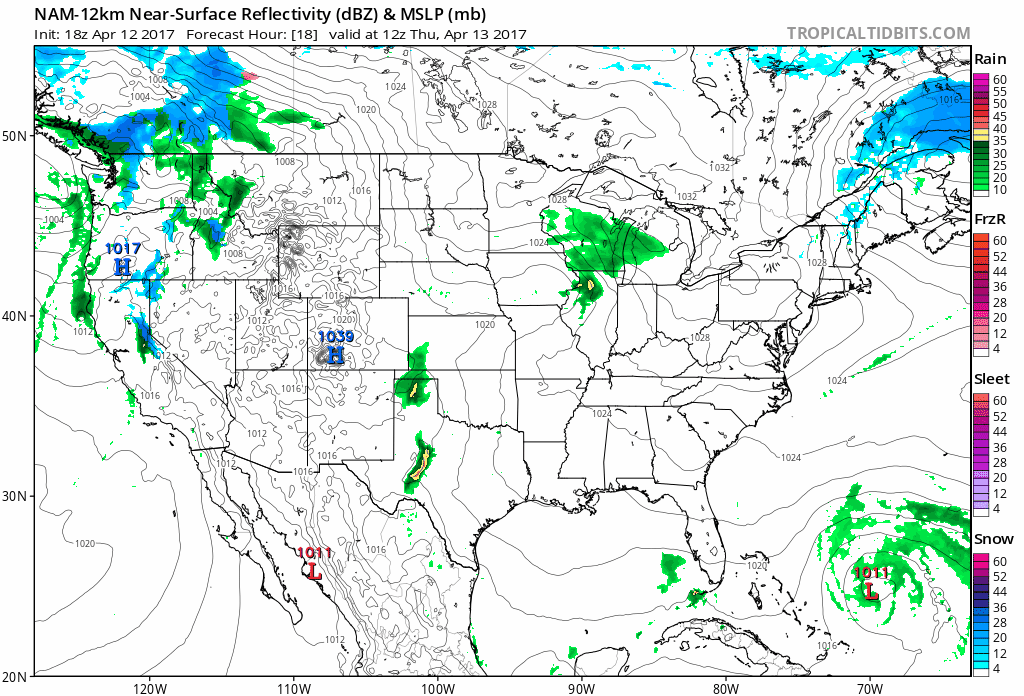
Relatively Quiet Spell. America sees a bit of a break in the severe thunderstorm department into the weekend, as heavy showers and T-storms lift across the Midwest into the Great Lakes Friday and Saturday. Soggy weather over the Pacific Northwest gives way to drier conditions and badly-needed sunshine over the weekend. Meteorologists can finally catch their breath. 84-hour 12 KM NAM: NOAA and Tropicaltidbits.com.
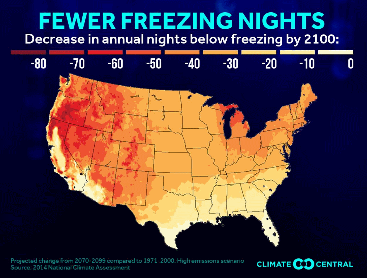
Fewer Freezing Nights. The growing season is getting longer, nationwide. Here's an excerpt from Climate Central and WXshift: "The growing season is underway in parts of the U.S., primarily in the Southeast. As the world warms, the average date of that last spring freeze is occurring earlier in the year, extending that season. While the longer growing season does have some benefits, it also raises concerns about both agriculture and health. Consistently warmer weather helps pests survive longer while also stressing crops and potentially decreasing yields. Each crop thrives in a favored temperature range, so net warming can lead to a geographical shift in areas that have been historically productive for a particular crop. Correspondingly, higher overnight temperatures tend to reduce the productivity and quality of grains and fruits, which can drive up the cost of produce at the supermarket..."
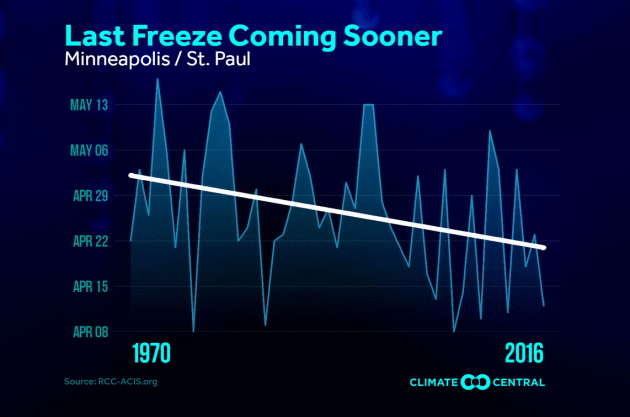
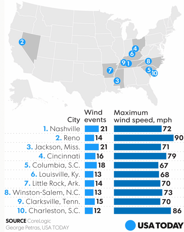
Photo credit: "The Mt. Washington Auto Road Stage Office, where the Observatory was first established, with an anemometer mounted on the roof and thermometer housing mounted on the northern exterior wall."
File image: USGS.
Tornado-Siren False Alarm Shows Radio-Hacking Risk. The Wall Street Journal has more on the recent hacking of the emergency sirens in Dallas: "...A hacker with understanding of radio technology and the right access to low-cost “software-defined radio” equipment could reproduce the Dallas siren attack elsewhere, said Chris Risley, the CEO of Bastille Networks Inc., a San Francisco company that specializes in radio-frequency security. A hacker might, for example, record the tones emitted during routine tests and then replay those tones to activate the system. “It could happen in other cities,” Mr. Risley said. Similar techniques were used as early as in the 1970s, when early hackers applied them to manipulate devices on telephone networks, security experts say..."
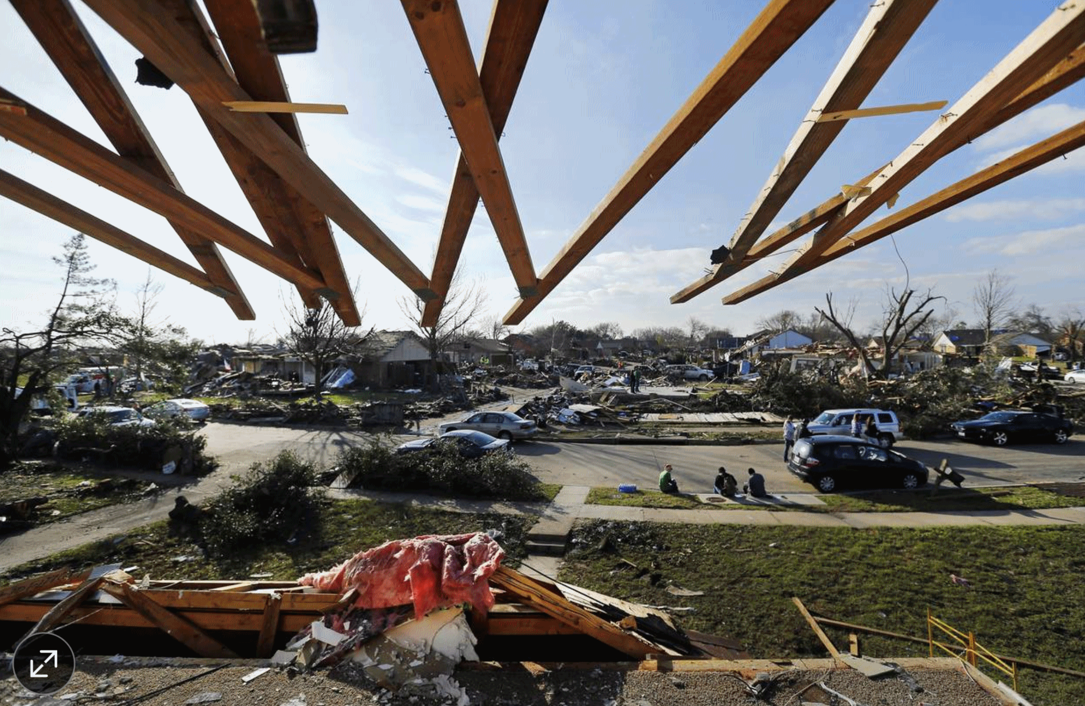
Photo credit: "Roof rafters protrude over an upstairs bedroom torn away by a tornado in Garland, Texas, in December 2015. A tornado warning system was hacked in Dallas last week." Photo: Tom Fox/The Dallas Morning News/Associated Press.
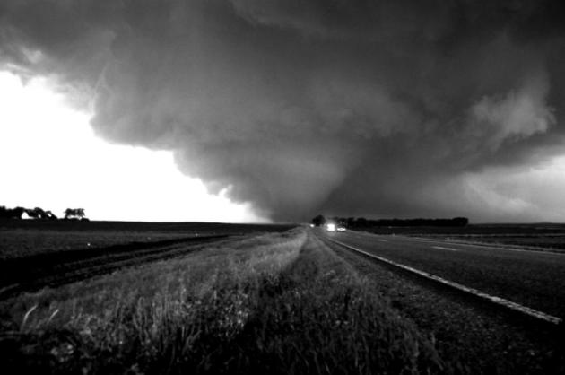
File photo from Albert Lea tornado on June 16, 2010 courtesy of meteorologist Aaron Shaffer.
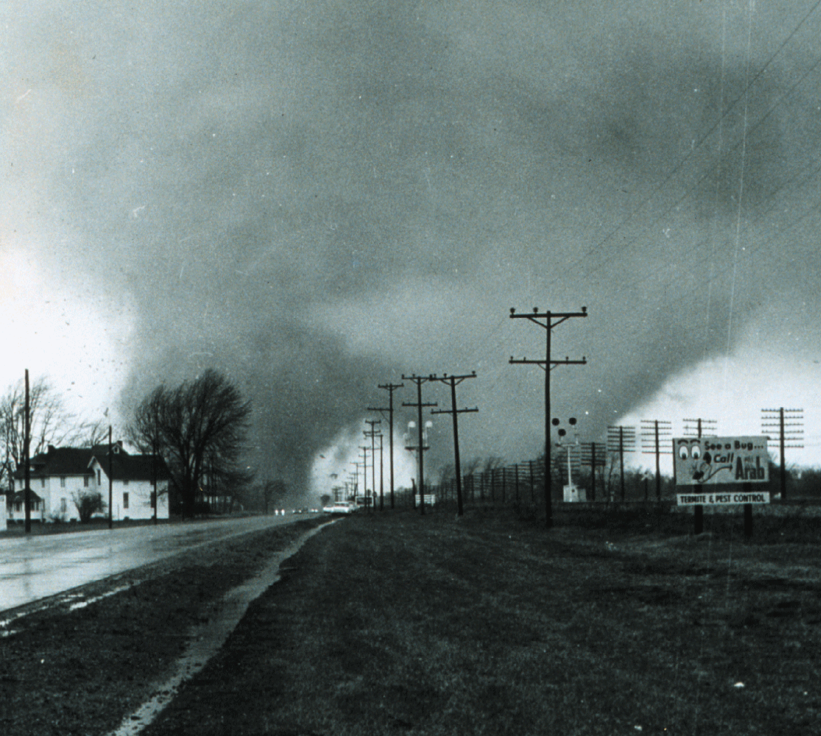
Palm Sunday 1965: Southern Great Lakes Ravaged by One of the Worst Tornado Outbreaks on Record. U.S. Tornadoes has a very good recap of that horrific day: "On April 11, 1965, and over a time span of approximately 12 hours, one of the most infamous tornado events in United States history took place across the Southern Great Lakes region. Commonly known as the Palm Sunday Tornado Outbreak (more precisely, the second Palm Sunday Tornado Outbreak, following one in 1920 and preceding another in 1994), numerous fast-moving tornadoes were unleashed upon the states of Iowa, Illinois, Wisconsin, Indiana, Michigan, and Ohio. The twisters claimed over 260 lives, injuring thousands of others and causing hundreds of millions of dollars in damages. It was the worst tornado outbreak in Indiana’s history with nearly 140 killed in the state alone. In modern tornado history, this ranks second to the Super Outbreak of April 3-4, 1974 in terms of violent tornado count in a single North American outbreak, with 17 F4+ tornadoes..."
Photo credit: "Famous picture of F4 tornado with two distinct funnels destroying the Midway Trailer Park near Dunlap, Indiana. Photo by Paul Huffman." (NWS Indianapolis, Indiana)
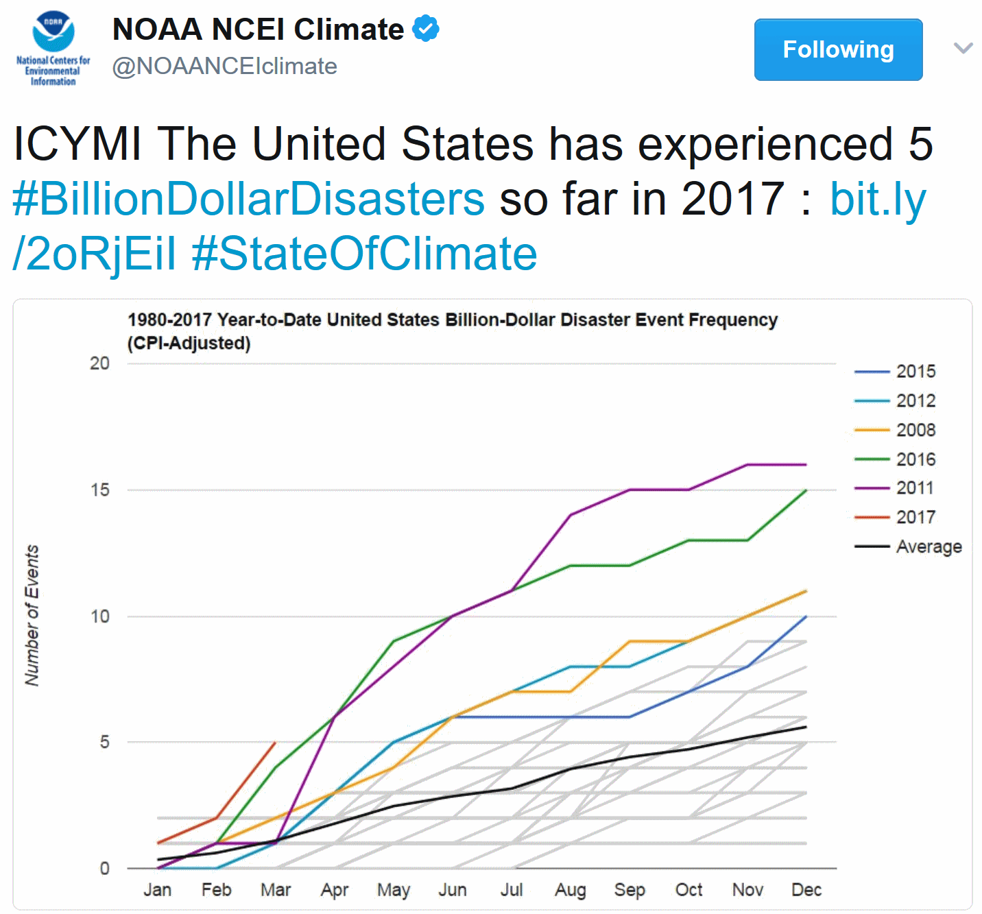
Most Billion Dollar Weather/Climate Disasters in Q1 on Record. Here are a few interesting nuggets from NOAA's National Centers for Environmental Information that provide perspective on the severity of Q1 weather and climate events in the first 3 months of 2017 across the USA:
- "In the first three months of 2017 there have been five weather and climate disaster events with losses exceeding $1 billion each across the United States. These events included a flooding event, a freeze event, and three severe storm events collectively causing 37 fatalities.
- The number of billion-dollar events for January–March (five) is the largest number of first-quarter events in the 1980–present period of record and doubles the average number of events for January–March over the last 5 years (2.4 events).
- The U.S. Climate Extremes Index (USCEI) for the year-to-date was the highest value on record at more than double the average..."
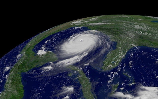
Image credit: NOAA. "Hurricane Katrina at its peak intensity. With advanced warnings, most New Orleans residents evacuated before the storm hit."
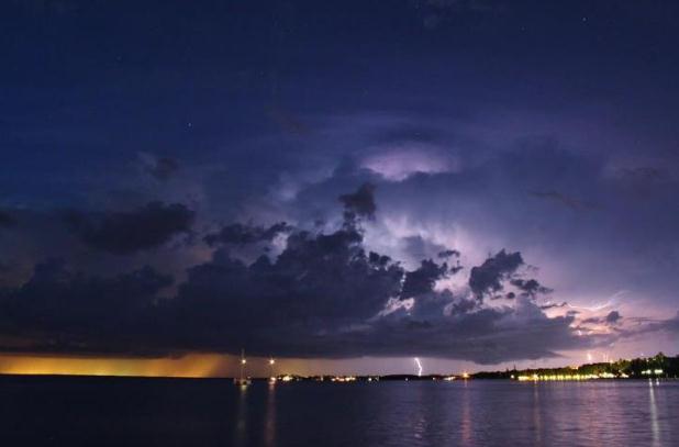
Photo credit: Key West office of The National Weather Service.
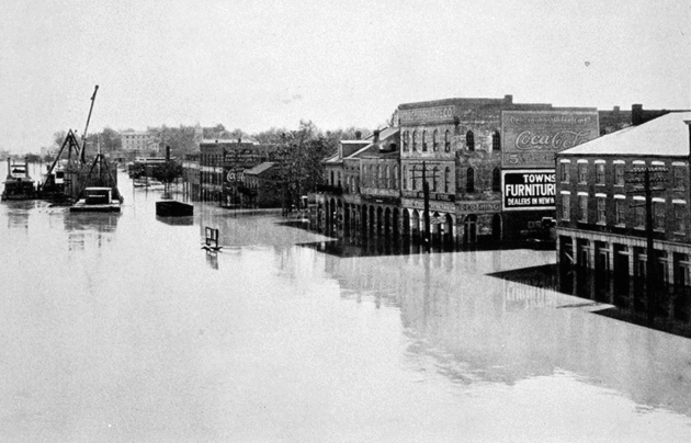
Photo credit: "After
extreme weather swept from the plains states to the Ohio River valley
in fall 1926, levees began bursting in the Lower Mississippi Valley in
March of ’27 and kept breaking through May." (Science History Images/Alamy)
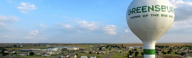
Greensburg, Kansas Overcame Environmental Disaster and Embraced a Green Future.
I heard the mayor of Greensburg talk about sustainability and how
they've rebuilt the town to take full advantage of wind and solar power
at a recent severe weather conference - it was inspiring and I left the
talk more confident than ever that other towns will follow a similar
path. Why? More resilience and less cost, savings that ultimately get
passed on to consumers. Here's an excerpt at ThinkProgress: "...In the months and years that followed, the Kansas town emerged from the ashes as a green phoenix, thanks in part to Dixson’s efforts. Using money from insurance companies and FEMA, Greensburg built the highest concentration of LEED-certified
buildings in the country. Energy-efficient structures feature natural
daylighting and geothermal heating and cooling. The downtown boasts
walkable roads and LED street lights. Wind turbines and solar panels
provide 100 percent of the town’s electricity. Dixson said the town
wanted to save money and achieve energy independence. Consume less.
Generate your own electricity. Avoid the ups and downs in the price of
fossil fuels. Thanks to their efforts, the people of Greensburg save
hundreds of thousands of dollars each year on energy costs, a huge sum
for a town of 800..."
Photo credit: Greensburg, Kansas. CREDIT: City of Greensburg.
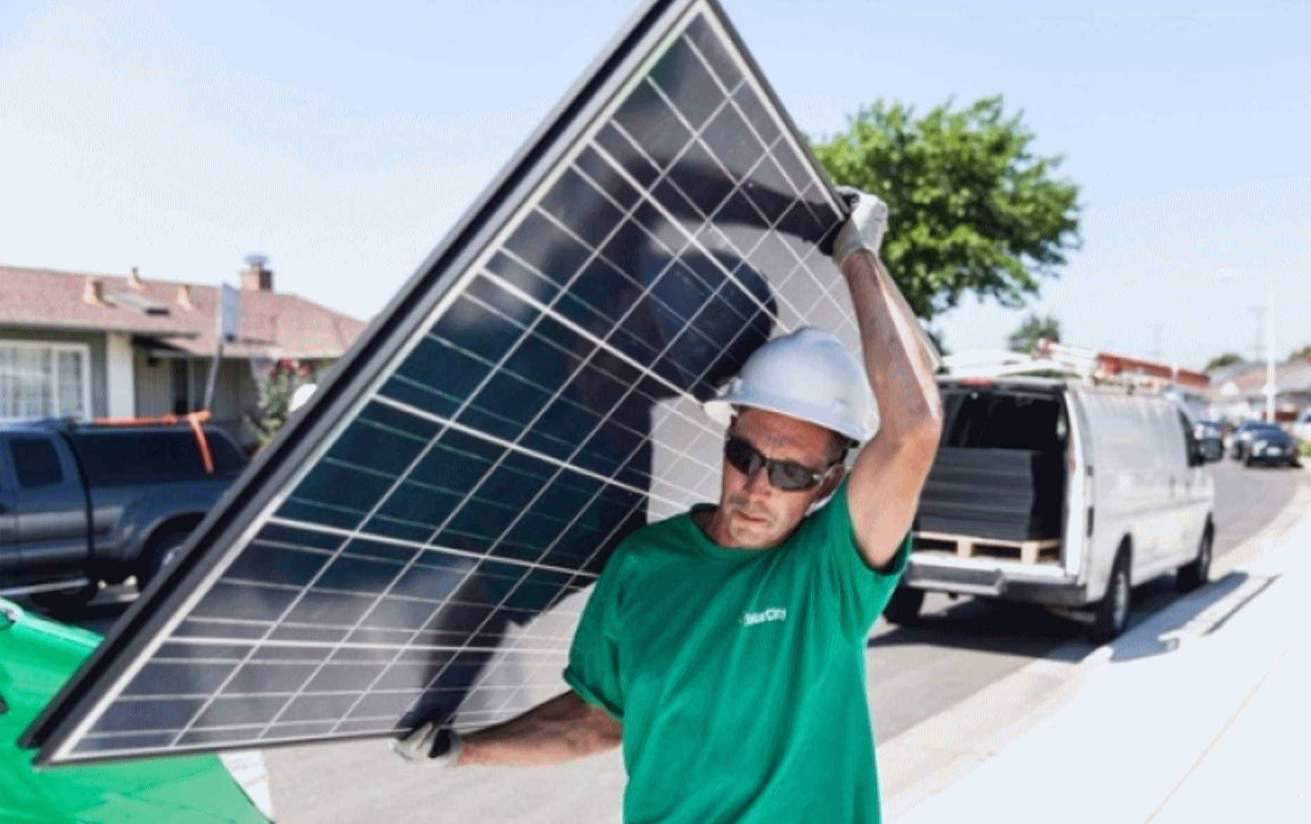
California Reaches Solar Milestone. Here's a clip from a post at Climate Nexus. Details from the San Francisco Chronicle: "Solar power met roughly half of California's electricity demand for the first time on March 11,
according to new estimates from the federal Energy Information
Administration. EIA estimates that almost 40 percent of electricity on
the grid between 11AM and 2PM
came from California's large-scale solar plants, with smaller solar
installations on homes and businesses supplying the rest. When factored
with other sources of clean energy in the state, renewable energy
accounted for more than 55 percent of power on the grid on March 11. The
abundant supply of solar in California this winter and spring has
driven wholesale prices near zero or into the negative during certain
hours..." (File image: Solar City).
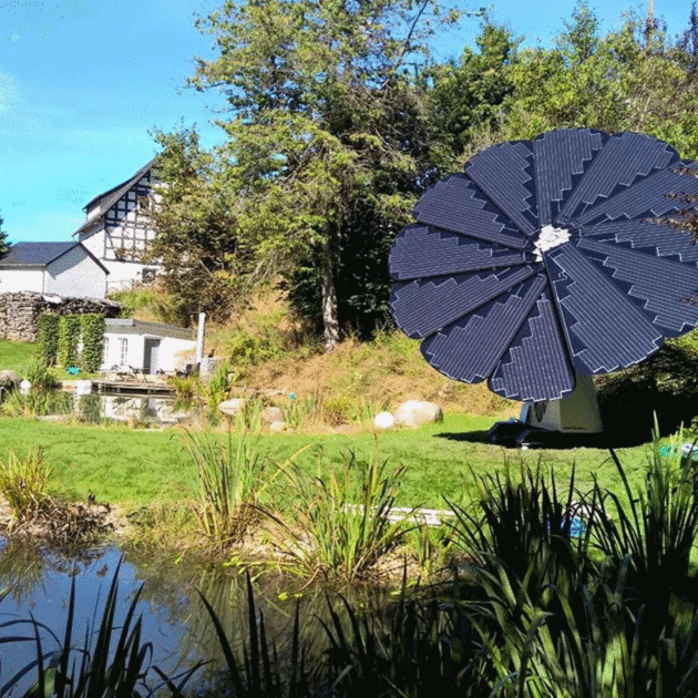
This Flower-Shaped Solar Panel Can Power Your Entire Home. The cost is about $12,000, but is there an ROI? Here's a clip from Flipboard: "Meet
the Smartflower: a portable, adjustable solar power system that uses
GPS-based dual axis tracking to follow the path of the sun throughout
the day, similar to the way a sunflower adjusts its petals to face the
sun. In the morning, the Smartflower automatically unfolds and positions
its "petals" at a 90-degree angle, which shifts as the sun moves across
the sky. At night, or when high winds make it unsafe to use, the flower
will draw its modular panels back into a folded position, according to Curbed.
By always maintaining the optimal angle to the sun, the Smartflower is
able to generate 40 percent more energy than traditional solar models..."
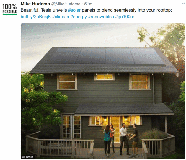
“I think this is really a fundamental part of achieving differentiated product strategy.
For
the solar panels, that means a ‘sleek and low-profile’ look for all
residential installation. Here are the new pictures. They achieved that
“with integrated front skirts and no visible mounting hardware”. That’s a
system developed by Zep Solar, a mounting equipment company acquired by
SolarCity before it was itself acquired by Tesla..."
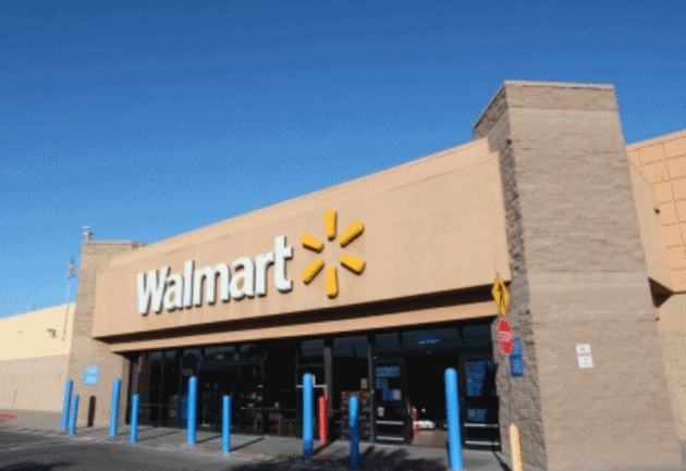
Walmart, Advanced Microgrid Solutions to Turn Big-Box Stores Into Hybrid Electric Buildings. Greentech Media has details: "Advanced
Microgrid Solutions has landed the world's largest retailer as a
partner: Wal-Mart. On Tuesday, the San Francisco-based startup announced
it is working with the retail giant to install behind-the-meter
batteries at stores to balance on-site energy and provide megawatts of
flexibility to utilities, starting with 40 megawatt-hours of projects at
27 Southern California locations. Under the terms of the deal, “AMS
will design, install and operate advanced energy storage systems" at the
stores for no upfront cost, while providing grid services and on-site
energy savings..."

Why Flying in America Keeps Getting More Miserable, Explained. Vox takes a look at how we got to this place: "...Anyone
who flies regularly has experienced the endless indignities of modern
air travel — the security theater, the cramped seats, the delays, the
missed flights, and all the rest. Making it particularly egregious is
the reality that the crucial ingredient of consumer choice seems to be
missing. Most of us have at one time or another sworn to ourselves that
we will “never” again fly on one airline or another, only to discover
that there are very few airlines one can switch to and that they all
seem dismal in their own way. The airline industry, unfortunately,
suffers from some serious business model flaws — most
notably very high fixed costs in the form of buying and maintaining
aircraft, and the problem that a half-empty flight is almost as
expensive to operate as a full one..."

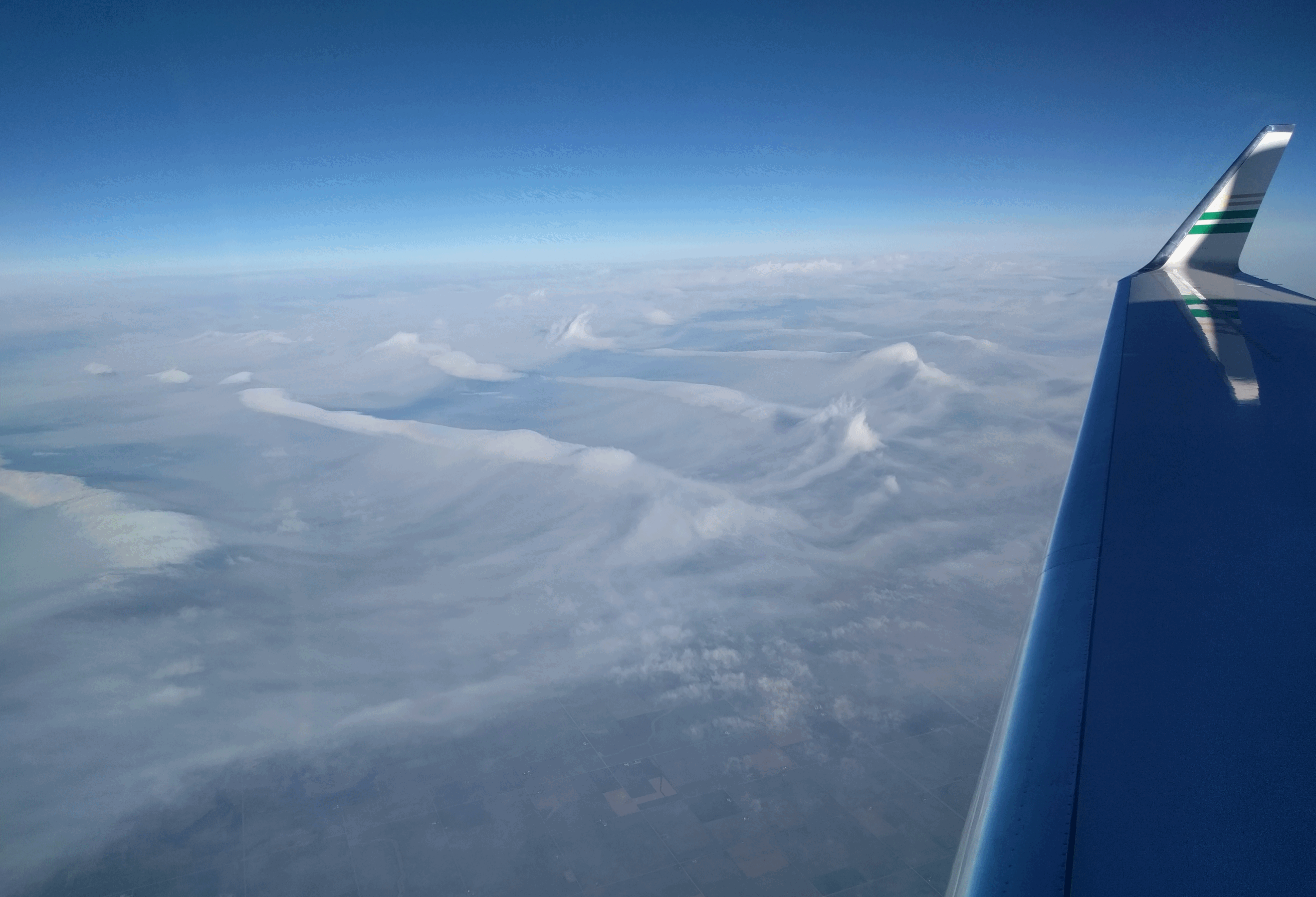
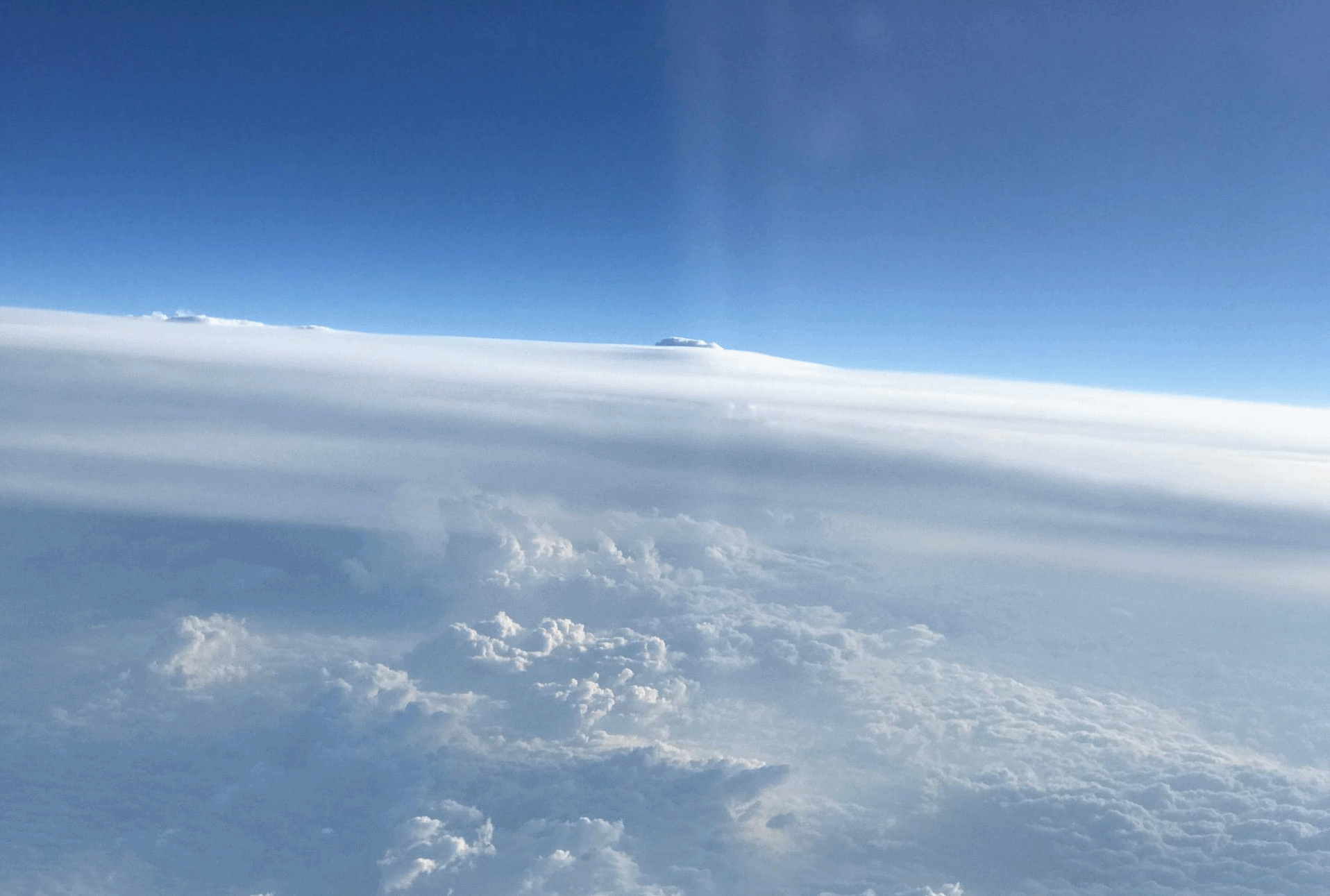
Kelvin Helmholtz Clouds.
These are "wave clouds" that form under very specific atmospheric
conditions. A friend, Mike Huang, was flying above Des Moines when he
snapped the photo above, resembling breaking waves at the shore. Here's
an except of a good explanation at EarthSky: "...Here’s
a special kind of cloud known to scientists as a Kelvin Helmholtz
cloud. These clouds look like breaking ocean waves, with the rolling
eddies seen at the top of the cloud layers usually evenly spaced and
easily identifiable. Kelvin Helmholtz clouds are named for Lord Kelvin
and Hermann von Helmholtz, who studied the physics of the instability
that leads to this type of cloud formation. A Kelvin Helmholtz
instability forms where there’s a velocity difference across the
interface between two fluids: for example, wind blowing over water.
You’ll often see the characteristic wave structure in this type of cloud
when two different layers of air in our atmosphere are moving at
different speeds. The upper layers of air are moving at higher speeds
and will often scoop the top of the cloud layer into these wave-like
rolling structures..."
Photo credit: Mike Huang.
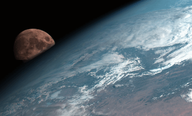
Moonrise. Here's an image from Japan's Himawari-8 satellite, courtesy of NOAA.
“There is no such thing as a minor lapse of integrity.” – Tom Peters

TODAY: Partly sunny, dry. Winds: E 7-12. High: 61
THURSDAY NIGHT: Partly cloudy. Low: 47
FRIDAY: PM showers arrive, few T-storms possible. Winds: SE 10-15. High: 62
SATURDAY: Lingering shower, thunder possible. Winds: NE 5-10. Wake-up: 56. High: 68
SUNDAY: Partly sunny, late day shower risk. Winds: NW 10-20. Wake-up: 52. High: 61
MONDAY: More clouds than sun. Winds: E 5-10. Wake-up: 39. High: 55
TUESDAY: Another jolt of rain, possibly heavy. Winds: SE 10-20. Wake-up: 41. High: 54
WEDNESDAY: Partly sunny and pleasant. Winds: NE 5-10. Wake-up: 42. High: 58
Climate Stories....
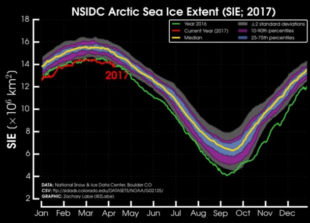
Another Record Low Month for Sea Ice. Here's an excerpt from Climate Central: "Climate change continues its rapid reshaping of the Arctic as yet another month saw sea ice set a record-low mark.
March data just released by the National Snow and Ice Data Center marks
six months in a row of near-record or record-low sea ice for the
region. It’s a story that’s been reported so often recently,
it risks feeling almost normal. But make no mistake. There has never
been a run like this in nearly 40 years of satellite data. Sea
ice was missing from a 452,000-square-mile area it usually covers in
March. That’s an area roughly the size of Sweden. Warm weather was yet
again a major culprit in the case of the missing ice..."
Image credit: "Arctic
sea ice extent is record low for this time of year and has been since
October 2016 with the exception of December (which was still the
second-lowest extent on record)." Credit: Zack Labe.

Climate Change a Character in Discovery's "Deadliest Catch". Here's an excerpt of a story at AP: "...It's
a big risk for us to discuss climate change because so many people can
think that it's a political issue when really it isn't, particularly in
the context of the fishing fleet," said R. Decker Watson, Jr., one of
the show's executive producers. The
waters off Alaska that provide the livelihood for the show's real-life
stars warmed by a dramatic 4 degrees in one year. The cold water-loving
crab is depleted in the traditional fishing areas, so some of the boats
strike out for new territory that is more dangerous because of fiercer
storms and is further from rescue workers if something goes wrong, he
said. In fact, the new
season documents one vessel lost at sea. It was not one of the crews
regularly featured in the series, but all of the regulars knew who was
involved, he said..."
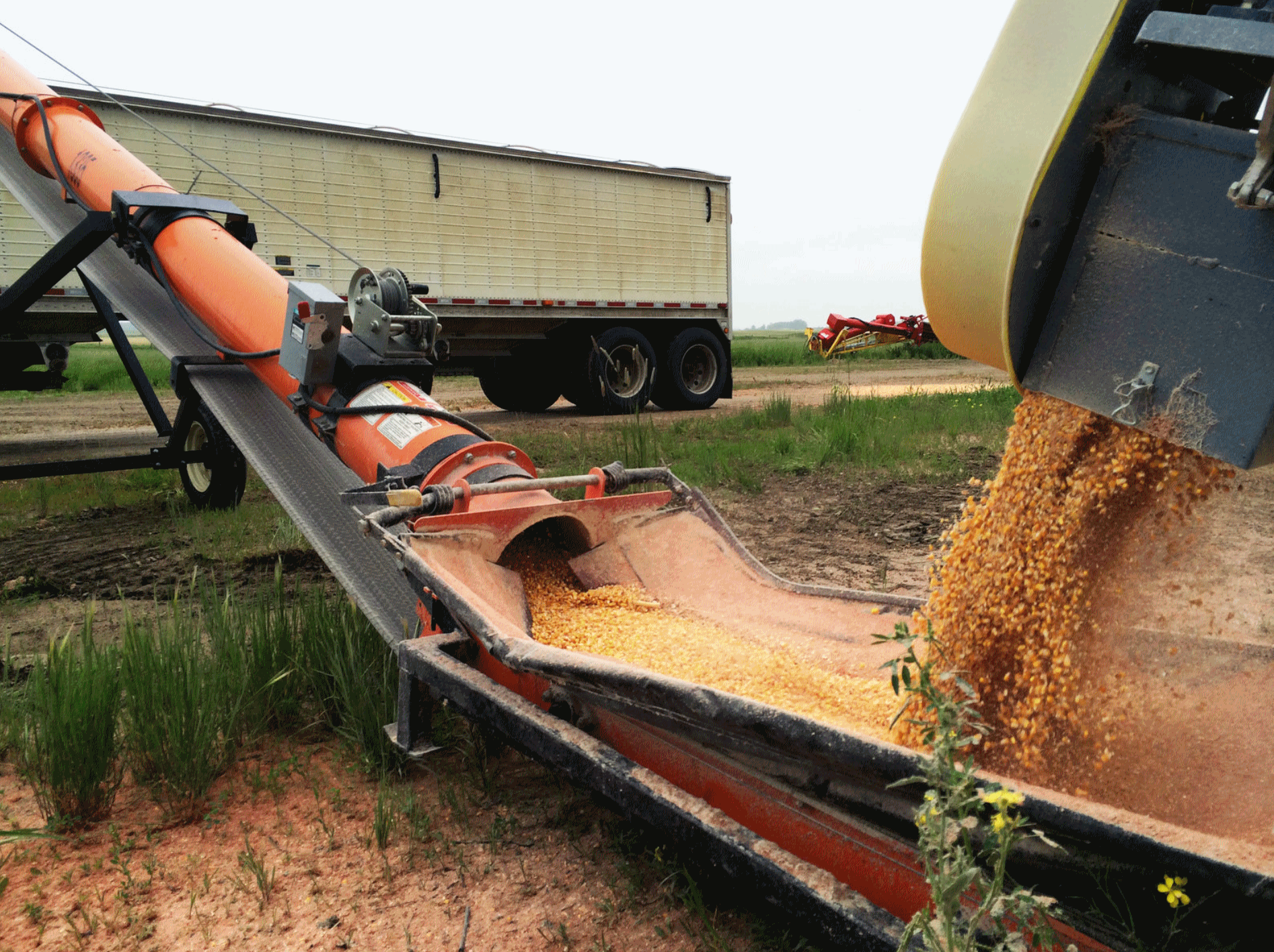
Shifting Climate Has North Dakota Farmers Swapping Wheat for Corn. Here's an excerpt from NPR: "...North Dakota's assistant state climatologist, Daryl Ritchison, says on average, rainfall has been two to three inches greater in the past two decades. "And of course, that's the average over that time period. There's been years where, of course, we've had literally eight or 10 inches above average," Ritchison says. That may not sound like a lot, but it's a big change from the semi-arid conditions that prevailed in the previous 60 years. Because of a warming trend, the growing season here has also increased two to three days a year in the last couple of decades, and by two weeks over the past century. Ritchison says the added warmth and moisture have helped make corn a successful crop in North Dakota..."
Photo credit: "Corn is loaded onto a truck on Larry Slaubaugh's farm in Wolford, N.D. He's seen a big shift from wheat to corn in recent years." John Ydstie/NPR.
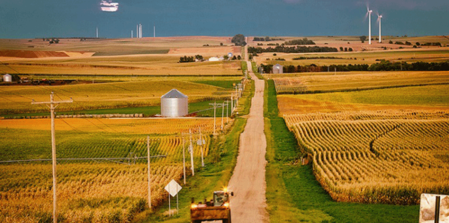
Climate Change Will Make American Farmers' Lives More Difficult. A longer growing season sounds good at first blush, but dig a little deeper and you start to understand how a more volatile climate system may not be a positive development for America's agriculture economy. Here's a clip from Truthdig: "...We’re predicting warmer and wetter springs, and drier, hotter summers,” Dr Davis says. “The season fragments and we start to see an early-early season, so that March starts looking like a good target for planting in the future. In the past, March has been the bleeding edge; nobody in their right mind would have planted then. But we’ve already seen the trend for early planting. It’s going to keep trending in that direction for summer annuals.” Worldwide, scientists have repeatedly warned that climate change driven by human dependence on fossil fuels presents serious problems for farmers: many crops are vulnerable to extremes of heat, and climate change presents a hazard for harvests in Africa, Asia and Europe. America in particular could face substantial losses, and, at the most basic level, the grasses – almost all the world’s staple foods are provided by the grass family – may not be able to adapt to rapidly changing climates..."
Photo credit: "America’s farmers may have to adapt to climate change by planting new hybrids—or new crops altogether." (Rich/Flickr)

How Climate Change Could Make Air Travel Even More Unpleasant. It's all about the configuration and strength of the jet stream, according to a story at The Washington Post: "...Williams focused on an area in the North Atlantic known for heavy air traffic, particularly between Europe and North America, and limited his simulations to winter, when turbulence is known to be at its highest. He examined 21 different wind-related characteristics known to be indicators of air turbulence levels, including wind speed and changes in air flow direction. The study found an increase in turbulence across the spectrum. Light turbulence was projected to increase by an average of 59 percent, light-to-moderate by 75 percent, moderate by 94 percent, moderate-to-severe by 127 percent and severe by 149 percent, although there’s substantial uncertainty associated with the more severe categories..."
File photo credit: "In this June 3, 2016, photo an American Airlines passenger jet takes off from Miami International Airport in Miami." (Alan Diaz/Associated Press).
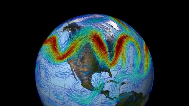
New Study Links Carbon Pollution to Extreme Weather. Here's an excerpt from Dr. John Abraham at The University of St. Thomas, writing for The Guardian: "...So, scientists really want to know what affects these undulations – both their magnitudes and their persistence. We also want to know whether these undulations will change in a warming planet. This is precisely where the new study comes in. The researchers used both weather observations and climate models to answer these questions. What they found was very interesting. Using measurements, the authors documented what conditions led to extreme weather patterns that persisted for extended durations. They found that many occur when the jet stream becomes stationary with the undulations stuck in place. They also saw that under certain situations, the jet stream undulations do not dissipate in time; they become trapped in a wave guide..." (Image: NASA GSFC)
Climate Change is a National Security Issue, Says the Military. Here's an excerpt from Nevada Public Radio: "Climate change is not a partisan issue. It’s a national and global security issue. When people are forced from their homes because of drought, they end up as refugees in other areas. This puts a strain on the systems of those who take in refugees. The new people feel marginalized as the old residents feel threatened. That may lead to anger and the susceptibility to radicalization of the refugees. All because they didn't have enough rain to grow food. Retired Brigadier General Dr. Stephen Xenakis says that's one scenario that makes climate change a threat to national security. War plays a part in the displacement of refugees, as we have seen in Syria. Any disruption that leads to personal insecurity will lead to global insecurity..."
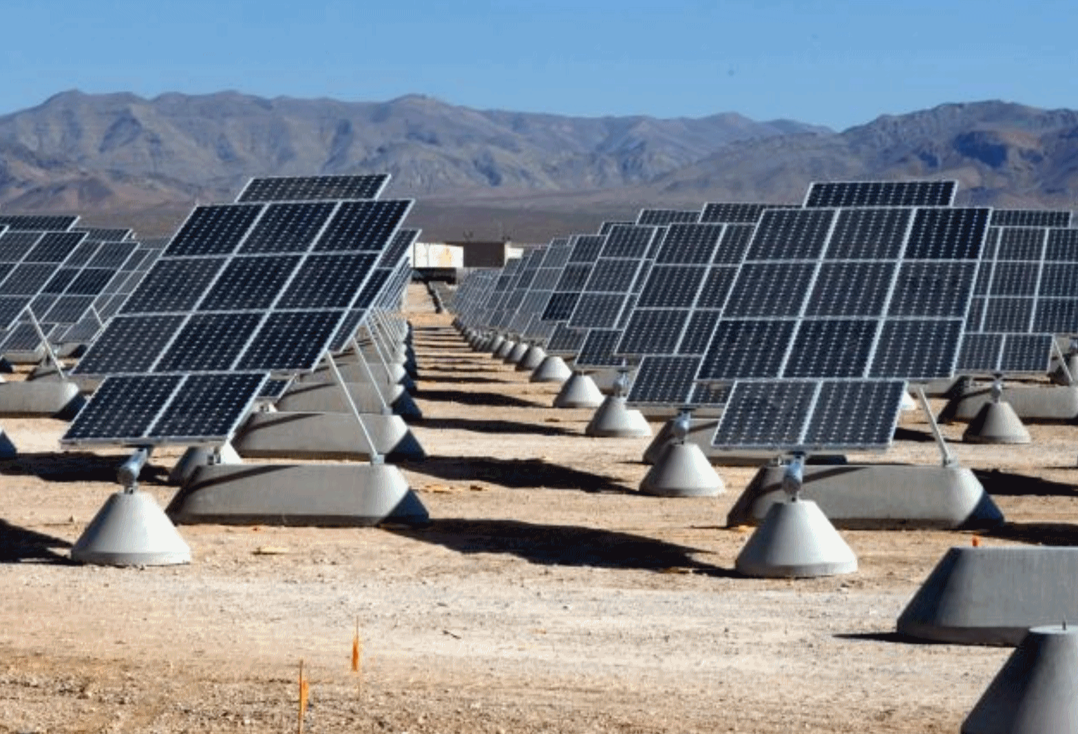
Photo credit: "The solar array at Nellis Air Force Base."
No comments:
Post a Comment