80 F. high temperature in the Twin Cities Saturday.
69 F. average high on May 13.
50 F. high on May 13, 2016.
May 14, 2013: Minneapolis sets a record high temperature of 98 degrees, breaking the previous record of 95 set in 1932.
Postcard-Worthy Weather on Mother's Day 2017
"It's not easy being a mother. If it were easy, fathers would do it" said Dorothy in "The Golden Girls". I'm dating myself. Today we celebrate our miraculous mothers, although in truth that should happen every day.
My late mom (Grace) was a disciplinarian, but kind - slow to anger. She pushed me (cello lessons, sports, Boy Scouts) and I quickly discovered what I was good at, what I loved. She never gave me a guilt trip for not setting out on a different path (doctor/lawyer/engineer). She loved me for what I was, warts and all. In this life that's all one can hope for.
The mercury approaches 80 degrees today with fading sun and a gentle southeast breeze. Dew points are in the 50s - still comfortable out there. That's about to change.
A surge of southern moisture fueling a slow-motion front sparks roving gangs of showers and T-storms this week. Many farms, gardens & lawns will pick up 1-3 inches of rain by Saturday. With any luck things dry out one week from today.
By Tuesday the dew point reaches 70 F, meaning TWICE as much water in the air as right now. The first sweaty front!
Soaking Storms.
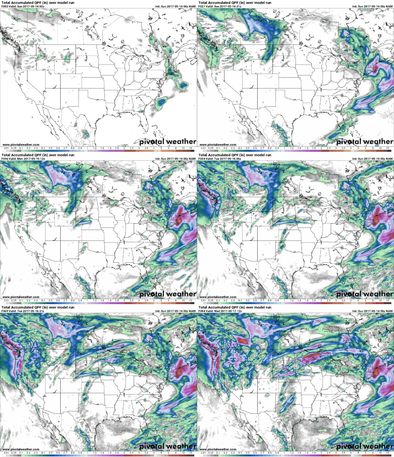
A few waves of showers and T-storms are likely from Monday into
Saturday; some 2-3" rainfall amounts not out of the question over the
next week. Graphic: Twin Cities National Weather Service.
3 Warm Days, Then a Minor Correction.
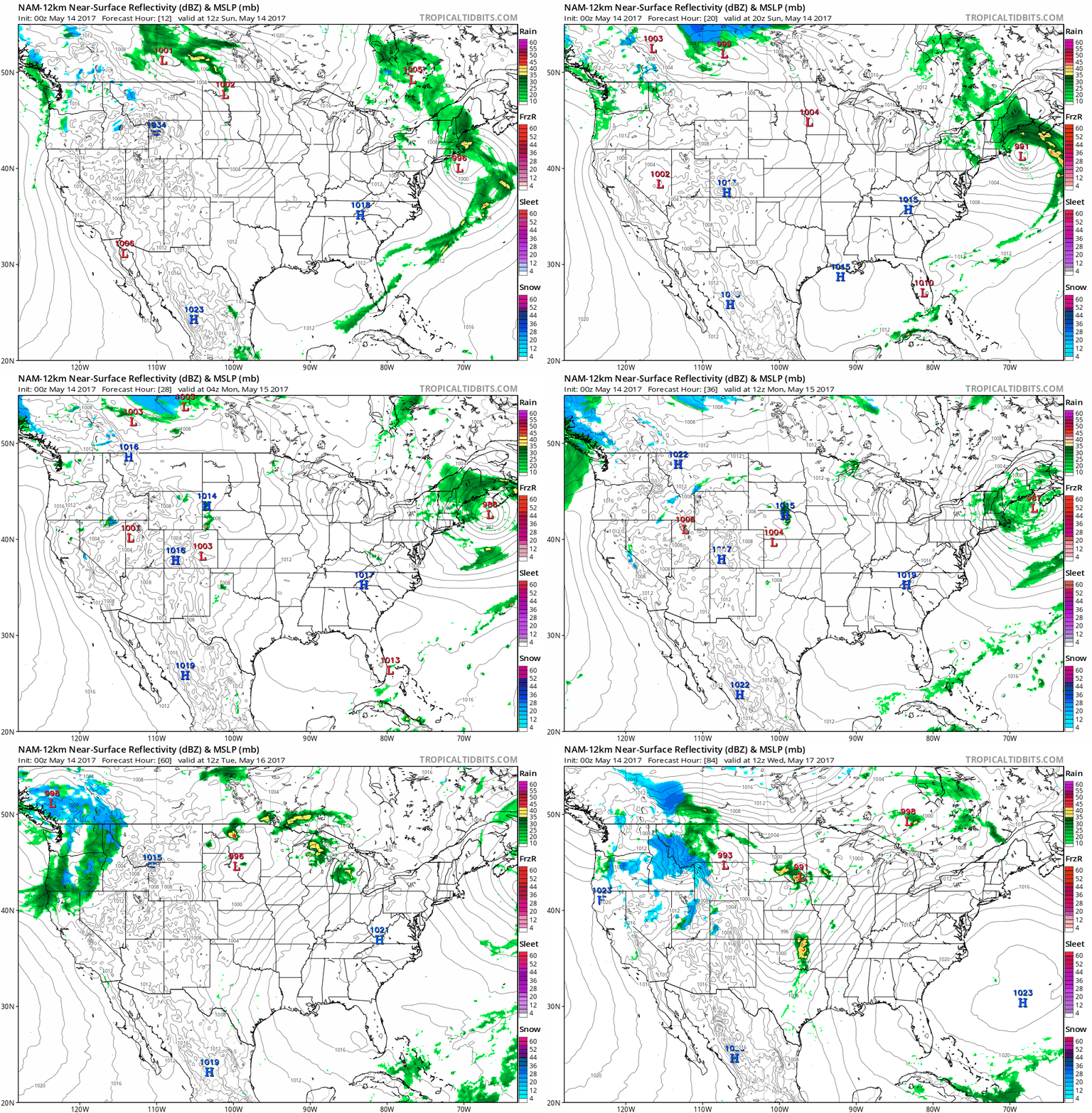
ECMWF data for the Twin Cities suggests 80s Tuesday as the warm sector
surges north, setting the stage for what may be a severe storm outbreak
Tuesday afternoon or evening. Too early for specifics, but many of the
necessary ingredients are brewing. We cool down as the week goes on, but
70s are forecast to return by the middle of next week.
Warm Memorial Day for Much of USA.
It sure looks that way; the 2-month guest-cast suggesting strong
ridging across America, with the sorry exception of the Pacific
Northwest, where cool, soggy weather may hang on. Cut-off low over
Nashville? Who knows.
Map credit: Aeris AMP.
Two Catastrophic Floods in Less Than Two Years Wasn't Just a Case of Bad Luck. Turns out it was a convergence of factors. Some perspective on recent flooding at St. Louis Post-Dispatch: "...Extreme bouts of precipitation don’t always translate to extreme floods, owing to a variety of factors such as soil moisture. Nonetheless, flood risk is rising with episodes of heavy rainfall becoming more common in the Midwest, says Ken Kunkel, a professor who researches extreme weather at North Carolina State University and is also involved with the National Climate Assessment. “Every decade has been higher than the previous decade in terms of these events,” Kunkel said. He says studies link more frequent downpours to rising global temperatures, which add more water vapor to the atmosphere, increasing the potential for precipitation whenever a storm system comes along. “They’ve got more fuel to work with, with more water vapor,” Kunkel said..."
Photo credit: David Carson, St. Louis Post-Dispatch.
Thousand-Year Flood for Missouri? Here's an excerpt of an analysis at Climate Signals: "A major slow-moving storm brought heavy rains, dangerous winds, tornadoes, and flooding across much of the central US beginning April 28. States from Oklahoma to Indiana recorded extreme three-day rainfall totals of 5 to 11 inches.[1] Eastern Texas saw two EF-3 tornadoes and Kansas experienced a rare late-season blizzard. An impressively large area of 100- to 1,000-year rains hammered Missouri[2][4] and the Ozarks were hit by record-shattering flood crests. At least 20 people have been killed.[3] Climate change is amplifying rainfall across all storm types. One of the clearest changes in the weather across the globe and in the US is the increasing frequency and intensity of heavy rain and snow. A warmer atmosphere holds more water, and storms supplied by climate change with increasing moisture are widely observed to produce heavier rain and snow..."
Despite Warnings, Drivers Continue to Die on Flooded Roads. And most of those fatalities occur in vehicles, according to U.S. News: "...Data compiled by Shea shows that 595 Americans have died in floodwater since 2011. A few fell into rivers or drowned while fishing on flooded waterways. And some children died playing too close to high water. But 61 percent of victims died in vehicles, often after driving around barriers or ignoring signs warning them to turn back. Texas, with its vast rural areas and many waterways, has had more flood-related deaths than any other state since 2011. Nim Kidd, chief of the Texas Division of Emergency Management, said too many people underestimate the power of water and "think emergencies and disasters happen to somebody else..."
File photo: AP.
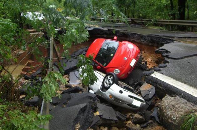
File photo: Virginia Department of Transportation.
Last Friday Was 20th Anniversary of "Great Miami Tornado". Here's a video link and story from NBC 6 in South Florida: "Friday
marks the 20th anniversary of the infamous twister known as the "Great
Miami Tornado." The F1 tornado was eight miles long with winds between
100 to 120 mph when it struck on May 12, 1997..."
I was outside of the elementary school waiting to pick up my first grader, and just as the bell rang the sky started assaulting us with giant hail balls of doom. The hail storm came out of nowhere, and we are very thankful none of the kids had been released from school before the hail began falling. The Honda Odyssey is battered and broken, but the kids are all safe..."
Photo credit: "A slightly different perspective." (SpaceX)
Graphic above: Ariel Costa for Quartz.
- Paying: A subscription is an ongoing commitment to the production of content, not a one-off payment for one piece of content that catches the eye.
- Regular Delivery: A subscriber does not need to depend on the random discovery of content; said content can be delivered to to the subscriber directly, whether that be email, a bookmark, or an app.
- Well-defined Value: A subscriber needs to know what they are paying for, and it needs to be worth it.
For the Weather Nerd In Your Life. The folks at Helicity Designs
have done a really good job with this site. This is the first time I've
ever seen Doppler radar tennis shoes. Great selection of T-shirts and
apparel as well. I hope they do well (I have my order in too).
MOTHER'S DAY: Fading sun, very nice. Hug your mother. Winds: SE 8-13. High: 78
SUNDAY NIGHT: Clouds increase, milder. Low: 60
MONDAY: Sticky, few strong T-storms. Winds: SE 8-13. High: 75
TUESDAY: Dew point near 70F. Few severe thunderstorms? Winds: S 15-25. Wake-up: 64. High: 84
WEDNESDAY: More heavy showers and T-storms. Winds: S 10-20. Wake-up: 65. High: 76
THURSDAY: Showers taper, some PM clearing. Winds: NE 10-15. Wake-up: 56. High: 70
FRIDAY: More T-storms push in from the south. Winds: E 10-15. Wake-up: 57. High: 69
SATURDAY: Showery rains, wetter day of weekend. Winds: NE 8-13. Wake-up: 54. High: 67
Climate Stories...
Study: Chicago's Forests Threatened by Climate Change. Minnesota is experiencing similar trends. Here's an excerpt from a story at Chicago Today, courtesy of WTTW-TV: "A first-of-its-kind study shows that forests in Chicago and surrounding areas face significant threats from climate change, with native trees especially vulnerable to increases in temperature, precipitation and other changes. In conducting the study, a team led by the U.S. Department of Agriculture’s Forest Service evaluated a 7-million-acre area covering parts of Illinois, Indiana, Michigan and Wisconsin. Researchers documented past and current conditions, summarized potential impacts of climate change on urban forests and outlined strategies for municipalities, park districts and forest preserve districts to manage the changes. One of the study’s key findings was that 15 percent of tree species in the region have either moderately high or high vulnerability to climate change..."
Photo credit: Flickr / Laura Marie.
Ocean Acidification. Not a theory, model or forecast, but a reality today. Graphic: Skeptical Science.
* thanks to AerisWeather modeling genius Patrick Francis for passing this post along.
Intelligence Community to Trump: When it Comes to Global Warming, You're Wrong. Here's an excerpt of a story at Mashable: "Each year the intelligence community puts together a "Worldwide Threat Assessment" report, and it inevitably scares the hell out of Congress and the public by detailing all the dangers facing the U.S. (Hint: there are a lot of them.) This year's report, published Thursday and discussed at a congressional hearing, makes for a particularly disquieting reading. While it focuses on the increasing danger that North Korea's nuclear weapons program poses as well as cyberterrorism threats, one environmental concern stands out on the list: climate change. According to the new report, delivered to the Senate Intelligence Committee by Dan Coats, the direction of national intelligence (DNI), warns that climate change is raising the likelihood of instability and conflict around the world..."
Photo credit: "Norfolk Naval Base, the largest in the world, is experiencing flooding from sea level rise." Image: U.S. Navy/Shutterstock.
Photo credit: "US secretary of state Rex Tillerson at the Arctic Council meeting in Fairbanks, Alaska." (Pic: Arctic Council Secretariat/Linnea Nordström).
Climate Change is Unraveling Natural Cycles in the West. High Country News reports: "...This follows a growing trend. According to the 2014 National Climate Assessment, from 1950 to 2005, spring shifted about eight days earlier in the Western United States, due to climate change. “This trend matters because of what it means for a lot of ecosystem processes and interactions between organisms,” says Kathy Gerst, research scientist with the USA-NPN. “Plants may flower earlier, but other organisms may respond to different cues, or to the same cues in different ways...”
Map credit: USA-National Phenology Network and the U.S. Geological Survey. Illustration by Brooke Warren/High Country News.
* The 32 page 2017 Worldwide Threat Assessment is here.
Disappearing Montana Glaciers a "Bellwether" of Melting to Come? NPR reports: "The glaciers in Montana's Glacier National Park are rapidly disappearing. Some have been reduced by as much as 85 percent over the past 50 years, while the average loss is 39 percent, according to a new study from the U.S. Geological Survey and Portland State University. The researchers looked at historic trends for 39 glaciers, 37 of which are found in the park. The other two are on U.S. Forest Service land. The stark data actually calls into question whether all of these formations are still glaciers. In fact, the scientists found that only 26 of them are still larger than 25 acres — a common benchmark for determining whether a mass of ice is classified as a glacier..."
Image credit: "Boulder Glacier in 1932 (left) and in 2005." T.J. Hileman/Glacier; NPGreg Pederson/USGS.
No comments:
Post a Comment