66 F. average high on May 5.
79 F. high on May 5, 2016.
May 6, 1965: 6 strong tornadoes, 4 of which were rated F4 on the Fujita Scale, devastate parts of east central Minnesota, including parts of the Twin Cities metro area. 14 people are killed, and 683 are injured. 2 of the F4 tornadoes hit Fridley.
A Dark Anniversary and No Such Thing as "Safe Sun"
"Keep your face always toward the sunshine - and shadows will fall behind you" said Walt Whitman. Who was probably wearing sunscreen while scribbling deep thoughts.
For over a week now I've been walking around, looking like my wife hit just me over the head with a skillet. In truth a dermatologist removed an actinic keratosis, a scaly lesion triggered by sun damage, an innocent-looking patch of crusty skin that can become cancerous over time. Which was a blunt reminder that there is no such thing as a 'safe level of sunshine'.
Slather on number 50 sunscreen over the weekend, with blue sky, low 60s and a cooling breeze. A shower may pop up late Monday and Tuesday, but the pattern favors dry weather the next 2 weeks, giving farmers a chance to get their crops into soggy fields. Highs will reach the 60s, close to average.
It's been 52 years since 4 separate EF-4 tornadoes plowed across Twin Cities suburbs, from Cologne to Fridley. Yes, tornadoes can strike metro areas, cross lakes and rivers.
Media, apps, sirens and NOAA Weather Radio can reduce the odds of an unpleasant surprise.
The Star Tribune has a comprehensive recap of that fateful evening here. Wikipedia has additional information as well.
Photo credit: "The National Weather Service confirmed that an EF-0 tornado touched down on Thursday night at the Hartsfield-Jackson International Airport in metro Atlanta." (NWS Peachtree City)
When To Expect Your Last Spring Freeze. Across much of the northern USA it's good to wait to plant annuals until after Mother's Day, give or take. That holds true this year, especially New England. Here's an excerpt from NOAA NCEI: "...Derived from the 1981–2010 U.S. Climate Normals—30-year averages of climatological variables like temperatures—this map shows the time of year, on average, that areas across the nation can expect to see their temperatures dip to 32°F or below for the last time. The map reveals some interesting regional differences across the country. In the East, the last spring freeze date generally progresses through time as you move northward on the map. However, in the West, the changes are much more complex due to elevation and coastal influences..."
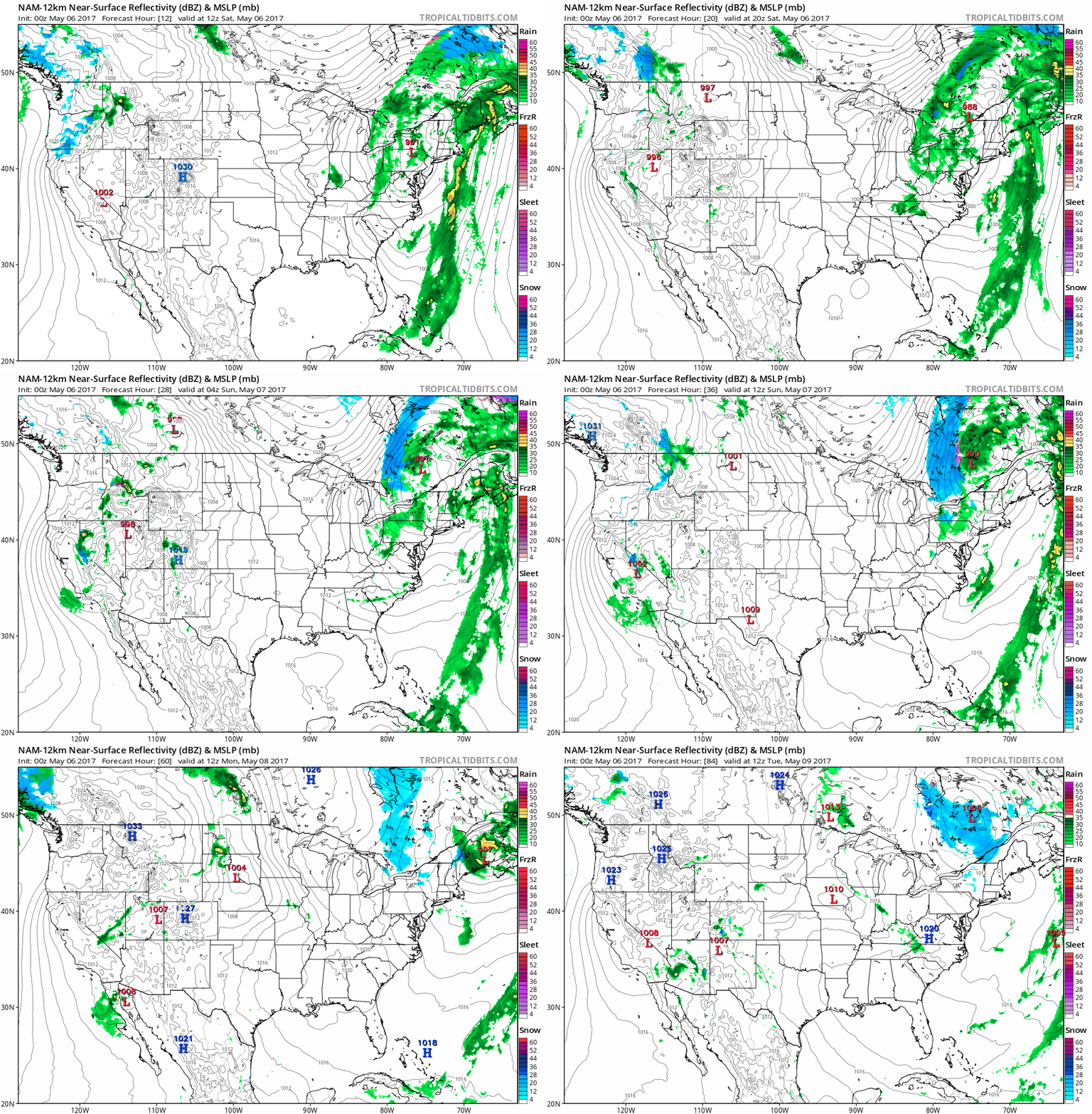
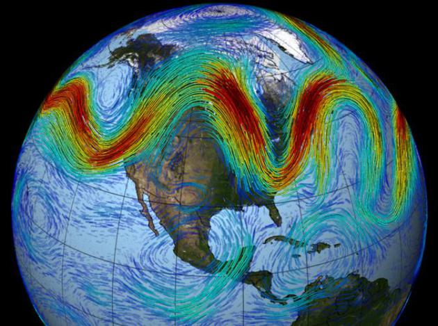
Atmospheric Holding Pattern. It's an Omega Block, upper level jet stream winds resembling the Greek letter omega (if you squint and look real hard). What that means is a stalled pattern, with copious rain (and some snow) for New England; more showery rains for California. The best weather next week comes over the central USA with a weak ridge of high pressure sandwiched between the coastal low pressure systems. NAM Future Radar: NOAA and Tropicaltidbits.com.
- "April monthly precipitation totals
varied from near normal in the northwest to one to two inches above
normal in the eastern half of the state. A few locations in east
central, south central and southeast Minnesota reported precipitation
totals that were more than three inches above historical averages.
[see: April 2017 Precipitation Total Map | April 2017 Precipitation Departure Map | April 2017 Climate Summary Table | April 2017 Percent of Normal Precipitation Map] - Average monthly temperatures for April were about one to two degrees above historical averages at most Minnesota reporting stations. The majority of the month was above normal. A sharp cool down for the last five days of the month tugged down the temperature departure a bit. Extremes for April ranged from a high of 83 degrees F near Milan on the 8th, to a low of 12 degrees F at Embarrass on the 11th and 12th..."
Latest: Receding Flood Allows I-44 to Reopen. Here's an update on historic flooding across Arkansas and Missouri from US News: "Residents of areas hit hard by flooding in eastern Missouri are getting some good news: River levels are subsiding, some evacuated residents will be allowed to go home and a closed interstate is reopening. Dropping water levels along the Meramec River on Thursday prompted the mayor of Valley Park to lift evacuation orders for levee-protected areas effective at 8 a.m. Friday. The lower part of the town was evacuated Monday amid worries a nearby levee wouldn't hold. Decreasing water levels also prompted officials to reopen westbound lanes of busy Interstate 44 in St. Louis County. Transportation officials hope to open eastbound lanes before Friday morning rush hour..."
Photo credit: "A military vehicle, left, and a truck pulling a boat pass in front of flooded businesses under water along U.S. 67 Wednesday, May 3, 2017, in the heavily flooded East Pocahontas, Ark. Downpours that dumped up to a foot of rain in parts of the nation’s midsection last weekend led to the sudden surge of water." (Stephen B. Thornton/The Arkansas Democrat-Gazette via AP) The Associated Press.
Floods May Be 2017's 6th Billion Dollar Disaster. No, it's not your imagination - we're seeing more weather and climate disasters over time. Here's an excerpt from KSGF.com: "...Because of this, flood damages are far from over, and communities up and down the Mississippi could see minor to major flooding in the coming weeks as the excess water works its way to the Gulf of Mexico. All of these damages will continue to add up, and once the tallies are in, they'll likely easily surpass the billion dollar mark, bringing the year's total to six — all before hurricane season. This year is off to a quick start for the number of billion dollar weather disasters, similar to 2016 and 2011, which each had 15 and 16 disasters, respectively. The average number of billion dollar weather disasters in the last five years is 10.6 events. Since records began in 1980, that average number is only 5.5 events..."

Billion Dollar U.S. Weather Disasters. The increase in billion-dollar disasters shows up with severe storms and flooding. Nature never moves in a straight line, but the trends are interesting. Graphic: NOAA NCDC.
Dozens of Missouri Flood Detection Gauges to Deactivate After State Budget Cuts. Well this makes perfect sense - a story courtesy of KSHB-TV in Kansas City: "At a time when flooding is a major problem for parts of Missouri, state lawmakers have cut funding for a program that helps monitor flood levels throughout the state. According to the U.S. Geological Survey, about 20 percent of Missouri stream gauges will go offline by the end of June. The gauges are used by state and federal agencies, like the National Weather Service, to help monitor floodwaters and collect water data..." (Map credit: NOAA).
Here's Where Heavy Rain Is Increasing the Most. Climate Central takes a look at the trends: "Heavier precipitation is a signature of climate change. For every 1°F of temperature increase, the atmosphere can effectively hold 4 percent more water vapor. So as the world warms from the increase in greenhouse gases, the amount of evaporation also increases from oceans, lakes, rivers, and soils. The extra water vapor is available to produce additional rain and snow, creating an environment ripe for heavy precipitation events which is exactly what we are seeing in the numbers. This week’s analysis, an update from our 2015 Climate Matters, shows an increase in the top 1 percent of daily rainfall events across the vast majority of states in the U.S..."
Dust Storm Chokes Beijing and Northern China. BBC has an update on the thick clouds of dust blowing off the deserts of northern China: "A dust storm is choking a large swathe of northern China including the capital, Beijing, in yet another air quality crisis to affect the country. Official air quality readings have soared well above the recommended World Health Organization (WHO) limit. Authorities are advising residents to avoid outdoor activity and for children and elderly people to remain indoors. The dust is blowing in from neighbouring Mongolia and China's Inner Mongolia Autonomous Region..."
Is Our Weather Increasingly Getting "Stuck"? What happens in the Arctic doesn't stay in the Arctic, either. Is rapid warming and melting impacting the configuration of the jet stream? The science is still emerging, but in the last 20 years I've seen a trend - a tendency toward more "blocking patterns". When weather stalls bad things result, like historic floods or record heat and drought. A storm stalling over New England for over a week means a high pressure bubble stalls out above Minnesota for an extended period of time. That spells good news for farmers who haven't been able to get into their fields. As of May 1 only 12% of the corn was in the fields, compared to an average of 36% planting by May 1. Last year's early spring meant 57% of the corn was planted by May 1, 2016. The next few weeks look generally mild and dry, giving Minnesota farmers a chance to make up for lost time.
Anniversary of May 4, 2007 Greensburg, Kansas EF-5 Tornado. U.S. Tornadoes has a gripping summary of the (unimaginable): "...As the tornado neared the town, it took on the much-feared “wedge” shape, visibly crowding the horizon in the lightning flashes. These are tornadoes that appear wider than they are tall. They’re usually bad news, primarily because they are so huge. Amidst a slew of increasingly urgent warnings, the town of Greensburg prepared as best it could. Life-saving equipment was moved out to wait. The 1,500+ inhabitants of the town were as ready as they could be. Around 9:50 p.m., the tornado that would almost fully destroyed Greensburg began shredding it to bits. The tornado had already been on the ground for almost an hour, and was entering the final part of its 26 mile track. At 1.7 miles in width, the hit would prove unconscionable. Terrible and miraculous all at once, “only” 11 residents lost their lives. Nearly 70 others were injured. The first EF5 on the launched-in-2007 Enhanced Fujita Scale, Greensburg was also the first F/EF5 in the state of Kansas since the Andover tornado of April 26, 1991. It was also the most recent to happen in the state..."
File photo credit: "Marine One flies over tornado damage in Greensburg, Kansas, Wednesday, May 9, 2007." (Charles Dharapak/AP Photo).
Climate Change, Tornadoes and Mobile Homes - A Dangerous Mix. This may be correlated with affordable housing and demographics vs. more tornadoes popping up around the USA. Here's an excerpt at phys.org: "...The annual impact of tornadoes is expected to increase threefold over the next few decades due to the "twin forces of increased climate variability and growth in the human-built environment," according to the study, which is published online in the journal Regional Science and Urban Economics. "If the climatologists are right abouut the continuing effects of climate change," said Mark Skidmore, MSU economics professor and co-author of the study, "then people living in mobile homes could be particularly vulnerable to tornadoes in the years to come."
Photo credit: Michigan State University.
Cheapest Life Insurance You Can Buy. Time to go on my annual rant, reminding you to invest a whopping $20-40 on a NOAA Weather Radio, if you haven't already done so. Media, apps, sirens are all great, but this is probably the only device that will wake you up at 3 AM if a tornado is heading toward your neighborhood. Get a battery-operated radio, in case power goes out, and make sure it has "SAME" technology, so you can program in your county (and not be needlessly warned for nearby counties). They are worth every penny. Here are a few options available on Amazon.
The
annual impact of tornadoes is expected to increase threefold over the
next few decades due to the "twin forces of increased climate
variability and growth in the human-built environment," according to the
study, which is published online in the journal Regional Science and
Urban Economics.
"If the climatologists are right about the continuing effects of climate change," said Mark Skidmore, MSU economics professor and co-author of the study, "then people living in mobile homes could be particularly vulnerable to tornadoes in the years to come."
The researchers investigated underlying factors of tornado fatalities in the U.S. from 1980 to 2014. There were 2,447 tornado-related deaths during that period; the bulk occurred in the "tornado alley" region of the Midwest and Southeast.
Read more at: https://phys.org/news/2017-05-climate-tornadoes-mobile-homesa-dangerous.html#jCp
As Arctic Ice Vanishes, New Shipping Routes Open. Here's a clip from The New York Times: "As global warming melts sea ice across the Arctic, shipping routes once thought impossible — including directly over the North Pole — may open up by midcentury. But high costs may keep the new routes from being used right away. The amount of sea ice covering the Arctic Ocean has declined sharply each decade since the 1980s, according to measurements taken each September when the ice is at its minimum. Older, thicker ice is disappearing as well. Scientists say global warming is largely responsible for the changes. Parts of the Arctic are warming twice as fast as elsewhere..."
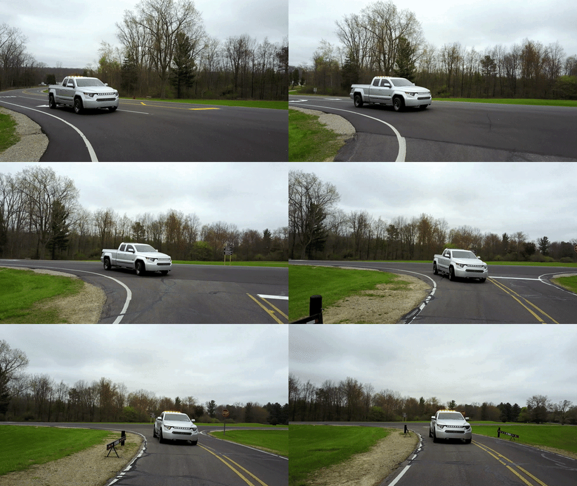
Image credit: Kevin Tong.
Photo credit: "Darth Vader Williamson, 39, is a surgical technician at a hospital in suburban Memphis."
TODAY: Sunny. Spectacular. Winds: NE 7-12. High: 63
SATURDAY NIGHT: Clear and cool. Low: 42
SUNDAY: Sunny and comfortable. Winds: SE 5-10. High: 64
MONDAY: Clouds increase, late shower possible. Winds: SE 10-20. Wake-up: 48. High: 66
TUESDAY: Unsettled, isolated T-shower possible. Winds: SE 10-15. Wake-up: 51. High: near 70
WEDNESDAY: More clouds than sun, cooler. Winds: NW 10-15. Wake-up: 49. High: 63
THURSDAY: Partly sunny, no weather drama. Winds: NE 7-12. Wake-up: 44. High: 61
FRIDAY: Mix of clouds and sunshine. Winds: NE 7-12. Wake-up: 46. High: 62
Climate Stories...
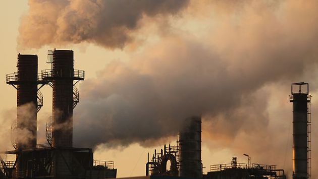
How to Make a Carbon Tax Insanely Popular. A story at The Week offers up one way to make a carbon tax fair for the poor and disadvantaged: "...So
what to take from this? Coalitions created across the traditional
liberal-conservative or Democrat-Republican divides will be in trouble.
Right-wing supporters will push towards offsetting the carbon tax with
other tax reductions, or elimination of regulations. Baker and the other
Republicans pushing the carbon tax, for instance, would like it to
replace Obama-era climate regulations. But to be broadly popular, a
carbon tax simply cannot be divorced from a broader left-populist
economic agenda. To succeed politically, it will need to come in a
broader package of policies, the net effect of which leaves most
Americans better off. As Paul argued: "The environment is something
that, when we're born, each and every one of us has a common piece of
ownership. And a tax and dividend policy restores that notion of common
ownership."
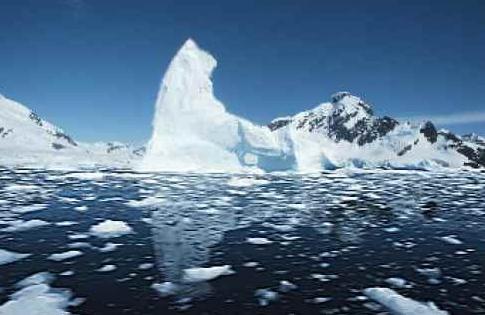
10 Things Climate Change Will Do. Deutsche Welle takes a look at symptoms, including an increased risk to shipping lanes from rogue icebergs: "...No ship has been struck by an iceberg in the North Atlantic Ocean since the Titanic sunk in 1912 and the International Ice Patrol was subsequently formed. But patrol workers are likely going to get a lot busier soon. In early April, more than 400 icebergs clogged up shipping lanes in the North Atlantic, forcing ships to take detours of up to 400 nautical miles - wasting significant time and fuel in the process. While icebergs are common in these waters, their number and timing is unusual. Experts say climate change could be to blame. The icebergs begin their journey after breaking off a glacier in Greenland, which is influenced largely by winter weather, especially storms accompanied by strong winds. Rising temperatures also lead to the melting of ice sheets, causing more chunks of ice to break off and float into the open ocean..."
- Replacing fluorocarbons used in refrigeration and air conditioning equipment with atmospherically benign alternatives like propane and ammonium.
- More electric generation from onshore wind turbines.
- Reducing food waste by one-half worldwide.
- Shifting more of the global diet from meat to plants.
- Restoring tropical forest on about half the degraded acreage identified as plausible reforestation locales.
- Assuring 13 years of schooling for girls around the world, especially in the poorest countries, as the surest path to voluntary population control.
- Encouraging family planning, with enhanced access to contraception, as a corollary effort.
- More utility-scale “solar farms...”
Map credit: "This map shows five of the 17 communities in the U.S. that are in the process of climate relocation. Upwards of 13 million Americans will be at risk of displacement from a projected 0.9 m rise in sea levels by 2100." (Center for Progressive Reform).
Global Warming "Hiatus" is Debunked Again by Researchers. Pause? What pause? Here's an excerpt from InsideClimate News: "...A new analysis in the journal Nature took a comprehensive look at what had been published on both sides of the issue. It found that a number of inconsistencies among studies proposing a hiatus—including variations in how the term "hiatus" was defined—led to cascading confusion. The study also pointed to some lessons for communicating climate science in the future. "It is easy to paint a controversial picture, but as often the devil is in the details," wrote the authors, who are scientists at the Institute for Atmospheric and Climate Science at ETH Zurich in Switzerland..."

File image: NASA ISS.
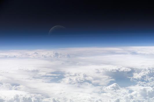
Image credit: A list of members of the bipartisan Climate Solutions Caucus in Washington D.C. is available at Citizens Climate Lobby.

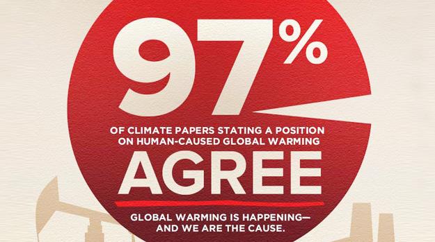
Is the Climate Consensus 97%, 99.9% or is Plate Tectonics a Hoax? Follow the logic carefully in a post at The Guardian: "...Lamar Smith also referenced a common denier argument that consensus should be measured by comparing the number of papers explicitly endorsing the theory to the total number of papers examined. By that measure, 0 out of 331 geology papers endorsed the theory, meaning the consensus is 0% and clearly plate tectonics is a hoax. Ultimately those are our three options in defining the climate “consensus.” Either every paper that doesn’t explicitly reject human-caused global warming is part of the 99.9% consensus, or 97% of papers taking a position on the cause of global warming are part of the consensus endorsing the theory, or climate science and plate tectonics are both hoaxes. It’s most accurate to say that 97% of relevant peer-reviewed studies agree that humans are causing global warming, 99.9% of climate papers don’t reject that theory, and those who deny the overwhelming consensus are peddling misinformation..."
No comments:
Post a Comment