71 F. average high on May 21.
80 F. high in the Twin Cities on May 21, 2016.
May 22, 2011: A strong EF-1 tornado with wind speeds up to 110 mph strikes north Minneapolis, causing extensive tree and structural damage. The tornado touched down in St. Louis Park and moved through north Minneapolis, lasting 14.25 miles before dissipating in Blaine after causing minor damage to the Anoka County Airport. The tornado reached a peak width of 1/2 mile.
May 22, 2001: Record cold high temperatures are set in over 30 cities in Minnesota, including a chilly 47 in the Twin Cities and 39 at Grand Rapids and Pine River. Half of an inch of snow falls at International Falls.
May 22, 1925: Temperatures take a nosedive from 100 to 32 degrees in 36 hours at New Ulm and Tracy.

Can't Shake a Shower Risk - but Weather Slowly Improves
"Weekends are a bit like rainbows; they look good from a distance but disappear when you get up close to them" wrote John Shirley. Memorial day, summer's big kick-off, is a week away and my nervous tick is back. For good reason.
According to climatologist Mark Seeley Minnesota's statewide average rainfall is roughly 30 percent higher now than it was from 1921 to 1950. There's more water in the air, and it's coming down harder, especially spring and early summer months.
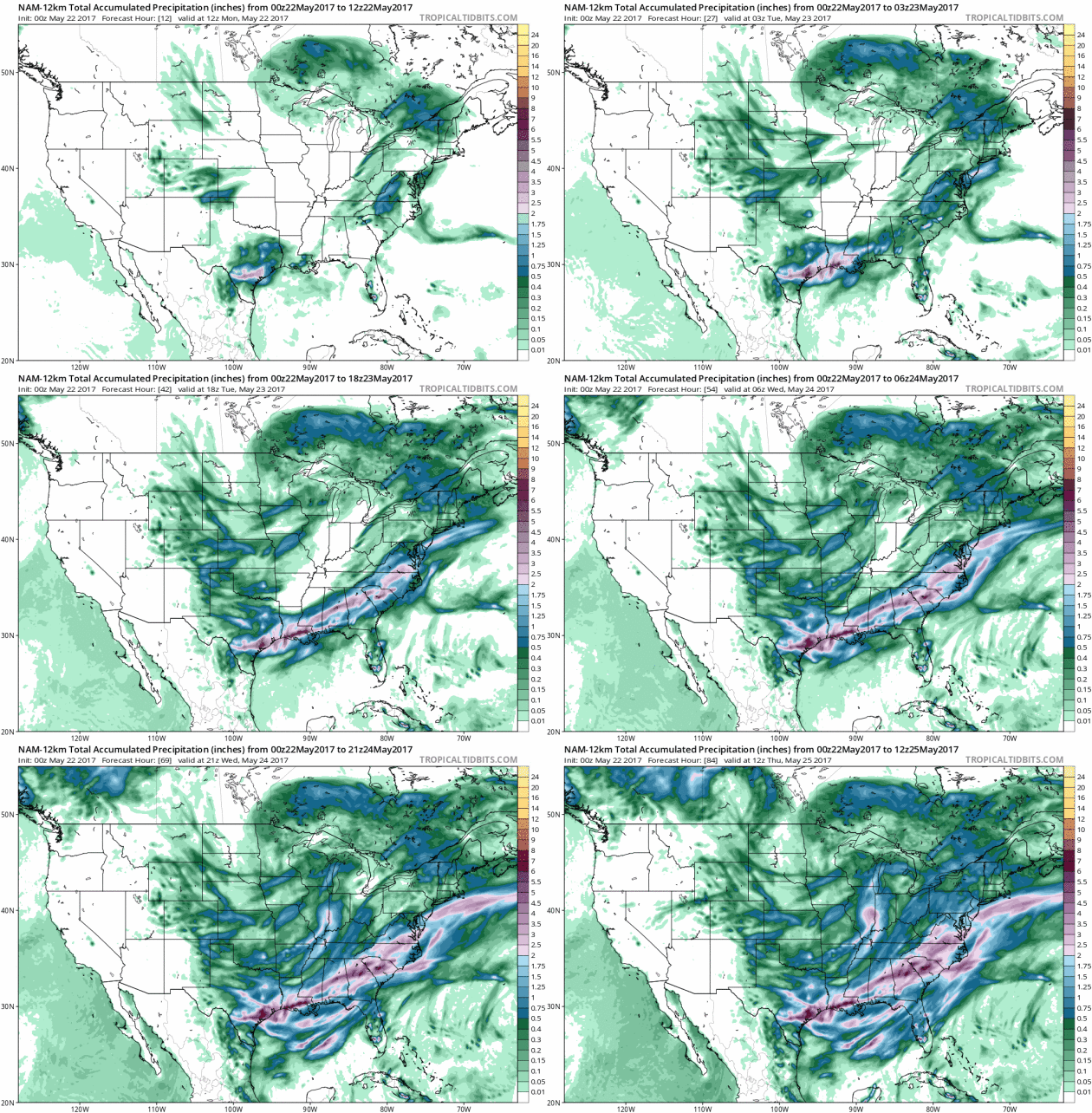
4 to 6 inches of rain swamped the area last week as a stalled trough of low pressure incubated 3 separate sloppy storms.
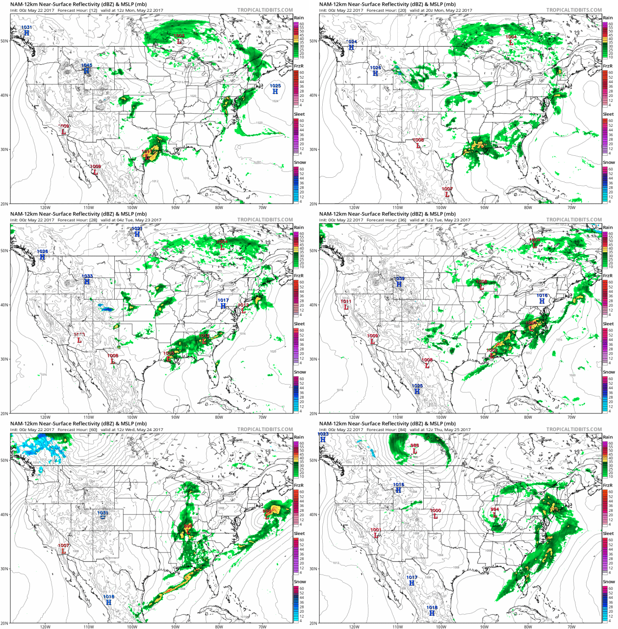
A 'Sunshine Watch' has been issued for today. Please don't stare up at that bright, glowing mystery-orb, but try to enjoy 60s before a few instability thundershowers mushroom to life. Showers spill into Tuesday before improving weather midweek. A warming trend is still brewing - we should top 70F by late week. No more drenching, all-day rains in sight, but a swirl of chilly air aloft may set off weekend showers, especially up north.
Far from perfect, but a definite improvement in the weather.
More Than a Month's Worth of Rain in 7 Days. The coveted Golden Rain Gauge Award goes to South St. Paul, where 5.08" rain fell since last Monday, according to local observers. The MSP Airport in Richfield picked up a cool 4.18" of rain with 3.45" in St. Paul.


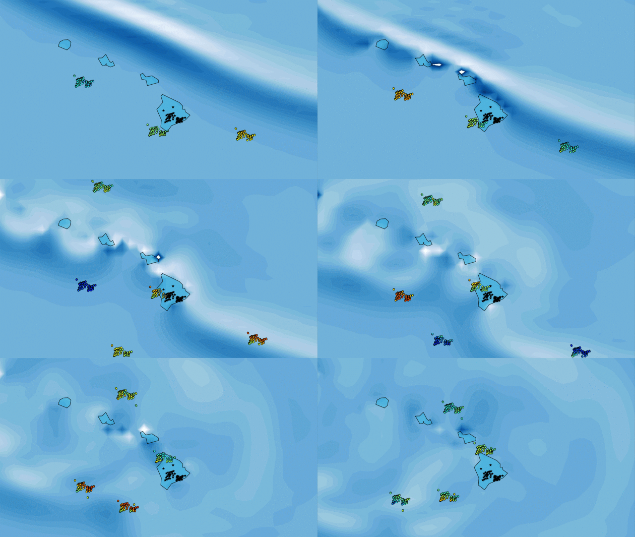
Scientists Look to Skies to Improve Tsunami Detection. Here's a snippet from an interesting NASA story: "A
team of scientists from Sapienza University in Rome, Italy, and NASA’s
Jet Propulsion Laboratory in Pasadena, California, has developed a new
approach to assist in the ongoing development of timely tsunami
detection systems, based upon measurements of how tsunamis disturb a
part of Earth’s atmosphere. The new approach, called Variometric
Approach for Real-time Ionosphere Observation, or VARION, uses
observations from GPS and other global navigation satellite systems
(GNSS) to detect, in real time, disturbances in Earth’s ionosphere
associated with a tsunami. The ionosphere is the layer of Earth’s
atmosphere located from about 50 to 621 miles (80 to 1,000 kilometers)
above Earth’s surface. It is ionized by solar and cosmic radiation and
is best known for the aurora borealis (northern lights) and aurora
australis (southern lights). When a tsunami forms and moves across the
ocean, the crests and troughs of its waves compress and extend the air
above them, creating motions in the atmosphere known as internal gravity
waves..."
Animation credit: "Animation
of Oct. 27, 2012, Queen Charlotte Island tsunami as it crossed Hawaii.
As the wave (dark blue/white lines approaching from the northeast)
moved, it perturbed the atmosphere and changed the density of
ionospheric electrons as reflected by navigation satellite signal
changes (colored dots)." Credits: Sapienza University/NASA-JPL/Caltech.
Solar Employs More U.S. Workers Than Apple, Google and Facebook Combined. With a little perspective on renewables and employment here's a clip from ThinkProgress: "...As
of 2016, California has just over 100,000 solar jobs — a one-third
increase over the previous year. The country added a record 50,000 solar jobs last year. The U.S. solar industry currently has more than 260,000 workers nationwide, according to The Solar Foundation. Their executive director, Andrea Luecke, points out
that’s more workers than “Apple, Google, Facebook and Amazon combined.”
(As a point of clarification, Amazon has added jobs at a torrid pace in
the last couple of years, so the 260,000 solar jobs is ‘only’ more than
Apple, Google, and Facebook combined.)..."
Photo credit: "A rooftop is covered with solar panels at the Brooklyn Navy Yard, February 2017." CREDIT: AP/Mark Lennihan.
Public to EPA on Cutting Regulations: "No!" NPR reports: "As part of President Trump's executive order to review "job-killing regulations," the Environmental Protection Agency last month asked for the public's input on what to streamline or cut. It held a series of open-mic meetings, and set up a website that has now received more than 28,000 comments, many of which urge the agency not to roll back environmental protections. "The EPA saves lives," wrote Benjamin Kraushaar, who described himself as a hydrologist, hunter and flyfisherman. He wrote that environmental regulations "ensure safe air and water for our future generations. This should not be even up for debate..."
Photo credit: "The Environmental Protection Agency's flag hangs over EPA headquarters in Washington, D.C." Bill Clark/CQ-Roll Call Inc.
Photo credit: "The World's Largest Ball of Twine in Cawker City, Kansas." Flickr/Ethan Prater
TODAY: Some sun, PM shower or T-shower. Winds: W 8-13. High: 64
MONDAY NIGHT: Evening shower, then clearing. Low: 47
TUESDAY: Cool and damp, few showers likely. Winds: N 8-13. High: 58
WEDNESDAY: Partly sunny and pleasant. Winds: NE 8-13. Wake-up: 45. High: 61
THURSDAY: Clouds increase, risk of T-shower. Winds: SE 10-15. Wake-up: 43. High: 69
FRIDAY: Mix of clouds and sun, not bad. Winds: SW 8-13. Wake-up: 55. High: 75
SATURDAY: Partly sunny, lukewarm breeze. Winds: NW 8-13. Wake-up: 57. High: 72
SUNDAY: Sunny start, few PM T-showers possible. Winds: NW 8-13. Wake-up: 53. High: near 70
Climate Stories...
Racing to Find Answers in the Ice. The New York Times
has done a remarkable job explaining the science and visually, telling the
story of what's happening in Antarctica - why not just coastal residents
need to pay attention: "...Unraveling the answers, and gaining a
better understanding of how Antarctica’s ice has waxed and waned in the
past, may offer a rough guide to the changes that human-caused global
warming could wreak in the future. Already, scientists know enough to be
concerned. About 120,000 years ago, before the last ice age, the planet
went through a natural warm period, with temperatures similar to those
expected in coming decades. The sea level was 20 to 30 feet higher than
it is today, implying that the ice sheets in both Greenland and
Antarctica must have partly disintegrated, a warning of what could occur
in the relatively near future if the heating of the planet continues
unchecked..."
Map credit: "Red areas have lost significant amounts of ice since 2010."
Climate Change Could Slash Staple Crops. CO2 is plant food? Yes, but too CO2 can ruin the recipe. Climate Central explains: "Climate change, and its impacts on extreme weather and temperature swings, is projected to reduce global production of corn, wheat, rice and soybeans by 23 percent in the 2050s, according to a new analysis. The study, which examined price and production of those four major crops from 1961 to 2013, also warns that by the 2030s output could be cut by 9 percent. The findings come as researchers and world leaders continue to warn that food security will become an increasingly difficult problem to tackle in the face of rising temperatures and weather extremes, combining with increasing populations, and volatile food prices. The negative impacts of climate change to farming were pretty much across the board in the new analysis. There were small production gains projected for Russia, Turkey and Ukraine in the 2030s, but by the 2050s, the models “are negative and more pronounced for all countries,” the researchers wrote in the study published this month in the journal Economics of Disasters and Climate Change..."
Photo credit: Andrew Seaman/flickr
Looming Floods, Threatened Cities. What if all those ("alarmist") scientists who specialize in this stuff turn out to be right? Here's an excerpt of Part 2 of The New York Times series on troubling changes in West Antarctica: "...In 2016, Robert M. DeConto of the University of Massachusetts, Amherst, and David Pollard of Pennsylvania State University published a study,
based on a computer analysis of Antarctica, that raised alarms
worldwide. Incorporating recent advances in the understanding of how ice
sheets might break apart, they found that both West Antarctica and some
vulnerable parts of East Antarctica would go into an unstoppable
collapse if the Earth continued to warm at a rapid pace. In their
worst-case scenario, the sea level could rise by six feet by the end of
this century, and the pace could pick up drastically in the 22nd
century. Dr. DeConto and Dr. Pollard do not claim that this is a
certainty — they acknowledge that their analysis is still rough — but
they argue that the possibility should be taken seriously..."
A Future of More Extreme Floods, Brought To You By Climate Change. The Verge has a must-read story: "Extreme
floods along the coastline may become much more common if sea levels
continue to climb unchecked, new research says. Scientists estimate that
as soon as 2030, a 4-inch sea level rise could double the frequency of
severe flooding in many parts of the world, and increase it by as much
as 25 times in the tropics. For the communities and ecosystems in the
floodwaters’ path, the toll could be catastrophic. Right now, the global
sea level is slowly but surely creeping upwards a fraction of an inch
each year (0.118 to 0.157 inches per year to be exact). That doesn’t
seem like much, but we’re already feeling the consequences of rising
waters and eroding coastlines. Tides high enough to flood homes and
infrastructure have become more common in some parts of the US like
Florida — “turning it from a rare event into a recurrent and disruptive
problem,” as a report by the National Oceanic and Atmospheric Administration put it earlier in 2017. In Louisiana, an entire community was driven from their homes on Isle de Jean Charles by rising seas..."
No comments:
Post a Comment