84 F. average high on July 17.
84 F. high on July 17, 2016.
July 18, 2000: Fall apparel makes an early debut with a 60 degree high temperature at the Twin Cities, 54 at Brainerd and 52 at Cambridge.
July 18, 1970: A tornado slices right through the center of Miltona.
July 18, 1867: The greatest 'unofficial' rainstorm in Minnesota history is reported. 36 inches of rain is recorded in 36 hours near Sauk Center. Disastrous flooding occurs in central Minnesota. The Pomme De Terre river becomes impassable; a courier attempted to cross on horseback and drowned. Flooding also occurs on the Mississippi, with millions of logs lost on the river.
A Place That Makes Minnesota Seem Pleasantly Mild
I just got back from my first glimpse of Alaska. It was relentless - overwhelming; everywhere I turned there was another Eureka Moment.
In addition to seeing Denali through a pall of smoke from distant wildfires, we spent some time in Fairbanks, the coldest city in the USA. You can plug in your vehicle, which makes sense considering the mercury dips below -40F at least 11-12 nights a year.
Kids have outdoor recess until the air temperature goes below -20F. Now that's hardy, and it almost makes Minnesota look like Club Med. Almost.
Today is the wettest day in sight; over 1 inch of rain from heavy thunderstorms sloshing across the state. Minnesota teeter-totters on the northern edge of a sprawling heat bubble, meaning uncomfortable humidity levels and sporadic T-storms into Saturday.
Right now Sunday looks like the sunnier, drier, more comfortable day of the weekend as Canadian air splashes south, cooling us off before the next inevitable heat spike later next week.
We shouldn't be surprised. On average the hottest weather of the year arrives roughly 3-4 weeks after the Summer Solstice. No kidding.
* The photo of a grizzly bear was taken on the Alaskan Highway about an hour out of Whitehorse, Yukon Territories. I was behind glass, so the bear couldn't hear me screaming hysterically. The black wolf shot was taken in Denali National Park, roughly the size of Massachusetts. Staggeringly beautiful. I panned for gold in Fairbanks ($74 in gold flakes!) and witnessed one of 26 amazing glaciers in Prince William Sound. If you haven't been to Alaska you owe it to yourself to see what is truly America's Final Frontier. There are no words...
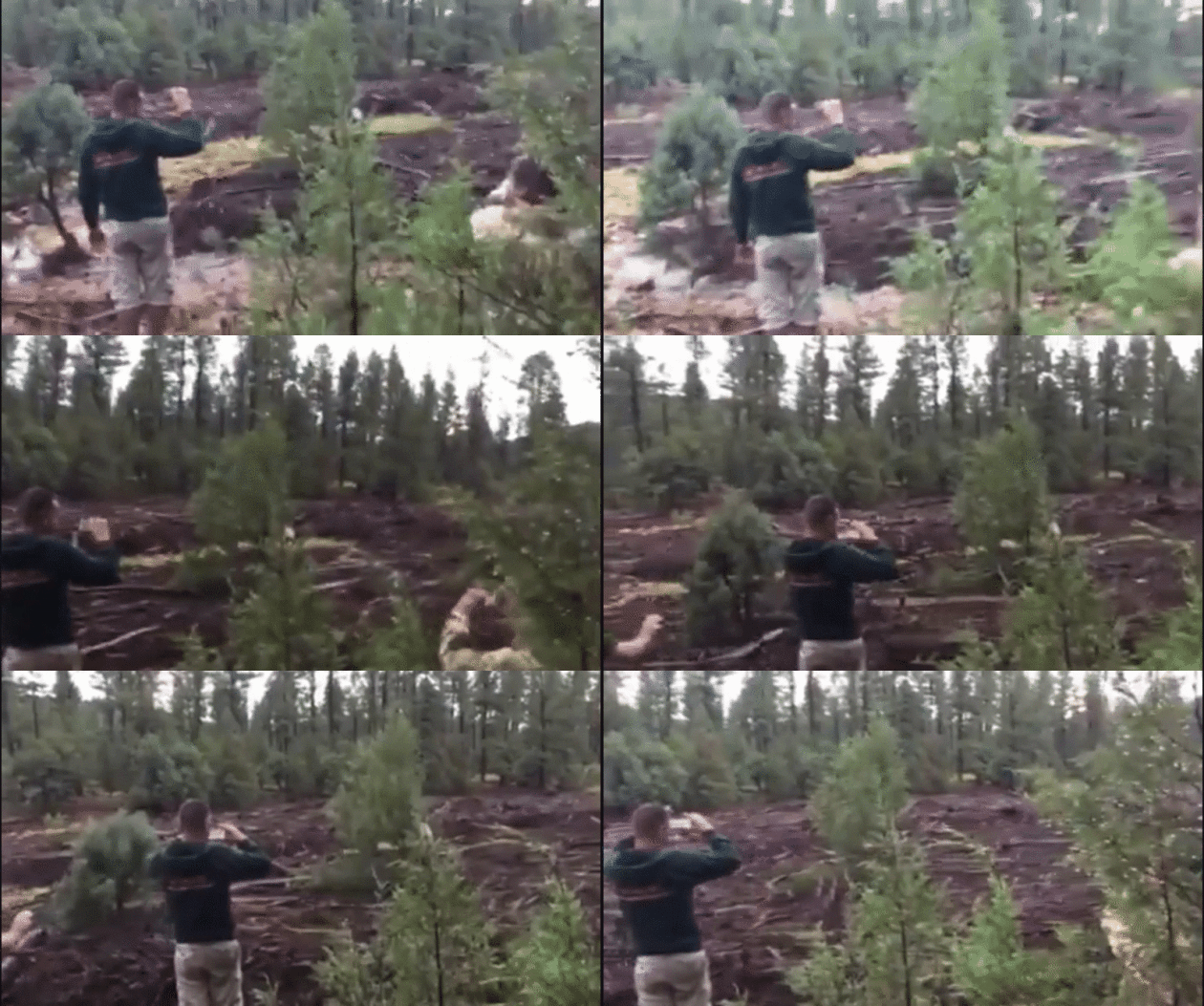
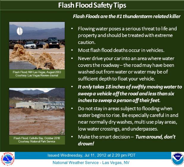
Witnesses Recount Horrific Flash Flood That Killed 5 Kids, 4 Adults in Arizona. It's easy (now) to look back with 20-20 hindsight and remind readers that the NWS issued warnings in advance. But the reality is, especially when people are swimming, they don't have access to apps on their smart phones or their AM/FM radios in their vehicles. It's a real problem. When you're swimming in a stream or river during the summer months situational awareness is critical, keeping an eye on what's happening with the weather upstream. My only advice: check radar on your phone before you take that dip in your favorite creek. CBS News reports: "...The National Weather Service estimated up to 1.5 inches of rain fell over the area in an hour. The thunderstorm hit about 8 miles upstream along Ellison Creek, which quickly flooded the narrow canyon where the swimmers were. Hornung noted that the National Weather Service had issued a flash flood warning about 1 1/2 hours before, "but unless they had a weather radio out there, they wouldn't have known about it. There is no cell phone service out here." The swift waters gushed for about 10 minutes before receding in the narrow canyon, Hornung said. "One witness said all they heard was this tremendous roar," Water Wheel Fire and Medical District Fire Chief Ron Sattelmaier told CBS News correspondent Mireya Villarreal..."
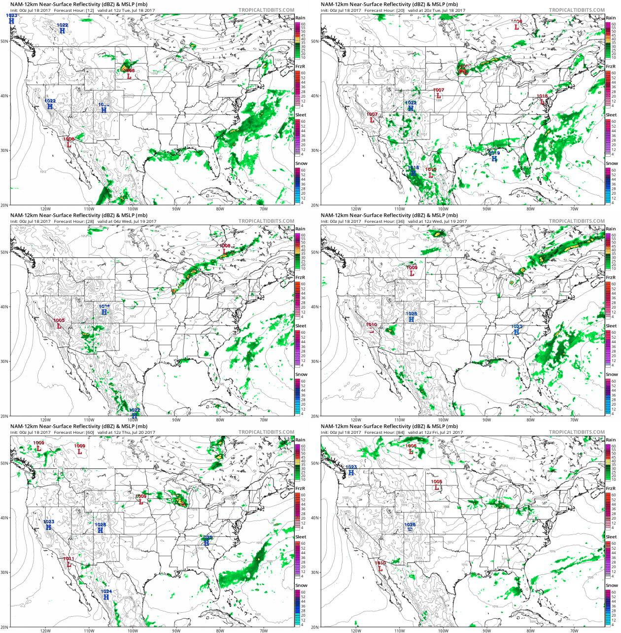
Tuesday Severe Storm Risk.
NOAA SPC prints out a severe bulls-eye over the Upper Midwest, where
large hail and a few isolated tornadoes may spin up later today. I'm
more concerned about the risk of flash flooding as high precipitable
water content fuels a temporarily-stalled east-west frontal boundary,
which may result in some significant rainfall totals.
Excessive Rainfall Potential.
The risk of "training thunderstorms" (storms redeveloping, passing over
the same waterlogged counties) is greatest today from Sioux Falls and
Des Moines to the Twin Cities, Eau Claire and Oshkosh.
One of the Worst Droughts in Decades Devastates South Europe Crops. Here's a clip from a story at Reuters: "...Drought
in southern Europe threatens to reduce cereal production in Italy and
parts of Spain to its lowest level in at least 20 years, and hit other
regional crops including olives and almonds. Castile and Leon, the
largest cereal growing region in Spain, has been particularly badly
affected, with crop losses estimated at around 60 to 70 percent. "This
year was not bad, it was catastrophic. I can't remember a year like this
since 1992 when I was a little child," said Joaquin Antonio Pino, a
cereal farmer in Sinlabajos, Avila..."
Graphic credit: European Drought Observatory, Reuters.
Disproportionate Number of Tropical Cyclone Deaths in Louisiana and Mississippi. A new paper highlighted at AMS caught my eye: "...More
than half of the U. S. tropical cyclone deaths from 1963 to 2012
occurred in either Louisiana or Mississippi (LA-MS). Even excluding the
fatalities associated with the levee failure in New Orleans, LA-MS had
almost one-quarter of the deaths. In contrast, Florida (FL) and Alabama
(AL) together incurred only about 5% of the deaths even though they
experienced about two-and-a-half times the number of hurricane and
tropical storm landfalls as LA-MS. This means that there were about 25
times as many deaths in LA-MS per landfall event as in FL-AL (and still
about 10 times more when leaving out Katrina's New Orleans impact). A
similar comparison shows LA-MS having fewer landfalls than Texas, but
more than seven times the number of deaths as in Texas (still three
times more when excluding New Orleans in Katrina)..."
90 Minute Lead Time on Recent Oklahoma Tornado? Impressive, but is it repeatable? Here's an excerpt of a post at Fox 23 News in Tulsa that caught my eye: "...An
experimental forecast model helped the National Weather Service predict
the path of an Oklahoma tornado hours before the tornado formed, the
agency said. According to a report from the National Oceanic and Atmospheric Administration,
western Oklahoma residents near Elk City were alerted to possible
tornado chances on the afternoon of May 16. “Ninety minutes later, a
dangerous, rain-wrapped EF-2 tornado struck the small town: It killed
one, injured eight, and destroyed about 200 homes and more than 30
businesses...”
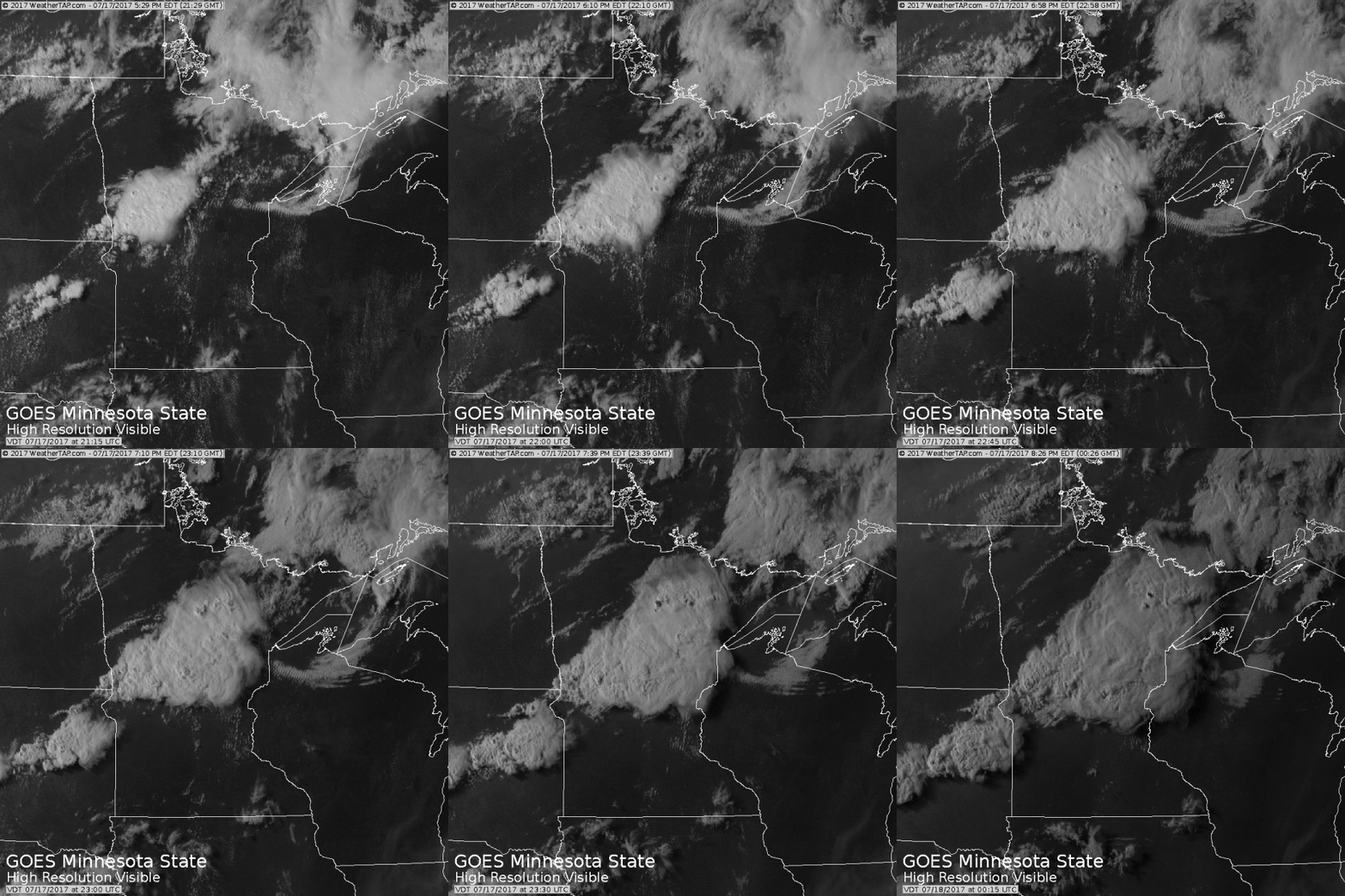
An Irritable Atmosphere.
In spite of a strong cap (inversion) surface heating was sufficient to
break through, rising thermals mutating into a line of strong to severe
thunderstorms Monday evening. Juicy air is feeding into this frontal
boundary, which may set the stage for flooding thunderstorms in some
communities.
Doppler "Sunburn".
Here is the reflectivity scan from KDLH (Duluth) at 9:04 pm yesterday,
when a low elevation scan interacted with a sun setting in the
southwest.
Graphic credit: "Weather stations in the U.S. that are having a warmer than normal, colder than normal and record hot year."
U.S. Farms Could Suffer as the Arctic Heats Up. WIRED takes a look at how changes in the Arctic don't always stay in the Arctic: "...Planet Earth is getting
hotter. One of the more confusing aspects of this global trend is the
persistent, undeniable discomfort of winter. Even more confusing is when
that chilly weather continues into April, May, or godforbidpleasenot
June. This might clear the confusion (but probably not the
frustration): Those colder temperatures in the first half of the year
might be due to warmer weather in the Arctic. Authors of a new study, published Monday in Nature Geoscience,
found this trend looking at over 100 years of climate data from the
Arctic and North America. This warm Arctic/cold North America connection
has been particularly noticeable since 1990. And that doesn't just mean
you'll be wearing a puffy jacket to Memorial Day cookouts from now on.
Spring is an important time for agriculture, and the authors noted that
US crop productivity declined by as much as 4 percent following warm
Arctic years. Plus, those crops, along every other plant affected by the
connected weather cycles, absorb less CO2—Arctic warming begets the potential for even more warming..."
Image credit: NSIDC.
Extreme Weather Forecasting: Looking Years, Even Decades Into The Future, Could Soon Be a Thing. My strong advice: don't hold your breath. But in the spirit of full disclosure and getting our hopes up, here's an excerpt of a story at news.com.au: "...Dr May’s team are now researching if the ensemble method can be used to predict weather events far into the future. By entering in variables, such as possible climate change scenarios, they can test different outcomes. “We’re making use of big data, four petabytes that’s as much as eight million laptops and we need the equivalent of 20,000 laptops joined up to generate that data,” he said. It could lead farmers to move livestock around that might be at risk, for emergency services to bolster civilian cyclone defenses or prepare for bushfires..."
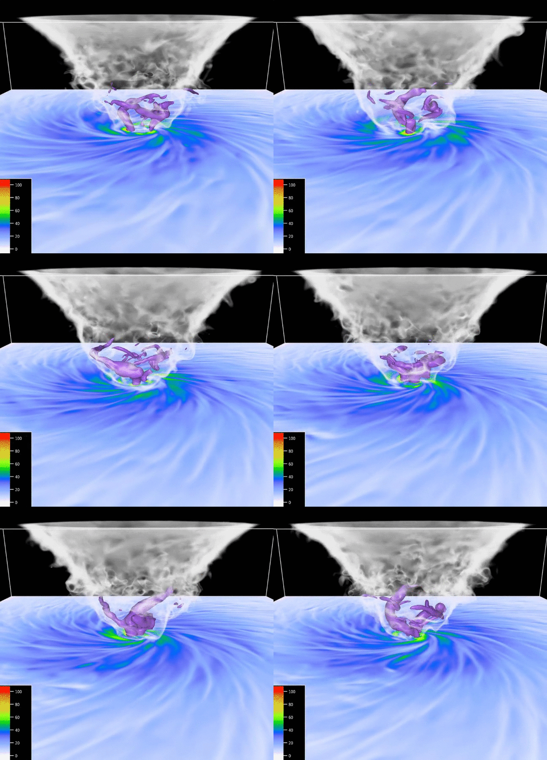
Experts Uncover the Origins of 10 Common Weather Terms. AccuWeather has an interesting post, including an explainer on how tornadoes got their name: "...Navigators exploring the tropics during the 16th century likely derived tornado from the Spanish word “tronar,” or, “to thunder,” according to linguist, teacher and author Janina Klimas. “There’s [also] a word that’s derived from that called ‘tronada,’ which is a thunderstorm,” said Klimas. “It seems that the ‘r’ and the ‘o’ got mixed up, and that’s where you get ‘tornado.’” Harper added that tornado also stems from both “tornar,” which means “to turn” in Spanish, and the Latin word “tornāre.” “At first, it was a very general word for a violent, windy thunderstorm in the tropics that gradually got the sense of turning into it, and it became our word for the funnel cloud storm,” he said..."
Tornado simulation: NCAR.
- Includes the latest available imagery (GOES-16)
- Select products to display by category, name, and time
- Pan and zoom map interface dynamically
- Display current location on map
- Adjust transparency and composite multiple layers
- Animate by relative or absolute time steps
- Save custom favorites..."

The Next Global Blackout Will Be Caused by the Sun. Just because you're paranoid doesn't mean (nature) isn't out to get you. Here's an excerpt from Inverse: "...It’s
difficult to calculate the extent of the damage a Carrington-scale
storm could do to Earth today, but we can be sure that most of the human
population would experience blackouts for far longer than New Yorkers
did in 1977. On the Earth’s surface, the damages to the electrical grid —
and the effects that would have on transportation, sanitation, medical,
and even water infrastructure — would cost around $1 or $2 trillion in
the first year,
with four to 10 years necessary for a full recovery. The storm would
destroy the entire fleet of satellites in orbit, causing up to $70 billion in damage.
Global telecommunications infrastructure would be destroyed so rapidly
that humans wouldn’t even know — or be able to find out — that a solar
storm had hit..."
21 Solar Facts. Climate Reality ran this back on June 21, but there are a few nuggets in here worth sharing: "...More
energy from the sun lands on the face of the earth in just one hour
than the entire global population uses in one year. We have all the
solar power we could want. Plus, unlike fossil fuels, it's renewable and
will never run out - at least not for a few billion years. The U.S.
Department of Energy estimated that 90 percent of the electricity used
by the U.S. could be generated from solar panels installed in abandoned
industrial sites in our nation's cities...factories, plants, etc.
Installing solar panels would put that space to a productive use and
create a significant amount of clean energy..."
Electric Vehicle Outlook 2017.
The electric revolution is coming faster than many realize. Yeah, I'm a
bit biased, but you can't stop progress - you can only slow it down.
Here's an excerpt from Bloomberg New Energy Finance: "...The
EV revolution is going to hit the car market even harder and faster
than BNEF predicted a year ago. EVs are on track to accelerate to 54% of
new car sales by 2040. Tumbling battery prices mean that EVs will have
lower lifetime costs, and will be cheaper to buy, than internal
combustion engine (ICE) cars in most countries by 2025-29...”
Photo credit: "Elon Musk at the National Governors Association meeting in Providence, R.I., on Saturday. Mr. Musk warned about the dangers of artificial intelligence and said the high price of Tesla shares reflects optimism for the company’s future." Photo: brian snyder/Reuters.
TODAY: Steamy with heavy T-storms likely. Localized flooding risk. Winds; SW 8-13. High: 85
TUESDAY NIGHT: Muggy with more T-storms around. Low: 68
WEDNESDAY: More sun, drier. Storms return late in the day/night. Winds: SE 7-12. High: 87
THURSDAY: Damp start, then sticky, hazy sun. Winds: E 5-10. Wake-up: 70. High: 89
FRIDAY: Still steamy, more heavy T-storms. Winds: SE 8-13. Wake-up: 71. High: 85
SATURDAY: Partly sunny, stray T-shower (best chance north). Winds: NW 10-15. Wake-up: 70. High: 88
SUNDAY: Plenty of sun, breathing easier again. Winds: N 8-13. Wake-up: 68. High: 82
MONDAY: Sunny and spectacular. Low humidity. Winds: NW 5-10. Wake-up: 66. High: 81
Climate Stories...
The Uninhabitable Earth. This story at New York Magazine set off a furor, even among many notable climate scientists who warned against presenting an overly bleak (worst-case) scenario for fear that readers will shut down. There will be disruptions and tipping points that nobody saw coming. Here's an excerpt: "...Until recently, permafrost was not a major concern of climate scientists, because, as the name suggests, it was soil that stayed permanently frozen. But Arctic permafrost contains 1.8 trillion tons of carbon, more than twice as much as is currently suspended in the Earth’s atmosphere. When it thaws and is released, that carbon may evaporate as methane, which is 34 times as powerful a greenhouse-gas warming blanket as carbon dioxide when judged on the timescale of a century; when judged on the timescale of two decades, it is 86 times as powerful. In other words, we have, trapped in Arctic permafrost, twice as much carbon as is currently wrecking the atmosphere of the planet, all of it scheduled to be released at a date that keeps getting moved up, partially in the form of a gas that multiplies its warming power 86 times over..."
File image: NASA.
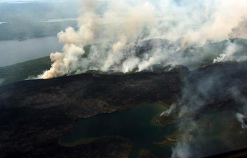
Boreal forest file photo: NASA.
Image credit: "Aerial view of sea side Miami." Photograh by George Steinmetz, National Geographic Creative.
Game of Thrones is Secretly All About Climate Change. Wait, (endless) summer is coming? Vox explains: "...The White Walkers are some of Thrones’ creepiest monsters — but they also help tell a really interesting metaphor about climate change.
For starters, the White Walkers are a threat to all humanity: Their
zombie minions are equally happy to rip apart people of all nations and
noble houses. Yet instead of uniting to combat the shared threat to
human existence, the houses in the show spend basically all their time
on their own petty disagreements and struggle for power. White Walkers
are generally ignored; some nobles deny their existence outright. Swap
climate change for White Walkers and "countries" for noble houses, and
it starts to sound a lot like the real world..."
The Duluth radar must have been seeing something else at 9:04 pm. The sun would have been setting in the northwest, not the southwest.
ReplyDelete