63 F. high temperature in the Twin Cities Sunday.
57 F. average high on October 18.
54 F. high on October 18, 2014.
October 19, 1972: Cold Snap. 1 above in Tower. 9 in St Peter and Luverne.
October 19, 1916: Redwood Falls received a record-setting 7 inches of snow.

Warming Trend, Winter May Be Delayed This Year
I don't know much - but here is what I do know: Google knows me better than I know myself. Computers and cars break down at the most inopportune time. And lip-readers get an entirely different football game on TV.
That, and the Earth is tilted by 23.5 degrees on its axis. During the winter Earth tilts away from the sun; northern latitudes receive only a glancing blow of sunlight. This cools northern latitudes in waves, as longer nights and snow on the ground brew up increasingly frigid air - sent via "airmail" from our friends in Canada.
Game of Thrones assures me that "winter is coming" and I don't disagree. But a strong El Nino may keep our winds blowing from the west, a milder "zonal" Pacific flow, for more of the winter than usual. Dips in the jet stream will whip up snow and cold fronts but El Nino may take the edge off the most extreme invasions of cold air, deflecting some of the coldest Canadian air into New England. Time will tell.
The maps look more like late September: mid-70s today, otherwise 60s - with rain likely on Friday. Skies clear Saturday - we should salvage another fine fall weekend.
No wintry smacks in sight just yet.


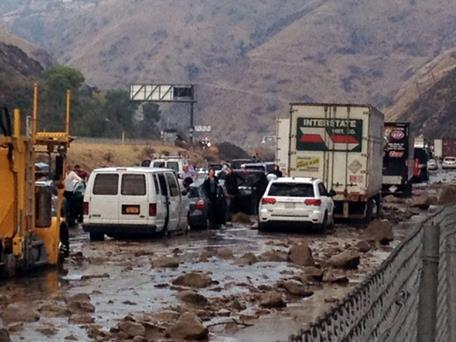
Photo credit above: "In this photo provided by Caltrans, vehicles are stopped in mud on California's Interstate-5 after flooding Thursday." (Caltrans/Associated Press).
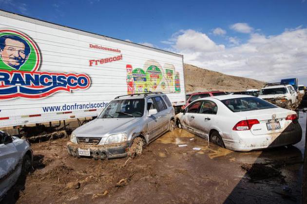
Photo credit above: "About 115 cars and 75 tractor-trailers were stuck on State Route 58. “It’s a miracle no one was seriously hurt,” Ray Pruitt, a spokesman for the Kern County sheriff, said." Credit Monica Almeida/The New York Times

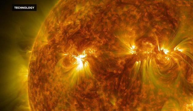
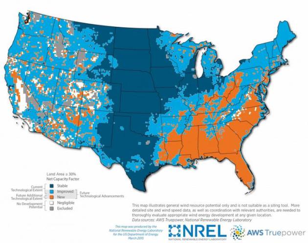
Unlocking Our Nation's Wind Potential. We're just scratching the surface of what is possible - and inevitable. Here's an excerpt from The U.S. Department of Energy: "...An Energy Department report released today shows how the next generation of wind turbines could make reliable, cost-effective wind power a reality in all 50 states. The report, Enabling Wind Power Nationwide,
explains that advanced wind turbines with taller towers and longer
blades will allow us to reach stronger, more consistent winds found high
above the ground, unlocking wind energy’s potential across an
additional 700,000 square miles—roughly one-fifth of the land area of
the United States..."
Map credit above: "New map shows how taller wind turbines could help unlock wind's potential in all 50 states, especially in the southeastern U.S." | Map courtesy of National Renewable Energy Laboratory.
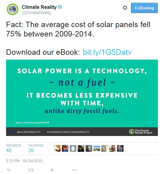
Solar Myths. Download the facts from the Climate Reality Project here.

Haven't Seen This Before.
I was booking a car (Enterprise) and noticed an option to "go green"
with CO2 offsets, much like you can buy carbon credits when you fly.
Good move, Enterprise.


TODAY: Lukewarm sunshine, breezy. Winds: SW 10-15. High: 75
MONDAY NIGHT: Partly cloudy, milder than average. Low: 53
TUESDAY: Patchy clouds, PM shower? Winds: E 8-13. High: 65
WEDNESDAY: Slow clearing, a bit cooler. Wake-up: 52. High: 61
THURSDAY: Sunny and pleasant. Wake-up: 43. High: 63
FRIDAY: Wettest day of the week. Showery rains likely. Winds: SE 10-20. Wake-up: 49. High: 59
SATURDAY: Getting sunnier, very nice. Winds: NW 8-13. Wake-up: 47. High: 59
SUNDAY: Partly sunny, late shower? Winds: SE 8-13. Wake-up: 44. High: near 60
Climate Stories...

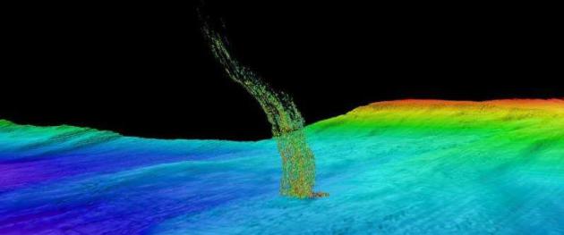
Image credit above: "Sonar image of bubbles rising from the seafloor off the Washington coast. The base of the column is 1/3 of a mile (515 meters) deep and the top of the plume is at 1/10th of a mile (180 meters) depth." Credit: Brendan Philip/University of Washington.
Sonar
image of bubbles rising from the seafloor off the Washington coast. The
base of the column is 1/3 of a mile (515 meters) deep and the top of
the plume is at 1/10 of a mile (180 meters) depth. Credit: Brendan
Philip/University of Washington
Read more at: http://phys.org/news/2015-10-plumes-washington-oregon-warmer-ocean.html#jCp
Read more at: http://phys.org/news/2015-10-plumes-washington-oregon-warmer-ocean.html#jCp
Climate
change isn’t just affecting the temperatures above ground. According to
a recent research project by the University of Washington, the Pacific
Ocean’s deep-water temperatures are rising enough to thaw out ancient
deposits of frozen methane. A recent Phys.org report noted that the
scientists discovered the methane thaw when they observed plumes of
methane bubbles rising up from the ocean floor off the coast of
Washington and Oregon.
Read more at: http://www.immortal.org/18896/ocean-methane-release-points-global-warming/
Read more at: http://www.immortal.org/18896/ocean-methane-release-points-global-warming/

No comments:
Post a Comment