25 F. average high on February 2.
16 F. high on February 2, 2015.
February 3, 1989: Bitterly cold temperatures occur across Minnesota with lows in the 40-below-zero range in the north.
February 3, 1947: A strong dust storm hits Crookston with winds near 50 mph. Visibility was reduced down to 300 feet.
Anatomy of a White-Out: Are We Getting Soft?
There's no denying Tuesday afternoon was a weather-mess, one notch below a blizzard in the metro. Snow was falling so hard plows couldn't keep up; a treadmill of creeping traffic steamrolling snow into glaze ice.
Some questioned the wisdom of closing schools in advance and sending workers home early. No matter what you do you're going to hear criticism, but putting student and employee safety first makes sense to me. Half a foot of snow was considered "flurries" in the 1970s. Since then traffic volume has nearly tripled.
Research highlighted in today's weather blog shows a 19 percent spike in traffic accidents during wintry weather, especially the PM commute.
Duh.
And up until yesterday our biggest one-day snow was 3.8 inches. We can be excused for being a little paranoid.
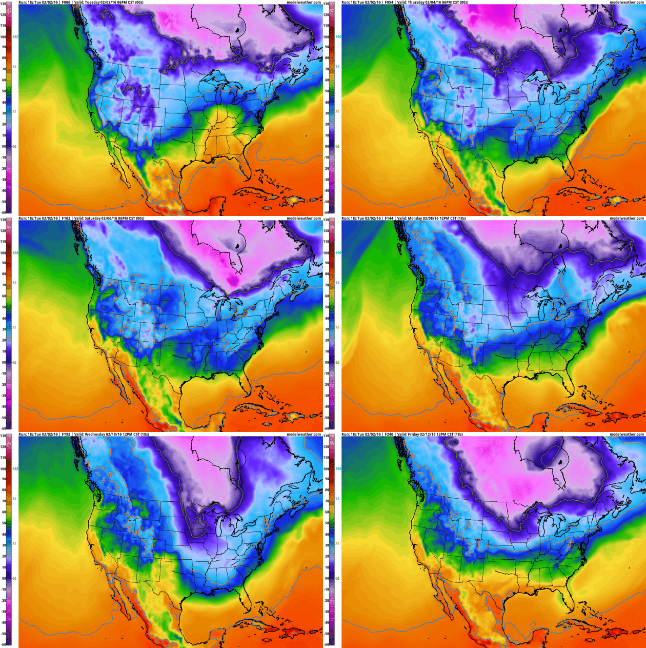
Expect to see the sun later today as Minnesota digs out; highs in the 20s until we top freezing this weekend. A snowy coating is possible for Super Bowl Sunday, followed by a couple of cold smacks the second week of February. An extended Pacific thaw may be 2 weeks away.
Get out and play in that powder now!
* Google Traffic at 2:14 PM Tuesday.
This Map of 30 Years of Car Crashes Should Pursuade You Not To Drive In Snow. As if we have a choice in the matter. Stay home 6 months out of the year? I'm sure the boss would have NO problem with that. Here's an excerpt from Vox: "...In a separate study of 13 major cities, Black and Mote found a 19 percent increase in traffic crashes and a 13 percent increase in injuries during wintry conditions. The type of winter precipitation (snowfall versus freezing rain, ice pellets, or sleet) had no bearing on the increased likelihood of an accident, but evening hours experienced a greater rate of accidents than other times of day. Winter precipitation did not increase the odds of being in a fatal crash, however. Black said this was "presumably because people slow down," and at reduced travel speeds the risk of being in a fatal car crash does not increase..."
Map credit above: "Winter-Precipitation-Related Transportation Fatalities in the US, Alan W. Black and Thomas L. Mote." Credit: Sarah Frostenson.
How Accurate are Groundhogs and 8 Other Animals at Predicting Weather? Inquiring minds want to know, and Marshall Shepherd has a good summary at Forbes; here's an excerpt: "...Groundhogs. A 2011 analysis by Weather Underground meteorologist Tim Roche showed that Phil’s accuracy is about 36% when compared to meteorological data back to 1969. This is consistent with a 39% accuracy rate as calculated by Stormfax and NOAA’s National Climatic Data Center (now the National Center for Environmental Information). The article in question cites ~50% accuracy rate but that was for a very short window of data and different groundhogs. Bottom line: It is less accurate than a coin flip. But did you really need me to tell you that?..."
Photo credit above: "Groundhog Club handler Ron Ploucha, center, holds Punxsutawney Phil." (AP Photo/Gene J. Puskar).
Four Faunal Forecasters. The National Environmental Education Foundation has a story that addresses much-maligned groundhogs, wooly bear caterpillars, cows, crickets and others critters and their valiant attempt to predict the weather; here's an excerpt: "...Move over, Punxsutawney Phil. Groundhogs aren’t the only animals known to “predict” the weather. Phil may be the most famous, but he’s certainly not the most accurate. Here are four animals that are known for their weather wisdom. Some of these proverbs are true, while others are not. Can you guess which ones are real?
Fact or Fiction? The width of a Woolly Bear Caterpillar’s orange stripe can predict how mild the winter will be. Fiction! According to an old proverb, if the width of a Woolly Bear Caterpillar’s reddish-brown stripe is wider than usual, the coming winter will be mild. Conversely, a narrower stripe means the coming winter will be harsh. While some scientific evidence suggests that this may be related to the previous winter’s severity, there’s no correlation between the stripe’s width and the following winter’s severity..."
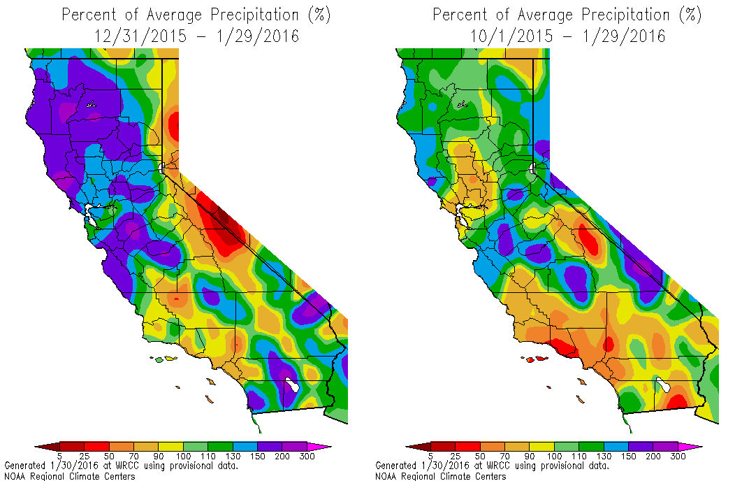
Four out of five strong El Niño Februaries were wetter than average in the Bay Area….Taking an average of all five Februaries above, you’d expect measurable rain 16 days of the month. In other words, you’re more likely to see a wet February day during a strong El Niño in the Bay Area than a dry day..."* More Super Bowl weather trivia can be found here, courtesy of Southeast Regional Climate Center.
Studying The Heart of El Nino, Where Its Weather Begins. The New York Times has an interesting story about how NOAA is researching the genesis of El Nino events in the Pacific; here's the intro: "In a Gulfstream jet more accustomed to hunting hurricanes in the Atlantic, researchers with the National Oceanic and Atmospheric Administration
were cruising this desolate stretch of tropical ocean where the
northern and southern trade winds meet. It’s an area that becalmed
sailors have long called the doldrums, but this year it is anything but
quiet. This is the heart of the strongest El Niño in a generation, one
that is pumping moisture and energy into the atmosphere and, as a
result, roiling weather worldwide..."
Photo credit above: "A satellite image of the area of the Pacific where a NOAA research team would be flying." Credit Kent Nishimura for The New York Times.
Why The U.S. East Coast Could Be a Major "Hotspot" for Rising Seas.
The east coast is far more vulnerable to rising seas than the west
coast; water from Florida to Maine rising at a rate 3-4 times the global
average. The Washington Post has details on some new research; here's a link and intro: "New research published
Monday adds to a body of evidence suggesting that a warming climate may
have particularly marked effects for some citizens of the country most
responsible for global warming in the first place — namely, U.S. East
Coasters. Writing in Nature Geoscience,
John Krasting and three colleagues from the Geophysical Fluid Dynamics
Laboratory of the National Oceanic and Atmospheric Administration find
that “Atlantic coastal areas may be particularly vulnerable to
near-future sea-level rise from present-day high greenhouse gas emission
rates...”
Image credit above: "Average SST anomaly for Jan. 22-23, 2016 relative to the long-term average from 1981 to present." Courtesy of Vincent Saba, NOAA.
An Argument for Renting, Not Owning East Coast Oceanfront Property. A link to the paper referenced above is here.
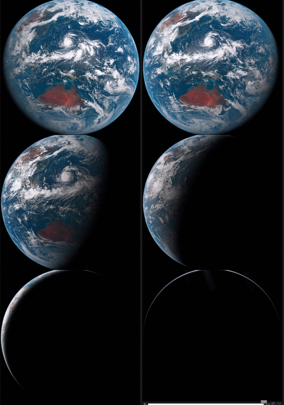
Image credit: JMA / Charlie Loyd.
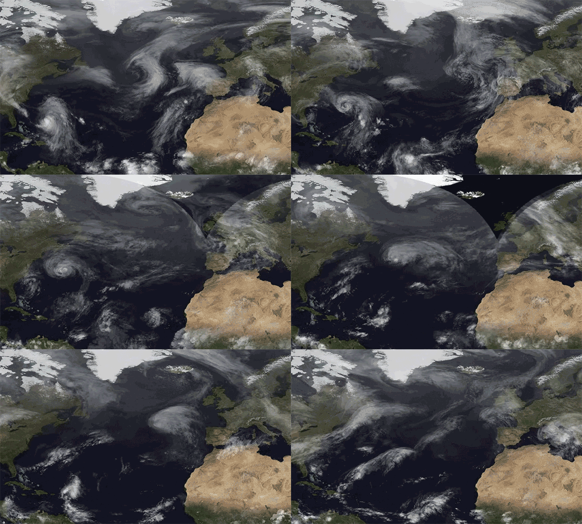
Animation credit above: "The transition of Hurricane Joaquin near the Bahamas to an extratropical storm that hit the U.K."
Image Source: BofA.
The U.S. Bet Big on American Oil and Now The Whole Global Economy is Paying The Price. Here's the intro to an analysis at Quartz: "Oil
has wrong-footed our leading experts—again. At the beginning of 2014,
the world was marveling in surprise as the US returned as a petroleum
superpower, a role it had relinquished in the early 1970s. It was
pumping so much oil and gas that experts foresaw a new American
industrial renaissance, with trillions of dollars in investment and
millions of new jobs. Two years later, faces are aghast as the same oil
has instead unleashed world-class havoc: Just a month into the new year,
the Dow Jones Industrial Average is down 5.5%..."
Photo credit above: "The unfathomable." (AP/LM Otero).
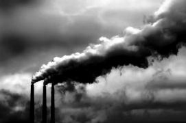
The Staggering Economic Cost of Air Pollution. The Washington Post reports; here's the intro: "Air
pollution caused by energy production in the U.S. caused at least $131
billion in damages in the year 2011 alone, a new analysis concludes —
but while the number sounds grim, it’s also a sign of improvement. In
2002, the damages totaled as high as $175 billion, and the decline in
the past decade highlights the success of more stringent emissions
regulations on the energy sector while also pointing out the need to
continue cracking down. “The bulk
of the cost of emissions is the result of health impacts — so morbidity
and particularly mortality,” said the paper’s lead author, Paulina Jaramillo, an assistant professor of engineering and public policy at Carnegie Mellon University..."
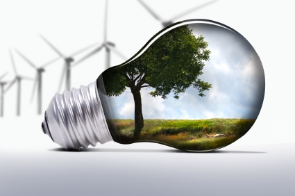
Xcel Energy Says Its "Nearly Certain" It Can Comply With Federal Clean Power Plan in Minnesota. I was encouraged to read this in the Star Tribune; here's an excerpt: "As
many U.S. power companies fight the federal Clean Power Plan, Xcel
Energy took a different path Friday, declaring the utility’s Minnesota
operations are “nearly certain” to comply with the plan’s greenhouse gas
reductions through cost-effective investments over the next decade. The
strategy, which Xcel first laid out last year and firmed up in a
regulatory filing late Friday, calls for $6 billion in wind and solar
energy investment, retirement of two Minnesota coal-burning units,
construction of a nearly $1 billion natural gas-fired generator and
further investment to retain the carbon-free energy from its two nuclear
power plants..."
Photo credit above: Glen Stubbe. "Two coal-burning units at the Sherco power plant in Becker, Minn., will be retired sometime in the 2020s, to Xcel Energy said."

Pursuing the Goal of Healthy Aging. Here's a clip from an interesting post at The New York Times: "...His
colleague S. Jay Olshansky, a gerontology specialist in the School of
Public Health at the University of Illinois in Chicago, said it is often
counterproductive to treat one disease at a time. Preventing cardiac
death, for example, can leave a person vulnerable to cancer or dementia,
he explained. A better approach, Dr. Kirkland said, would be to target
the processes fundamental to aging that underlie all age-related chronic
diseases: chronic low-grade inflammation unrelated to infection;
cellular degradation; damage to major molecules like DNA, proteins and
sugars; and failure of stem cells and other progenitor cells to function
properly..." (Graphic credit: Paul Rogers).
TODAY: Risk of shoveling. AM flurries, PM sun. Winds: NW 10-15. High: 21
WEDNESDAY NIGHT: Patchy clouds. Low: 8
THURSDAY: Weak clipper, few flurries. Winds: SW 7-12. High: 23
FRIDAY: Coating - 1" of light, PM snow possible. Winds: S 5-10. Wake-up: 9. High: 25
SATURDAY: Partly sunny, chance of a thaw. Winds: S 8-13. Wake-up: 19. High: 32
SUNDAY: What football game? Snowy coating. Winds: NW 10-15. Wake-up: 28. High: 33
MONDAY: More flurries, cold wind. Winds: NW 15-25. Wake-up: 18. High: 21 (falling)
TUESDAY: Leftover clouds, feels like February. Subzero wind chill. Wake-up: 5. High: 13
Climate Stories...
Groundhog Decade: In This Movie, It's Always The Hottest Decade on Record. Here's the intro at ThinkProgress: "Somewhere on a Hollywood movie set for Groundhog Day, Part Two: Bill Murray wakes up to find he’s just lived through the hottest decade on record, just as he did in the 2000s, just as he did in the 1990s, just as he did in the 1980s. And he keeps waking up in the hottest decade on record, until he gains the kind of maturity and wisdom that can only come from doing the same thing over and over and over again with no change in the result. Ah, if only life were like a movie. Here is global mean surface temperature — by decade..."
Graphic credit above: "Global Average Temperature by Decade." CREDIT: HotWhopper.
Graphic credit: "Chart showing average global temperatures from 1850 to 2015 according to three major datasets." Photograph: Met Office, UK.
1) Climate change never took a break.
You may have heard that, according to satellite data, there has been no significant warming for the last 18 years. This is grossly misleading. Eighteen years ago, El Niño drove up global temperatures , making 1998 an exceptionally hot year. Contrarians use 1998 as a baseline because subsequent warming appears modest by comparison. However, the mercury has continued its inexorable rise. Since the 1880s, average temperatures have risen 1.8 degrees Fahrenheit, on average. 2015 was the hottest year on record, according to NOAA, and 2016 will likely be even hotter..." (Image credit: NASA).
Long Term Global Warming Requires External Drivers. Here's a summary of new research at the Nicholas School of the Environment at Duke: "By examining how Earth cools itself back down after a period of natural warming, a study by scientists at Duke University and NASA’s Jet Propulsion Laboratory confirms that global temperature does not rise or fall chaotically in the long run. Unless pushed by outside forces, temperature should remain stable. The new evidence may finally help put the chill on skeptics’ belief that long-term global warming occurs in an unpredictable manner, independently of external drivers such as human impacts..."
Graphic credit above: Grimes, PLOS 2016.
“The DoD must be able to adapt current and future operations to address the impacts of climate change in order to maintain an effective and efficient U.S. military” to include:
- Identification and assessment of the effects of climate change on the DoD mission.
- Taking those effects into consideration when developing plans and implementing procedures.
- Anticipating and managing risks that develop as a result of climate change to build resilience.

Record Snowfall, Changing Climate Raise Questions About Preparedness for Storm Cleanup. Are we now seeing super-sized snowstorms and blizzards, the result of a warmer, wetter atmosphere with more water vapor available to fuel developing systems? Here's an excerpt from The Baltimore Sun: "...Meteorologists say it may be prudent to expect more snow. Paul Kocin, a NOAA meteorologist, said it may not be time for the Baltimore area to invest in the kind of snow removal equipment used in Buffalo or Boston. But he has noticed a pattern of megastorms hitting in recent years. While a link hasn't been proven, he said one cause could be global warming, and that could make big snowstorms more likely in the future. Antonio Busalacchi Jr., a professor of atmospheric and oceanic science at the University of Maryland, College Park, said: "As climate warms, there is an increase in water vapor that has to come down somewhere."
South England's 2014 Floods Made More Likely by Climate Change. Speaking of more fuel available to "juice" storms; here's an excerpt from New Scientist: "...Immediately after the January 2014 storms, Nathalie Schaller of the University of Oxford and her colleagues wanted to run simulations of the weather across the whole of Europe and asses its impact. To do so they utilised the spare capacity of people’s home computers through a citizen science project called weather@home. In their 134,354 simulations, they varied sea surface temperature and sea ice to compare the actual climate with a hypothetical world in which there was no human influence on the atmosphere. “Being able to run this many simulations means we can have high statistical confidence in the results,” says Neil Massey, also from the University of Oxford. Schaller and her colleagues showed that global warming made it 43 per cent more likely to happen..." (File photo: UK Met Office).
Climate Change and Vector-Borne Diseases. Will warming air and oceans accelerate the spread of Zika Virus? Here's an excerpt from Climate Nexus: "...By altering conditions--local temperatures, rainfall and population movements--that determine the spread of the pathogens, global warming makes the transmission of vector-borne diseases (VBDs) unpredictable and difficult to control. When it comes to VBDs like Zika, climate change is a threat multiplier.
Rising global temperatures can lengthen the season and increase the geographic range of disease-carrying insects. As temperatures warm, mosquitoes and other warm-weather vectors can move into higher altitudes and new regions farther from the equator.
Increased rainfall, flooding and humidity creates more viable areas for vector breeding and allows breeding to occur more quickly, as eggs hatch faster in hotter climates..."
No comments:
Post a Comment