25 F. average high on February 2.
21 F. high on February 2, 2015.
February 2, 1996: The all-time state record low temperature is set in Minnesota. With numerous media folk present, the low dips to -60 three miles south of Tower. Governor Arne Carlson cancelled school statewide due to the cold.
February 2, 1988: The temperature bottoms out at -43 at Embarrass.
February 2, 1927: Spring-like temperatures are felt on Groundhog Day. Tracy is 57 and Fairmont reaches 56.
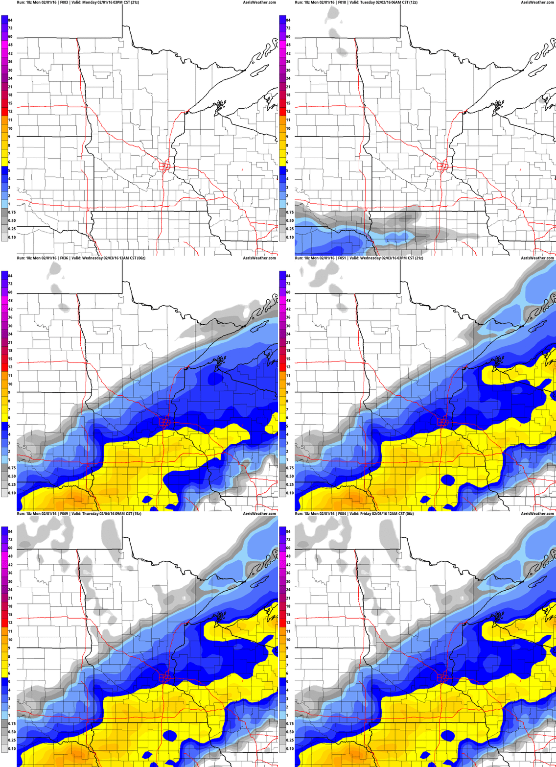
Plowable Snow: Blizzard Criteria South of MSP
Uh oh. Time to call out the National Guard, alert FEMA, resuscitate Al Roker, and put the President on hold. Yes, it's going to snow hard this afternoon.
Uh oh. Time to call out the National Guard, alert FEMA, resuscitate Al Roker, and put the President on hold. Yes, it's going to snow hard this afternoon.
I
expect enough snow to shovel and plow, turning the PM commute into
(forgive me, Stephen King) "a carnival of nightmare and death."
Hopefully without the death part. But there's little doubt we're in for a
white-knuckle PM commute.
Expect
wind-whipped snow after lunch; over southern Minnesota winds may be
strong enough (over 35 mph) and visibility low enough (under 1/4 mile)
to reach blizzard criteria. Take it easy out there later on.
Weather
models have been more maddening than usual with this on-again,
off-again, on-again snow event. Now most of the models are in agreement:
4-8" possible by tonight; the heaviest amounts southof the Minnesota River.
Travel conditions improve Wednesday;
a welcome weekend thaw before Canada flushes another export of bitter
cold south of the border. Expect a night or two below zero by the middle
of next week.
Another El Nino-flavored warming trend is likely the latter half of February.
* NAM accumulated snowfall predictions: NOAA and AerisWeather.
Storm and Blizzard Warnings. Click here for the latest interactive map from Aeris. Most of the MSP metro area
is under a Winter Storm Warning (which means it's pretty much imminent).
Blizzard warnings are posted as close as Mankato and Windom; travel
expected to get progressively worse the farther south and west you
travel away from the Twin Cities.
4 KM NAM Guidance.
The "WRF" model prints out 5-7" for most o f the metro by midnight
Tuesday night, closer to 8 or 9" south of the Minnesota River. Map:
WeatherBell.
12 KM NAM Projections.
The 00z run of the NAM shows a swath of 8-10" south of the Minnesota
River, a good 4-8" for much of the MSP metro area - fairly good
alignment with the 4 KM run.
Snowy Convergence.
Here is why we have perpetual migraines and gray hairs, what hairs we
have left. Every model has a slightly different version of
reality-to-come. Meteorologist's confidence levels go up when the models
converge on a roughly similar solution; in this case 4-8" for much of
the metro; more southern suburbs, less northern suburbs. Source: Iowa
State University.
Close to Blizzard Criteria. In open fields south and west of MSP we may have blizzard conditions during the PM hours Tuesday. Winds are forecast
to gust past 30 mph this afternoon and evening. This won't be a dry,
powdery snow with surface temperatures in the upper 20s, but I could see
a fair amount of drifting souuthwest of Glencoe and Lakeville,
especially in open spaces and exposed highways. A blizzard requires
sustained winds close to 35 mph and visibility under 1/4 mile. Not
quite, at least not in the metro.
NAM Numbers.
Maximum vertical velocity is forecast late this afternoon and evening,
when snow may be falling at the rate of 1"/hour. I expect the worst
travel conditions from 3 PM to 10 PM tonight; NAM guidance printing out
.65", which would verify around 6 or 7" at the airport.
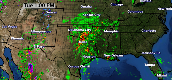
Timing The Storm: Here is future radar (based primarily on NOAA NAM guidance). Graphics courtesy of AerisWeather, which has superimposed surface temperatures at specific points in time:



Catching Up. As of Monday MSP snowfall for the wiinter was the same as Des Moines: 18.7" That's just not right. Sioux Falls has picked up two and a half times more snow than the Twin Cities, which (as of yesterday) was running a 15.3" snowfall deficit, to date. Those numbers will change today.
Regional Overview. Most of Wisconsin and Minnesota is running a snowfall deficit for the winter, as of February 1. At International Falls a nearly 24" snowfall hole, a whopping 52.2" deficit at Marquette, Michigan! Numbers and maps courtesy of AerisWeather meteorologist D.J. Kayser.
The Strange - And Sometimes Secret - Ways Cities Deal With Massive Piles of Snow. A story at Atlas Obscura got my attention; here's a clip: "...St. Paul once built a mountain at Midway Stadium
that didn’t melt for months. In D.C., after this most recent storm, the
city has piled up snow in parking lot of the RFK Memorial Stadium,
where some of the snow piles have reached 12 feet high. As far as snow piles go, though, 12 feet tall is amateur hour. In Anchorage, the city builds snow mountains
by creating a level of snow, then icing them down so trucks can climb
up the initial level. “We keep ramping up and building up as the winter
goes,” the public works superintendent told the Alaska Republic
in 2012. That year, the city got so much snow that its private dumps
started filling up, and at least one snow pile reached 60 feet..."
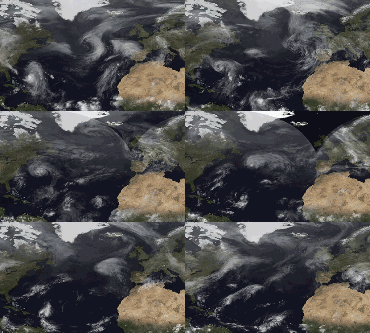
Animation credit above: "The transition of Hurricane Joaquin near the Bahamas to an extratropical storm that hit the U.K."
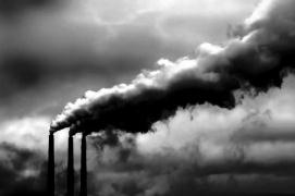
The Staggering Economic Cost of Air Pollution. The Washington Post reports; here's the intro: "Air
pollution caused by energy production in the U.S. caused at least $131
billion in damages in the year 2011 alone, a new analysis concludes —
but while the number sounds grim, it’s also a sign of improvement. In
2002, the damages totaled as high as $175 billion, and the decline in
the past decade highlights the success of more stringent emissions
regulations on the energy sector while also pointing out the need to
continue cracking down. “The bulk
of the cost of emissions is the result of health impacts — so morbidity
and particularly mortality,” said the paper’s lead author, Paulina Jaramillo, an assistant professor of engineering and public policy at Carnegie Mellon University..."
* The report referenced above is available here (pdf).
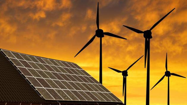
Wind, Sun and Fire. Here's an excerpt of a Paul Krugman Op-Ed at The New York Times: "...But
things are actually much more hopeful than that, thanks to remarkable
technological progress in renewable energy. The numbers are really
stunning. According to a recent report
by the investment firm Lazard, the cost of electricity generation using
wind power fell 61 percent from 2009 to 2015, while the cost of solar power
fell 82 percent. These numbers — which are in line with other estimates
— show progress at rates we normally only expect to see for information
technology. And they put the cost of renewable energy into a range
where it’s competitive with fossil fuels..." (File image: Shutterstock).

Regulators Approve Minnesota Power Solar Project at Camp Ripley. Here's the intro to a Star Tribune story: "Despite
questions about the price tag, Minnesota regulators on Thursday
approved Minnesota Power’s planned $30 million solar power project at
the Minnesota Army National Guard’s Camp Ripley Training Center near
Little Falls, Minn. The project’s 120,000 solar panels covering 80 acres
will generate electricity used by the Duluth-based utility’s customers.
But in a unique arrangement, the solar panels will switch roles during a
power outage — feeding electricity just to Camp Ripley to complement
other planned backup generation..."
Photo credit above: "Ben Cutler, left, and Norman Whitaker, both of Microsoft Research, with the “Leona Philpot,” a prototype underwater data center, at the company’s headquarters in Redmond, Wash." Credit Matt Lutton for The New York Times.
Image credit above: "Ben Lecomte has swum across the Atlantic Ocean, and now he aims to traverse the Pacific, which will take him five or six months." Bongani Mlambo/The Longest Swim.

TUESDAY: Winter Storm Warning, snow becomes heavier by afternoon. Winds: NE 15-30. High: 28
TUESDAY NIGHT: Snow tapers late, potential for 4-8" - heaviest amounts south metro. Treacherous travel. Winds: NE 15-30. Low: 16
WEDNESDAY: Flurries taper, travel slowly improves. Winds: NW 10-15. High: 20
THURSDAY: Weak clipper, few flurries. Wake-up: 14. High: 25
FRIDAY: Patchy clouds, above avg. temps. Winds: W 5-10. Wake-up: 16. High: 29
SATURDAY: Intervals of sun, thawing out by afternoon. Winds: W 5-10. Wake-up: 18. High: 33
SUNDAY: Mostly cloudy, dripping icicles. Winds: SE 7-12. Wake-up: 25. High: 35
MONDAY: Colder wind, coating of flakes? Wake-up: 16. High: 22
Climate Stories...
“The DoD must be able to adapt current and future operations to address the impacts of climate change in order to maintain an effective and efficient U.S. military” to include:
- Identification and assessment of the effects of climate change on the DoD mission.
- Taking those effects into consideration when developing plans and implementing procedures.
- Anticipating and managing risks that develop as a result of climate change to build resilience.

Record Snowfall, Changing Climate Raise Questions About Preparedness for Storm Cleanup. Are we now seeing super-sized snowstorms and blizzards, the result of a warmer, wetter atmosphere with more water vapor available to fuel developing systems? Here's an excerpt from The Baltimore Sun: "...Meteorologists say it may be prudent to expect more snow. Paul Kocin, a NOAA meteorologist, said it may not be time for the Baltimore area to invest in the kind of snow removal equipment used in Buffalo or Boston. But he has noticed a pattern of megastorms hitting in recent years. While a link hasn't been proven, he said one cause could be global warming, and that could make big snowstorms more likely in the future. Antonio Busalacchi Jr., a professor of atmospheric and oceanic science at the University of Maryland, College Park, said: "As climate warms, there is an increase in water vapor that has to come down somewhere."
South England's 2014 Floods Made More Likely by Climate Change. Speaking of more fuel available to "juice" storms; here's an excerpt from New Scientist: "...Immediately after the January 2014 storms, Nathalie Schaller of the University of Oxford and her colleagues wanted to run simulations of the weather across the whole of Europe and asses its impact. To do so they utilised the spare capacity of people’s home computers through a citizen science project called weather@home. In their 134,354 simulations, they varied sea surface temperature and sea ice to compare the actual climate with a hypothetical world in which there was no human influence on the atmosphere. “Being able to run this many simulations means we can have high statistical confidence in the results,” says Neil Massey, also from the University of Oxford. Schaller and her colleagues showed that global warming made it 43 per cent more likely to happen..." (File photo: UK Met Office).
Climate Change and Vector-Borne Diseases. Will warming air and oceans accelerate the spread of Zika Virus? Here's an excerpt from Climate Nexus: "...By altering conditions--local temperatures, rainfall and population movements--that determine the spread of the pathogens, global warming makes the transmission of vector-borne diseases (VBDs) unpredictable and difficult to control. When it comes to VBDs like Zika, climate change is a threat multiplier.
Rising global temperatures can lengthen the season and increase the geographic range of disease-carrying insects. As temperatures warm, mosquitoes and other warm-weather vectors can move into higher altitudes and new regions farther from the equator.
Increased rainfall, flooding and humidity creates more viable areas for vector breeding and allows breeding to occur more quickly, as eggs hatch faster in hotter climates..."


- Averaged over the five-year period 2016-2020, forecast patterns suggest enhanced warming over land, and at high northern latitudes. There is some indication of continued cool conditions in the Southern Ocean, and of relatively cool conditions in the North Atlantic sub-polar gyre. The latter is potentially important for climate impacts over Europe, America and Africa.
- During the five-year period 2016-2020, global average temperature is expected to remain high and is likely to be between 0.28°C and 0.77°C above the long-term (1981-2010) average. This compares with an anomaly of +0.44 ± 0.1 °C observed in 2015, currently the warmest year on record. These high global temperatures are consistent with continued high levels of greenhouse gases and big changes that are currently underway in the climate system and were highlighted in a recent Met Office research news article...
The Climate-Change Refugee Crisis Is Only Just Beginning. Climate
change and increasing volatility in weather (and water resources) as a
"threat multiplier" - a perpetual planetary migraine that flavors
troublespots, especially in unstable regions, like Africa and The Middle
East. Here's an excerpt from Quartz: "...These
days, climate change is in vogue. Everything from the war in Syria to
unrest in West Africa has been laid at the feet of the weather gods.
Some of the claims have been dismissed as spurious. But there’s plenty of evidence that migration in sub-Saharan Africa is indeed partly due to extreme weather. 70% of the continent’s migrants
have left their homes because of poverty or a lack of work, according
to research provided by the UN. Environment Program (UNEP). The authorities estimate the number of migrants by counting the bodies of those who’ve succumbed to the heat. An estimated 64% of Africans—and close to 90% of Ethiopians—earn their living from agriculture..."
Image: NASA's Visible Earth.
No comments:
Post a Comment