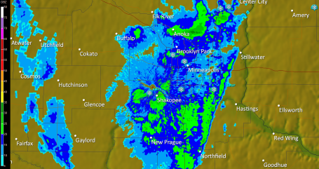
Update: 3:12 pm. Partly-thundery Monday PM. Doppler shows a cluster of heavy showers/storms right over the immediate metro area - almost makes me wonder if the "urban heat island" (warmer air over the immediate Twin Cities) might have been the catalyst to get these storms blossoming almost directly overhead. The storms are drifting toward the NORThWEST (yes, really) and the heaviest storms should be west of the metro area by 5 or 6 pm - you may be able to salvage some outdoor plans during the evening hours.
No comments:
Post a Comment