 Tuesday Memories. Showers and storms swept across the MN Arrowhead (.36" at Hibbing and .37" at Grand Marais and .13" at Duluth) but otherwise most of the state salvaged a pretty amazing day - highs mostly in the 80s.
Today I got confirmation on something I suspected: we just lived through an incredible 30-day period. According to the local National Weather Service Office in Chanhassen we experienced 395 severe storms between June 17 and July 17. That compares to 120 severe storms in all of 2009! So in a mere 30 days we saw more than 3 TIMES more severe weather than we did all of last year. Unbelievable. In just the Twin Cities warning area (most of central/southern MN and a few counties in western Wisconsin) a total of 204 warnings were issued, 72 of those tornado warnings. The tornado tally (for just the MPX/Twin Cities coverage area) so far: 37, although that number may go up or down in the coming days. I'm still trying to confirm how many (total) tornadoes have been observed at the Grand Forks, Duluth and Sioux Falls offices (which cover northwest, northeast and extreme southwestern counties, respectively). SPC issued a "moderate risk" of severe storms and tornadoes a total of 5 times, in just 30 days. To put that in perspective between 2008 and early 2010 SPC had issued 5 moderate risks. So we endured (in one month) what had previously taken over 2 years to achieve in terms of elevated weather risk.
For all the details from the NWS click here.
 Recipe For Severe. All the ingredients came together last Saturday for a major severe weather outbreak across Minnesota, second only to the June 17 swarm. Low-level moisture, a jet stream 300-500 miles farther south than usual for mid July, severe instability - a recipe for atmospheric trouble.
It was a quiet, sun-drenched Tuesday for most of Minnesota, but a few severe storms flared up south and west of Mankato, down around Comfrey (reports of 1" diameter hail) and tennis ball size hail was reported up in Rice Lake, WI (it hailed for 20 minutes, enough to turn the ground white!) A funnel was observed just west of Cumberland, WI - another one of those odd "supercell" storms that went on to track almost all the way across Wisconsin, dropping large hail and funnel clouds all the way to near Green Bay and Milwaukee.
Soak up today's blue sky and 80-degree highs, because the latest NAM/WRF model (probably the most accurate & reliable simulation of future weather) is printing out nearly 4" of rain for the metro area Thursday. If that verifies it would be nearly a MONTH'S worth of rain in less than 12 hours. Why? A warm frontal boundary is forecast to push northward tonight, brisk low-level jet stream winds pumping muggy, 70-degree dew point air north into Minnesota. Warm fronts tend to strengthen at night, producing ripe conditions for MCS systems, mesoscale convective systems, huge swarms of T-storms that tend to mushroom late at night, producing torrential rains and nearly continuous lightning before weakening later in the morning, hundreds of miles downwind near Chicago. This scenario could play out tomorrow - not yet convinced we're going to see that much rain (I want to see the late morning model update to see how consistent the computers are with this) but I see no reason why we won't pick up at least an inch or two of rain tomorrow, best chance of a soaking during the morning hours. If the models pan out it could be a VERY slow, white-knuckle commute tomorrow morning with a potential for flash flooding, wet basements, swollen streams - the works. Check back around midday - I'll update the blog and the rainfall projections for Thursday. If you live in an area prone to flooding you'll want to stay alert - tomorrow could be a real mess.
 Thursday MCS? With the approach of another juicy (70-degree dew point) warm front conditions may be ripe for very heavy thunderstorms Thursday, the best chance of a few inches of rain coming during the morning hours. You may want to leave extra time to get into work tomorrow. If the models verify there will be plenty of water on area roads - could be a wild commute.
The good news: after a soggy, puddle-infested start skies clear out Friday, and we're still cautiously optimistic about the weekend. A nagging swirl of cold air aloft may spark a few isolated late-day T-storms Saturday, right now Sunday appears to be the sunnier, drier day statewide. Highs both days should reach the 80s, plenty warm for the lake or pool, a slight drop in humidity by Sunday as a weak bubble of high pressure settles over the state. More storms may rumble in next Tuesday, but right now it appears the worst of the blast-furnace heat may stay JUST to our south and west - 90s for parts of South Dakota and Iowa, but right now I don't see any prolonged, debilitating levels of heat and humidity for Minnesota.
 Good News For Farmers. This is a map showing rainfall departure from normal for the last 60 days, since May 20. Parts of the MN Arrowhead, southwest metro in the Twin Cities and farmland just north/west of St. Cloud are running a rainfall deficit of 1-2", but soil moisture is adequate across most of the state. Southern Minnesota is wetter than average, with much of central Wisconsin 4-5" wetter than average for this 60-day period. Some counties in Iowa have seen 2 to 3 times more rain than average since the start of the growing season - reports of crops rotting in the fields because of standing water. Click here to see the latest data, courtesy of NOAA.
Finally, the latest from NOAA: June was the warmest month, worldwide, since accurate records were first started in 1880. It was the 4th consecutive month of record warmth around the world, the 304 month in a row where global temperatures were above the 20th century average. 2010 is still on track to be the warmest year (globally) on record, even warmer than 2005. More coincidences? Possibly, but at some point you look at all these trends, scratch your head, and wonder if maybe those climate scientists aren't right (a recent poll of published, active PhD climate scientists showed that 97% of them believe the earth's atmosphere is warming, and man has at least some role in this warming trend). That's good enough for me - should be good enough for all of us mere mortals (who don't study the earth's climate 18 hours/day). The professional (paid) deniers and their "institutes" will come up with more excuses and refutations, citing a global conspiracy among climate scientists. Don't believe them, any more than you'd believe a tobacco lobbyist denying the ill effects of smoking and the link between tobacco and cancer. The trends are apparent to anyone taking the time to really look at the science. No one heat wave, month or year proves anything, but what we have here is a steady trickle of evidence, a gradual accumulation of coincidences that can no longer be denied. Melting glaciers, thinning arctic ice, rising sea levels, an uptick in drought and 1-in-500 year floods are all symptoms. The earth's atmosphere is running a mild fever. The question: do we believe the doctors and treat the patient now, or wait for those symptoms to worsen? It's not ideology, it's not a political litmus test, it's not a "new religion." It's basic science.
 Is the Cure (Geo-engineering) Worse Than The Disease (Global Warming)? Somehow the idea of scientists tinkering with the atmosphere in an attempt to artificially cool the atmosphere is a bit disconcerting (at least to me). We might make the problem even worse, at least in theory. Scientific American looks at the limits of science in this timely article.
Our grandkids are going to be pissed. They will hold us accountable for sitting on our hands, bickering with professional scientists - waiting, hoping for a magic cure or "more evidence." That's why I've been speaking out for 15 years. I hope another (viable) theory comes along that explains what we're observing worldwide, but for now I believe NOAA, NASA, the National Academy of Science, the hundreds of other professional scientific groups that have all (unequivocally) stated that climate change is real, and probably the result of the 38% increase in greenhouse gases. I was taught that actions have consequences. We've been binging on oil, coal and natural gas for 200 years, most of the greenhouse spike in the last 50 years. This week China just surpassed the USA as the greatest producer/user of energy on the planet. Think we have a problem now? Just wait 10 years. You haven't seen anything yet.
More on the June records from those crazy, tree-hugging, Al-Gore-Loving conspirators at NOAA here. Another recap here. Thanks for reading this, and please keep an open mind. I bring this up from time to time because I honestly, genuinely believe we have a problem. For me it's a little like my faith - you see enough evidence, eventually you reach a conclusion. There's plenty of peer-reviewed science on the web. Don't rely on cable TV pundits and ill-informed radio demagogues for your science. You owe it to yourself, your kids, and future generations to make up your own mind. Not to minimize any of the other threats out there (and I know there are plenty) but this IS going to be one of the biggest stories of the 21st century. It's not a fad or a fluke. Climate change is real. We ignore it at our own long-term peril.
 Bonnie? NHC will fly a "hurricane hunter" reconnaissance aircraft into a tropical disturbance dumping copious rains on Puerto Rico. As the center of the storm passes over warm, tropical, Caribbean water it will probably strengthen into Tropical Storm Bonnie, in fact there is now a 60% probability it will reach tropical storm status within the next 24 hours.
 Latest Track Projections. Not looking too good for south Florida. A few of the models increase Bonnie's strength to (Category 1) status by the time it passes near Miami sometime Friday. The main circulation may remain over warm waters, meaning in all probability Hurricane Bonnie will enter the Gulf of Mexico Saturday as a full-fledged hurricane before coming ashore near New Orleans. Much is still up in the air, but there is a very distinct possibility of a "double-strike", first Florida, then the Gulf Coast. Just what oil-weary residents didn't want to hear. Click here for the latest track on this intensifying storm (which may be upgraded to tropical storm status as early as today).
 Spill Predictions. This is the most detailed model I've seen yet that predicts the movement of oil in the Gulf of Mexico, based on the Loop Current, and projected low-level winds. What will happen if Bonnie tracks directly over the northeastern Gulf of Mexico? No idea - but in all probability it won't be good. See the latest projections here.
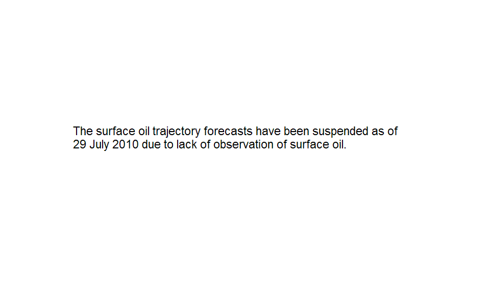
 Irish Tornado. Although rare, tornadoes do strike Europe. Here is footage of a small tornado that touched down on Achill Island, in Ireland!
 Russian Heatwave. Although tame by U.S. standards, highs in the low to mid 90s in Moscow are (apparently) a pretty big deal. In a country where few homes have air conditioning, people have been flocking to pools, lakes and rivers, trying anything to keep their collective cool. Millions of acres of wheat have withered away from the prolonged heat, the very latest on the heat here.
 Taking Lessons From What Went Wrong. In the wake of catastrophe often comes innovation. Steps will be taken to lessen the risk of another Deepwater Horizon disaster down the road, in fact something good may even emerge from the pain, suffering and expense. The New York Times looks at previous disasters, lessons learned, and the long-term implications.
Paul's Conservation MN Outlook for the Twin Cities and all of Minnesota
Today: Lot's of sunshine, a warm breeze, very pleasant. Winds: West 8-13. High: 85
Wednesday night: Dry evening, clouds increase - heavy T-storms possible late. Low: 69
Thursday: Sticky & unsettled with showers and thunderstorms. Very heavy rain is possible early in the day - a few storms by late afternoon could turn severe. High: 81
Friday: Wet start, getting sunnier as the day goes on. High: 83
Saturday: Partly sunny and humid - a stray late-day T-storm can't be ruled out (most of the day should be dry). Winds: NW 8-13. High: 84
Sunday: Mostly sunny - probably dry statewide. Winds: SW 3-8. High: 86
Monday: Partly sunny, risk of a passing T-storm. High: 84
Tuesday: More clouds, scattered T-storms likely. High: 85
No comments:
Post a Comment