Saturday, July 17, 2010
Severe Risk Lingers Into The Evening
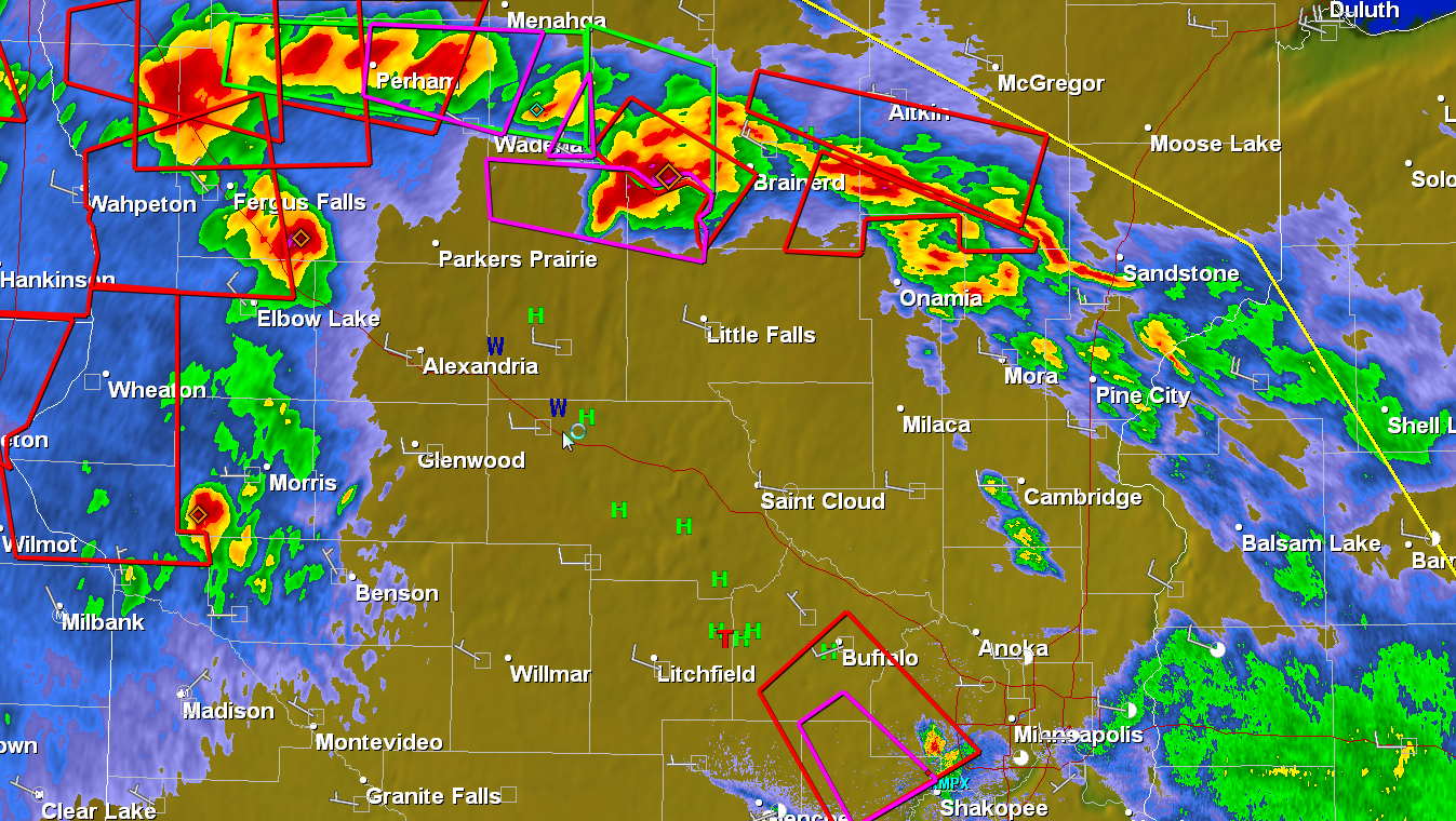
5:55 pm. Round 1 winding down - Round 2 after 7 pm? More strong/severe storms are flaring up from near Morris and Fergus Falls to Wadena and Brainerd - the entire swarm of storms is pushing east/southeast at 30-35 mph. More hail, highs winds and isolated tornadoes are possible later this evening, probably after 7 pm in the metro area. (immediate short-term tornado threat has diminished for the southwest metro)

Subscribe to:
Post Comments (Atom)
No comments:
Post a Comment