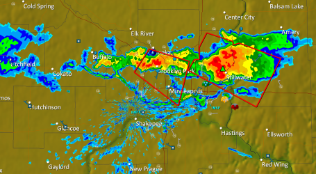
Tornadic "Supercells". NWS Doppler radar out of Grand Forks at 5:30 pm Tuesday shows a developing "squall line" of severe storms pushing into the Red River Valley - may still be severe as they reach the Fargo/Moorhead area. Any severe storms this evening may redevelop into an MCS, a mesoscale convective system, later today, pushing a band of torrential rains and frequent lightning across central and northern Minnesota. The brunt of the storms may pass just north of the Twin Cities (St. Cloud stands a better chance of downpours/frequent lightning) but a stormy start can't be ruled out across much of Minnesota Wednesday morning, including MSP. The sun comes out late morning and midday before severe storms redevelop during the afternoon hours, the greatest risk of hail/isolated tornadoes appears to be just south/east of the Twin Cities after 3 pm Wednesday afternoon. Expect watches & warnings Wednesday PM hours.
No comments:
Post a Comment