Saturday, August 7, 2010
Severe Update (tornado watch remains in effect until 1 am)
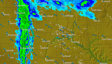
Update: 8:40 pm. 2" hail estimates near Wadena - tornado warnings remain in effect from near Wadena to Parkers Prairie and Alexandria. Doppler radar continues to detect strong rotation - reports of funnel clouds near Fergus Falls and at least 1-3 tornado touchdowns in Wilkin county (storm spotter Andy Gabrielson from Severe Studios is on the scene and reports some damage to homes near the town of Doran - no reports of injuries, but a large tornado did apparently touch down in Wilkin county. A tornado watch remains in effect for central MN and the Twin Cities until 1 am. The greatest tornado risk appears to be well north of the Twin Cities, from near St. Cloud and Little Falls to the Mille Lacs area - but we may see strong straight-line winds, hail and torrential rains between 10 pm and 3 am Tuesday morning.
Subscribe to:
Post Comments (Atom)
No comments:
Post a Comment