Atmospheric poetry
"Bittersweet October. The mellow, messy, leaf-kicking, perfect pause between the opposing miseries of summer and winter," wrote Carol Bishop Hips. Poet Nathanial Hawthorne must have had this year in mind when he wrote, "There is no season when such pleasant and sunny spots may be lighted on, and produce so pleasant an effect on the feelings, as now in October." Amen.

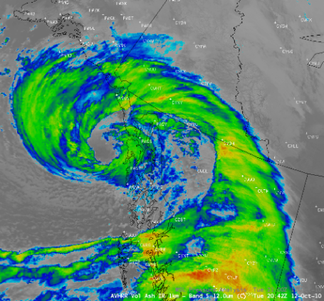
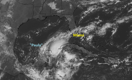
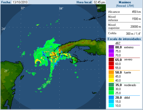
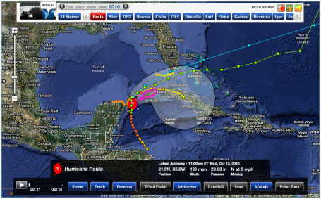
"Paula" : A Mini-Hurricane? Radar out of western Cuba Wednesday afternoon showed the eye of Hurricane Paula coming nito range, a rather disorganized spiral band of heavy showers and T-storms funneling moisture into the warm core of the storm. To see the latest (Cuban) radar loop click here.

From Pete Boulay at the MN State Climatology Office:
"We are now in day 10 of a dry spell. We had a 19 day dry spell ending on March 6, 2010 so we haven't had the driest spell for the year yet. I attached a spreadsheet of past dry spells for the Twin Cities. The longest? 51 days ending on January 1, 1944."
Paul's Conservation MN Outlook for the Twin Cities and all of Minnesota:
Today: Bright sun, lukewarm breeze. Wind: W 10-20. High: near 70
Thursday night: Partly cloudy and chilly. Low: 40
Friday: Plenty of sun, a bit cooler - still very pleasant. High: 61
Saturday: Turning milder with sunshine and a light breeze, the nicer day of the weekend. Winds: NW 8-13. High: 67
Saturday night: Clear to partly cloudy. Low: 44
Sunday: Sunny start, clouds increase later in the day (few showers possible up north by late PM). Winds: E 5-10. High: 63
Monday: Cloudy with a period of rain likely. High: 54
Tuesday: Rain lingers, a cool, foul day. High: 53
Wednesday: Sunshine returns, seasonably cool. High: 58
* GFS computer model hinting at low to mid 60s the following weekend, the weekend of October 23-24.
I feel a little like Steve Martin in one of my favorite movies, "L.A. Story". He plays the role of a weather guy in Los Angeles, which can't be that stressful most of the year. My favorite scene: Martin on a raft in his swimming pool, shouting to his TV News Director boss: "it's the same! The weather is THE SAME!!" Then El Nino strikes, it pours on what was supposed to be a sunny day, and that's when things get interesting. Add L.A. story to your Netflix cue - it really is a charming, heartwarming story.
"It's the same!" One more day of blue skies, light winds and low humidity - a few boxelder bugs tormenting you, but all things considered some of the best weather in North America continues to float over our heads. Welcome to the 19th day in a row without measurable rain in the Twin Cities - officially the longest dry-stretch this year, according to Pete Boulay at the MN State Climate Office. Chances are we'll go 22 days without rain - the first chance of puddles Sunday night and Monday as a more significant surge of Canadian air approaches, a tug-of-war playing out overhead producing a quarter inch or so of rain next Monday and Tuesday. Highs will dip into the low/mid 50s - hardly a cold front, but it will feel more like mid October out there by early next week.
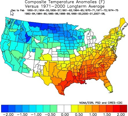
When the weather is this nice for this long I start to get nervous. VERY nervous. Every day I fire up the models, scan the maps, wondering what can possibly go wrong - and what time? So far so good. The GFS model goes out about 16 days, and I still don't see any harsh swipes of arctic air, no wind chill, certainly no accumulating snow looking out through the 28th day of October. We're already 8-9 degrees F. warmer than average statewide for the month of October. At the rate we're going we may very well enjoy one of the sunniest, mildest and driest Octobers on record, certainly in the Top 5. We'll see.
After cooling off early next week temperatures recover next week - computer simulations hinting at more 60s by the weekend of October 23-24, in fact the models keep spiking the temperature up close to 60 through the last week of the month. Not sure I can promise a lukewarm Halloween, but so far so good. Enjoy the siesta, the extended weather honeymoon. Who knows what November will bring...but at least we'll have October.
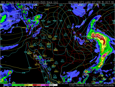
Nor 'Easter! Computer models spin up a major storm over New England Friday and Saturday, an intrusion of chilly Canadian air (behind a fast-moving Alberta Clipper) combining with warm, tropical air from the Gulf Stream to create a rapid drop in barometric pressure. The resulting partial vacuum will whip up some 30-50 mph winds (Gale watches are posted for coastal New Englad) - beach erosion and coastal flooding is likely from Long Island to Cape Cod. Inland: enough chilly air for heavy wet snow from the Catskills of New York into the Green Mts. of New Hampshire. Skiers are excited - just about everyone else is dreading this major storm, which WILL impact air travel into the northeast by the weekend. More on the impending storm here.
Welcome to the driest spell of weather all year. According to Pete Boulay at the MN Climate Office we had a 19-day spell of dry weather ending March 6. We're up to 19 days with only a trace of sprinkles in the metro, we'll go 22 days before the first chance of rain next Monday & Tuesday. While the northeast gets hammered by a nor'easter (capable of coastal flooding and half a foot of snow for the Catskills of New York) we'll continue to bask under a bright blue sky. Cool, crisp, jacket-worthy mornings, lukewarm afternoons and light winds as high pressure settles overhead. A cooler front sparks rain early next week, but more 60s return for the weekend of Oct. 23-24.
Finally, Hurricane Paula will brush the Florida Keys with high winds. Yes, we see storms in Minnesota. But at least our storms DON'T HAVE NAMES.

A Climate Proposal Beyond Cap And Trade. How can we reduce carbon emissions and encourage alternative energy sources without crippling the economy or imposing a "tax" (which no one wants?) The debate continues, more options in this New York Times article.

No comments:
Post a Comment